
Spatial evapotranspiration, rainfall and land use data in water
Hydrol. Earth Syst. Sci., 19, 507–532, 2015
www.hydrol-earth-syst-sci.net/19/507/2015/
doi:10.5194/hess-19-507-2015
© Author(s) 2015. CC Attribution 3.0 License.
Spatial evapotranspiration, rainfall and land use data
in water accounting – Part 1: Review of the accuracy
of the remote sensing data
P. Karimi1 and W. G. M. Bastiaanssen1,2,3
1 UNESCO-IHE
Institute for Water Education, Delft, the Netherlands
Water Management Institute, Battaramulla, Sri Lanka
3 Faculty of Civil Engineering and Geosciences, Water Management Department, Delft University of Technology,
Delft, the Netherlands
2 International
Correspondence to: P. Karimi ([email protected])
Received: 20 November 2013 – Published in Hydrol. Earth Syst. Sci. Discuss.: 22 January 2014
Revised: 5 December 2014 – Accepted: 12 December 2014 – Published: 28 January 2015
Abstract. The scarcity of water encourages scientists to
develop new analytical tools to enhance water resource
management. Water accounting and distributed hydrological
models are examples of such tools. Water accounting needs
accurate input data for adequate descriptions of water distribution and water depletion in river basins. Ground-based
observatories are decreasing, and not generally accessible.
Remote sensing data is a suitable alternative to measure the
required input variables. This paper reviews the reliability of
remote sensing algorithms to accurately determine the spatial distribution of actual evapotranspiration, rainfall and land
use. For our validation we used only those papers that covered study periods of seasonal to annual cycles because the
accumulated water balance is the primary concern. Review
papers covering shorter periods only (days, weeks) were not
included in our review. Our review shows that by using remote sensing, the absolute values of evapotranspiration can
be estimated with an overall accuracy of 95 % (SD 5 %) and
rainfall with an overall absolute accuracy of 82 % (SD 15 %).
Land use can be identified with an overall accuracy of 85 %
(SD 7 %). Hence, more scientific work is needed to improve
the spatial mapping of rainfall and land use using multiple
space-borne sensors. While not always perfect at all spatial
and temporal scales, seasonally accumulated actual evapotranspiration maps can be used with confidence in water accounting and hydrological modeling.
1
Introduction
The demand for fresh water is increasing worldwide due
to economic and population growth (Molden et al., 2007;
Vörösmarty et al., 2010). Proper planning of such scarce water resources in terms of storage, allocation, return flow and
environmental services is vital for optimizing the resource
(Chartres and Varma, 2010). There is, however, a lack of
fundamental data on vertical and lateral water flows, water stocks, water demand, and water depletion. At the same
time, there is a decline in the network density of operational hydrometeorological field stations. The absence of adequate field data sets is an important obstacle for sound,
evidence-based water resource management decisions. The
consequence of data scarcity is more severe in transboundary
river basins where, apart from collection, the accessibility of
data is hindered by political issues (Awulachew et al., 2013).
Remotely sensed hydrological data are an attractive alternative to conventional ground data collection methods (Bastiaanssen et al., 2000; Engman and Gurney, 1991; Wagner
et al., 2009; Neale and Cosh, 2012). Satellites measure the
spatial distribution of hydrological variables indirectly with
a high temporal frequency across vast river basins. There are
many public data archives where every user can download
preprocessed satellite data. Quality flags are often provided,
as well as manuals with explanations on how the satellite
data have been preprocessed and can be reproduced. These
recurrent data sets are highly transparent, politically neutral
and consistent across entire river basins, even for large basins
Published by Copernicus Publications on behalf of the European Geosciences Union.
508
P. Karimi and W. G. M. Bastiaanssen: Spatial evapotranspiration, rainfall and land use data – Part 1
such as the Nile and the Ganges. While certain satellite data
sets have been processed to a first level of reflectance, emittance, and backscatter coefficients, others will even provide
second level products that can be directly explored for water
resource planning purposes (e.g., land cover, soil moisture,
and rainfall). Evapotranspiration (ET) is one of the parameters that often requires additional processing of the spectral
data; only a very few public domain data archives provide
preprocessed ET data and, in fact, spatial ET modeling is
still underdeveloped. Examples of several remotely sensed
ET algorithms that could be applied to interpret raw satellite
data into spatial layers of ET are well summarized in a recent
book edited by Irmak (2012).
Time series of various hydrological variables such as precipitation, evapotranspiration, snow cover, soil moisture, water levels, and aquifer storage can be downloaded from public
domain satellite-based data archives. With the right analytical tools and skills, these abundant data sets of hydrological
processes can be used to produce information on water resource conditions in river basins. Tools such as Water Accounting Plus (WA+) (Karimi et al., 2013a, b) are expressly
designed to exploit remote sensing estimates of hydrological
variables. Water accounting is the process of communicating water related information about a geographical domain,
such as a river basin or a country, to users such as policy
makers, water authorities, basin managers, and public users.
Water accounting information can be key to river basin management policy, especially when administrations are reluctant to share their – sometimes imperfect – in situ data with
neighboring states and countries. WA+ can facilitate conflict management in internationally shared river basins. In
addition to that, hydrological variables derived from remote
sensing can also be used for spatially distributed hydrological modeling. Studies by Houser et al. (1998), Schuurmans
et al. (2003), and Immerzeel and Droogers (2008) have, for
instance, demonstrated that such inputs have improved hydrological model performance for river basins in Australia,
the Netherlands and India, respectively.
A major point of criticism that is commonly laid down on
remote sensing data has been the lack of accuracy. With the
improvement of technology the accuracy has however improved significantly over the last 30 years; yet it is necessary
to remain critical. It is important to note that the conventional
methods of measuring hydrological processes (e.g., rainfall
and discharge) are not flawless either and, thus, the accuracy
of both types of measurements needs to be verified. There are
also limitations with what conventional measurement methods can offer especially when spatially distributed data is
concerned. For instance, the actual ET of river basins can
hardly be measured operationally through ground measurements; therefore, the depletion of water remains difficult to
estimate and quantify. Thus, ET is often ignored in water accounting frameworks such as the SEEA-Water system proposed by the United Nations Statistics Division (UN, 2007)
and the Australian water accounting system (ABS, 2004).
Hydrol. Earth Syst. Sci., 19, 507–532, 2015
Remote sensing techniques, however, can provide spatially
distributed daily estimates of actual ET and this opens new
pathways in the accounting of water depletion (Karimi et al.,
2013a).
This paper investigates the errors and reliability of remotely sensed ET, rainfall, and land use based on a comprehensive literature review. The choice of the variables
that have been investigated in this paper (ET, rainfall, land
use/land cover) is based on the common use in hydrological
and water resource management studies. Only recent publications on accumulated ET and rainfall for a minimum time
period of one growing cycle have been consulted, which implies that some of the well-known reference papers are excluded because they relate to shorter flux observation periods. Elder remote sensing algorithms were also excluded.
The companion paper (Karimi et al., 2015) investigates impacts of the errors associated with the satellite measurement
for ET, rainfall and land use on the accuracy of WA+ outputs,
using a case study from the Awash Basin in Ethiopia. See Appendix D for a glossary of the abbreviations used throughout
the paper.
2
2.1
Remote sensing data for water accounting (WA+)
Evapotranspiration
Over the past decades several methods and algorithms to estimate actual ET through satellite measurements have been developed. Most of these estimates are based on the surface energy balance equation. The surface energy balance describes
the partitioning of natural radiation absorbed at Earth’s surface into physical land surface processes. Evapotranspiration
is one of these key processes of the energy balance, because
latent heat (energy) is required for evaporation to take place.
The energy balance at Earth’s surface reads
LE = Rn − G − H
W m−2 ,
(1)
where Rn is the net radiation, G is the soil heat flux, H is
the sensible heat flux, and LE is the latent heat flux. The
sensible heat flux H is a function of the temperature difference between the canopy surface and the lower part of the
atmosphere, and the soil heat flux G is a similar function
related to the temperature difference between the land surface and the top soil. A rise of surface temperature will thus
usually increase H and G fluxes. Evaporative cooling will
reduce H and G, and result in a lower surface temperature.
The LE is the equivalent energy amount (W m−2 ) of the ET
flux (kg m−2 s−1 or mm d−1 ). The net radiation absorbed at
the land surface is computed from shortwave and long-wave
radiation exchanges. Solar radiation is shortwave and is the
most important supplier of energy. More information on the
energy balance is provided in general background material
such as Brutsaert (1982), Campbell and Norman (1998) or
Allen et al. (1998).
www.hydrol-earth-syst-sci.net/19/507/2015/
P. Karimi and W. G. M. Bastiaanssen: Spatial evapotranspiration, rainfall and land use data – Part 1
Surface temperature is measured routinely by spaceborne radiometers such as the Advanced Very High Resolution Radiometer (AVHRR), Moderate Resolution Imaging
Spectrometer (MODIS), Visible Infrared Imager Radiometer Suite (VIIRS), Landsat, Advanced Space borne Thermal Emission and Reflection Radiometer (ASTER), China–
Brazil Earth Resources Satellite (CBERS), and the Chinese
HJ and Feng Yung satellites. Remotely sensed surface temperature is the major input variable in ET algorithms. Examples of thermal infrared ET algorithms are provided by
EARS (Rosema, 1990), SEBAL (Bastiaanssen et al., 1998),
TSEB (Norman et al., 1995), SEBS (Su, 2002; Jia et al.,
2003), METRIC (Allen et al., 2007), ALEXI (Anderson et
al., 1997), and ETWatch (Wu et al., 2012). The differences
among these algorithms are often related to the parameterization of H , general model assumptions, and the amount of
input data required to operate these models.
Other groups of ET algorithms are based on the vegetation index and its derivatives such as published by Nemani
and Running (1989), Guerschman et al. (2009), K. Zhang
et al. (2010), Mu et al. (2011), and Miralles et al. (2011).
ETLook (Bastiaanssen et al., 2012) is a new ET model that
directly computes the surface energy balance using surface
soil moisture estimations for the top soil (to feed soil evaporation) and subsoil moisture for the root zone (to feed vegetation transpiration). Soil moisture data can be inferred from
thermal measurements (e.g., Scott et al., 2003) or from microwave measurements (e.g., Dunne et al., 2007). Microwave
measurements provide a solution for all weather conditions
and can be applied at any spatial scale for which moisture
data is available.
A different school of remote-sensing-based ET algorithms
is built around the derivation of a relative value of ET using trapezoid/triangle methods. Trapezoid/triangle diagrams
are constructed from a population of pixel values of surface
temperature and vegetation index and used to infer the relative value of ET (e.g., Choudhury, 1995; Moran et al., 1994;
Roerink et al., 2000; Wang et al., 2007). In these diagrams,
the range of surface temperature values at a given class of
vegetation index is the basis for determining relative ET, assuming that the lowest temperature in a certain range of vegetation index represents potential ET. The highest temperature
coincides with zero evaporation. The main assumption in triangle/trapezoidal methods is that the variation in vegetation
index relation to surface temperature is driven primarily by
the variation in soil water content rather than differences in
atmospheric conditions.
Merging different global ET products such as MOD16
(Mu et al., 2011) and ERA-Interim (Dee et al., 2011) at
global and regional scales into one ET product is another approach that has been used by a group of scientists. This approach mainly uses statistical methods to combine ET products that are based on different methods, algorithms, and origins (e.g., global: Mueller et al., 2013; Africa: Trambauer et
al., 2014; US: Velpuri et al., 2013). New ensemble ET prodwww.hydrol-earth-syst-sci.net/19/507/2015/
509
ucts on the basis of several open access and global-scale operational ET products from Earth observations are under development, but are not published yet.
Review papers on advanced algorithms for estimating spatial layers of ET have been published by Moran and Jackson (1991), Kustas and Norman (1996), Bastiaanssen (1998),
Courault et al. (2005), Glenn et al. (2007), Gowda et
al. (2007), Kalma et al. (2008), Verstraeten et al. (2008), and
Allen et al. (2011). While these review papers provide a good
understanding of the evolution of ET algorithm development,
they rarely report the accuracies attainable, especially at a
seasonal or longer time frame.
2.2
Rainfall
There are different algorithms to infer rainfall from satellite
data. The four essentially different technologies are (i) indexing the number and duration of clouds (Barrett, 1988), (ii) accumulated cold cloud temperatures (Dugdale and Milford,
1986), (iii) microwave emissivity (Kummerow et al., 1996),
and (iv) radar reflectivity (Austin, 1987). Techniques using
microwave wavelength information are promising alternatives for measuring rainfall because of the potential for sensing the raindrops themselves and not a surrogate of rain, such
as the cloud type. Microwave radiation with wavelengths in
the order of 1 mm–5 cm has a strong interaction with raindrops, since the drop size of rain is comparable to this wavelength. This feature makes them suitable to detect rainfall
intensity. Active microwave (radar) measurements of rainfall
are based on the Rayleigh scattering caused by the interaction of rain and the radar signal (Cracknell and Hayes, 1991).
Spaceborne radar measurements of rain intensity are possible
with the precipitation radar (PR) aboard the NASA Tropical
Rainfall Measuring Mission (TRMM) and Global Precipitation Mission (GPM) satellites, which assesses the attenuation
of the radar signal caused by the rain. The PR has a pixel
size of 5 km and can oversee a swath of 220 km. Unfortunately, it is usually necessary to evaluate the rainfall radar reflectivity factor empirically on a region-by-region basis over
lengthy periods of time. In other words, rain radar systems –
both ground-based and satellite-based – need calibration for
proper rainfall estimates. We will conclude later that most
papers investigated in our review process do apply a certain
level of field calibration. Several operational rainfall products based on satellite measurements have been created or
improved more recently. Among the new ensemble rainfall
products is the Climate Hazards Group InfraRed Precipitation Station (CHIRPS) that provides promising results (Funk
et al., 2013).
Review papers on the determination of rainfall from satellite measurements have been prepared, by, for instance, Barrett (1988), Barrett and Beaumont (1994), Petty (1995), Petty
and Krajewski (1996), Kummerow et al. (1996), Smith et
al. (1998), Kidd (2001), Stephens and Kummerow (2007),
and Huffman et al. (2007). A selection of available rainfall
Hydrol. Earth Syst. Sci., 19, 507–532, 2015
510
P. Karimi and W. G. M. Bastiaanssen: Spatial evapotranspiration, rainfall and land use data – Part 1
Table 1. Overview of the main existing regional and global-scale satellite-based data sources of rainfall. The column “gauge” indicates
whether a calibration against ground data is included.
Product
Main principle data
Resolution
Spatial
coverage
MPE
Meteosat 7, 8, 9 10
3 km
Indian ocean
CMORPH
Microwave estimates (DMSP F-13, 14 &
15 (SSM/I), NOAA-15, 16, 17 & 18
(AMSU-B), AMSR-E, and TRMM
(TMI)), IR motion vectors
8 km
PERSIANN
Microwave estimates (DMSP F-13, 14, &
15, NOAA-15, 16, 17, and TRMM
(TMI))
GSMap
Minimum
time steps
interval
Producer
N
15 min
EUMETSAT
50◦ N–50◦ S
N
30 min
NOAA/CPC
0.25◦
60◦ N–60◦ S
N
1h
UC Irvine
Microwave estimates (DMSP F-13, 14 &
15 (SSM/I), AMSR, AMSR-E, and
TRMM (TMI))
0.1◦
60◦ N–60◦ S
N
1h
JAXA
NRLblended
Microwave estimates (DMSP F-13, 14, &
15 (SSM/I), F-16 (SSMIS))
0.25◦
60◦ N–60◦ S
N
3h
NRL
TCI (3G68)
Microwave estimates (TRMM (TMI)),
and PR
0.5◦
37◦ N–37◦ S
N
1h
NASA
TOVS
HIRS, MSU sounding retrievals
1◦
Global
N
Daily
NASA
Hydro
estimator
GOES IR
4 km
Global
N
15 min
NOAA
TRMM 3B42
Microwave estimates (TRMM, SSM/I,
AMSR and AMSU), IR estimates from
geostationary satellites
0.25◦
50◦ N–50◦ S
Y
3h
NASA
CPC-RFE2.0
Microwave estimates (SSM/I, AMSU-B),
IR estimates from METEOSAT
0.1◦
20◦ W–55◦ E,
40◦ S–40◦ N
Y
Daily
FEWS
GPCP 1DD
IR estimates from geostationary satellites,
TOVS
1◦
50◦ N–50◦ S
Y
Daily
NASA/GSFC
CMAP
Microwave estimates (SSM/I), GOES IR
2.5◦
Global
Y
5 days
NOAA
TAMSAT
Meteosat thermal-IR
3 km
Africa
Y
10 days
Reading
University
TRMM 3B43
Microwave estimates (TRMM, SSM/I,
AMSR and AMSU), IR estimates from
geostationary satellites
0.25◦
40◦ N–40◦ S
Y
Monthly
NASA
GPCP_V2
Microwave estimates (SSM/I), IR, TOVS
2.5◦
Global
Y
Monthly
NASA/GSFC
products based on remote sensing techniques – sometimes
used in combination with other methodologies – is presented
in Table 1.
2.3
Land use
Whereas land cover describes the physical properties of vegetation (e.g., grass, savannah, forest), land use denotes the
usage of that land cover (e.g., pasture, crop farming, soccer field). Maps of land use are fundamental to WA+ beHydrol. Earth Syst. Sci., 19, 507–532, 2015
Gauge
cause it determines the services and processes in a spatial
context. Different types of land use provide benefits and services such as food production (agricultural land), economic
production (industrial areas), power generation (reservoirs),
environmental ecosystems (wetlands), livelihoods etc., and
they have an associated water consumptive use. Land use
classification based on the use of water, differs from classical land use land cover maps that focus mainly on the description of woody vegetation such as forests and shrubs for
ecological and woodland management purposes. WA+ needs
www.hydrol-earth-syst-sci.net/19/507/2015/
P. Karimi and W. G. M. Bastiaanssen: Spatial evapotranspiration, rainfall and land use data – Part 1
land use maps focused on crop types (e.g., rainfed potatoes,
irrigated maize) and the source of water consumed (e.g., surface water and groundwater). Some of the first maps dedicated for agricultural water management were prepared by
Thenkabail et al. (2005), Cheema and Bastiaanssen (2010),
Yalew et al. (2012) and Kiptala et al. (2013). Furthermore,
land use classifications for WA+ at river basin scale require
a pixel size of 30–100 m that can be delivered by Landsat8 and Proba-V satellite data, respectively. It is expected that
the arrival of Sentinel-2 data during the course of 2014 with
pixel sizes ranging between 10–30 m and a short revisit time
of 5 days will greatly enhance development of new land use
classifications that are tailored for water use and water accounting.
Land use changes affect the water balance of river basins
and thus also the amount of water flowing to downstream areas. Bosch and Hewlett (1982) and Van der Walt et al. (2004)
discuss for instance how replacing natural vegetation by
exotic forest plantations reduced the stream flow in South
Africa. Maes et al. (2009) evaluated the effect of land use
changes on ecosystem services and water quantity on basins
in Belgium and Australia. The role of land use is thus a
crucial component of sound water accounting and water resource management (Molden, 2007).
Land use is usually identified on the basis of spectral reflectance and its change with vegetation phonology. The reflectance in the near and middle infrared part of the electromagnetic spectrum, especially, is often related to certain land
use classes. The relationship between reflectance and land
use is however not unique, and field inspections are usually
needed for better interpretation. Soil type, soil moisture and
surface roughness all have an influence on reflectance. The
health of the vegetation and factors such as the angle and size
of leaves also affect the photosynthetic activity of the plants.
There is another land use mapping technology that is entirely
based on the difference in time profiles of spectral vegetation
indices. Fourier analysis of vegetation index can be used to
quantify land use classes and crop types (e.g., Roerink et al.,
2003), especially when time profiles are linked to existing
cropping calendars.
All the land use classification papers we reviewed report
on a confusion matrix that describes the overall classification accuracy by showing how often certain land use classes
are confused in the remote sensing analysis with other land
use classes. Congalton (1991) and Foody (2002) give a full
explanation on errors in land use data.
Review papers on the use of remote sensing for land use
land cover classification are provided in Bastiaanssen (1998),
Smits et al. (1999), Mucher et al. (2000), Cihlar (2000),
Franklin and Wulder (2002), Thenkabail et al. (2009b), and
García-Mora et al. (2012).
www.hydrol-earth-syst-sci.net/19/507/2015/
3
3.1
511
Results
Accuracy of spatial evapotranspiration data
The lack of validation of spatial layers of ET is one of the
drawbacks in defining the reliability of remotely sensed ET
products. There are no reliable and low-cost ground-based
ET flux measurement techniques, although new inventions
are always underway (Euser et al., 2014). It is simply too
costly to install instruments that have the capacity to measure ET operationally at various locations dispersed across
a river basin. The main methods to measure ET at the field
scale include lysimeters, Bowen ratio, eddy covariance systems, surface renewal systems, scintillometers, and classical
soil water balancing. Lysimeters can be very accurate for in
situ measurements of ET at small scale if they are properly
maintained. Bowen ratio and eddy covariance flux towers and
surface renewal systems are fairly accurate methods for estimating ET at scales of up to 1 km (Rana and Katerji, 2000),
although not free of errors (e.g., Teixeira and Bastiaanssen,
2010; Twine et al., 2000). Scintillometers have the capability
to measure fluxes across path lengths of 5–10 km (Hartogensis et al., 2010; Meijninger and de Bruin, 2000).
To deal with the problem of measuring ET fluxes in a composite terrain, large-scale field experiments in the African
continent (e.g., Sahel: Goutorbe et al., 1997; southern Africa:
Otter et al., 2002), the European continent (e.g., France:
Andre et al., 1986; Spain: Bolle et al., 2006), the American continent (e.g., Kansas: Smith et al., 1992; Arizona and
Oklahoma: Jackson et al., 1993) and the Asian continent
(e.g., China: Wang et al., 1992: Korea: Moon et al., 2003)
were set up to measure fluxes simultaneously within a certain
geographic region at a number of sites with different land use
classes. Several remotely sensed ET algorithms were developed and validated using these data sets. The limitation is
however that the duration of these field campaigns was for
budgetary reasons restricted to several weeks only.
Validation studies with different ET algorithms using the
same spatial ground truth data sets are very interesting. The
International Water Management Institute (IWMI) undertook
for instance a validation study to determine the accuracy of
various ET methods for irrigated cotton and grapes in Turkey
(Kite and Droogers, 2000). Although here the period was
not sufficiently long to encompass one growing season. The
Commonwealth Science and Industrial Research Organisation (CSIRO) in Australia studied the predictions of eight different ET products, at a minimum monthly frequency and at
a spatial resolution of at least 5 km, using flux tower observations and watershed data across the entire continent as part of
the Water Information Research and Development Alliance
(WIRADA) project (Glenn et al., 2011). The studied ET
products were based on different methods including largescale water balance modeling, thermal imagery (Mcvicar
and Jupp, 1999, 2002), spectral imagery (Guerschman et al.,
2009), inferred LAI (leaf area index; Y. Zhang et al., 2010),
Hydrol. Earth Syst. Sci., 19, 507–532, 2015
512
P. Karimi and W. G. M. Bastiaanssen: Spatial evapotranspiration, rainfall and land use data – Part 1
passive microwave (Bastiaanssen et al., 2012), and the global
MODIS reflectance-based algorithm (Mu et al., 2007). The
results showed that at annual-scale remote-sensing-based ET
estimates, barring the global MODIS product that was at the
time an unrefined method that needed improvements (Mu et
al., 2011), had an acceptable mean absolute percentage error
(MAPE) ranging from 0.6 to 18 % with an average MAPE
of 6 % (King et al., 2011). Along similar lines, the Council
for Scientific and Industrial Research (CSIR) in South Africa
conducted a remote sensing study on a smaller scale to investigate the performance of three ET algorithms (Jarmain et al.,
2009).
To assess the overall error in accumulated ET products,
a comprehensive literature review was conducted and reported errors by various authors were synthesized. All the
papers included in the review were published within the past
13 years (hence from the year 2000 onwards) and they cover
a range of in situ measurements and remote sensing ET algorithms. The reviewed papers cover a range of remote sensing
methods for ET measurements including SEBAL, METRIC,
SEBS, TSEB, ALEXI, ET Watch, and SatDAET. In essence,
the spatial ET layers reported in these papers were not a priori calibrated and the authors reported on the validation aspect. Since the primary purpose of this study was to quantify errors in accumulated ET, only papers that report errors
on ET estimates over a minimum period of one growing cycle which on average is about 5–6 months, hereafter called
seasonal ET, were consulted. Papers dealing with ET over
shorter periods were thus excluded in our review (e.g., Anderson et al., 2011; Chávez et al., 2008; Gonzalez-Dugo et
al., 2009; Mu et al., 2011). This, also, implies that GEWEX
(Global Energy and Water Exchanges Project)-related field
experiments could not be used because intensive campaigns
with multiple flux covered periods of weeks only. The manifold flux campaigns organized by the US Department of
Agriculture (Kustas et al., 2006; JORNEX: Rango et al.,
1998; SALSA: Chehbouni et al., 1999) also did not meet
our criterion. To be able to compare error levels from different studies only papers that report errors in terms of mean
error were included in the review. Thus, some of the valuable papers on this topic that use RMSE (root mean square
error) to describe errors without including mean error could
not be included in the review (e.g., Batra et al., 2006; Cleugh
et al., 2007; Guerschman et al., 2009; Venturini et al., 2008).
The data sources consulted are summarized in Appendix A.
It reflects the accumulated ET conditions encountered in
11 countries. Thirty-one publications met the criteria specified and were analyzed. One publication often contains more
data points due to multiple models, multiple years, and multiple areas. Hence, the total number of points was n=46. Considering this number, the probability density function is unlikely to change if other papers – or more papers – were to
be considered in the review.
The probability distribution of mean absolute percentage
error in remote sensing ET estimates is presented in Fig. 1.
Hydrol. Earth Syst. Sci., 19, 507–532, 2015
Figure 1. Probability density function of the reported mean absolute percentage error in remotely sensed ET estimates. A season or
longer period was considered.
The results demonstrate the absolute error of annual or seasonal ET to vary between 1 and 20 %. The average MAPE is
5.4 %, with a standard deviation of 5.0 %. It is evident from
Fig. 1 that the distribution is positively skewed. These results
are closely in line with findings by King et al. (2011) in Australia, both in terms of average and the range of error in ET
estimates.
Many of the publications reported an error of less than
5 %, a remarkable good and unexpected result. In many
cases, the authors of the papers were both the developers and
the testers of the algorithms, and parameter tuning was possible. The left-hand bar in Fig. 1 is, we believe, a biased view
of the reality. For this reason, the data points were fitted by
means of a skewed normal distribution so that less weight is
given to the class with exceptionally low errors.
There are seven papers that report a mean absolute percentage error of 1 % for the ET of cropland. Without exception, all these papers are based on the Surface Energy
Balance Algorithm for Land (SEBAL) and its related algorithm Mapping ET at High Resolution with Internalized Calibration (METRIC). Apparently, these algorithms work well
for crops, which was recognized earlier by Bastiaanssen et
al. (2009) and Allen et al. (2011). Another interesting observation is that at river basin scale – i.e., the scale where water
accounting is done – all papers report a MAPE of less than
5 %. These case studies include the 3 % difference between
the measured ET and remotely sensed ET of selected river
basins in Sri Lanka (Bastiaanssen and Chandrapala, 2003),
1.7 % difference observed by Singh et al. (2011) for the Midwest in the USA using the METRIC algorithm, 1.8 and 3 %
differences observed by Wu et al. (2012) using ET Watch in
the Hai Basin of the North China Plain, 5 % difference observed by Bastiaanssen et al. (2002) for the Indus Basin, 1 %
difference observed by Evans et al. (2009) for the Murray–
Darling Basin, and 0.6, 2.1, 3.9, and 18 % differences for
www.hydrol-earth-syst-sci.net/19/507/2015/
P. Karimi and W. G. M. Bastiaanssen: Spatial evapotranspiration, rainfall and land use data – Part 1
different algorithms observed by King et al. (2011) for the
Australian continent.
At the other end of the spectrum, the largest ET deviations
were found by Jiang et al. (2009) for alkali scrubs in south
Florida. They used the SatDAET algorithm which is an ET
estimation method that uses the contextual relationship between remotely sensed surface temperature and vegetation
index to calculate evaporative fraction (EF). They compared
the estimated ET using SatDAET for both clear and cloudy
days with ET from lysimeters and observed a 19 % difference
for 1999.
There is no single preferred ET model. The selection of
the algorithm depends on the application, the required spatial resolution, the period for which the ET fluxes should be
estimated for, the size of the study area, the land use classes
present, etc. A useful distinction is to discern global-scale
models (few) and local-scale models (many). Also, the level
of validation and application of these models widely differ.
Whereas certain models are tested with a single experimental flux site, other models have been applied in more than 30
countries.
Considering this positive evaluation, spatial layers of ET
should be encouraged for applications in water accounting
and hydrological modeling. Except for Jhorar et al. (2011),
Winsemius et al. (2008) and Rientjes et al. (2013), this is
rarely done because water managers and hydrologists do not
accept ET layers as being sufficiently accurate. This new
analysis proves that the science of remote sensing in the last
13 years has advanced and that mapping of ET has become
more reliable.
3.2
Accuracy of spatial rainfall data
A comprehensive literature review – similar to ET – was
conducted for remote sensing rainfall products. Twenty-four
peer reviewed papers that describe the accuracy of annual
and seasonal rainfall from satellites, published over the last
5 years were reviewed (see Appendix B). Sixty-eight data
points were reconstructed from these publications. The selected papers used various remote sensing rainfall products
including TRMM, PERSIANN, RFE, ERA40, CMORPH,
and CMAP. A common problem is the scale mismatch between rain gauges and the area integrated rainfall of one single microwave-based pixel of the satellite image.
Several of these papers compared different rainfall algorithms. Some also used the same field data to verify several rainfall algorithms. For example, Asadullah et al. (2008)
compared five satellite-based rainfall estimates (SRFEs) with
historical average rainfall data from gauges over the period 1960–1990 in Uganda. The difference between gauged
data and SRFEs was found to vary between 2 and 19 %.
Products such as CMORPH, TRMM 3B42, TAMSAT, and
RFE underestimated rainfall by 2, 8, 12, and 19 %, respectively, while PERSIANN overestimated by 8 %. Stisen
and Sanholt (2010) compared three global SRFE products,
www.hydrol-earth-syst-sci.net/19/507/2015/
513
Figure 2. Probability density function of the reported mean absolute
percentage error in rainfall estimates from remote sensing. A season
or longer period is considered.
i.e., CMORPH, TRMM 3B42 and PERSIANN, and two SRFEs made for Africa, i.e., CPC-FEWS v2 and a locally calibrated product based on TAMSAT data, with the average
gauge rainfall in Senegal River basin. They concluded that
rainfall estimation methods that are designed for Africa significantly outperform global products. This superior performance is attributed both to the inclusion of local rain gauge
data and to the fact that they are made specifically for the atmospheric conditions encountered on the African continent.
Of the global products, SRFEs from TRMM were found
more accurate, presumably because monthly calibration of
the 3B43 product is a default process of the algorithm. The
global SRFEs showed an improved performance after bias
correction and recalibration. The positive effects of the inclusion of rain gauge data in SRFEs is also reported in the study
by Dinku et al. (2011), which compared five SRFEs with
rain gauge data in the Blue Nile Basin. Several studies show
that local calibration significantly improves the accuracy of
satellite-based rainfall estimates: Almazroui et al. (2012) in
Saudi Arabia, Cheema and Bastiaanssen (2012) in the Indus
Basin, Duan and Bastiaanssen (2013) in the Lake Tana and
Caspian Sea regions, and Hunink et al. (2014) in the highelevation Tungurahua Province in the Andes mountain range
of Ecuador.
The error probability distribution function curve reconstructed from the a priori calibrated rainfall data set is shown
in Fig. 2. The mean absolute percentage error varies between
0 and 65 %, and the average MAPE for calibrated satellite
rainfall estimates is 18.5 %. The standard deviation is 15.4 %,
with a positive skewness of 0.9. As with the density function
for ET, the curve fitting of the distribution was forced with a
skewed normal distribution to ensure that less weight is assigned to the class of 0–10 % deviation. This indicates that
for the majority of case studies, the error in calibrated rainfall maps is less than 18.5 %. Large error bands were found
Hydrol. Earth Syst. Sci., 19, 507–532, 2015
514
P. Karimi and W. G. M. Bastiaanssen: Spatial evapotranspiration, rainfall and land use data – Part 1
Table 2. Mean deviation of the input variables and the distribution
of the error.
Figure 3. Probability density function of the reported mean absolute
percentage error in land use classification using remote sensing.
for all rainfall algorithms, and no particular algorithm performs better in terms of variance. The unresolved problem
of the pixel–gauge-scale mismatch is one major source of
this problem. The average MAPE is 14, 17, 21, 23, 28, and
29 % for TRMM, ERA40, GPCP 1DD, CMORPH, RFE, and
PERSIANN, respectively. These average values represent the
average MAPE of each SRFE regardless of the product version.
The interim conclusions are therefore that (i) the processes
to derive rainfall from satellite data are more complex than
the derivation of ET and (ii) that the performance of existing rainfall products is not satisfactory and requires caution
when applied for water accounting and hydrological modeling, despite the fact that most SRFEs have an a priori calibration procedure. More research and development of operational rainfall algorithms using various types of sensors is
deemed necessary.
3.3
Accuracy of land use land cover maps
The publications listed in Appendix C were reviewed for land
use estimations. Sixty-five papers were reviewed. Seventyeight data points were reconstructed from these papers.
Rather diverging land use classes and data from 35 different
countries were included in this comparative data set. The results are presented in Fig. 3. The shape of the probability density function of error differs from the ones obtained for ET
and rainfall: it is tending towards a standardized normal distribution, which implies that the number of very good results
and very poor results are similar. Table 2 provides a summary of the statistical results. The mean absolute percentage
error, defined as 1 minus overall accuracy, for land use classification is 14.6 %, with a standard deviation of 7.4 % and a
skewness of 0.35.
The overall performance is rather good, and this can be
partially explained by the fact that high-resolution satellites
Hydrol. Earth Syst. Sci., 19, 507–532, 2015
Remote
sensing
parameter
Calibration
ET
Rainfall
Land use
No
Yes
Yes
Mean
absolute
percentage
error
(%)
Standard
deviation
error
(%)
5.4
18.5
14.6
4.9
15.4
7.4
Skewness
(–)
No. of
data
points
1.18
0.90
0.37
41
69
78
were often used for the land use and land cover classification. The spectral measurements of Landsat and Aster satellites were especially often applied because they have bands
suitable for the detection of a range of land use classes in the
near- and middle-infrared part of the spectrum. To investigate
the impact of the spatial resolution of the used imagery on the
accuracy of the land use product, we divided the data points
into two groups based on the reported resolution. The MAPE
for land use classifications that are based on high-resolution
images, 30 m and less, is 12.9 %, whereas for those that use
moderate- and low-resolution images, more than 200 m, the
MAPE is 19.8 %. The number of land use classes shows no
significant impact on the overall accuracy of the map. The results reveal that the global-scale land cover maps have lower
overall accuracy due to their large pixel size. The overall accuracies of global maps varies between 69 and 87 % with an
average of 76.4 %, which is equivalent to a MAPE of 13–
31 % and average of 23.4 %. This observation shows that
global land cover maps should be used with caution in water
accounting applications.
The overall accuracy in the reviewed papers varies between 68 and 98 %. This is in good agreement with the suggested range of 70–90 % by Bach et al. (2006) in their review
paper. The review also revealed that Landsat products, with
42 case studies out of the total 78, are the most commonly
used imagery for land use land cover classification purposes.
The free access Landsat-8 data may thus set the directions
for near future development of land use classifications, especially when being complemented with Sentinel data. The
Finer Resolution Observation and Monitoring – Global Land
Cover (Gong et al., 2013) is an example of that.
Many land use studies are based on ground truth data sets
that are used for controlling or supervising the classification
process. The data in Appendix C thus have an element of a
priori calibration which increases the overall accuracy. Without ground truthing, the overall calibration can be expected
to be lower. Also, it must be noted that only the overall accuracy of the confusion matrix is used. While the overall accuracy might be acceptable, it is likely that the error in certain
individual land use classes is significantly different.
www.hydrol-earth-syst-sci.net/19/507/2015/
P. Karimi and W. G. M. Bastiaanssen: Spatial evapotranspiration, rainfall and land use data – Part 1
4
Conclusions and way forward
The increasing number of satellite-based measurements of
land and water use data are provided by generally accessible
data archives, although evapotranspiration data sets are under development. Satellites provide spatial information with
a high temporal frequency over wide areas, which make remotely sensed maps of land use and hydrological variables
an attractive alternative to conventionally collected data sets.
However, the uncertainty about the possible errors in remote sensing estimates has been an ongoing concern among
the users of these products. The goal of this study was to
investigate the errors and reliability of some of these remotely sensed hydrological variables created by advanced
algorithms through an international literature review. Only
recent data sets, not older than 13 years, were reviewed.
The main interest of this review was to understand the
measure of error in remote sensing data for water accounting. The review focused on ET, precipitation, and land use
classifications. A comprehensive literature review was conducted and for each variable several numbers of post-2000
peer-reviewed publications were consulted for reported differences between satellite-based estimates from conventional
ground measurements. It is important to note that conventional ground measurements come with their own errors and
uncertainty that should ideally be taken in consideration
when used for verifying the accuracy of satellite-based estimates. This holds true for ET where the number of operational flux towers is limited, but also for rainfall that has
distinct microscale variability and cannot be measured by a
single gauge. However, in most documented studies these
ground measurements are treated as “the best available estimates” in the absence of reliable information on their accuracy. As such, they are widely used to validate satellite-based
data. The probability distribution functions of the mean absolute percentage errors for all three variables were created,
and these functions have more value than a single research
paper, with a single algorithm applied to a particular location.
The results show that the average MAPE for satellitebased estimates of annual or seasonal ET, rainfall, and land
use classification are 5.4, 18.5, and 14.6 %, respectively. The
largest error is thus associated with rainfall. Bias correction
and local calibration of global and regional rainfall products
seem to improve the quality of the data layers. However,
more research is needed to improve remotely sensed rainfall estimation algorithms (e.g., CHIRPS), with a focus on
downscaling procedures as the standard pixel size is often too
large. Radar-based regional precipitation estimates that offer
higher spatiotemporal resolutions are promising and need to
be utilized further. Also, the attenuation of microwave signals between cellular communication networks can be used
for assessing areal averaged rainfall. In addition, given the
differences among reported precipitation measurements by
different global and regional products for the same pixels,
www.hydrol-earth-syst-sci.net/19/507/2015/
515
there is a need for a database that offers an ensemble based
on a rigorous and statistically sound method.
In contrast to rainfall, the error in satellite-based ET is relatively small, especially at the aggregation level of a river
basin. ET is a vital component of hydrological cycle and
reliable estimates of local ET are the essential for modeling river basin hydrology accurately. Remotely sensed ET
can be used both as input to distributed hydrological models, and as a means to calibrate the simulations, although locally large errors can occur. Nonetheless, despite its existing
potential and accuracy, satellite-based ET is underutilized in
hydrological studies. Contributing factors are presumably the
difficulty to access and acquire reliable ET data through the
public domain, and the difficulty to compare it with reliable
field data. Thus, future focus should be on development of
open access ET databases. Such efforts are now underway
by various organizations such as the US Geological Survey,
US Department of Agriculture, the Commonwealth Science
and Industrial Research Organization of Australia and the
Chinese Academy of Sciences. However, these products have
not yet been made fully available to the public, albeit first estimates of an ensemble ET product are under development.
There is also a need for higher-resolution ET data in terms
of both spatial and temporal resolutions. This is a key factor
if satellite-based ET data are to be used extensively in water
management and hydrological studies.
Land use mapping was one of the earliest ways in which
satellite imagery was used to produce environmental information and it is the most widely studied subject employing
remote sensing. The quality of the classifications has improved over time by the availability of high-resolution images and local research projects. The low-resolution and operational land classification mapping product is, however,
still the standard method. Global high-resolution land use
and land cover databases are conceived as the next generation of information systems for WA+ and other applications,
and the product created by Tsinghua University is a first
example. The land use classifications come with an overall
MAPE of 14.6 %, and accuracy of 85 %. This level of accuracy, although acceptable, calls for improvements given the
wide use of these maps. Another important issue is the need
for a new type of land use mapping dedicated to agricultural
and river basin water management issues. This is of essential
value when land use maps are used in hydrological and water
management-related studies such as water accounting.
As revealed by the results of this review study, there is a
great deal of heterogeneity regarding the accuracy and reliability of remote sensing data and methods. Oftentimes the
reliability of remote-sensing-based products is rather case
and location specific. Future research could, therefore, aim
at cross-comparing remote sensing data and methods on ET,
rainfall and land use for different regions. Ensemble mean
ET products are currently under development.
Hydrol. Earth Syst. Sci., 19, 507–532, 2015
516
P. Karimi and W. G. M. Bastiaanssen: Spatial evapotranspiration, rainfall and land use data – Part 1
Appendix A: Literature review on evapotranspiration
Table A1. Selected ET validation papers that describe experimental data sets covering a season or longer.
Method
Field
instrument
Location and year
Land use
METRIC
Lysimeter
Idhao, US, 1985
Native sedge forage
METRIC
Lysimeter
Idaho, US, 1989
ALEXI
Eddy covariance
SEBAL
SEBAL
Source
MAPE
(%)
4
Allen et al. (2005)
4
Sugar beet
12
Allen et al. (2007)
1
New Mexico, US, 2008
Agricultural areas
6
Anderson et al. (2012)
6.7
Water balance
Sri Lanka
River basin
–
Bastiaanssen and Chandrapala (2003)
1
Water balance
Indus, Pakistan
River basin
20
Bastiaanssen et al. (2002)
5
SEBAL
Lysimeter
California, US, 2002
Alfalfa
7
F. Cassel and M. Robertson
(personal communication,
2006)
2
SEBAL
Lysimeter
California, US, 2002
Peaches
7
F. Cassel and M. Robertson
(personal communication,
2006)
7
SEBAL
Water balance
Murray–Darling
Basin, Australia
River Basin
–
Evans et al. (2009)
1
NDVI-based model
Eddy
covariance
New Mexico, US
Cottonwood,
saltcedar
10
Groeneveld et al. (2007)
2.2
NDVI-based model
Bowen ratio
Colorado, US, 2006
Greasewood,
salt rabbitbrush
5
Groeneveld et al. (2007)
12.2
NDVI-based model
Eddy
covariance
California, US, 2000–
2002
Salt grass, alkali
sacaton
9
Groeneveld et al. (2007)
12.5
SEBAL
Water balance
Central Luzon, 2001
Rice
3
Hafeez et al. (2002)
10.5
SEBAL
Scintillometer
Horana, 1999
Palm trees
and rice
5
Hemakumara and
Chandrapala (2003)
0.9
METRIC
Bowen ratio
Nebraska, US, 2005
Corn
4
Irmak et al. (2011)
4.3
METRIC
Bowen ratio
Nebraska, US, 2006
Corn
4
Irmak et al. (2011)
4.2
SEBAL
Water balance
Western Cape,
South Africa
2004–2006
Grapes
12
Jarmain et al. (2007)
12
ETWatch
Water balance
Hai Basin, China –
2002–2009
Basin
135
Jia et al. (2012)
8.3
SatDAET
Lysimeter
Florida, US, 1998
Alkali scrub
Jiang et al. (2009)
14
SatDAET
Lysimeter
Florida, US, 1999
Alkali scrub
3
Jiang et al. (2009)
19
CMRS1
Water balance
Australia
River basin
NA
King et al. (2011)
2.1
CMRS2
Water balance
Australia
River basin
NA
King et al. (2011)
0.6
NDTI
Water balance
Australia
River basin
NA
King et al. (2011)
18
ETLooK
Water balance
Australia
River basin
NA
King et al. (2011)
3.9
SEBAL
Scintillometer
Gediz Basin,
Turkey, 1998
Grapes, cotton
4
Kite and Droogers (2000)
16
SEBAL
Surface
renewal
Sacramento Valley,
US, 2001
Rice
8
Lal et al. (2012)
1
TSEB
Measurements
Yellow River,
China, 2004
Wetlands
–
Li et al. (2012)
7.9
SEBS
Measurements
Australia, 2009
Irrigated
agriculture
16
Ma et al. (2012)
7.5
Hydrol. Earth Syst. Sci., 19, 507–532, 2015
No. of
images
8
www.hydrol-earth-syst-sci.net/19/507/2015/
P. Karimi and W. G. M. Bastiaanssen: Spatial evapotranspiration, rainfall and land use data – Part 1
517
Table A1. Continued.
Method
Field
instrument
Location and year
Land use
METRIC/SEBAL
Water balance
India, 2003
Irrigated
agriculture
SEBAL
Water balance
Sudd, Sudan, 2000
SEBAL
Water balance
SEBAL
No. of
images
Source
MAPE
(%)
40
Mallick et al. (2007)
11.6
Wetland
–
Mohamed et al. (2004)
1.8
Sobat, Sudan, 2000
Wetland
–
Mohamed et al. (2004)
5.7
Water balance
California, US, 2002
Almonds
7
B. L. Sanden (personal
communication, 2005)
1
SEBAL
Bowen ratio
Nebraska, US
Corn
7
Singh et al. (2008)
5
METRIC
Eddy
covariance
Nebraska, US
River basin
8
Singh et al. (2011)
1.7
SEBAL
Water balance
California, US
Irrigated
agriculture
5
Soppe et al. (2006)
1
SEBAL
Lysimeter
Idaho, US,
1989–1991
Irrigated agriculture
11
Tasumi et al. (2003)
4.3
SEBAL
Eddy
covariance
Petrolina,
2001–2007
Mango, grapes
9
Teixeira et al. (2008)
1
SEBAL
Eddy
covariance
Brazil
Natural
vegetation and
irrigated crops
18
Teixeira et al. (2009)
1
SEBAL
Water balance
Imperial Valley,
1997–1998
Several
12
Thoreson et al. (2009)
1
SEBAL
Eddy
covariance
Middle Rio Grande,
US, 2002–2003
Pecan, alfalfa
7
Wang and Sun (2005)
3
ETWatch
Lysimeter
Hai Basin, China,
2002–2005
Wheat-maize
rotation
–
Wu et al. (2012)
9
ETWatch
Eddy
covariance
Hai Basin, China,
2002–2005
River Basin
20
Wu et al. (2012)
3
ETWatch
Water balance
Hai Basin, China,
2002–2005
River basin
–
Wu et al. (2012)
1.8
SEBAL
Water balance
North district, China
Regional scale
26
Yang et al. (2012)
5.6
WUE∗ -based model
Eddy
covariance
Jilin Province,
China 2003
Mixed forest
45
Zhang et al. (2009)
4
WUE-based model
Eddy
covariance
Jilin Province,
China 2004
Mixed forest
45
Zhang et al. (2009)
2
WUE-based model
Eddy
covariance
Jilin Province,
China 2005
Mixed forest
45
Zhang et al. (2009)
0.4
∗ water use efficiency
www.hydrol-earth-syst-sci.net/19/507/2015/
Hydrol. Earth Syst. Sci., 19, 507–532, 2015
518
P. Karimi and W. G. M. Bastiaanssen: Spatial evapotranspiration, rainfall and land use data – Part 1
Appendix B: Literature review on rainfall
Table B1. Selected validation papers that describe experimental data sets covering a season or longer.
Source
Area
Year
RS data source
Deviation
Almazroui et al. (2011)
Almazroui et al. (2012)
Asadullah et al. (2010)
Asadullah et al. (2010)
Asadullah et al. (2010)
Asadullah et al. (2010)
Asadullah et al. (2010)
Bitew and Gebremichael (2011)
Bitew and Gebremichael (2011)
Bitew and Gebremichael (2011)
Bitew and Gebremichael (2011)
Cheema and Bastiaanssen (2012)
Cheema and Bastiaanssen (2012)
Chen et al. (2011)
Collischonn et al. (2008)
Dinku et al. (2007)
Dinku et al. (2011)
Dinku et al. (2011)
Dinku et al. (2011)
Dinku et al. (2011)
Dinku et al. (2011)
Duan and Bastiaanssen (2013)
Duan and Bastiaanssen (2013)
Feidas (2009)
Feidas (2009)
Feidas (2009)
Fernandes et al. (2008)
Fernandes et al. (2008)
Fu et al. (2011)
Getirana et al. (2011)
Getirana et al. (2011)
Getirana et al. (2011)
Jiang et al. (2012)
Jiang et al. (2012)
Jiang et al. (2012)
Kizza et al. (2012)
Kizza et al. (2012)
Milewski et al. (2009)
Moffitt et al. (2011)
Pierre et al. (2011)
Pierre et al. (2011)
Pierre et al. (2011)
Semire et al. (2012)
Stisen and Sandholt (2010)
Stisen and Sanholt (2010)
Stisen and Sanholt (2010)
Stisen and Sanholt (2010)
Stisen and Sanholt (2010)
Su et al. (2008)
Villarini et al. (2009)
Voisin et al. (2008)
Saudi Arabia
Saudi Arabia
Uganda
Uganda
Uganda
Uganda
Uganda
Gilgel, Ethiopia
Gilgel, Ethiopia
Gilgel, Ethiopia
Gilgel, Ethiopia
Indus
Indus
Dongjing Basin, China
Tapajo’s Basin, Brazil
Ethiopian Highlands
Blue Nile, Ethiopia
Blue Nile, Ethiopia
Blue Nile, Ethiopia
Blue Nile, Ethiopia
Blue Nile, Ethiopia
Lake Tana
Caspian Sea, Iran
Greece
Greece
Greece
Amazon Basin, South America
Amazon Basin, South America
Poyang Basin, China
Negro Basin, South America
Negro Basin, South America
Negro Basin, South America
Mishui Basin, China
Mishui Basin, China
Mishui Basin, China
Lake Victoria
Lake Victoria
Egypt
Bangladesh
Sahelian belt
Sahelian belt
Sahelian belt
Malaysia
Senegal River basin
Senegal River basin
Senegal River basin
Senegal River basin
Senegal River basin
La Plata Basin
Oklahoma, USA
Amazon
1998–2008
1998–2008
2003–2007
2003–2007
2003–2007
2003–2007
2003–2007
2006–2007
2006–2007
2006–2007
2006–2007
2007
2007
2002–2010
1997–2006
1998–2004
1981–2004
1981–2004
2003–2004
2003–2004
2003–2004
1999, 2000, 2004
2000–2003
1998–2006
1998–2007
1998–2008
1980–2002
1980–2002
2003–2006
1998–2002
1998–2002
1998–2002
2003–2008
2003–2008
2003–2008
2001–2004
2001–2004
TRMM
TRMM
CMORPH
PERSIANN
RFE 2.0
TRMM 3B42
TAMSAT
CMORPH
TRMM 3B42RT
PERSIANN
TRMM 3B42
TRMM 3B43 V6
TRMM 3B43 V6
TRMM 3B42RT
TRMM 3B42
TRMM 3B43
CMAP
GPCP
CMORPH
TRMM 3B42
RFE
TRMM 3B43 V7
TRMM 3B43 V7
TRMM 3B42
TRMM 3B43
GPCP-1DD
ERA-40
GPCP
GSMaP
TMPA
NCEP-2
ERA-40
CMORPH
3B42RT
3B42V6
TRMM 3B43
PERSIANN
TRMM
TRMM 3B42V6
RFE 2.0
TRMM 3B42
CMORPH
TRMM 3B43 V6
CMORPH
PERSIANN
TRMM
CCD
CPC-FEWs
TRMM
TRMM
ERA-40
0
12.05
2
8
19
8
12
29
29
58
64
6.1
10.9
22.1
12
8
3
5
1
5
48
1
20
4.2
7.6
28.7
10
7
54
18
13
18
41
43
4.54
5
1
15
11.6
23
6
34
15
34
47
23
6
21
6
10
26.5
Hydrol. Earth Syst. Sci., 19, 507–532, 2015
2000–2005
2004–2007
2004–2007
2004–2007
2001–2010
2003–2005
2003–2005
2003–2005
2003–2005
2003–2005
1998–2006
1998–2003
1997–1999
www.hydrol-earth-syst-sci.net/19/507/2015/
P. Karimi and W. G. M. Bastiaanssen: Spatial evapotranspiration, rainfall and land use data – Part 1
519
Table B1. Continued.
Source
Area
Year
RS data source
Deviation
Voisin et al. (2008)
Voisin et al. (2008)
Voisin et al. (2008)
Voisin et al. (2008)
Voisin et al. (2008)
Voisin et al. (2008)
Voisin et al. (2008)
Voisin et al. (2008)
Voisin et al. (2008)
Voisin et al. (2008)
Voisin et al. (2008)
Voisin et al. (2008)
Voisin et al. (2008)
Voisin et al. (2008)
Voisin et al. (2008)
Voisin et al. (2008)
Voisin et al. (2008)
Wilk et al. (2006)
Amazon
Mississippi, USA
Mississippi, USA
Mackenzie, Canada
Mackenzie, Canada
Congo, Africa
Congo, Africa
Danube, Europe
Danube, Europe
Mekong, SEA
Mekong, SEA
Senegal
Senegal
Yellow River, China
Yellow River, China
Yenisei, Russia
Yenisei, Russia
Okavango Basin
1997–1999
1997–1999
1997–1999
1997–1999
1997–1999
1997–1999
1997–1999
1997–1999
1997–1999
1997–1999
1997–1999
1997–1999
1997–1999
1997–1999
1997–1999
1997–1999
1997–1999
1991–1996
GPCP 1DD
ERA-40
GPCP 1DD
ERA-40
GPCP 1DD
ERA-40
GPCP 1DD
ERA-40
GPCP 1DD
ERA-40
GPCP 1DD
ERA-40
GPCP 1DD
ERA-40
GPCP 1DD
ERA-40
GPCP 1DD
TRMM
24.7
32.3
25.3
1.1
28.8
13.4
31
29.1
17.1
0.4
4.1
51.6
23.3
1.3
30.4
0.7
26.2
20
www.hydrol-earth-syst-sci.net/19/507/2015/
Hydrol. Earth Syst. Sci., 19, 507–532, 2015
520
P. Karimi and W. G. M. Bastiaanssen: Spatial evapotranspiration, rainfall and land use data – Part 1
Appendix C: Literature review on land use and land
cover
Table C1. Selected validation papers that report on confusion matrices.
Source
Area
Image
year
Image source
Abd El-Kawy et al. (2011)
Nile Delta, Egypt
2005
Landsat ETM+
96
Aguirre-Gutiérrez et al. (2012)
Sierra Madre, Mexico
2006
Landsat ETM+
87
Bach et al. (2006)
Erda, Germany
1989–1992
CORINE
(Landsat TM)
75
Bach et al. (2006)
Erda, Germany
1994
Landsat-5 TM
79
Bach et al. (2006)
Stein, Germany
1989–1992
CORINE (Landsat TM)
69
Bach et al. (2006)
Stein, Germany
1994
Landsat-5 TM
74
Bicheron et al. (2008)
Global
2004–2006
MERIS/Envisat
73
Blanco et al. (2013)
Latin America
2008
Modis-Terra
84
Büttner et al. (2006)
Global
1999–2000
Landsat
ETM+/SPOT
87
Cassidy et al. (2013)
Lower Mekong
2005
Landsat TM
85
Cheema and Bastiaanssen (2010)
Indus Basin
2007
SPOT/vegetation
77
Cingolani (2004)
Cordoba, Argentina
1997
Landsat 5 TM
86
Clark et al. (2010)
Dry Chaco, South
America
2000–2008
MODIS
80
Colditz et al. (2012)
Mexico
2005
MODIS
83
Hubert-Moy et al. (2001)
Baie de Lannion,
France
1996–1997
Landsat 5TM
89
Estes et al. (2012)
Serengeti National
Park
2002–2003
Landsat ETM+
83
Friedl et al. (2010)
Global
2000–2001
Modis 5
75
Gamanya et al. (2007)
Central Zimbabwe
2001
ASTER
92
Gamanya et al. (2007)
Central Zimbabwe
2001
Landsat TM
89
Kandrika and Roy (2008)
Orissa, India
2004–2005
AWiFS IRS-P6
87
Kavzoglu and Colkesen (2009)
Kocaeil, Turkey
1997
Landsat ETM+
91
Kavzoglu and Colkesen (2009)
Kocaeil, Turkey
1997
Landsat ETM+
90
Kavzoglu and Colkesen (2009)
Kocaeil, Turkey
2002
Aster
88
Kavzoglu and Colkesen (2009)
Kocaeil, Turkey
2002
Aster
93
Kavzoglu and Colkesen (2009)
Kocaeil, Turkey
2002
Aster
91
Kavzoglu and Colkesen (2009)
Kaya et al. (2002)
Kocaeil, Turkey
Kenya
1997
2001
Landsat ETM+
RADARSAT-1
87
85
Keuchel et al. (2003)
Tenerife, Spain
1988
Landsat 5TM
90
Hydrol. Earth Syst. Sci., 19, 507–532, 2015
Overall
accuracy
(%)
www.hydrol-earth-syst-sci.net/19/507/2015/
P. Karimi and W. G. M. Bastiaanssen: Spatial evapotranspiration, rainfall and land use data – Part 1
521
Table C1. Continued.
Source
Area
Image
year
Image source
Overall
accuracy
(%)
Keuchel et al. (2003)
Tenerife, Spain
1988
Landsat 5TM
88
Keuchel et al. (2003)
Tenerife, Spain
1988
Landsat 5TM
93
Klein et al. (2012)
Central Asia
2009
MODIS
91
Kolios and Stylios (2013)
Greece
2009
Landsat 7 ETM+
97
Liu and Yang (2013)
Jilin, China
2009
Landsat TM
95
Liu et al. (2002)
Rondonia, Brazil
1995/1997
Landsat TM/Spot
80
Mayaux et al. (2006)
Global
1999–2000
SPOT-Vegetation
68
Munthali and Murayama (2011)
Dzalanyama, Malawi
2008
ALOS
79
Munthali and Murayama (2011)
Dzalanyama, Malawi
2000
Landsat ETM+
78
Oldeland et al. (2010)
Rehoboth, Namibia
2005
HyMap
98
Otukei and Blaschke (2010)
Pallisa, Uganda
2001
Landsat 7 ETM+
94
Pan et al. (2010)
Honghe Reserve,
China
2006
Landsat-5 TM
88
Peña-Barragán et al. (2011)
Yolo County,
California
2006
ASTER
79
Pérez-Hoyos et al. (2012)
Regional/Europe
–
Merged-global
maps
87
Petropoulos et al. (2012)
Greece
2009
Hyperion
89
Qi et al. (2012)
Panyu, China
2009
RADARSAT-2
PolSAR
87
Ren et al. (2009)
NW Yunnan, China
2000
Landsat ETM+
97
Reno et al. (2011)
Amazon, Brazil
2008
Landsat 5
83
Renó et al. (2011)
Amazon, Brazil
1970
Landsat 2
86
Rodriguez-Galiano and ChicaOlmo (2012)
Granada, Spain
2004
Landsat 5TM
86
Rozenstein and Karnieli (2011)
Israel
2009
Landsat 5 TM
81
Setiawan et al. (2006)
Yogyakarta, Indonesia
1994
Landsat TM
80
Shao and Lunetta (2012)
North Carolina and
Virginia, USA
2000–2009
MODIS
91
Shimoni et al. (2009)
Glinska Poljana,
Croatia
2001
E-SAR
84
Shrestha and Zinck (2001)
Likhu Basin, Nepal
1988
Landsat TM
94
Song et al. (2005)
Connecticut, USA
2001
Landsat ETM
85
Stavrakoudis et al. (2011)
Lake Koronia, Greece
2005
IKONOS
93
Stefanov et al. (2001)
Arizona, USA
1998
Landsat TM
85
Sulla-Menashe et al. (2011)
Regional/Northern
Eurasia
2001–2005
MODIS
73
www.hydrol-earth-syst-sci.net/19/507/2015/
Hydrol. Earth Syst. Sci., 19, 507–532, 2015
522
P. Karimi and W. G. M. Bastiaanssen: Spatial evapotranspiration, rainfall and land use data – Part 1
Table C1. Continued.
Source
Area
Image
year
Image source
Szuster et al. (2011)
Thai island, Thailand
2004
ASTER
95
Szuster et al. (2011)
Thai island, Thailand
2004
ASTER
94
Szuster et al. (2011)
Thai island, Thailand
2004
ASTER
94
Ta¸sdemir et al. (2012)
Bulgaria
2009
Rapideye
94
Thenkabail et al. (2009a)
Global
1997–1999
AVHHR
79
Tovar et al. (2013)
Cajamarca, Peru
2007
Landsat 5 TM
80
Tseng et al. (2008)
Connecticut, USA
1987
Landsat TM
98
Wang et al. (2010)
Hengshan, China
2003
Hyprion
80
Waske and Braun (2009)
Jena, Germany
2005
ENVISAT/ERS-2
83
Weiers et al. (2002)
Schleswig-Holstein,
Germany
1992–1997
Landsat TM
85
Weiers et al. (2002)
Denmark
1992–1997
Landsat TM
70
Whiteside et al. (2011)
Florence Creek,
Australia
2000
ASTER
79
Wickham et al. (2013)
Wickham et al. (2013)
USA
USA
2001
2006
Landsat TM
Landsat TM
79
78
Wickham et al. (2013)
USA
2001
Landsat TM
85
Wickham et al. (2013)
USA
2006
Landsat TM
84
Wu et al. (2010)
Dan-Shuei, China
1995
Landsat 5 TM
88
Zhang et al. (2008)
North China plain,
China
2003
MODIS_EVI
75
Zhu et al. (2012)
Massachusetts, USA
2007
ALOS
72
Zhu et al. (2012)
Massachusetts, USA
2000–2007
Landsat/ALOS
94
Zhu et al. (2012)
Massachusetts, USA
2000–2002
Landsat
93
Hydrol. Earth Syst. Sci., 19, 507–532, 2015
Overall
accuracy
(%)
www.hydrol-earth-syst-sci.net/19/507/2015/
P. Karimi and W. G. M. Bastiaanssen: Spatial evapotranspiration, rainfall and land use data – Part 1
523
Appendix D: Glossary
Table D1. Glossary.
Term
Description
1DD
3B42RT
ALEXI
ALOS
AMSR-E
AMSU
ASTER
AVHRR
CBERS
CMAP
CMORPH
CMRSET
CORINE
CPC
CSIRO
DMSP
EARS
EUMETSAT
FEWS
GOES
GPCC
GPCP
GPI
GSFC
GSMaP
HIRS
IR
IWMI
METRIC
MODIS
MPE
NASA
NDTI
NOAA
PERSIANN
PR
RFE
SatDAET
SEBAL
SEBS
SEEAW
SPOT
SSM/I
TAMSAT
TCI
TMI
TOVS
TRMM
TSEB
VIIRS
WIRADA
One degree daily
3B42 real time
Atmosphere–Land Exchange Inverse
Advanced Land Observing Satellite
Advanced Microwave Sounding Radiometer-Earth
Advanced Microwave Sounding Unit
Advanced Spaceborne Thermal Emission and Reflection Radiometer
Advanced Very High Resolution Radiometer
China Brazil Earth Resources Satellite
CPC Merged Analysis of Precipitation
CPC Morphing technique
CSIRO MODIS Reflectance-based Scaling ET
Coordination of Information on the Environment
Climate Prediction Center
Commonwealth Science and Industrial Research Organisation
Defense Meteorological Satellite Program
Environmental Analysis and Remote Sensing
European Organisation for the Exploitation of Meteorological Satellites
Famine Early Warning Systems (FEWS)
Geostationary Operational Environmental Satellites
Global Precipitation Climatology Centre
Global Precipitation Climatology Project
GOES precipitation index
Goddard Space Flight Center (GSFC)
Global Satellite Mapping of Precipitation
High-resolution Infrared Radiation Sounder
Infrared
International Water Management Institute
Mapping EvapoTranspiration at high Resolution with Internalized Calibration
Moderate Resolution Imaging Spectrometer
Multi-Sensor Precipitation Estimate
National Aeronautics and Space Administration
Normalized difference temperature index
National Oceanic and Atmospheric Administration
Precipitation Estimation From Remotely Sensed Information using Artificial Neural Networks
Precipitation radar
Rainfall estimation algorithm
Satellite daily ET
Surface Energy Balance Algorithm for Land
Surface Energy Balance System
System of Environmental–Economic Accounts for Water
Satellite Pour l’Observation de la Terre
Special Sensor Microwave/Imager
Tropical Applications of Meteorology using Satellite data
TRMM Combined Instrument
TRMM Microwave Imager
TIROS Operational Vertical Sounder
Tropical Rainfall Measuring Mission
Two source energy balance
Visible Infrared Imager Radiometer Suite
Water Information Research and Development Alliance
www.hydrol-earth-syst-sci.net/19/507/2015/
Hydrol. Earth Syst. Sci., 19, 507–532, 2015
524
P. Karimi and W. G. M. Bastiaanssen: Spatial evapotranspiration, rainfall and land use data – Part 1
Acknowledgements. Funds for this research were provided by the
CGIAR Research Programme on Water, Land and Ecosystems.
Edited by: B. van den Hurk
References
ABS – Australian Bureau of Statistics: Water Account, Australia –
2000–01, Canberra, 2004.
Abd El-Kawy, O. R., Rød, J. K., Ismail, H. A., and Suliman, A. S.:
Land use and land cover change detection in the western Nile
delta of Egypt using remote sensing data, Appl. Geogr., 31, 483–
494, doi:10.1016/j.apgeog.2010.10.012, 2011.
Aguirre-Gutiérrez, J., Seijmonsbergen, A. C., and Duivenvoorden,
J. F.: Optimizing land cover classification accuracy for change
detection, a combined pixel-based and object-based approach
in a mountainous area in Mexico, Appl. Geogr., 34, 29–37,
doi:10.1016/j.apgeog.2011.10.010, 2012.
Allen, R. G., Pereira, L., Raes, D., and Smith, M.: Crop evapotranspiration: guidelines for computing crop water requirements,
Issues 56–57, Food and Agriculture Organization of the United
Nations, Rome, Italy, 1998.
Allen, R. G., Tasumi, M., Morse, A., and Trezza, R.: A Landsatbased energy balance and evapotranspiration model in Western
US water rights regulation and planning, Irrig. Drain. Syst., 19,
251–268, doi:10.1007/s10795-005-5187-z, 2005.
Allen, R. G., Tasumi, M., Morse, A., Trezza, R., Wright, J. L.,
Bastiaanssen, W., Kramber, W., Lorite, I., and Robison, C. W.:
Satellite-Based Energy Balance for Mapping Evapotranspiration
with Internalized Calibration (METRIC) – Applications, J. Irrig.
Drain. Eng., 133, 395–406, 2007.
Allen, R. G., Irmak, A., Trezza, R., Hendrickx, J. M. H., Bastiaanssen, W. and Kjaersgaard, J.: Satellite-based ET estimation
in agriculture using SEBAL and METRIC, Hydrol. Process., 25,
4011–4027, doi:10.1002/hyp.8408, 2011.
Almazroui, M.: Calibration of TRMM rainfall climatology over
Saudi Arabia during 1998–2009, Atmos. Res., 99, 400–414,
2011.
Almazroui, M., Islam, M. N., Jones, P. D., Athar, H., and
Rahman, M. A.: Recent climate change in the Arabian
Peninsula: Seasonal rainfall and temperature climatology of
Saudi Arabia for 1979–2009, Atmos. Res., 111, 29–45,
doi:10.1016/j.atmosres.2012.02.013, 2012.
Anderson, M. C., Norman, J. M., Diak, G. R., Kustas, W. P., and
Mecikalski, J. R.: A Two-Source Time-Integrated Model for Estimating Surface Fluxes Using Thermal Infrared Remote Sensing, Remote Sens. Environ., 60, 195–216, doi:10.1016/S00344257(96)00215-5, 1997.
Anderson, M. C., Kustas, W. P., Norman, J. M., Hain, C. R.,
Mecikalski, J. R., Schultz, L., González-Dugo, M. P., Cammalleri, C., d’Urso, G., Pimstein, A., and Gao, F.: Mapping daily
evapotranspiration at field to continental scales using geostationary and polar orbiting satellite imagery, Hydrol. Earth Syst. Sci.,
15, 223–239, doi:10.5194/hess-15-223-2011, 2011.
Anderson, M. C., Kustas, W. P., Alfieri, J. G., Gao, F., Hain, C.,
Prueger, J. H., Evett, S., Colaizzi, P., Howell, T., and Chávez,
J. L.: Mapping daily evapotranspiration at Landsat spatial scales
Hydrol. Earth Syst. Sci., 19, 507–532, 2015
during the BEAREX’08 field campaign, Adv. Water Resour., 50,
162–177, doi:10.1016/j.advwatres.2012.06.005, 2012.
Andre, J. C., Goutorbe, J. P., and Penier, A.: HAPEX-MOBILHY,
a hydrologic atmospheric pilot experiment for the study of water
budget and evaporation flux at the climatic scales, B. Am. Meteorol. Soc., 67, 138–144, 1986.
Asadullah, A., McIntyre, N. E. I. L., and Kigobe, M.: Evaluation
of five satellite products for estimation of rainfall over Uganda,
Hydrolog. Sci. J., 53, 1137–1150, 2008.
Asadullah, A., Mcintyre, N., and Kigobe, M. A. X.: Evaluation of five satellite products for estimation of rainfall
over Uganda/Evaluation de cinq produits satellitaires pour
l’estimation des précipitations en Ouganda Evaluation of five
satellite products for estimation of rainfall over Uganda, Hydrolog. Sci. J., 53, 1137–1150, 2010.
Austin, P. M.: Relation between measured radar reflectivity and surface rainfall, Mon. Weather Rev., 115, 1053–1070, 1987.
Awulachew, S. B., Molden, D., Smakhtin, V., and Peden, D.: The
Nile River Basin: Water, Agriculture, Governance and Livelihoods, Routledge, Oxon, UK, 2013.
Bach, M., Breuer, L., Frede, H. G., Huisman, J. A., Otte, A.,
and Waldhardt, R.: Accuracy and congruency of three different digital land-use maps, Landsc. Urban Plan., 78, 289–299,
doi:10.1016/j.landurbplan.2005.09.004, 2006.
Barrett, E. C.: Precipitation monitoring by satellites. Remote sensing for studies of global environmental changes, ISPRA Courses,
RS/88/10, Commission of European communities, Joint Research Center, Ispra Establishment, Ispra, Italy, 1988.
Barrett, E. C. and Beaumont, M. J.: Satellite rainfall monitoring: An overview, Remote Sens. Rev., 11, 23–48,
doi:10.1080/02757259409532257, 1994.
Bastiaanssen, W. G. M.: Remote sensing in water resources management: the state of the art, International Water Management
Institute (IWMI), Colombo, Sri Lanka, 1998.
Bastiaanssen, W. G. M. and Chandrapala, L.: Water balance variability across Sri Lanka for assessing agricultural and environmental water use, Agric. Water Manage., 58, 171–192, 2003.
Bastiaanssen, W. G. M., Menenti, M., Feddes, R. A., Holtslag, A.
A. M., Pelgrum, H., Wang, J., Ma, Y., Moreno, J. F., Roerink, G.
J., and van der Wal, T.: A remote sensing surface energy balance
algorithm for land (SEBAL), 1. Formulation, J. Hydrol., 212–
213, 198–212, 1998.
Bastiaanssen, W. G. M., Molden, D. J., and Makin, I. W.: Remote sensing for irrigated agriculture: examples from research
and possible applications, Agric. Water Manage., 46, 137–155,
doi:10.1016/S0378-3774(00)00080-9, 2000.
Bastiaanssen, W. G. M., Ahmad, M.-D., and Chemin, Y.: Satellite surveillance of evaporative depletion across the Indus Basin,
Water Resour. Res., 38, 9-1–9-9, doi:10.1029/2001WR000386,
2002.
Bastiaanssen, W. G. M., Miltenburg, I., Evans, R., Molloy, R., Bastiaanssen, F. J. M., and van der Pol, E.: An operational satellitebased irrigation monitoring and scheduling tool for saving water
in irrigation, in Irrigation and Drainage Conference, Swan Hill,
Vic, Australia, 2009.
Bastiaanssen, W. G. M., Cheema, M. J. M., Immerzeel, W. W., Miltenburg, I., and Pelgrum, H.: The surface energy balance and
actual evapotranspiration of the transboundary Indus Basin estimated from satellite measurements and the ETLook model,
www.hydrol-earth-syst-sci.net/19/507/2015/
P. Karimi and W. G. M. Bastiaanssen: Spatial evapotranspiration, rainfall and land use data – Part 1
Water Resour. Res., 48, W11512, doi:10.1029/2011WR010482,
2012.
Batra, N., Islam, S., Venturini, V., Bisht, G., and Jiang,
L.: Estimation and comparison of evapotranspiration from
MODIS and AVHRR sensors for clear sky days over the
Southern Great Plains, Remote Sens. Environ., 103, 1–15,
doi:10.1016/j.rse.2006.02.019, 2006.
Bicheron, P., Defourny, P., Brockmann, C., Schouten, L., Vancutsem, C., Huc, M., Bontemps, S., Leroy, M., Achard, F., Herold,
M., Ranera, F., and Arino, O.: GLOBCOVER Products Report
Description and Products Description and Validation Report,
MEDIAS, France, 2008.
Bitew, M. M. and Gebremichael, M.: Evaluation of satellite rainfall products through hydrologic simulation in a fully distributed hydrologic model, Water Resour. Res., 47, W06526,
doi:10.1029/2010WR009917, 2011.
Blanco, P. D., Colditz, R. R., López Saldaña, G., Hardtke, L. A.,
Llamas, R. M., Mari, N. A., Fischer, A., Caride, C., Aceñolaza, P. G., del Valle, H. F., Lillo-Saavedra, M., Coronato, F.,
Opazo, S. A., Morelli, F., Anaya, J. A., Sione, W. F., Zamboni,
P., and Arroyo, V. B.: A land cover map of Latin America and
the Caribbean in the framework of the SERENA project, Remote Sens. Environ., 132, 13–31, doi:10.1016/j.rse.2012.12.025,
2013.
Bolle, H. J., Eckardt, M., Koslowsky, D., Maselli, F., MeliaMiralles, J., Menenti, M., Olesen, F.-S., Petkov, L., Rasool, I.,
and van deGriend, A.: Mediterranean land-surface processes assessed from space, Series: Regional Climate Studies, XXVIII,
Springer, Berlin, 760 pp., 2006.
Bosch, J. M. and Hewlett, J. D.: A review of catchment experiments
to determine the effect of vegetation changes on water yield
and evapotranspiration, J. Hydrol., 55, 3–23, doi:10.1016/00221694(82)90117-2, 1982.
Brutsaert, W.: Evaporation into the Atmosphere, Theory, History
and Applications, D. Reidel Publishing Company, Dordrecht, the
Netherlands, 302 pp., 1982.
Büttner, G., Feranec, J., and Jaffrain, G.: The thematic accuracy of
Corine land cover 2000, European Environment Agency, Copenhagen, 2006.
Campbell, G. S. and Norman, J. M.: An introduction to environmental biophysics, Springer, New York, 1998.
Cassidy, L., Southworth, J., Gibbes, C., and Binford, M.:
Beyond classifications: Combining continuous and discrete
approaches to better understand land-cover change within
the lower Mekong River region, Appl. Geogr., 39, 26–45,
doi:10.1016/j.apgeog.2012.11.021, 2013.
Chartres, C. and Varma, S.: Out of Water: From Abundance to
Scarcity and How to Solve the World’s Water Problems, FT
Press, New Jersey, 2010.
Chávez, J. L., Neale, C. M. U., Prueger, J. H., and Kustas, W. P.:
Daily evapotranspiration estimates from extrapolating instantaneous airborne remote sensing ET values, Irrig. Sci., 27, 67–81,
doi:10.1007/s00271-008-0122-3, 2008.
Cheema, M. J. M. and Bastiaanssen, W. G. M.: Land use and land
cover classification in the irrigated Indus Basin using growth phenology information from satellite data to support water management analysis, Agric. Water Manage., 97, 1541–1552, 2010.
Cheema, M. J. M. and Bastiaanssen, W. G. M.: Local calibration of
remotely sensed rainfall from the TRMM satellite for different
www.hydrol-earth-syst-sci.net/19/507/2015/
525
periods and spatial scales in the Indus Basin, Int. J. Remote Sens.,
33, 2603–2627, 2012.
Chehbouni, A., Kerr, Y. H., Watts, C., Hartogensis, O., Goodrich,
D., Scott, R., Schieldge, J., Lee, K., Shuttleworth, W. J., Dedieu,
G., and De Bruin, H. A. R.: Estimation of area-average sensible
heat flux using a large-aperture scintillometer during the SemiArid Land-Surface-Atmosphere (SALSA) Experiment, Water
Resour. Res., 35, 2505–2511, doi:10.1029/1999WR900111,
1999.
Chen, C., Yu, Z., Li, L., and Yang, C.: Adaptability Evaluation of TRMM Satellite Rainfall and Its Application in the
Dongjiang River Basin, Proced. Environ. Sci., 10, 396–402,
doi:10.1016/j.proenv.2011.09.065, 2011.
Choudhury, B. J.: Synergism of optical and microwave observations
for land surface studies, in: Passive microwave remote sensing
of land–atmosphere interactions, microwave remote sensing of
land-atmosphere interactions, edited by: Choudhury, B. J., Kerr,
Y. H., Njoku, E. G., and Pampaloni, P., VSP BV, Utrecht, the
Netherlands, 155–191, 1995.
Cihlar, J.: Land cover mapping of large areas from satellites?: Status and research priorities, Int. J. Remote Sens., 21, 1093–1114,
2000.
Cingolani, A.: Mapping vegetation in a heterogeneous mountain
rangeland using landsat data: an alternative method to define
and classify land-cover units, Remote Sens. Environ., 92, 84–97,
doi:10.1016/j.rse.2004.05.008, 2004.
Clark, M. L., Aide, T. M., Grau, H. R. and Riner, G.: A scalable approach to mapping annual land cover at 250 m using
MODIS time series data: A case study in the Dry Chaco ecoregion of South America, Remote Sens. Environ., 114, 2816–2832,
doi:10.1016/j.rse.2010.07.001, 2010.
Cleugh, H. A., Leuning, R., Mu, Q., and Running, S.
W.: Regional evaporation estimates from flux tower and
MODIS satellite data, Remote Sens. Environ., 106, 285–304,
doi:10.1016/j.rse.2006.07.007, 2007.
Colditz, R. R., López Saldaña, G., Maeda, P., Espinoza, J. A., Tovar, C. M., Hernández, A. V., Benítez, C. Z., Cruz López, I., and
Ressl, R.: Generation and analysis of the 2005 land cover map for
Mexico using 250m MODIS data, Remote Sens. Environ., 123,
541–552, doi:10.1016/j.rse.2012.04.021, 2012.
Collischonn, B., Collischonn, W., and Tucci, C. E. M.:
Daily hydrological modeling in the Amazon basin using TRMM rainfall estimates, J. Hydrol., 360, 207–216,
doi:10.1016/j.jhydrol.2008.07.032, 2008.
Congalton, R. G.: A Review of Assessing the Accuracy of Classifications of Remotely Sensed Data, Remote Sens. Environ., 46,
35–46, 1991.
Courault, D., Seguin, B., and Olioso, A.: Review on estimation of
evapotranspiration from remote sensing data: From empirical to
numerical modeling approaches, Irrig. Drain. Syst., 19, 223–249,
doi:10.1007/s10795-005-5186-0, 2005.
Cracknell, A. P. and Hayes, L.: Introduction to remote sensing, Taylor & Francis, London, 1991.
Dee, D. P., Uppala, S. M., Simmons, A. J., Berrisford, P., Poli,
P., Kobayashi, S., Andrae, U., Balmaseda, M. A., Balsamo, G.,
Bauer, P., Bechtold, P., Beljaars, A. C. M., van de Berg, L., Bidlot, J., Bormann, N., Delsol, C., Dragani, R., Fuentes, M., Geer,
A. J., Haimberger, L., Healy, S. B., Hersbach, H., Hólm, E. V.,
Isaksen, L., Kållberg, P., Köhler, M., Matricardi, M., McNally,
Hydrol. Earth Syst. Sci., 19, 507–532, 2015
526
P. Karimi and W. G. M. Bastiaanssen: Spatial evapotranspiration, rainfall and land use data – Part 1
A. P., Monge-Sanz, B. M., Morcrette, J.-J., Park, B.-K., Peubey,
C., de Rosnay, P., Tavolato, C., Thépaut, J.-N., and Vitart, F.: The
ERA-Interim reanalysis: configuration and performance of the
data assimilation system, Q. J. Roy. Meteorol. Soc., 137, 553–
597, doi:10.1002/qj.828, 2011.
Dinku, T., Ceccato, P., Grover-Kopec, E., Lemma, M., Connor, S.
J., and Ropelewski, C. F.: Validation of satellite rainfall products
over East Africa’s complex topography, Int. J. Remote Sens., 28,
1503–1526, doi:10.1080/01431160600954688, 2007.
Dinku, T., Connor, S., and Ceccato, P.: Nile River Basin, in: Nile
River Basin, edited by: Melesse, A. M., Springer Netherlands,
Dordrecht, 109–127, 2011.
Duan, Z. and Bastiaanssen, W. G. M.: First results from Version 7
TRMM 3B43 precipitation product in combination with a new
downscaling–calibration procedure, Remote Sens. Environ., 131,
1–13, doi:10.1016/j.rse.2012.12.002, 2013.
Dugdale, G. and Milford, J. R.: Rainfall estimation over the Sahel
using Meteosat thermal infrared data, in: ISLSCP Parameterization of Land-Surface Characteristics: use of Satellite Data in Climate Studies, edited by: Rolfe, E. and Battrick, B., ESA, Paris,
315–319, 1986.
Dunne, S. C., Entekhabi, D., and Njoku, E.: Impact of multiresolution active and passive microwave measurements on soil moisture estimation using the Ensemble Kalman Smoother, IEEE T.
Geosci. Remote, 45, 1016–1028, 2007.
Engman, E. T. and Gurney, R. J.: Remote sensing in hydrology,
Chapman and Hall Ltd., London, 1991.
Estes, A. B., Kuemmerle, T., Kushnir, H., Radeloff, V. C., and
Shugart, H. H.: Land-cover change and human population trends
in the greater Serengeti ecosystem from 1984–2003, Biol. Conserv., 147, 255–263, doi:10.1016/j.biocon.2012.01.010, 2012.
Euser, T., Luxemburg, W. M. J., Everson, C. S., Mengistu, M. G.,
Clulow, A. D., and Bastiaanssen, W. G. M.: A new method to
measure Bowen ratios using high-resolution vertical dry and wet
bulb temperature profiles, Hydrol. Earth Syst. Sci., 18, 2021–
2032, doi:10.5194/hess-18-2021-2014, 2014.
Evans, R., Bastiaanssen, W., Molloy, R., Hulbert, S., and Miltenburg, I.: Improving the picture for irrigation using SEBAL in
Australia to measure evapotranspiration (ET), in: Irrigation and
Drainage Conference 2009, Swan Hill, Vic, Australia, 2009.
Feidas, H.: Validation of satellite rainfall products over Greece,
Theor. Appl. Climatol., 99, 193–216, doi:10.1007/s00704-0090135-8, 2009.
Fernandes, K., Fu, R., and Betts, A. K.: How well does the
ERA40 surface water budget compare to observations in
the Amazon River basin?, J. Geophys. Res., 113, D11117,
doi:10.1029/2007JD009220, 2008.
Foody, G. M.: Status of land cover classification accuracy assessment, Remote Sens. Environ., 80, 185–201, doi:10.1016/S00344257(01)00295-4, 2002.
Franklin, S. E. and Wulder, M. A.: Remote sensing methods
in medium spatial resolution satellite data land cover classification of large areas, Prog. Phys. Geogr., 26, 173–205,
doi:10.1191/0309133302pp332ra, 2002.
Friedl, M. A., Sulla-Menashe, D., Tan, B., Schneider, A., Ramankutty, N., Sibley, A., and Huang, X.: MODIS Collection 5
global land cover: Algorithm refinements and characterization of new datasets, Remote Sens. Environ., 114(, 168–182,
doi:10.1016/j.rse.2009.08.016, 2010.
Hydrol. Earth Syst. Sci., 19, 507–532, 2015
Fu, Q., Ruan, R., and Liu, Y.: Accuracy Assessment of Global Satellite Mapping of Precipitation (GSMaP) Product over Poyang
Lake Basin, China, Proced. Environ. Sci., 10, 2265–2271,
doi:10.1016/j.proenv.2011.09.354, 2011.
Funk, C. C., Peterson, P. J., Landsfeld, M. F., Pedreros, D. H.,
Verdin, J. P., Rowland, J. D., Romero, B. E., Husak, G. J.,
Michaelsen, J. C., and Verdin, A. P.: A Quasi-Global Precipitation Time Series for Drought Monitoring, US Geological Survey
Data Series 832, US Geological Survey, p. 4, doi:10.3133/ds832,
2013.
Gamanya, R., De Maeyer, P., and De Dapper, M.: An automated
satellite image classification design using object-oriented segmentation algorithms: A move towards standardization, Expert Syst. Appl., 32, 616–624, doi:10.1016/j.eswa.2006.01.055,
2007.
García-Mora, T. J., Mas, J.-F., and Hinkley, E. A.: Land cover mapping applications with MODIS: a literature review, Int. J. Digit.
Earth, 5, 63–87, doi:10.1080/17538947.2011.565080, 2012.
Getirana, A. C. V., Espinoza, J. C. V., Ronchail, J., and Rotunno
Filho, O. C.: Assessment of different precipitation datasets and
their impacts on the water balance of the Negro River basin,
J. Hydrol., 404, 304–322, doi:10.1016/j.jhydrol.2011.04.037,
2011.
Glenn, E. P., Huete, A. R., Nagler, P. L., Hirschboeck, K. K., and
Brown, P.: Integrating Remote Sensing and Ground Methods
to Estimate Evapotranspiration, CRC, Crit. Rev. Plant Sci., 26,
139–168, doi:10.1080/07352680701402503, 2007.
Glenn, E. P., Doody, T. M., Guerschman, J. P., Huete, A. R., King,
E. A., McVicar, T. R., Van Dijk, A. I. J. M., Van Niel, T. G.,
Yebra, M., and Zhang, Y.: Actual evapotranspiration estimation
by ground and remote sensing methods: the Australian experience, Hydrol. Process., 25, 4103–4116, doi:10.1002/hyp.8391,
2011.
Gong, P., Wang, J., Yu, L., Zhao, Y. C., Zhao, Y. Y., Liang, L., Niu,
Z. G., Huang, X. M., Fu, H. H., Liu, S., Li, C. C., Li, X. Y., Fu,
W., Liu, C. X., Xu, Y., Wang, X. Y., Cheng, Q., Hu, L. Y., Yao,
W. B., Zhang, H., Zhu, P., Zhao, Z. Y., Zhang, H. Y., Zheng, Y.
M., Ji, L. Y., Zhang, Y. W., Chen, H., Yan, A., Guo, J. H., Yu, L.,
Wang, L., Liu, X. J., Shi, T. T., Zhu, M. H., Chen, Y. L., Yang,
G. W., Tang, P., Xu, B., Ciri, C., Clinton, N., Zhu, Z. L., Chen,
J., and Chen, J.: Finer resolution observation and monitoring of
global land cover: first mapping results with Landsat TM and
ETM+ data, Int. J. Remote Sens., 34, 2607–2654, 2013.
Gonzalez-Dugo, M. P., Neale, C. M. U., Mateos, L., Kustas, W.
P., Prueger, J. H., Anderson, M. C., and Li, F.: A comparison of operational remote sensing-based models for estimating
crop evapotranspiration, Agr. Forest Meteorol., 149, 1843–1853,
doi:10.1016/j.agrformet.2009.06.012, 2009.
Goutorbe, J. P., Lebel, T., Dolman, A. J., Gash, J. H. C., Kabat,
P., Kerr, Y. H., Monteny, B., Prince, S. D., Stricker, J. N. M.,
Tinga, A., and Wallace, J. S.: An overview of HAPEX-Sahel: a
study in climate and desertification, J. Hydrol., 188–189, 4–17,
doi:10.1016/S0022-1694(96)03308-2, 1997.
Gowda, P. H., Colaizzi, P. D., Evett, S. R., Howell, T. A., and Tolk,
J. A.: Remote sensing based energy balance algorithms for mapping ET: current status and future challenges, T. ASABE, 50,
1639–1644, 2007.
Groeneveld, D. P., Baugh, W. M., Sanderson, J. S., and
Cooper, D. J.: Annual groundwater evapotranspiration mapped
www.hydrol-earth-syst-sci.net/19/507/2015/
P. Karimi and W. G. M. Bastiaanssen: Spatial evapotranspiration, rainfall and land use data – Part 1
from single satellite scenes, J. Hydrol., 344, 146–156,
doi:10.1016/j.jhydrol.2007.07.002, 2007.
Guerschman, J. P., Van Dijk, A. I. J. M., Mattersdorf, G., Beringer,
J., Hutley, L. B., Leuning, R., Pipunic, R. C., and Sherman,
B. S.: Scaling of potential evapotranspiration with MODIS
data reproduces flux observations and catchment water balance observations across Australia, J. Hydrol., 369, 107–119,
doi:10.1016/j.jhydrol.2009.02.013, 2009.
Hafeez, M. M., Chemin, Y., Van De Giesen, N., and Bouman, B. A.
M.: Estimation of crop water deficit through remote sensing in
Central Luzon, Philippines, in: vol. 5, IEEE International Geoscience and Remote Sensing Symposium, 24–28 June, Torento,
Canada, 2778–2780, 2002.
Hartogensis, O. K., Weisensee, U., Evans, J., van Kesteren, A. J.
H., and Beyrich, F.: First Results of two Optical Millimeterwave Scintillometer Systems during LITFASS2009, 10th EMS
Annu. Meet. 10th Eur. Conf. Appl. Meteorol. Abstr., held:
13–17 September 2010, Zürich, Switzerland, http://meetings.
copernicus.org/ems2010/ (last access: 5 October 2013), 2010.
Hemakumara, H. M. and Chandrapala, L.: Evapotranspiration
fluxes over mixed vegetation areas measured from large aperture
scintillometer, Agr. Water Manage., 58, 109–122, 2003.
Houser, P. R., Shuttleworth, W. J., Famiglietti, J. S., and Goodrich,
D. C.: Integration of soil moisture remote sensing and hydrologic
modeling using data assimilation, Water Resour. Res., 34, 3405–
3420, 1998.
Hubert-Moy, L., Cotonnec, A., Le Du, L., Chardin, A., and Perez,
P.: A comparison of parametric classification procedures of remotely sensed data applied on different landscape units, Remote
Sens. Environ., 75, 174–187, 2001.
Huffman, G. J., Bolvin, D. T., Nelkin, E. J., Wolff, D. B.,
Adler, R. F., Gu, G., Hong, Y., Bowman, K. P., and
Stocker, E. F.: The TRMM Multisatellite Precipitation Analysis (TMPA): Quasi-Global, Multiyear, Combined-Sensor Precipitation Estimates at Fine Scales, J. Hydrometeorol., 8, 38–55,
doi:10.1175/JHM560.1, 2007.
Hunink, J. E., Immerzeel, W. W., and Droogers, P.: A
High-resolution Precipitation 2-step mapping Procedure (HiP2P): Development and application to a tropical
mountainous area, Remote Sens. Environ., 140, 179–188,
doi:10.1016/j.rse.2013.08.036, 2014.
Immerzeel, W. W. and Droogers, P.: Calibration of a distributed
hydrological model based on satellite evapotranspiration, J. Hydrol., 349, 411–424, doi:10.1016/j.jhydrol.2007.11.017, 2008.
Irmak, A. (Ed.): Evapotranspiration Remote Sensing and Modeling,
InTech, Rijeka, Croatia, 2012.
Irmak, A., Ratcliffe, I., and Hubbard, K.: Estimation of Land Surface Evapotranspiration with a Satellite Remote Sensing Procedure, Great Plains Research 21, University of Nebraska, Lincoln,
73–88, 2011.
Jackson, T. J., Le Vine, D. M., Griffis, A. J., Goodrich, D. C.,
Schmugge, T. J., Swift, C. T., and O’Neill, P. E.: Soil moisture
and rainfall estimation over a semiarid environment with the ESTAR microwave radiometer, IEEE T. Geosci. Remote, 31, 836–
841, doi:10.1109/36.239906, 1993.
Jarmain, C., Klaasse, A., Bastiaanssen, W. G. M., and Roux, A. S.:
Remote sensing tools for water use efficiency of grapes in the
Winelands region, Western Cape, in: 13th Sanciahs symposium,
Cape Town, 2007.
www.hydrol-earth-syst-sci.net/19/507/2015/
527
Jarmain, C., Everson, C., Savage, M., Mengisto, M., Clulow, A.,
Walker, S., and Gush, M.: Refining tools for evaporation monitoring in support of water resources management, Water Research
Commission, Pretoria, South Africa, 2009.
Jhorar, R. K., Smit, A. A. M. F. R., Bastiaanssen, W. G. M.,
and Roest, C. W. J.: Calibration of a distributed irrigation water management model using remotely sensed evapotranspiration rates and groundwater heads, Irrig. Drain., 60, 57–69,
doi:10.1002/ird.541, 2011.
Jia, L., Su, B., van den Hurk, B., Menenti, M., Moene, A., and de
Bruin, H. A. R.: Estimation of sensible heat flux using the Surface Energy Balance System (SEBS) and ATSR measurements,
Phys. Chem. Earth, 28, 75–88, 2003.
Jia, Z., Liu, S., Xu, Z., Chen, Y., and Zhu, M.: Validation of remotely sensed evapotranspiration over the Hai
River Basin, China, J. Geophys. Res., 117, D13113,
doi:10.1029/2011JD017037, 2012.
Jiang, L., Islam, S., Guo, W., Singh Jutla, A., Senarath,
S. U. S., Ramsay, B. H., and Eltahir, E.: A satellitebased Daily Actual Evapotranspiration estimation algorithm
over South Florida, Global Planet. Change, 67, 62–77,
doi:10.1016/j.gloplacha.2008.12.008, 2009.
Jiang, S., Ren, L., Hong, Y., Yong, B., Yang, X., Yuan, F., and
Ma, M.: Comprehensive evaluation of multi-satellite precipitation products with a dense rain gauge network and optimally merging their simulated hydrological flows using the
Bayesian model averaging method, J. Hydrol., 452–453, 213–
225, doi:10.1016/j.jhydrol.2012.05.055, 2012.
Kalma, J. D., McVicar, T. R., and McCabe, M. F.: Estimating land
surface evaporation: A review of methods using remotely sensed
surface temperature data, Surv. Geophys., 29, 421–469, 2008.
Kandrika, S. and Roy, P. S.: Land use land cover classification
of Orissa using multi-temporal IRS-P6 awifs data: A decision
tree approach, Int. J. Appl. Earth Obs. Geoinf., 10, 186–193,
doi:10.1016/j.jag.2007.10.003, 2008.
Karimi, P., Bastiaanssen, W. G. M., and Molden, D.: Water Accounting Plus (WA+) – a water accounting procedure for
complex river basins based on satellite measurements, Hydrol. Earth Syst. Sci., 17, 2459–2472, doi:10.5194/hess-17-24592013, 2013a.
Karimi, P., Bastiaanssen, W. G. M., Molden, D., and Cheema, M. J.
M.: Basin-wide water accounting based on remote sensing data:
an application for the Indus Basin, Hydrol. Earth Syst. Sci., 17,
2473–2486, doi:10.5194/hess-17-2473-2013, 2013b.
Karimi, P., Bastiaanssen, W. G. M., Sood, A., Hoogeveen, J.,
Peiser, L., Bastidas-Obando, E., and Dost, R.: Spatial evapotranspiration, rainfall and land use data in water accounting –
Part 2: Reliability of water accounting results for policy decisions in the Awash basin, Hydrol. Earth Syst. Sci., 19, 533–550,
doi:10.5194/hess-19-533-2015, 2015.
Kavzoglu, T. and Colkesen, I.: A kernel functions analysis for support vector machines for land cover classification, Int. J. Appl.
Earth Obs. Geoinf., 11, 352–359, doi:10.1016/j.jag.2009.06.002,
2009.
Kaya, S., Pultz, T. J., Mbogo, C. M., Beier, J. C., and Mushinzimana, E.: The Use of Radar Remote Sensing for Identifying
Environmental Factors Associated with Malaria Risk in Coastal
Kenya, International Geoscience and Remote Sensing Symposium (IGARSS ’02), 24–28 June, Toronto, 2002.
Hydrol. Earth Syst. Sci., 19, 507–532, 2015
528
P. Karimi and W. G. M. Bastiaanssen: Spatial evapotranspiration, rainfall and land use data – Part 1
Keuchel, J., Naumann, S., Heiler, M., and Siegmund, A.: Automatic
land cover analysis for Tenerife by supervised classification using remotely sensed data, Remote Sens. Environ., 86, 530–541,
doi:10.1016/S0034-4257(03)00130-5, 2003.
Kidd, C.: Satellite rainfall climatology: a review, Int. J. Climatol.,
21, 1041–1066, doi:10.1002/joc.635, 2001.
King, E. A., Van Niel, T. G., Van Dijk, A. I. J. M., Wang, Z., Paget,
M. J., Raupach, T., Guerschman, J., Haverd, V., Mcvicar, T. R.,
Miltenburg, I., Raupach, M. R., and Zhang, Y.: Actual Evapotranspiration Estimates for Australia Inter-comparison and Evaluation, CSIRO: Water for a Healthy Country National Research
Flagship Copyright, Canberra, 2011.
Kiptala, J., Mohamed, Y., Mul, M., Cheema, M. J. M., and van der
Zaag, P.: Land use and land cover classification using phenological variability from MODIS vegetation in the Upper Pangani
River Basin, Eastern Africa, Phys. Chem. Earth A/B/C, 66, 112–
122, 2013.
Kite, G. and Droogers, P.: Comparing evapotranspiration estimates
from satellites, hydrological models and field data, J. Hydrol.,
229, 1–2, doi:10.1016/S0022-1694(99)00193-6, 2000.
Kizza, M., Westerberg, I., Rodhe, A., and Ntale, H. K.: Estimating areal rainfall over Lake Victoria and its basin using
ground-based and satellite data, J. Hydrol., 464–465, 401–411,
doi:10.1016/j.jhydrol.2012.07.024, 2012.
Klein, I., Gessner, U., and Kuenzer, C.: Regional land
cover mapping and change detection in Central Asia
using MODIS time-series, Appl. Geogr., 35, 219–234,
doi:10.1016/j.apgeog.2012.06.016, 2012.
Kolios, S. and Stylios, C. D.: Identification of land cover/land
use changes in the greater area of the Preveza peninsula in
Greece using Landsat satellite data, Appl. Geogr., 40, 150–160,
doi:10.1016/j.apgeog.2013.02.005, 2013.
Kummerow, C., Olson, W. S., and Giglio, L.: A simplified scheme
for obtaining precipitation and vertical hydrometeor profiles
from passive microwave sensors, IEEE T. Geosci. Remote, 34,
1213–1232, doi:10.1109/36.536538, 1996.
Kustas, W. P. and Norman, J. M.: Use of remote sensing for evapotranspiration monitoring over land surfaces, Hydrolog. Sci. J.,
41, 495–516, doi:10.1080/02626669609491522, 1996.
Kustas, W. P., Anderson, M. C., French, A. N., and Vickers, D.:
Using a remote sensing field experiment to investigate fluxfootprint relations and flux sampling distributions for tower and
aircraft-based observations, Adv. Water Resour., 29, 355–368,
doi:10.1016/j.advwatres.2005.05.003, 2006.
Lal, D., Clark, B., Bettner, T., Thoreson, B., and Snyder, R.:
Rice evapotranspiration estimates and crop coefficients in GlennColusa Irrigation District, Sacramento Valley, California, in: USCID Water Management Conference, Austin, 2012.
Li, H., Wang, H., Kong, Y., and Li, L.: Estimation of evapotranspiration in Yellow River Delta wetland based on two-source energy
balance (TSEB) model, Remote Sensing Technol. Appl., 27, 58–
67, 2012.
Liu, T. and Yang, X.: Mapping vegetation in an urban area
with stratified classification and multiple endmember spectral mixture analysis, Remote Sens. Environ., 133, 251–264,
doi:10.1016/j.rse.2013.02.020, 2013.
Liu, X.-H., Skidmore, A. K., and Van Oosten, H.: Integration
of classification methods for improvement of land-cover map
Hydrol. Earth Syst. Sci., 19, 507–532, 2015
accuracy, ISPRS J. Photogramm. Remote Sens., 56, 257–268,
doi:10.1016/S0924-2716(02)00061-8, 2002.
Ma, W., Hafeez, M., Rabbani, U., Ishikawa, H., and Ma, Y.: Retrieved actual ET using SEBS model from Landsat-5 TM data
for irrigation area of Australia, Atmos. Environ., 59, 408–414,
doi:10.1016/j.atmosenv.2012.05.040, 2012.
Maes, W. H., Heuvelmans, G., and Muys, B.: Assessment of Land
Use Impact on Water-Related Ecosystem Services Capturing the
Integrated Terrestrial-Aquatic System, Environ. Sci. Technol.,
43, 7324–7330, doi:10.1021/es900613w, 2009.
Mallick, K., Bhattacharya, B. K., Chaurasia, S., Dutta, S., Nigam,
R., Mukherjee, J., Banerjee, S., Kar, G., Rao, V. U. M., Gadgil,
A. S., and Parihar, J. S.: Evapotranspiration using MODIS data
and limited ground observations over selected agroecosystems in
India, Int. J. Remote Sens., 28, 2091–2110, 2007.
Mayaux, P., Eva, H., Gallego, J., Strahler, A. H. A. H., Herold,
M., Agrawal, S., Naumov, S., De Miranda, E. E., Di Bella,
C. M., Ordoyne, C., Kopin, Y., Roy, P. S. S., Member, S., De
Miranda, E. E., and Di Bella, C. M.: Validation of the global
land cover 2000 map, IEEE T. Geosci. Remote, 44, 1728–1739,
doi:10.1109/TGRS.2006.864370, 2006.
Mcvicar, T. R. and Jupp, D. L. B.: Estimating one-time-of-day meteorological data from standard daily data as inputs to thermal
remote sensing based energy balance models, Agr. Forest Meteorol., 96, 219–238, 1999.
Mcvicar, T. R. and Jupp, D. L. B.: Using covariates to spatially interpolate moisture availability in the Murray – Darling Basin A
novel use of remotely sensed data, Remote Sens. Environ., 79,
199–212, 2002.
Meijninger, W. M. L. and de Bruin, H. A. R.: The sensible
heat fluxes over irrigated areas in western Turkey determined
with a large aperture scintillometer, J. Hydrol., 229, 42–49,
doi:10.1016/S0022-1694(99)00197-3, 2000.
Milewski, A., Sultan, M., Jayaprakash, S. M., Balekai, R., and
Becker, R.: RESDEM, a tool for integrating temporal remote
sensing data for use in hydrogeologic investigations, Comput.
Geosci., 35, 2001–2010, doi:10.1016/j.cageo.2009.02.010, 2009.
Miralles, D. G., Holmes, T. R. H., De Jeu, R. A. M., Gash, J. H.,
Meesters, A. G. C. A., and Dolman, A. J.: Global land–surface
evaporation estimated from satellite-based observations, Hydrol.
Earth Syst. Sci., 15, 453–469, doi:10.5194/hess-15-453-2011,
2011.
Moffitt, C. B., Hossain, F., Adler, R. F., Yilmaz, K. K., and Pierce,
H. F.: Validation of a TRMM-based global Flood Detection System in Bangladesh, Int. J. Appl. Earth Obs. Geoinf., 13, 165–177,
doi:10.1016/j.jag.2010.11.003, 2011.
Mohamed, Y. A., Bastiaanssen, W. G. M., and Savenije, H. H. G.:
Spatial variability of evaporation and moisture storage in the
swamps of the upper Nile studied by remote sensing techniques,
J. Hydrol., 289, 145–164, doi:10.1016/j.jhydrol.2003.11.038,
2004.
Molden, D.: Water for food, water for life: A comprehensive assessment of water management in agriculture, Earthscan, London,
2007.
Molden, D., Dong, B., Loeve, R., Barker, R., and Tuong, T. P.: Agricultural water productivity and savings: policy lessons from two
diverse sites in China, Water Policy, 9, 29–44, 2007.
Moon, B., Hong, J., Lee, B., Yun, J. I., Park, E. W., and Kim, J.:
CO2 and energy exchange in a rice paddy for the growing sea-
www.hydrol-earth-syst-sci.net/19/507/2015/
P. Karimi and W. G. M. Bastiaanssen: Spatial evapotranspiration, rainfall and land use data – Part 1
son of 2002 in Hari, Korea Byung-Kwan, Korean J. Agric. For.
Meteorol., 5, 51–60, 2003.
Moran, M. S. and Jackson, R. D.: Assessing the spatial distribution
of evapotranspiration using remotely sensed inputs, J. Environ.
Qual., 20, 725–737, 1991.
Moran, M. S., Clarke, T. R., Inoue, Y., and Vidal, A.: Estimating
crop water deficit using the relation between surface-air temperature and spectral vegetation index, Remote Sens. Environ., 49,
246–263, doi:10.1016/0034-4257(94)90020-5, 1994.
Mu, Q., Heinsch, F. A., Zhao, M., and Running, S. W.: Development
of a global evapotranspiration algorithm based on MODIS and
global meteorology data, Remote Sens. Environ., 111, 519–536,
2007.
Mu, Q., Zhao, M., and Running, S. W.: Improvements to a MODIS
global terrestrial evapotranspiration algorithm, Remote Sens. Environ., 115, 1781–1800, doi:10.1016/j.rse.2011.02.019, 2011.
Mucher, C. A., Steinnocher, K. T., Kressler, F. P., and Heunks,
C.: Land cover characterization and change detection for environmental monitoring of pan-Europe, Int. J. Remote Sens., 21,
1159–1181, doi:10.1080/014311600210128, 2000.
Mueller, B., Hirschi, M., Jimenez, C., Ciais, P., Dirmeyer, P. A.,
Dolman, A. J., Fisher, J. B., Jung, M., Ludwig, F., Maignan,
F., Miralles, D. G., McCabe, M. F., Reichstein, M., Sheffield,
J., Wang, K., Wood, E. F., Zhang, Y., and Seneviratne, S.
I.: Benchmark products for land evapotranspiration: LandFluxEVAL multi-data set synthesis, Hydrol. Earth Syst. Sci., 17,
3707–3720, doi:10.5194/hess-17-3707-2013, 2013.
Munthali, K. G. and Murayama, Y.: Land use/cover change detection and analysis for Dzalanyama forest reserve, Lilongwe,
Malawi, Procedia – Social and Behavioral Sciences, 21, 203–
211, doi:10.1016/j.sbspro.2011.07.035, 2011.
Neale, C. M. U. and Cosh, M. H.: Remote sensing and hydrology, IAHS Red Book Series, Publ. 352, IAHS Wallingford, UK,
482 pp., 2012.
Nemani, R. R. and Running, S. W.: Estimation of Regional
Surface Resistance to Evapotranspiration from NDVI and
Thermal-IR AVHRR Data, J. Appl. Meteorol., 28, 276–284,
doi:10.1175/1520-0450(1989)028<0276:EORSRT>2.0.CO;2,
1989.
Norman, J. M., Kustas, W. P., and Humes, K. S.: Source approach
for estimating soil and vegetation energy fluxes in observations
of directional radiometric surface temperature, Agr. Forest Meteorol., 77, 263–293, doi:10.1016/0168-1923(95)02265-Y, 1995.
Oldeland, J., Dorigo, W., Lieckfeld, L., Lucieer, A., and Jürgens, N.:
Combining vegetation indices, constrained ordination and fuzzy
classification for mapping semi-natural vegetation units from hyperspectral imagery, Remote Sens. Environ., 114, 1155–1166,
doi:10.1016/j.rse.2010.01.003, 2010.
Otter, L. B., Guenther, A., and Greenberg, J.: Seasonal and spatial variations in biogenic hydrocarbon emissions from southern
African savannas and woodlands, Atmos. Environ., 36, 4265–
4275, 2002.
Otukei, J. R. and Blaschke, T.: Land cover change assessment using decision trees, support vector machines and maximum likelihood classification algorithms, Int. J. Appl. Earth Obs. Geoinf.,
12, S27–S31, doi:10.1016/j.jag.2009.11.002, 2010.
Pan, X., Zhang, S., Zhang, H., Na, X., and Li, X.: A variable precision rough set approach to the remote sensing
www.hydrol-earth-syst-sci.net/19/507/2015/
529
land use/cover classification, Comput. Geosci., 36, 1466–1473,
doi:10.1016/j.cageo.2009.11.010, 2010.
Peña-Barragán, J. M., Ngugi, M. K., Plant, R. E., and Six, J.:
Object-based crop identification using multiple vegetation indices, textural features and crop phenology, Remote Sens. Environ., 115, 1301–1316, doi:10.1016/j.rse.2011.01.009, 2011.
Pérez-Hoyos, A., García-Haro, F. J., and San-Miguel-Ayanz, J.: A
methodology to generate a synergetic land-cover map by fusion
of different land-cover products, Int. J. Appl. Earth Obs. Geoinf.,
19, 72–87, doi:10.1016/j.jag.2012.04.011, 2012.
Petropoulos, G. P., Kalaitzidis, C., and Prasad Vadrevu, K.:
Support vector machines and object-based classification
for obtaining land-use/cover cartography from Hyperion hyperspectral imagery, Comput. Geosci., 41, 99–107,
doi:10.1016/j.cageo.2011.08.019, 2012.
Petty, G. W.: The status of satellite-based rainfall estimation over
land, Remote Sens. Environ., 51, 125–137, doi:10.1016/00344257(94)00070-4, 1995.
Petty, G. W. and Krajewski, W. F. W. F.: Satellite estimation
of precipitation over land, Hydrolog. Sci. J., 41, 433–452,
doi:10.1080/02626669609491519, 1996.
Pierre, C., Bergametti, G., Marticorena, B., Mougin, E., Lebel, T.,
and Ali, A.: Pluriannual comparisons of satellite-based rainfall
products over the Sahelian belt for seasonal vegetation modeling,
J. Geophys. Res., 116, D18201, doi:10.1029/2011JD016115,
2011.
Qi, Z., Yeh, A. G.-O., Li, X., and Lin, Z.: A novel algorithm
for land use and land cover classification using RADARSAT2 polarimetric SAR data, Remote Sens. Environ., 118, 21–39,
doi:10.1016/j.rse.2011.11.001, 2012.
Rana, G. and Katerji, N.: Measurement and estimation of actual evapotranspiration in the field under Mediterranean climate: a review, Eur. J. Agron., 13, 125–153, doi:10.1016/S11610301(00)00070-8, 2000.
Rango, A., Ritchie, J. C., Kustas, W. P., Schmugge, T. J., Humes,
K. S., Hipps, L. E., Prueger, J. H., and HavstadRango, K. M.:
JORNEX: A multidisciplinary remote sensing campaign to quantify plant community/atmospheric interactions in the northern
Chihuahuan desert of New Mexico, in: Hydrology in a Changing
Environment, edited by: Wheater, H. and Kirby, C., John Wiley,
London, UK, 585–590, 1998.
Ren, G., Zhu, A.-X., Wang, W., Xiao, W., Huang, Y., Li, G., Li, D.,
and Zhu, J.: A hierarchical approach coupled with coarse DEM
information for improving the efficiency and accuracy of forest
mapping over very rugged terrains, Forest Ecol. Manage., 258,
26–34, doi:10.1016/j.foreco.2009.03.043, 2009.
Renó, V. F., Novo, E. M. L. M., Suemitsu, C., Rennó, C. D., and
Silva, T. S. F.: Assessment of deforestation in the Lower Amazon
floodplain using historical Landsat MSS/TM imagery, Remote
Sens. Environ., 115, 3446–3456, doi:10.1016/j.rse.2011.08.008,
2011.
Rientjes, T. H. M., Muthuwatta, L. P., Bos, M. G., Booij, M. J., and
Bhatti, H. A.: Multi-variable calibration of a semi-distributed hydrological model using streamflow data and satellite-based evapotranspiration, J. Hydrol., 505, 276–290, 2013.
Rodriguez-Galiano, V. and Chica-Olmo, M.: Land cover change
analysis of a Mediterranean area in Spain using different sources
of data: Multi-seasonal Landsat images, land surface tempera-
Hydrol. Earth Syst. Sci., 19, 507–532, 2015
530
P. Karimi and W. G. M. Bastiaanssen: Spatial evapotranspiration, rainfall and land use data – Part 1
ture, digital terrain models and texture, Appl. Geogr., 35, 208–
218, doi:10.1016/j.apgeog.2012.06.014, 2012.
Roerink, G. J., Su, Z., and Menenti, M.: S-SEBI: A simple remote sensing algorithm to estimate the surface energy balance, Phys. Chem. Earth B, 25, 147–157, doi:10.1016/S14641909(99)00128-8, 2000.
Roerink, G. J., Menenti, M., Soepboer, W., and Su, Z.: Assessment of climate impact on vegetation dynamics by using remote sensing, Phys. Chem. Earth, A/B/C, 28, 103–109,
doi:10.1016/S1474-7065(03)00011-1, 2003.
Rosema, A.: Comparison of Meteosat-based rainfall and evapotranspiration mapping in the Sahel region, Int. J. Remote Sens., 11,
2299–2309, doi:10.1080/01431169008955176, 1990.
Rozenstein, O. and Karnieli, A.: Comparison of methods for landuse classification incorporating remote sensing and GIS inputs,
Appl. Geogr., 31, 533–544, doi:10.1016/j.apgeog.2010.11.006,
2011.
Schuurmans, J. M., Troch, P. A., Veldhuizen, A. A., Bastiaanssen,
W. G. M., and Bierkens, M. F. P.: Assimilation of remotely
sensed latent heat flux in a distributed hydrological model, Adv.
Water Resour., 26, 151–159, 2003.
Scott, C. A., Bastiaanssen, W. G. M., and Ahmad, M.D.: Mapping Root Zone Soil Moisture Using Remotely
Sensed Optical Imagery, J. Irrig. Drain. Eng., 129, 326–335,
doi:10.1061/(ASCE)0733-9437(2003)129:5(326), 2003.
Semire, F. A., Mohd-Mokhtar, R., Ismail, W., Mohamad, N., and
Mandeep, J. S. S.: Ground validation of space-borne satellite
rainfall products in Malaysia, Adv. Space Res., 50, 1241–1249,
doi:10.1016/j.asr.2012.06.031, 2012.
Setiawan, H., Mathieu, R., and Thompson-Fawcett, M.: Assessing the applicability of the V-I-S model to map urban land use in the developing world: Case study of Yogyakarta, Indonesia, Comput. Environ. Urban Syst., 30, 503–
522, doi:10.1016/j.compenvurbsys.2005.04.003, 2006.
Shao, Y. and Lunetta, R. S.: Comparison of support vector machine,
neural network, and CART algorithms for the land-cover classification using limited training data points, ISPRS J. Photogramm.
Remote Sens., 70, 78–87, doi:10.1016/j.isprsjprs.2012.04.001,
2012.
Shimoni, M., Borghys, D., Heremans, R., Perneel, C., and Acheroy,
M.: Fusion of PolSAR and PolInSAR data for land cover
classification, Int. J. Appl. Earth Obs. Geoinf., 11, 169–180,
doi:10.1016/j.jag.2009.01.004, 2009.
Shrestha, D. P. and Zinck, J. A.: Land use classification in mountainous areas: integration of image processing, digital elevation data
and field knowledge (application to Nepal), Int. J. Appl. Earth
Obs. Geoinf., 3, 78–85, doi:10.1016/S0303-2434(01)85024-8,
2001.
Singh, R. K., Irmak, A., Irmak, S., and Martin, D. L.: Application of SEBAL Model for Mapping Evapotranspiration and
Estimating Surface Energy Fluxes in South-Central Nebraska,
J. Irrig. Drain. Eng., 134, 273–285, doi:10.1061/(ASCE)07339437(2008)134:3(273), 2008.
Singh, R. K., Liu, S., Tieszen, L. L., Suyker, A. E., and Verma, S. B.:
Estimating seasonal evapotranspiration from temporal satellite
images, Irrig. Sci., 30, 303–313, doi:10.1007/s00271-011-0287z, 2011.
Hydrol. Earth Syst. Sci., 19, 507–532, 2015
Smith, D. M., Kniveton, D. R., and Barrett, E. C.: A Statistical Modeling Approach to Passive Microwave Rainfall Retrieval, J. Appl.
Meteorol., 37, 135–154, 1998.
Smith, E. A., Cooper, H. J., Xiang, X., Mugnai, A., and Tripoli,
G. J.: Foundations for Statistical-Physical Precipitation Retrieval from Passive Microwave Satellite Measurements. Part
I: Brightness-Temperature Properties of a Time-dependent
Cloud-Radiation Model, J. Appl. Meteorol., 31, 506–531,
doi:10.1175/1520-0450(1992)031<0506:FFSPPR>2.0.CO;2,
1992.
Smits, P. C., Dellepiane, S. G., and Schowengerdt, R. a.: Quality assessment of image classification algorithms for land-cover mapping: A review and a proposal for a cost-based approach, Int. J.
Remote Sens., 20, 1461–1486, doi:10.1080/014311699212560,
1999.
Song, M., Civco, D. L., and Hurd, J. D.: A competitive pixel-object
approach for land cover classification, Int. J. Remote Sens., 26,
4981–4997, doi:10.1080/01431160500213912, 2005.
Soppe, R. W., Bastiaanssen, W., Keller, A., Clark, B., Thoreson,
B., Eckhardt, J. and Davids, G.: Use of High Resolution Thermal
Landsat Data to Estimate Evapotranspiration Within the Imperial
Irrigation District in Southern California, Am. Geophys. Union,
2006.
Stavrakoudis, D. G., Theocharis, J. B., and Zalidis, G. C.: A Boosted
Genetic Fuzzy Classifier for land cover classification of remote
sensing imagery, ISPRS J. Photogramm. Remote Sens., 66, 529–
544, doi:10.1016/j.isprsjprs.2011.01.010, 2011.
Stefanov, W. L., Ramsey, M. S., and Christensen, P. R.: Monitoring
urban land cover change?: An expert system approach to land
cover classification of semiarid to arid urban centers, Remote
Sens. Environ., 77, 173–185, 2001.
Stephens, G. L. and Kummerow, C. D.: The Remote Sensing of
Clouds and Precipitation from Space: A Review, J. Atmos. Sci.,
64, 3742–3765, doi:10.1175/2006JAS2375.1, 2007.
Stisen, S. and Sandholt, I.: Evaluation of remote-sensingbased rainfall products through predictive capability in hydrological runoff modelling, Hydrol. Process., 24, 879–891,
doi:10.1002/hyp.7529, 2010.
Su, F., Hong, Y., and Lettenmaier, D. P.: Evaluation of TRMM Multisatellite Precipitation Analysis (TMPA) and Its Utility in Hydrologic Prediction in the La Plata Basin, J. Hydrometeorol., 9,
622–640, doi:10.1175/2007JHM944.1, 2008.
Su, Z.: The Surface Energy Balance System (SEBS) for estimation of turbulent heat fluxes, Hydrol. Earth Syst. Sci., 6, 85–100,
doi:10.5194/hess-6-85-2002, 2002.
Sulla-Menashe, D., Friedl, M. A., Krankina, O. N., Baccini, A.,
Woodcock, C. E., Sibley, A., Sun, G., Kharuk, V., and Elsakov, V.: Hierarchical mapping of Northern Eurasian land cover
using MODIS data, Remote Sens. Environ., 115, 392–403,
doi:10.1016/j.rse.2010.09.010, 2011.
Szuster, B. W., Chen, Q., and Borger, M.: A comparison of
classification techniques to support land cover and land use
analysis in tropical coastal zones, Appl. Geogr., 31, 525–532,
doi:10.1016/j.apgeog.2010.11.007, 2011.
Ta¸sdemir, K., Milenov, P., and Tapsall, B.: A hybrid method combining SOM-based clustering and object-based analysis for identifying land in good agricultural condition, Comput. Electron.
Agric., 83, 92–101, doi:10.1016/j.compag.2012.01.017, 2012.
www.hydrol-earth-syst-sci.net/19/507/2015/
P. Karimi and W. G. M. Bastiaanssen: Spatial evapotranspiration, rainfall and land use data – Part 1
Tasumi, M., Trezza, R., Allen, R. G., and Wright, J. L.: U.S. Validation Tests on the SEBAL Model for Evapotranspiration via Satellite, in: Vol. 17, 54th IEC meeting of the international commission on irrigation and drainage (ICID) Workshop remote sensing
of ET for large regions, 17 September, Montpellier, France, 1–
14, 2003.
Teixeira, A. H. D. C. and Bastiaanssen, W. G. M.: Five methods
to interpret field measurements of energy fluxes over a microsprinkler-irrigated mango orchard, Irrigation Sci., 30, 13–28,
doi:10.1007/s00271-010-0256-y, 2010.
Teixeira, A. H. D. C., Bastiaanssen, W. G. M., Moura, M. S. B.,
Soares, J. M., Ahmad, M. D., and Bos, M. G.: Energy and water
balance measurements for water productivity analysis in irrigated
mango trees, Northeast Brazil, Agr. Forest Meteorol., 148, 1524–
1537, doi:10.1016/j.agrformet.2008.05.004, 2008.
Teixeira, A. H. D. C., Bastiaanssen, W. G. M., Ahmad, M. D., and
Bos, M. G.: Reviewing SEBAL input parameters for assessing
evapotranspiration and water productivity for the Low-Middle
São Francisco River basin, Brazil, Agr. Forest Meteorol., 149,
462–476, 2009.
Thenkabail, P. S., Schull, M., and Turral, H.: Ganges and Indus river
basin land use/land cover (LULC) and irrigated area mapping using continuous streams of MODIS data, Remote Sens. Environ.,
95, 317–341, doi:10.1016/j.rse.2004.12.018, 2005.
Thenkabail, P. S., Biradar, C. M., Noojipady, P., Dheeravath, V.,
Li, Y., Velpuri, M., Gumma, M., Gangalakunta, O. R. P., Turral,
H., Cai, X., Vithanage, J., Schull, M. A., and Dutta, R.: Global
irrigated area map (GIAM), derived from remote sensing, for the
end of the last millennium, Int. J. Remote Sens., 30, 3679–3733,
doi:10.1080/01431160802698919, 2009a.
Thenkabail, P. S., Turral, H., Biradar, C., and Lyon, J. G.: Remote
sensing of global croplands for food security, CRC Press, Boca
Raton, FL, 2009b.
Thoreson, B., Clark, B., Soppe, R., Keller, A., Bastiaanssen, W.
G. M., and Eckhardt, J.: Comparison of evapotranspiration estimates from remote sensing (SEBAL), water balance, and crop
coefficient approaches, in: ASCE World Environmental and Water Resources Congress 2009: Great Rivers, 17–21 May, Kansas
City, 1–15, doi:10.1061/41036(342)437, 2009.
Tovar, C., Seijmonsbergen, A. C., and Duivenvoorden, J. F.:
Monitoring land use and land cover change in mountain regions: An example in the Jalca grasslands of
the Peruvian Andes, Landsc. Urban Plan., 112, 40–49,
doi:10.1016/j.landurbplan.2012.12.003, 2013.
Trambauer, P., Dutra, E., Maskey, S., Werner, M., Pappenberger, F.,
van Beek, L. P. H., and Uhlenbrook, S.: Comparison of different
evaporation estimates over the African continent, Hydrol. Earth
Syst. Sci., 18, 193–212, doi:10.5194/hess-18-193-2014, 2014.
Tseng, M.-H., Chen, S.-J., Hwang, G.-H., and Shen, M.-Y.: A
genetic algorithm rule-based approach for land-cover classification, ISPRS J. Photogramm. Remote Sens., 63, 202–212,
doi:10.1016/j.isprsjprs.2007.09.001, 2008.
Twine, T. E., Kustas, W. P., Norman, J. M., Cook, D. R., Houser,
P. R., Meyers, T. P., Prueger, J. H., Starks, P. J., and Wesely, M.
L.: Correcting eddy-covariance flux underestimates over a grassland, Agr. Forest Meteorol., 103, 279–300, doi:10.1016/S01681923(00)00123-4, 2000.
UN: System of Environmental Economic Accounting for Water,
Geneva, 2007.
www.hydrol-earth-syst-sci.net/19/507/2015/
531
Van der Walt, I. J., Struwig, A., and van Rensburg, J. R. J.: Forestry
as a streamflow reduction activity in South Africa: Discussion
and evaluation of the proposed procedure for the assessment of
afforestation permit applications in terms of water sustainability, GeoJournal, 61, 173–181, doi:10.1007/s10708-004-2872-7,
2004.
Velpuri, N. M., Senay, G. B., Bohms, R. K., and Verdin, J. P.:
A comprehensive evaluation of two MODIS evapotranspiration
products over the conterminous United States: Using point and
gridded FLUXNET and water balance ET, Remote Sens. Environ., 139, 35–49, 2013.
Venturini, V., Islam, S., and Rodriguez, L.: Estimation of evaporative fraction and evapotranspiration from MODIS products using a complementary based model, Remote Sens. Environ., 112,
132–141, doi:10.1016/j.rse.2007.04.014, 2008.
Verstraeten, W. W., Veroustraete, F., and Feyen, J.: Assessment of Evapotranspiration and Soil Moisture Content
Across Different Scales of Observation, Sensors, 8, 70–117,
doi:10.3390/s8010070, 2008.
Villarini, G., Krajewski, W. F., and Smith, J. A.: New paradigm
for statistical validation of satellite precipitation estimates: Application to a large sample of the TMPA 0.25◦ 3-hourly
estimates over Oklahoma, J. Geophys. Res., 114, D12106,
doi:10.1029/2008JD011475, 2009.
Voisin, N., Wood, A. W., and Lettenmaier, D. P.: Evaluation of Precipitation Products for Global Hydrological Prediction, J. Hydrometeorol., 9, 388–407, doi:10.1175/2007JHM938.1, 2008.
Vörösmarty, C. J., McIntyre, P. B., Gessner, M. O., Dudgeon, D.,
Prusevich, A., Green, P., Glidden, S., Bunn, S. E., Sullivan, C.
A., Liermann, C. R., and Davies, P. M.: Global threats to human water security and river biodiversity, Nature, 467, 555–561,
doi:10.1038/nature09440, 2010.
Wagner, W., Verhoest, N. E. C., Ludwig, R., and Tedesco, M.: Editorial “Remote sensing in hydrological sciences”, Hydrol. Earth
Syst. Sci., 13, 813–817, doi:10.5194/hess-13-813-2009, 2009.
Wang, J., Chen, Y., He, T., Lv, C., and Liu, A.: Application of geographic image cognition approach in land type classification using Hyperion image: A case study in China, Int. J. Appl. Earth
Obs. Geoinf., 12, S212–S222, doi:10.1016/j.jag.2009.06.003,
2010.
Wang, J. R., Gogineni, S. P., and Ampe, J.: Active and passive microwave measurements of soil moisture in FIFE, J. Geophys.
Res., 97, 18979, doi:10.1029/92JD00848, 1992.
Wang, K., Wang, P., Li, Z., Cribb, M., and Sparrow, M.: A simple
method to estimate actual evapotranspiration from a combination
of net radiation, vegetation index, and temperature, J. Geophys.
Res., 112, D15107, doi:10.1029/2006JD008351, 2007.
Wang, Y. and Sun, D.: The ET estimation from ASTER image
based on SEBAL and TSEB method, Proceedings of SPIE 6045,
MIPPR 2005: Geospatial Information, Data Mining, and Applications, 604532, doi:10.1117/12.651845, 2005.
Waske, B. and Braun, M.: Classifier ensembles for land cover mapping using multitemporal SAR imagery, ISPRS J. Photogramm.
Remote Sens., 64, 450–457, doi:10.1016/j.isprsjprs.2009.01.003,
2009.
Weiers, S., Groom, G., and Wissen, M.: Comparability and subjectivity of land cover maps pro- duced with digital image classification techniques?: some recent experiences from Denmark and
Hydrol. Earth Syst. Sci., 19, 507–532, 2015
532
P. Karimi and W. G. M. Bastiaanssen: Spatial evapotranspiration, rainfall and land use data – Part 1
northern Germany, Geogr. Tidsskr. Danish J. Geogr., 102, 59–77,
2002.
Whiteside, T. G., Boggs, G. S., and Maier, S. W.: Comparing object-based and pixel-based classifications for mapping
savannas, Int. J. Appl. Earth Obs. Geoinf., 13, 884–893,
doi:10.1016/j.jag.2011.06.008, 2011.
Wickham, J. D., Stehman, S. V., Gass, L., Dewitz, J., Fry, J. A., and
Wade, T. G.: Accuracy assessment of NLCD 2006 land cover
and impervious surface, Remote Sens. Environ., 130, 294–304,
doi:10.1016/j.rse.2012.12.001, 2013.
Wilk, J., Kniveton, D., Andersson, L., Layberry, R., Todd,
M. C., Hughes, D., Ringrose, S., and Vanderpost, C.: Estimating rainfall and water balance over the Okavango River
Basin for hydrological applications, J. Hydrol., 331, 18–29,
doi:10.1016/j.jhydrol.2006.04.049, 2006.
Winsemius, H. C., Savenije, H. H. G., and Bastiaanssen, W. G.
M.: Constraining model parameters on remotely sensed evaporation: justification for distribution in ungauged basins?, Hydrol. Earth Syst. Sci., 12, 1403–1413, doi:10.5194/hess-12-14032008, 2008.
Wu, B., Yan, N., Xiong, J., Bastiaanssen, W. G. M., Zhu, W., and
Stein, A.: Validation of ETWatch using field measurements at diverse landscapes: A case study in Hai Basin of China, J. Hydrol.,
436–437, 67–80, 2012.
Wu, C., Cheng, C., Lo, H., and Chen, Y.: Study on estimating
the evapotranspiration cover coefficient for stream flow simulation through remote sensing techniques, Int. J. Appl. Earth Obs.
Geoinf., 12, 225–232, doi:10.1016/j.jag.2010.03.001, 2010.
Yalew, S., Teferi, E., and Van Griensven, A.: Land Use Change and
Suitability Assessment in the Upper Blue Nile Basin Under Water Resources and Socio-economic Constraints: A Drive Towards
a Decision Support System, in: International Congress on Environmental Modelling and Software Managing Resources of a
Limited Planet, Sixth Biennial Meeting, edited by: Seppelt, R.,
Voinov, A. A., Lange, S., and Bankamp, D., 1–5 July, Leipzig,
Germany, 2124–2131, 2012.
Hydrol. Earth Syst. Sci., 19, 507–532, 2015
Yang, Y., Shang, S., and Jiang, L.: Remote sensing temporal and spatial patterns of evapotranspiration and the responses to water management in a large irrigation district of North China, Agr. Forest Meteorol., 164, 112–122,
doi:10.1016/j.agrformet.2012.05.011, 2012.
Zhang, J., Hu, Y., Xiao, X., Chen, P., Han, S., Song, G., and Yu, G.:
Satellite-based estimation of evapotranspiration of an old-growth
temperate mixed forest, Agr. Forest Meteorol., 149, 976–984,
doi:10.1016/j.agrformet.2008.12.002, 2009.
Zhang, K., Kimball, J. S., Nemani, R. R., and Running, S. W.:
A continuous satellite-derived global record of land surface
evapotranspiration from 1983 to 2006, Water Resour. Res., 46,
W09522, doi:10.1029/2009WR008800, 2010.
Zhang, X., Sun, R., Zhang, B., and Tong, Q.: Land cover classification of the North China Plain using MODIS_EVI time
series, ISPRS J. Photogramm. Remote Sens., 63, 476–484,
doi:10.1016/j.isprsjprs.2008.02.005, 2008.
Zhang, Y., Leuning, R., Hutley, L. B., Beringer, J., McHugh,
I., and Walker, J. P.: Using long-term water balances to parameterize surface conductances and calculate evaporation at
0.05◦ spatial resolution, Water Resour. Res., 46, W05512,
doi:10.1029/2009WR008716, 2010.
Zhu, Z., Woodcock, C. E., Rogan, J., and Kellndorfer, J.: Assessment of spectral, polarimetric, temporal, and spatial dimensions for urban and peri-urban land cover classification using
Landsat and SAR data, Remote Sens. Environ., 117, 72–82,
doi:10.1016/j.rse.2011.07.020, 2012.
www.hydrol-earth-syst-sci.net/19/507/2015/
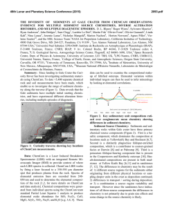
© Copyright 2026