
28 January 2015 - International Organization for Migration
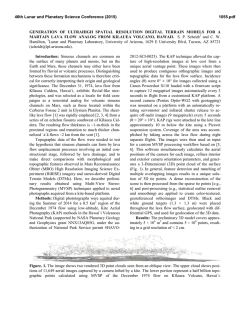
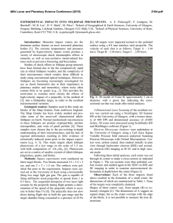
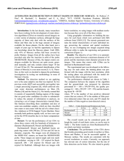
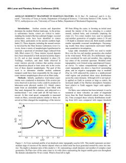
IOM DEMOCRATIC REPUBLIC OF THE CONGO IOM’s Disaster Risk Reduc on in North Kivu SITUATION REPORT SITUATION REPORT 28 January 2015 Figure 1. The ac ve lava lake of Mount Nyiragongo. © IOM 2014 (Photo: Dario Tedesco) In this issue Nyiragongo and Mt Nyamulagira Volcanoes: Ac vity and News Situa on Report A MONUSCO helicopter night flight took place on 23 June 2014 to monitor the activity of Nyiragongo and Nyamulagira volcanoes. Volcanologists from the Goma Volcano Observatory (GVO) and experts from the Civil Defence and the International Organization for Migration (IOM) participated in the mission. The flight was requested by the GVO following news on the radio of possible volcanic activity in Virunga National Park, which is located between the two volcanoes. The situation called for an immediate verification. The flight allowed the experts to discern that the activity of both volcanoes was concentrated solely in their respective craters. No evidence of lava flows or other hazardous activity (explosions, plume, or smoke emissions) was observed in either volcano or in areas in the proximity of the volcanoes. The GVO’s seismic network records showed no seismicity that might indicate a possible eruption. A small number of tremors occurred between 21 and 22 June, which may have been related to increased degassing within the Nyamulagira crater. There was no evidence of new magma injections through the crust. Night aerial photos of the two craters (Figures 3 and 4, respectively) show the current activity of these volcanoes. Figure 2. Mount Nyiragongo’s lava lake in the crater as seen during the day. 1 Mt. Nyiragongo Since May 2002, Mt. Nyiragongo has been in a steady state of activity. At that time, a lava lake formed rapidly in the crater. Since 2010 the lava lake has been in a stable equilibrium, not showing any significant level increase. towards a quieter and less dangerous activity, similar to Nyiragongo. This activity is typified by by the presence of a stable, long‐standing lava lake. This type of activity is not harmful to the population living south of Mt Nyamulagira. Figure 3. The ac ve lava lake of Mount Nyiragongo. It is considered the Figure 4. The inner part of the pit crater within the Nyamulagira crater. The largest on the planet. Appeared in 2002, since 2010 is in a steady state glowing means that magma has finally reached the surface although its ac vity without increasing its volumes of lava within the crater. depth should be s ll of few hundreds metres. The first photo (Figure 2) shows the current lava levels within the Nyiragongo crater. The level of the lava lake is about 50 metres lower than its maximum (recorded in 2011), which is the current rim of the lava lake itself. This current situation is considered to be normal and does not point to an imminent eruption. Mt. Nyamulagira Since June 22, 2014, a clear glowing has been visible from within the Nyamulagira crater. Visual observations on June 23 confirm that a new lava lake has emerged. Nonetheless, it is still not possible to see the lava within its pit crater (see photo of Nyamulagira volcano, Figure 5, taken during the day‐time). Our visual observations also show a tick plume, rich in SO2 (sulphur dioxide). The possible height of the lava within the Nyamulagira crater cannot be measured; only in very favourable meteorological conditions will it be possible to have a clear view of the emergent lava lake. The presence of a newly formed lava lake within the crater of Nyamulagira would mark a change in the activity of this volcano, which is one of the most active in Africa. A lava lake would indicate that it is moving Contact: Laurent DE BOECK, Chief | [email protected] | www.drcongo.iom.int of Although there is currently no direct threat to human settlements around the volcano, it is important to continue to monitor the plume’s direction and gaseous content. It is also be important to continuously check if the number of respiratory pathologies increases at local health centres in villages hit by the plume. The GVO continues to monitor and record seismic activity; any tremor is interpreted as a possible precursor to new eruptive events. This serves as a warning to all possible future eruptive events, including beyond the Nyamulagira crater. Figure 5. Mount Nyamulagira crater and its very ac ve “pit crater”. The ac vity visible today is centred around this inner crater. Its dimensions are almost 300 metres large and about 415 metres deep. Mission, IOM Democra c Republic of the Congo 2 Satellite Imagery and Information The University of Torino’s (Italy) MIROVA Project analyses satellite imagery of the Nyiragongo and Nyamulagira volcanoes and shares the images and their analysis to the GVO and IOM free of charge. This enables he GVO and IOM to remain updated on the activity of the volcanoes. The data is updated several times a day, and is very accurate and reliable. Only if the volcanoes are completely covered by clouds is the data difficult to use. Figure 6a. The important number of data of Mt Nyiragongo shows that its ac vity has been very constant in the last years and no changes or anomalies have been recently detected. This ac vity does not pose any treat for local popula ons. Figure 6b. Conversely to Nyiragongo, there are very few data collected on Nyamulagira . The main reason is that up to two years ago there have been very li le ac vity on this crater and only recently has been possible to detect the presence of a “crypto”‐lava lake. The latest available information shows that the Nyiragongo lava lake outputs a significant thermal signal, with an almost constant thermal activity in the last years (Figure 6a). Satellite information on the Nyamulagira volcano (Figure 6b) is more difficult to analyse in terms of volcanic activity. The position of the lava lake, far below the crater surface, makes the image difficult to interpret, which means that it is not possible to determine thermal activity and the possible volume of lava in the pit crater. To understand the activity of the volcano, long‐term data and image analysis are needed. Despite this limitation, it is possible to determine that the activity within the crater in June 2014 was at its most intense since July 2013. Figures 7 and 8. The figures show the evolu on of the lava lake within Nyiragongo crater since its appearance in 2002. The last measurements in October/ November 2014 show no varia ons to the one taken in 2010. This data allows to understand the current ac vity within the Nyamulagira crater and its possible evolu on with me. Contact: Laurent DE BOECK, Chief | [email protected] | www.drcongo.iom.int of Mission, IOM Democra c Republic of the Congo 3 similar to the Nyiragongo’s activity since 2002 (Figure 7 and 8). It should be possible to monitor the level and speed of the rise of the lava within the pit crater in function of the crater activity. The current activity of Nyamulagira and Nyiragongo does If the activity within the Nyamulagira crater continues as not pose any immediate threat to the areas of Sake and shown in the last weeks, and if the presence of the pit Goma, respectively. crater of a new lava lake remains, it is possible to hypothesize that the evolution of its activity will be It appears that the activity that was visually observed in Nyamulagira, and subsequently confirmed through satellite imagery on 23 June (and in the following days; Figure 6b), might bring a steady state of thermal activity, similar to Nyiragongo (Figure 6a). For more informa on, please contact: Dario TEDESCO, Disaster Risk Reduc on Specialist, [email protected], +243(0)81 664 5057 Monique VAN HOOF, Emergency Programme Coordinator, [email protected], +243(0)82 248 7445 Contact: Laurent DE BOECK, Chief | [email protected] | www.drcongo.iom.int of Mission, IOM Democra c Republic of the Congo 4
© Copyright 2026