
folleto campamento 2015
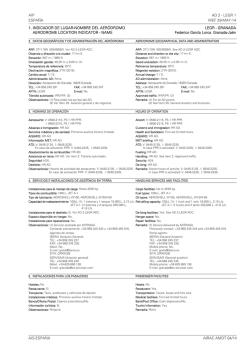
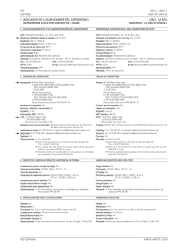
AIP
ESPAÑA
AD 2 - LEAM 1
16-OCT-14
1. INDICADOR DE LUGAR-NOMBRE DEL AERÓDROMO
AERODROME LOCATION INDICATOR - NAME
LEAM - ALMERÍA
2. DATOS GEOGRÁFICOS Y DE ADMINISTRACIÓN DEL AERÓDROMO
AERODROME GEOGRAPHICAL DATA AND ADMINISTRATION
ARP: 365038N 0022212W. Ver AD 2-LEAM ADC.
Distancia y dirección a la ciudad: 9 km W.
Elevación: 21 m / 70 ft.
Ondulación geoide: 49,60 m ± 0,05 m (1).
Temperatura de referencia: 31°C.
Declinación magnética: 1°W (2010).
Cambio anual: 6,8’E.
Administración AD: Aena.
Dirección: Aeropuerto de Almería - Crta. de Níjar, km 9 - 04130 Almería.
TEL: +34-950 213 701/13/21
FAX: +34-950 213 859
AFTN: LEAM
E-mail: [email protected]
Tránsito autorizado: IFR/VFR.
Observaciones: (1) Para todos los puntos del AD.
ARP: 365038N 0022212W. See AD 2-LEAM ADC.
Distance and direction to the city: 9 km W.
Elevation: 21 m / 70 ft.
Geoid undulation: 49.60 m ± 0.05 m (1).
Reference temperature: 31°C.
Magnetic variation: 1°W (2010).
Annual change: 6.8’E.
AD administration: Aena.
Address: Aeropuerto de Almería - Crta. de Níjar, km 9 - 04130 Almería.
TEL: +34-950 213 701/13/21
FAX: +34-950 213 859
AFTN: LEAM
E-mail: [email protected]
Approved traffic: IFR/VFR.
Remarks: (1) For all AD points.
3. HORARIO DE OPERACIÓN
HOURS OF OPERATION
Aeropuerto: V: 0510-2045, PS 30 MIN PPR.
I: 0610-2145, PS 30 MIN PPR.
Aduanas e Inmigración: HR AD.
Servicios médicos y de sanidad: Ver GEN 1.4.
AIS/ARO: HR AD.
Información MET: HR AD.
ATS: V: 0455-2105, I: 0555-2205.
En caso de activación PPR: V: 0455-2135, I: 0555-2235.
Abastecimiento de combustible: HR AD.
Asistencia en tierra: HR AD.
Seguridad: HR AD.
Deshielo: No.
Observaciones: Horario de actividad del aeropuerto: V: 0455-2105; I: 0555-2205.
En caso de activación PPR: V: 0455-2135; I: 0555-2235.
Airport: V: 0510-2045, PS 30 MIN PPR.
I: 0610-2145, PS 30 MIN PPR.
Customs and Immigration: HR AD.
Health and Sanitation: See GEN 1.4.
AIS/ARO: HR AD.
MET briefing: HR AD.
ATS: V: 0455-2105, I: 0555-2205.
In case PPR is activated: V: 0455-2135, I: 0555-2235.
Fuelling: HR AD.
Handling: HR AD.
Security: HR AD.
De-icing: No.
Remarks: Airport hours of activity: V: 0455-2105; I: 0555-2205.
In case PPR is activated: V: 0455-2135; I: 0555-2235.
4. SERVICIOS E INSTALACIONES DE ASISTENCIA EN TIERRA
HANDLING SERVICES AND FACILITIES
Instalaciones para el manejo de carga: Hasta 3.000 kg.
Tipos de combustible: 100LL, JET A-1.
Tipos de lubricante: AEROSHELL 100 - W (Aso W100).
Capacidad de reabastecimiento: 100LL: 1 cisterna 1.500 L, 5 L/s.
JET A-1: 4 cisternas 120.000 L, 67 L/s.
Instalaciones para el deshielo: No.
Espacio disponible en hangar: No.
Instalaciones para reparaciones: No.
Observaciones: Agentes de rampa:
AGA AIRLINES GROUND ASSISTANCE
Airlines Ground Assistance S.L.
Tel.: +34-629 818 997
E-mail: [email protected]
SITA: LEIOCXH
MENZIES AVIATION
Tel.: +34-950 213 797
E-mail: [email protected]
SITA: LEIKR7X
SWISSPORT SPAIN
Tel.: +34-950 213 988 / 986 / 979
E-mail: [email protected]
[email protected]
SITA: LEIKLXH; LEIKPXH
Cargo facilities: Up to 3,000 kg.
Fuel types: 100LL, JET A-1.
Oil types: AEROSHELL 100 - W (Aso W100).
Refuelling capacity: 100LL: 1 truck 1,500 L, 5 L/s.
JET A-1: 4 trucks 120,000 L, 67 L/s.
De-Icing facilities: No.
Hangar space: No.
Repair facilities: No.
Remarks: Ramp agents:
AGA AIRLINES GROUND ASSISTANCE
Airlines Ground Assistance S.L.
Tel.: +34-629 818 997
E-mail: [email protected]
SITA: LEIOCXH
MENZIES AVIATION
Tel.: +34-950 213 797
E-mail: [email protected]
SITA: LEIKR7X
SWISSPORT SPAIN
Tel.: +34-950 213 988 / 986 / 979
E-mail: [email protected]
[email protected]
SITA: LEIKLXH; LEIKPXH
5. INSTALACIONES PARA LOS PASAJEROS
PASSENGER FACILITIES
Hoteles: No.
Restaurante: Sí.
Transporte: Autobuses, taxis y coches de alquiler.
Instalaciones médicas: No.
Banco/Oficina Postal: Cajero automático/No.
Información turística: Sí.
Observaciones: Ninguna.
Hotels: No.
Restaurant: Yes.
Transportation: Buses, taxies and hire cars.
Medical facilities: No.
Bank/Post Office: Cash dispenser/No.
Tourist information: Yes.
Remarks: None.
AIS-ESPAÑA
AMDT 255/14
AD 2 - LEAM 2
WEF 09-JAN-14
AIP
ESPAÑA
6. SERVICIOS DE SALVAMENTO Y EXTINCIÓN DE INCENDIOS
RESCUE AND FIRE FIGHTING SERVICE
Categoría de incendios: 7.
Equipo de salvamento: De acuerdo con la categoría de incendios publicada.
Retirada de aeronaves inutilizadas: Servicio proporcionado por compañías
externas con un tiempo mínimo de respuesta
de 45 min.
Observaciones: Ninguna.
Fire category: 7.
Rescue equipment: In accordance with the fire category published.
Removal of disabled aircraft: Service provided by external companies with
minimum response time of 45 min.
Remarks: None.
7. DISPONIBILIDAD ESTACIONAL/REMOCIÓN DE OBSTÁCULOS
SEASONAL AVAILABILITY/OBSTACLE CLEARING
Equipo: No.
Prioridad: No.
Observaciones: Ninguna.
Equipment: No.
Priority: No.
Remarks: None.
8. DETALLES DEL ÁREA DE MOVIMIENTO
MOVEMENT AREA DETAILS
Plataforma: Superficie: Hormigón.
Resistencia: PCN 52/R/B/W/T.
Calles de rodaje: Anchura: 23 m.
Superficie: Asfalto.
Resistencia: T1, T2, T3: PCN 59/F/B/W/T EXC
S1: PCN 81/F/A/W/T
S2: PCN 60/F/A/W/T
S3: PCN 57/F/C/W/T
S4: PCN 106/F/A/W/T
Posiciones de comprobación: Altímetro: Plataforma puerta A ELEV: 12 m/39 ft.
Plataforma puerta D ELEV: 15 m/49 ft.
VOR: No.
INS: No.
Observaciones: Ninguna.
Apron: Surface: Concrete.
Strength: PCN 52/R/B/W/T.
Taxiways: Width: 23 m.
Surface: Asphalt.
Strength: T1, T2, T3: PCN 59/F/B/W/T EXC
S1: PCN 81/F/A/W/T
S2: PCN 60/F/A/W/T
S3: PCN 57/F/C/W/T
S4: PCN 106/F/A/W/T
Check locations: Altimeter: Apron gate A ELEV: 12 m/39 ft.
Apron gate D ELEV: 15 m/49 ft.
VOR: No.
INS: No.
Remarks: None
9. SISTEMAS Y SEÑALES DE GUÍA DE RODAJE
TAXIING GUIDANCE SYSTEM AND MARKINGS
Sistema de guía de rodaje: Puntos de espera en pista, letreros y puestos de
estacionamiento.
Señalización de RWY: Designadores, eje, umbral, umbral desplazado RWY 07,
punto de visada, faja lateral y zona de toma de contacto.
Señalización de TWY: Eje y borde.
Observaciones: Ninguna.
Taxiing guidance system: Runway-holding positions, boards and parking
positions.
RWY markings: Designators, centre line, threshold, displaced threshold
RWY 07, aiming point, side stripe and touchdown zone.
TWY markings: Centre line and edge.
Remarks: None.
10. OBSTÁCULOS DE AERÓDROMO
AERODROME OBSTACLES
Obstáculos que perforan las Superficies de Transición, Horizontal Interna y
Cónica establecidas en el Anexo 14 de OACI:
Obstacles which penetrate Transitional, Inner Horizontal and Conical Surfaces
contained in Annex 14 of ICAO:
Ver carpeta/CD “OBSTÁCULOS DE AERÓDROMO”.
See folder/CD “AERODROME OBSTACLES”.
Observaciones: Ver AD 2 - LEAM AOC.
Remarks: See AD 2 - LEAM AOC.
11. SERVICIO METEOROLÓGICO PRESTADO
METEOROLOGICAL SERVICE PROVIDED
Oficina MET: Almería MET.
HR: HR AD.
METAR: Semihorario.
TAF: 24 HR.
TREND: No.
Información: En persona y telefónica.
Documentación de vuelo/Idioma: Cartas y lenguaje claro/Español.
Cartas: Mapas significativos y de viento y temperatura en altitud.
Equipo suplementario: Presentador de imágenes de nubes, rayos y de información radar.
Dependencia ATS atendida: TWR, APP.
Información adicional: Oficina principal: Sevilla; H24; TEL: +34-954 462 030.
Oficina meteorológica Almería: HR AD;
TEL: +34-950 220 236.
Observaciones: Existe resumen climatológico de aeródromo. Se hacen avisos
de aeródromo.
MET office: Almería MET.
HR: HR AD.
METAR: Half-hourly.
TAF: 24 HR.
TREND: No.
Briefing: In person and by telephone.
Flight documentation/Language: Charts and plain language/Spanish.
Charts: Significant forecasted and altitude and wind maps.
Supplementary equipment: Clouds, lighting image and radar information
display.
ATS unit served: TWR, APP.
Additional information: Main office: Sevilla; H24; TEL: +34-954 462 030.
Meteorological office Almería: HR AD;
TEL: +34-950 220 236.
Remarks: Aerodrome climatological summary available. Aerodrome warnings
available.
AIRAC AMDT 13/13
AIS-ESPAÑA
AIP
ESPAÑA
AD 2 - LEAM 3
16-OCT-14
12. CARACTERÍSTICAS FÍSICAS DE LA PISTA
RUNWAY PHYSICAL CHARACTERISTICS
RWY
Orientación
Direction
DIM
(m)
THR
PSN
THR ELEV
TDZ ELEV
SWY
(m)
CWY
(m)
Franja (m)
Strip (m)
OFZ
RESA
(m)
RWY/SWY SFC
PCN
07
(1)
073.01° GEO
074° MAG
3200 x 45
365024.4265N
0022308.3345W
THR: 8 m/26 ft
TDZ: No
No
60 x 300
3320 x 300
No
190 x 150
RWY: Asfalto/Asphalt
PCN 59/F/B/W/T
SWY: No
25
(2)
253.03° GEO
254° MAG
3200 x 45
365053.3325N THR: 21.5 m/70 ft
0022110.5670W TDZ: 21.5 m/70 ft
No
60 x 150
3320 x 300
Si/Yes
190 x 150
RWY: Asfalto/Asphalt
PCN 59/F/B/W/T
SWY: No
7.50 m
7.76 m
-0.05%
0.4%
0.55%
0.7%
0.8%
21.80 m
21.38 m
16.10 m
15.10 m
11.40 m
Profile:
7.90 m
Perfil:
7.80 m
Remarks: (1) THR RWY 07 displaced 150 m.
(2) End RWY 25 coordinates: 365023.0N 0022314.1W.
7.88 m
Observaciones: (1) THR RWY 07 desplazado 150 m.
(2) Coordenadas extremo RWY 25: 365023.0N 0022314.1W.
0.27%
60 m
CWY
150 m
580.1 m
146.9 m
849.1 m
3200 m
THR 07
DESPLAZADO/DISPLACED
13. DISTANCIAS DECLARADAS
RWY
07
25
07 INT S2
25 INT S3
140.7 m
673.8 m
673.8 m
60 m
CWY
THR 25
DECLARED DISTANCES
TORA (m)
TODA (m)
ASDA (m)
LDA (m)
3200
3200
2230
1266
3260
3260
2290
1326
3200
3200
2230
1266
3050
3200
–
–
Observaciones: Ninguna.
Remarks: None.
14. ILUMINACIÓN DE APROXIMACIÓN Y DE PISTA
APPROACH AND RUNWAY LIGHTING
Pista: 07
Aproximación: Sencillo, 420 m. LIH.
PAPI (MEHT): 3° (15,98 m / 52 ft).
Umbral: Verdes con barras de ala.
Zona de toma de contacto: No.
Eje pista: 3050 m: 2150 m blancas + 600 m blancas y rojas + 300 m rojas.
Distancia entre luces: 15 m.
Borde de pista: 3200 m: 150 m rojas + 2450 m blancas + 600 m amarillas. LIH.
Distancia entre luces: 50 m.
Extremo de pista: Rojas.
Zona de parada: No.
Observaciones: Ninguna.
Runway: 07
Approach: Simple, 420 m. LIH.
PAPI (MEHT): 3° (15.98 m / 52 ft).
Threshold: Green with wing bars.
Touchdown zone: No.
Runway centre line: 3050 m: 2150 m white + 600 m white and red + 300 m red.
Distance between lights: 15 m.
Runway edge: 3200 m: 150 m red + 2450 m white + 600 m yellow. LIH.
Distance between lights: 50 m.
Runway end: Red.
Stopway: No.
Remarks: None.
Pista: 25
Aproximación: Precisión CAT I, 900 m. LIH.
PAPI (MEHT): 3° (18,45 m / 61 ft).
Umbral: Verdes con barras de ala.
Zona de toma de contacto: No.
Eje pista: 3200 m: 2300 blancas + 600 m blancas y rojas + 300 m rojas.
Distancia entre luces: 15 m.
Borde de pista: 3200 m: 2600 m blancas + 600 m amarillas. LIH.
Distancia entre luces: 50 m.
Extremo de pista: Rojas.
Zona de parada: No.
Observaciones: Ninguna.
Runway: 25
Approach: Precision CAT I, 900 m. LIH.
PAPI (MEHT): 3° (18.45 m / 61 ft).
Threshold: Green with wing bars.
Touchdown zone: No.
Runway centre line: 3200 m: 2300 white + 600 m white and red + 300 m red.
Distance between lights: 15 m.
Runway edge: 3200 m: 2600 m white + 600 m yellow. LIH.
Distance between lights: 50 m.
Runway end: Red.
Stopway: No.
Remarks: None.
AIS-ESPAÑA
AMDT 255/14
AD 2 - LEAM 4
WEF 18-SEP-14
AIP
ESPAÑA
15. OTRA ILUMINACIÓN, FUENTE SECUNDARIA DE ENERGÍA
OTHER LIGHTING, SECONDARY POWER SUPPLY
ABN/IBN: No.
WDI: 1 cerca S3, LGTD.
Iluminación de TWY: Borde.
Iluminación de plataforma: Postes proyectores.
Fuente secundaria de energía: Grupos electrógenos que proporcionan un
tiempo de conmutación (luz) de máximo 1 segundo para los sistemas: eje, borde, extremo de
pista y de máximo 15 segundos para el resto de
los sistemas de iluminación.
Observaciones: Ninguna.
ABN/IBN: No.
WDI: 1 near S3, LGTD.
TWY lighting: Edge.
Apron lighting: Floodlighting poles.
Secondary power supply: Engine generators that provide a maximum
swith-over time (light) of 1 second for the systems:
centre line, edge, runway end and a maximum
switch-over time of 15 seconds for the rest of the
lighting systems.
Remarks: None.
16. ZONA DE ATERRIZAJE PARA HELICÓPTEROS
HELICOPTER LANDING AREA
Situación: No.
Elevación: No.
Dimensiones, superficie, carga admisible, señalización: No.
Orientación: No.
Distancias declaradas: No.
Iluminación: No.
Observaciones: Ninguna.
Position: No.
Elevation: No.
Dimensions, surface, maximum weight, marking: No.
Direction: No.
Declared distances: No.
Lighting: No.
Remarks: None.
17. ESPACIO AÉREO ATS
ATS AIRSPACE
Denominación y límites laterales
Designation and lateral limits
Límites verticales
Vertical limits
Clase de
espacio aéreo
Airspace
class
Unidad responsable
Idioma
Unit
Language
Altitud de
transición
Transition
altitude
ALMERÍA CTR
Círculo de 6,5 NM de radio centrado en ARP.
Circle radius 6.5 NM centred on ARP.
300 m AGL
SFC
D
Almería TWR
ES/EN
1850 m/6000 ft
ALMERÍA ATZ
Círculo de 8 km de radio centrado en ARP.
Circle radius 8 km centred on ARP. (1)
900 m HGT (2)
SFC
D
Almería TWR
ES/EN
Observaciones: (1) O la visibilidad horizontal, lo que resulte inferior.
Remarks: (1) Or the ground visibility, whichever is lower.
(2) O hasta la elevación del techo de nubes, lo que resulte más bajo.
(2) Or up to the clouds ceiling, whichever is lower.
18. INSTALACIONES DE COMUNICACIÓN ATS
Servicio
Service
APP
TWR
VDF
ATS COMMUNICATION FACILITIES
Distintivo llamada
Call sign
FREQ
(MHz)
HR
Almería APP
Almería TWR
118.350
118.350
121.500
243.000
257.800
121.700
118.350
121.500
HR ATS
HR ATS
HR ATS
HR ATS
HR ATS
HR ATS
HR ATS
HR ATS
Almería gonio
19. RADIOAYUDAS PARA LA NAVEGACIÓN Y EL ATERRIZAJE
Observaciones
Remarks
APP/L
EMERG
EMERG
MIL
GMC
RADIO NAVIGATION & LANDING FACILITIES
Instalación (VAR)
Facility (VAR)
ID
FREQ
HR
Coordenadas
Coordinates
VOR (1ºW)
AMR
114.100 MHz
H24
364959.4N 0021533.9W
DME
AMR
CH 88X
H24
364959.1N 0021534.0W
AIRAC AMDT 08/14
ELEV
DME
60 m / 196 ft
Observaciones
Remarks
R-029 COV a/to:
FL80 56 NM
FL90 60 NM
FL100 66 NM
FL120 76 NM
FL140 100 NM
R-062 COV a/to:
FL85 66 NM
FL100 80 NM
FL110 90 NM
R-298 COV a/to:
FL135 60 NM
Oscilaciones de / Oscillations of
± 4º BTN 26-32 NM
FL170 60 NM
FL200 74 NM
R-116 COV a/to:
FL70 48 NM
FL80 54 NM
FL90 60 NM
AIS-ESPAÑA
AIP
ESPAÑA
AD 2 - LEAM 5
WEF 18-SEP-14
Instalación (VAR)
Facility (VAR)
ID
FREQ
HR
Coordenadas
Coordinates
NDB (1ºW)
AMN
310.000 kHz
H24
365054.1N 0022245.0W
COV 60 NM.
Oscilaciones de / Oscillations of ±10º
en/in sector BTN 165º-352
LOC 25 (1ºW)
ILS CAT I
IAM
109.900 MHz
H24
365020.6N 0022324.0W
333.800 MHz
H24
365045.9N 0022123.7W
CH 36X
284.000 kHz
H24
H24
365045.9N 0022123.7W
365233.0N 0021423.7W
254° MAG/407 m FM THR 07.
A 17 NM (15,4 DME) AVBL BTN +/35º FM RCL a/at 4500 ft MSL ó ABV.
A 25 NM (23,4 DME) AVBL BTN +/10º FM RCL a/at 3500 ft MSL ó ABV.
3°; RDH 17,4 m; a/at 379 m FM
THR 25 & 125 m FM RCL a la izquierda en el sentido de APCH / To the left
on APCH direction.
A 10 NM BLW 1500 ft sólo AVBL a 8º
a la izquierda y 7º a la derecha del RCL/
At 10 NM BLW 1500 ft only AVBL at
8º to the left and 7º to the right of RCL.
REF DME THR 25
074° MAG/10.537 m FM THR 25;
COV 15 NM.
NO AVBL en/in sector: 004º/007º;
080/110º; 140º/170º & 305º/330º.
GP 25
ILS/DME 25
LO 25 (1ºW)
IAM
AM
ELEV
DME
24 m / 78 ft
Observaciones
Remarks
20. REGLAMENTACIÓN LOCAL
LOCAL REGULATIONS
Aeródromo cerrado para aviones sin radio comunicación en ambos sentidos.
Aerodrome closed to aircraft without two-way radio communications.
Prohibido vuelos de arrastre de pancartas.
Banner towing flights are forbidden.
ASISTENCIA EN TIERRA A LA AVIACIÓN GENERAL
HANDLING SERVICES TO GENERAL AVIATION
Deberán contratar obligatoriamente el servicio de un agente handling (ver casilla 4):
• Todas las aeronaves que no estacionen dentro de la plataforma destinada a
aviación general.
• Aeronaves con envergadura superior a 12 m o con MTOW superior a 3,5 TM.
• Aeronaves con reactores.
• Todas las operaciones que tengan como origen o destino un aeropuerto No
Schengen.
• Los vuelos que transporten pasajeros.
Hiring of a handling agent (see item 4) is mandatory for:
RESTRICCIONES EN EL ÁREA DE MANIOBRAS
• Las aeronaves tipo 4D que aterricen por la RWY 25 deberán abandonar pista por S1.
• Las aeronaves tipo 4C y 4D que salgan de pista por S3 deberán acceder a
plataforma directamente por puerta D.
RESTRICTIONS IN THE MANOEUVRING AREA
• Type 4D aircraft landing on RWY 25 must leave runway via S1.
LIMITACIONES A LAS PUERTAS DE PLATAFORMA
LIMITATIONS TO APRON GATES
Puerta A: máxima envergadura 52 m (aeronaves tipo D o inferior).
Puerta B: máxima envergadura 65 m (aeronaves tipo E o inferior).
Puerta C: máxima envergadura 36 m (aeronaves tipo C o inferior).
Puerta D: máxima envergadura 52 m (aeronaves tipo D o inferior).
Gate A: maximum wingspan 52 m (aircraft type D or below).
Gate B: maximum wingspan 65 m (aircraft type E or below).
Gate C: maximum wingspan 36 m (aircraft type C or below).
Gate D: maximum wingspan 52 m (aircraft type D or below).
PROCEDIMIENTOS DE OPERACIÓN DE AERONAVES 4E
PROCEDURE AIRCRAFT 4E OPERATION
1.- GENERALIDADES
1.- GENERAL
Los análisis de riesgos realizados acreditan que el Aeropuerto de Almería
garantiza suficientemente el nivel de seguridad operacional requerido para la
operación de aeronaves categoría 4E.
The risk analysis carried out, prove that Almeria Airport guarantees
sufficiently the operational safety level required for the operation of aircraft
category 4E.
Para que una aeronave de tipo 4E pueda operar es obligatoria la solicitud previa por parte de la Compañía Aérea o el Agente Handling y una autorización
explícita por parte del Centro de Operaciones del Aeropuerto.
For a type 4E aircraft may operate, it is mandatory a previous request by the
Airline of Handling Agent and an explicit clearance from the Airport Operations Center.
2.- ESTACIONAMIENTO
2.- STAND
Se ha definido el puesto de estacionamiento 20 para aeronaves tipo 4E.
Stand 20 has been defined for aircraft type 4E.
3.- MOVIMIENTO EN SUPERFICIE
3.- GROUND MOVEMENT
A) Llegada
Salida de pista por S1 o S4 (en función de la pista en uso), rodaje por la calle de rodaje paralela T hasta puerta B de acceso a plataforma,
donde esperarán al vehículo “SÍGAME” para dirigirse al puesto de estacionamiento.
A) Arrival
Runway exit via S1 or S4 (depending on the runway in use), taxiing via
parallel taxiway T until gate B to access to apron, where they will wait for
the “FOLLOW ME” vehicle to be guided to the stand.
B) Salida
Salida de plataforma por puerta B, rodaje hasta pista por calle de rodaje T
hasta S1 o S4 (en función de la pista en uso).
En condiciones de visibilidad reducida, en salidas por RWY 25 el vehículo
“SÍGAME” procederá al guiado de la aeronave hasta cabecera.
B) Departure
Apron exit via gate B, taxiing up to runway via taxiway T up to S1 or S4
(depending on the runway in use).
In low visibility conditions, departures from RWY 25, “FOLLOW ME”
vehicle will guide the aircraft up to threshold.
AIS-ESPAÑA
• All aircraft using stands outside the apron intended for general aviation.
• Aircraft with a wingspan larger than 12 m or with a MTOW of over 3.5 TM.
• Jet aircraft.
• All operations with origin or destination a Non Schengen airport.
• Passenger flights.
• Type 4C and 4D aircraft departing runway via S3, must access directly to
apron via gate D.
AIRAC AMDT 08/14
AD 2 - LEAM 6
WEF 18-SEP-14
AIP
ESPAÑA
4.- RESTRICCIONES
4.- RESTRICTIONS
Durante el uso del puesto de estacionamiento 20 por una aeronave 4E queda
inutilizado el puesto de estacionamiento 21.
During the use stand 20 by type 4E aircraft, the stand 21 is unusuable.
En las calles de rodaje S4 y T3 no se cumple el requisito de ancho de franja
de calle de rodaje para clave 4E (40,5 m desde el eje en lugar de 47,5 m
recomendados para aeronaves 4E).
Taxiways S4 and T3 don´t comply with the requirement of taxiway strip
wide for type 4E aircraft (40.5 m from the axis instead of 47.5 m recommended by aircraft type 4E).
21. PROCEDIMIENTOS DE ATENUACIÓN DE RUIDOS
NOISE ABATEMENT PROCEDURES
No.
No.
22. PROCEDIMIENTOS DE VUELO
FLIGHT PROCEDURES
SISTEMA DE PRESENTACION RADAR
RADAR DISPLAY SYSTEM
Se autoriza la utilización del sistema de presentación radar de vigilancia instalado en la torre de control de Almería para realizar las siguientes funciones:
- Asistencia radar a las aeronaves en aproximación final.
- Asistencia radar a otras aeronaves en las cercanías del aeródromo.
- Suministrar asistencia para la navegación para vuelos VFR.
The use of the radar presentation system installed in Almeria control tower is
authorized to perform the following functions:
- Radar assistance to aircraf on final approach.
- Radar assistance to other aircraft in the vicinity of the aerodrome.
- Provide navigation assistance to VFR flights.
Queda así mismo autorizada la utilización de la información radar presentada
en la pantalla radar instalada en la torre de control de Almería para los siguientes usos:
The radar information displayed in the radar screen installed in Almeria control tower is also authorized to be used for the following purposes:
1- Modo C: Una vez comprobada la exactitud de la información de modo C
presentada en la pantalla radar, autorizar a las aeronaves sucesivas a ocupar altitudes libres de la aeronave precedente.
1- Mode C: Once the accuracy of mode C information presented in the radar
screen is checked, authorize succesive aircraft to take up the vacated altitudes of the preceding aircraft.
2- Ajustes de velocidad: basándose en la información de la velocidad presentada en la pantalla radar , el controlador podrá sugerir incrementos o reducciones de velocidad a las aeronaves en secuencia de aproximación.
2- Speed adjustment: based in the speed information presented in the radar
screen, the controller may advise aircraft in the approach path to increase
or decrease their speed.
3- Separaciones Geográficas: mediante la confirmación y/ o notificación por
parte de las aeronaves al cruzar un punto de notificación publicado en AIP
y que está representado en la presentación radar, el controlador podrá autorizar ascensos y descensos en aplicación de la correspondiente separación geográfica.
3- Geographical separation: through the confirmation and/or notificacion by
the aircraft when crossing over a reporting point published in the AIP and
represented in the radar display, the controller may authorize ascents or
descents in accordance with the applicable geographical separation.
PROCEDIMIENTOS DE VISIBILIDAD REDUCIDA (LVP)
LOW VISIBILITY PROCEDURES (LVP)
1.- GENERALIDADES
1.- GENERAL
1.1 Se aplicarán los procedimientos de visibilidad reducida en superficie (LVP)
cuando las condiciones meteorológicas mínimas sean las siguientes:
- visibilidad general en el área de movimiento para la RWY 07/25, por carecer de RVR, sea inferior o igual a 550 m.
1.1 Surface low visibility procedures (LVP) will be applied when the minimum
meteorological conditions are as follows:
- general visibility in the movement area for RWY 07/25, due to the lack
of RVR, is 550 m or below.
1.2 TWR informará a los pilotos de que se están aplicando los procedimientos de visibilidad reducida.
1.2 TWR will inform pilots about the application of low visibility procedures.
2.- MOVIMIENTO EN SUPERFICIE
2.- GROUND MOVEMENT
Los pilotos procederán a verificar en todo momento la situación de la aeronave, comprobando que el rodaje se ejecuta en condiciones de completa seguridad. En caso de desorientación o duda detendrán la aeronave, e informarán
a TWR inmediatamente.
Pilots will proceed to verify the aircraft position at all times, checking that
taxiing is being executed under total safety conditions. In case of being disoriented or in doubt, pilots will stop the aircraft and will immediately notify
TWR.
2.1 Llegadas:
2.1 Arrivals:
2.1.1 Las aeronaves que hayan aterrizado notificarán:
- Pista libre; y
- Calle de salida autorizada.
2.1.1 Aircraft that have landed will report:
- Runway vacated and
- Exit taxiway authorized.
2.1.2 A la entrada de la plataforma de estacionamiento, las aeronaves esperarán la presencia del vehículo "SIGAME" a fin de ser dirigidos al puesto
asignado.
2.1.2 At the apron entry, aircraft must wait for the arrival of a "FOLLOW ME"
vehicle in order to be guided to the assigned stand.
2.2 Salidas:
2.2 Departures:
2.2.1 A fin de establecer una mejor puesta en secuencia del tránsito los pilotos no solicitarán autorizaciones de puesta en marcha de motores, retroceso o rodaje cuando los valores de RVR o visibilidad en su caso, estuviesen por debajo de sus mínimos operacionales.
2.2.1 In order to establish the best transit sequence, pilots must not request
clearance for engines start-up, push-back or taxiing, when the RVR
values or the meteorological visibility is below their operational minima.
2.2.2 Normalmente, en los casos en que el RVR/visibilidad sea inferior a
550 m, solamente se autorizará el rodaje de una aeronave, a la vez en
el Área de maniobras.
2.2.2 Usually, when the RVR/visibility is lower than 550 m, only one aircraft at
a time will be authorized to taxi in the manoeuvring area.
3.- FALLO DE COMUNICACIONES Y SITUACIONES ANÓMALAS EN EL
ÁREA DE MANIOBRAS
3.- COMMUNICATIONS FAILURE AND ANOMALOUS SITUATIONS IN
MANOEUVERING AREA.
En el caso de que una aeronave o vehículo operando en el área de maniobras
experimente un fallo en las comunicaciones procederá como sigue:
Whenever an aircraft or a vehicle operating in the manoeuvering area experiences a communication failure, it will proceed as follows:
a) Aeronave de Salida:
La aeronave continuará por la ruta asignada hasta el límite de la autorización ATC extremando las precauciones, donde mantendrá posición y esperará la llegada de un vehículo "SÍGAME" que le guiará al puesto de estacionamiento designado.
a) Departing aircraft:
The aircraft must continue by the assigned route to ATC clearance limit,
taking extreme caution, where must hold position and wait for the arrival
of a "FOLLOW ME" vehicle in order to be guided to the designated stand.
b) Aeronave de Llegada:
Si la aeronave acaba de aterrizar, mantendrá posición una vez abandonada
completamente la pista y esperará la llegada de un vehículo "SÍGAME" que
le guiará al puesto de estacionamiento designado.
b) Arrival aircraft:
If the aircraft has just landed, maintain position once completely abandoned the runway and wait for the arrival of a "FOLLOW ME" vehicle in order
to be guided to the designated stand.
AIRAC AMDT 08/14
AIS-ESPAÑA
AIP
ESPAÑA
AD 2 - LEAM 7
WEF 18-SEP-14
If the aircraft had a taxi ATC clearance, must continue on the assigned route, if any, to the limit of the ATC authorization, taking extreme caution,
where must hold position and wait for the arrival of a "FOLLOW ME" vehicle in order to be guided to the designated stand.
c) Vehículo:
El vehículo permanecerá en su posición y esperará la llegada de un vehículo "SÍGAME" que le guiará hasta el lugar que se determine.
c) Vehicle:
The vehicle must hold its position and wait for the arrival of a "FOLLOW
ME" vehicle in order to be guided to the determined location.
CIRCUITO DE TRÁNSITO DE AD
AD TRAFFIC CIRCUIT
TWR
25
Si la aeronave ya tuviera una autorización de rodaje ATC, continuará por la
ruta asignada, si la hubiera, hasta el límite de la autorización ATC extremando las precauciones, donde mantendrá posición y esperará la llegada
de un vehículo "SÍGAME" que le guiará al puesto de estacionamiento designado.
07
23. INFORMACIÓN SUPLEMENTARIA
ADDITIONAL INFORMATION
No.
No.
AIS-ESPAÑA
AIRAC AMDT 08/14
© Copyright 2026