
Cycle Superhighway - Transport for London
Transport for London Surface Transport Cycle Superhighway North-South route Environmental Evaluation Report Version: Date: Final v2 January 2015 CYCLE SUPERHIGHWAY NORTH SOUTH ROUTE Environmental Evaluation Report Contents EXECUTIVE SUMMARY ........................................................................................................................................... 4 PROJECT DESCRIPTION & METHODOLOGY ........................................................................................................ 7 PROJECT DESCRIPTION...............................................................................................................................................7 ENVIRONMENTAL EVALUATION METHODOLOGY ............................................................................................................8 CONSULTATION...........................................................................................................................................................8 DETAILED APPRAISAL ............................................................................................................................................. 9 PLANNING AND TRANSPORT POLICY ............................................................................................................................9 BIODIVERSITY .............................................................................................................................................................9 CULTURAL HERITAGE ................................................................................................................................................13 TOWNSCAPE .............................................................................................................................................................17 NOISE AND VIBRATION ..............................................................................................................................................19 DUST AND EMISSIONS TO AIR ....................................................................................................................................21 WATER RESOURCES .................................................................................................................................................23 PHYSICAL FITNESS ...................................................................................................................................................23 JOURNEY EXPERIENCE..............................................................................................................................................24 SUSTAINABLE DESIGN ...............................................................................................................................................25 ENVIRONMENTAL MANAGEMENT ................................................................................................................................26 APPENDIX A: ENVIRONMENTAL EVALUATION REPORT TEMPLATE .............................................................. 27 APPENDIX B: RELEVANT PLANNING AND TRANSPORT POLICIES ................................................................. 38 APPENDIX C: EVALUATION OF CONSERVATION AREAS ................................................................................. 42 APPENDIX D: LIST OF LISTED BUILDINGS AND STRUCTURES ....................................................................... 49 APPENDIX E: SCHEDULED MONUMENTS ........................................................................................................... 52 APPENDIX F: NOISE CALCULATIONS .................................................................................................................. 54 APPENDIX G: NO2 CONCENTRATIONS................................................................................................................ 57 APPENDIX H: ENVIRONMENTAL DATA SOURCES ............................................................................................. 69 List of Figures Figure 1 – Geographical illustration of Cycle Superhighway North South....................................................................7 Figure 2 - Sites of Importance for Nature Conservation .............................................................................................10 Figure 3 - Sighting of Protected Species ....................................................................................................................11 Figure 4 - Conservation Areas ....................................................................................................................................13 Figure 5 - Archaeological Priority Areas .....................................................................................................................14 Figure 6 - Listed Buildings and Structures ..................................................................................................................15 Figure 7 - World Heritage Sites & Scheduled Monuments .........................................................................................16 Figure 8 - Streetscape Character Areas .....................................................................................................................17 Figure 9 - Important Areas for Noise ..........................................................................................................................19 Figure 10 - Areas of Air Quality Standard Exceedance ..............................................................................................21 Figure 11 - Changes in Predicted Annual Mean NO2 Concentration .........................................................................22 Figure 12 – Flood Risk Zones (dark blue) and River Thames (Light Blue) ................................................................23 List of Tables Table 1: Summary of Environmental Impacts ...............................................................................................................6 Table 2 - Streetscape Character Areas ......................................................................................................................18 Table 3 - Important Areas for Noise............................................................................................................................20 Table 4 - Noise Impact by Road Length .....................................................................................................................20 Table 5 - NO2 Impact by Road Length........................................................................................................................22 Page 2 of 69 CYCLE SUPERHIGHWAY NORTH-SOUTH ROUTE Author(s) and Contributor(s) Sophia Borgese (B.Sc.), Strategy Planner, Surface Transport Environment Team Giovanni Nacci (B.Sc. M.Sc. AIEMA), Principal Technical Specialist - Environment, Surface Transport Environment Team (Acting as Environmental Manager) Page 3 of 69 Environmental Evaluation Report CYCLE SUPERHIGHWAY NORTH-SOUTH ROUTE Environmental Evaluation Report Executive Summary Introduction This document presents the outcomes of the environmental evaluation of the North-South Cycle Superhighway Route (i.e. the Project). It includes a brief description of the Project, the evaluation methodology that has been used, the likely environmental impacts of the Project and measures to protect the built and natural environment. The environmental evaluation follows Surface Transport’s Project Environmental Evaluation procedure, part of its Environmental Management System. Where applicable, the environmental evaluation is guided by the Department for Transport’s Analysis Guidance (TAG) and Design for Roads and Bridges (DMRB). Summary of Impacts Significance of Impacts The Project is likely to lead to localised and route-wide beneficial and adverse environmental impacts; these impacts span the whole significance’s spectrum from significant, to moderate to slight, including many areas where the Project is likely to have a neutral impact on the environment. The environmental evaluation has concluded that the Project is unlikely to have significant environmental impacts on the following areas: Planning and Transport Policy Biodiversity Cultural Heritage Townscape Water Resources Physical Fitness Journey Experience Sustainable Design Environment Management For Dust and Emissions to Air, significant impacts both adverse and beneficial are likely to occur at a localised level only. Overall, substantial beneficial impacts are expected on 1.9km of the wider London road network, moderate beneficial impacts on 5.4km, substantial adverse impacts on 0.46km, and moderate adverse impacts on 5.2km. For Noise and Vibration, significant impacts both adverse and beneficial are likely to occur at a localised level only. Major positive impacts are expected on 0.42km of the network, moderate beneficial impacts on 0.56km of the network, major adverse impacts on 0.55km of the network and moderate adverse impacts on 0.14km of the network. No moderate or major magnitude changes are expected within the Important Areas for noise. Air quality and noise impacts are driven by the redistribution of traffic on and around the Route. Traffic redistribution in turn redistributes air and noise emissions across the study area. Overall the Projects will not increase Dust and Air Emissions, or Noise and Vibration. Page 4 of 69 CYCLE SUPERHIGHWAY NORTH-SOUTH ROUTE Environmental Evaluation Report The next paragraphs and Table 1 below summarise the main environmental impacts of the Project during the construction and operational phase. Operational phase Benefits The Project is likely to have a number of route-wide benefits, for instance it supports a number of local, regional and national policies which aim to encourage cycling and the use of more sustainable modes of transport. The Project is also likely to improve cyclists’ journey experience and their physical fitness. The Project is likely to have a number of localised benefits particularly in terms of noise and air quality. 44 road-links are predicted to experience a reduction in noise. Based on a simple comparison of the total length of road links with moderate or major magnitude impacts, it can be seen that the Scheme will bring slightly more beneficial impacts than adverse impacts on the basis of length of road link. No moderate or major magnitude changes are expected within the Important Areas for noise. In terms of air quality, significant beneficial impacts are expected on 7.3 km of road. A greater length of the road network is predicted to have significant beneficial impacts than significant adverse impacts. Many of the affected road links with increases or decreases in traffic are within the Air Quality Focus Areas. These are Areas that the GLA has identified as being priority areas for improvements in air quality due to concentrations within those areas and population exposure. Within these Focus Areas, significant beneficial impacts are expected on 3.7 km of road and significant adverse impacts on 1.9 km of road. Within the Focus Areas, a greater length of the road network is predicted to have significant beneficial impacts than significant adverse impacts. Total emissions within the affected Focus Areas are expected to decrease with the Scheme. Disbenefits There are no route-wide disbenefits. Where disbenefits are likely to arise, these tend to be of a localised nature. For instance localised noise and air quality disbenefits are likely to occur as a result of redistribution of traffic at certain locations. 71 road-links will experience an increase in noise, however the magnitude of these impacts is such that overall the scheme will bring more beneficial localised noise impacts than adverse localised noise impacts. In terms of air quality, significant adverse impacts are predicted on 5.7 km of road, but again a greater length of the road network is predicted to have a beneficial impact than adverse impacts. Energy consumption from way-finding monoliths will have a negative impact on energy efficiency objectives. Construction phase During the implementation works, some slight temporary and localised adverse impacts will arise in the form of visual intrusion, energy consumption, waste production, dust, emissions to air, noise, vibration and disruption to the existing and other cycle routes. Page 5 of 69 CYCLE SUPERHIGHWAY NORTH-SOUTH ROUTE Environmental Evaluation Report Table 1: Summary of Environmental Impacts Construction Operational Scale Phase Phase Planning and Transport Policy (p.9) 0 ++ Route-Wide Biodiversity (p.9) - 0 Local Cultural Heritage (p.13) 0 to - 0 Local Townscape (p.17) 0 to - 0 Local Noise and Vibration (p.19) - +++ to - - - Local Dust and Emissions to Air (p.21) - +++ to - - - Local Water Resources (p.23) 0 0 Route-Wide Physical Fitness (p.23) 0 + Route-Wide Journey Experience (p.24) - ++ Route-Wide Sustainable Design (p.25) - 0 to - Local Key: ---- Slight Adverse Mode Adverse Significant Adverse O Neutral + ++ +++ Slight Beneficial Moderate Beneficial Significant Beneficial Page 6 of 69 CYCLE SUPERHIGHWAY NORTH-SOUTH ROUTE Environmental Evaluation Report Project Description & Methodology Project Description The Project is part of the Cycle Superhighways Programme, one of London's key cycling programmes which forms part of the Mayor’s Cycle Revolution. The aim of the Programme is to break down the barriers that stop people commuting by bicycle. The Route (i.e. the geographical area along which the Project will operate) is 5.5km in length and extends from St Georges Road at the Elephant and Castle roundabout, in the south, to York Way at King’s Cross Station in the north. The route runs through three Local Authorities which are, from South to North: London Borough of Southwark City of London London Borough of Camden (on the boundary of Camden and Islington on some occasions) The Route runs on both the Transport for London Road Network (TLRN) and Local Authority roads. Figure 1 shows the geographical extent of the Project. Figure 1 – Geographical illustration of Cycle Superhighway North South The Project will aim to deliver the following measures where appropriate: Cyclist segregation from general traffic on the entire Route Page 7 of 69 CYCLE SUPERHIGHWAY NORTH-SOUTH ROUTE Environmental Evaluation Report Advanced Stop Lines (ASLs) Safety mirrors at left turns De-cluttering Improved lighting Planting Improved pedestrian facilities Way-finding Cycle Parking Early starts for cyclists Cycle specific stages at junctions Coach and bus stop bypasses Two stage right turns for cyclists Environmental Evaluation Methodology The environmental evaluation of the Project follows Surface Transport’s Project Environmental Evaluation Procedure, part of its Environmental Management System. Where applicable, the environmental evaluation is guided by the Department for Transport’s Analysis Guidance (TAG) and the Highway Agency’s Design for Roads and Bridges (DMRB). Appraisal methodologies are discussed in more detail under each relevant section. This Environmental Evaluation Report defines the requirements for achieving the appropriate level of environmental evaluation for a project so that negative environmental impacts are understood and minimised, environmental benefits are enhanced, environmental risks are managed, challenges to the project are reduced and the required relevant environmental opinions, directions, consents, permits and licenses are identified. The Report provides assurance to the Project Manager, Client and Environmental Manager that the project’s design and performance, the appraisal, monitoring and sampling methodology used, and other technical and reporting activities are of the required quality and standard to meet TfL’s environmental obligations. This report has been adapted from the Environmental Evaluation Report Template shown in Appendix A. Consultation Consultation involving key stakeholder has taken place from the end of September 2014 to the beginning of November 2014. Page 8 of 69 CYCLE SUPERHIGHWAY NORTH-SOUTH ROUTE Environmental Evaluation Report Detailed Appraisal Planning and Transport Policy The Project is consistent and in accordance with national, regional and local planning and transport policy objectives which seek to achieve a more sustainable transport system by promoting cycling (Appendix B). The Project complements other existing and proposed initiatives such as other Cycle Superhighways, the London Cycle Network, Legible London, London Cycle Hire Scheme and The Mayor’s Vision for Cycling in London. The Project will therefore result in moderate beneficial effects on planning and transport policy. Biodiversity There are three key biodiversity elements along the Route, these are: Sites of Importance for Nature Conservation (SINCs), protected species and street trees. SINCs are the next most important green spaces along the Route. They form part of a national network of non-statutory valued natural sites of Metropolitan, Borough or Local importance Figure 2 displays SINCs in the area surrounding the Project. Page 9 of 69 CYCLE SUPERHIGHWAY NORTH-SOUTH ROUTE Environmental Evaluation Report Figure 2 - Sites of Importance for Nature Conservation A number of protected species have been sighted along the Route (Figure 3). These are animals and plants which, as a result of their rarity, vulnerability or persecution, are given some form of special protection through wildlife legislation. Species which may be found on the highway and therefore at potential impact from the Project are birds and bats which may nest or roost in street trees. Page 10 of 69 CYCLE SUPERHIGHWAY NORTH-SOUTH ROUTE Environmental Evaluation Report Figure 3 - Sighting of Protected Species There are a large number of street trees along the Route. Trees are extremely important in an urban environment as they not only provide habitat sites for a number of protected species, but they also improve the visual appearance of an area. Trees also contribute towards the reduction of atmospheric particulate matter (PM10) and help adapt to climate change. Preliminary design indicates that no street trees will be removed. Page 11 of 69 CYCLE SUPERHIGHWAY NORTH-SOUTH ROUTE Environmental Evaluation Report TAG helps determine the impact that a project may have on biodiversity by combining the nature conservation value of an environmental feature with the magnitude of a project’s impact. The conservation value of the SINCs, protected species and street trees is of high or medium importance at the local scale with a limited potential for substitution, the magnitude of the impact in neutral. Therefore the overall impact is Value (high or medium) + Magnitude (neutral) = Neutral There are also a number of trees that whilst not at risk they are in close proximity to the works. The potential adverse impact to these trees must be noted and appraised prior to the commencement of the works. The National Joint Utilities Group’s (NJUG) ‘Guidelines for the Planning, Installation and Maintenance of Utility Apparatus in Proximity to Trees’ and the British Standard ‘BS 5837:2005, Trees in relation to construction – Recommendations’ states that within the prohibited zone (i.e. one metre from the tree trunk) excavation of any kind must not be undertaken unless there has been full consultation with the TfL Arboricultural and Landscape Manager. Removal of trees must be agreed with TfL Arboricultural and Landscape Manager. Trees in Conservation Areas must not be felled unless the Local Authority has been notified. The contractors will be required to produce an Environmental Management Plan through which they will seek to ensure that biodiversity features along the Route are protected and that a neutral impact on biodiversity is maintained during the implementation of the Project. If protected species are present during works, TfL will ensure that only Defra licensed ecologists handle protected species. The Project Team has and will be in contact with the TfL Arboriculture and Landscape Manager for the area throughout the development of the Project. Page 12 of 69 CYCLE SUPERHIGHWAY NORTH-SOUTH ROUTE Environmental Evaluation Report Cultural Heritage There are a number of heritage designations, features and assets along the Route. These include Conservation Areas (Figure 4), Archaeological Priority Areas (Figure 5Error! Reference source not found.), Listed Buildings and Structures (Figure 6), Scheduled Monuments and World Heritage Sites (Figure 7). Figure 4 - Conservation Areas Page 13 of 69 CYCLE SUPERHIGHWAY NORTH-SOUTH ROUTE Figure 5 - Archaeological Priority Areas Page 14 of 69 Environmental Evaluation Report CYCLE SUPERHIGHWAY NORTH-SOUTH ROUTE Figure 6 - Listed Buildings and Structures Page 15 of 69 Environmental Evaluation Report CYCLE SUPERHIGHWAY NORTH-SOUTH ROUTE Environmental Evaluation Report Figure 7 - World Heritage Sites & Scheduled Monuments Appendix C lists all Conservation Areas along the route and provides a brief description of each together with an appraisal of the likely impacts of the Project. Appendix D lists nationally and locally Listed Buildings and Structures along the Route. Appendix E lists all Scheduled Monuments. There are two World Heritage Sites (WHS) within 2 kilometres of the Route, these are The Tower of London and The Palace of Westminster, Westminster Abbey with St Margaret's Church. Overall, the impact of the Project on cultural heritage during implementation and operation is expected to be neutral. This conclusion was derived by applying professional judgment guided by TAG. The impact is likely to be neutral as the project maintains the existing historic character of the townscape; has no appreciable impacts, either positive or negative, on any known or potential heritage assets; and does not result in severance or loss of integrity, context or understanding within the historic landscape. New way-finding street furniture, blue Cycle Superhighway branding and lighting upgrades are not likely to impact on the current heritage status of the Conservation Areas. Page 16 of 69 CYCLE SUPERHIGHWAY NORTH-SOUTH ROUTE Environmental Evaluation Report Some excavation may be required particularly when relocating stats and utilities. Required excavation is likely to be under 45cm and therefore have a neutral impact on archaeological remains. In London, archaeological remains tend to be found at a depth greater than one metre from the surface (with the exception of some ancient walls and Scheduled Ancient Monuments which are protected from the surface). If any excavation is to be over one metre, then the contractors will be expected to hand-dig the site if in an archaeological priority area. If archaeological remains are found, work shall stop and will only resume after approval from the relevant Local Authority Conservation Officer is received. The contractors will be required to produce an Environmental Management Plan through which they will seek to ensure that cultural heritage features along the Route are protected and that a neutral impact on cultural heritage is maintained during the construction of the Project. Townscape The Project is located in a number of townscape character areas identified in Figure 8 and described in Table 2. Figure 8 - Streetscape Character Areas Page 17 of 69 CYCLE SUPERHIGHWAY NORTH-SOUTH ROUTE Environmental Evaluation Report Table 2 - Streetscape Character Areas Section Streetscape 1-8 Urban Residential 9-13 Urban Civic and Residential 14-16 Urban Civic 17 & 18 19 20 & 21 22-25 Definition Privately owned properties face directly onto the street, the streets may be enclosed by buildings of significant stature, both historic and contemporary in style. Dominated by substantial governmental and commercial office buildings of both contemporary and traditional style. In addition to this there are privately owned properties facing directly onto the street Dominated by substantial governmental and commercial office buildings of both contemporary and traditional style River - Urban Civic Dominated by substantial governmental and commercial office buildings of both contemporary and traditional style Urban Civic and Commercial Dominated by substantial governmental and commercial office buildings of both contemporary and traditional style. In addition there are purpose-built retail outlets. Urban Civic Dominated by substantial governmental and commercial office buildings of both contemporary and traditional style Overall, the impact of the Project on the townscape during the operational phase is expected to be neutral. This conclusion was derived by applying professional judgement guided by TAG. TAG describes a project to have a neutral effect on townscape when it: Avoids neither being visually intrusive nor has an adverse effect on the current level of tranquillity (where these exist) of the townscape through which the route passes. Maintains existing townscape character in an area which is not a designated townscape, that is, neither national nor local high quality, nor is it vulnerable to change. Avoids conflict with government policy towards enhancing urban environments. The townscape is already subject to stress conditions and the proposed measures are not expected to worsen them. Some temporary and localised visual intrusion from the construction phase will have a slight adverse impact on townscape. Overall the Project is expected to have a neutral slight adverse impact on townscape during the construction phase due to the traffic diversions and the consequent disruption to travel. In addition disruption could be worsened as a result of cumulative impacts from the simultaneous implementation of other projects in the area. During the operational phase, the Project is expected to have a neutral impact. Page 18 of 69 CYCLE SUPERHIGHWAY NORTH-SOUTH ROUTE Environmental Evaluation Report Noise and Vibration The Route passes through some densely populated areas; some of which have been identified by Defra as Important Areas for Noise. These are areas where high traffic volumes meet high numbers of noise sensitive receptors (Figure 9 and Table 3). Figure 9 - Important Areas for Noise Page 19 of 69 CYCLE SUPERHIGHWAY NORTH-SOUTH ROUTE Table 3 - Important Areas for Noise Importa nt Area London Borough ID Environmental Evaluation Report Road Links Length (km) 1031 Lambeth & Southwark Westminster Bridge Road, A302, A3 Kennington Park Road 3.65 1065 Lambeth A301 Waterloo Road, A3200 York Road, Addington Street 1.17 1190 Southwark A3 Borough High Street, A2198 Long Lane 0.45 1306 Camden & City of London & Islington A201 Farringdon Street, Ludgate Hill, A40 Newgate Street, Angel Street 2.63 683 Southwark A3200 Southwark Street 0.18 941 Southwark A200 Tooley Street 0.01 1148 City of London A3211 Lower Thames Street, A1213 Gracechurch Street 1.85 1189 Southwark A3 Borough High Street, A200 St Thomas Street, A200 Tooley Street 0.64 1304 City of London A3211 Victoria Embankment 0.02 1307 Islington A201 Farringdon Street 0.07 A high level noise assessment for short term impacts was carried out by Aecom following DMRB. Results show that the likely impact of the Project on noise ranges from Major Beneficial to Major Adverse as shown in Table 4 and Appendix F. The table shows road links where there is a change in Basic Noise Level (BNL) of over 1dB. Changes less than 1dB are deemed to be negligible. Changes between 1dB and 2.9dB are deemed to be minor. Changes between 3dB and 4.9dB are deemed to be moderate. Changes above 5dB are deemed to be major. Table 4 - Noise Impact by Road Length In total there are 115 links where noise changes by more than 1dB, 71 links will experience an increase in noise whilst 44 links would experience a reduction in noise. The magnitude of these increases however is such that overall the Project will bring more beneficial impacts than adverse impacts. Moderate or major beneficial impacts are expected on 8 links (0.97km) and moderate or major adverse impacts on 4 links (0.69km). No moderate or major magnitude changes are expected within the Important Areas for noise. The noise assessment at this stage has not identified the location of sensitive receptors and the impact of noise on those sensitive receptors. Page 20 of 69 CYCLE SUPERHIGHWAY NORTH-SOUTH ROUTE Environmental Evaluation Report Some localised short-term slight adverse impacts on noise and vibration can be expected during the construction phase from the use of plant and vehicles. Appropriate mitigation measures that seek to minimise noise during this phase will be put in place by the contractors. The contractors will be required to produce an Environmental Management Plan through which they will seek to minimise noise and vibration during the implementation phase. Dust and Emissions to Air Part of the Route passes through areas which exceed air quality standards (Figure 10). Figure 10 - Areas of Air Quality Standard Exceedance A high level air quality assessment was carried out by Aecom following DMRB. Results show that the likely impact of the Project on air quality ranges from Significant Adverse to Significant Beneficial as shown in Table 5, Figure 11 and Appendix G. A significant impact is one of moderate or substantial impact. Page 21 of 69 CYCLE SUPERHIGHWAY NORTH-SOUTH ROUTE Environmental Evaluation Report Table 5 - NO2 Impact by Road Length Figure 11 - Changes in Predicted Annual Mean NO2 Concentration The assessment focuses on the road links with a change of more than 1,000 AADT, as changes below this threshold are likely to be negligible (Source: DMRB). Overall, 16.5 km of road are expected to have adverse impacts and 15.0 km to have beneficial impacts. Significant beneficial impacts are expected on 7.3 km of road and significant adverse impacts on 5.7 km of road. The study shows that changes in traffic will redistribute emissions across the study area but will not increase overall emission levels. Some localised short-term slight impacts on local air quality can be expected during the implementation phase from the use of plant and vehicles. The contractors will be required to produce an Environmental Management Plan through which they will seek to minimise dust and emissions to air during the implementation phase. TfL will require the contractor to comply with the Greater London Authority and London Councils’ Control of Dust and Emissions from Construction and Demolition Best Practice Guidance. Page 22 of 69 CYCLE SUPERHIGHWAY NORTH-SOUTH ROUTE Environmental Evaluation Report Water Resources The southern part of the Route lies in areas identified by the Environment Agency as being at risk of flooding. Parts of the route are adjacent to the River Thames. Figure 12 displays Flood Risk Zones. Figure 12 – Flood Risk Zones (dark blue) and River Thames (Light Blue) The Route runs over the River Thames when passing over Blackfriars Bridge. The Environment Agency has confirmed that Flood Defence Consent is not required. The project will have no impact on flood defence structures. The risk to flooding along the Route will remain unchanged. Overall the impact of the Project on the water environment is expected to be neutral. TAG describes a project to have a neutral impact on water when there is no appreciable effect, either positive or negative, on the identified attributes. The contractors will be required to produce an Environmental Management Plan through which they will seek to avoid any impact to the water environment during the construction phase. Physical Fitness TAG advises that significant improvements in fitness and well-being are most evident in those who cycle 30km or more per week and that those people taking up physical activities will receive greater health benefits than those partaking in physical activities already. Page 23 of 69 CYCLE SUPERHIGHWAY NORTH-SOUTH ROUTE Environmental Evaluation Report The Project will complement other cycling initiatives but will not lead to an immediate increase in cycling trips; therefore the Project will have an initial neutral effect upon physical fitness. However, increased health benefits can be expected as the Project generates additional cycling trips in future. TAG does not provide a seven point impact appraisal scale for Physical Fitness. However, using professional judgment a conservative slight beneficial impact of the Project upon physical fitness can be expected. The number of cycling trips and associated health benefits will ultimately depend upon individuals’ personal choices. Nonetheless, the overall potential health benefit of the Project is clear, especially if the cycling activity is complemented with other physical daily activities such as walking. Journey Experience Different types of townscapes and the cycle routes in them provide different journey experiences to cyclists. For example canal, park and off-carriageway routes provide a better journey experience compared to on-carriageway routes. Journey experience of cyclists along the Route is evaluated in accordance with TAG Journey Ambience methodology. TAG identifies three components that contribute to journey experience. These are Traveller Care (cleanliness, facilities, information and environment), Traveller Views and Traveller Stress (frustration, fear of potential accidents and route uncertainty). It is expected that Traveller Care along the Route will be improved during the operational phase of the Project, in particular: Cleanliness – The Route will benefit from the proposed enhanced maintenance and enforcement measures. Local Authorities will continue to be responsible for litter collection and cleansing along the Route. Facilities – The route will now be fully segregated and resurfaced. It will be maintained to a high standard. Information – Way-finding monoliths and additional signage will be out in place to provide information about the Route and the local area. Maps of the Route will be available online to help cyclists plan their journeys. Environment – The overall condition and smoothness of cycle rides is expected to be improved from the resurfacing of the Route and Route segregation Views along the Route range from “restricted” (views are obscured by vegetation, fencing or buildings) to “no view” in more built up areas (views are obscured either side of the road by buildings). Overall, it is expected that the Project will have a neutral effect on Travellers Views during the operational phase. The majority of the route is on carriageway and the route will not improve views of the area or hinder them. Travellers Views in the more built up areas may be further improved through measures such as landscape improvements and tree planting if possible. Page 24 of 69 CYCLE SUPERHIGHWAY NORTH-SOUTH ROUTE Environmental Evaluation Report It is expected that during the operational phase the Project will have a positive effect on Traveller Stress. The positive benefits are identified through the alleviation of three recognised causes of travel stress: Frustration – Congestion, road layout and geometry and the inability to make good progress along the route are usually causes of frustration. Route resurfacing and segregation will help to reduce frustration. Fear of potential accidents – One of the key objectives of the Project is to improve the image and perception of cycling, safety and the perception of safety. These objectives will be achieved by implementing measures such as Cycle Superhighway branding and segregation that will increase visibility of the Route to other road users. These measures combined with Smarter Travel measures such as led rides, cycle support for school leavers and HGV and freight driver training will help reduce fear of potential accidents. Route uncertainty – Route uncertainty would be improved through the implementation of distinctive blue branding and segregation. The Route will be signed with way-finding monoliths providing key information such as route number and average journey times to destinations. Proposed landscape improvements and lighting features are desired to provide continuity to the route but again the implementation of these is uncertain at present. Overall the Project is going to be moderate beneficial to journey experience for cyclists During the construction phase Traveller Views, Facilities and Frustration are expected to worsen due to the restriction or diversion of existing routes as the measures are implemented. Sustainable Design TfL will encourage the use of sustainable materials, particularly in the design of the street furniture. TfL will require the contractor to reduce, reuse or recycle the waste that is generated and to record quantities of all waste streams. The contractor will also be required to comply with current legislation relating to the handling, transfer and disposal of all waste materials. TfL will seek to locate street furniture in well lit areas where no additional street lighting is required. All lighting along the route will be replaced and upgraded to current standards; however it is uncertain at this stage whether LED will be implemented. In the event that additional street lighting is needed to provide light to street furniture, the lighting will be designed and located to minimise the visual intrusion of lighting columns into the daytime streetscape and to minimise light pollution at night-time. Despite the use of sustainable materials, adopting the waste hierarchy and promoting the use of renewable energy, a slight adverse impact in respect of greenhouse gas emissions (due to an increase in energy use during implementation and operation and fuel use during construction) and the production of waste materials, is likely. Page 25 of 69 CYCLE SUPERHIGHWAY NORTH-SOUTH ROUTE Environmental Evaluation Report Environmental Management TfL will ensure that the contractors hold and maintain an environmental management system independently certified to ISO 14001:2004. TfL will require the contractors to produce an Environmental Management Plan for the construction phase. The Environmental Management Plan will demonstrate how the contractors are going to implement appropriate environmental procedures, including preventative measures and controls for dealing with the unlikely event of environmental incidents. The contractors shall ensure that the Environmental Management Plan covers the whole of the works and highlight any site specific issues. TfL will require the contractors to comply with current legislation relating to the handling, transfer and disposal of all waste materials including requirements set by the Waste Management Plans Regulations 2008 and Waste Electrical and Electronic Equipment Regulations 2006. TfL will require the contractors to comply with the Greater London Authority and London Councils’ Control of Dust and Emissions from Construction and Demolition Best Practice Guidance. TfL will require the contractors to follow the British Standard BS 5837:2005, Trees in relation to construction – Recommendations and NJUG’s Guidelines for the Planning, Installation and Maintenance of Utility Apparatus in Proximity to Trees and that Local Authority Tree Officers and TfL Arboricultural and Landscape Managers are consulted about the potential impact that the Project can have on trees along the Route. In the unlikely event that excavation for the installation of way-finding monoliths is over one metre in depth, TfL will require the contractors to hand-dig the site if in an archaeological priority area and if archaeological remains are found, work shall stop and will only resume after approval from the relevant Local Authority conservation officer and / or English Heritage is received. In the unlikely event that protected species are present on site during works, TfL will ensure that only Defra licensed ecologists handle protected species. To ensure compliance, TfL will monitor the performance of the contractors as works progress. Page 26 of 69 CYCLE SUPERHIGHWAY NORTH-SOUTH ROUTE Appendix A: Environmental Evaluation Report Template Page 27 of 69 Environmental Evaluation Report CYCLE SUPERHIGHWAY NORTH-SOUTH ROUTE Page 28 of 69 Environmental Evaluation Report CYCLE SUPERHIGHWAY NORTH-SOUTH ROUTE Page 29 of 69 Environmental Evaluation Report CYCLE SUPERHIGHWAY NORTH-SOUTH ROUTE Page 30 of 69 Environmental Evaluation Report CYCLE SUPERHIGHWAY NORTH-SOUTH ROUTE Page 31 of 69 Environmental Evaluation Report CYCLE SUPERHIGHWAY NORTH-SOUTH ROUTE Page 32 of 69 Environmental Evaluation Report CYCLE SUPERHIGHWAY NORTH-SOUTH ROUTE Page 33 of 69 Environmental Evaluation Report CYCLE SUPERHIGHWAY NORTH-SOUTH ROUTE Page 34 of 69 Environmental Evaluation Report CYCLE SUPERHIGHWAY NORTH-SOUTH ROUTE Page 35 of 69 Environmental Evaluation Report CYCLE SUPERHIGHWAY NORTH-SOUTH ROUTE Page 36 of 69 Environmental Evaluation Report CYCLE SUPERHIGHWAY NORTH-SOUTH ROUTE Page 37 of 69 Environmental Evaluation Report CYCLE SUPERHIGHWAY NORTH-SOUTH ROUTE Environmental Evaluation Report Appendix B: Relevant Planning and Transport Policies The table below outlines the national, regional and local planning and transport policy documents which the Project supports. Policy Document Scale Conformity with Policy Sustainable Development: The planning system should secure more sustainable patterns of transport development. Improved accessibility to facilities such as walking, cycling and public transport should be encouraged. The Project will encourage access to cycling facilities. Planning and Climate Change: Spatial planning should contribute to reducing carbon emissions and stabilising climate change (mitigation) and take into account the unavoidable consequences (adaptation).The Project will promote cycling which has no carbon emissions. Biodiversity and Geological Conservation: Planning policies on the protection of biodiversity and geological conservation through planning decisions aim to maintain, enhance, restore or add to biodiversity and geological conservation interests. The Project’s design will seek to maintain biodiversity and ensure that no adverse impacts on biodiversity will occur. Tree planting and landscape improvements are planned where possible. Transport: Requirement to promote accessibility to jobs, shopping, leisure facilities and services by way of public transport, walking and cycling. The policy supports solutions to reduce greenhouse gas emissions and congestion giving priority to pedestrian and cycle movements. The policy also states that developments should create safe and secure layouts which minimise conflicts between traffic and cyclists or pedestrians; which this project clearly sets out to do. The Project is consistent with the aims of the policy as it will promote accessibility to jobs, shopping, leisure facilities and services by way of cycling. National Planning Policy Framework 2012 National Planning and the Historic Environment: There is a requirement that special attention should be paid to the desirability of preserving or enhancing the character or appearance of any conservation area. Developments with less than substantial harm to the significance of a designated heritage asset should be weighed against the public benefits of the proposal. This development will not cause an adverse negative impact on the conservation areas and there will be great benefits to the public. It is advised that development within the historic environment should be of a high quality design. The Project is to consider the preservation of the appearance of conservation areas and where possible aims to ensure that street furniture will be of a high quality design. There is a need to assess the possibility of archaeological remains being found if excavations are set to be carried out. Works on site must stop immediately if archaeology is found. Planning and Noise: This policy framework guides local authorities on the use of their planning powers to minimise the adverse impact of noise. It outlines the considerations to be taken into account in determining planning applications both for noise-sensitive developments and for those activities which generate noise. The Contractors appointed to deliver the Project will be required to produce an Environmental Management Plan which amongst other things will need to address how noise is to be minimised during the Project’s implementation phase. Development and Flood Risk: The Policy framework ensures that flood risk is taken into account at all stages in the planning process to avoid inappropriate development in areas at risk of flooding, and to direct development away from areas at highest risk. The Project should seek to obtain the relevant Flood Defence consent if required. Page 38 of 69 CYCLE SUPERHIGHWAY NORTH-SOUTH ROUTE Policy Document Environmental Evaluation Report Scale Conformity with Policy Planning Policy Statement 10: Planning for Sustainable Waste Management (PPS10) National PPS10 helps deliver sustainable development through driving waste management up the waste hierarchy, addressing waste as a resource and looking to disposal as the last option, but one which must be adequately catered for. The Contractors appointed to deliver the Project will be required to produce a Site Waste Management Plan. White Paper: The Future of Transport: A Network for 2030 National The Paper, amongst other things, aims to make cycling a real alternative for local trips. The Project is designed to facilitate and promote bicycle trips, which would have otherwise been made by bus, tube or car. The Report examines the long-term links between transport and the UK's economic productivity, growth and stability, within the context of the Government's broader commitment to sustainable development. The Report demonstrates that small-scale interventions such as cycling are often the most cost-effective solutions. The Report recognises the important contribution of cycling as a sustainable form of transport and how cycling contributes to every one of the five goals set out in Towards a Sustainable Transport System: Supporting Economic Growth in a Low Carbon World, namely: competitiveness and productivity, climate change; health, security and safety; quality of life; and equality of opportunity. The Eddington Transport Strategy National Sustainable Future for Cycling National The Mayor’s Transport Strategy (March 2012) Regional (London) The Strategy recognises that transport investment in new major projects such as those that promote and encouraging cycling is required to achieve sustainable growth. The Strategy also recognises the health benefits of cycling. Way to Go! (November 2008) Regional (London) Publication which outlines the Mayor’s vision for transport and intended revisions to the Transport Strategy. The Publication makes specific reference to the previous and ongoing Cycle Superhighway projects. The Mayor’s Transport Strategy (Public Draft, October 2009January 2010) Regional (London) Publication which outlines London’s transport strategy. The Publication makes specific reference to the previous and ongoing Cycle Superhighway projects. London Cycle Action Plan (February 2004) Regional (London) The Plan sets out measures to help achieve the Mayor’s vision of developing London as an exemplary sustainable world city. In particular the Plan seeks to increase cycle accessibility, safety and priority. It gives support to innovative cycle Projects and it seeks to promote cycling and its status. Living Well in London – The Mayor’s Draft Health Equalities Strategy for London (January 2008) Regional (London) The Draft Strategy sets out a framework to reduce health inequalities. In doing so it seeks to develop and promote London as a healthy place for all through the provision of high quality cycling opportunities, continued investment in sustainable modes of transport and the planning of developments that are sustainable. Regional (London) The Plan places importance on sustainable development that takes into account impacts on natural resources, environmental and cultural assets and the health of local people. REMA states that new development should be supported by necessary and accessible health and social infrastructure. The Plan also seeks to achieve an increase in the capacity, quality and integration of public transport in London, support shifts to more sustainable modes of transport and improve the provision of cycling facilities. The London Plan 2011 (revised early minor alterations REMA 2013) Page 39 of 69 CYCLE SUPERHIGHWAY NORTH-SOUTH ROUTE Policy Document Environmental Evaluation Report Scale Conformity with Policy Planning for a Better London (published July 2008) Regional (London) The Report sets out the Mayor’s strategic thinking and outlines key areas to be covered in what is now the new revision of the London Plan (2011). The Report further highlights the importance of establishing a strategic planning framework supportive of cycling. The London Plan (Consultation draft replacement plan, October 2009 Regional (London) Publication which outlines London’s land-use strategy. The Publication makes specific reference to the previous and ongoing Cycle superhighway projects. The Mayor of London Air Quality Strategy Regional (London) The Strategy presents policies and proposals aimed at improving London's air quality. Measures seek to facilitate a major improvement in public transport capacity, and encourage a shift from car travel towards cycling and other sustainable forms of travel. The Project will promote cycling and as such will support the Strategy. Clearing the air (The Mayor’s draft Air Quality Strategy for consultation with the London Assembly and functional bodies, October 2009) Regional (London) The Strategy sets measures to reduce concentrations of particulate matter (PM10) and nitrogen dioxide (NO2). The Publication makes specific reference to the previous and ongoing Cycle Superhighway projects. The Strategy seeks to actively manage long term noise, mainly from transport sources. The Strategy recognises that modal shift away from motorised vehicles, towards cycling for instance, can contribute to a reduction of transport related noise. The Project will promote cycling and as such will support the Strategy. The Strategy seeks to ensure that there is no overall loss of wildlife habitats in London, and that more open spaces are created and made accessible to all Londoners. The Project will not take away green areas but has an aim of introducing improvements to urban realm (including ‘greening’). The Mayor of London Noise Ambient Strategy Regional (London) The Mayor of London Biodiversity Strategy Regional (London) The Mayor of London Climate Change Action Plan Regional (London) The Plan recommends key actions to help London and Londoners tackle climate change. Cycling is recognised as one measure that can help reduce transport related carbon emissions. The Project will promote cycling and in doing so it will support the Plan. Regional (London) The Mayor wants to attract and encourage cycling in London. By planning to create segregated cycle lanes the protection of cyclists, through their own dedicated space along the route, is seen as attractive, comfortable and safe. The cycle superhighway routes are labelled as “a Crossrail for the bike”. The project will adhere to the Mayors vision of cycling in London. Regional (London) This strategy advertises cycling as a major transport mode right across the capital, from central London to the outer boroughs. It supports the creation of streets and spaces where everyone respects each other's right to use the road and as a result reduce cycling casualties. It aims to promote cycling as an enjoyable, everyday, healthy activity. It states that cycling needs to be embedded into the way the city is planned and run. The project will accomplish these points. The Mayors vision of cycling in London Cycling Revolution London strategy, published in 2010 Page 40 of 69 CYCLE SUPERHIGHWAY NORTH-SOUTH ROUTE Policy Document The Southwark Plan Environmental Evaluation Report Scale Conformity with Policy Local (Southwark) The Plan sets out to provide adequate conditions for pedestrians and cyclists including restrictions to parking and the promotion of walking and cycling. The Plan includes providing more direct, safe and secure walking and cycling routes, integrating with surrounding networks where possible and furthering the delivery of the London Cycle Network. London Borough of Southwark Unitary Development Plan (UDP) Local (Southwark) City of London Unitary Development Plan (UDP) Local (City of London) The Plan seeks to encourage cycling and improve conditions for cyclists. It states that cycling is a convenient, healthy, non-polluting and non-congesting means of travel which should be encouraged and positive action is needed to make it attractive, and, above all, safe. The Plan also seeks to provide for the needs of essential road traffic, improve road safety and reduce the impacts on the environment. Therefore the Plan seeks to restrain the unnecessary use of the private car in order to achieve a more balanced road space between users. The Project has the potential to reduce traffic through encouraging and promoting cycling and thus is consistent with the Plan. The Plan seeks to achieve a reduction in the overall level of traffic in the City in order to allow for more efficient public transport operations and improve air quality, the general environment and safety. The Plan also encourages additional and improved capacity in public transport services. The Project, by providing for a sustainable mode of travel is consistent with the UDP’s public transport strategy. City of London Local Development Framework (LDF) Local (City of London) The Preferred Options Paper outlines a number of preferred policy approaches for the future development of the City of London. Some approaches seek to ensure that the impact on the environment of travel in and through the City is minimised. Other options seek to improve sustainability, integration, reliability, safety, capacity and accessibility of all modes of public transport. The Project, through providing for a sustainable mode of transport is thus consistent with the Plan. City of London Local Implementation Plan (LIP) Local (City of London) The Plan highlights a need to promote and encourage cycling and improvements to cycling facilities. The Project, through promoting cycling and improving cycling facilities is consistent with the Plan. Local (Camden) Camden wants to have a safe and healthy population. Walking and cycling should be easier and safer; the public transport system will continue to be improved; and congestion and high levels of pollution will continue to be reduced. The Framework reads that development should make suitable provision for pedestrians, cyclists and public transport. Within the framework the Core Strategy promotes the use of walking, cycling, low emission vehicles, car clubs and pool cars as alternatives to the use of private cars. The Project has the potential to encourage cycling thereby contributing to improving the air quality; therefore this project is consistent with the plan. Camden Local Development Framework (LDF) (replacing UDP) Includes Core Strategy, Development Policies Page 41 of 69 CYCLE SUPERHIGHWAY NORTH-SOUTH Environmental Evaluation Report Appendix C: Evaluation of Conservation Areas Conservation Area West Square (TLRN Southwark) St George’s Circus (TLRN Southwark) Conservation Are Key Characteristics (Source Local Authority) The West Square Conservation Area was designated by Southwark Council on 17th September 1971 as a conservation area, under the Civic Amenities Act of 1967. The West Square Conservation Area is a mixed area containing a number of notable terraces of good quality late Georgian and mid-19th century houses, with a number of significant public buildings. The Imperial War Museum, with its surrounding parkland; Geraldine Mary Harmsworth Park, is the centrepiece of the conservation area. St George’s Roman Catholic Cathedral is another important building. This area was originally an area of common marshland known as Southwark Fields and then St George’s Fields after the nearby church of St. George the Martyr. It remained as agricultural land until the end of the 18th century until housing was built. St. George’s Circus is important historically as forming part of an example of Georgian town planning on the grand scale. The development of St. George’s Circus followed the opening of Blackfriars Bridge in 1769. The conservation area was designated on 23 October 2000. Page 42 of 69 Impact on Conservation Area’s Character Overall, the impact of the Project on this conservation area is neutral as the project maintains the existing historic character of the townscape; has no appreciable impacts, either positive or negative, on any known or potential heritage assets; and does not result in severance or loss of integrity, context or understanding within the historic landscape. Overall, the impact of the Project on this conservation area is neutral as the project maintains the existing historic character of the townscape; has no appreciable impacts, either positive or negative, on any known or potential heritage assets; and does not result in severance or loss of integrity, context or understanding within the historic landscape. CYCLE SUPERHIGHWAY NORTH-SOUTH ROUTE Conservation Area Whitefriars (TLRN City of London) Fleet Street (TLRN City of London) Environmental Evaluation Report Conservation Are Key Characteristics (Source Local Authority) The area was designated a Conservation Area in 1981 and extended in 1991. From the 12th century the western boundary was established by the Temple. The earliest established occupation of the area was by the Carmelite Friary (Whitefriars) from c.1250. From the 12th Century the area has been used and developed to accommodate the changing commerce of the area; providing Embankments and workshop buildings. Part of the present Fleet Street Conservation Area was designated in 1971 as 'Fleet Street South' and was extended substantially in 1981 to include the whole length of Fleet Street. It is likely that the alignment of Fleet Street originates from the Roman period. Fleet Street has always been a highly important route and from the 13th century was flanked by ecclesiastical land and 'inns'. The street itself soon became lined with houses, shops and taverns. There was a gradual rebuilding of properties after the fire with the increasing introduction of architectural variety leading to some of the richest and most elaborate buildings in Fleet Street being constructed in the late 19th and early 20th centuries. Consequently the area contains buildings of distinction, many of which are listed, and encompassing a wide range of periods, designs and materials. Page 43 of 69 Impact on Conservation Area’s Character Overall, the impact of the Project on this conservation area is neutral as the project maintains the existing historic character of the townscape; has no appreciable impacts, either positive or negative, on any known or potential heritage assets; and does not result in severance or loss of integrity, context or understanding within the historic landscape. Overall, the impact of the Project on this conservation area is neutral as the project maintains the existing historic character of the townscape; has no appreciable impacts, either positive or negative, on any known or potential heritage assets; and does not result in severance or loss of integrity, context or understanding within the historic landscape. CYCLE SUPERHIGHWAY NORTH-SOUTH ROUTE Conservation Area Smithfield (TLRN City of London) Charterhouse Square (TLRN City of London) Environmental Evaluation Report Conservation Are Key Characteristics (Source Local Authority) Formed from a combination of smaller conservation areas becoming Smithfield Conservation Area by the Corporation in 1991. Originally known as 'Smoothfield', it was a flat grassy area of high ground to the north-west of the City outside the City walls. Smithfield became one of several locations for cemeteries during the Roman occupation. Smithfield Conservation Area is notable in that, to the present day, much of its physical character is derived not just from its topography, but also the presence of institutions and activities which have been associated with the area for several centuriesbuilding of St Bartholomew’s Hospital, Meat Markets, and replacement of buildings with Victorian and Edwardian buildings. Originally designated in 1994 and then re-designated in 2007. The area comprises of a range of buildings that act as an important transition between the varied and richly historic character of Charterhouse Square, the railway infrastructure and large modern buildings to the south. The area incorporates the cutting, platforms and associated structure of the former Aldersgate Street Station (now Barbican Station), part of a major Victorian engineering project associated with London’s first underground railway line. The area is focused on an intact group of Victorian buildings with a distinctive industrial character illustrated by their large windows and a range of surviving features. The streetscape is defined by robust brick and Portland Stone masonry buildings with consistent building heights and rooflines. Page 44 of 69 Impact on Conservation Area’s Character Overall, the impact of the Project on this conservation area is neutral as the project maintains the existing historic character of the townscape; has no appreciable impacts, either positive or negative, on any known or potential heritage assets; and does not result in severance or loss of integrity, context or understanding within the historic landscape. Overall, the impact of the Project on this conservation area is neutral as the project maintains the existing historic character of the townscape; has no appreciable impacts, either positive or negative, on any known or potential heritage assets; and does not result in severance or loss of integrity, context or understanding within the historic landscape. CYCLE SUPERHIGHWAY NORTH-SOUTH ROUTE Conservation Area Hatton Garden (LA Road Camden) Bloomsbury (LA Road Camden) King’s Cross St Pancras (LA Road Camden) Environmental Evaluation Report Conservation Are Key Characteristics (Source Local Authority) A number of features from the 13th-16th century are still present. 17th century construction of the Hatton Estate which contained streets laid out in an intersecting grid pattern. After the estate became occupied by prosperous merchants (properties consisted of regular brick face Georgian terraces). 19th century- was mainly a residential area. Late 19th century- jewellery and diamond trade and clock and watch industries. 20th century high quality buildings built Bloomsbury is widely considered to be an internationally significant example of town planning. The original street layouts, which employed the concept of formal landscaped squares and an interrelated grid of streets to create an attractive residential environment, remain a dominant characteristic of the area. The building of Covent Garden was a key architectural development which strongly influenced the form of Bloomsbury. The Conservation Area contains some of the most important historic buildings and structures in the country and has areas of great interest and variety. The area is known for its residential developments. Kings cross station was completed mid-1800s and when it opened it was the largest railway station in Britain. Midland Railway began the development of St Pancras Station soon after. Whilst parts of the King's Cross Conservation Area are dominated by the stations and the area's function as a gateway to Central London, there is great variety in the character and appearance of the area as a whole. Page 45 of 69 Impact on Conservation Area’s Character Overall, the impact of the Project on this conservation area is neutral as the project maintains the existing historic character of the townscape; has no appreciable impacts, either positive or negative, on any known or potential heritage assets; and does not result in severance or loss of integrity, context or understanding within the historic landscape. Overall, the impact of the Project on this conservation area is neutral as the project maintains the existing historic character of the townscape; has no appreciable impacts, either positive or negative, on any known or potential heritage assets; and does not result in severance or loss of integrity, context or understanding within the historic landscape. Overall, the impact of the Project on this conservation area is neutral as the project maintains the existing historic character of the townscape; has no appreciable impacts, either positive or negative, on any known or potential heritage assets; and does not result in severance or loss of integrity, context or understanding within the historic landscape. CYCLE SUPERHIGHWAY NORTH-SOUTH ROUTE Conservation Area Environmental Evaluation Report Conservation Are Key Characteristics (Source Local Authority) Impact on Conservation Area’s Character Keystone Crescent (LA Road Islington) The area was developed with terraces of housing between 1830 and 1850, partly in response to the new link (Caledonian Road) between the New Road (Euston Road - Pentonville Road) and the Holloway area. Much of the development is contemporary with this and also with the coming of the Regent's Canal (1820) and King's Cross Railway Station (1852), both of which acted as stimuli to industrial development to the north and west of the area. This area remains visually of undoubted coherent character and is largely unchanged since it was first laid out. Overall, the impact of the Project on this conservation area is neutral as the project maintains the existing historic character of the townscape; has no appreciable impacts, either positive or negative, on any known or potential heritage assets; and does not result in severance or loss of integrity, context or understanding within the historic landscape. Rosebery Avenue (LA Road Islington) The conservation area is centred around Rosebery Avenue, which was constructed in 1896 as a new diagonal road artery from Central London, although the conservation area also includes Exmouth Market which is a much older street. From the Warner Street bridge to the New River Head, Rosebery Avenue is lined by many excellent examples of fin-de-siècle and Edwardian architecture, including Finsbury Town Hall (1896), the original fire station (1897) and its LCC replacement (1911). Several residential blocks have impressive gables and pinnacles and a fine metropolitan scale. Overall, the impact of the Project on this conservation area is neutral as the project maintains the existing historic character of the townscape; has no appreciable impacts, either positive or negative, on any known or potential heritage assets; and does not result in severance or loss of integrity, context or understanding within the historic landscape. Page 46 of 69 CYCLE SUPERHIGHWAY NORTH-SOUTH ROUTE Conservation Area King’s Cross (LA Road Camden) New River (LA Road Islington) Environmental Evaluation Report Conservation Are Key Characteristics (Source Local Authority) The area is a reflection of the contemporary impact of the railways as much development is of a similar period to King's Cross Station (1852), and some parts of the area (particularly in York Way) clearly reflect the impact of the arrival of the canal and the railways. There is a variety of buildings in terms of architectural styles and scales. The buildings have a variety of uses, especially at ground level. In Islington the Set Piece includes the junctions with York Way and Caledonian Road, the Lighthouse block and the curve of Grays Inn Road as it meets Euston Road. It is a remarkable survival of a complete early to mid-19th Century central area townscape. The area can be seen as an intact Victorian ‘town centre’ displaying a hierarchy of buildings and uses from offices, flats, larger shops and entertainment, via local shops with accommodation above, down to terraces of small houses and industrial premises. The New River Conservation Area is one of the largest in Islington, and is of outstanding importance. The area includes the site of the New River Head, with its historic industrial and water buildings and Sadler's Wells Theatre, while the rest of the area mainly comprises late 18th and early 19th century residential estates built by the New River Company, the Brewer's Company and the Lloyd Baker Estate. These include some of the finest terraces and squares in the Borough. The area has a rare quality and consistency of scale, materials, design and detailing which require careful and sensitive policies for its protection and enhancement. Page 47 of 69 Impact on Conservation Area’s Character Overall, the impact of the Project on this conservation area is neutral as the project maintains the existing historic character of the townscape; has no appreciable impacts, either positive or negative, on any known or potential heritage assets; and does not result in severance or loss of integrity, context or understanding within the historic landscape. Overall, the impact of the Project on this conservation area is neutral as the project maintains the existing historic character of the townscape; has no appreciable impacts, either positive or negative, on any known or potential heritage assets; and does not result in severance or loss of integrity, context or understanding within the historic landscape. CYCLE SUPERHIGHWAY NORTH-SOUTH ROUTE Conservation Area Regent’s Canal West (LA Road Islington) Clerkenwell Green (LA Road Islington) Environmental Evaluation Report Conservation Are Key Characteristics (Source Local Authority) The Regent's Canal was completed in 1820 and forms part of the first industrial transport network constructed to serve wide areas of the country. It met with immediate success and resulted in the construction of wharves along most of one bank and around Battlebridge Basin (opened in the same year as the canal). The other bank had to accommodate a towpath for the horses to pull the canal boats. The warehouses and industrial buildings reached the water's edge for the most part, facilitating the hoisting of goods and materials directly into or out of the canal boats. It is these characteristics - the wharf buildings rising sheer from the canal's edge and the canal towpath clearly separated from adjoining development - that still mark out the special character of the canal and basin today. The Clerkenwell and Smithfield area has the longest history of any part of the borough. It has a special character and appearance which stems from its mix of uses, its architecture and its history, which justifies its conservation area status. The Government Office for London has accepted that this area has a special character, which is of importance to London as a whole. Page 48 of 69 Impact on Conservation Area’s Character Overall, the impact of the Project on this conservation area is neutral as the project maintains the existing historic character of the townscape; has no appreciable impacts, either positive or negative, on any known or potential heritage assets; and does not result in severance or loss of integrity, context or understanding within the historic landscape. Overall, the impact of the Project on this conservation area is neutral as the project maintains the existing historic character of the townscape; has no appreciable impacts, either positive or negative, on any known or potential heritage assets; and does not result in severance or loss of integrity, context or understanding within the historic landscape. CYCLE SUPERHIGHWAY NORTH-SOUTH Environmental Evaluation Report Appendix D: List of Listed Buildings and Structures ID Building or Structure Street Grade 1 2 NUMBER 34B NUMBERS 295 AND 297 WILLING HOUSE AND ATTACHED WALL WITH RAILINGS NUMBERS 1-7 AND ATTACHED RAILINGS INCLUDING MIDLAND HOTEL (NUMBERS 2-5) AND CLIFTON HOTEL (NUMBER 7) NUMBERS 13 AND 14 AND ATTACHED RAILINGS NUMBER 75 NUMBER 64, QUEENS HEAD PUBLIC HOUSE (NUMBER 66), NUMBER 68 AND ATTACHED RAILINGS NUMBERS 53 AND 55 AND ATTACHED RAILINGS NUMBERS 54-72 AND ATTACHED RAILINGS NUMBERS 33-49 AND ATTACHED RAILINGS NUMBERS 18-36 AND ATTACHED RAILINGS NUMBERS 31-51 AND ATTACHED RAILINGS NUMBERS 48, 50 AND 52 AND ATTACHED RAILINGS NUMBERS 42, 44 AND 46 AND ATTACHED RAILINGS NUMBERS 4, 5 AND 6 AND ATTACHED RAILINGS NUMBER 29 AND ATTACHED RAILINGS NUMBERS 34-40 AND ATTACHED RAILINGS NUMBERS 19-29 AND ATTACHED RAILINGS NUMBERS 28, 30 AND 32 AND ATTACHED RAILINGS NUMBERS 9-27 AND ATTACHED RAILINGS NUMBERS 15 AND 17 AND ATTACHED RAILINGS NUMBERS 12-26 AND ATTACHED RAILINGS NUMBERS 7-13 AND ATTACHED RAILINGS NUMBERS 1-7 AND ATTACHED RAILINGS NUMBER 34 AND ATTACHED RAILINGS NUMBER 65 AND ATTACHED RAILINGS FIELD LANE FOUNDATION CENTRE NUMBERS 45-63 AND ATTACHED RAILINGS NUMBERS 45, 47 AND 49 NUMBER 3 AND ATTACHED RAILINGS NUMBER 2 AND ATTACHED RAILINGS PAKENHAM ARMS PUBLIC HOUSE NUMBER 50 NUMBERS 23-43 AND ATTACHED RAILINGS NUMBERS 28-48 AND ATTACHED RAILINGS NUMBERS 47-57 AND ATTACHED RAILINGS YORK WAY PENTONVILLE ROAD II II GRAYS INN ROAD II ST CHADS STREET II ST CHADS STREET WICKLOW STREET II II ACTON STREET II ACTON STREET FREDERICK STREET FREDERICK STREET AMPTON STREET ACTON STREET II II II II II FREDERICK STREET II FREDERICK STREET II AMPTON PLACE FREDERICK STREET FREDERICK STREET ACTON STREET II II II II FREDERICK STREET II FREDERICK STREET ACTON STREET FREDERICK STREET ACTON STREET FREDERICK STREET CUBITT STREET CUBITT STREET CUBITT STREET KINGS CROSS ROAD CALTHORPE STREET STAMFORD STREET PAKENHAM STREET PAKENHAM STREET CALTHORPE STREET CALTHORPE STREET CALTHORPE STREET MOUNT PLEASANT II II II II II II II II II II II II II II II II II 3 4 5 6 7 8 9 10 11 12 13 14 16 17 18 19 20 21 22 23 24 25 26 27 28 29 30 31 32 33 34 35 36 37 Page 49 of 69 CYCLE SUPERHIGHWAY NORTH-SOUTH ROUTE Environmental Evaluation Report ID Building or Structure Street Grade 38 APPLE TREE PUBLIC HOUSE ROSEBERY AVENUE BRIDGE VIADUCT (THAT PART IN ISLINGTON) ROSEBERY AVENUE VIADUCT, THAT PART IN THE LONDON BOROUGH OF CAMDEN BOLLARD ADJACENT TO NUMBER 1 ROMAN CATHOLIC ITALIAN CHURCH OF ST PETER NUMBERS 25 AND 27 ST ANDREWS HOUSE BRIDGE OR VIADUCT OVER FARRINGDON STREET MOUNT PLEASANT II WARNER STREET II WARNER STREET II HERBAL HILL CLEKENWELL ROAD FARRINGDON ROAD SAFFRON HILL HOLBORN VIADUCT EC1 HOLBORN VIADUCT EC1 FARRINGDON STREET EC4 FARRINGDON STREET FLEET STREET BRIDGE LANE EC4 BRIDEWELL PLACE EC4 BRIDEWELL PLACE EC4 NEW BRIDGE STREET EC4 NEW BRIDGE STREET EC4 NEW BRIDGE STREET EC4 QUEEN VICTORIA STREET EC4 NEW BRIDGE STREET EC4 VICTORIA EMBANKMENT EC4 BLACKFRIARS BRIDGE BLACKFRIARS BRIDGE VICTORIA EMBANKMENT EC4 BLACKFRIARS BRIDGE EC4 PAKENHAM STREET STAMFORD STREET BLACKFRIARS ROAD BLACKFRIARS ROAD BLACKFRIARS ROAD BLACKFRIARS ROAD II II* II II 39 40 41 42 43 44 45 46 NUMBERS 24 AND 25 47 NUMBER 26 (FORMERLY KNOWN AS NUMBERS 26 AND 27) 48 HOOP AND GRAPES PUBLIC HOUSE 49 50 THE PUNCH TAVERN AND OFFICES ABOVE NUMBERS 16 AND 17 51 NUMBER 2 52 NUMBER 12 53 FORMER OFFICES OF THE BRIDEWELL HOSPITAL 54 NUMBER 15 55 BLACKFRIARS HOUSE 56 THE BLACK FRIAR PUBLIC HOUSE 57 UNILEVER HOUSE 58 UNILEVER HOUSE 59 DRINKING FOUNTAIN ON EAST SIDE OF ROAD AT NORTH END OF BRIDGE 60 K2 TELEPHONE KIOSK 61 STATUE OF QUEEN VICTORIA AT APPROACH TO BLACKFRIARS BRIDGE 62 BLACKFRIARS BRIDGE 63 64 65 66 67 68 NUMBER 3 AND ATTACHED RAILINGS NUMBER 1 AND ATTACHED RAILINGS GATEPOSTS AND RAILINGS AT NUMBER 74 NUMBER 74 NUMBERS 75-78 AND ATTACHED RAILINGS NUMBERS 81, 82 AND 8 AND ATTACHED RAILINGS Page 50 of 69 II II II II II II II II II* II II II* II II II II II II II II II II II II CYCLE SUPERHIGHWAY NORTH-SOUTH ROUTE Environmental Evaluation Report ID Building or Structure Street Grade 69 70 NUMBERS 85 AND 86 INCLUDING RAILINGS PEABODY ESTATE OBELISK AT THE CENTRE OF ST GEORGE'S CIRCUS THE DUKE OF CLARENCE PUBLIC HOUSE THE ELIZABETH BAXTER HOSTEL AND ATTACHED RAILINGS FORMER CHURCH OF ST JUDE NUMBERS 63-83 KINGS CROSS STATION NUMBERS 55-67 AND ATTACHED RAILINGS INCLUDING THE KINGS HEAD PUBLIC HOUSE (NUMBERS 61-63) ST BRIDES FOUNDATION INSTITUTE AND LIBRARY K2 TELEPHONE KIOSK AT JUNCTION WITH ST GEORGES ROAD LAURIE TERRACE AND RAILINGS BLACKFRIARS ROAD BLACKFRIARS ROAD ST GEORGE'S CIRCUS LONDON ROAD II II LAMBETH ROAD II ST GEORGES ROAD ST GEORGES ROAD EUSTON ROAD II II I SWINTON STREET II BRIDE LANE WESTMINSTER BRIDGE ROAD ST GEORGES ROAD II 71 72 73 74 75 76 77 78 79 80 Page 51 of 69 II* II II II CYCLE SUPERHIGHWAY NORTH-SOUTH ROUTE Environmental Evaluation Report Appendix E: Scheduled Monuments ID Scheduled Monument 1 The Jewel Tower 2 The Chapter House and Pyx Chamber in the abbey cloisters, Westminster Abbey 2 The Chapter House and Pyx Chamber in the abbey cloisters, Westminster Abbey 3 4 5 6 7 Inner Temple Hall Buttery Barnard's Inn Hall (Mercers' School) Benedictine nunnery of St Mary, Clerkenwell Apothecaries' Hall Stationers' Hall 8 London Wall: section of Roman wall at the Central Criminal Court, Old Bailey 9 9 London Wall: site of Newgate and 121-124 Newgate Street, remains of Roman and Bastion London Wall: site of Newgate and 121-124 Newgate Street, remains of Roman and Bastion 10 Baynard's Castle, 78m south-west of St Benet Metropolitan Welsh Church 11 The London Greyfriars, site of, Newgate Street, Farringdon London Wall: section of Roman wall and medieval bastion in Postman's Park and King Edward Street London Wall: section of Roman wall and Roman, medieval and post-medieval gateway at Aldersgate 12 13 14 London Wall: section of Roman and medieval wall and bastion at Noble Street 15 Goldsmiths' Hall London Wall: the west gate of Cripplegate fort and a section of Roman wall in London Wall underground car park, adjacent to Noble Street London Wall: section of Roman and medieval wall and bastions, west and north of Monkwell Square London Wall: site of the Roman and medieval gateway of Cripple Gate London Wall: section of Roman and medieval wall at St Alphage Garden, incorporating remains of St Alphage's Church 16 17 18 19 20 London Wall: remains of Roman fort wall and east gate under Aldermanbury 20 London Wall: remains of Roman fort wall and east gate under Aldermanbury 21 Roman amphitheatre, Guildhall Yard London Wall: section of Roman wall within the London Wall underground car park, 25m north of Austral House and 55m north west of Coleman Street Armourers' and Brasiers' Hall London Wall: remains of Roman wall and conduit and medieval postern, Bloomfield House to site of Moor Gate 22 23 24 Page 52 of 69 CYCLE SUPERHIGHWAY NORTH-SOUTH ROUTE ID Environmental Evaluation Report Scheduled Monument 26 27 London Wall: remains of Roman and medieval wall from W end of All Hallows Church to 38 Camomile Street London Wall: remains of Roman wall and bastion, Camomile Street London Wall: remains of Roman wall and bastion, Goring Street 28 London Wall: remains of Roman wall from Sir John Cass College to Bevis Marks 28 London Wall: remains of Roman wall from Sir John Cass College to Bevis Marks 29 30 31 31 33 34 35 36 37 38 39 40 41 42 43 44 45 46 47 48 London Wall: section in Roman Wall House, Crutched Friars Priory and Hospital of St Mary Spital Merchant Taylors' Hall Merchant Taylors' Hall Remains of St Pancras Church, Pancras Lane Huggin Hill Roman bath house, 120m WNW of St James's Church Painter Stainers' Hall Smiths' Wharf Queenhithe dock Vintners' Hall Tallow Chandlers' Hall Skinners' Hall Dyers' Hall Innholders' Hall Roman governor's palace (site of) Fishmongers' Hall Monument Structures of archaeological interest below Billingsgate Market Watermen's Hall Roman hypocaust and building on site of Coal Exchange London Wall: remains of medieval and Roman wall extending 75yds (68m) N from Trinity Place to railway London Wall (remains of medieval wall by Tower Hill station) Tower Hill West Tower of London Rose Court, Southwark The Globe Theatre Remains of Winchester Palace, Clink Street and waterfront Roman riverboat, 136m west of Greenwood Theatre Abbey buildings, Bermondsey London Wall: section bounding All Hallows Churchyard Remains of Roman and medieval wall and gateway W of boundary of Stationers' Hall to Ludgate Hill London Wall: section in Amen Court 25 49 50 51 51 52 53 54 55 56 57 58 59 Page 53 of 69 CYCLE SUPERHIGHWAY NORTH-SOUTH ROUTE Environmental Evaluation Report Appendix F: Noise Calculations ID Do-Minimum (DM) Length (km) Do-Something (DS) AAWT %H GV Speed (km/h) BNL LA10, 18h dB AAWT %H GV Speed (km/h) BNL LA10, 18h dB Difference DS- DM (LA10 18h dB) Type of Impact 0 0.144 5525 3 20* 63 1214 1 24 52.9 -9.7 Major Beneficial 1 0.176 5525 3 36 63 1214 1 36 53.5 -9.0 Major Beneficial 2 0.096 2666 3 20* 60 1176 3 20* 54.4 -5.2 Major Beneficial 3 0.083 6172 6 20* 65 3279 5 20* 61.5 -3.6 Moderate Beneficial 4 0.236 2931 6 22 61 2546 1 24 57.9 -3.4 Moderate Beneficial 5 0.056 6172 6 36 64 3279 5 36 61.0 -3.4 Moderate Beneficial 6 0.034 28414 5 20* 71 12184 5 20* 67.6 -3.3 Moderate Beneficial 7 0.147 2999 3 20* 60 1936 2 20* 56.7 -3.1 Moderate Beneficial 8 0.098 10014 5 20* 66 4224 7 20* 63.5 -2.8 Minor Beneficial 9 0.08 13922 5 20* 68 7486 5 20* 65.3 -2.6 Minor Beneficial 10 0.34 29284 5 34 71 16452 5 36 68.2 -2.4 Minor Beneficial 11 0.256 4624 4 26 62 2163 6 20* 59.9 -2.4 Minor Beneficial 12 0.126 12873 4 41 67 8666 2 41 64.8 -2.2 Minor Beneficial 13 0.08 2804 5 29 60 1512 10 29 58.3 -2.1 Minor Beneficial 14 0.017 23760 5 20* 70 15245 5 20* 68.4 -2.0 Minor Beneficial 15 0.13 6238 4 23 63 3908 4 22 61.5 -2.0 Minor Beneficial 16 0.131 2811 5 22 61 1520 10 23 58.9 -1.9 Minor Beneficial 17 0.249 9381 4 21 66 5364 6 21 63.9 -1.9 Minor Beneficial 18 0.018 2811 5 20* 61 1520 10 20* 59.3 -1.8 Minor Beneficial 19 0.159 8431 5 20* 66 4869 6 20* 63.9 -1.8 Minor Beneficial 20 0.05 17356 5 35 68 10275 6 35 66.6 -1.8 Minor Beneficial 21 0.179 17353 5 33 68 10269 6 34 66.6 -1.7 Minor Beneficial 22 0.05 17359 5 32 68 10281 6 32 66.6 -1.7 Minor Beneficial 23 0.103 1249 15 20* 59 1246 9 20* 57.6 -1.7 Minor Beneficial 24 0.051 17359 5 21 69 10281 6 21 67.1 -1.7 Minor Beneficial 25 0.074 5803 4 20* 64 3453 5 20* 61.9 -1.6 Minor Beneficial 26 0.04 5803 4 20* 64 3453 5 20* 61.9 -1.6 Minor Beneficial 27 0.101 17061 5 20* 69 10237 6 20* 67.2 -1.6 Minor Beneficial 28 0.088 4208 4 22 62 2999 4 22 60.5 -1.5 Minor Beneficial 29 0.149 10018 4 35 66 6305 5 35 64.0 -1.5 Minor Beneficial 30 0.083 6163 4 31 63 4144 4 31 61.8 -1.5 Minor Beneficial 31 0.04 7024 3 20* 64 4803 3 20* 62.3 -1.4 Minor Beneficial 32 0.254 1249 15 35 58 1246 9 35 56.8 -1.4 Minor Beneficial 33 0.119 10018 4 24 65 6305 5 25 64.0 -1.4 Minor Beneficial 34 0.198 3827 4 20* 62 2769 5 20* 60.6 -1.3 Minor Beneficial 35 0.177 16802 5 22 68 12664 5 23 67.1 -1.2 Minor Beneficial 36 0.053 10673 4 21 66 6800 5 20* 64.9 -1.2 Minor Beneficial 37 0.476 21847 5 31 69 16816 5 28 68.1 -1.1 Minor Beneficial 38 0.156 5330 2 28 62 3678 3 28 60.7 -1.1 Minor Beneficial 39 0.308 10182 3 35 65 8354 3 35 64.3 -1.1 Minor Beneficial 40 0.186 2646 6 20* 61 2317 5 20* 60.0 -1.0 Minor Beneficial 41 0.249 29136 4 26 70 21040 5 30 69.1 -1.0 Minor Beneficial Page 54 of 69 CYCLE SUPERHIGHWAY NORTH-SOUTH ROUTE ID Do-Minimum (DM) Length (km) Environmental Evaluation Report Do-Something (DS) AAWT %H GV Speed (km/h) BNL LA10, 18h dB AAWT %H GV Speed (km/h) BNL LA10, 18h dB Difference DS- DM (LA10 18h dB) Type of Impact 42 0.22 5005 2 26 62 4280 2 26 60.7 -1.0 Minor Beneficial 43 0.05 5729 3 20* 63 4943 2 20* 61.8 -1.0 Minor Beneficial 44 0.05 4571 5 28 62 5342 5 28 63.3 1.0 Minor Adverse 45 0.043 7782 2 20* 64 8418 3 20* 64.6 1.0 Minor Adverse 46 0.01 7782 2 20* 64 8418 3 20* 64.6 1.0 Minor Adverse 47 0.11 8266 4 30 65 8703 4 20* 65.6 1.0 Minor Adverse 48 0.01 4509 2 20* 61 5156 3 20* 62.3 1.0 Minor Adverse 49 0.036 1806 5 27 58 2181 5 26 59.0 1.0 Minor Adverse 50 0.034 13950 5 36 67 17464 5 36 68.4 1.0 Minor Adverse 51 0.06 3621 2 26 60 4522 2 26 61.0 1.0 Minor Adverse 52 0.01 4582 5 20* 63 5353 5 20* 63.9 1.0 Minor Adverse 53 0.013 13964 5 20* 68 17491 5 20* 68.9 1.0 Minor Adverse 54 0.026 4574 5 20* 63 5347 5 20* 63.9 1.0 Minor Adverse 55 0.013 13963 5 27 67 17498 5 27 68.3 1.0 Minor Adverse 56 0.086 7392 2 33 63 9104 2 33 64.1 1.0 Minor Adverse 57 0.093 2292 5 25 59 2743 5 25 60.1 1.0 Minor Adverse 58 0.164 5222 7 20* 65 7837 6 20* 65.7 1.0 Minor Adverse 59 0.18 2298 10 20 62 2589 11 21 62.6 1.0 Minor Adverse 60 0.335 2852 4 24 60 2746 7 24 61.0 1.0 Minor Adverse 61 0.062 4042 2 20* 61 5673 1 20* 61.9 1.1 Minor Adverse 62 0.076 5122 8 20* 65 6568 8 20* 66.0 1.1 Minor Adverse 63 0.149 7392 2 22 63 9104 2 21 64.1 1.1 Minor Adverse 64 0.073 4874 2 36 62 5875 3 36 63.0 1.1 Minor Adverse 65 0.113 2852 4 21 60 2746 7 21 61.3 1.1 Minor Adverse 66 0.32 2847 4 20* 60 2740 7 20* 61.4 1.2 Minor Adverse 67 0.083 8270 3 20* 65 11017 3 20* 65.7 1.2 Minor Adverse 68 0.217 7392 2 23 63 9104 2 21 64.1 1.2 Minor Adverse 69 0.075 3812 7 31 63 5195 7 30 63.8 1.2 Minor Adverse 70 0.051 5087 2 22 62 6096 3 22 63.0 1.2 Minor Adverse 71 0.026 5086 2 21 62 6096 3 21 63.1 1.2 Minor Adverse 72 0.119 1866 1 20* 56 2117 2 20* 57.4 1.3 Minor Adverse 73 0.016 3615 6 39 62 4839 6 39 63.4 1.3 Minor Adverse 74 0.01 3626 6 20 62 4851 6 20* 63.7 1.3 Minor Adverse 75 0.059 3626 6 23 62 4852 6 23 63.4 1.3 Minor Adverse 76 0.31 4296 5 24 62 5580 5 24 63.6 1.3 Minor Adverse 77 0.061 4004 8 20* 64 6075 6 20* 65.0 1.3 Minor Adverse 78 0.137 2520 3 28 59 3379 2 28 59.9 1.4 Minor Adverse 79 0.075 3116 4 24 60 4102 4 24 61.7 1.4 Minor Adverse 80 0.051 3116 4 20* 61 4102 4 20* 62.1 1.4 Minor Adverse 81 0.042 6874 4 24 64 8678 4 24 65.2 1.4 Minor Adverse 82 0.028 6874 4 20* 64 8678 4 20* 65.6 1.4 Minor Adverse 83 0.265 6847 4 21 64 8229 5 20* 65.5 1.4 Minor Adverse 84 0.102 4260 3 21 62 5312 4 21 63.1 1.5 Minor Adverse 85 0.065 3364 4 22 61 4318 4 22 62.2 1.5 Minor Adverse Page 55 of 69 CYCLE SUPERHIGHWAY NORTH-SOUTH ROUTE ID Do-Minimum (DM) Length (km) Environmental Evaluation Report Do-Something (DS) AAWT %H GV Speed (km/h) BNL LA10, 18h dB AAWT %H GV Speed (km/h) BNL LA10, 18h dB Difference DS- DM (LA10 18h dB) Type of Impact 86 0.087 4260 3 20 62 5312 4 20* 63.2 1.5 Minor Adverse 87 0.178 7532 2 20* 63 9421 3 20* 65.1 1.6 Minor Adverse 88 0.064 14284 2 35 66 20420 2 35 68.0 1.7 Minor Adverse 89 0.204 1082 1 20* 52 1224 2 20* 54.0 1.7 Minor Adverse 90 0.09 4251 5 28 62 5307 8 28 64.1 1.7 Minor Adverse 91 0.034 7777 5 20* 65 11017 6 20* 67.2 1.8 Minor Adverse 92 0.034 14284 2 22 66 20421 2 21 68.0 1.8 Minor Adverse 93 0.072 4251 5 20* 63 5307 8 20* 64.8 1.8 Minor Adverse 94 0.176 6752 2 36 63 10999 2 36 65.3 2.0 Minor Adverse 95 0.332 1747 1 24 56 2029 3 24 57.8 2.1 Minor Adverse 96 0.025 1729 2 25 56 2342 2 25 58.1 2.1 Minor Adverse 97 0.066 1723 2 25 56 2334 2 25 58.1 2.1 Minor Adverse 98 0.022 3086 5 20* 61 5139 4 20* 63.3 2.1 Minor Adverse 99 0.2 2371 3 23 58 3977 2 23 60.5 2.1 Minor Adverse 100 0.13 2306 3 20* 59 3917 2 20* 60.7 2.1 Minor Adverse 101 0.042 1729 2 20* 56 2341 2 20* 58.4 2.1 Minor Adverse 102 0.101 3452 5 20 62 6203 4 20* 63.8 2.1 Minor Adverse 103 0.119 2307 3 24 58 3917 2 24 60.4 2.2 Minor Adverse 104 0.122 11015 2 22 65 16660 2 20 67.2 2.2 Minor Adverse 105 0.123 2472 5 20 60 4783 4 20* 62.5 2.3 Minor Adverse 106 0.323 1702 7 29 58 2668 6 29 60.4 2.3 Minor Adverse 107 0.085 1594 4 22 57 2432 4 21 59.4 2.4 Minor Adverse 108 0.44 2394 0 20 57 3270 1 20 59.2 2.4 Minor Adverse 109 0.033 1824 5 20* 59 2833 5 20* 61.0 2.4 Minor Adverse 110 0.175 1041 9 22 56 2009 4 21 58.5 2.6 Minor Adverse 111 0.067 1000 2 32 53 1884 2 32 57.0 4.3 Moderate Adverse 112 0.07 1000 2 24 53 1884 2 24 56.9 4.3 Moderate Adverse 113 0.122 1230 3 24 54 3344 1 24 59.2 5.0 Major Adverse 114 0.427 1056 6 20* 55 3576 4 20* 61.3 6.0 Major Adverse Page 56 of 69 CYCLE SUPERHIGHWAY NORTH-SOUTH ROUTE Environmental Evaluation Report Appendix G: NO2 Concentrations Link Predicted NO2 Concentration (µg/m3) Traffic Flow (veh/day) Significance of Impact Road length (m) Reference DM DS Change DM DS Change 1 24,711 22,122 -2,588 59.8 59 -0.8 Minor Beneficial 134 2 21,278 19,104 -2,174 58.7 58 -0.7 Minor Beneficial 370 3 4,786 6,404 1,618 45.3 47.1 1.8 Minor Adverse 153 4 10,803 12,673 1,871 51.8 53.7 1.9 Minor Adverse 182 5 3,096 1,366 -1,731 43.4 41.4 -2 Moderate Beneficial 96 6 9,606 12,798 3,191 50.6 53.8 3.3 Moderate Adverse 83 7 3,907 5,015 1,108 44.3 45.6 1.3 Minor Adverse 65 8 3,620 4,765 1,145 44 45.3 1.3 Minor Adverse 75 9 2,809 1,073 -1,736 43.1 41.1 -2 Moderate Beneficial 197 10 6,005 7,022 1,017 46.7 47.8 1.1 Minor Adverse 92 11 1,209 2,333 1,124 41.2 42.5 1.3 Minor Adverse 175 12 15,269 12,579 -2,690 56.7 53.6 -3.1 Moderate Beneficial 351 13 4,969 7,724 2,755 45.5 48.6 3 Moderate Adverse 104 14 19,516 14,710 -4,806 58.1 55.7 -2.4 Moderate Beneficial 177 15 20,164 11,942 -8,222 58.4 53 -5.4 Substantial Beneficial 51 16 11,632 4,907 -6,725 52.7 45.5 -7.2 Substantial Beneficial 98 17 18,443 22,478 4,035 57.8 59.1 1.3 Minor Adverse 75 18 16,219 20,325 4,106 57.1 58.4 1.3 Minor Adverse 13 19 11,697 12,997 1,300 52.7 54 1.3 Minor Adverse 99 20 3,185 - -3,185 43.5 39.8 -3.7 Moderate Beneficial 356 21 30,043 19,758 -10,284 61.3 58.2 -3.1 Moderate Beneficial 34 22 33,847 24,358 -9,489 62.4 59.7 -2.7 Moderate Beneficial 271 23 12,107 10,428 -1,679 53.1 51.4 -1.7 Minor Beneficial 50 24 10,872 8,558 -2,314 51.9 49.5 -2.4 Moderate Beneficial 140 25 10,350 8,043 -2,307 51.3 48.9 -2.4 Moderate Beneficial 56 26 8,700 10,258 1,558 49.6 51.2 1.6 Minor Adverse 55 Page 57 of 69 CYCLE SUPERHIGHWAY NORTH-SOUTH ROUTE Link Environmental Evaluation Report Predicted NO2 Concentration (µg/m3) Traffic Flow (veh/day) Significance of Impact Road length (m) -1.9 Minor Beneficial 27 42.5 1.3 Minor Adverse 175 52.8 54.9 2.1 Moderate Adverse 50 1,989 49.5 51.6 2.1 Moderate Adverse 149 11,993 -1,397 54.4 53 -1.4 Minor Beneficial 50 2,781 3,799 1,018 43.1 44.2 1.2 Minor Adverse 440 33 20,888 16,916 -3,972 58.6 57.3 -1.3 Minor Beneficial 35 34 20,888 16,916 -3,972 58.6 57.3 -1.3 Minor Beneficial 19 35 5,550 7,295 1,746 46.2 48.1 1.9 Minor Adverse 163 36 9,528 10,809 1,281 50.5 51.8 1.3 Minor Adverse 75 37 11,751 13,886 2,135 52.8 54.9 2.1 Moderate Adverse 73 38 6,794 9,123 2,330 47.6 50.1 2.5 Moderate Adverse 39 39 22,338 18,360 -3,978 59 57.8 -1.3 Minor Beneficial 24 40 20,886 16,913 -3,973 58.6 57.3 -1.3 Minor Beneficial 44 41 5,950 7,629 1,679 46.6 48.5 1.8 Minor Adverse 76 42 12,698 14,189 1,491 53.7 55.2 1.5 Minor Adverse 23 43 3,265 1,765 -1,499 43.6 41.9 -1.7 Minor Beneficial 131 44 4,948 6,171 1,223 45.5 46.9 1.4 Minor Adverse 87 45 20,190 16,575 -3,615 58.4 57.2 -1.2 Minor Beneficial 71 46 8,159 5,579 -2,580 49 46.2 -2.8 Moderate Beneficial 40 47 22,338 18,360 -3,978 59 57.8 -1.3 Minor Beneficial 113 48 12,794 19,351 6,557 53.8 58.1 4.3 Substantial Adverse 122 49 8,586 10,575 1,989 49.5 51.6 2.1 Moderate Adverse 217 50 4,948 6,170 1,223 45.5 46.9 1.4 Minor Adverse 102 51 3,483 2,249 -1,235 43.9 42.4 -1.4 Minor Beneficial 147 52 7,985 10,080 2,095 48.9 51.1 2.2 Moderate Adverse 28 53 3,620 4,765 1,145 44 45.3 1.3 Minor Adverse 51 Reference DM DS Change DM DS Change 27 10,711 8,917 -1,794 51.7 49.8 28 1,209 2,333 1,124 41.2 29 11,751 13,886 2,135 30 8,586 10,575 31 13,389 32 Page 58 of 69 CYCLE SUPERHIGHWAY NORTH-SOUTH ROUTE Link Environmental Evaluation Report Predicted NO2 Concentration (µg/m3) Traffic Flow (veh/day) Significance of Impact Road length (m) 1.6 Minor Adverse 10 44.5 -3 Moderate Beneficial 40 43.6 41.9 -1.7 Minor Beneficial 18 -4,138 50.8 46.3 -4.5 Substantial Beneficial 159 5,635 1,424 44.7 46.3 1.6 Minor Adverse 59 6,741 4,010 -2,730 47.5 44.5 -3 Moderate Beneficial 74 60 10,896 6,231 -4,666 51.9 46.9 -5 Substantial Beneficial 249 61 9,034 12,797 3,763 50 53.8 3.9 Moderate Adverse 34 62 7,169 3,809 -3,360 48 44.2 -3.7 Moderate Beneficial 83 63 4,938 6,164 1,226 45.5 46.9 1.4 Minor Adverse 90 64 7,169 3,808 -3,360 48 44.2 -3.7 Moderate Beneficial 56 65 25,377 19,534 -5,843 60 58.2 -1.8 Minor Beneficial 476 66 34,015 27,673 -6,342 62.4 60.6 -1.8 Minor Beneficial 340 67 16,220 20,318 4,097 57.1 58.4 1.3 Minor Adverse 13 68 7,954 9,558 1,604 48.8 50.5 1.7 Minor Adverse 265 69 6,417 1,410 -5,007 47.2 41.5 -5.7 Substantial Beneficial 144 70 27,599 17,708 -9,891 60.6 57.6 -3.1 Moderate Beneficial 17 71 6,417 1,410 -5,007 47.2 41.5 -5.7 Substantial Beneficial 176 72 23,632 22,047 -1,585 59.4 59 -0.5 Minor Beneficial 78 73 23,632 22,047 -1,585 59.4 59 -0.5 Minor Beneficial 90 74 21,278 19,104 -2,175 58.7 58 -0.7 Minor Beneficial 131 75 23,632 22,047 -1,585 59.4 59 -0.5 Minor Beneficial 32 76 8,586 10,575 1,989 49.5 51.6 2.1 Moderate Adverse 86 77 10,255 8,684 -1,571 51.2 49.6 -1.6 Minor Beneficial 20 78 11,697 12,997 1,300 52.7 54 1.3 Minor Adverse 113 79 4,938 6,164 1,227 45.5 46.9 1.4 Minor Adverse 72 80 11,746 13,879 2,133 52.8 54.9 2.1 Moderate Adverse 135 Reference DM DS Change DM DS Change 54 4,212 5,635 1,423 44.7 46.3 55 6,741 4,011 -2,730 47.5 56 3,265 1,766 -1,499 57 9,793 5,655 58 4,212 59 Page 59 of 69 CYCLE SUPERHIGHWAY NORTH-SOUTH ROUTE Link Environmental Evaluation Report Predicted NO2 Concentration (µg/m3) Traffic Flow (veh/day) Significance of Impact Road length (m) 2.1 Moderate Adverse 135 43.4 1.3 Minor Adverse 323 44.7 46.3 1.6 Minor Adverse 16 -1,501 43.6 41.9 -1.7 Minor Beneficial 80 20,286 4,082 57.1 58.4 1.3 Minor Adverse 34 10,870 8,556 -2,314 51.9 49.5 -2.4 Moderate Beneficial 102 87 10,868 8,553 -2,315 51.9 49.5 -2.4 Moderate Beneficial 56 88 22,338 18,361 -3,978 59 57.8 -1.3 Minor Beneficial 15 89 22,334 18,361 -3,974 59 57.8 -1.3 Minor Beneficial 42 90 20,879 16,916 -3,963 58.6 57.3 -1.3 Minor Beneficial 48 91 20,883 16,916 -3,967 58.6 57.3 -1.3 Minor Beneficial 72 92 10,707 8,917 -1,790 51.7 49.8 -1.9 Minor Beneficial 69 93 20,160 11,935 -8,224 58.4 53 -5.4 Substantial Beneficial 50 94 23,632 22,047 -1,585 59.4 59 -0.5 Minor Beneficial 97 95 20,190 16,575 -3,615 58.4 57.2 -1.2 Minor Beneficial 90 96 7,985 10,080 2,095 48.9 51.1 2.2 Moderate Adverse 42 97 12,698 14,189 1,491 53.7 55.2 1.5 Minor Adverse 47 98 4,990 6,482 1,492 45.6 47.2 1.7 Minor Adverse 310 99 13,389 11,993 -1,397 54.4 53 -1.4 Minor Beneficial 50 100 13,383 11,984 -1,399 54.4 53 -1.4 Minor Beneficial 164 101 4,990 6,482 1,492 45.6 47.2 1.7 Minor Adverse 310 102 20,190 16,574 -3,616 58.4 57.2 -1.2 Minor Beneficial 101 103 18,428 22,442 4,014 57.8 59.1 1.3 Minor Adverse 122 104 18,429 22,447 4,019 57.8 59.1 1.3 Minor Adverse 147 105 2,119 3,291 1,172 42.3 43.6 1.4 Minor Adverse 33 106 6,191 4,273 -1,918 46.9 44.8 -2.1 Moderate Beneficial 156 107 4,695 6,589 1,895 45.2 47.3 2.1 Moderate Adverse 62 Reference DM DS Change DM DS Change 81 11,746 13,879 2,133 52.8 54.9 82 1,977 3,099 1,123 42.1 83 4,199 5,621 1,421 84 3,257 1,756 85 16,204 86 Page 60 of 69 CYCLE SUPERHIGHWAY NORTH-SOUTH ROUTE Link Environmental Evaluation Report Predicted NO2 Concentration (µg/m3) Traffic Flow (veh/day) Significance of Impact Road length (m) -1.4 Minor Beneficial 164 51.5 1.5 Minor Adverse 105 57.4 56.8 -0.6 Minor Beneficial 302 -1,862 57.4 56.8 -0.6 Minor Beneficial 358 20,779 2,419 57.8 58.6 0.8 Minor Adverse 64 18,632 22,184 3,552 57.9 59 1.1 Minor Adverse 47 114 417 1,613 1,196 40.3 41.7 1.4 Minor Adverse 372 115 14,450 16,600 2,150 55.5 57.2 1.7 Minor Adverse 54 116 17,253 19,112 1,859 57.4 58 0.6 Minor Adverse 119 117 8,749 10,943 2,194 49.7 52 2.3 Moderate Adverse 178 118 6,065 9,103 3,038 46.8 50 3.3 Moderate Adverse 164 119 33,843 24,439 -9,404 62.4 59.7 -2.7 Moderate Beneficial 249 120 34,067 27,519 -6,548 62.4 60.6 -1.8 Minor Beneficial 233 121 18,587 22,075 3,488 57.8 59 1.1 Minor Adverse 385 122 18,616 22,146 3,530 57.9 59 1.1 Minor Adverse 107 123 21,943 20,427 -1,516 58.9 58.4 -0.5 Minor Beneficial 21 124 24,894 21,088 -3,806 59.8 58.6 -1.2 Minor Beneficial 212 125 34,474 28,381 -6,093 62.5 60.8 -1.7 Minor Beneficial 465 126 10,519 7,400 -3,119 51.5 48.2 -3.3 Moderate Beneficial 201 127 4,236 1,121 -3,116 44.7 41.1 -3.6 Moderate Beneficial 115 128 4,534 1,121 -3,413 45.1 41.1 -3.9 Moderate Beneficial 63 129 24,168 22,074 -2,094 59.6 59 -0.6 Minor Beneficial 93 130 15,717 14,215 -1,503 56.9 55.2 -1.7 Minor Beneficial 31 131 10,554 7,466 -3,087 51.6 48.3 -3.3 Moderate Beneficial 43 132 19,910 17,959 -1,950 58.3 57.6 -0.6 Minor Beneficial 78 133 22,600 20,429 -2,172 59.1 58.4 -0.7 Minor Beneficial 92 134 15,038 13,738 -1,300 56.7 54.8 -1.9 Minor Beneficial 123 Reference DM DS Change DM DS Change 108 13,383 11,984 -1,399 54.4 53 109 9,095 10,525 1,430 50 110 17,209 15,348 -1,860 111 17,208 15,347 112 18,360 113 Page 61 of 69 CYCLE SUPERHIGHWAY NORTH-SOUTH ROUTE Link Environmental Evaluation Report Predicted NO2 Concentration (µg/m3) Traffic Flow (veh/day) Significance of Impact Road length (m) 1.2 Minor Adverse 74 41.1 -3.9 Moderate Beneficial 58 55.4 54 -1.4 Minor Beneficial 117 1,052 49.3 50.4 1.1 Minor Adverse 75 23,720 7,128 57.2 59.5 2.3 Moderate Adverse 34 16,592 23,720 7,128 57.2 59.5 2.3 Moderate Adverse 64 141 8,913 9,964 1,051 49.8 50.9 1.1 Minor Adverse 33 142 8,913 9,964 1,051 49.8 50.9 1.1 Minor Adverse 38 143 8,332 9,384 1,052 49.2 50.3 1.1 Minor Adverse 52 144 10,534 7,430 -3,103 51.5 48.3 -3.3 Moderate Beneficial 190 145 8,541 7,371 -1,169 49.4 48.2 -1.3 Minor Beneficial 52 146 16,680 19,527 2,848 57.2 58.2 0.9 Minor Adverse 42 147 7,843 12,777 4,934 48.7 53.8 5.1 Substantial Adverse 176 148 13,651 17,387 3,735 54.7 57.5 2.8 Moderate Adverse 101 149 16,993 21,280 4,287 57.3 58.7 1.4 Minor Adverse 76 150 8,612 11,733 3,122 49.5 52.8 3.2 Moderate Adverse 45 151 8,913 9,964 1,051 49.8 50.9 1.1 Minor Adverse 33 152 19,881 22,264 2,383 58.3 59 0.8 Minor Adverse 332 153 10,107 11,504 1,397 51.1 52.5 1.4 Minor Adverse 10 154 13,331 14,440 1,109 54.4 55.4 1.1 Minor Adverse 84 155 7,627 9,042 1,415 48.5 50 1.5 Minor Adverse 94 156 5,111 6,333 1,223 45.7 47.1 1.4 Minor Adverse 234 157 4,206 5,252 1,046 44.7 45.9 1.2 Minor Adverse 60 158 9,936 11,356 1,420 50.9 52.4 1.5 Minor Adverse 22 159 13,060 14,250 1,190 54.1 55.3 1.2 Minor Adverse 45 160 10,107 11,504 1,397 51.1 52.5 1.4 Minor Adverse 17 161 12,662 13,922 1,260 53.7 54.9 1.2 Minor Adverse 73 Reference DM DS Change DM DS Change 135 11,079 12,218 1,139 52.1 53.2 136 4,534 1,121 -3,413 45.1 137 14,397 12,936 -1,462 138 8,389 9,440 139 16,592 140 Page 62 of 69 CYCLE SUPERHIGHWAY NORTH-SOUTH ROUTE Link Environmental Evaluation Report Predicted NO2 Concentration (µg/m3) Traffic Flow (veh/day) Significance of Impact Road length (m) 1.2 Minor Adverse 25 52.5 1.4 Minor Adverse 20 51.1 52.5 1.4 Minor Adverse 45 1,397 51.1 52.5 1.4 Minor Adverse 50 11,492 1,395 51.1 52.5 1.4 Minor Adverse 46 4,913 6,270 1,357 45.5 47 1.5 Minor Adverse 194 168 9,660 8,345 -1,314 50.6 49.2 -1.4 Minor Beneficial 17 169 7,879 6,632 -1,247 48.7 47.4 -1.4 Minor Beneficial 36 170 8,977 7,516 -1,461 49.9 48.3 -1.6 Minor Beneficial 10 171 7,123 8,839 1,716 47.9 49.8 1.8 Minor Adverse 62 172 10,872 8,558 -2,313 51.9 49.5 -2.4 Moderate Beneficial 33 173 8,742 6,424 -2,318 49.7 47.2 -2.5 Moderate Beneficial 20 174 10,892 9,431 -1,461 51.9 50.4 -1.5 Minor Beneficial 59 175 7,646 5,542 -2,104 48.5 46.2 -2.3 Moderate Beneficial 102 176 10,870 8,556 -2,315 51.9 49.5 -2.4 Moderate Beneficial 37 177 23,632 22,047 -1,585 59.4 59 -0.5 Minor Beneficial 71 178 17,746 20,865 3,118 57.6 58.6 1 Minor Adverse 33 179 9,482 11,821 2,338 50.4 52.8 2.4 Moderate Adverse 45 180 19,342 20,770 1,429 58.1 58.5 0.5 Minor Adverse 24 181 19,817 11,891 -7,926 58.2 52.9 -5.3 Substantial Beneficial 101 182 20,164 11,942 -8,221 58.4 53 -5.4 Substantial Beneficial 50 183 20,899 22,672 1,773 58.6 59.1 0.6 Minor Adverse 10 184 24,320 25,641 1,321 59.6 60 0.4 Negligible 10 185 14,308 15,832 1,524 55.3 56.9 1.6 Minor Adverse 10 186 29,370 30,897 1,528 61.1 61.6 0.4 Minor Adverse 158 187 24,323 25,642 1,319 59.6 60 0.4 Negligible 33 188 29,501 31,102 1,601 61.2 61.6 0.4 Minor Adverse 10 189 24,302 25,619 1,317 59.6 60 0.4 Negligible 50 Reference DM DS Change DM DS Change 162 12,662 13,922 1,260 53.7 54.9 163 10,106 11,503 1,397 51.1 164 10,097 11,491 1,394 165 10,107 11,504 166 10,098 167 Page 63 of 69 CYCLE SUPERHIGHWAY NORTH-SOUTH ROUTE Link Environmental Evaluation Report Predicted NO2 Concentration (µg/m3) Traffic Flow (veh/day) Significance of Impact Road length (m) 2.4 Moderate Adverse 160 48.6 -1.7 Minor Beneficial 130 46.6 47.9 1.3 Minor Adverse 26 -1,702 48.7 46.8 -1.9 Minor Beneficial 59 6,119 -1,702 48.7 46.8 -1.9 Minor Beneficial 58 2,712 3,789 1,077 43 44.2 1.2 Minor Adverse 130 196 2,712 3,789 1,077 43 44.2 1.2 Minor Adverse 129 197 2,871 5,556 2,685 43.2 46.2 3 Moderate Adverse 123 198 4,010 7,205 3,195 44.5 48 3.5 Moderate Adverse 101 199 1,161 2,188 1,027 41.2 42.4 1.2 Minor Adverse 67 200 1,161 2,188 1,027 41.2 42.4 1.2 Minor Adverse 70 201 11,637 7,323 -4,313 52.7 48.1 -4.5 Substantial Beneficial 149 202 11,637 7,323 -4,313 52.7 48.1 -4.5 Substantial Beneficial 119 203 7,821 6,120 -1,702 48.7 46.8 -1.9 Minor Beneficial 99 204 12,445 8,701 -3,744 53.5 49.6 -3.9 Moderate Beneficial 22 205 12,397 7,899 -4,499 53.4 48.8 -4.7 Substantial Beneficial 53 206 4,969 7,724 2,755 45.5 48.6 3 Moderate Adverse 344 207 18,428 22,442 4,014 57.8 59.1 1.3 Minor Adverse 78 208 14,953 10,067 -4,886 55.9 51.1 -4.9 Substantial Beneficial 126 209 11,828 9,704 -2,123 52.9 50.7 -2.2 Moderate Beneficial 308 210 19,313 20,671 1,358 58.1 58.5 0.4 Minor Adverse 46 211 19,318 20,696 1,378 58.1 58.5 0.4 Minor Adverse 141 212 20,895 22,672 1,777 58.6 59.1 0.6 Minor Adverse 10 213 19,145 20,385 1,240 58 58.4 0.4 Negligible 116 214 19,124 20,363 1,239 58 58.4 0.4 Negligible 14 215 20,507 22,149 1,642 58.5 59 0.5 Minor Adverse 66 216 4,964 7,718 2,754 45.5 48.6 3 Moderate Adverse 193 Reference DM DS Change DM DS Change 190 9,482 11,821 2,338 50.4 52.8 191 9,350 7,741 -1,609 50.3 192 5,908 7,081 1,173 193 7,822 6,120 194 7,822 195 Page 64 of 69 CYCLE SUPERHIGHWAY NORTH-SOUTH ROUTE Link Environmental Evaluation Report Predicted NO2 Concentration (µg/m3) Traffic Flow (veh/day) Significance of Impact Road length (m) 3 Moderate Adverse 45 52.9 1.5 Minor Adverse 199 50.9 53.2 2.4 Moderate Adverse 178 2,384 44 46.7 2.7 Moderate Adverse 22 4,154 2,927 41.2 44.6 3.4 Moderate Adverse 427 25,839 27,485 1,646 60.1 60.6 0.5 Minor Adverse 47 223 5,908 7,081 1,173 46.6 47.9 1.3 Minor Adverse 51 224 9,110 10,490 1,380 50 51.5 1.4 Minor Adverse 71 225 14,863 16,500 1,637 55.8 57.2 1.3 Minor Adverse 40 226 16,160 19,354 3,193 57 58.1 1.1 Minor Adverse 42 227 11,019 13,106 2,087 52 54.1 2.1 Moderate Adverse 186 228 14,827 16,167 1,340 55.8 57 1.2 Minor Adverse 72 229 12,692 16,343 3,651 53.7 57.1 3.4 Moderate Adverse 64 230 12,736 16,530 3,794 53.8 57.2 3.4 Moderate Adverse 55 231 18,443 22,471 4,029 57.8 59.1 1.3 Minor Adverse 47 232 4,888 3,483 -1,405 45.5 43.9 -1.6 Minor Beneficial 88 233 7,159 4,814 -2,346 48 45.4 -2.6 Moderate Beneficial 83 234 821 2,395 1,574 40.8 42.6 1.8 Minor Adverse 56 235 4,428 6,035 1,606 44.9 46.7 1.8 Minor Adverse 75 236 4,651 7,057 2,406 45.2 47.9 2.7 Moderate Adverse 61 237 602 2,307 1,705 40.5 42.5 2 Moderate Adverse 115 238 517 2,444 1,927 40.4 42.7 2.3 Moderate Adverse 104 239 643 4,108 3,466 40.5 44.6 4 Substantial Adverse 163 240 7,246 4,540 -2,706 48.1 45.1 -3 Moderate Beneficial 130 241 18,949 20,231 1,282 58 58.4 0.4 Minor Adverse 106 242 3,669 4,816 1,148 44.1 45.4 1.3 Minor Adverse 145 243 4,107 5,292 1,185 44.6 45.9 1.3 Minor Adverse 357 Reference DM DS Change DM DS Change 217 4,969 7,725 2,755 45.5 48.6 218 10,411 11,876 1,466 51.4 219 9,884 12,215 2,331 220 3,584 5,969 221 1,227 222 Page 65 of 69 CYCLE SUPERHIGHWAY NORTH-SOUTH ROUTE Link Environmental Evaluation Report Predicted NO2 Concentration (µg/m3) Traffic Flow (veh/day) Significance of Impact Road length (m) 1.8 Minor Adverse 56 40.3 -2.5 Moderate Beneficial 50 55.4 53.9 -1.5 Minor Beneficial 172 -1,058 48.2 47.1 -1.2 Minor Beneficial 200 9,337 -2,005 52.4 50.3 -2.1 Moderate Beneficial 50 11,342 6,216 -5,126 52.4 46.9 -5.4 Substantial Beneficial 32 250 1,429 3,884 2,455 41.5 44.3 2.8 Moderate Adverse 122 251 691 1,802 1,111 40.6 41.9 1.3 Minor Adverse 144 252 602 2,311 1,709 40.5 42.5 2 Moderate Adverse 96 253 11,342 9,333 -2,009 52.4 50.3 -2.1 Moderate Beneficial 50 254 14,362 12,836 -1,526 55.4 53.9 -1.5 Minor Beneficial 46 255 11,330 9,317 -2,013 52.3 50.3 -2.1 Moderate Beneficial 150 256 4,445 3,216 -1,230 45 43.6 -1.4 Minor Beneficial 198 257 11,342 6,208 -5,134 52.4 46.9 -5.4 Substantial Beneficial 72 258 5,372 2,513 -2,859 46 42.7 -3.3 Moderate Beneficial 256 259 6,820 5,450 -1,369 47.6 46.1 -1.5 Minor Beneficial 224 260 5,060 6,382 1,321 45.6 47.1 1.5 Minor Adverse 105 261 9,993 7,787 -2,205 51 48.6 -2.3 Moderate Beneficial 172 262 3,118 4,459 1,341 43.4 45 1.5 Minor Adverse 202 263 10,878 8,679 -2,199 51.9 49.6 -2.3 Moderate Beneficial 300 264 11,510 8,437 -3,074 52.5 49.3 -3.2 Moderate Beneficial 50 265 16,171 8,696 -7,475 57 49.6 -7.4 Substantial Beneficial 80 266 23,656 25,065 1,409 59.4 59.9 0.4 Minor Adverse 10 267 5,859 7,912 2,053 46.5 48.8 2.2 Moderate Adverse 78 268 19,342 20,770 1,429 58.1 58.5 0.5 Minor Adverse 50 269 14,311 15,832 1,521 55.3 56.9 1.6 Minor Adverse 10 270 14,288 15,810 1,522 55.3 56.9 1.6 Minor Adverse 34 Reference DM DS Change DM DS Change 244 821 2,395 1,574 40.8 42.6 245 2,580 469 -2,110 42.8 246 14,376 12,856 -1,520 247 7,415 6,356 248 11,342 249 Page 66 of 69 CYCLE SUPERHIGHWAY NORTH-SOUTH ROUTE Link Environmental Evaluation Report Predicted NO2 Concentration (µg/m3) Traffic Flow (veh/day) Significance of Impact Road length (m) -1.5 Minor Beneficial 18 48.4 -2.5 Moderate Beneficial 170 46.3 47.6 1.3 Minor Adverse 73 -2,054 55.4 53.4 -2 Moderate Beneficial 160 10,087 -1,037 52.1 51.1 -1.1 Minor Beneficial 64 4,385 6,386 2,001 44.9 47.1 2.2 Moderate Adverse 165 277 19,707 22,143 2,437 58.2 59 0.8 Minor Adverse 64 278 23,949 25,246 1,297 59.5 59.9 0.4 Negligible 64 279 15,645 17,837 2,192 56.9 57.6 0.7 Minor Adverse 56 280 6,334 8,185 1,852 47.1 49.1 2 Moderate Adverse 35 281 4,385 6,386 2,001 44.9 47.1 2.2 Moderate Adverse 165 282 11,125 10,094 -1,031 52.1 51.1 -1.1 Minor Beneficial 45 283 8,583 10,969 2,386 49.5 52 2.5 Moderate Adverse 58 284 11,889 13,561 1,672 52.9 54.6 1.7 Minor Adverse 66 285 18,632 22,185 3,552 57.9 59 1.1 Minor Adverse 69 286 11,827 10,618 -1,209 52.9 51.6 -1.2 Minor Beneficial 54 287 8,548 7,524 -1,023 49.5 48.4 -1.1 Minor Beneficial 91 288 2,414 3,418 1,003 42.6 43.8 1.2 Minor Adverse 88 289 11,519 10,443 -1,076 52.5 51.4 -1.1 Minor Beneficial 150 290 9,839 11,069 1,229 50.8 52.1 1.3 Minor Adverse 52 291 19,918 22,334 2,416 58.3 59 0.8 Minor Adverse 10 292 7,172 8,357 1,186 48 49.3 1.3 Minor Adverse 78 293 11,511 10,431 -1,081 52.5 51.4 -1.1 Minor Beneficial 81 294 11,515 10,435 -1,080 52.5 51.4 -1.1 Minor Beneficial 62 295 11,107 10,064 -1,043 52.1 51 -1.1 Minor Beneficial 127 296 20,156 11,928 -8,228 58.4 53 -5.4 Substantial Beneficial 179 297 2,679 4,550 1,870 42.9 45.1 2.1 Moderate Adverse 130 Reference DM DS Change DM DS Change 271 14,376 12,856 -1,520 55.4 53.9 272 9,894 7,542 -2,352 50.9 273 5,662 6,824 1,163 274 14,442 12,388 275 11,124 276 Page 67 of 69 CYCLE SUPERHIGHWAY NORTH-SOUTH ROUTE Link Environmental Evaluation Report Predicted NO2 Concentration (µg/m3) Traffic Flow (veh/day) Significance of Impact Road length (m) 2.1 Moderate Adverse 119 45.2 2.1 Moderate Adverse 200 53.6 52.5 -1.1 Minor Beneficial 45 2,418 57.8 58.5 0.8 Minor Adverse 10 19,214 2,418 57.3 58.1 0.8 Minor Adverse 10 16,797 19,214 2,418 57.3 58.1 0.8 Minor Adverse 10 304 2,249 3,344 1,095 42.4 43.7 1.3 Minor Adverse 15 305 17,643 18,939 1,295 57.5 58 0.4 Minor Adverse 30 306 2,249 3,344 1,095 42.4 43.7 1.3 Minor Adverse 15 Reference DM DS Change DM DS Change 298 2,679 4,549 1,870 42.9 45.1 299 2,754 4,619 1,865 43 300 12,520 11,430 -1,091 301 18,351 20,769 302 16,797 303 Page 68 of 69 CYCLE SUPERHIGHWAY NORTH-SOUTH Environmental Evaluation Report Appendix H: Environmental Data Sources Category Dataset Source National Nature Reserve English Nature Scheduled Ancient Monument English Heritage Special Area of Conservation English Nature Special Protection Area English Nature Site of Special Scientific Interest English Nature World Heritage site English Heritage Metropolitan Open Land Greater London Authority Green Belt Not available Metropolitan Greater London Authority Borough grade 1 Greater London Authority Borough grade 2 Greater London Authority Local significance Greater London Authority TfL habitat site TfL habitat sites Transport for London Ecological Survey 2005 Protected Species All Protected Species Greenspace Information for Greater London (GIGL) Archaeological priority area Local Authority Data. Conservation area Local Authority Data. Locally Listed Building Local Authority Data. Nationally listed building English Heritage Millennium Greens Defra London Square English Heritage Registered Battlefields English heritage Registered park or garden English heritage Flood Zone 2 Environment Agency Flood zone 3 Environment Agency Flood risk area Environment Agency Flood defences Environment Agency Flood events (TLRN only) Transport for London Asset Information Management System Increase hard surfaced area N/A Noise Data Important Areas for Noise Defra Air Quality Areas of air quality standard exceedance TfL Sensitive Site Designated Landscape Site of Importance for Nature Conservation Heritage Conservation Area Flood Risk Page 69 of 69
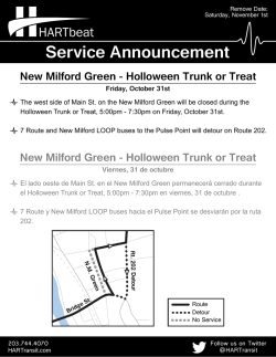

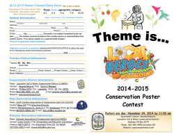
© Copyright 2026