
Lista de Ramsar .
The List of Wetlands of International Importance
Published 3 May 2016
The Ramsar List was established in response to Article 2.1 of the Convention on Wetlands (Ramsar, Iran,
1971), which reads: “Each Contracting Party shall designate suitable wetlands within its territory for inclusion
in a List of Wetlands of International Importance, hereinafter referred to as “the List” which is maintained by
the bureau [secretariat of the Convention] established under Article 8.”
Wetlands included in the List acquire a new status at the national level and are recognized by the international
community as being of significant value not only for the country, or the countries, in which they are located,
but for humanity as a whole.
The Convention establishes that “wetlands should be selected for the List on account of their international
significance in terms of ecology, botany, zoology, limnology or hydrology.” Over the years, the Conference
of the Contracting Parties has adopted more specific criteria interpreting the Convention text, as well as an
Information Sheet on Ramsar Wetlands and a Classification system of wetland type.
All issues pertaining to the Ramsar List were encapsulated in Resolution VII.11 adopted by the Conference
of the Parties in May 1999 and entitled Strategic Framework and guidelines for the future development
of the List of Wetlands of International Importance 1, which has been frequently updated.
Everything in the Strategic Framework is founded upon this “Vision for the Ramsar List”: “To develop and
maintain an international network of wetlands which are important for the conservation of global biological
diversity and for sustaining human life through the ecological and hydrological functions they perform.”
Full data submitted by the Parties for each of their Ramsar Sites, with one-paragraph descriptions of each
site, are entered in the Ramsar Sites Information Service (rsis.ramsar.org).
Coordinates:
Geographical coordinates provided in this List are merely notional “centre points” for quick reference and
are not intended to be legal specifications; for Sites with complex shapes or multiple parts, the centre points
may not even lie within the Sites’ boundaries. For detailed information on Ramsar Site boundaries, consult
the Ramsar Information Sheets submitted by the Parties (Ramsar Sites Information Service).
Abbreviations:
MR: Sites included in the Montreux Record, “a record of Ramsar Sites where changes in ecological
character have occurred, are occurring or are likely to occur” maintained by the Secretariat in consultation
with the Contracting Party concerned (Recommendation 4.8).
TRS: Transboundary Ramsar Site, where “an ecologically coherent wetland extends across national
borders and the Ramsar Site authorities on both or all sides of the border have formally agreed to collaborate
in its management, and have notified the Secretariat of this intent” (Ramsar Manual).
1
The current Strategic Framework is available in print form as No. 17 in the Ramsar Handbooks series on the Ramsar
website at www.ramsar.org/pdf/lib/hbk4-17.pdf
Ramsar List
Page 2
La Liste des zones humides d’importance internationale
La Liste de Ramsar a été établie conformément à l’article 2.1 de la Convention sur les zones humides
(Ramsar, Iran, 1971) qui stipule:”Chaque Partie contractante devra désigner les zones humides appropriées de
son territoire à inclure dans la Liste des zones humides d’importance internationale, appelée ci-après, «la
Liste», et qui est tenue par le Bureau institué en vertu de l’article 8.”
Les zones humides qui sont inscrites sur la Liste acquièrent un nouveau statut au niveau national et, aux yeux
de la communauté internationale, prennent une importance non seulement pour le pays ou les pays où elles
se trouvent mais aussi pour toute l’humanité.
La Convention précise: «Le choix des zones humides à inscrire sur la Liste devrait être fondé sur leur
importance internationale au point de vue écologique, botanique, zoologique, limnologique ou
hydrologique ». Au fil des années, la Conférence des Parties contractantes a adopté des critères plus
spécifiques pour interpréter le texte de la Convention, de même qu’une Fiche descriptive des zones humides Ramsar
et un Système de classification des types de zones humides.
La Résolution VII.7, adoptée par la Conférence des Parties en mai 1999, et intitulée Cadre stratégique et
lignes directrices pour orienter l’évolution de la Liste des zones humides d’importance
internationale 2 contient tout ce qui concerne la Liste de Ramsar.
Le Cadre stratégique repose intégralement sur cette «Vision pour la Liste de Ramsar»: “Élaborer et maintenir
un réseau international de zones humides importantes, en raison des fonctions écologiques et hydrologiques
qu’elles remplissent, pour la conservation de la diversité biologique mondiale et la pérennité de la vie
humaine.”
Toutes les données soumises par les Parties sur chacun de leurs Sites Ramsar, comprenant un paragraphe de
description sur chaque site, sont saisies dans le Service d’information sur les Sites Ramsar
(rsis.ramsar.org/fr).
Coordonnées :
Les coordonnées géographiques figurant dans cette Liste sont avant tout des « points centraux », fournis à
des fins de référence rapide, et en aucun cas des indications ayant force juridique ; il se peut même, dans le
cas de sites aux formes complexes ou composés de plusieurs parties, que les points centraux se trouvent en
dehors des limites des sites. Pour des informations précises sur les limites des Sites Ramsar, veuillez consulter
les Fiches descriptives Ramsar soumises par les Parties (Service d’information sur les Sites Ramsar).
Abréviations :
MR: Sites inclus dans le Registre de Montreux, «un registre des Sites Ramsar dont les caractéristiques
écologiques ont connu, connaissent ou sont susceptibles de connaître des modifications», tenu par le
Secrétariat en consultation avec la Partie contractante concernée (Recommandation 4.8).
TRS: Sites Ramsar transfrontières : “des zones humides écologiquement cohérentes s’étendent de part et
d’autre de frontières et les autorités responsables de ces Sites, des deux côtés de la frontière, décident, dans le
cadre d’accords officiels, de collaborer à la gestion et notifient le Secrétariat de leur intention” (Manuel de
Ramsar).
2
Le Cadre stratégique est disponible sous forme imprimée dans le No 17 des Manuels Ramsar et peut être téléchargé
sur le site Web de Ramsar: www.ramsar.org/pdf/lib/hbk4-17fr.pdf.
Ramsar List
Page 3
La Lista de Humedales de Importancia Internacional
La Lista de Ramsar se estableció con arreglo al párrafo 1 del artículo 2 de la Convención sobre los Humedales
(Ramsar, Irán, 1971), que dice lo siguiente: “Cada Parte Contratante designará humedales idóneos de su
territorio para ser incluidos en la Lista de Humedales de Importancia Internacional, en adelante llamada “la
Lista”, que mantiene la Oficina [secretaría de la Convención] establecida en virtud del Artículo 8.”
Los humedales incluidos en la Lista pasan a formar parte de una nueva categoría en el plano nacional y la
comunidad internacional reconoce que tienen un valor significativo no sólo para el o los países donde se
encuentran, sino también para la toda la humanidad.
La Convención estipula que “la selección de los humedales que se incluyan en la Lista deberá basarse en su
importancia internacional en términos ecológicos, botánicos, zoológicos, limnológicos o hidrológicos.” Con
los años la Conferencia de las Partes Contratantes ha adoptado criterios más precisos para interpretar el texto
de la Convención, así como una Ficha Informativa de los Humedales de Ramsar y un Sistema de Clasificación de tipos de
humedales.
Todos las cuestiones relacionadas con la Lista de Ramsar se encapsularon en la Resolución VII.11 adoptada
por la Conferencia de las Partes en mayo de 1999, titulada Marco estratégico y lineamientos para el
desarrollo de la Lista de H umedales de Importancia Internacional .3
El contenido íntegro del Marco Estratégico descansa en la siguiente “Visión para la Lista de Ramsar”: “Crear
y mantener una red internacional de humedales que revistan importancia para la diversidad biológica mundial
y para el sustento de la vida humana debido a las funciones ecológicas e hidrológicas que desempeñan.”
Los datos completos presentados por las Partes para cada uno de sus Sitios Ramsar, y una descripción de un
párrafo de cada sitio, se incluyen en el Servicio de Información sobre Sitios Ramsar (rsis.ramsar.org/es).
Coordenadas:
Las coordenadas geográficas que se proporcionan en la Lista son “puntos centrales” meramente hipotéticos
para tener una referencia rápida de su ubicación y no pretenden ser especificaciones con carácter jurídico; en
los Sitios con configuraciones complejas o compuestos de muchas partes, puede que los puntos centrales ni
siquiera estén situados dentro de sus límites. Para obtener información detallada sobre los límites de los Sitios
Ramsar, consulte las Fichas Informativas de Ramsar presentadas por las Partes (Servicio de Información
sobre Sitios Ramsar).
Abreviaciones:
MR: sitios incluidos en el Registro de Montreux, “un Registro de los Sitios Ramsar en los que se hubieran
producido, se estuvieran produciendo o pudieran producirse modificaciones en las condiciones ecológicas”
que lleva la Secretaría en consulta con cada una de las Partes Contratantes interesadas (Recomendación 4.8).
TRS: Sitios Ramsar transfronterizos: “un humedal ecológicamente cohesivo se extiende a través de
fronteras nacionales y las autoridades del sitio Ramsar de ambos o todos los lados de la frontera han
acordado oficialmente colaborar en su manejo, y han notificado a la Secretaría tal decisión” (Manual de
Ramsar).
3
El Marco Estratégico está disponible en versión impresa como No. 17 de la serie Manuales Ramsar y en la página
Web de Ramsar en: www.ramsar.org/pdf/lib/hbk4-17sp.pdf.
Ramsar List
Page 4
Status of the Convention
Number of Contracting Parties / Nombre de Parties contractantes /
Número de Partes Contratantes:
169
Number of Sites designated / Nombre de Sites désignés /
Número de Sitios designados:
2,240
Total area / Superficie totale / Superficie total:
215,240,112 hectares
Ramsar List
Page 5
site
date of designation
region, province, state
area
coordinates
site
date de désignation
région, province, état
superficie
coordonnées
sitios
fecha de designación
región, provincia, estado
área
coordenadas
_____________________________________________________________________________________________________________
ALBANIA / ALBANIE (4 Ramsar Sites, 98,181 hectares)
*
*
*
*
Albanian Prespa Lakes (Liqenet e Prespes Shqiptare)
Butrint
Karavasta Lagoon
Lake Shkodra and River Buna
13/06/13
28/03/03
29/11/95
02/02/06
Korçë
Vlora
Fier
Shkodra
15,119
13,500
20,000
49,562
ha
ha
ha
ha
40°51’23”N 20°56’43”E
39°50’N 020°00’E
41º00’N 019º30’E
42°03’N 019°29’E
ALGERIA / ALGÉRIE / ARGELIA (50 Ramsar Sites, 2,991,013 hectares)
*
*
*
*
*
*
*
*
*
*
*
*
*
*
*
*
*
*
*
*
*
*
*
*
*
Aulnaie de Aïn Khiar
Chott Aïn El Beïda
Chott de Zehrez Chergui
Chott de Zehrez Gharbi
Chott Ech Chergui
Chott El Beïdha – Hammam Essoukhna
Chott El Hodna
Chott Melghir
Chott Merrouane et Oued Khrouf
Chott Oum El Raneb
Chott Sidi Slimane
Chott Tinsilt
Complexe de zones humides de la plaine de
Guerbes-Sanhadja
Dayet El Ferd
Garaet Annk Djemel et El Merhsel
Garaet El Taref
Garaet Guellif
Garaet Timerganine
Grotte karstique de Ghar Boumâaza
Gueltates Afilal
Ile de Rachgoun
La Réserve Naturelle du Lac des Oiseaux
La Vallée d’Iherir
Lac de Fetzara
Lac de Télamine
*
*
*
*
*
*
*
*
*
*
*
*
*
*
*
*
*
*
*
*
*
*
*
*
Le Cirque de Aïn Ouarka
Les Gueltates d’Issakarassene
Les Salines d’Arzew
Marais de Bourdim
Marais de la Macta
Marais de la Mekhada
Oasis de Moghrar et de Tiout
Oasis de Ouled Saïd
Oasis de Tamantit et Sid Ahmed Timmi
Oglat Ed Daïra
Oum Lâagareb
Réserve Intégrale du Lac El Mellah
Réserve Intégrale du Lac Oubeïra
Réserve Intégrale du Lac Tonga
Réserve Naturelle du Lac de Béni-Bélaïd
Réserve Naturelle du Lac de Réghaïa
Sebkha d’Oran
Sebkhet Bazer
Sebkhet El Hamiet
Sebkhet El Melah
Site classé Sebkhet Ezzmoul
Site Ramsar du lac Boulhilet
Tourbière du Lac Noir
Vallée de l’oued Soummam
*
Lac du barrage de Boughezoul
04/06/03
12/12/04
04/06/03
04/06/03
02/02/01
12/12/04
02/02/01
04/06/03
02/02/01
12/12/04
12/12/04
12/12/04
El Tarf
Ouargla
Djelfa
Djelfa
Saïda
Sétif, Batna
M’Sila, Batna
El Oued, Biskra, Khenchela
El Oued
Ouargla
Ouargla
Oum El Bouaghi
180
6,853
50,985
52,200
855,500
12,223
362,000
551,500
337,700
7,155
616
2,154
ha
ha
ha
ha
ha
ha
ha
ha
ha
ha
ha
ha
36°40’N 008°20’E
31°58’N 005°22’E
35°15’N 003°30’E
34°58’N 002°44’E
34º27’N 000º50’E
35°55’N 005°45’E
35º18’N 004º40’E
34°15’N 006°19’E
33º55’N 006º10’E
32°02’N 005°22’E
33°17’N 003°45’E
35°53’N 006°29’E
02/02/01
12/12/04
12/12/04
12/12/04
12/12/04
18/12/09
04/06/03
04/06/03
05/06/11
22/03/99
02/02/01
04/06/03
12/12/04
05/06/11
04/06/03
02/02/01
12/12/04
18/12/09
02/02/01
04/06/03
04/06/03
02/02/01
02/02/01
12/12/04
05/06/11
12/12/04
04/11/83
04/11/83
04/06/03
04/06/03
02/02/01
12/12/04
12/12/04
12/12/04
18/12/09
18/12/09
04/06/03
18/12/09
Skikda, El Tarf
Tlemcen
Oum El Bouaghi
Oum El Bouaghi
Oum El Bouaghi
Oum El Bouaghi
Tlemcen
Tamanrasset
Wilaya de Ain Temouchent
El Kala
Illizi
Annaba
Oran
Commune de Boughezoul
Nâama
Tamanrasset
Oran, Mascara
El Tarf
Mascara, Mostaganem, Oran
El Tarf
Nâama
Adrar
Adrar
Nâama
Wilaya El Tarf
El Tarf
El Tarf
El Tarf
Jijel
Alger
Oran
Sétif
Sétif
Ghardaia
Oum El Bouaghi
Oum El Bouaghi
El Tarf
Kabylie
42,100
3,323
18,140
33,460
24,000
1,460
20,000
20,900
66
120
6,500
20,680
2,399
9,058
2,350
35,100
5,778
11
44,500
8,900
195,500
25,400
95,700
23,430
729
2,257
3,160
2,700
600
842
56,870
4,379
2,509
18,947
6,765
856
5
12,453
ha
ha
ha
ha
ha
ha
ha
ha
ha
ha
ha
ha
ha
ha
ha
ha
ha
ha
ha
ha
ha
ha
ha
ha
ha
ha
ha
ha
ha
ha
ha
ha
ha
ha
ha
ha
ha
ha
36º53’N 007º16’E
34°28’N 001°15’W
35°47’N 006°51’E
35°41’N 007°08’E
35°47’N 006°59’E
35°40’N 006°58’E
34°42’N 001°18’E
23°09’N 005°46’E
35°19’N001°28’W
36º42’N 008º07’E
25º24’N 008º25’E
36°47’N 007°32’E
35°43’N 000°23’E
35°44’N 002°47’E
32°44’N 000°10’E
22º25’N 005º45’E
35°40’N 000°81’E
36°48’N 008°15’E
35º41’N 000º10’W
36°48’N 008°00’E
32°53’N 000°40’E
29º24’N 000º18’E
27º45’N 000º15’E
33°18’N 001°48’W
36°49’N 008°13’E
36°53’N 008°20’E
36º50’N 008º23’E
36º53’N 008º31’E
36°53’N 006°05’E
36°46’N 003°20’E
35º22’N 000º48’W
36°05’N 005°41’E
35°55’N 005°33’E
30°25’N 002°55’E
35°53’N 006°30’E
35°45’N 006°48’E
36°54’N 008°12’E
36°42’N 005°00’E
ANDORRA / ANDORRE (3 Ramsar Sites, 6,870 hectares)
Ramsar List
Page 6
*
*
*
Parc naturel de la vallée de Sorteny (Parc natural de la
vall de Sorteny)
Parque Natural Comunal de los Valles del Comapedrosa
(Parc Natural Comunal de les Valls del Comapedrosa)
Vall de Madriu-Perafita-Claror
23/07/12
Ordino
1,080 ha
42°37’08”N 001°34’48”E
15/04/14
28/08/13
La Massana
Encamp, Andorra la Vella, Sant Julià
de Lòria, Escaldes-Engordany
1,543 ha
4,247 ha
42°35’26”N 001°28’03”E
42°29’01”N 001°36’22”E
ANTIGUA AND BARBUDA / ANTIGUA-ET-BARBUDA / ANTIGUA Y BARBUDA (1 Ramsar Site, 3,600 hectares)
*
Codrington Lagoon
02/06/05
Barbuda
3,600
17°39’N 061°51’W
ARGENTINA / ARGENTINE (22 Ramsar Sites, 5,625,407 hectares)
*
*
*
*
*
*
*
*
*
*
*
*
*
*
*
*
*
*
*
*
*
*
Bahía de Samborombón
Bañados del Río Dulce y Laguna de Mar Chiquita
Delta del Paraná
Glaciar Vinciguerra y turberas asociadas
Humedal Laguna Melincué
Humedales Chaco
Humedales de Península Valdés
Jaaukanigás
Laguna Blanca
Laguna de Llancanelo MR
Laguna de los Pozuelos
Lagunas Altoandinas y Puneñas de Catamarca
Lagunas de Guanacache, Desaguadero y del Bebedero
Lagunas de Vilama
Lagunas y Esteros del Iberá
Parque Provincial El Tromen
Palmar Yatay
Reserva Costa Atlantica de Tierra del Fuego
Reserva Ecológica Costanera Sur
Reserva Natural Otamendi
Reserva Provincial Laguna Brava
Río Pilcomayo
24/01/97
28/05/02
03/10/15
16/09/09
24/07/08
02/02/04
20/07/12
10/10/01
04/05/92
08/11/95
04/05/92
02/02/09
14/12/99
20/09/00
18/01/02
02/02/06
05/06/11
13/09/95
22/03/05
22/03/08
02/02/03
04/05/92
Buenos Aires
Córdoba
Santa Fe, Entre Ríos
Tierra del Fuego
Santa Fe
Chaco
Chubut
Santa Fe
Neuquén
Mendoza
Jujuy
Catamarca
Mendoza, San Juan, San Luis
Jujuy
Corrientes
Neuquén
Entre Rios
Tierra del Fuego
Buenos Aires
Buenos Aires
Rioja
Formosa
ha
ha
ha
ha
ha
ha
ha
ha
ha
ha
ha
ha
ha
ha
ha
ha
ha
ha
ha
ha
ha
ha
36º15’S 057º15’W
30°23’S 062°46’W
32°16'7"S 60°43'1"W
54°45’S 068°20’W
33°43’S 061°30’W
27°20’S 058°50’W
42°30’00”S 064°20’00”W
28°45’S 059°15’W
39º02’S 070º21’W
35º45’S 069º08’W
22º20’S 066º00’W
26°52’S 067°56’W
33°00’S 067°36’W
22º36’S 066º55’W
28°31’S 057°09’W
37°05’S 070°06’W
31°52’S 058°19’W
53º20’S 068º30’W
34°37’S 058°21’W
34°14’S 058°53’W
28°04’S 069°05’W
25º30’S 058º30’W
50 ha
3,230 ha
490,231 ha
39°53’16”N 044°34’18”E
41º03’N 043º37’E
40º24’N 045º17’E
243,965
~ 996,000
243,126
2,760
92,000
508,000
42,695
492,000
11,250
65,000
16,224
1,228,175
962,370
157,000
24,550
30,000
21,450
28,600
353
3,000
405,000
51,889
ARMENIA / ARMENIE (3 Ramsar Sites, 493,511 hectares)
*
*
*
Khor Virap Marsh
Lake Arpi
Lake Sevan
25/01/07
06/07/93
06/07/93
Ararat Province
Shirak Province
Gegharquniq Province
AUSTRALIA / AUSTRALIE (65 Ramsar Sites, 8,319,663 hectares)
*
*
*
*
*
*
*
*
*
*
*
*
*
*
*
*
*
*
*
*
Apsley Marshes
Ashmore Reef National Nature Reserve
Banrock Station Wetland Complex
Barmah Forest
Becher Point Wetlands
Blue Lake
Bool & Hacks Lagoons
Bowling Green Bay
Cobourg Peninsula
Coongie Lakes
Coral Sea Reserves (Coringa-Herald and Lihou
Reefs and Cays)
Corner Inlet
Currawinya Lakes
East Coast Cape Barren Island Lagoons (ECCBIL)
Edithvale-Seaford Wetlands
Eighty-mile Beach
Elizabeth and Middleton Reefs Marine National
Nature Reserve
Fivebough and Tuckerbil Swamps
Flood Plain Lower Ringarooma River
Forrestdale & Thomsons Lakes
16/11/82
21/10/02
21/10/02
15/12/82
05/01/01
17/03/96
01/11/85
22/10/93
08/05/74
15/06/87
Tasmania
880
External Terr. / Ashmore & Cartier 58,300
South Australia
1,375
Victoria
28,515
Western Australia
708
New South Wales
338
South Australia
3,200
Queensland
35,500
Northern Territory
220,700
South Australia
2,178,952
ha
ha
ha
ha
ha
ha
ha
ha
ha
ha
41º56’S 148º12’E
12°14’S 123°07’E
34°11’S 140°20’E
35º55’S 145º08’E
32º23’S 115º44’E
36º24’S 148º19’E
37º08’S 140º41’E
19º27’S 147º15’E
11º15’S 132º15’E
27º27’S 140º00’E
21/10/02
15/12/82
11/03/96
16/11/82
29/08/01
07/06/90
Coral Sea Islands Territory
Victoria
Queensland
Tasmania
Victoria
Western Australia
1,728,920
67,186
151,300
4,473
261
125,000
ha
ha
ha
ha
ha
ha
17°04’S 150°39’E
38º45’S 146º32’E
28º45’S 144º19’E
40º22’S 148º23’E
38°04’S 145°07’E
19º31’S 120º40’E
21/10/02
21/10/02
16/11/82
07/06/90
Coral Sea Islands Territory
New South Wales
Tasmania
Western Australia
187,726
689
3,519
754
ha
ha
ha
ha
29°41’S 159°06’E
34°30’S 146°23’E
40º54’S 147º56’E
32º09’S 115º52’E
Ramsar List
Page 7
*
*
*
*
*
*
*
*
*
*
*
*
*
*
*
*
*
*
*
*
*
*
*
*
*
*
*
*
*
*
*
*
*
*
*
*
*
*
*
*
*
*
*
*
*
Ginini Flats Subalpine Bog Complex
Gippsland Lakes
Great Sandy Strait (including Great Sandy Strait,
Tin Can Bay, and Tin Can Inlet)
Gunbower Forest
Gwydir Wetlands: Gingham and Lower Gwydir
(Big Leather) Watercourses
Hattah-Kulkyne Lakes
Hosnies Spring
Hunter Estuary Wetlands
Interlaken Lakeside Reserve
Jocks Lagoon
Kakadu National Park
Kerang Wetlands
Lake Albacutya
Lake Gore
Lake Pinaroo (Fort Grey Basin)
Lake Warden system
Lakes Argyle & Kununurra
Lavinia Nature Reserve
Little Llangothlin Nature Reserve
Little Waterhouse Lake
Logan Lagoon
Macquarie Marshes
Moreton Bay
Moulting Lagoon
Muir-Byenup System
Myall Lakes
Narran Lake Nature Reserve
NSW Central Murray Forests
Ord River floodplain
Paroo River Wetlands
Peel-Yalgorup system
Piccaninnie Ponds Karst Wetlands
Pittwater-Orielton Lagoon
Port Phillip Bay & Bellarine Peninsula
Pulu Keeling National Park
Riverland
Roebuck Bay
Shoalwater and Corio Bays
The Coorong, Lakes Alexandrina & Albert Wetland
The Dales
Toolibin Lake
Towra Point
Vasse-Wonnerup system
Western District Lakes
Western Port
11/03/96
15/12/82
Australian Capital Territory
Victoria
125 ha
60,015 ha
35º31’S 148º46’E
38º00’S 147º36’E
14/06/99
15/12/82
Queensland
Victoria
93,160 ha
19,931 ha
25º28’S 152º54’E
35º49’S 144º19’E
14/06/99
15/12/82
11/12/90
21/02/84
16/11/82
16/11/82
12/06/80
15/12/82
15/12/82
05/01/01
17/03/96
07/06/90
07/06/90
16/11/82
17/03/96
16/11/82
16/11/82
01/08/86
22/10/93
16/11/82
05/01/01
14/06/99
14/06/99
20/05/03
07/06/90
13/09/07
07/06/90
21/12/12
16/11/82
15/12/82
17/03/96
23/09/87
07/06/90
11/03/96
01/11/85
21/10/02
07/06/90
21/02/84
07/06/90
15/12/82
15/12/82
New South Wales
Victoria
Christmas Island Territory
New South Wales
Tasmania
Tasmania
Northern Territory
Victoria
Victoria
Western Australia
New South Wales
Western Australia
Western Australia
Tasmania
New South Wales
Tasmania
Tasmania
New South Wales
Queensland
Tasmania
Western Australia
New South Wales
New South Wales
New South Wales
Western Australia
New South Wales
Western Australia
South Australia
Tasmania
Victoria
Cocos (Keeling) Islands
South Australia
Western Australia
Queensland
South Australia
Christmas Island Territory
Western Australia
New South Wales
Western Australia
Victoria
Victoria
823
955
202
3,388
517
19
1,979,766
9,419
5,731
4,017
719
2,300
150,000
7,034
258
56
2,257
19,850
113,314
4,507
10,631
44,612
5,531
83,992
141,453
138,304
26,530
862
3,334
22,897
2,603
30,640
55,000
239,100
142,530
580
497
604
1,109
32,898
59,297
ha
ha
ha
ha
ha
ha
ha
ha
ha
ha
ha
ha
ha
ha
ha
ha
ha
ha
ha
ha
ha
ha
ha
ha
ha
ha
ha
ha
ha
ha
ha
ha
ha
ha
ha
ha
ha
ha
ha
ha
ha
29º18’S 149º14’E
34º41’S 142º26’E
10º28’S 105º41’E
32º51’S 151º46’E
42º09’S 147º10’E
41º21’S 148º18’E
13°01’S 132°26’E
35º40’S 143º56’E
35º46’S 141º58’E
33º47’S 121º29’E
29º06’S 141º13’E
33º48’S 121º56’E
16º19’S 128º44’E
39º45’S 144º05’E
30º05’S 151º47’E
40º52’30”S 147º36’40”E
40º10’S 148º17’E
30º51’S 147º39’E
27º20’S 153º10’E
42º05’S 148º10’E
34º29’S 116º43’E
32º30’S 152º17’E
29º43’S 147º26’E
35°46’00”S 144°39’00”E
15º15’S 128º22’E
30°20’S 143°51’E
32º49’S 115º42’E
38°03’S 140°56’E
42º47’S 147º30’E
38º04’S 144º36’E
11º49’S 096º49’E
34º02’S 140º51’E
18º07’S 122º16’E
22º40’S 150º17’E
35º56’S 139º18’E
10°29’S 105°34’E
32º55’S 117º36’E
34º00’S 151º10’E
33º37’S 115º25’E
38º10’S 143º31’E
38º22’S 145º17’E
48
133
36,090
148
137
2,180
870
190
119
267
265
543
211
18,532
44,229
62
2,065
ha
ha
ha
ha
ha
ha
ha
ha
ha
ha
ha
ha
ha
ha
ha
ha
ha
46°51’54”N 013°55’11”E
47°35’N 011°48’E
48º17’N 016º48’E
47°03’N 006°19’E
47º01’N 014º31’E
47°15’N 016°05’E
48º17’47”N 013º16’20”E
47°19’N 012°26’E
47°07’N 013°54’E
47°05’N 013°47’E
47°10’N 013°53’E
46°35’N 014°08’E
47°43’N 015°33’E
47°35’N 014°25’E
47º49’N 016º53’E
47º35’N 014º21’E
47º30’N 009º38’E
AUSTRIA / AUTRICHE (23 Ramsar Sites, 124,968 hectares)
*
*
*
*
*
*
*
*
*
*
*
*
*
*
*
*
*
Autertal/St. Lorenzener Hochmoor
Bayerische Wildalm and Wildalmfilz TRS
Donau-March-Thaya-Auen MR TRS
Güssing Fishponds (Güssinger Fischteiche)
Hörfeld-Moor
Lafnitztal
Lower Inn Reservoirs (Stauseen am Unteren Inn)
Mires of Pass Thurn
Mires of the Sauerfelder Wald
Mires of the Schwarzenberg
Mires of the Überling
Moor- und Seenlandschaft Keutschach-Schiefling
Moore am Nassköhr
Nationalpark Kalkalpen
Neusiedlersee, Seewinkel & Hanság TRS
Pürgschachen Moor
Rheindelta
12/09/11
15/12/04
16/12/82
05/06/13
30/10/96
01/03/02
16/12/82
02/02/04
02/02/04
02/02/04
02/02/04
13/12/04
15/10/04
02/02/04
16/12/82
09/09/91
16/12/82
Carinthia
Tyrol
NiederÖsterreich
Burgenland
Kärnten, Steiermark
Burgenland, Styria
Upper Austria
Salzburg
Salzburg
Salzburg
Salzburg
Kärnten
Styria
OberÖsterreich
Burgenland
Steiermark
Vorarlberg
Ramsar List
Page 8
*
*
*
*
*
*
Rotmoos im Fuschertal
Sablatnigmoor
Untere Lobau TRS
Upper Drava River (Obere Drau)
Waldviertel ponds, peat bogs & floodplains (Teich-,
Moor- und Flusslandschaft Waldviertel)
Wilder Kaiser
ha
ha
ha
ha
ha
47º17’N 012º47’E
46º34’N 014º36’E
48º10’N 016º30’E
46°45’N 13°17’E
48º46’N 015º59’E
3,781 ha
47°34’00”N 012°18’00”E
21/05/01
500 ha
40°01’N 047°38’E
21/05/01
99,060 ha
39°07’N 048°59’E
32,600 ha
21º05’N 073º20’W
5,200 ha
1,610 ha
25º40’N 050º50’E
26º11’N 050º34’E
601,700 ha
9,500 ha
22º02’N 089º31’E
25º09’N 091º04’E.
33 ha
13°04’N 059°35’W
24/02/95
19/05/92
16/12/82
06/05/14
22/12/99
Salzburg
Kärnten
Wien
Carinthia
NiederÖsterreich
08/04/13
Tyrol
58
96
915
1,029
13,000
AZERBAIJAN / AZERBAÏDJAN / AZERBAIYÁN (2 Ramsar Sites, 99,560 hectares)
*
*
Agh-Ghol
Ghizil-Agaj (first designated by USSR in 1976
as ‘Kirov Bays’)
BAHAMAS (1 Ramsar Site, 32,600 hectares)
*
Inagua National Park
07/02/97
Great Inagua Island
BAHRAIN / BAHREÏN / BAHREIN (2 Ramsar Sites, 6,810 hectares)
*
*
Hawar Islands
Tubli Bay
27/10/97
27/10/97
BANGLADESH (2 Ramsar Sites, 611,200 hectares)
*
*
Sundarbans Reserved Forest
Tanguar Haor
21/05/92
10/07/00
Khulna
Sunamganj
BARBADOS / BARBADE (1 Ramsar Site, 33 hectares)
*
Graeme Hall Swamp
12/12/05
BELARUS / BÉLARUS / BELARÚS (26 Ramsar Sites, 765,386 hectares)
*
*
*
*
*
*
*
*
*
*
*
*
*
*
*
*
*
*
*
*
*
*
*
*
*
*
Berezinsky Biosphere Reserve
Dikoe Fen Mire
Dnieper River Floodplain
Drobzbitka-Svina
Duleby Islands-Zaozerye
Golubickaya Puscha
Iput River Floodplain
Kotra TRS
Kozyansky
Mid-Pripyat State Landscape Zakaznik
Morochno
Olmany Mires Zakaznik
Osveiski
Podvelikiy Moh
Polesye Valley of River Bug
Pripyatsky National Park
Prostyr TRS
Servech
Sporovsky Biological Reserve (‘Zakaznik’)
Stary Zhaden
Svislochsko-Berezinskiy
Vigonoshchanskoe
Vileity
Vydritsa
Yelnia
Zvanets
25/01/10
30/03/15
29/05/14
29/05/14
07/09/12
29/05/14
30/03/15
21/10/02
29/03/13
10/08/01
07/09/12
10/08/01
21/10/02
30/03/15
29/05/14
29/03/13
18/10/05
29/05/14
22/11/99
07/09/12
30/03/15
16/01/13
30/09/14
29/03/13
21/10/02
21/10/02
Belarusian Lakeland
Brest Region and Grodno Region
Gomel Region
Vitebsk Region
Mogilev Region
Vitebsk Region
Gomel Region
Grodno Region
Vitebsk Region
Brest Region
Brest Region
Brest Region
Vitebsk Region
Brest Region
Brest Region
Gomel Region
Brest Region
Vitebsk Region
Brest Region
Gomel Region
Mogilev Region
Brest Region
Vitebsk Region
Gomel Region
Vitebsk Region
Brest Region
85,149
23,145
29,353
6,727
30,772
18,240
3,502
10,584
26,060
90,447
5,845
94,219
22,600
10,647
23,159
88,553
9,544
9,068
19,384
17,048
18,341
54,182
8,452
21,292
23,200
15,873
ha
ha
ha
ha
ha
ha
ha
ha
ha
ha
ha
ha
ha
ha
ha
ha
ha
ha
ha
ha
ha
ha
ha
ha
ha
ha
54°38’N 028°30’E
52°47’23”N 024°14’45”E
51°38’17”N 030°37’E
55°36’N 029°23’E
53°40’N 029°30’E
54°59’5”N 028°2’28”E
52°31’N 031°29’E
54°00’N 024°30’E
55°25’N 029°22’E
52°09’N 027°00’E
51°51’36”N 026°37’53”E
52°44’N 027°16’E
56°05’N 028°10’E
52°44’6”N 026°16’28”E
51°50'13"N 023°43'E
52°00′N 028°00’E
51°56’N 026°05’E
54°58'2"N 027°30'E
52°23’N 025°20’E
51°53’01” 027°035’52”E
53°22’29”N 28°058’32”E
52°42’N 025°40’E
55°15'3"N 26°046'22"E
52°46′N 029°40′E
55°35’N 027°52’E
52°05’N 024°50’E
2,360
3
2,200
9,974
ha
ha
ha
ha
50º59’N 002º51’E
50°24’N 005°34’E
51º23’N 004º28’E
50°32’N 006°06’E
BELGIUM / BELGIQUE / BELGICA (9 Ramsar Sites, 46,944 hectares)
*
*
*
*
De Ijzerbroeken te Diksmuide en Lo-Reninge MR
Grotte des Émotions
Kalmthoutse Heide
Les Hautes Fagnes
04/03/86
24/03/03
04/03/86
24/03/03
Vlaamse Gewest
Région Wallone
Vlaamse Gewest
Région Wallone
Ramsar List
Page 9
*
*
*
*
*
Marais d’Harchies (Zone Humide d’Intérêt Biologique
des Marais d’Harchies-Hensies-Pommeroeul)
Schorren van de Beneden Schelde MR
Vallée de la Haute-Sûre TRS
Vlaamse Banken
Zwin
04/03/86
04/03/86
24/03/03
04/03/86
04/03/86
Région Wallone
Vlaamse Gewest
Région Wallone
Vlaamse Gewest
Vlaamse Gewest
557
420
29,000
1,900
530
ha
ha
ha
ha
ha
50º27’44”N 003º40’50”E
51º20’N 004º15’E
49°53’N 005°51’E
51º10’N 002º44’E
51º21’N 003º22’E
Belize, Orange Walk
Toledo
6,637 ha
16,955 ha
17º44’N 088º29’W
15°58’N 089°00’W
91,600 ha
06°39’N 002°32’E
47,500 ha
895,480 ha
144,774 ha
06°30’N 002°00’E
11°50’N 002°30’E
11°37’N 001°40’E
142 ha
970 ha
114 ha
27°40’23”N 091°26’29”E
27°26’46”N 090°11’8”E
27°25’55”N 089°59’33”E
BELIZE / BELICE (2 Ramsar Sites, 23,592 hectares)
*
*
Crooked Tree Wildlife Sanctuary
Sarstoon Temash National Park
22/04/98
19/10/05
BENIN / BÉNIN (4 Ramsar Sites, 1,179,354 hectares)
*
*
*
*
Basse Vallée de l’Ouémé, Lagune de Porto-Novo,
Lac Nokoué
Basse Vallée du Couffo, Lagune Côtiere,
Chenal Aho, Lac Ahémé
Site Ramsar du Complexe W
Zone Humide de la Rivière Pendjari
24/01/00
24/01/00
02/02/07
02/02/07
Alibori
Atacora
BHUTAN / BHOUTAN / BHUTÁN (3 Ramsar Sites, 1,226 hectares)
*
*
*
Bumdeling
Gangtey-Phobji
Khotokha
07/05/12
02/05/14
07/05/12
Trashiyangtse Dzongkhag
Wangdue Phodrang
Wangdue Dzongkhag
BOLIVIA / BOLIVIE (11 Ramsar Sites, 14,842,405 hectares)
*
*
*
*
*
*
*
*
*
*
*
Bañados del Izozog y el río Parapetí
Cuenca de Tajzara
Lago Titicaca (Sector Boliviano)
Lagos Poopó y Uru Uru
Laguna Concepción
Los Lípez
Palmar de las Islas y las Salinas de San José
Pantanal Boliviano
Río Blanco
Río Matos
Río Yata
17/09/01
13/06/00
26/08/98
11/07/02
06/05/02
27/06/90
17/09/01
17/09/01
02/02/13
02/02/13
02/02/13
Santa Cruz
Tarija
La Paz
Oruru
Santa Cruz
Potosí
Santa Cruz
Santa Cruz
Beni
Beni
Beni
615,882
5,500
800,000
967,607
31,124
1,427,717
856,754
3,189,888
2,404,916
1,729,788
2,813,229
ha
ha
ha
ha
ha
ha
ha
ha
ha
ha
ha
18°27’S 061°49’W
21º47’S 065º06’W
16º10’S 068º52’W
18°46’S 067°07’W
17°31’S 061°21’W
22º10’S 067º24’W
19°15’S 061°00’W
18°00’S 058°30’W
13°37’59”S 063°23’35”W
14°48’54”S 066°12’00”W
12°18’32”S 066 06’11”W
BOSNIA AND HERZEGOVINA / BOSNIE-HERZÉGOVINE / BOSNIA Y HERZEGOVINA (3 Ramsar Sites, 56,779
hectares)
*
*
*
Bardaca Wetland (Bardača-močvarni kompleks)
Hutovo Blato
Livanjsko Polje (Livno karst field)
02/02/07
24/09/01
11/04/08
Republic of Srpska Entity
09/12/96
Ngamiland
Hercegbosanska canton
3,500 ha
7,411 ha
45,868 ha
45°06’N 017°27’E
43°03’N 017°37’E
43°53’N 016°47’E
5,537,400 ha
19º17’S 022º54’E
17º49’S 038º49’W
03º51’S 033º47’W
03º00’S 044º57’W
BOTSWANA (1 Ramsar Site, 5,537,400 hectares)
*
Okavango Delta System
BRAZIL / BRESIL / BRASIL (13 Ramsar Sites, 7,260,873 hectares)
*
*
*
*
*
*
*
*
*
*
*
Abrolhos Marine National Park
Atol das Rocas Biological Reserve
Baixada Maranhense Environmental Protection Area
Cabo Orange National Park (Parque Nacional do Cabo
Orange)
Ilha do Bananal
Lagoa do Peixe
Mamirauá
Pantanal Matogrossense
Parque Estadual Marinho do Parcel Manoel Luís
including the Baixios do Mestre Álvaro & Tarol
Reentrancias Maranhenses
Reserva Particular del Patrimonio Natural (RPPN)
02/02/10
11/12/15
29/02/00
Bahía
Rio Grande do Norte
Maranhão
91,300 ha
35,186.4 ha
1,775,036 ha
02/02/13
04/10/93
24/05/93
04/10/93
24/05/93
Amapá
Tocantins
Rio Grande do Sul
Amazonas
Mato Grosso
657,328
562,312
34,400
1,124,000
135,000
ha
ha
ha
ha
ha
03°38’59”N 051°11’24”W
10º31’S 050º12’W
31º14’S 050º57’W
02º18’S 066º02’W
17º39’S 057º25’W
29/02/00
30/11/93
Maranhão
Maranhão
34,556 ha
2,680,911 ha
c.00º30’S 044º45’W
01º41’S 045º04’W
Ramsar List
Page 10
*
*
“Fazenda Rio Negro”
22/05/09
Reserva Particular do Patrimonio Natural SESC Pantanal 06/12/02
Rio Doce State Park (Parque Estadual do Rio Doce)
15/03/10
Mato Grosso del Sur
Mato Grosso
Minas Gerais
7,000 ha
87,871 ha
35,973 ha
19°33’S 056°13’W
16°39’S 056°15’W
19°38’S 042°32’W
28/11/84
24/09/02
11/02/11
28/11/84
24/09/02
19/03/96
24/09/02
Burgas
Pleven
Sofia Dristrict
Varna
Montana
Burgas
1,404
18,330
14,967
350
3,365
404
307
ha
ha
ha
ha
ha
ha
ha
42º34’N 027º28’E
43°40’N 025°11’E
42º56’N 023º01’E
43º42’N 028º30’E
43°49’N 023°31’E
43º35’N 028º33’E
42°27’N 027°27’E
24/09/02
24/09/75
24/09/75
11/11/02
Burgas
Burgas
Silistra
Burgas
922
5,500
1,464
2,900
ha
ha
ha
ha
42°35’N 027°37’E
42º19’N 027º45’E
44°06’46”N 027°06’41”E
42°30’N 027°25’E
BULGARIA / BULGARIE (11 Ramsar Sites, 49,913 hectares)
*
*
*
*
*
*
*
*
*
*
*
Atanasovo Lake
Belene Islands Complex TRS
Dragoman Marsh Karst Complex
Durankulak Lake MR
Ibisha Island TRS
Lake Shabla
Poda
Pomorie Wetland Complex (Pomorie Lake, Pomoriysko
Ezero)
Ropotamo Complex
Srebarna MR TRS
Vaya Lake
BURKINA FASO (18 Ramsar Sites, 677,722 hectares)
*
*
*
*
*
*
*
*
*
*
*
*
*
*
*
*
*
*
Barrage de Bagre
Barrage de la Kompienga
Barrage de la Tapoa
Barrage de Tougouri
Barrage de Yalgo
Bassin du Nakanbé-Mané
Cône d’épandage de Banh
Forêt Galerie de Léra (Nan, Tchèfoun)
La Forêt Classée et Réserve Partielle de Faune
Comoé-Léraba
La Mare aux hippopotames
La Mare d’Oursi
La Vallée du Sourou
Lac Bam
Lac de Tingrela
Lac Dem
Lac Higa
Parc National du W
Réserve Totale de Faune d’Arly (Parc National d’Arly)
07/10/09
07/10/09
07/10/09
02/02/16
02/02/16
02/02/16
07/10/09
07/10/09
Centre-Est, Centre-Sud
Est, Centre-Est
Région de l’Est
Centre-Nord
Centre-Nord
Centre-Nord
Région du Nord
Cascades
36,793
16,916
3,419
1,221
4,522.4
19,477
10,003
451
ha
ha
ha
ha
ha
ha
ha
ha
11°33’N 000°40’W
11°08’N 000°40’E
12°07’N 001°43’W
13°19’11”N 000°32’06”E
13°35’20”N 000°19’9”E
12°58’N 001°26’E
14°10’N 002°33’W
10°36’N 005°18’W
07/10/09
27/06/90
27/06/90
07/10/09
07/10/09
07/10/09
07/10/09
07/10/09
27/06/90
07/10/09
Cascades
Hauts-Bassins
Sahel
Boucle du Mouhoun
Centre-Nord
Cascades
Centre-Nord
Sahel
Région de l’Est
Region de l’Est
124,500
19,200
45,000
20,926
2,693
494
1,354
1,514
235,000
134,239
ha
ha
ha
ha
ha
ha
ha
ha
ha
ha
09°52’N 004°40’W
11º37’N 004º08’W
14º30’N 000º30’W
13°00’N 003°28’W
13°24’N 001°31’W
10°38’N 004°50’W
13°12’N 001°10’W
13°36’N 000°44’W
12º00’N 002º30’E
11°35’N 001°27’E
05/10/02
14/03/13
14/03/13
14/03/13
Bujumbura Rural
Karuzi, Muyinga, Ruyigi, Cankuzo
Kirundo
Makamba
10,673
50,800
16,242
800
ha
ha
ha
ha
03°14’46”S 029°15’06”E
03°10’00”S 030°20’00”E
02°30’00”S 030°09’20”E
03°55’00”S 030°13’00”E
18/07/05
18/07/05
18/07/05
03/07/13
Maio
535 ha
15°09’16”N 023°13’33”W
BURUNDI (4 Ramsar Sites, 78,515 hectares)
*
*
*
*
Parc National de la Rusizi
Parc National de la Ruvubu
Paysage Aquatique Protégé du Nord
Réserve Naturelle de la Malagarazi
CABO VERDE (4 Ramsar Sites, ? 535 hectares)
*
*
*
*
Curral Velho
Lagoa de Pedra Badejo
Lagoa de Rabil
Salinas of the English Port (Salinas de Porto Inglês)
CAMBODIA / CAMBODGE / CAMBOYA (4 Ramsar Sites, 75,942 hectares)
*
*
*
*
Boeng Chhmar and Associated River System
and Floodplain
Koh Kapik and Associated Islets
Middle Stretches of the Mekong River north
of Stoeng Treng
Prek Toal Ramsar Site
23/06/99
23/06/99
Kampong Thom, Siem Reap
Koh Kong province
28,000 ha
12,000 ha
12º48’20”N 104º16’55”E
11º28’00”N 103º04’00”E
23/06/99
02/10/15
Stoeng Treng
Battambang province
14,600 ha
21,342 ha
13º44’04”N 106º00’00”E
13°9’N 103°38’E
CAMEROON / CAMEROUN / CAMERÚN (7 Ramsar Sites, 827,060 hectares)
Ramsar List
Page 11
*
*
*
*
*
*
*
Barombi Mbo Crater Lake
Estuaire du Rio Del Rey
Partie Camerounaise du fleuve Ntem
Partie Camerounaise du fleuve Sangha
Partie Camerounaise du Lac Tchad
The Waza Lagone Floodplain
Zone humide d’Ebogo
08/10/06
20/05/10
05/06/12
02/02/08
02/02/10
20/03/06
05/06/12
Southwest Region
Southwest Region
South Region
East Region
Far North Region
Far North Region
Centre Region
27/05/87
27/05/87
15/01/81
16/10/85
05/06/05
21/02/94
24/05/82
24/05/82
24/05/82
27/05/87
24/05/82
27/05/87
27/05/98
24/05/82
24/05/82
28/04/88
24/05/82
31/10/96
24/05/82
26/09/95
31/10/96
27/05/87
27/05/87
24/05/82
24/05/82
27/05/87
24/05/82
27/05/87
24/05/82
27/05/87
24/05/82
27/05/87
05/11/87
27/05/87
16/10/85
10/06/93
24/05/82
Québec
Alberta
Québec
Nova Scotia
British Columbia
British Columbia
Manitoba
Northwest Territories
British Columbia
Newfoundland
Alberta
Québec
Québec
Saskatchewan
Ontario
Prince Edward Island
New Brunswick
Ontario
Northwest Territories
Ontario
Ontario
Nova Scotia
Manitoba
Yukon Territory
Alberta
Ontario
Northwest Territories
Ontario
Northwest Territories
Saskatchewan
Northwest Territories
New Brunswick
Nova Scotia
Ontario
Ontario
New Brunswick
Alberta, NW Territories
415
165,000
39,848
6,200
12,500
600,000
3,097
ha
ha
ha
ha
ha
ha
ha
04°40’N 009°23’E
04°37’N 008°43’E
02°22’45”N 010°33’13”E
01°50’N 016°02’E
12°46’N 014°19’E
11°38’N 014°37’E
03°23’09”N 011°29’20”E
2,215
18,050
2,398
1,020
15,070
6,970
23,000
815,900
20,682
925
50,000
2,310
11,952
15,602
13,730
24,440
1,200
1,840
32,800
3,447
6,000
1,925
3,600
617,000
321,300
1,564
262,400
2,408,700
6,278,200
63,500
300,000
12,200
26,800
25,290
244
4,997
1,689,500
ha
ha
ha
ha
ha
ha
ha
ha
ha
ha
ha
ha
ha
ha
ha
ha
ha
ha
ha
ha
ha
ha
ha
ha
ha
ha
ha
ha
ha
ha
ha
ha
ha
ha
ha
ha
ha
48º01’N 069º20’W
53º30’N 113º30’W
47º04’N 070º48’W
45º48’N 064º16’W
50°41’N 115°13’W
49º10’N 116º35’W
50º05’N 098º00’W
66º10’N 074º00’W
49º06’00”N 123º03’00”W
47º50’N 059º18’W
58º30’N 119º00’W
45º02’N 074º29’W
46º08’N 072º39’W
51º20’N 105º15’W
42º35’N 080º15’W
46º32’N 063º48’W
45º44’N 064º45’W
44º44’N 079º40’W
60º50’N 094º20’W
45º18’N 075º45’W
44º23’N 080º52’W
44º42’N 063º06’W
50º10’N 097º06’W
67º34’N 139º50’W
58º42’N 111º08’W
41º59’N 082º30’W
75º43’N 098º40’W
52º30’N 084º30’W
67º00’N 102º00’W
51º55’N 104º20’W
68º40’N 093º00’W
45º47’N 064º35’W
45º13’N 064º16’W
51º20’N 080º25’W
42º22’N 082º22’W
47º20’N 064º56’W
60º15’N 113º15’W
CANADA (37 Ramsar Sites, 13,086,771 hectares)
*
*
*
*
*
*
*
*
*
*
*
*
*
*
*
*
*
*
*
*
*
*
*
*
*
*
*
*
*
*
*
*
*
*
*
*
*
Baie de l’Isle-Verte
Beaverhill Lake
Cap Tourmente
Chignecto
Columbia Wetlands
Creston Valley
Delta Marsh
Dewey Soper Migratory Bird Sanctuary
Fraser River Delta
Grand Codroy Estuary
Hay-Zama Lakes
Lac Saint-François
Lac Saint-Pierre
Last Mountain Lake
Long Point
Malpeque Bay
Mary’s Point
Matchedash Bay Provincial Wildlife Area
McConnell River
Mer Bleue Conservation Area
Minesing Swamp
Musquodoboit Harbour
Oak Hammock Marsh
Old Crow Flats
Peace-Athabasca Delta
Point Pelee
Polar Bear Pass
Polar Bear Provincial Park
Queen Maud Gulf
Quill Lakes
Rasmussen Lowlands
Shepody Bay
Southern Bight-Minas Basin
Southern James Bay (Moose River & Hannah Bay)
St. Clair
Tabusintac Lagoon & River Estuary
Whooping Crane Summer Range
CENTRAL AFRICAN REPUBLIC / RÉPUBLIQUE CENTRAFRICAINE / REPÚBLICA CENTROAFRICANA
(2 Ramsar Sites, 376,300 hectares)
*
*
Les rivières de Mbaéré-Bodingué
Rivière Sangha située en République Centrafricaine
05/12/05
05/11/09
Sangha-Mbaéré, Lobaye préfectures 101,300 ha
Sangha-Mbaéré
275,000 ha
03°50’N 017°50’E
02°40’N 016°15’E
Batha
Lac, Kenam
Baguirmi
Salamat, Bahr Koh
Chari-Baguirmi, Mayo-Kebbi,
Tandjilé
Mayo-Kebbi
ha
ha
ha
ha
ha
12º50’N 017º30’E
14°20’N 013°37’E
11°15’N 016°15’E
10º45’N 020°33’E
10°30’N 016°14’E
135,000 ha
09°18’N 014°17’E
58,946 ha
52°38’S 069°10’W
CHAD / TCHAD (6 Ramsar Sites, 12,405,068 hectares)
*
*
*
*
*
*
Lac Fitri
Partie tchadienne du lac Tchad
Plaine de Massenya
Plaines d’inondation des Bahr Aouk et Salamat
Plaines d’inondation du Logone et les dépressions
Toupouri
Réserve de faune de Binder-Léré
13/06/90
14/08/01
17/10/08
01/05/06
14/11/05
14/11/05
195,000
1,648,168
2,526,000
4,922,000
2,978,900
CHILE / CHILI (13 Ramsar Sites, 361,761 hectares)
*
Bahía Lomas
06/12/04
Región XII
Ramsar List
Page 12
*
*
*
*
*
*
*
*
*
*
*
*
Carlos Anwandter Sanctuary MR
Complejo Lacustre Laguna del Negro Francisco y
Laguna Santa Rosa
Humedal el Yali
Las Salinas de Huentelauquén
Parque Andino Juncal
Salar de Aguas Calientes IV
Salar de Pujsa
Salar de Surire
Salar de Tara
Salar del Huasco
Santuario de la Naturaleza Laguna Conchalí
Sistema hidrológico de Soncor del Salar de Atacama
39º41’S 073º11’W
27/07/81
Región X
02/12/96
02/12/96
02/02/15
22/05/10
14/08/09
14/08/09
02/12/96
02/12/96
02/12/96
02/02/04
02/12/96
Región de Atacama
Región V
Coquimbo
Valparaiso
Región de Antofagasta
Región de Antofagasta
Región I
Región de Antofagasta
Región I
Región IV
Región de Antofagasta
62,460
520
2,772
13,796
15,529
17,397
15,858
96,439
6,000
34
67,133
ha
ha
ha
ha
ha
ha
ha
ha
ha
ha
ha
27º17’S 069º08’W
33º50’S 071º38’W
31°35’S 71°33’24”W
32°55’S 070°03’W
24°59’S 068°38’W
23°11’S 067°32’W
18º51’S 069º00’W
22º56’S 067º15’W
20º18’S 068º50’W
31°53’S 071°30’W
23º18’S 068º10’W
16/10/15
07/12/04
11/01/02
Chizhou City
Yunnan
Shanghai
33,340 ha
1,985 ha
32,600 ha
30°23'N 117°5'17"E
27°50’33”N 099°59’10”E
31°38’N 121°58’E
11/01/02
11/01/02
11/01/02
07/12/04
31/03/92
16/10/13
31/03/92
11/01/02
07/12/04
Liaoning
Jiangsu
Inner Mongolia
Yunnan
Hunan
Heilongjiang
Hainan
Inner Mongolia
Qinghai
11,700
78,000
740,000
5,958
190,000
31,538
5,400
7,680
65,907
ha
ha
ha
ha
ha
ha
ha
ha
ha
39°15’N 121°15’E
33°05’N 120°49’E
48°33’N 117°30’E
27°25’36”N 103°19’33”E
29º19’49”N 112º59’00”E
46°18′34″N 133°44′57″E
19º59’N 110º35’E
39°48’N 109°35’E
34°54’25”N 097°40’48”E
02/02/08
01/09/11
02/02/08
16/10/15
02/02/08
07/07/09
01/09/11
01/09/11
Fujian
Gansu
Guangdong
Guangdong
Guangxi
Zhejiang
Heilongjiang
Heilongjiang
2,358
247,431
11,591
35,679
3,000
325
229,523
20,000
ha
ha
ha
ha
ha
ha
ha
ha
23°55’N 117°25’E
34°16’40”N 102°26’53”E
22°59’N 115°19’E
23°17'N 117°15'21"E
21°34’N 108°08’E
30°16’N 120°03’E
51°19’14”N 125°22’52”E
46°44’18”N 132°13’53”E
01/09/11
11/01/02
16/10/13
16/10/13
02/02/08
11/01/02
16/10/13
07/12/04
04/09/95
07/12/04
07/12/04
11/01/02
07/12/04
31/03/92
31/03/92
11/01/02
16/10/13
Heilongjiang
44,364 ha
Heilongjiang
21,836 ha
Hubei
11,579 ha
Hubei
9,320 ha
Hubei
43,450 ha
Guangdong
400 ha
Jilin
144,000 ha
Yunnan
3,560 ha
Hong Kong Special Admin. Region
1,540 ha
Tibet Autonomous Region
43,496 ha
Tibet Autonomous Region
73,782 ha
Hunan
168,000 ha
Yunnan
2,083 ha
Qinghai
53,600 ha
Jiangxi
22,400 ha
Heilongjiang
164,400 ha
Shandong
95,950 ha
46°07’40”N 133°38’14”E
47°49’N 133°40’E
30°20’01”N 113°49’34”E
31°28’14”N 110°02’51”E
29°50’N 113°19’E
22°33’N 114°54’E
45°54’32”N 123°45’56”E
26°53’48”N 100°08’06”E
22º29’20”N 114º01’44”E
31°11’55”N 092°40’51”E
30°44’29”N 081°19’43”E
28°50’N 112°40’E
27°51’16”N 099°38’44”E
36º50’N 100º10’E
29º10’N 115º59’E
47°56’N 134°20’E
37°42’18”N 119°09’02”E
02/02/08
11/01/02
07/12/04
02/02/08
11/01/02
31/03/92
11/01/02
11/01/02
07/12/04
31/03/92
Shanghai
Guangxi
Liaoning
Sichuan
Hunan
Jilin
Heilongjiang
Jiangsu
Qinghai
Heilongjiang
31°31’N 122°05’E
21°28’N 109°43’E
40°54’45”N 121°45’41”E
33°43’N 102°44’E
29°01’N 112°05’E
44º02’N 122º41’E
45°17’N 132°32’E
33°31’N 120°22’E
34°54’43”N 097°16’29”E
47º12’N 124º12’E
4,877 ha
CHINA / CHINE (49 Ramsar Sites, 4,112,424 hectares)
*
*
*
*
*
*
*
*
*
*
*
*
*
*
*
*
*
*
*
*
*
*
*
*
*
*
*
*
*
*
*
*
*
*
*
*
*
*
*
*
*
*
*
*
*
*
*
Anhui Shengjin Lake National Nature Reserve
Bitahai Wetland
Chongming Dongtan Nature Reserve, Shanghai
Da Lian National Spotted Seal (Phoca vitulina) Nature
Reserve
Dafeng (Elaphurus davidianus) National Nature Reserve
Dalai Lake National Nature Reserve, Inner Mongolia
Dashanbao Wetland
Dong dongting hu
Dongfanghong National Nature Reserve
Dongzhaigang
Eerduosi National Nature Reserve
Eling Lake
Fujian Zhangjiangkou National Mangrove Nature
Reserve
Gansu Gahai Wetlands Nature Reserve
Guangdong Haifeng Wetlands
Guangdong Nanpeng Archipelago Wetlands
Guangxi Beilun Estuary National Nature Reserve
Hangzhou Xixi Wetlands
Heilongjiang Nanweng River National Nature Reserve
Heilongjiang Qixing River National Nature Reserve
Heilongjiang Zhenbaodao Wetland National Nature
Reserve
Honghe National Nature Reserve
Hubei Chen Lake Wetland Nature Reserve
Hubei Dajiu Lake Wetland
Hubei Honghu Wetlands
Huidong Harbor Sea Turtle National Nature Reserve
Jilin Momoge National Nature Reserve
Lashihai Wetland
Mai Po Marshes and Inner Deep Bay
Maidika
Mapangyong Cuo
Nan Dongting Wetland and Waterfowl Nature Reserve
Napahai Wetland
Niaodao (“Bird Island”)
Poyanghu
San Jiang National Nature Reserve
Shandong Yellow River Delta Wetland
Shanghai Yangtze Estuarine Wetland Nature Reserve
for Chinese Sturgeon
Shankou Mangrove Nature Reserve
Shuangtai Estuary
Sichuan Ruoergai Wetland National Nature Reserve
Xi Dongting Lake (Mupinghu) Nature Reserve
Xianghai
Xingkai Lake National Nature Reserve
Yancheng National Nature Reserve
Zhaling Lake
Zhalong
3,760
4,000
128,000
166,570
35,000
105,467
222,488
453,000
64,920
210,000
ha
ha
ha
ha
ha
ha
ha
ha
ha
ha
Ramsar List
Page 13
*
*
Zhangye Heihe Wetland National Nature Reserve
Zhanjiang Mangrove National Nature Reserve
16/10/15
11/01/02
Gansu
Guangdong
41,165 ha
20,279 ha
39°30’N 99°46’10”E
20°54’N 110°08’E
250,158.9 ha
03°49’19”N 067°51’30”W
6,579 ha
8,888 ha
39,000 ha
04°46’N 075°25’W
04°53’N 077°22’W
01º03’N 077º12’W
400,000 ha
4,058 ha
10º45’N 074º29’W
04°30’N 073°45’W
COLOMBIA / COLOMBIE (6 Ramsar Sites, 708,683.9 hectares)
*
*
*
*
*
*
Complejo de Humedales de la Estrella Fluvial Inírida
(EFI)
Complejo de Humedales Laguna del Otún
Delta del Río Baudó
Laguna de la Cocha
Sistema Delta Estuarino del Río Magdalena,
Ciénaga Grande de Santa Marta
Sistema Lacustre de Chingaza
08/07/14
Guainía
25/06/08
05/06/04
08/01/01
Risaralda
Chocó
Nariño
18/06/98
25/06/08
Magdalena
Cundinamarca
COMOROS / COMORES / COMORAS (3 Ramsar Sites, 16,030 hectares)
*
*
*
Lac Dziani Boudouni
Le Karthala
Le Mont Ntringui
09/02/95
12/11/06
12/11/06
Ngazidja
Anjouan
30 ha
13,000 ha
3,000 ha
12°21’S 043º45’E
11°46’S 043°21’E
12°11’S 044°25’E
13/12/07
13/12/07
13/12/07
18/06/98
Kouilou
15,366 ha
Kouilou
504,950 ha
Plateaux,Cuvette,Sangha,Likouala 5,908,074 ha
Likouala
438,960 ha
04°53’S 011°57’E
03°55’S 011°27’E
00°15’S 016°42’E
01º05’N 017º15’E
02/02/15
03/04/09
13/12/07
02/02/15
03/04/09
18/09/12
18/09/12
18/09/12
02/02/15
Cuvette-Ouest
Brazzaville
Likouala
Niari
Sangha, Likouala
Sangha, Cuvette
Sangha, Cuvette-Ouest
Niari
Cuvette
CONGO (13 Ramsar Sites, 13,758,741 hectares)
*
*
*
*
*
*
*
*
*
*
*
*
*
Cayo-Loufoualeba
Conkouati-Douli
Grands affluents
La Réserve Communautaire du Lac Télé/Likouala-auxHerbes
Leketi-Mbama
Les Rapides du Congo-Djoué
Libenga
Loubetsi-Nyanga
Sangha-Nouabalé-Ndoki
Site Ramsar Ntokou-Pikounda
Site Ramsar Odzala Kokoua
Site Ramsar Vallée du Niari
Tchikapika-Owando
774,965.0
2,500
59,409
251,151
1,525,000
427,200
1,300,000
1,581,000
970,165.8
ha
ha
ha
ha
ha
ha
ha
ha
ha
0°59’55”N 14°47’4”E
04°19’S 015°11’E
02°51’N 018°00’E
2°55’5”S 12°1’23”E
01°41’N 016°26’E
00°10’15”N 016°16’50”E
00°56’00”N 014°52’00”E
03°47’S 012°30’E
0°54’2”N 15°57’34”E
9,969
67,296
9,445
75,310
59,692
99,623
75
139
24,519
500
30,654
192,520
ha
ha
ha
ha
ha
ha
ha
ha
ha
ha
ha
ha
10º52’N 084º45’W
10º30’N 084º51’W
09º37’N 082º40’W
10º30’N 083º30’W
10°40’N 084°08’W
5º32’N 086º59’W
10º52’N 085º51’W
10º50’N 086º46’W
10º20’N 085º20’W
10º19’N 085º50’W
08º52’N 083º36’W
09°30’N 083°42’W
10,551
15,507
40,210
27,274
14,402
19,400
ha
ha
ha
ha
ha
ha
04°58’N 006°02’W
05°07’N 005°36’W
05°21’N 003°46’W
05°07’N 003°12’W
05°10’N 003°24’W
05º12’N 004º53’W
Zagreb County
756 ha
Sisak-Moslavina, Brod-Posavina Cties 51,218 ha
45º36’40”N 015º44’09”E
45°21’43”N 016°15’02”E
CONGO, DEMOCRATIC REPUBLIC OF: SEE DEMOCRATIC REPUBLIC OF CONGO
COSTA RICA (12 Ramsar Sites, 569,742 hectares)
*
*
*
*
*
*
*
*
*
*
*
*
Caño Negro
Cuenca Embalse Arenal
Gandoca-Manzanillo
Humedal Caribe Noreste
Humedal Maquenque
Isla del Coco
Laguna Respringue
Manglar de Potrero Grande
Palo Verde MR
Tamarindo
Terraba-Sierpe
Turberas de Talamanca
27/12/91
07/03/00
11/12/95
20/03/96
22/05/10
21/04/98
06/05/99
06/05/99
27/12/91
09/06/93
11/12/95
02/02/03
Alajuela
Alajuela, Guancaste
Limón
Limón y Heredia
Alajuela
Guanacaste
Guanacaste
Guanacaste
Guanacaste
Puntarenas
San José, Cartago, Límon
CÔTE D’IVOIRE (6 Ramsar Sites, 127,344 hectares)
*
*
*
*
*
*
Complexe Sassandra-Dagbego
Fresco
Grand Bassam
Îles Ehotilé-Essouman
N’Ganda N’Ganda
Parc national d’Azagny
18/10/05
18/10/05
18/10/05
18/10/05
18/10/05
27/02/96
Bas-Sassandra
Sud-Bandama
Sud-Comoé
Sud-Comoé
Sud-Comoé
Lagunes
CROATIA / CROATIE / CROACIA (5 Ramsar Sites, 94,358 hectares)
*
*
Crna Mlaka (Crna Mlaka Fishponds)
Lonjsko polje Nature Park
18/01/93
18/01/93
Ramsar List
Page 14
*
*
*
Nature Park Kopacki rit (Kopacki rit) MR
Neretva River Delta
Vransko Lake (“Vransko jezero”)
18/01/93
18/01/93
02/02/13
Baranya
Dubrovnik-Neretva County
Zadar, Sibenik-Knin
18/11/02
18/11/02
12/04/01
18/11/02
18/11/02
18/11/02
Villa Clara, Sancti Spiritus
Isla de la Juventud
Matanzas
Ciego de Ávila
Granma, Las Tunas
Camagüey
23,894 ha
12,742 ha
5,748 ha
45º40’N 018º54’E
43°01’40”N 017°34’25”E
43°53’27”N 015°35’20”E
CUBA (6 Ramsar Sites, 1,188,411 hectares)
*
*
*
*
*
*
Buenavista
Ciénaga de Lanier y Sur de la Isla de la Juventud
Ciénaga de Zapata
Gran Humedal del Norte de Ciego de Ávila
Humedal Delta del Cauto
Humedal Río Máximo-Cagüey
313,500
126,200
452,000
226,875
47,836
22,000
ha
ha
ha
ha
ha
ha
22°27’N 078°49’W
21°36’N 082°48’W
22°20’N 081°22’W
22°19’N 078°29’W
20°34’N 077°12’W
21°43’N 077°27’W
1,107 ha
34°53’N 033°36’E
CYPRUS / CHYPRE / CHIPRE (1 Ramsar Site, 1,107 hectares)
*
Larnaca Salt Lake
11/07/01
CZECH REPUBLIC / RÉPUBLIQUE TCHEQUE / REPUBLICA CHECA (14 Ramsar Sites, 60,207 hectares)
*
*
*
*
*
Jizera Headwaters (Horní Jizera)
Krkonošká rašeliniště (Krkonose mountains mires) TRS
Krušnohorská rašeliniště (Krušnohorská mountain mires)
Lednické rybníky (Lednice fishponds)
Liběchovka and Pšovka Brooks (Mokřady Liběchovky
a Pšovky)
* Litovelské Pomoraví MR
* Mokřady dolního Podyjí MR TRS
* Novozámeckŷ a Brehyňskŷ rybník
(Novozámeckŷ/Brehyňskŷ fishponds)
* Poodří MR
* Punkva subterranean stream (Podzemní Punkva)
* Springs and Mires of the Slavkov Forest (Pramenné
vývěry a rašeliniště Slavkovského lesa)
* Šumavská rašeliniště (Šumava peatlands)
* Třeboňská rašeliniště (Třeboň mires)
* Třeboňská rybníky (Třeboň fishponds) MR
13/02/12
02/11/93
22/12/06
02/07/90
13/11/97
Liberec
Trutnov
Ústecký, Karlovarský
Breclav
2,303
230
11,224
650
350
ha
ha
ha
ha
ha
50°50’51”N 015°19’32”E
50º46’N 015º38’E
50°31’N 013°10’E
48º46’N 016º46’E
50º25’N 014º30’E
02/11/93
02/11/93
Olomouc, Sumperk
Breclav
5,122 ha
11,525 ha
49º42’N 017º05’E
48º50’N 016º45’E
02/07/90
02/11/93
18/03/04
C. Lípa
Ostrava, N. Jicín
South-Moravian region
923 ha
5,450 ha
1,571 ha
50º37’N 014º34’E
49º42’N 018º03’E
49°25’N 016°44’E
13/02/12
02/07/90
02/11/93
02/07/90
Karlovarský kraj
Klatovy, Prachatice
J. Hradec, C. Budejovice
J. Hradec, Tábor, C. Budejovice
3,223
6,371
1,100
10,165
ha
ha
ha
ha
50°01’31”N 012°45’35”E
49º05’N 013º25’E
48º32’N 014º49’E
48º38’N 014º49’E
DEMOCRATIC REPUBLIC OF CONGO / RÉPUBLIQUE DÉMOCRATIQUE DU CONGO / REPÚBLICA
DEMOCRÁTICA DEL CONGO (3 Ramsar Sites, 7,435,624 hectares)
*
*
*
Ngiri-Tumba-Maindombe
Parc national des Mangroves MR
Parc national des Virunga
24/07/08
18/01/96
18/01/96
Equateur, Bandundu
Bas-Zaïre
Nord-Kivu
6,569,624 ha
66,000 ha
800,000 ha
01°30’S 017°30’E
05º45’S 012º45’E
01º15’S 029º30’E
DENMARK / DANEMARK / DINAMARCA (43 Ramsar Sites, 2,315,395 hectares)
*
*
*
*
*
*
*
*
*
*
*
*
*
*
*
*
*
*
*
*
Ertholmene
Filsø
Hirsholmene
Horsens Fjord and Endelave
Karrebaek, Dybsø & Avnø Fjords
Læsø
Lille Vildmose
Lillebælt
Maribo Lakes
Nærå Coast and Æbelø area
Nakskov Fjord and Inner Fjord
Nissum Bredning with Harboøre and Agger Tange
Nissum Fjord
Nordre Rønner
Præstø Fjord, Jungshoved Nor, Ulvshale and Nyord
Randers and Mariager Fjords and the adjacent sea
Ringkøbing Fjord MR
Sejrø Bugt, Nekselø Bugt and Saltbæk Vig
South Funen Archipelago
Stadil and Vest Stadil Fjords
02/09/77
02/09/77
02/09/77
02/09/77
02/09/77
02/09/77
18/05/13
02/09/77
02/09/77
02/09/77
02/09/77
02/09/77
02/09/77
02/09/77
02/09/77
02/09/77
02/09/77
02/09/77
02/09/77
02/09/77
Bornholm Municipality
Ribe
Region Nordjylland
Region Midtjylland
Storstrøm
Region Nordjylland
Region Nordjylland
Region Syddanmark
Region Sjælland
Region Syddanmark
Region Sjælland
Regions Midtjylland & Nordjylland
Region Midtjylland
Region Nordjylland
Region Sjælland
Regions Midtjylland & Nordjylland
Region Midtjylland
Region Sjælland
Region Syddanmark
Region Midtjylland
1,266
4,270
3,714
42,737
18,860
66,548
7,393
35,189
3,823
13,161
8,561
12,786
10,952
2,993
24,778
39,190
27,652
44,111
38,329
6,932
ha
ha
ha
ha
ha
ha
ha
ha
ha
ha
ha
ha
ha
ha
ha
ha
ha
ha
ha
ha
55º19’N 015º11’E
55º42’N 008º15’E
57º28’50”N 010°34’25”E
55º51’N 010º10’E
55º10’N 011º45’E
57º12’N 011º10’E
56°54’N 010°12’E
55º21’N 009º43’E
54º45’N 011º33’E
55º36’N 010º13’E
54º50’N 011º02’E
56º38’N 008º15’E
56º21’N 008º14’E
57º22’N 010º56’E
55º05’N 012º15’E
56º42’N 010º13’E
56º00’N 008º15’E
55º47’N 011º18’E
54º55’N 010º32’E
56º11’N 008º09’E
Ramsar List
Page 15
*
*
*
*
*
*
*
*
Stavns Fjord and adjacent waters
Ulvedybet and Nibe Bredning
Vadehavet (Wadden Sea)
Vejlerne and Løgstør Bredning
Waters between Lolland and Falster, including Rødsand,
Guldborg Sound, & Bøtø Nor
Waters north of Anholt
Waters south of Zealand, Skælskør Fjord, Glænø and
adjacent wetlands
Waters southeast of Fejø and Femø islands
ha
ha
ha
ha
55º54’N 010º40’E
57º02’N 009º35’E
55º16’N 008º32’E
56º56’N 009º03’E
Region Sjælland
Region Midtjylland
34,812 ha
11,616 ha
54º38’N 011º45’E
56º42’N 011º34’E
Region Sjælland
Region Sjælland
18,577 ha
41,826 ha
55º11’N 011º18’E
54º54’N 011º30’E
2,300 ha
2,197 ha
1,790 ha
62°06’17”N 007°35’55”W
62°00’33”N 006°40’07”W
61°46’11”N 006°49’46”W
02/09/77
02/09/77
14/05/87
02/09/77
Region Midtjylland
Region Nordjylland
Region Syddanmark
Region Nordjylland
02/09/77
02/09/77
02/09/77
02/09/77
15,533
18,575
151,080
43,534
DENMARK (Faroe Islands) / DANEMARK (Îles Féroé) / DINEMARCA (Islas Feroe)
*
*
*
Mykines
Nolsoy (Nólsoy)
Skuvoy (Skúvoy and Skúgvoy)
31/05/12
31/05/12
31/05/12
Faroe Islands
Faroe Islands
Faroe Islands
DENMARK (Greenland) / DANEMARK (Groenland) / DINAMARCA (Groenlandia)
*
*
*
*
*
*
*
*
*
*
*
*
Aqajarua (Mudderbugten) and Sullorsuaq (Kvandalen)
Eqalummiut Nunaat and Nassuttuup Nunaa
Heden (Jameson Land)
Hochstetter Forland
Ikkattoq and adjacent archipelago
Kilen
Kitsissunnguit (Grønne Ejland)
Kitsissut Avalliit (Ydre Kitsissut)
Kuannersuit Kuussuat
Naternaq (Lersletten)
Ørsted Dal, Pingel Dal and Enhjøringen Dal
Qínnquata Marraa and Kuussuaq
27/01/88
27/01/88
27/01/88
27/01/88
27/01/88
27/01/88
27/01/88
27/01/88
27/01/88
27/01/88
08/06/11
27/01/88
Qeqertarsuaq
Kangaatsiaq, Sisimiut
Ittoqqortoormiit
22/11/02
Djibouti
Nuuk
Qasigiannquit, Aasiaat
Qaqortoq
Qeqertarsuaq
Qasigiannquit, Kangaatsiaq
Scoresbysund
Qeqertarsuaq
ha
ha
ha
ha
ha
ha
ha
ha
ha
ha
ha
ha
69º39’N 051º58’W
67º28’N 050º49’W
70º58’N 024º04’W
75º28’N 019º52’W
62º40’N 050º08’W
81º10’N 013º24’W
68º50’N 051º56’W
60º45’N 048º25’W
69º38’N 053º17’W
68º24’N 051º46’W
71°40’N 023°24’W
69º56’N 054º14’W
3,000 ha
11°35’N 043°09’E
22,350
579,530
252,390
184,820
44,880
51,280
6,910
4,470
5,190
184,010
218,000
6,480
DJIBOUTI (1 Ramsar Site, 3,000 hectares)
*
Haramous-Loyada
DOMINICAN REPUBLIC / RÉPUBLIQUE DOMINICAINE / REPÚBLICA DOMINICANA (4 Ramsar Sites, 135,097
hectares)
*
*
*
Humedales de Jaragua
Lago Enriquillo
Parque Nacional Manglares del Bajo Yuna
04/07/14
15/05/02
02/02/13
*
Refugio de Vida Silvestre Laguna Cabral o Rincón
02/02/11
Pedernales
32,979 ha
Suroeste
~ 20,000 ha
Duarte, Sánchez Ramirez, Samaná,
77,518 ha
Maris Trinidad Sánchez
Arahona e Independecia
4,600 ha
17°43’47”N 71°32’0”W
18°28’N 071°39’W
19°10’12”N 069°40’48”W
18°16’N 071°15’W
ECUADOR / EQUATEUR (18 Ramsar Sites, 286,651 hectares)
*
*
*
*
*
*
*
*
*
*
*
*
*
*
*
*
*
*
Abras de Mantequilla
Complejo de Humedales Ñucanchi Turupamba
Complejo Llanganati
Humedales del Sur de Isabela
Isla Santay
La Segua
La Tembladera
Laguna de Cube
Manglares Churute
Manglares del Estuario Interior del Golfo de Guayaquil
“Don Goyo”
Parque Nacional Cajas
Refugio de Vida Silvestre Isla Santa Clara
Reserva Biológica Limoncocha
Reserva Ecológica de Manglares Cayapas-Mataje
Reserva Ecológica El Ángel
Sistema Lacustre Lagunas del Compadre
Sistema Lacustre Yacuri
Zona Marina Parque Nacional Machalilla
14/03/00
05/06/06
25/06/08
17/09/02
31/10/00
07/06/00
06/12/11
02/02/02
07/09/90
Los Ríos
Napo, Pichincha
Tungurahua, Cotopaxi
Galápagos
Guayas
Manabí
El Oro
Esmeraldas
Guayas
22,500
12,290
30,355
872
4,705
1,836
1,471
113
35,042
ha
ha
ha
ha
ha
ha
ha
ha
ha
01º28’S 079º45’W
00°16’S 078°09’W
01°06’S 078°21’W
00°57’S 090°58’W
02º13’S 079º51’W
00º42’S 080º12’W
03°30’14”S 079°59’46”W
00°24’N 079°39’W
02º28’S 079º42’W
02/02/13
14/08/02
02/02/02
10/07/98
12/06/03
07/12/12
15/12/12
15/12/12
07/09/90
Guayas
Azuay
El Oro
Sucumbíos
Esmeraldas
Carchi
Loja, Zamora Chinchipe
Loja, Zamora Chinchipe
Manabí
15,337
29,477
46
4,613
44,847
17,003
23,952
27,762
14,430
ha
ha
ha
ha
ha
ha
ha
ha
ha
02°24’17”S 079°55’50”W
02°50’S 079°14’W
03°10’S 080°26’W
00º25’S 076º35’W
01°16’N 079°00’W
00°43’51”N 077°56’43”W
04°12’26”S 079°06’10”W
04°38’27”S 079°21’12”W
01º00’S 080º45’W
Ramsar List
Page 16
EGYPT / EGYPTE / EGIPTO (4 Ramsar Sites, 415,532 hectares)
*
*
*
*
Lake Bardawil MR
Lake Burullus MR
Lake Qarun Protected Area
Wadi El Rayan Protected Area
09/09/88
09/09/88
04/06/12
04/06/12
Kafr El Sheikh
Fayoum
Fayoum
59,500
46,200
134,042
175,790
ha
ha
ha
ha
31º05’N 033º05’E
31º30’N 030º50’E
29°34’22”N 030°35’23”E
29°12’N 030°18’E
4,479
63,500
11,519
10,180
49,454
60,698
ha
ha
ha
ha
ha
ha
13°19’51”N 088°14’54”W
13°13’N 088°32’W
13°42’24”N 090°00’59”W
14°17’N 089°29’W
13°22’N 089°03’W
14°03’N 089°04’W
7,557 ha
13°19’N 088°04’W
EL SALVADOR (7 Ramsar Sites, 207,387 hectares)
*
*
*
*
*
*
Area Natural Protegida Laguna del Jocotal
Complejo Bahía de Jiquilisco
Complejo Barra de Santiago
Complejo Güija
Complejo Jaltepeque
Embalse Cerrón Grande
22/01/99
31/10/05
23/07/14
16/12/10
02/02/11
22/11/05
*
Laguna de Olomega
02/02/10
San Miguel
Usulutan
Ahuachapán, Sonsonate
Santa Ana
La Paz y San Vicente
Chalatenango, San Salvador,
Cuscatlán, Cabañas
San Miguel, La Unión
EQUATORIAL GUINEA / GUINÉE ÉQUATORIALE / GUINEA ECUATORIAL (3 Ramsar Sites, 136,000 hectares)
*
*
*
Isla de Annobón
Reserve Natural del Estuario del Muni
Río Ntem o Campo
02/06/03
02/06/03
02/06/03
Annobón
Bata-Litoral
Bata-Litoral
23,000 ha
80,000 ha
33,000 ha
27/01/10
17/06/97
17/06/97
17/06/97
08/02/11
17/06/97
31/03/03
27/01/10
27/01/10
27/10/10
29/03/94
17/06/97
17/06/97
17/06/97
03/02/06
17/06/97
17/06/97
Ida-Viru County
Tartu, Jõgeva, & Viljandi Counties
Tartu County
Jõgeva, Järva, Lääne-Viru Counties
Lääne County
Hiiu County, Hiiumaa Island
Saaremaa County
Lääne County
Lääne & Pärnu Counties
Pärnu County
Lääne County
Ida-Viru County
Pärnu County
Läänemaa County
Pärnu County
Pärnu & Viljandi Counties
Saare County, Saaremaa Island
11,000
34,220
32,600
10,110
27,450
17,700
2,424
8,178
6,620
11,240
48,610
13,980
6,398
4,640
5,869
39,639
24,100
11/04/06
Serua
01°25’S 005°36’E
01°13’N 009°45’E
02°13’N 009°52’E
ESTONIA / ESTONIE (17 Ramsar Sites, 304,778 hectares)
*
*
*
*
*
*
*
*
*
*
*
*
*
*
*
*
*
Agusalu
Alam-Pedja
Emajõe Suursoo Mire and Piirissaar Island
Endla
Haapsalu-Noarootsi
Hiiumaa Islets and Käina Bay
Laidevahe Nature Reserve
Leidissoo
Lihula
Luitemaa
Matsalu Nature Reserve
Muraka
Nigula Nature Reserve TRS
Puhto-Laelatu-Nehatu Wetland Complex
Sookuninga Nature Reserve
Soomaa
Vilsandi National Park
ha
ha
ha
ha
ha
ha
ha
ha
ha
ha
ha
ha
ha
ha
ha
ha
ha
59°05’N 027°32’E
58º28’N 026º13’E
58º23’N 027º18’E
58º52’N 026º09’E
59°08’04”N 023°27’29”E
58º48’N 022º58’E
58°18’N 022°49’E
59°06’N 023°44’E
58°39’N 023°56’E
58°10’N 024°35’E
58º45’N 023º40’E
59º08’N 027º06’E
58º00’N 024º40’E
58º34’N 023º33’E
58°00’N 024°45’E
58º25’N 025º05’E
58º23’N 021º54’E
615 ha
18°07’28”S 177°56’52”E
FIJI / FIDJI (1 Ramsar Site, 615 hectares)
*
Upper Navua Conservation Area – (UNCA)
FINLAND / FINLANDE / FINLANDIA (49 Ramsar Sites, 799,518 hectares)
*
*
*
*
*
*
*
*
*
*
*
*
*
*
*
*
*
Aspskär Islands
Bird-lakes of Rääkkylä and Kitee
Bird-lakes of Rantasalmi
Bird Wetlands of Haapavesi
Bird Wetlands of Hailuoto Island
Bird Wetlands of Hanko and Tammisaari
Bird Wetlands of Lapväärtti
Bird Wetlands of Siikajoki
Bird Wetlands of Vanajavesi Area
Björkör & Lågskär Archipelago
Kainuunkylä Islands
Kauhaneva – Pohjankangas National Park
Kirkon – Vilkkiläntura Bay
Koitelainen Mires
Krunnit Islands
Lake Kirkkojärvi and Lupinlahti Bay
Lake Kirkkojärvi Area
28/05/74
02/02/04
02/02/04
02/02/04
02/02/04
02/02/04
02/02/04
02/02/04
02/02/04
28/05/74
02/02/04
02/02/04
02/02/04
28/05/74
28/05/74
02/02/04
02/02/04
Southern Finland
Eastern Finland
Eastern Finland
Oulu
Oulu
Southern Finland
Western Finland
Oulu
Western Finland, Southern Finland
Ǻland
Lapland
Western Finland
Southern Finland
Lapland
Oulu
Southern Finland
Western Finland
728
1,227
1,109
3,616
6,512
55,196
1,224
2,691
702
6,309
1,005
6,849
194
48,938
4,435
649
305
ha
ha
ha
ha
ha
ha
ha
ha
ha
ha
ha
ha
ha
ha
ha
ha
ha
60º16’N 026º25’E
62°10’N 029°56’E
62°01’N 028°24’E
64°15’N 025°30’E
65°00’N 024°45’E
59°49’N 023°10’E
62°11’N 021°26’E
64°52’N 024°48’E
61°13’N 024°15’E
59º52’N 020º02’E
66°12’N 023°44’E
62°11’N 022°25’E
60°31’N 027°42’E
67º46’N 027º10’E
65º23’N 024º47’E
60°33’N 027°13’E
61°27’N 024°03’E
Ramsar List
Page 17
*
*
*
*
*
*
*
*
*
*
*
*
*
*
*
*
*
*
*
*
*
*
*
*
*
*
*
*
*
*
*
*
Lake Kutajärvi Area
Lake Läppträsket
Lake Sysmäjärvi
Lakes Aittojärvi and Kongasjärvi
Lakes Heinä-Suvanto and Hetejärvi
Lätäseno – Hietajoki Mires
Lemmenjoki National Park
Levaneva Mires
Liminganlahti Bay Area
Martimoaapa-Lumiaapa-Penikat Mires
Olvassuo Mires
Oulanka National Park
Patvinsuo National Park
Pernajanlahti Bay
Pilvineva Mires
Porvoonjoki Estuary-Stensböle
Quark Archipelago
Riisitunturi National Park
River Luiro Mires
Salamajärvi National Park
Sammuttijänkä – Vaijoenjänkä Mires
Signilskär-Märket Archipelago
Siikalahti Bay Area
Söderskär & Långören Archipelago
Sotkavuoma Mire
Suurenaukeansuo – Isosuo Mires and Lake Pohjalampi
Teuravuoma – Kivijärvenvuoma Mires
Torronsuo National Park
Valkmusa National Park
Vanhankaupunginlahti, Laajalahti
Vassorfjärden Bay
Veneneva – Pelso Mires
02/02/04
02/02/04
02/02/04
02/02/04
02/02/04
02/02/04
02/02/04
02/02/04
02/02/04
28/05/74
02/02/04
02/02/04
28/05/74
02/02/04
02/02/04
28/05/74
28/05/74
02/02/04
02/02/04
02/02/04
02/02/04
28/05/74
02/02/04
28/05/74
02/02/04
02/02/04
02/02/04
02/02/04
02/02/04
28/05/74
02/02/04
02/02/04
Southern Finland
Southern Finland
Eastern Finland
Oulu
Eastern Finland, Western Finland
Lapland
Lapland
Western Finland
Oulu
Lapland
Oulu
Oulu, Lapland
Eastern Finland
Southern Finland
Western Finland
Southern Finland
Western Finland
Lapland
Lapland
Western Finland
Lapland
Ǻland
Southern Finland
Southern Finland
Lapland
Eastern Finland
Lapland
Southern Finland
Southern Finland
Southern Finland
Western Finland
Oulu
1,051
199
734
703
1,224
43,367
285,990
3,343
12,275
14,086
27,073
29,390
12,727
1,143
3,667
958
63,699
12,461
12,345
9,261
51,749
22,566
682
18,219
2,602
1,640
5,788
3,093
1,710
508
1,537
12,039
ha
ha
ha
ha
ha
ha
ha
ha
ha
ha
ha
ha
ha
ha
ha
ha
ha
ha
ha
ha
ha
ha
ha
ha
ha
ha
ha
ha
ha
ha
ha
ha
61°03’N 025°27’E
60°02’N 023°39’E
62°41’N 029°03’E
65°16’N 026°54’E
63°09’N 026°08’E
68°40’N 022°20’E
68°35’N 025°36’E
62°46’N 022°05’E
64°56’N 025°21’E
65º50’N 025º08’E
65°07’N 027°15’E
66°27’N 029°20’E
63º06’N 030º44’E
60°26’N 026°00’E
63°28’N 023°59’E
60º21’N 025º42’E
63°26’N 021°25’E
66°12’N 028°27’E
67°20’N 027°33’E
63°15’N 024°45’E
69°25’N 027°30’E
60º14’N 019º17’E
61°33’N 029°33’E
60º08’N 025º39’E
68°20’N 023°16’E
62°10’N 027°03’E
67°20’N 024°05’E
60°44’N 023°37’E
60°34’N 026°40’E
60º12’N 024º54’E
63°12’N 021°59’E
64°28’N 026°10’E
FORMER YUGOSLAV REPUBLIC OF MACEDONIA: SEE THE FORMER YUGOSLAV REPUBLIC OF MACEDONIA
FRANCE / FRANCIA (44 Ramsar Sites, 3,567,384.5 hectares)
*
*
*
*
*
*
*
*
*
*
*
*
*
*
*
*
*
*
*
*
*
*
*
*
*
*
*
*
*
*
Baie de Somme
Baie du Mont Saint-Michel
Basses Vallées Angevines
Bassin d’Arcachon – Secteur du delta de la Leyre
Bassin du Drugeon
Camargue
Etang de Biguglia
Etang de Palo
Etang d’Urbino
Etangs de la Champagne humide
Etangs de la Petite Woëvre
Etangs du Lindre, forêt du Romersberg et zones voisines
Etangs palavasiens
Golfe du Morbihan
Grande Briere
Impluvium d’Evian
La Brenne
La Petite Camargue
Lac de Grand-Lieu
Lac du Bourget – Marais de Chautagne
Le marais audomarois
Les étangs de Villepey
Les étangs littoraux de la Narbonnaise
Marsis d’Orx et zones humides associées
Marais du Cotentin et du Bessin, Baie des Veys
Marais du Fier d’Ars
Marais salants de Guérande et du Més
Marais Vernier et Vallée de la Risle
Mares temporaires de Tre Padule de Suartone
Rhin supérieur / Oberrhein TRS
30/01/98
14/10/94
01/02/95
27/10/11
02/02/03
01/12/86
08/04/91
15/09/08
15/09/08
08/04/91
08/04/91
02/02/03
15/09/08
08/04/91
01/02/95
15/09/08
08/04/91
08/01/96
01/02/95
02/02/03
15/09/08
15/09/08
02/02/06
27/10/11
08/04/91
02/02/03
01/09/95
18/12/15
02/02/07
05/09/08
Picardie
Basse-Normandie, Bretagne
Pays de la Loire
Aquitaine
Franche-Comté
Provence-Alpes-Côte d’Azur
Corse
Corse
Corse
Champagne-Ardenne
Lorraine
Lorraine
Languedoc-Roussillon
Bretagne
Pays de la Loire
Rhône-Alpes
Centre
Languedoc-Rousillon
Pays de la Loire
Rhône-Alpes
Nord-Pas-de-Calais
Provence-Alpes-Côte d’Azur
Languedoc-Roussillon
Aquitaine
Basse-Normandie
Poitou-Charentes
Pays de la Loire
Haute-Normandie
Corse
Alsace
17,320
62,000
6,450
5,175
5,906
85,000
1,790
212
790
255,800
5,300
5,308
5,797
23,000
19,000
3,275
140,000
37,000
6,300
5,500
3,726
255
12,334
962
32,500
4,452
5,200
9,564.5
218
22,413
ha
ha
ha
ha
ha
ha
ha
ha
ha
ha
ha
ha
ha
ha
ha
ha
ha
ha
ha
ha
ha
ha
ha
ha
ha
ha
ha
ha
ha
ha
50º14’N 001º33’E
48º40’N 001º40’W
47º34’N 000º28’W
44°39’52”N 001°01’51”W
46°50’N 006°10’E
43º30’N 004º30’E
42º36’N 009º29’E
41°57’N 009°24’E
42°02’N 009°29’E
48º35’N 004º45’E
49º02’N 005º48’E
48°47’N 006°48’E
43°30’N 003°51’E
47º35’N 002º47’W
47º22’N 002º10’W
46°22’N 006°36’E
46º44’N 001º15’E
43º30’N 004º15’E
47º05’N 001º40’W
45°44’N 005°51’E
50°46’N 002°16’E
43°24’N 006°43’E
43°03’N 003°03’E
43°35’52”N 001°23’50”W
49º23’N 001º10’W
46°13’N 001°28’W
47º20’N 002º30’W
49°26’N 000°29’E
41°28’N 009°14’E
48°25’N 007°45’E
Ramsar List
Page 18
*
*
*
Rives du Lac Léman
Salines d’Hyères
Tourbière de Moltifao
46º21’N 006º23’E
43°05’N 006°11’E
42°28’52”N 009°09’13”E
08/04/91
15/09/08
27/10/11
Rhône-Alpes
Provence-Alpes-Côte d’Azur
Corse
08/12/93
15/09/08
15/09/08
08/12/93
Guyane Française
Guyane Française
Martinique
Guadeloupe
ha
ha
ha
ha
05º40’N 053º54’W
05°25’N 053°05’W
14°25’N 060°50’W
16º19’26”N 061º35’28”W
27/10/11
27/10/11
15/09/08
02/02/14
08/12/93
Terres Australes et Antarctiques Fr. 205,800 ha
Île de Mayotte
115 ha
Polynésie française
5,000 ha
Nouvelle-Calédonie
43,970 ha
Guyane Française
137,000 ha
22°21’00”S 040°21’00”E
12°47’S 045°16’E
17°30’S 149°50’W
22°08’S 166°47’E
04º38’N 052º06’W
15/09/08
27/10/11
Terres Australes et Antarctiques Fr. 2,270,000 ha
Saint-Martin
2,997 ha
(43°07’S 063°51’E)
18°05’N 063°05’W
02/02/09
02/02/09
02/02/07
02/02/07
30/12/86
02/02/09
30/12/86
02/02/07
30/12/86
Moyen Ogooué, Ogooué maritime
Ogooué Ivindo
Province de l’Estuaire
Province de l’Estuaire
ha
ha
ha
ha
ha
ha
ha
ha
ha
00°39’S 010°01’E
00°13’N 012°24’E
00°37’N 009°33’E
00°12’N 009°37’E
02º18’S 009º37’E
01°04’S 013°10’E
02º43’S 010º05’E
01°58’S 012°17’E
00º34’S 009º32’E
North Bank Division
North Bank Division
Banjul, Kanifing, Brikama
20,000 ha
4,940 ha
6,304 ha
13º50’N 015º90’W
13°34’N 016°31’W
13°26’N 016°38’W
Adjara
Guria and Samegrelo
770 ha
33,710 ha
41º52’N 041º50’E
42º12’N 041º42’E
8,605 ha
6,517 ha
7 ha
52°45’N 011°49’E
48º01’N 011º08’E
47°35’N 011°47’E
1,915 ha
900 ha
33 ha
FRANCE (outre-mer)
*
*
*
*
*
*
*
*
*
*
*
Basse-Mana
Estuaire du fleuve Sinnamary
Etang des Salines
Grand Cul-de-Sac Marin de Guadeloupe
Île d’Europa (Terres Australes et Antarctiques
françaises)
La Vasière des Badamiers (Île de Mayotte - océan indien)
Lagon de Moorea
Les Lacs du Grand Sud néo-calédonien
Marais de Kaw
Réserve Naturelle Nationale des Terres Australes
Françaises
Zones humides et marines de Saint-Martin
59,000
28,400
207
29,500
GABON (9 Ramsar Sites, 2,818,469 hectares)
*
*
*
*
*
*
*
*
*
Bas Ogooué
Chutes et Rapides sur Ivindo
Park National Akanda
Parc National Pongaara
Petit Loango
Rapides de Mboungou Badouma et de Doumé
Setté Cama
Site Ramsar des Monts Birougou
Wongha-Wonghé
Haut Ogooué, Ogooué Lolo
Ngounié, Ogooué-lolo
862,700
132,500
54,000
92,969
480,000
59,500
220,000
536,800
380,000
GAMBIA / GAMBIE (3 Ramsar Sites, 31,244 hectares)
*
*
*
Baobolon Wetland Reserve
Niumi National Park TRS
Tanbi Wetlands Complex
16/09/96
13/10/08
02/02/07
GEORGIA / GÉORGIE (2 Ramsar Sites, 34,480 hectares)
*
*
Ispani Mire
Wetlands of Central Kolkheti
07/02/97
07/02/97
GERMANY / ALLEMAGNE / ALEMANIA (34 Ramsar Sites, 868,226 hectares)
*
*
*
*
*
*
*
*
*
*
*
*
*
*
*
*
*
*
*
*
Aland-Elbe-Niederung und Elbaue Jerichow
Ammersee
Bayerische Wildalm TRS
Bodensee: Wollmatinger Ried, Giehrenmoos &
Mindelsee
Chiemsee
Diepholzer Moorniederung
Donauauen & Donaumoos
Dümmer
Elbauen, Schnackenburg-Lauenburg
Galenbecker See
Hamburgisches Wattenmeer
Helmestausee Berga-Kelbra
Ismaninger Speichersee & Fischteichen
Krakower Obersee
Lech-Donau-Winkel
Mühlenberger Loch
Niederelbe, Barnkrug-Otterndorf
Niederung der Untere Havel/Gülper See, Schollener See
Oberrhein / Rhin supérieur TRS
Ostseeboddengewässer WestrügenHiddensee-Zingst
21/02/03
26/02/76
09/10/07
Sachsen-Anhalt
Bayern
Bayern
26/02/76
26/02/76
26/02/76
26/02/76
26/02/76
26/02/76
31/07/78
01/08/90
31/07/78
26/02/76
31/07/78
26/02/76
09/06/92
26/02/76
31/07/78
28/08/08
Baden-Württemberg
Bayern
Niedersachsen
Bayern
Niedersachsen
Niedersachsen
Mecklenburg-Vorpommern
Hamburg
Thüringen, Sachsen-Anhalt
Bayern
Mecklenburg-Vorpommern
Bayern
Hamburg
Niedersachsen
Brandenburg, Sachsen-Anhalt
Baden-Württemberg
1,286
8,660
15,060
8,000
3,600
7,560
1,015
11,700
1,453
955
870
4,014
675
11,760
8,920
25,117
ha
ha
ha
ha
ha
ha
ha
ha
ha
ha
ha
ha
ha
ha
ha
ha
47º41’N 009º07’E
47º53’N 012º29’E
52º34’N 008º48’E
48º28’N 010º13’E
52º32’N 008º23’E
53º08’N 011º05’E
53º38’N 013º44’E
53º53’N 008º17’E
51º26’N 011º00’E
48º13’N 011º41’E
53º37’N 012º18’E
48º44’N 011º00’E
53º32’N 009º48’E
53º47’N 009º07’E
52º45’N 012º13’E
48°25’N 007°45’E
31/07/78
Mecklenburg-Vorpommern
25,800 ha
54º30’N 012º45’E
Ramsar List
Page 19
*
*
*
*
*
*
*
*
*
*
*
*
*
*
Ostufer Müritz
Peitzer Teichgebiet
Rheinauen zwischen Eltville und Bingen
Rieselfelder Münster
Schleswig-Holstein Wadden Sea and adjacent areas
Starnberger See
Steinhuder Meer
Unterer Inn, Haiming-Neuhaus
Unterer Niederrhein
Unteres Odertal, Schwedt
Wattenmeer, Elbe-Weser-Dreieck
Wattenmeer, Jadebusen & westliche
Wesermündung
Wattenmeer, Ostfriesisches Wattenmeer &
Dollart MR
Weserstaustufe Schlüsselburg
31/07/78
31/07/78
26/02/76
28/10/83
15/11/91
26/02/76
26/02/76
26/02/76
28/10/83
31/07/78
26/02/76
Mecklenburg-Vorpommern
Brandenburg
Hessen, Rheinland-Pfalz
Nordrhein-Westfalen
Schleswig-Holstein
Bayern
Niedersachsen
Bayern
Nordrhein-Westfalen
Brandenburg
Niedersachsen
26/02/76
Niedersachsen
26/02/76
28/10/83
Niedersachsen
Nordrhein-Westfalen
14/08/92
14/08/92
14/08/92
22/02/88
14/08/92
14/08/92
Volta
Greater Accra
Central
Ashanti
Greater Accra
Greater Accra
ha
ha
ha
ha
ha
ha
ha
ha
ha
ha
ha
53º27’N 012º49’E
51º51’N 014º25’E
50º00’N 008º00’E
52º02’N 007º39’E
54º30’N 008º40’E
47º45’N 011º18’E
52º28’N 009º20’E
48º20’N 013º09’E
51º43’N 006º14’E
53º04’N 014º19’E
53º50’N 008º24’E
49,490 ha
53º40’N 008º19’E
121,620 ha
1,600 ha
53º42’N 007º21’E
52º27’N 008º59’E
4,830
1,060
566
233
454,988
5,720
5,730
1,955
25,000
5,400
38,460
GHANA (6 Ramsar Sites, 176,134 hectares)
*
*
*
*
*
*
Keta Lagoon Complex Ramsar Site
Densu Delta Ramsar Site
Muni-Pomadze Ramsar Site
Owabi Wildlife Sanctuary Ramsar Site
Sakumo Ramsar Site
Songor Lagoon
101,022.7
5,893
9,461
7,260
1,364.4
51,133.3
ha
ha
ha
ha
ha
ha
05º55’N 000º50’E
05º33’N 000º18’W
05º22’N 000º40’W
06º44’N 001º41’W
06°0’N 000°0’E
05º45’N 000º30’E
GREECE / GRÈCE / GRECIA (10 Ramsar Sites, 163,501 hectares)
*
*
*
*
*
*
*
*
*
*
Amvrakikos gulf MR
Artificial lake Kerkini
Axios, Loudias, Aliakmon delta MR
Evros delta
Kotychi lagoons MR
Lake Mikri Prespa
Lake Vistonis, Porto Lagos, Lake Ismaris &
adjoining lagoons MR
Lakes Volvi & Koronia MR
Messolonghi lagoons MR
Nestos delta & adjoining lagoons MR
21/08/75
21/08/75
21/08/75
21/08/75
21/08/75
21/08/75
Aitoloakarnania, Preveza, Arta
Serres
Thessaloniki, Imanthia, Piera
Evros
Ileia
Florina
23,649
10,996
11,808
9,267
6,302
5,078
ha
ha
ha
ha
ha
ha
39º06’N 020º55’E
41º13’N 023º08’E
40º30’N 022º43’E
40º50’N 026º04’E
38º01’N 021º17’E
40º46’N 021º05’E
21/08/75
21/08/75
21/08/75
21/08/75
Rodopi, Xanthi
Thessaloniki
Aitoloakarnania
Xanthi
24,396
16,388
33,687
21,930
ha
ha
ha
ha
41º03’N 025º11’E
40º41’N 023º20’E
38º20’N 021º15’E
40º54’N 024º47’E
GRENADA / GRENADE / GRANADA (1 Ramsar Site, [518] hectares)
*
Levera Wetland [preliminary data]
22/05/12
Saint Patrick Parish
24/05/06
25/04/95
26/06/90
02/02/06
28/01/00
20/03/96
22/03/07
Alta Verapaz
San Marcos
Petén
Petén
Izabal
Izabal
Izabal
[518 ha] [12°13’30”N 061°36’40”W]
GUATEMALA (7 Ramsar Sites, 628,592 hectares)
*
*
*
*
*
*
*
Eco-región Luchuá
Manchón-Guamuchal
Parque Nacional Laguna del Tigre MR
Parque Nacional Yaxhá-Nakum-Naranjo
Punta de Manabique
Refugio de Vida Silvestre Bocas del Polochic
Reserva de Usos Múltiples Río Sarstún
53,523
13,500
335,080
37,160
132,900
21,227
35,202
ha
ha
ha
ha
ha
ha
ha
15°53’N 090°40’W
14º28’N 092º05’W
17º27’N 090º52’W
17°09’N 089°25’W
15º50’N 088º28’W
15º25’N 089º22’W
15°51’N 088°58’W
517,300
317,200
281,400
527,400
1
10
85,000
90,000
1,015,450
1,046,400
180,400
ha
ha
ha
ha
ha
ha
ha
ha
ha
ha
ha
12°00’N 011°30’W
10°36’N 011°50’W
12°01’N 013°34’W
11°33’N 012°18’W
10º38’N 015º23’W
09º26’N 013º46’W
10º55’N 015º00’W
09º45’N 013º41’W
09°53’N 010°37’W
10°30’N 009°30’W
09°20’N 010°40’W
GUINEA / GUINÉE (16 Ramsar Sites, 6,422,361 hectares)
*
*
*
*
*
*
*
*
*
*
*
Bafing-Falémé
Bafing-Source
Gambie-Koulountou
Gambie-Oundou-Liti
Ile Alcatraz
Ile Blanche
Iles Tristao
Konkouré
Niger-Mafou
Niger-Niandan-Milo
Niger Source
16/10/07
16/10/07
14/11/05
14/11/05
18/11/92
23/06/93
18/11/92
18/11/92
17/01/02
17/01/02
17/02/02
Labé
Mamou
Boké
Labé
Kamsar, Boké
Kankan, Faranah
Kankan
Faranah
Ramsar List
Page 20
*
*
*
*
*
Niger-Tinkisso
Rio Kapatchez
Rio Pongo
Sankarani-Fié
Tinkisso
17/01/02
18/11/92
18/11/92
17/01/02
17/01/02
Kankan
Kankan
Faranah, Kankan
400,600
20,000
30,000
1,015,200
896,000
ha
ha
ha
ha
ha
11°20’N 009°15’W
10º25’N 014º33’W
10º08’N 014º08’W
10°25’N 008°30’W
11°13’N 010°35’W
1,046,950
39,098
14,970.2
88,615.0
ha
ha
ha
ha
11°14’N 16°02’W
11º43’N 15º02’W
11°51’40”N 14°9’34”W
12°17’41”N 16°11’38”W
GUINEA-BISSAU / GUINÉE-BISSAU (4 Ramsar Sites, 1,189,633.2 hectares)
*
*
*
*
Archipel Bolama-Bijagós
Lagoa de Cufada
Lagune de Wendu Tcham
Parc Naturel des Mangroves du Fleuve Cacheu (PNTC)
21/01/14
14/05/90
22/05/15
22/05/15
Bolama
Quinara
Gabú
Cacheu
23/06/93
03/02/03
28/03/95
20/03/96
02/02/13
02/02/13
Atlántida
Gracias a Dios
Atlántida
Atlántida
Cortés
Islas de la Bahía
13,225
7,394
78,150
11,200
30,029
16,226
ha
ha
ha
ha
ha
ha
15º45’N 087º02’W
15°08’N 085°10’W
15º51’N 087º40’W
15º44’N 087º21’W
15°39’18”N 088°11’49”W
16°06’00”N 085°56’14”W
10/07/99
22/04/13
05/06/05
Tegucigalpa
Atlántida
Comayagua, Cortés, Santa Barbára
69,711 ha
649 ha
43,640 ha
13º20’N 087º25’W
15°47’54”N 087°13’23”W
14°51’N 88°00’W
HONDURAS (9 Ramsar Sites, 270,224 hectares)
*
*
*
*
*
*
*
*
*
Barras de Cuero y Salado
Laguna de Bacalar
Parque Nacional Jeanette Kawas
Refugio de Vida Silvestre Punta Izopo
Sistema de Humedales Coyamel-Omoa
Sistema de Humedales de la Isla de Utila
Sistema de Humedales de la Zona Sur de
Honduras
Sistema de Humedales Laguna de Zambuco (SH-LZ)
Subcuenca del Lago de Yojoa
HUNGARY / HONGRIE / HUNGRÍA (29 Ramsar Sites, 256,948 hectares)
*
*
*
*
*
*
*
*
*
*
*
*
*
*
*
*
*
*
*
*
*
*
*
*
*
*
*
*
*
Baradla Cave System and related wetlands TRS
Béda-Karapancsa
Biharugra Fishponds
Bodrogzug
Borsodi-Mezöség
Csongrád-bokrosi Sóstó sodic-alkaline pans
Felsö-Tisza (Upper Tisza) TRS
Fishponds and Marshlands south of Lake Balaton
(Dél-balatoni halastavak és berkek)
Gemenc
Hortobágy
Ipoly Valley TRS
Kis-Balaton
Lake Balaton (Balaton)
Lake Fehér at Kardoskút
Lake Kolon at Izsák
Lake Fertö TRS
Lakes by Tata
Mártély Landscape Protection Area
Montág-puszta
Nyirkai-Hany TRS
Ócsai Turjános
Pacsmag Fishponds Nature Conservation Area
Pusztaszer
Rába valley (Rába-völgy)
Rétszilas Fishponds Nature Conservation Area
Szaporca
Upper Kiskunság alkaline lakes
Upper Kiskunság alkaline steppes (Felsö-Kiskunsági
szikes puszták)
Velence and Dinnyés Nature Conservation Area
14/08/01
30/04/97
30/04/97
17/03/89
20/02/08
04/12/04
04/12/04
Borsod-Abaúj-Zemplén
Barany
Békés
Borsod-Abaúj-Zemplén
Borsod-Abaúj-Zemplén
Bács-Kiskun, Csongrád
Szabolcs-Szatmár-Bereg
2,075
8,669
2,791
3,782
18,471
865
22,311
ha
ha
ha
ha
ha
ha
ha
48°28’N 020°30’E
45°57’N 018°46’15”E
46º58’N 021º32’E
48º11’N 021º25’E
47°46’1”N 020°49’8”E
46°44’28”N 019°58’2”E
48°25’17”N 022°12’28”E
09/06/11
30/04/97
11/04/79
14/08/01
11/04/79
17/03/89
11/04/79
30/04/97
17/03/89
17/03/89
11/04/79
20/02/08
29/09/06
17/03/89
30/04/97
11/04/79
29/09/06
30/04/97
11/04/79
11/04/79
Somogy
Tolna, Bács Kiskun
Hajdú-Bihar, Jász-Nagykun-Szolnok
Nógrád
Zala, Somogy
Zala, Somogy, Veszprem
Békés
Bács-Kiskun
Györ-Moson-Sopron
Komárom-Esztergom
Csongrád
Békés, Csongrád
Györ-Moson-Sopron
Pest
Tolna
Csongrád
Vas
Fejér
Baranya
Bács-Kiskun
9,483
19,770
32,037
2,304
14,745
59,800
492
3,059
8,432
1,633
2,232
2,203
460
1,146
439
5,000
10,961
1,508
290
7,394
ha
ha
ha
ha
ha
ha
ha
ha
ha
ha
ha
ha
ha
ha
ha
ha
ha
ha
ha
ha
46°42’N 017°36’E
46º13’16”N 018º51’18”E
47º34’N 020º55’E
48°04’N 019°07’E
46º39’N 017º12’E
46º50’N 017º45’E
46º28’N 020º30’E
46º45’26”N 019º21’E
47º41’N 016º44’16”E
47º30’N 018º18’E
46º26’N 020º10’E
46°21’N 020°40’E
47°42’N 017°11’E
47º16’N 019º14’4”E
46º37’03”N 018º22’E
46º26’N 020º08’E
47°02’N 016°40’E
46º50’N 018º34’E
45°47’12”N 018°5’22”E
46º49’N 019º10’18”E
29/09/06
11/04/79
Bács-Kiskun, Pest
Fejer
13,632 ha
965 ha
47°04’N 019°10’E
47º11’N 018º33’E
3,086 ha
1,470 ha
64°33’41”N 021°46’09”W
64º23’N 021º55’W
40,160 ha
20,000 ha
64°57’00”N 019°16’00”W
65º40’N 017º00’W
ICELAND / ISLANDE / ISLANDIA (6 Ramsar Sites, 128,666 hectares)
*
*
*
*
Andakill Protected Habitat Area (Andakíll, Hvanneyri)
Grunnafjördur
Gudlaugstungur Nature Reserve (Friðland í
Guðlaugstungum)
Myvatn-Laxá region (part)
18/02/13
24/06/96
Borgarfjardarsysla County
18/02/13
02/12/77
Austur-Húnavatnssýsla County
Ramsar List
Page 21
*
*
Snæfell and Eyjabakkar Area (Snæfells- og
Eyjabakkasvæðið)
Thjörsárver
18/02/13
Norður-Múlasýsla County
20/03/90
26,450 ha
64°43’N 15°32’W
37,500 ha
64º35’N 019º15’W
INDIA / INDE (26 Ramsar Sites, 689,131 hectares)
*
*
*
*
*
*
*
*
*
*
*
*
*
*
*
*
*
*
*
*
*
*
*
*
*
*
Ashtamudi Wetland
Bhitarkanika Mangroves
Bhoj Wetland
Chandertal Wetland
Chilika Lake
Deepor Beel
East Calcutta Wetlands
Harike Lake
Hokera Wetland
Kanjli
Keoladeo National Park MR
Kolleru Lake
Loktak Lake MR
Nalsarovar Bird Sanctuary
Point Calimere Wildlife and Bird Sanctuary
Pong Dam Lake
Renuka Wetland
Ropar
Rudrasagar Lake
Sambhar Lake
Sasthamkotta Lake
Surinsar-Mansar Lakes
Tsomoriri
Upper Ganga River (Brijghat to Narora Stretch)
Vembanad-Kol Wetland
Wular Lake
19/08/02
19/08/02
19/08/02
08/11/05
01/10/81
19/08/02
19/08/02
23/03/90
08/11/05
22/01/02
01/10/81
19/08/02
23/03/90
24/09/12
19/08/02
19/08/02
08/11/05
22/01/02
08/11/05
23/03/90
19/08/02
08/11/05
19/08/02
08/11/05
19/08/02
23/03/90
Kerala
Orissa
Madhya Pradesh
Himachal Pradesh
Orissa
Assam
West Bengal
Punjab
Jammu & Kashmir
Punjab
Rajasthan
Andhra Pradesh
Manipur
Gujarat
Tamil Nadu
Himachal Pradesh
Himachal Pradesh
Punjab
Tripura
Rajasthan
Kerala
Jammu & Kashmir
Jammu & Kashmir
Uttar Pradesh
Kerala
Jammu & Kashmir
61,400
65,000
3,201
49
116,500
4,000
12,500
4,100
1,375
183
2,873
90,100
26,600
12,000
38,500
15,662
20
1,365
240
24,000
373
350
12,000
26,590
151,250
18,900
ha
ha
ha
ha
ha
ha
ha
ha
ha
ha
ha
ha
ha
ha
ha
ha
ha
ha
ha
ha
ha
ha
ha
ha
ha
ha
08°57’N 076°35’E
20°39’N 086°54’E
23°14’N 077°20’E
32°29’N 077°36’E
19º42’N 085º21’E
26°08’N 091°39’E
22°27’N 088°27’E
31º13’N 075º12’E
34°05’N 074°42’E
31°25’N 075°22’E
27º13’N 077º32’E
16°37’N 081°12’E
24º26’N 093º49’E
22°46’33”N 072°02’21”E
10°19’N 079°38’E
32°01’N 076°05’E
31°37’N 077°27’E
31°01’N 076°30’E
23°29’N 090°01’E
27º00’N 075º00’E
09°02’N 076°37’E
32°45’N 075°12’E
32°54’N 078°18’E
28°33’N 078°12’E
09°50’N 076°45’E
34º16’N 074º33’E
162,700
80,000
90
105,194
202,896
408,286
413,810
ha
ha
ha
ha
ha
ha
ha
01º24’S 104º16’E
00º51’N 112º06’E
05°58’28”S 106°41’35”E
04°28’S 121°59’E
01°57’S 104°36’E
03°03’S 112°0’E
08°38’S 140°23’E
INDONESIA / INDONÉSIE (7 Ramsar Sites, 1,372,976 hectares)
*
*
*
*
*
*
*
Berbak
Danau Sentarum
Pulau Rambut Wildlife Reserve
Rawa Aopa Watumohai National Park
Sembilang National Park
Tanjung Puting National Park
Wasur National Park
08/04/92
30/08/94
11/11/11
06/03/11
06/03/11
11/12/13
16/03/06
Jambi
West Kalimantan
Jakarta Special Capital Region
Southwest Sulawesi
South Sumatra
Central Kalimantan
Irian Jaya
IRAN (ISLAMIC REPUBLIC OF) / IRAN (RÉPUBLIQUE ISLAMIQUE D’) / IRAN (REPÚBLICA ISLÁMICA DEL)
(24 Ramsar Sites, 1,486,438 hectares)
*
*
*
*
*
*
*
*
*
*
*
*
*
*
*
*
*
*
*
*
Alagol, Ulmagol and Ajigol Lakes
Amirkelayeh Lake
Anzali Mordab (Talab) complex MR
Bujagh National Park
Choghakhor Wetland
Deltas of Rud-e-Gaz and Rud-e-Hara
Deltas of Rud-e-Shur, Rud-e-Shirin and Rud-e-Mindab
Fereydoon Kenar, Ezbaran and Sorkh Ruds Ab-Bandans
Gavkhouni Lake and marshes of the lower
Zaindeh Rud
Gomishan Lagoon
Govater Bay and Hur-e-Bahu
Hamun-e-Puzak, south end MR
Hamun-e-Saberi & Hamun-e-Helmand MR
Kanibarazan Wetland
Khuran Straits
Lake Gori
Lake Kobi
Lake Urmia [or Orumiyeh]
Lake Parishan & Dasht-e-Arjan
Miankaleh Peninsula, Gorgan Bay and
23/06/75
23/06/75
23/06/75
23/06/75
03/03/10
23/06/75
23/06/75
28/03/03
Mazandaran
1,400 ha
Gilan
1,230 ha
Gilan
15,000 ha
Gilan
3,177 ha
Chahar Mahal and Bakhtiari Province 1,687 ha
Bandar-e Abbas
15,000 ha
Bandar-e Abbas
45,000 ha
Mazandaran
5,427 ha
37º21’N 054º35’E
37º17’N 050º12’E
37º25’N 049º28’E
37º27’N 049º55’E
31º55’N 050º54’E
26º40’N 057º20’E
27º05’N 056º45’E
36°40’N 52°33’E
23/06/75
05/11/01
01/11/99
23/06/75
23/06/75
17/01/11
23/06/75
23/06/75
23/06/75
23/06/75
23/06/75
Isfahan
32º20’N 052º47’E
37°11’N 053°57’E
25º10’N 061º30’E
31º20’N 061º45’E
31º20’N 061º20’E
36°59’N 045°46’E
26º45’N 055º40’E
37º55’N 046º42’E
36º57’N 045º30’E
37º30’N 045º30’E
29º30’N 052º00’E
Golestan
Baluchestan
Sistan & Baluchestan
Sistan & Baluchestan
West Azarbaijaan Province
Bandar-e Abbas
Azarbayjan-e Sharqi
Azarbayjan-e Gharbi
Azarbayjan-e Gharbi
Fars
43,000
17,700
75,000
10,000
50,000
927
100,000
120
1,200
483,000
6,200
ha
ha
ha
ha
ha
ha
ha
ha
ha
ha
ha
Ramsar List
Page 22
*
*
*
*
Lapoo-Zaghmarz Ab-bandan
Neyriz Lakes & Kamjan Marshes MR
Shadegan Marshes & mudflats of Khor-al Amaya &
Khor Musa MR
Sheedvar Island
Shurgol, Yadegarlu & Dorgeh Sangi Lakes MR
23/06/75
23/06/75
Mazandaran
Fars
100,000 ha
108,000 ha
36º50’N 053º17’E
29º40’N 053º30’E
23/06/75
29/12/99
23/06/75
Khuzestan
Hormozgan
Azarbayjan-e Gharbi
400,000 ha
870 ha
2,500 ha
30º30’N 048º45’E
26º48’N 053º24’E
37º00’N 045º30’E
07/04/14
07/04/14
17/10/07
03/03/14
Basrah, Maysan, Thi-Qar
Al-Nasyriah Province
Basra, Amara
Muthanna
219,700
180,000
137,700
500
ha
ha
ha
ha
31°11’N 46°59’E
30°48’22”N 047°01’01”E
31°25’29”N 047°38’44”E
31°19’0”N 45°0’22”E
203
308
92
375
958
683
468
546
2,973
460
364
1,436
1,491
4,768
1,041
607
307
11,905
1,061
1,198
176
17,728
1,120
1,404
1,742
81
182
1,464
1,032
194
127
1,436
397
1,382
900
130
162
589
195
654
2,230
861
367
1,003
194
ha
ha
ha
ha
ha
ha
ha
ha
ha
ha
ha
ha
ha
ha
ha
ha
ha
ha
ha
ha
ha
ha
ha
ha
ha
ha
ha
ha
ha
ha
ha
ha
ha
ha
ha
ha
ha
ha
ha
ha
ha
ha
ha
ha
ha
53º24’N 006º08’W
52º53’N 008º55’W
51º50’N 008º00’W
51º52’N 007º55’W
52º27’N 006º17’W
54º03’N 010º00’W
51º57’N 007º48’W
53º27’N 006º10’W
52º07’N 009º55’W
53º19’N 007º37’W
53º05’N 008º51’W
51º50’N 008º15’W
54º17’N 008º30’W
54º00’N 006º20’W
52º03’N 007º35’W
54º11’N 008º49’W
51º52’N 009º01’W
53º12’N 009º10’W
54º15’N 009º10’W
54º12’N 009º33’W
54º57’N 008º07’W
53º30’N 009º15’W
53º40’N 007º20’W
53º27’N 007º23’W
53º56’N 008º25’W
53º25’N 007º23’W
53º37’N 007º17’W
54º02’N 007º25’W
53º35’N 007º23’W
54º54’N 008º07’W
53º19’N 007º58’W
53º22’N 006º08’W
54º06’N 009º28’W
54º03’N 009º40’W
54º37’N 007º57’W
53º11’N 006º51’W
53º20’N 007º21’W
52º20’N 006º19’W
53º30’N 006º08’W
53º20’N 006º12’W
53º03’N 007º38’W
52º16’N 009º48’W
52º10’N 007º07’W
55º17’N 007º15’W
52º30’N 006º20’W
66 ha
300 ha
32º51’N 035º05’E
33º04’N 035º35’E
IRAQ (4 Ramsar Sites, 537,900 hectares)
*
*
*
*
Central Marshes
Hammar Marsh
Hawizeh Marsh (Haur Al-Hawizeh)
Sawa Lake
IRELAND / IRLANDE / IRLANDA (45 Ramsar Sites, 66,994 hectares)
*
*
*
*
*
*
*
*
*
*
*
*
*
*
*
*
*
*
*
*
*
*
*
*
*
*
*
*
*
*
*
*
*
*
*
*
*
*
*
*
*
*
*
*
*
Baldoyle Bay
Ballyallia Lough
Ballycotton Bay
Ballymacoda
Bannow Bay
Blacksod Bay and Broadhaven
Blackwater Estuary
Broadmeadow Estuary
Castlemaine Harbour
Clara Bog
Coole Lough & Garryland Wood
Cork Harbour
Cummeen Strand
Dundalk Bay
Dungarvan Harbour
Easky Bog
Gearagh, The
Inner Galway Bay
Killala Bay/Moy Estuary
Knockmoyle/Sheskin
Lough Barra Bog
Lough Corrib
Lough Derravaragh
Lough Ennell
Lough Gara
Lough Glen
Lough Iron
Lough Oughter
Lough Owel
Meenachullion Bog
Mongan Bog
North Bull Island
Owenboy
Owenduff catchment
Pettigo Plateau
Pollardstown Fen
Raheenmore Bog
Raven, The
Rogerstown Estuary
Sandymount Strand/Tolka Estuary
Slieve Bloom Mountains
Tralee Bay
Tramore Backstrand
Trawbreaga Bay
Wexford Wildfowl Reserve
25/10/88
11/06/96
11/06/96
11/06/96
11/06/96
11/06/96
11/06/96
11/06/96
30/05/90
06/12/88
30/05/90
11/06/96
11/06/96
11/06/96
11/06/96
30/05/90
30/05/90
11/06/96
11/06/96
01/06/87
01/06/87
11/06/96
11/06/96
11/06/96
11/06/96
11/06/96
11/06/96
11/06/96
11/06/96
30/05/90
06/12/88
06/09/88
01/06/87
31/07/86
31/07/86
30/05/90
06/12/88
31/07/86
25/10/88
11/06/96
31/07/86
10/07/89
11/06/96
11/06/96
15/11/84
Dublin
Cork
Cork
Wexford
Mayo
Kerry
Offaly
Galway
Cork
Sligo
Lough
Sligo
Cork
Mayo, Sligo
Mayo
Donegal
West Meath
West Meath
Sligo, Roscommon
West Meath
West Meath
West Meath
Donegal
Offaly
Dublin
Mayo
Mayo
Donegal
Kildare
Offaly
Wexford
Dublin
Offaly, Laois
Kerry
Waterford
Donegal
Wexford
ISRAEL / ISRAËL (2 Ramsar Sites, 366 hectares)
*
*
En Afeq Nature Reserve
Hula Nature Reserve
12/11/96
12/11/96
Ramsar List
Page 23
ITALY / ITALIE / ITALIA (52 Ramsar Sites, 60,223 hectares)
*
*
*
*
*
*
*
*
*
*
*
*
*
*
*
*
*
*
*
*
*
*
*
*
*
*
*
*
*
*
*
*
*
*
*
*
*
*
*
*
*
*
*
*
*
*
*
*
*
*
*
*
Bacino dell’Angitola
Biviere di Gela
Isola Boscone
Lago dei Monaci
Lago di Barrea
Lago di Burano
Lago di Caprolace
Lago di Fogliano
Lago di Nazzano
Lago di Sabaudia
Lago di San Giuliano
Lago di Tovel
Laguna di Marano: Foci dello Stella
Laguna di Orbetello
Laguna di Venezia: Valle Averto
Lagustelli di Percile
Le Cesine
Oasi del Sele-Serre Persano
Oasi di Castelvolturno o Variconi
Ortazzo e Ortazzino
Palude del Brusà – Le Vallette
Palude Brabbia
Palude della Diaccia Botrona
Palude di Bolgheri
Palude di Colfiorito
Palude di Ostiglia
Pantano di Pignola
Piallassa della Baiona e Risega
Pian di Spagna-Lago di Mezzola
Punte Alberete
Sacca di Belócchio
Saline di Cervia
Saline di Margherita di Savoia
Stagno di Cábras
Stagno di Cagliari
Stagno di Corru S’Ittiri, Stagni di San Giovanni
e Marceddì
Stagno di Mistras
Stagno di Molentargius
Stagno di Pauli Maiori
Stagno di S’Ena Arrubia
Stagno di Sale Porcus
Torbiere d’Iseo
Torre Guaceto
Valle Bertuzzi
Valle Campotto e Bassarone
Valle Cavanata
Valle di Gorino
Valle Santa
Valli del Mincio
Valli residue del comprensorio di Comacchio
Vendicari
Vincheto di Cellarda
11/04/89
12/04/88
11/04/89
14/12/76
14/12/76
14/12/76
14/12/76
14/12/76
14/12/76
14/12/76
13/12/06
19/09/80
14/05/79
14/12/76
11/04/89
27/08/08
06/12/77
13/12/06
13/12/06
04/09/81
27/09/10
05/12/84
22/05/91
14/12/76
14/12/76
05/12/84
13/12/06
04/09/81
14/12/76
14/12/76
14/12/76
04/09/81
02/08/79
28/03/79
14/12/76
Calabria
Sicilia
Lombardia
Lazio
Abruzzo
Toscana
Lazio
Lazio
Lazio
Lazio
Basilicata
Trentino Alto Adige
Friuli-Venezia Giulia
Toscana
Veneto
Latium
Puglia
Campania
Campania
Emilia Romagna
Veneto
Lombardia
Toscana
Toscana
Umbria
Lombardia
Basilicata
Emilia Romagna
Lombardia
Emilia Romagna
Emilia Romagna
Emilia Romagna
Puglia
Sardegna
Sardegna
875
256
201
94
303
410
229
395
265
1,474
2,118
37
1,400
887
500
256
620
174
195
440
171
459
2,500
518
157
123
172
1,630
1,740
480
223
785
3,871
3,575
3,466
ha
ha
ha
ha
ha
ha
ha
ha
ha
ha
ha
ha
ha
ha
ha
ha
ha
ha
ha
ha
ha
ha
ha
ha
ha
ha
ha
ha
ha
ha
ha
ha
ha
ha
ha
38º44’N 016º14’E
37º01’N 014º20’E
45º03’N 011º14’E
41º22’N 012º55’E
41º46’N 013º58’E
42º24’N 011º23’E
41º20’N 012º58’E
41º23’N 012º54’E
42º12’N 012º36’E
41º16’N 013º01’E
40°38’N 016°29’E
46º16’N 010º57’E
45º44’N 013º08’E
42º27’N 011º13’E
45º21’N 012º09’E
42°06’N 012°55’E
40º20’N 018º21’E
40°37’N 015°08’E
41°02’N 015°56’E
44º20’N 012º19’E
45°10’N 011°13’E
45º44’N 008º40’E
42º48’N 010º57’E
43º13’N 010º33’E
43º01’N 012º53’E
45º04’N 011º06’E
40°36’N 015°45’E
44º30’N 012º15’E
46º13’N 009º26’E
44º31’N 012º14’E
44º37’N 012º16’E
44º15’N 012º20’E
41º24’N 016º04’E
39º57’N 008º29’E
39º12’N 009º03’E
28/03/79
03/05/82
14/12/76
28/03/79
14/12/76
03/05/82
05/12/84
21/07/81
04/09/81
28/03/79
10/03/78
04/09/81
14/12/76
05/12/84
04/09/81
11/04/89
14/12/76
Sardegna
Sardegna
Sardegna
Sardegna
Sardegna
Sardegna
Lombardia
Puglia
Emilia Romagna
Emilia Romagna
Friuli-Venezia Giulia
Emilia Romagna
Emilia Romagna
Lombardia
Emilia Romagna
Sicilia
Veneto
2,610
680
1,401
287
223
330
325
940
3,100
1,363
243
1,330
261
1,082
13,500
1,450
99
ha
ha
ha
ha
ha
ha
ha
ha
ha
ha
ha
ha
ha
ha
ha
ha
ha
39º44’N 008º30’E
39º54’N 008º28’E
39º14’N 009º10’E
39º52’N 008º37’E
39º50’N 008º34’E
40º01’N 008º21’E
45º38’N 010º02’E
40º43’N 017º48’E
44º47’N 012º14’E
44º35’N 011º50’E
45º43’N 013º28’E
44º48’N 012º21’E
44º33’N 011º50’E
45º10’N 010º42’E
44º37’N 012º11’E
36º48’N 015º07’E
46º01’N 011º58’E
5,700 ha
18º04’N 077º48’W
82 ha
7,523 ha
24,542 ha
18°11’38”N 077°15’46”W
17°55’N 076°49’W
17°49’N 077°04’W
1,318 ha
43°27’N 144°06’E
JAMAICA / JAMAÏQUE (4 Ramsar Sites, 37,847 hectares)
*
*
*
*
Black River Lower Morass
Mason River Protected Area, Bird Sanctuary and
Ramsar Site
Palisadoes – Port Royal
Portland Bight Wetlands and Cays
07/10/97
St. Elizabeth
06/12/11
22/04/05
02/02/06
Clarendon, St Ann
Kingston
St Catherine, Clarendon
JAPAN / JAPON / JAPÓN (50 Ramsar Sites, 148,002 hectares)
*
Akan-ko
08/11/05
Hokkaido
Ramsar List
Page 24
*
*
*
*
*
*
*
*
*
*
*
*
*
*
*
*
*
*
*
*
*
*
*
*
*
*
*
*
*
*
*
*
*
*
*
*
*
*
*
*
*
*
*
*
*
*
*
*
*
Akiyoshidai Groundwater System
Akkeshi-ko & Bekambeushi-shitsugen
Arao-higata
Biwa-ko
Fujimae-higata
Furen-ko and Shunkuni-tai
08/11/05
10/06/93
03/07/12
10/06/93
18/11/02
08/11/05
Higashiyoka-higata
28/05/15
Hinuma
28/05/15
Hizen Kashima-higata
28/05/15
Hotokenuma
08/11/05
Hyo-ko
30/10/08
Imuta-ike
08/11/05
Izu-numa & Uchi-numa
13/09/85
Kabukuri-numa and the surrounding rice paddies
08/11/05
Katano-kamoike
10/06/93
Kejo-numa
30/10/08
Kerama-shoto Coral Reef (extended 28/05/2015)
08/11/05
Kiritappu-shitsugen
10/06/93
Kuju Bogatsuru and Tadewara-shitsugen
08/11/05
Kushimoto Coral Communities
08/11/05
Kushiro-shitsugen
17/06/80
Kutcharo-ko
06/07/89
Lower Maruyama River and the surrounding rice paddies 03/07/12
Manko
15/05/99
Mikata-goko
08/11/05
Miyajima
03/07/12
Miyajima-numa
18/11/02
Nagura Ampuru
08/11/05
Nakaikemi-shicchi
03/07/12
Nakaumi
08/11/05
Notsuke-hanto and Notsuke-wan
08/11/05
Oku-Nikko-shitsugen
08/11/05
Onuma
03/07/12
Oyama Kami-ike and Shimo-ike
30/10/08
Oze
08/11/05
Sakata
28/03/96
Sarobetsu-genya
08/11/05
Shinji-ko
08/11/05
Streams in Kume-jima
30/10/08
Tateyama Midagahara and Dainichidaira
03/07/12
Tofutsu-ko
08/11/05
Tokai Hilly Land Spring-fed Mires
03/07/12
Uryunuma-shitsugen
08/11/05
Utonai-ko
12/12/91
Watarase-yusuichi
03/07/12
Yakushima Nagata-hama
08/11/05
Yatsu-higata
10/06/93
Yonaha-wan
03/07/12
Yoshigadaira Wetlands
28/05/15
Yamaguchi
Hokkaido
Kumamoto
Shiga, Honshu
Aichi
Hokkaido
Kyushu Okinawa Area
Kanto region
Kyushu Okinawa Area
Aomori
Niigata
Kagoshima
Miyagi, Honshu
Miyagi
Ishikawa, Honshu
Miyagi
Okinawa
Hokkaido
Oita
Wakayama
Hokkaido
Hokkaido
Hyogo
Okinawa
Fukui
Hiroshima
Hokkaido
Okinawa
Fukui
Shimane, Tottori
Hokkaido
Tochigi
Hokkaido
Yamagata
Fukushima, Gunma, Niigata
Niigata
Hokkaido
Shimane
Okinawa
Toyama
Hokkaido
Aichi
Hokkaido
Hokkaido
Ibaragi, Tochigi, Gunma, Saitama
Kagoshima
Chiba, Honshu
Miyako Island
Gunma Prefecture
563
5,277
754
65,984
323
6,139
218
935
57
222
24
60
559
423
10
34
8,290.0
2,504
91
574
7,863
1,607
560
58
1,110
142
41
157
87
8,043
6,053
260
1,236
39
8,711
76
2,560
7,652
255
574
900
23
624
510
2,861
10
40
704
887
ha
ha
ha
ha
ha
ha
ha
ha
ha
ha
ha
ha
ha
ha
ha
ha
ha
ha
ha
ha
ha
ha
ha
ha
ha
ha
ha
ha
ha
ha
ha
ha
ha
ha
ha
ha
ha
ha
ha
ha
ha
ha
ha
ha
ha
ha
ha
ha
ha
34°15’N 131°18’E
43º03’N 144º54’E
32°58’10”N 130°25’30”E
35º15’N 136º05’E
35°04’N 136°50’E
43°18’N 145°21’E
33°10’31”N 130°15’48”E
36°16’41”N 140°30’17”E
33°6’46”N 130°7’46”E
40°49’N 141°23’E
37°50’N 139°14’E
31°49’N 130°28’E
38º43’N 141º06’E
38°38’N 141°06’E
36º19’N 136º17’E
38°37’N 140°57’E
26°12’N 127°18’E
43º05’N 145º05’E
33°06’N 131°15’E
33°27’N 135°47’E
43º09’N 144º26’E
45º09’N 142º20’E
35°37’05”N 134°49’00”E
26º11’N 127º41’E
35°35’N 135°53’E
34°14’34”N 132°16’09”E
43°20’N 141°43’E
24°24’N 124°09’E
35°39’40”N 136°05’20”E
35°28’N 133°14’E
43°35’N 145°16’E
36°47’N 139°26’E
41°59’16”N 140°40’28”E
38°45’N 139°45’E
36°56’N 139°14’E
37º49’N 138º53’E
45°05’N 141°42’E
35°26’N 132°58’E
26°22’N 126°46’E
36°34’18”N 137°32’06”E
43°56’N 144°24’E
35°05’02”N 137°12’59”E
43°42’N 141°36’E
42º42’N 141º43’E
36°14’20”N 139°40’56”E
30°24’N 130°25’E
35º41’N 140º00’E
24°45’57”N 125°16’16”E
36°38’59”N 138°34’9”E
7,372 ha
31º49’N 036º48’E
JORDAN / JORDANIE / JORDANIA (1 Ramsar Site, 7,372 hectares)
*
Azraq Oasis MR
10/01/77
KAZAKHSTAN / KAZAJSTÁN (10 Ramsar Sites, 3,281,398 hectares)
*
*
*
*
*
*
*
*
*
*
Alakol-Sasykkol Lakes System
Ili River Delta and South Lake Balkhash
Koibagar-Tyuntyugur Lake System
Kulykol-Taldykol Lake System
Lakes of the lower Turgay and Irgiz (first designated
by the USSR)
Lesser Aral Sea and Delta of the Syrdarya River
Naurzum Lake System
Tengiz-Korgalzhyn Lake System (designated by USSR)
Ural River Delta and adjacent Caspian Sea coast
Zharsor-Urkash Lake System
25/11/09
01/01/12
07/05/09
07/05/09
Almaty, East Kazakhstan Oblasts
Almaty Oblast
Kostanay Oblast
Kostanay Oblast
914,663
976,630
58,000
8,300
ha
ha
ha
ha
46°16’N 081°32’E
45°35’52”N 074°44’17”E
52°39’N 065°45’E
51°23’N 061°52’E
11/10/76
02/02/12
12/07/09
11/10/76
10/03/09
12/07/09
Kyzylorda Oblast
Kostanay Oblast
Akmola Oblast
Atyrau Oblast
Kostanay Oblast
348,000
330,000
139,714
353,341
111,500
41,250
ha
ha
ha
ha
ha
ha
48º42’N 062º11’E
46°20’50”N 061°00’09”E
51°32’N 064°26’E
50°25’N 069°15’E
46°58’N 051°45’E
51°22’N 062°48’E
Ramsar List
Page 25
KENYA (6 Ramsar Sites, 265,449 hectares)
*
*
*
*
*
*
Lake Baringo
Lake Bogoria
Lake Elmenteita
Lake Naivasha
Lake Nakuru
Tana River Delta Ramsar Site
10/01/02
27/08/01
05/09/05
10/04/95
05/06/90
07/09/12
Rift Valley Province
Rift Valley Province
Rift Valley Province
Rift Valley Province
Rift Valley Province
Coast Province
03/04/13
North Tarawa
31,469
10,700
10,880
30,000
18,800
163,600
ha
ha
ha
ha
ha
ha
00°32’N 036°05’E
00º15’N 036º05’E
00°46’S 036°23’E
00º46’S 036º22’E
00º24’S 036º05’E
02°27’S 040°17’E
1,033 ha
01°31’09”N 173°00’08”E
50,948 ha
29°53’3”N 48°7’18”E
KIRIBATI (1 Ramsar Site, 1,033 hectares)
*
Nooto-North Tarawa
KOREA, REPUBLIC OF: SEE REPUBLIC OF KOREA
KUWAIT / KOWEÏT (1 Ramsar Site, 50,948 hectares)
*
Mubarak Al-Kabeer Reserve
05/09/15
Jahra
KYRGYZ REPUBLIC / RÉPUBLIQUE KIRGHIZE / REPÚBLICA KIRGUISA (3 Ramsar Sites, 679,408 hectares)
*
*
*
Chatyr Kul
Issyk-Kul State Nature Reserve with the Issyk-Kul Lake
Son-Kol Lake
08/11/05
12/11/02
23/01/11
Naryn Oblast
Issyk Kul Province
Naryn Oblast
16,100 ha
626,439 ha
36,869 ha
40°37’N 075°18’E
42°25’00”‘N 077°15’00”E
41°50’N 075°07’E
LAO PEOPLE’S DEMOCRATIC REPUBLIC / RÉPUBLIQUE DEMOCRATIQUE POPULAIRE LAO / REPÚBLICA
DEMOCRÁTICA POPULAR LAO (2 Ramsar Sites, 14,760 hectares)
*
*
Beung Kiat Ngong Wetlands
Xe Champhone Wetlands
16/06/10
16/06/10
Champasak Province
Savannakhet Province
2,360 ha
12,400 ha
14º46’N 106º04’E
16º23’N 105º13’E
19,700
1,995
48,020
5,318
51,725
23,560
57º17’N 023º07’E
57º00’N 023º26’E
56°49’N 026°54’E
57°58’N 024°50’E
56°10’N 020°55’E
56º34’N 026º30’E
LATVIA / LETTONIE / LETONIA (6 Ramsar Sites, 150,318 hectares)
*
*
*
*
*
*
Lake Engure
Lake Kanieris
Lubana Wetland Complex
Northern Bogs (Ziemelu purvi) TRS
Pape Wetland Complex
Teici and Pelecares bogs
25/07/95
25/07/95
31/10/02
31/10/02
31/10/02
25/07/95
Talsu, Tukums
Tukums
Madona, Rezekne, Balvi, Gulbene
Limbazi, Valmiera
Liepaja
Madonas,Jakabhapils,Preilu
ha
ha
ha
ha
ha
ha
LEBANON / LIBAN / LÍBANO (4 Ramsar Sites, ? 1,075 hectares)
*
*
*
*
Ammiq Wetlands
Deir el Nouriyeh cliffs of Ras Chekaa
Palm Islands Nature Reserve
Tyre Beach
16/04/99
16/04/99
03/08/01
16/04/99
280? ha
Tripoli
415 ha
380 ha
34°30’N 035°46’E
Quthing
434 ha
30°20’S 028°12’E
LESOTHO (1 Ramsar Site, 434 hectares)
*
Lets’eng-la-Letsie
01/07/04
LIBERIA / LIBÉRIA (5 Ramsar Sites, 95,879 hectares)
*
*
*
*
*
Gbedin Wetlands
Kpatawee Wetlands
Lake Piso
Marshall Wetlands
Mesurado Wetlands
24/08/06
24/08/06
02/07/03
24/08/06
24/08/06
Nimba
25
Bong
835
Singe, Robertsport, Grand Cape Mount76,091
Margibi
12,168
Montserrado
6,760
ha
ha
ha
ha
ha
07°16’N 008°48’W
07°07’N 009°38’W
06°45’N 011°13’W
06°08’N 010°22’W
06°18’N 010°45’W
33 ha
50 ha
32º46’N 021º21’E
32º47’N 022º21’E
LIBYA/ LIBYE / LIBIA (2 Ramsar Sites, 83 hectares)
*
*
Ain Elshakika
Ain Elzarga
LIECHTENSTEIN (1 Ramsar Site, 101 hectares)
05/04/00
05/04/00
Darnah
Darnah
Ramsar List
Page 26
*
Ruggeller Riet
06/08/91
47º15’N 009º33’E
101 ha
LITHUANIA / LITUANIE / LITUANIA (7 Ramsar Sites, 65,581 hectares)
*
*
*
*
*
*
*
Adutiskis-Svyla-Birveta wetland complex (AdutiškioSvylos-Birvėtos šlapžemių kompleksas)
Cepkeliai TRS
Girutiskis bog (Girutiškio pelkė)
Kamanos
Nemunas Delta
Viesvilé
Zuvintas
15/11/11
04/10/93
15/11/11
04/10/93
04/10/93
04/10/93
04/10/93
Utena, Vilnius
Alytus
Vilnius
Siauliai
Klaipeda
Taurage
Alytus
6,881
11,227
1,402
6,401
28,952
3,218
7,500
ha
ha
ha
ha
ha
ha
ha
55°15’15”N 026°41’28”E
54º00’N 024º30’E
55°11’52”N 025°51’21”E
56º16’N 022º39’E
55º18’N 021º20’E
55º09’N 022º27’E
54º28’N 023º35’E
313 ha
16,900 ha
49º30’N 006º22’E
49°53’N 005°51’E
LUXEMBOURG / LUXEMBURGO (2 Ramsar Sites, 17,213 hectares)
*
*
Haff Réimech
Vallée de la Haute-Sûre TRS
15/04/98
24/03/03
MACEDONIA: SEE THE FORMER YUGOSLAV REPUBLIC OF MACEDONIA
MADAGASCAR (10 Ramsar Sites, 1,347,628 hectares)
*
*
*
*
*
*
*
*
*
*
Complexe des lacs Ambondro et Sirave (CLAS)
Complexe des lacs de Manambolomaty
Lac Kinkony
Parc national Tsimanampesotse
Le Lac Alaotra: les zones humides et bassins versants
Marais de Torotorofotsy avec leurs bassins versants
Parc de Tsarasaotra
Rivière Nosivolo et affluents
Zone humide de Mandrozo
Zones humides de Bedo
02/02/15
25/09/98
05/06/12
25/09/98
09/09/03
02/02/05
09/05/05
17/09/10
05/06/12
12/05/07
Menabe
Mahajanga
Mahajanga
Toliara
Ambatondrazaka
Toamasina
Antananarivo
Toamasina
Mahajanga
Toliary
14,481.5
7,491
13,800
203,740
722,500
9,993
5
358,511
15,145
1,962
ha
ha
ha
ha
ha
ha
ha
ha
ha
ha
20°54’24”S 43°56’10”E
19º01’S 044º24’E
16°08’S 045°49’E
24º07’S 043º45’E
17°28’S 048°31’E
18°52’S 048°22’E
18°52’S 047°32’E
20°03’S 048°07’E
17°32’27”S 044°05’47”E
19°57’S 044°36’E
14/11/96
Southern Malawi
224,800 ha
15º15’S 035º45’E
MALAWI (1 Ramsar Site, 224,800 hectares)
*
Lake Chilwa
MALAYSIA / MALAISIE / MALASIA (6 Ramsar Sites, 134,158 hectares)
*
*
*
*
*
*
Kuching Wetlands National Park
Lower Kinabatangan-Segama Wetland
Pulau Kukup
Sungai Pulai
Tanjung Piai
Tasek Bera
08/11/05
28/10/08
31/01/03
31/01/03
31/01/03
10/11/94
Sarawak
Sabah
Johor
Johor
Johor
Pahang
01/02/04
22/03/13
22/03/13
22/03/13
Mopti, Ségou, Tomboctou
Kayes
Koulikoro
Mopti
6,610
78,803
647
9,126
526
38,446
ha
ha
ha
ha
ha
ha
01°41’N 110°14’E
05°38’N 118°35’E
01°19’N 103°25’E
01°23’N 103°32’E
01°16’N 103°31’E
02º58’N 102º36’E
4,119,500
24,740
3,900
56,500
ha
ha
ha
ha
15º12’N 004º06’W
14°38’39”N 011°01’38”W
13°18’00”W 008°07’46”W
13°21’39”N 003°27’19”W
11 ha
5 ha
35º58’N 014º21’E
35º57’N 014º23’E
MALI (4 Ramsar Sites, 4,204,640 hectares)
*
*
*
*
Delta Intérieur du Niger 4
Lac Magui
Lac Wegnia
Plaine Inondable du Sourou
MALTA / MALTE (2 Ramsar Sites, 16 hectares)
*
*
Ghadira
Is-Simar
30/09/88
29/01/96
MARSHALL ISLANDS / ILES MARSHALL / ISLAS MARSHALL (2 Ramsar Sites, 70,119 hectares)
*
*
4
Jaluit Atoll Conservation Area
Namdrik Atoll
13/07/04
02/02/12
Jaluit Atoll district
Ralik Chain
69,000 ha
1,119 ha
06°00’N 169°34’E
05°37’00”N 168°06’30”E
The Delta Intérieur du Niger site incorporates the former Ramsar Sites Lac Horo, Séri, and Walado Debo/Lac Debo, designated on 25/05/87.
Ramsar List
Page 27
MAURITANIA / MAURITANIE (4 Ramsar Sites, 1,240,600 hectares)
*
*
*
*
Chat Tboul
Lac Gabou et le réseau hydrographique du Plateau
du Tagant
Parc National du Banc d’Arguin
Parc National du Diawling
10/11/00
Keur-Masséne
13/02/09
22/10/82
23/08/94
Tagant
Nouakchott
Nouakchott
15,500 ha
16º33’N 016º24’W
9,500 ha
1,200,000 ha
15,600 ha
17°56’N 011°52’W
20º50’N 016º45’W
16º22’N 016º23’W
353 ha
22 ha
26 ha
20°27’S 057°43’E
20°25’36”S 057°43’11”E
20°08’S 057°29’E
MAURITIUS / MAURICE / MAURICIO (3 Ramsar Sites, 401 hectares)
*
*
*
Blue Bay Marine Park
Pointe d’Esny Wetland
Rivulet Terre Rouge Estuary Bird Sanctuary
30/01/08
16/09/11
30/05/01
Grand Port
Grand Port
Port Louis
MEXICO / MEXIQUE / MÉXICO (142 Ramsar Sites, 8,643,580 hectares)
*
*
*
*
*
*
*
*
*
*
*
*
*
*
*
*
*
*
*
*
*
*
*
*
*
*
*
*
*
*
*
*
*
*
*
*
*
*
*
*
*
*
*
*
Agua Dulce
Anillo de Cenotes
Área de Protección de Flora y Fauna Cuatrociénegas
Área de Protección de Flora y Fauna de Términos
Área de Protección de Flora y Fauna Yum Balam
Áreas de Protección de Flora y Fauna de Nahá
y Metzabok
Área Natural Protegida Estatal Presa de Silva y Zonas
Aledañas
Arroyos y manantiales de Tanchachín
Bahía de San Quintín
Bala’an K’aax
Balandra
Baño de San Ignacio
Canal del Infiernillo y esteros del territorio Comcaac
(Xepe Coosot)
Cascadas de Texolo y su entorno
Ciénaga de Tamasopo
Ciénegas de Lerma
Complejo Lagunar Bahía Guásimas – Estero Lobos
Corredor Costero La Asamblea – San Francisquito
Cuencas y corales de la zona costera de Huatulco
Dzilam (reserva estatal)
Ecosistema Ajos-Bavispe, zona de influencia Cuenca Río
San Pedro
Ecosistema Arroyo Verde APFF Sierra de
Álamos Río Cuchujaqui
El Jagüey, “Buenavista de Peñuelas”
Ensenada de Pabellones
Estero de Punta Banda
Estero El Chorro
Estero El Soldado
Estero La Manzanilla
Estero Majahuas
Humedal de Importancia Especialmente para la Conservación de Aves Acuáticas Reserve Ría Lagartos
Humedal La Sierra de Guadalupe
Humedal Los Comondú
Humedales de Bahía Adair
Humedales de Bahía de San Jorge
Humedales de Guachochi
Humedales de la Laguna La Cruz
Humedales de la Laguna La Popotera
Humedales de Montaña La Kisst
Humedales de Montaña María Eugenia
Humedales de Yavaros-Moroncarit
Humedales del Delta del Río Colorado
Humedales del Lago de Pátzcuaro
Humedales El Mogote – Ensenada de La Paz
Humedales La Libertad
02/02/08
02/02/09
22/06/95
02/02/04
02/02/04
Sonora
Yucatán
Coahuila
Campeche
Quintana Roo
02/02/04
Chiapas
02/02/11
02/02/08
02/02/08
02/02/04
02/02/08
02/02/09
Guanajuato
San Luis Potosí
Baja California
Quintana Roo
Baja California Sur
Nuevo Léon
3,934
1,174
5,438
131,610
449
4,225
ha
ha
ha
ha
ha
ha
20°55’37”N 101°50’48”W
21°50’N 099°08’W
30°26’N 115°58’W
19°19’N 089°03’W
24°19’N 110°20’W
24°52’00”N 099°20’41”W
27/11/09
02/02/06
02/02/08
02/02/04
02/02/08
27/11/05
27/11/03
07/12/00
Sonora
Veracruz
San Luis Potosí
Estado de México
Sonora
Baja California
Oaxaca
Yucatán
29,700
500
1,364
3,023
135,198
44,304
44,400
61,707
ha
ha
ha
ha
ha
ha
ha
ha
29°10’N 112°14’W
19°24’N 097°00’W
21°50’N 099°18’W
19°14’N 099°30’W
27°32’N 110°29’W
29°27’N 113°50’W
15°47’N 096°12’W
21º35’N 088º35’W
02/02/10
Sonora
182,623 ha
31°10’30”N 110°11’17”W
02/02/10
02/02/11
02/02/08
02/02/06
02/02/08
02/02/11
02/02/08
02/02/08
Sonora
Aguascalientes
Sinaloa
Baja California
Jalisco
Sonora
Jalisco
Jalisco
04/07/86
02/02/08
02/02/08
02/02/09
02/02/10
30/10/13
02/02/13
05/06/05
02/02/08
02/02/12
02/02/10
20/03/96
02/02/05
02/02/08
02/02/08
Yucatán
Baja California Sur
Baja California Sur
Sonora
Sonora
Chihuahua
Sonora
Veracruz
Chiapas
Chiapas
Sonora
Baja California, Sonora
Michoacán
Baja California Sur
Chiapas
39
891
84,347
705,016
154,052
ha
ha
ha
ha
ha
31°55’N 113°01’W
20°43’21”N 089°19’23”W
26º51’N 102º08’W
18°40’N 091°45’W
21°28’N 087°19’W
7,216 ha
17°03’N 091°36’W
174
35
40,639
2,393
267
350
264
786
ha
ha
ha
ha
ha
ha
ha
ha
27°01’N 108°45’W
21°43’N 102°19’W
24°26’N 107°34’W
31°44’N 116°38’W
19°54’N 105°24’W
27°57’48”N 110°58’33”W
19°18’N 104°47’W
19°50’N 105°21’W
60,348
348,087
460,959
42,430
12,198
58
6,665
1,975
36
86
13,627
250,000
707
9,184
5,432
ha
ha
ha
ha
ha
ha
ha
ha
ha
ha
ha
ha
ha
ha
ha
21º30’N 088º00’W
26°40’N 112°30’W
26°05’N 111°48’W
31°35’N 113°53’W
31°06’00”N 113°04’11”W
107°07’31”W 26°50’08”N
28°47’15”N 111°52’53”W
18°40’N 095°31’W
16°44’N 092°39’W
16°43’N 092°37’W
26°43’39”N 109°31’00”W
31º50’N 114º59’W
19°34’N 101°40’W
24°09’N 110°21’W
17°39’N 091°43’W
Ramsar List
Page 28
*
*
*
*
*
*
*
*
*
*
*
*
*
*
*
*
*
*
*
*
*
*
*
*
*
*
*
*
*
*
*
*
*
*
*
*
*
*
*
*
*
*
*
*
*
*
*
*
*
*
*
*
*
*
*
*
*
*
*
*
*
*
*
*
*
*
*
Isla Rasa
Isla San Pedro Mártir
Islas Marietas
La Alberca de los Espinos
La Mancha y El Llano
La Mintzita
La Tovara
Lago de Chapala
Lago de San Juan de los Ahorcados
Laguna Barra de Navidad
Laguna Chalacatepec
Laguna Costera El Caimán
Laguna de Atotonilco
Laguna de Babícora
Laguna de Chichankanab
Laguna de Cuyutlán vasos III y IV
Laguna de Hanson, Parque Nacional Constitución de 1857
Laguna de Hueyapan (El Texcal)
Laguna de Metztitlán
Laguna de Santiaguillo
Laguna de Sayula
Laguna de Tamiahua
Laguna de Tecocomulco
Laguna de Yuriria
Laguna de Zacapu
Laguna de Zapotlán
Laguna Huizache-Caimanero
Laguna La Juanota
Laguna Madre
Laguna Ojo de Liebre
Laguna Playa Colorada – Santa María La Reforma
Laguna San Ignacio
Laguna Xola-Paramán
Lagunas de Chacahua
Lagunas de Santa María-Topolobampo-Ohuira
Manantiales Geotermales de Julimes
Manglares de Nichupté
Manglares y humedales de la Laguna de Sontecomapan
Manglares y humedales del Norte de Isla Cozumel
Manglares y humedales de Tuxpan
Marismas Nacionales
Oasis de la Sierra El Pilar
Oasis Sierra de La Giganta
Otoch Ma’ax Yetel Kooh
Parque Estatal Cañón de Fernández
Parque Estatal Lagunas de Yalahau
Parque Nacional Arrecife Alacranes
Parque Nacional Arrecife de Puerto Morelos
Parque Nacional Arrecifes de Cozumel
Parque Nacional Arrecifes de Xcalak
Parque Nacional Bahía de Loreto
Parque Nacional Cabo Pulmo
Parque Nacional Cañón del Sumidero
Parque Nacional Isla Contoy
Parque Nacional Isla Isabel
Parque Nacional Lagunas de Montebello
Parque Nacional Sistema Arrecifal Veracruzano
Playa Barra de la Cruz
Playa de Colola
Playa de Maruata
Playa Tortuguera Cahuitán
Playa Tortuguera Chenkán
Playa Tortuguera El Verde Camacho
Playa Tortuguera Rancho Nuevo
Playa Tortuguera Tierra Colorada
Playa Tortuguera X’cacel-X’cacelito
Playón Mexiquillo
02/02/06
02/02/04
02/02/04
02/02/09
02/02/04
02/02/09
02/02/08
02/02/09
02/02/09
02/02/08
02/02/08
02/02/05
18/03/06
02/02/08
02/02/04
02/02/11
02/02/10
02/02/10
02/02/04
02/02/12
02/02/04
27/11/05
27/11/03
02/02/04
05/06/05
05/06/05
02/02/07
30/10/13
02/02/04
02/02/04
02/02/04
02/02/04
02/02/08
02/02/08
02/02/09
30/10/13
02/02/08
02/02/04
02/02/09
02/02/06
22/06/95
02/02/08
02/02/08
02/02/08
02/02/08
02/02/07
02/02/08
02/02/04
02/02/05
27/11/03
02/02/04
02/02/08
02/02/04
27/11/03
27/11/03
27/11/03
02/02/04
02/02/08
02/02/08
02/02/08
02/02/04
02/02/04
02/02/04
27/11/03
27/11/03
02/02/04
02/02/04
Baja California
Sonora
Nayarit
Michoacán
Veracruz
Michoacán
Nayarit
Jalisco, Michoacán
Zacatecas
Jalisco
Jalisco
Michoacán
Jalisco
Chihuahua
Quintana Roo
Colima
Baja California
Morelos
Hidalgo
Durango
Jalisco
Veracruz
Hidalgo
Guanajuato
Michoacán
Jalisco
Sinaloa
Chihuahua
Tamaulipas
Baja California Sur
Sinaloa
Baja California Sur
Jalisco
Oaxaca
Sinaloa
Chihuahua
Quintana Roo
Veracruz
Quintana Roo
Veracruz
Sinaloa, Nayarit
Baja California Sur
Baja California Sur
Yucatán
Durango
Yucatán
Yucatán
Quintana Roo
Quintana Roo
Quintana Roo
Baja California Sur
Baja California Sur
Chiapas
Quintana Roo
Nayarit
Chiapas
Veracruz
Oaxaca
Michoacan
Michoacán
Oaxaca
Campeche
Sinaloa
Tamaulipas
Guerrero
Quintana Roo
Michoacán
66
30,165
1,357
33
1,414
57
5,733
114,659
1,099
794
1,093
1,125
2,850
26,045
1,999
4,051
510
276
2,937
24,016
16,800
88,000
1,769
15,020
40
1,496
48,283
232
307,894
36,600
53,140
17,500
775
17,424
22,500
368
4,257
8,921
32,786
6,870
200,000
180,803
41,181
5,367
17,002
5,683
334,113
9,066
11,987
17,949
206,581
7,100
21,789
5,126
94
6,022
52,238
18
287
80
65
121
6,454
30
54
362
67
ha
ha
ha
ha
ha
ha
ha
ha
ha
ha
ha
ha
ha
ha
ha
ha
ha
ha
ha
ha
ha
ha
ha
ha
ha
ha
ha
ha
ha
ha
ha
ha
ha
ha
ha
ha
ha
ha
ha
ha
ha
ha
ha
ha
ha
ha
ha
ha
ha
ha
ha
ha
ha
ha
ha
ha
ha
ha
ha
ha
ha
ha
ha
ha
ha
ha
ha
28°49’N 112°59’W
28°23’N 112°19’W
20°42’N 105°34’W
19°54’N 101°46’W
19°36’N 096°23’W
19°38’N 101°16’W
21°35’N 105°15’W
20°14’N 103°03’W
24°01’N 102°18’W
19°11’N 104°40’W
19°40’N 105°13’W
17°58’N 101°16’W
20°22’N 103°39’W
29°20’N 107°50’W
19°52’N 088°46’W
18°58’09”N 104°06’42”W
32°02’N 115°54’W
18°54’N 099°09’W
20°41’N 098°52’W
24°50’15”N 104°51’35”W
20°02’N 103°32’W
20°58’N 097°19’W
19°52’N 098°23’W
20°15’N 101°08’W
19°50’N 101°47’W
19°45’N 103°29’W
22°50’N 105°55’W
26°29’13”N 106°28’28”W
24°44’N 097°35’W
27°45’N 114°05’W
25°02’N 108°09’W
26°45’N 113°07’W
19°44’N 105°16’W
16°00’N 097°40’W
25°36’33”N 109°06”23”W
28°24’46’’N 105°25’48’’W
21°04’N 086°48’W
18°32’N 095°02’W
20°35’N 086°48’W
21°00’N 097°21’W
22º08’N 105º32’W
24°44’N 110°55’W
25°51’N 111°23’W
20°38’N 087°37’W
25°21’N 103°44’W
20°38’N 089°13’W
22°28’N 089°41’W
20°55’N 086°50’W
20°16’N 087°02’W
18°20’N 087°48’W
25°49’N 111°08’W
23°27’N 109°25’W
16°52’N 093°07’W
21°29’N 086°47’W
21°51’N 105°53’W
16°06’N 091°43’W
19°08’N 096°00’W
15°50’N 095°56’W
18°18’N 103°26’W
18°16’N 103°21’W
16°17’N 098°29’W
19°06’N 091°00’W
23°24’N 106°32’W
23°14’N 097°46’W
16°25’N 098°38’W
20°20’N 087°21’W
18°07’N 102°52’W
Ramsar List
Page 29
*
*
*
*
*
*
*
*
*
*
*
*
*
*
*
*
*
*
*
*
*
*
*
*
*
*
*
*
*
*
*
Presa de Atlangatepec
Presa Jalpan
Presa La Vega
Presa Manuel Ávila Camacho (Presa Valsequillo)
Reserva de la Biosfera Archipiélago de Revillagigedo
Reserva de la Biosfera Banco Chinchorro
Reserva de la Biosfera Chamela-Cuixmala
Reserva de la Biosfera La Encrucijada
Reserva de la Biosfera Los Petenes
Reserva de la Biosfera Pantanos de Centla
Reserva de la Biosfera Ría Celestún
Reserva Estatal El Palmar
Río Sabinas
Río San Pedro-Meoqui
Santuario Playa Boca de Apiza-El Cupadero-El Tecuanillo
Sian Ka’an
Sistema de Humedales Remanentes del Delta del Río
Colorado
Sistema de Lagunas Interdunarias de la Cuidad de
Veracruz
Sistema de Represas y Corredores biológicos de la
Cuenca Hidrográfica del Río Necaxa
Sistema Estuarino Boca del Cielo
Sistema Estuarino Puerto Arista
Sistema Lacustre Ejidos de Xochimilco y San
Gregorio Atlapulco
Sistema Lagunar Agiabampo – Bacorehuis – Río
Fuerte Antiguo
Sistema Lagunar Alvarado
Sistema Lagunar Ceuta
Sistema Lagunar Estuarino Agua Dulce – El Ermitaño
Sistema Lagunar San Ignacio – Navachiste – Macapule
Sistema Ripario de la Cuenca y Estero de San José
del Cabo
Zona Sujeta a Conservación Ecológica Cabildo-Amatal
Zona Sujeta a Conservación Ecológica El Gancho-Murillo
Zona Sujeta a Conservación Ecológica Sistema Lagunar
Catazajá
02/02/09
02/02/04
02/02/10
02/02/12
02/02/04
02/02/04
02/02/04
20/03/96
02/02/04
22/06/95
02/02/04
27/11/03
02/02/08
02/02/12
02/02/08
27/11/03
Tlaxcala
Querétaro
Jalisco
Puebla
Mexican Island Territory
Quintana Roo
Jalisco
Chiapas
Campeche
Tabasco
Yucatán
Yucatán
Coahuila de Zaragoza
Chihuahua
Colima
Quintana Roo
1,200
68
1,950
23,612
636,685
144,360
13,142
144,868
282,857
302,706
81,482
50,177
603,123
374
40
652,193
ha
ha
ha
ha
ha
ha
ha
ha
ha
ha
ha
ha
ha
ha
ha
ha
19°33’39”N 098°10’49”W
21°12’N 099°28’W
20°37’59”N 103°50’50”W
18°55’00”N 098°10’58”W
18°50’N 112°47’W
18°35’N 087°20’W
19°29’N 104°59’W
15º11’N 092º53’W
20°11’N 090°32’W
18º18’N 092º27’W
20°45’N 090°22’W
21°03’N 090°12’W
27°53’N 101°09’W
28°17’00”N 105°26’40”W
18°45’N 103°49’W
19°30’N 087°37’W
02/02/08
Baja California, Sonora
127,614 ha
32°19’N 115°16’W
02/02/05
Veracruz
141 ha
19°10’N 096°10’W
02/02/08
02/02/08
02/02/08
Hidalgo, Puebla
Chiapas
Chiapas
1,541 ha
8,931 ha
62,138 ha
20°10’N 098°04’W
15°48’N 093°35’W
16°00’N 093°53’W
02/02/04
Distrito Federal
2,657 ha
19°17’N 099°04’W
02/02/08
02/02/04
02/02/08
02/02/08
02/02/08
Sonora
Veracruz
Sinaloa
Jalisco
Sinaloa
90,804
267,010
1,497
1,281
79,873
ha
ha
ha
ha
ha
26°10’N 109°14’W
18°39’N 095°51’W
24°02’N 107°04’W
20°00’N 105°30’W
25°26’N 108°49’W
02/02/08
02/02/08
02/02/08
Baja California Sur
Chiapas
Chiapas
124,219 ha
2,832 ha
4,643 ha
23°03’N 109°41’W
14°46’N 092°28’W
14°37’N 092°18’W
02/02/08
Chiapas
41,059 ha
17°39’N 091°43’W
23 ha
43º44’N 007º26’E
MONACO (1 Ramsar Site, 23 hectares)
*
Réserve sous-marine du Larvotto
20/08/97
MONGOLIA / MONGOLIE (11 Ramsar Sites, 1,439,530 hectares)
*
*
*
*
*
*
*
*
*
*
*
Ayrag Nuur
Har Us Nuur National Park
Lake Achit and its surrounding wetlands
Lake Buir and its surrounding wetlands
Lake Ganga and its surrounding wetlands
Lake Uvs and its surrounding wetlands
Lakes in the Khurkh-Khuiten Valley
Mongol Daguur (Mongolian Dauria)
Ogii Nuur
Terhiyn Tsagaan Nuur
Valley of Lakes (Boon Tsagaan Nuur, Taatsiin
Tsagaan Nuur, Adgiin Tasgaan Nuur, Orog Nuur)
13/04/99
13/04/99
22/03/04
22/03/04
22/03/04
22/03/04
22/03/04
08/12/97
06/07/98
06/07/98
Arkhangai Province
06/07/98
Bayan-Khongor Province
Hovd Province
Hovd Province
Bayan-Ulgii, Uvs Provinces
Dornod Province
Sukhbaatar Province
Uvs Province
Khentii Province
Dornod Province
ha
ha
ha
ha
ha
ha
ha
ha
ha
ha
48º53’N 093º25’E
47º58’N 092º50’E
49°40’N 090°35’E
47°48’N 117°40’E
45°15’N 114°00’E
50°20’N 092°45’E
48°18’N 110°34’E
49º42’N 115º06’E
47º46’N 102º46’E
48º10’N 099º43’E
45,600 ha
45º19’N 099º58’E
20,000 ha
150 ha
42º12’N 019º17’E
42°23’37”N 018°42’55”E
600 ha
4,000 ha
33°07’N 005°03’W
31°30’N 009°48’W
45,000
321,360
73,730
104,000
3,280
585,000
42,940
210,000
2,510
6,110
MONTENEGRO / MONTÉNÉGRO (2 Ramsar Sites, 20,150 hectares)
*
*
Skadarsko Jezero
Tivat Saline (Tivatska solila)
15/12/95
30/01/13
Bar, Podgorica Municipalities
Tivat Municipality
MOROCCO / MAROC / MARRUECOS (24 Ramsar Sites, 272,010 hectares)
*
*
Aguelmams Sidi Ali – Tifounassine
Archipel et dunes d’Essawira
15/01/05
15/01/05
Ifrane, Khénifra
Essawira
Ramsar List
Page 30
*
*
*
*
*
*
*
*
*
*
*
*
*
*
*
*
*
*
*
*
*
*
Baie d’Ad-Dakhla
Baie de Khnifiss
Barrage Al Massira
Barrage Mohammed V
Cap des Trois Fourches
Complexe de Sidi Moussa-Walidia
Complexe du bas Loukkos
Complexe du bas Tahaddart
Embouchure de l’oued Dr’a
Embouchure de la Moulouya
Embouchures des oueds Chbeyka-Al Wa’er
Lac d’Afennourir
Lacs Isly-Tislite
Marais et côte du Plateau de Rmel
Merja Sidi Boughaba
Merja Zerga
Moyenne Dr’a
Oasis du Tafilalet
Sebkha Bou Areg
Sebkha Zima
Zones humides de l’oued El Maleh
Zones humides de Souss-Massa
15/01/05
20/06/80
15/01/05
15/01/05
15/01/05
15/01/05
15/01/05
15/01/05
15/01/05
15/01/05
15/01/05
20/06/80
15/01/05
15/01/05
20/06/80
20/06/80
15/01/05
15/01/05
15/01/05
15/01/05
15/01/05
15/01/05
Ad-Dakhla
Tan Tan
Qal’at Essraghna
Nador
Nador
Al Jadida
Larache
Tanger
Guelmim
Berkane
Tan Tan
Ifrane
Errachidia
Kénitra, Larache
Kénitra
Kénitra
Ouarzazate, Zagora
Errachidia, Goulmima
Nador
Safi
Mohammedia
Agadir
40,000
20,000
14,000
5,000
5,000
10,000
3,600
11,000
10,000
3,000
8,000
800
800
1,300
650
7,300
45,000
65,000
14,000
760
1,200
1,000
ha
ha
ha
ha
ha
ha
ha
ha
ha
ha
ha
ha
ha
ha
ha
ha
ha
ha
ha
ha
ha
ha
23°45’N 015°50’W
28º03’N 012º15’W
32°28’N 007°34’W
34°41’N 002°57’W
35°26’N 002°59’W
32°54’N 008°49’W
35°07’N 006°00’W
35°34’N 006°00’W
28°34’N 010°58’W
35°04’N 002°23’W
28°14’N 011°42’W
33º17’N 005º16’W
32°13’N 005°35’W
35°02’N 006°14’W
34º15’N 006º40’W
34º51’N 006º16’W
30°29’N 006°21’W
31°17’N 004°15’W
35°10’N 002°51’W
32°05’N 008°40’W
33°39’N 007°23’W
30°13’N 009°37’W
1,363,700 ha
3,171,172 ha
12°30’S 034°51’E
17°59’32”S 36°0’10”E
25°10’N 96°22’E
17°32’57”N 096°36’58”E
MOZAMBIQUE (2 Ramsar Sites, 4,534,872 hectares)
*
*
Lake Niassa and its Coastal Zone (Lago Niassa
e Zona Costeira)
Zambezi Delta
26/04/11
03/08/04
Niassa Province
Sofala, Zambezia
04/11/14
17/11/04
Kachin State
Bago Region
47,884.4 ha
10,359 ha
13/12/13
23/08/95
23/08/95
23/08/95
23/08/95
Kavango Region
46,964
600,000
500
16,500
12,600
ha
ha
ha
ha
ha
18°1243”‘S 21°45’36”E
19º15’S 015º30’E
28º40’S 016º30’E
23º23’S 014º29’E
23º00’S 014º27’E
13/08/03
13/08/03
23/09/07
23/09/07
13/08/03
17/12/87
02/02/16
28/10/08
23/09/07
23/09/07
Chitawan
Kailali
Sagarmatha
Bagamti
Kapilvastu
Kosi
Gandaki
Ilam
Karnali
Karnali
3,200
2,563
7,770
1,030
225
17,500
26,106
90
494
1,583
ha
ha
ha
ha
ha
ha
ha
ha
ha
ha
27°37’N 084°26’E
28°41’N 080°57’E
27°52’N 080°42’E
28°05’N 085°25’E
27°35’N 083°05’E
26º39’N 086º59’E
28°12'20"N 83°59'5"E
27°00’N 087°56’E
29°12’N 082°57’E
29°30’N 082°05’E
2,124
2,082.5
9,640
700
514
9,400
2,734
6,123.5
2,054.5
ha
ha
ha
ha
ha
ha
ha
ha
ha
053º07’N 005º55’E
052º41’N 007º02’E
051°44’N 004°46’E
052°03’N 004°47’E
053º02’N 005º55’E
52°42’N 006°03’E
051º25’N 005º54’E
52°26'N 5°44'28"E
053º27’20”N 005º45’06”E
MYANMAR (2 Ramsar Sites, 58,243 hectares)
*
*
Indawgyi Wildlife Sanctuary
Moeyungyi Wetland Wildlife Sanctuary
NAMIBIA / NAMIBIE (5 Ramsar Sites, 676,564 hectares)
*
*
*
*
*
Bwabwata – Okavango Ramsar Site
Etosha Pan, Lake Oponono & Cuvelai drainage
Orange River Mouth
Sandwich Harbour
Walvis Bay
NEPAL (10 Ramsar Sites, 60,561 hectares)
*
*
*
*
*
*
*
*
*
*
Beeshazar and Associated Lakes
Ghodaghodi Lake Area
Gokyo and Associated Lakes
Gosaikunda and Associated Lakes
Jagadishpur Reservoir
Koshi Tappu
Lake Cluster of Pokhara Valley
Mai Pokhari
Phoksundo Lake
Rara Lake
NETHERLANDS / PAYS-BAS / PAÍSES BAJOS (54 Ramsar Sites, 903,731 hectares)
*
*
*
*
*
*
*
*
*
Alde Feanen
Bargerveen
Biesbosch
Broekvelden / Vettenbroek
Deelen
De Wieden
Deurnsche Peel & Mariapeel
Veluwerandmeren
Duinen Ameland
07/01/93
07/01/93
23/05/80
29/08/00
07/01/93
29/08/00
07/01/93
29/08/00
03/02/14
Friesland
Drenthe
Noord-Brabant
Zuid-Holland
Friesland
Overijssel
Noord-Brabant
Flevoland, Gelderland, Overijssel
Friesland
Ramsar List
Page 31
*
*
*
*
*
*
*
*
*
*
*
*
*
*
*
*
*
*
*
*
*
*
*
*
*
*
*
*
*
*
*
*
*
*
*
Duinen en Lage Land Texel
Duinen Schiermonnikoog
Duinen Terschelling
Duinen Vlieland
Engbertsdijksvenen
Grevelingen
Groote Peel
Haringvliet
Hollands Diep
IJmeer
IJsselmeer
Ketelmeer en Vossemeer
Krammer-Volkerak
Lauwersmeer
Leekstermeergebied
Markermeer
Markiezaat
Naardermeer
North Sea Coastal Area
Oostelijke Vechtplassen
Oosterschelde
Oostvaardersplassen
Oudegaasterbrekken, Fluessen en omgeving
Rottige Meenthe en Brandemeer
Sneekermeer / Goengarijpsterpoelen / Terkaplesterpoelen and Akmarijp
Veerse Meer
Voordelta
Voornes Duin
Wadden Sea
Weerribben
Westerschelde & Saeftinghe
Zoommeer
Zuidlaardermeergebied
Zwanenwater
Zwarte Meer
03/02/14
03/02/14
03/02/14
03/02/14
02/06/89
29/08/00
23/05/80
29/08/00
29/08/00
29/08/00
29/08/00
29/08/00
04/09/95
29/08/00
29/08/00
29/08/00
03/02/14
23/05/80
29/08/00
29/08/00
03/04/87
02/06/89
29/08/00
29/08/00
Noord-Holland
4,088
Friesland
833
Friesland
4,040
Friesland
1,484
Overijssel
998
Zuid-Holland, Zeeland
13,753
Noord-Brabant
1,348
Zuid-Holland
10,880
Zuid-Holland
4,139
Flevoland, Noord-Holland
7,400
Friesland, Flevoland, Noord-Holland 113,341
Overijssel, Flevoland
3,843
Zeeland, N.-Brabant, Zuid-Holland
6,159
Groningen, Friesland
5,754
Groningen, Drenthe
1,543
Flevoland, Noord-Holland
61,000
Zeeland, Noord-Brabant
1,832
Noord-Holland
1,151
Noord-Holland,Friesland,Groningen 144,474
Flevoland, Noord-Holland
4,500
Zeeland
36,978
Flevoland
5,477
Friesland
3,054
Friesland
1,369
ha
ha
ha
ha
ha
ha
ha
ha
ha
ha
ha
ha
ha
ha
ha
ha
ha
ha
ha
ha
ha
ha
ha
ha
053º05’34”N 004º49’11”E
053º29’15”N 006º10’25”E
053º23’57”N 005º18’23”E
053º17’20”N 005º02’21”E
052°29’N 006°40’E
51°45’N 004°00’E
51º20’N 005º49’E
51°46’N 004°15’E
51°42’N 004°30’E
51°23’N 005°05’E
51°45’N 005°27’E
052°35’53”N 005°45’35”E
051º39’N 004º15’E
053°22’N 006°13’E
053°11’N 006°26’E
52°33’N 005°14’E
051°28’N 004°16’E
52º17’N 005º07’E
53°26’N 005°47’E
52°13’N 005°05’E
051º33’N 004º00’E
052º26’N 005º21’E
052°59’N 005°31’E
52°51’N 005°53’E
29/08/00
29/08/00
29/08/00
29/08/00
02/05/84
23/05/80
04/09/95
29/08/00
29/08/00
15/06/88
04/09/95
Friesland
2,300 ha
Zeeland
2,539 ha
Zeeland, Zuid-Holland
92,271 ha
Zuid-Holland
1,432 ha
Groningen,Friesland,Noord Holland 271,023 ha
Overijssel
3,329 ha
Zeeland
43,647 ha
Noord-Brabant, Zeeland
1,175 ha
Groningen, Drenthe
2,100 ha
Noord Holland
600 ha
Overijssel, Flevoland
2,162 ha
053°02’N 005°46’E
051°32’N 003°44’E
51°43’N 003°35’E
051°53’N 004°03’E
53º14’N 005º14’E
52º47’09”N 005º56’33”E
051°22’N 003°48’E
51°30’N 004°12’E
053°08’N 006°41’E
52º49’N 004º42’E
052º38’N 005º58’E
NETHERLANDS (Aruba) / PAYS-BAS (Aruba) / PAISES BAJOS (Aruba)
*
Het Spaans Lagoen
23/05/80
Aruba
12º30’N 070º00’W
70 ha
NETHERLANDS (Netherlands Antilles) / PAYS-BAS (Antilles néerlandaises) / PAISES BAJOS (Antillas Neerlandesas)
*
*
*
*
*
*
*
*
*
De Slagbaai
Het Gotomeer
Het Lac
Het Pekelmeer
Klein Bonaire Island & adjacent sea
Malpais/Sint Michiel
Muizenberg
Northwest Curaçao
Rif-Sint Marie
23/05/80
23/05/80
23/05/80
23/05/80
23/05/80
05/02/13
05/02/13
05/02/13
05/02/13
Bonaire
Bonaire
Bonaire
Bonaire
Bonaire
Curaçao
Curaçao
Curaçao
Curaçao (668 in rsis)
90
150
700
400
600
1,100
65
2,441
667
ha
ha
ha
ha
ha
ha
ha
ha
ha
12º16’N 068º25’W
12º14’N 068º22’W
12º06’N 068º14’W
12º02’N 068º19’W
12º10’N 068º19’W
12°10’N 069°00’W
12°09’29”N 068°55’07”W
12°21’11”N 069°05’00”W
12°12’16”N 069°03’16”W
NEW ZEALAND / NOUVELLE-ZELANDE / NUEVA ZELANDIA (6 Ramsar Sites, 55,512 hectares)
*
*
*
*
*
*
Awarua Wetlands
Farewell Spit
Firth of Thames
Kopuatai Peat Dome
Manawatu river mouth and estuary
Whangamarino
13/08/76
13/08/76
29/01/90
04/12/89
25/07/05
04/12/89
South Island
South Island
North Island
North Island
North Island
North Island
08/11/01
08/11/01
08/11/01
Atlántico Norte
Chinandega
Jinotega
ha
ha
ha
ha
ha
ha
46º34’S 168º32’E
40º32’S 172º50’E
37º13’S 175º23’E
37º26’S 175º33’E
40°29’S 175°14’E
37º18’S 175º07’E
85,000 ha
81,700 ha
5,415 ha
14°23’N 082°46’W
12°53’N 087°13’W
13°10’N 085°58’W
~20,000
11,388
~7,800
10,201
~200
~5,923
NICARAGUA (9 Ramsar Sites, 406,852 hectares)
*
*
*
Cayos Miskitos y Franja Costera Immediata
Deltas del Estero Real y Llanos de Apacunca
Lago de Apanás-Asturias
Ramsar List
Page 32
*
*
*
*
*
*
Los Guatuzos
Refugio de Vida Silvestre Río San Juan
Sistema de Humedales de la Bahía de Bluefields MR
Sistema de Humedales de San Miguelito
Sistema Lacustre Playitas-Moyúa-Tecomapa
Sistema Lagunar de Tisma
30/07/97
08/11/01
08/11/01
08/11/01
29/06/11
08/11/01
Río San Juan
Río San Juan, Atlántico Sur
Atlántico Sur
Río San Juan
Matagalpa
Managua, Granada
43,750
43,000
86,501
43,475
1,161
16,850
ha
ha
ha
ha
ha
ha
11º00’N 084º52’W
~10°56’N 083°40’W
11°55’N 083°45’W
11°25’N 084°51’W
12°35’47”N 086°02’48”W
12°04’N 085°56’W
66,829
376,162
318,966
2,413,237
25,366
26,737
7,713
340,423
368,536
220,000
88,050
65,850
ha
ha
ha
ha
ha
ha
ha
ha
ha
ha
ha
ha
14º12’N 000º55’E
13°57’N 002°98’E
12°04’N 003°30’E
18°18’N 009°30’E
14°15’N 004°37’E
14°02’N 009°35’E
15°04’N 005°38’E
14º15’N 013º20’E
19°43’N 012°56’E
12º15’N 002º25’E
12º04’N 003º13’E
12°21’N 002°54’E
29,213
101,095
344
4,229
607,354
229,054
1,860
58,100
572
19,742
25,165
ha
ha
ha
ha
ha
ha
ha
ha
ha
ha
ha
05°47’N 004°42’E
12°31’N 010°29’E
12°48’N 010°44’E
10°30’N 004°33’E
13°04’N 013°48’E
08°51’N 005°45’E
10°24’N 009°51’E
10º22’N 012º46’E
05°42’N 006°47’E
08°42’N 008°58’E
04°53’N 006°30’E
424
52
550
1,915
4,316
375
434
119
1,799
48,400
553
606
1,472
190
3,872
4,544
17,036
3,158
6,442
177
182
3,256
4,936
392
5,682
1,084
724
153
1,288
ha
ha
ha
ha
ha
ha
ha
ha
ha
ha
ha
ha
ha
ha
ha
ha
ha
ha
ha
ha
ha
ha
ha
ha
ha
ha
ha
ha
ha
60º50’N 011º08’E
69°04’N 015°10’E
61°55’N 010°02’E
69°21’N 019°03’E
67°17’N 014°00’E
60°48’N 010°08’E
68°30’N 016°42’E
59°42’30”N 009°49’11”E
62°08’N 009°15’E
64º00’N 009º10’E
62º33’N 006º05’E
66°25’N 013°56’E
68°57’N 015°12’E
62º46’N 006º28’E
63°30’N 008°37’E
61°02’N 011°07’E
65°19’N 011°37’E
65°12’N 011°28’E
61°13’N 009°55’E
59º15’N 010º25’E
63°49’N 011°37’E
58º50’N 005º34’E
67°34’N 014°40’E
59°20’00”N 010°44’30”E
61°48’N 012°05’E
68°21’N 014°23’E
58º13’N 006º45’E
66°21’N 012°19’E
69˚16’N 018˚31’E
NIGER / NÍGER (12 Ramsar Sites, 4,317,869 hectares)
*
*
*
*
*
*
*
*
*
*
*
*
Complexe Kokorou-Namga
Dallol Bosso
Dallol Maouri
Gueltas et Oasis de l’Aïr
La mare de Dan Doutchi
La mare de Lassouri
La mare de Tabalak
Lac Tchad
Oasis du Kawar
Parc national du “W”
Zone humide du moyen Niger
Zone humide du moyen Niger II
17/06/01
26/04/04
26/04/04
16/09/05
16/09/05
16/09/05
16/09/05
17/06/01
16/09/05
30/04/87
17/06/01
26/04/04
Tillaberi
Dosso
Dosso
Agadez
Tahoua
Zinder
Tahoua
Diffa
Agadez
Tillabery
Dosso
Dosso
NIGERIA / NIGÉRIA (11 Ramsar Sites, 1,076,728 hectares)
*
*
*
*
*
*
*
*
*
*
*
Apoi Creek Forests
Baturiya Wetland
Dagona Sanctuary Lake
Foge Islands
Lake Chad Wetlands in Nigeria
Lower Kaduna-Middle Niger Floodplain
Maladumba Lake
Nguru Lake (and Marma Channel) complex
Oguta Lake
Pandam and Wase Lakes
Upper Orashi Forests
30/04/08
30/04/08
30/04/08
30/04/08
30/04/08
30/04/08
30/04/08
02/10/00
30/04/08
30/04/08
30/04/08
Bayelsa
Kano
Yobe
Kebbi, Niger State
Borno
Kwara, Niger State
Bauchi
Jigawa, Yobe
Imo
Nasarawa
Rivers State
NORWAY / NORVÈGE / NORUEGA (63 Ramsar Sites, 889,504 hectares)
*
*
*
*
*
*
*
*
*
*
*
*
*
*
*
*
*
*
*
*
*
*
*
*
*
*
*
*
*
Akersvika
Anda
Atnsjømyrene
Balsfjord Wetland System
Bliksvær
Dokkadelta
Evenes Wetland System
Fiskumvannet Nature Reserve
Fokstumyra
Froan Nature Reserve & Landscape Protected Area
Giske Wetlands System
Glomådeltaet
Grunnfjorden
Haroya Wetlands System
Havmyran
Hedmarksvidda Wetland System
Horsvær
Horta
Hynna
Ilene & Presterødkilen Wetland System
Innherred Freshwater System
Jaeren
Karlsøvær
Kurefjorden
Kvisleflået
Laukvikøyene
Lista Wetlands System
Lovunda/Lundeura
Målselvutløpet
09/07/74
27/05/13
12/11/10
06/08/02
06/08/02
06/08/02
12/11/10
27/05/13
06/08/02
19/03/96
19/03/96
12/11/10
27/05/13
19/03/96
06/08/02
12/11/10
27/05/13
27/05/13
06/08/02
24/07/85
27/05/13
24/07/85
06/08/02
24/07/85
06/08/02
27/05/13
19/03/96
27/05/13
12/11/10
Hedmark
Nordland
Oppland
Troms
Nordland
Oppland
Nordland
Buskerud
Oppland
Sør-Trøndelag
Møre og Romsdal
Nordland
Nordland
Møre og Romsdal
Sør-Trøndelag
Hedmark
Nordland
Nord-Trøndelag
Oppland
Vestfold
Nord-Trøndelag
Rogaland
Nordland
Østfold
Hedmark
Nordland
Vest-Agder
Nordland
Troms
Ramsar List
Page 33
*
*
*
*
*
*
*
*
*
*
*
*
*
*
*
*
*
*
*
*
*
*
*
*
*
Måstadfjellet
Mellandsvågen
Mosvasstangen
Nordre Øyeren
Nordre Tyrifjord Wetlands System
Øra
Ørland Wetland System
Øvre Forra
Pasvik
Reisautløpet
Risøysundet
Røstøyan
Rott-Håstein-Kjør
Runde
Sandblåst-/Gaustadvågen
Sklinna
Skogvoll
Slettnes
Stabbursneset
Tanamunningen
Tautra & Svaet
Trondheimfiord Wetland System
Tufsingdeltaet
Ulendeltaet
West-Vikna archipelago
27/05/13
19/03/96
19/03/96
24/07/85
19/03/96
24/07/85
24/07/85
06/08/02
19/03/96
12/11/10
27/05/13
12/11/10
12/11/10
27/05/13
19/03/96
12/11/10
06/08/02
06/08/02
24/07/85
06/08/02
24/07/85
06/08/02
06/08/02
12/11/10
27/05/13
Nordland
Møre og Romsdal
Telemark
Akerhus
Buskerud
Østfold
Sør-Trøndelag
Nord-Trøndelag
Finnmark
Troms
Nordland
Nordland
Rogaland
Møre og Romsdal
Møre og Romsdal
Nord-Trøndelag
Nordland
Finnmark
Finnmark
Finnmark
Nord-Trøndelag
Sør- and Nord-Trøndelag
Hedmark
Nord-Trøndelag
Nord-Trøndelag
802
96
1,441
6,256
322
1,676
3,168
10,254
1,910
600
504
6,968
10,722
1,351
245
589
5,544
1,230
1,620
3,409
2,054
1,760
895
280
13,592
ha
ha
ha
ha
ha
ha
ha
ha
ha
ha
ha
ha
ha
ha
ha
ha
ha
ha
ha
ha
ha
ha
ha
ha
67°38’N 012°34’E
63º21’N 008º30’E
59º49’N 008º11’E
59º53’N 011º09’E
60º07’N 010º12’E
59º10’N 011º00’E
63º42’N 009º35’E
63°36’N 011°36’E
69º10’N 029º15’E
69˚47’N 021˚00’E
68°59’N 015°40’E
67°27’N 011°56’E
58º55’N 005º28’E
62°24’N 005°40’E
62º59’N 007º17’E
65°12’N 010°59’E
69°10’N 015°50’E
71°05’N 028°12’E
70º10’N 024º57’E
70°30’N 028°25’E
63º35’N 010º37’E
63°34’N 010°51’E
62°12’N 011°49’E
64°09’N 013°49’E
64°58’34”N 010°49’40”E
ha
ha
ha
ha
ha
ha
ha
ha
ha
74°25’N 019°02’E
77º04’N 015º00’E
78º20’N 011º36’E
78º27’N 016º15’E
76°30’N 025°01’E
77º08’N 014º48’E
78º55’N 012º10’E
77°51’N 013°50’E
76º34’N 016º40’E
107 ha
23°37’12”N 58°28’41”E
ha
NORWAY (Spitzbergen) / NORVÈGE (Spitzberg) / NORUEGA (Spitsbergen)
*
*
*
*
Bear Island (Bjørnøya)
Dunøyane
Forlandsøyane
Gasøyane
*
*
*
*
Isøyane
Kongsfjorden
Nordenskiöldkysten
Sørkapp
*
Hopen
12/11/10
24/07/85
24/07/85
24/07/85
12/11/10
24/07/85
24/07/85
12/11/10
12/11/10
298,300
1,191
540
236
325,400
230
710
31,750
39,710
OMAN / OMÁN (1 Ramsar Site, 107 hectares)
*
Qurm Nature Reserve
19/04/13
Muscat
10/05/01
22/03/96
05/11/02
23/07/76
23/07/76
10/05/01
05/11/02
10/05/01
10/05/01
10/05/01
23/07/76
10/05/01
10/05/01
10/05/01
05/11/02
23/07/76
22/03/96
23/07/76
Balochistan
Punjab
Sindh
Sindh
Sindh
Sindh, Balochistan
Sindh
Sindh
Balochistan
Sindh
Sindh
Balochistan
Sindh
Balochistan
Sindh
North West Frontier Province
Punjab
North West Frontier Province
22/03/96
Punjab
PAKISTAN (19 Ramsar Sites, 1,343,627 hectares)
*
*
*
*
*
*
*
*
*
*
*
*
*
*
*
*
*
*
*
Astola (Haft Talar) Island
Chashma Barrage
Deh Akro-II Desert Wetland Complex
Drigh Lake
Haleji Lake
Hub (Hab) Dam
Indus Delta
Indus Dolphin Reserve
Jiwani Coastal Wetland
Jubho Lagoon
Kinjhar (Kalri) Lake
Miani Hor
Nurri Lagoon
Ormara Turtle Beaches
Runn of Kutch
Tanda Dam
Taunsa Barrage
Thanedar Wala
Uchhali Complex (including Khabbaki, Uchhali
and Jahlar Lakes)
PALAU / PALAOS (1 Ramsar Site, 500 hectares)
5,000
34,099
20,500
164
1,704
27,000
~472,800
125,000
4,600
706
13,468
55,000
2,540
2,400
566,375
405
6,576
4,047
ha
ha
ha
ha
ha
ha
ha
ha
ha
ha
ha
ha
ha
ha
ha
ha
ha
ha
25°07’N 063°52’E
32º25’N 071º22’E
26°50’N 068°20’E
27º34’N 068º06’E
24º47’N 067º46’E
25°15’N 067°07’E
24°06’N 067°42’E
28°01’N 069°15’E
25°05’N 061°48’E
24°20’N 068°40’E
24º56’N 068º03’E
25°24’N 066°06’E
24°30’N 068°47’E
25°13’N 064°28’E
24°23’N 070°05’E
33º35’N 071º22’E
30º42’N 070º50’E
32º37’N 071º05’E
1,243 ha
32º37’N 072º00’E
Ramsar List
Page 34
*
Lake Ngardok Nature Reserve
18/10/02
Melekeok
500 ha
07°31’00”N 134°34’00”E
20/10/03
26/11/90
Panamá
Veraguas
48,919 ha
80,765 ha
08°57’N 079°01’W
07º45’N 081º07’W
09/03/10
13/10/93
09/06/93
Comarca Ngöble Buglé
Darién
Bocas del Toro
24,089 ha
13,805 ha
16,414 ha
08°56’N 081°44’W
08º18’N 078º14’W
09º30’N 082º30’W
PANAMA / PANAMÁ (5 Ramsar Sites, 183,992 hectares)
*
*
*
*
*
Bahía de Panamá
Golfo de Montijo
Humedales de Importancia Internacional
Damani-Guariviara
Punta Patiño
San San-Pond Sak
PAPUA NEW GUINEA / PAPOUASIE-NOUVELLE-GUINÉE / PAPUA NUEVA GUINEA (2 Ramsar Sites, 594,924
hectares)
*
*
Lake Kutubu
Tonda Wildlife Management Area
22/09/98
16/03/93
Southern Highlands
Western Province
4,924 ha
590,000 ha
06º25’S 143º20’E
08º45’S 141º23’E
07/06/95
07/06/95
20/10/03
14/07/04
07/06/95
07/06/95
San Pedro
Paraguari, Ñeembucú, Central
Presidente Hayes
Boquerón
Alto Paraguay
Pte. Hayes
25,000
100,000
2,500
8,470
370,000
280,000
ha
ha
ha
ha
ha
ha
23º34’S 057º22’W
26º30’S 057º33’W
22°17’S 059°18’W
22°38’S 059°03’W
19º52’S 058º34’W
24º15’S 059º30’W
17,657
3,827,329
1,979
460,000
502
1,250
3,399
2,080,000
335,000
53,000
691
2,972
263
ha
ha
ha
ha
ha
ha
ha
ha
ha
ha
ha
ha
ha
16°22’S 071°08’W
04°00’S 075°25’W
13°37’S 071°44’W
15º50’S 069º30W
15°46’S 071°03’W
05°14’S 079°17’W
05°31’N 080°53’W
05º15’S 074º40’W
13º55’S 076º15’W
11º00’S 076º08’W
17º08’S 071º51’W
03º25’S 080º17’W
12º12’S 076º59’W
PARAGUAY (6 Ramsar Sites, 785,970 hectares)
*
*
*
*
*
*
Estero Milagro
Lago Ypoá
Laguna Chaco Lodge
Laguna Teniente Rojas Silva
Río Negro
Tinfunque
PERU / PEROU / PERÚ (13 Ramsar Sites, 6,784,042 hectares)
*
*
*
*
*
*
*
*
*
*
*
*
*
Bofedales y Laguna de Salinas
Complejo de humedales del Abanico del río Pastaza
Humedal Lucre – Huacarpay
Lago Titicaca (Peruvian sector)
Laguna del Indio – Dique de los Españoles
Lagunas Las Arreviatadas
Manglares de San Pedro de Vice
Pacaya Samiria
Paracas
Reserva Nacional de Junín
Santuario Nacional Lagunas de Mejía
Santuario Nacional Los Manglares de Tumbes
Zona Reservada Los Pantanos de Villa
28/10/03
05/06/02
23/09/06
20/01/97
28/10/03
15/07/07
12/06/08
30/03/92
30/03/92
20/01/97
30/03/92
20/01/97
20/01/97
Arequipa
Loreto
Cusco
Puno
Arequipa
Cajamarca
Sechura
Loreto
Ica
Junín y Pasco
Arequipa
Tumbes
Lima
PHILIPPINES / FILIPINAS (6 Ramsar Sites, 154,409 hectares)
*
*
*
*
*
*
Agusan Marsh Wildlife Sanctuary
Las Piñas-Parañaque Critical Habitat and Ecotourism
Area (LPPCHEA)
Naujan Lake National Park
Olango Island Wildlife Sanctuary
Puerto Princesa Subterranean River National Park
Tubbataha Reefs National Marine Park
12/11/99
15/03/13
Mindanao
Manila
14,836 ha
175 ha
08º17’N 125º53’E
14°29’35”N 120°58’50”E
12/11/99
01/07/94
30/06/12
12/11/99
Oriental Mindoro
Cebu
Palawan
Sulu Sea
14,568
5,800
22,202
96,828
ha
ha
ha
ha
13º10’N 121º11’E
10º16’N 124º03’E
10°10’00”N 118°55’00”E
08º57’N 119º52’E
POLAND / POLOGNE / POLONIA (13 Ramsar Sites, 145,075 hectares)
*
*
*
*
*
*
*
*
*
Biebrzanski National Park (Biebrzanski Park Narodowy)
Druzno Lake Nature Reserve
Karas Lake Nature Reserve (Rezerwat przyrody “Jezioro
Karas”)
Lake of Seven Islands Nature Reserve (Rezerwat
pyzyrody “Jezioro Siedmiu Wysp”)
Luknajno Lake Nature Reserve (Rezerwat przyrody
“Jezioro Luknajno”)
Milicz Fishponds Nature Reserve (Rezerwat przyrody
“Stawy Milickie”)
Narew River National Park
Poleski National Park
Slowinski National Park (Slowinski Park Narodowy)
27/10/95
29/10/02
Podlaskie
Warminsko-Mazurskie
59,233 ha
3,068 ha
53º28’N 022º57’E
54°05’N 019°26’E
03/01/84
Warminsko-Mazurskie
815 ha
53º33’N 019º29’E
03/01/84
Warminsko-Mazurskie
1,618 ha
54º18’N 021º35’E
22/11/77
Warminsko-Mazurskie
1,189 ha
53º49’N 021º38’E
27/10/95
29/10/02
29/10/02
27/10/95
Dolnoslaskie
Podlaski
Lubelskie
Pomorskie
5,324
7,350
9,762
32,744
ha
ha
ha
ha
51º34’N 017º20’E
53°04’N 022°52’E
51°17’N 023°27’E
54º43’N 017º18’E
Ramsar List
Page 35
*
*
*
*
Subalpine peatbogs in Karkonosze Mountains TRS
Swidwie Lake Nature Reserve (Rezerwat przyrody
“Jezioro Swidwie”)
Warta River Mouth National Park (Park Narodowy
“Ujscie Warty”)
Wigry National Park
29/10/02
Dolnoslaskie
03/01/84
Zachodniopomorskie
03/01/84
29/10/02
40 ha
50°45’N 015°36’E
891 ha
53º33’N 014º22’E
Lubuskie
Podlaskie
7,956 ha
15,085 ha
52º36’N 014º47’E
54°00’N 023°06’E
02/12/05
16/06/08
16/06/08
16/06/08
16/06/08
16/06/08
16/06/08
02/12/05
08/05/96
24/11/80
02/12/05
16/06/08
08/05/96
08/05/96
02/12/05
02/12/05
Região Norte
Archipiélago de las Azores
Archipiélago de las Azores
Archipiélago de las Azores
Archipiélago de las Azores
Archipiélago de las Azores
Archipiélago de las Azores
Região Centro
Região Alentejo
Região Lisboa e Vale do Tejo
Archipiélago de las Azores
Archipiélago de las Azores
Região Lisboa e Vale do Tejo
Região Alentejo
Região Lisboa e Vale do Tejo
Região Centro
346
120
312
316
2,855
2,171
2,182
5,075
25,588
14,563
87
7
1,995
2,638
662
1,518
ha
ha
ha
ha
ha
ha
ha
ha
ha
ha
ha
ha
ha
ha
ha
ha
41°45’N 008°39’W
39°01’n 027°58’W
38°35’N 028°42’W
39°42’N 031°06’W
37°45’N 025°19’W
37°51’N 025°46’W
37°45’N 025°28’W
40°21’N 007°37’W
38º27’N 008º43’W
38º50’N 008º57’W
38°38’N 027°57’W
37°16’N 024°46’W
38º30’N 009º10’W
38º03’N 008º48’W
39°29’N 008°38’W
40°08’N 008°50’W
27/07/12
13/12/12
08/05/96
08/05/96
08/05/96
24/10/01
24/10/01
Região Centro
Archipiélago de las Azores
Região Centro
Região Lisboa e Vale do Tejo
Região Centro
Região Lisboa e Vale do Tejo
Região Centro
1,559
16
585
529
226
50
233
ha
ha
ha
ha
ha
ha
ha
40°33’52”N 008°30’28”W
38°44’N 027°04’W
40º40’N 008º33’W
39º23’N 008º32’W
40º08’N 008º38’W
39°27’N 009°03’W
40°11’N 008°41’W
16/06/08
16/06/08
16/06/08
16/06/08
08/05/96
24/11/80
08/05/96
30/10/12
Archipiélago de las Azores
Archipiélago de las Azores
Archipiélago de las Azores
Archipiélago de las Azores
Região Algarve
Região Algarve
Região Algarve
Região Algarve
1,283
2,572
231
748
1,454
16,000
2,235
44,331
ha
ha
ha
ha
ha
ha
ha
ha
38°44’N 027°12’W
39°26’N 031°12’W
38°39’N 028°04’W
38°26’N 028°13’W
37º08’N 008º37’W
37º03’N 007º47’W
37º12’N 007º26’W
37º27’N 007º48’W
PORTUGAL (31 Ramsar Sites, 132,487 hectares)
*
*
*
*
*
*
*
*
*
*
*
*
*
*
*
*
*
*
*
*
*
*
*
*
*
*
*
*
*
*
*
Bertiandos and S. Pedro of Arcos Lagoons
Caldeira da Graciosa (Furna do Enxofre)
Caldeira do Faial
Caldeirão do Corvo
Complexo Vulcânico das Furnas
Complexo Vulcânico das Sete Cidades
Complexo Vulcânico do Fogo
Estrela Mountain upper Plateau and upper Zêzere River
Estuário do Sado
Estuário do Tejo
‘Fajãs’ of Caldeira and Cubres Lagoons
Ilhéus das Formigas e Recife Dollabarat
Lagoa de Albufeira
Lagoa de St. André et Lagoa de Sancha
Mira Minde Polje and related Springs
Mondego Estuary
Pateira de Fermentelos Lake and Águeda and Cértima
Valleys
Paúl da Praia da Vitória (Praia da Vitória Marsh)
Paúl de Arzila
Paúl de Boquilobo
Paúl de Madriz (Bas Mondego)
Paúl de Tornada (Tornada Marsh)
Paúl do Taipal (Taipal Marsh)
Planalto Central da Terceira (Furnas do Enxofre e
Algar do Carvão)
Planalto Central das Flores (Morro Alto)
Planalto Central de São Jorge (Pico da Esperança)
Planalto Central do Pico (Achada)
Ria de Alvor
Ria Formosa
Sapais de Castro Marim
Vascão River (Ribeira do Vascão)
REPUBLIC OF KOREA / RÉPUBLIQUE DE COREE / REPÚBLICA DE COREA (21 Ramsar Sites, 18,624 hectares)
*
*
*
*
*
*
*
*
*
*
*
*
*
*
*
*
*
*
*
*
*
1100 Altitude Wetland
Dongbaekdongsan
Du-ung Wetland
Ganghwa Maehwamarum Habitat
Gochang and Buan Tidal Flats
Han River-Bamseom Islets
Hanbando Wetland
Jangdo Island High Moor
Jeungdo Tidal Flat
Moojechineup
Muan Tidal Flat
Muljangori-oreum wetland
Mulyeongari-oreum
Odaesan National Park Wetlands
Seocheon Tidal Flat
Songdo Tidal Flat
Sumeunmulbaengdui
Suncheon Bay
The High Moor, Yongneup of Mt. Daeam
Ungok Wetland
Upo Wetland
12/10/09
14/03/11
20/12/07
13/10/08
01/02/10
20/06/12
13/05/15
30/03/05
29/07/11
20/12/07
14/01/08
13/10/08
18/10/06
13/10/08
02/12/09
10/07/14
13/05/15
20/01/06
28/03/97
07/04/11
02/03/98
Jeju-do (Island)
Jeju-do (Island)
Chungcheongnam-do
Incheon Metropolitan City
Gomso Bay
Seoul
Gangwon-do
Chollanam-do
Jeollanam-do
Ulsan
Joellanam-do
Jeju-do (Island)
Jeju-do (Island)
Gwangwon-do
Chungcheongnam-do
Incheon
Jeju-do (Island)
Jeollanam-do
Kangwon-do
Jeollabuk-do
Kyongsangnam-do
13
59
6
1
4,550
27
191.5
9
3,130
4
3,589
63
31
2
1,530
611
117.5
3,550
106
180
854
ha
ha
ha
ha
ha
ha
ha
ha
ha
ha
ha
ha
ha
ha
ha
ha
ha
ha
ha
ha
ha
33°21’N 126°28’E
33°31’N 126°43’E
36°49’N 126°11’E
37°38’N 126°32’E
35°33’N 126°35’E
37°32’21”N 126°55’41”E
37°13’16”N 128°20’14”E
34°41’N 125°23’E
34°58’30”N 126°10’16”E
35°27’N 129°08’E
35°06’N 126°23’E
33°24’N 126°36’E
33°22’N 126°42’E
37°48’N 128°38’E
36°00’N 126°30’E
37°24’26”N 126°35’58”E
33°21’55”N 126°26’59”E
34°48’N 127°24’E
38º13’N 128º07’E
35°28’N 126°39’E
35º33’N 128º25’E
Ramsar List
Page 36
REPUBLIC OF MOLDOVA / RÉPUBLIQUE DE MOLDAVIE / REPÚBLICA DE MOLDAVA (3 Ramsar Sites, 94,705
hectares)
*
*
*
Lower Dniester (Nistru de Jos)
Lower Prut Lakes
Unguri – Holosnita
20/08/03
20/06/00
14/09/05
Tighina, Slodozia
Judet Cahul
Soroca, Ocnita
60,000 ha
19,152 ha
15,553 ha
46°34’N 029°49’E
45º42’N 028º11’E
48°17’N 028°03’E
ROMANIA / ROUMANIE / RUMANIA (19 Ramsar Sites, 1,156,448 hectares)
*
*
*
*
*
*
*
*
*
*
*
*
*
*
*
*
*
*
*
Bistret TRS
Blahnita
Borcea Arm (Bratul Borcea)
Calafat-Ciuperceni-Danube
Canaralele de la Horsova
Comana Natural Park (Parcul Natural Comana)
Danube Delta
Danube Islands-Bugeac-Iortmac (Ostroavele DunariiBugeac-Iortmac)
Dumbrăviţa Fishpond Complex (Complexul Piscicol
Dumbrăviţa)
Iron Gates Natural Park
Jiu-Danube Confluence (Confluenta Jiu-Dunare)
Lake Calarasi (Iezerul Calarasi) TRS
Lake Techirghiol
Mures Floodplain
Old Danube-Macin Arm (Dunarea Veche–Bratul Macin)
Olt-Danube Confluence (Confluenta Olt-Dunăre)
Poiana Stampei Peat Bog (Tinovul Poiana Stampei)
Small Island of Braila
Suhaia TRS
13/06/12
02/02/13
02/02/13
02/02/13
02/02/13
25/10/11
21/05/91
Dolj County
Dolj County
Calarasi, Ialomita Counties
Dolj County
Ialomita, Constanta Counties
Giurgiu County
Tulcea County
02/02/13
Calarasi, Constanta Counties
02/02/06
18/01/11
02/02/13
13/06/12
23/03/06
02/02/06
02/02/13
13/06/12
25/10/11
15/06/01
13/06/12
Transylvania
Caras Severin, Mehedinti Counties
Dolj County
Calarasi County
Constanţa County
Arad, Timiş Counties
Braila, Tulcea, Constanta Counties
Olt, Teleorman Counties
Suceava County
Braila County
Teleorman County
27,482
45,286
21,529
29,206
7,406
24,963
647,000
ha
ha
ha
ha
ha
ha
ha
43 52’34”N 023°34’40”E
44°25’31”N 022°38’17”E
44°17’12”N 027°40’03”E
43°50’46”N 022°57’09”E
44°40’37”N 027°55’28”E
44°09’N 026°09’E
45º10’N 029º15’E
82,832 ha
44°13’32”N 027°45’48”E
414
115,666
19,800
5,001
1,462
17,166
26,792
46,623
640
17,586
19,594
ha
ha
ha
ha
ha
ha
ha
ha
ha
ha
ha
45°46’N 025°29’E
44°41’N 021°56’E
43°59’38”N 023°53’48”E
44°11’24”N 027°16’28”E
44°03’N 028°38’E
46°13’N 021°09’E
44°59’01”N 028°09’14”E
43°45’43”N 024°43’53”E
47°17’28”N 025°05’57”E
44º58’N 027º55’E
43°44’17”N 025°11’33”E
RUSSIAN FEDERATION / FÉDÉRATION DE RUSSIE / FEDERACIÓN DE RUSIA (35 Ramsar Sites, 10,323,767
hectares)
*
*
*
*
*
*
*
*
*
*
*
*
*
*
*
*
*
*
*
*
*
*
*
*
*
*
*
*
Area between the Pura & Mokoritto rivers
Berezovye Islands, Gulf of Finland
Brekhovsky Islands in the Yenisei estuary
Chany Lakes
Gorbita Delta
Islands in Ob Estuary, Kara Sea
Islands in Onega Bay, White Sea
Kama-Bakaldino mires
Kandalaksha Bay
Karaginsky Island, Bering Sea
Khingano-Arkharinskaya Lowland
Kuban Delta: Akhtaro-Grivenskaya group of limans
Kuban Delta: Group of limans between
rivers Kuban & Protoka
Kurgalsky Peninsula
Lake Bolon & the mouths of the Selgon &
Simmi Rivers
Lake Khanka
Lake Manych-Gudilo
Lake Udyl & the mouths of the Bichi, Bitki &
Pilda Rivers
Lower Dvuobje
Moroshechnaya River
Mshinskaya wetland system
Oka & Pra River Floodplains
Parapolsky Dol
Pskovsko-Chudskaya Lowland
Selenga Delta
Southern coast of the Gulf of Finland, Baltic Sea
Svir Delta
Tobol-Ishim Forest-steppe
ha
ha
ha
ha
ha
ha
ha
ha
ha
ha
ha
ha
72º32’N 085º30’E
60º18’N 028º30’E
70º30’N 082º45’E
55º02’N 077º40’E
73º00’N 094º55’E
66º40’N 070º58’E
64º56’N 035º10’E
56º24’N 045º20’E
66º46’N 033º08’E
58º47’N 163º52’E
49º10’N 130º00’E
44º50’N 038º30’E
88,400 ha
65,000 ha
45º30’N 037º48’E
59º41’N 028º09’E
13/09/94
11/10/76
13/09/94
Khabarovsk Krai
53,800 ha
Primorski Krai
310,000 ha
Kalmykia-Khalmg Tangch Republic &
112,600 ha
Rostov Oblast
49º35’N 136º05’E
44º53’N 132º30’E
44º36’N 042º50’E
13/09/94
13/09/94
13/09/94
13/09/94
13/09/94
13/09/94
13/09/94
13/09/94
13/09/94
13/09/94
13/09/94
Khabarovsk Krai
Khanty-Mansi & Yamalo-Nenets
Korak Autonomous Area
Leningrad Oblast
Ryazan Oblast
Korak Autonomous Area
Pskov Oblast
Buryat Republic
Leningrad Oblast
Leningrad Oblast
Tyumen Oblast
52º09’N 139º51’E
64º32’N 065º46’E
56º21’N 156º15’E
59º03’N 030º14’E
55º01’N 040º23’E
61º37’N 165º47’E
58º09’N 027º52’E
52º17’N 106º22’E
60º00’N 029º15’E
60º35’N 032º56’E
55º27’N 069º00’E
13/09/94
13/09/94
13/09/94
13/09/94
13/09/94
13/09/94
13/09/94
13/09/94
11/10/76
13/09/94
13/09/94
13/09/94
Taimyrsky/Dolgano-Nenets
Leningrad Oblast
Taimyrsky/Dolgano-Nenets
Novosibirsk Oblast
Taimyrsky/Dolgano-Nenets
Yamalo-Nenets
Karelia
Nizhegorod Oblast
Murmansk Oblast
Korak Autonomous Area
Amur Oblast
Krasnodarsky Krai
13/09/94
13/09/94
Krasnodarsky Krai
Leningrad Oblast
~1,125,000
12,000
~1,400,000
364,848
~75,000
128,000
3,600
226,500
208,000
193,597
~200,000
84,600
57,600
540,000
219,000
75,100
161,542
1,200,000
93,600
12,100
6,400
60,500
1,217,000
ha
ha
ha
ha
ha
ha
ha
ha
ha
ha
ha
Ramsar List
Page 37
*
*
*
*
*
*
*
Torey Lakes
Upper Dvuobje
Utkholok
Veselovskoye Reservoir
Volga Delta
Wetlands in the Lower Bagan area
Zeya-Bureya Plains
13/09/94
13/09/94
13/09/94
13/09/94
11/10/76
13/09/94
13/09/94
Chita Oblast
Khanty-Mansi Auto. Area
Korak Autonomous Area
Rostov Oblast
Astrakhan Oblast
Novosibirsk Oblast
Amur Oblast
ha
ha
ha
ha
ha
ha
ha
50º05’N 115º32’E
61º42’N 067º10’E
57º40’N 157º11’E
46º55’N 041º02’E
45º54’N 048º47’E
54º09’N 078º23’E
49º55’N 127º39’E
60 ha
25 ha
13°43’N 060°55’W
13°48’N 060°37’W
470 ha
13°54’18”S 171°50’00”W
172,500
470,000
220,000
309,000
800,000
26,880
31,600
RWANDA (1 Ramsar Site, ? hectares)
*
Rugezi-Bulera-Ruhondo
01/12/05
SAINT LUCIA / SAINTE-LUCIA / SANTA LUCÍA (2 Ramsar Sites, 85 hectares)
*
*
Mankòtè Mangrove
Savannes Bay
19/02/02
19/02/02
SAMOA (1 Ramsar Site, 470 hectares)
*
Lake Lanoto’o
07/10/04
Tuamasaga
SAO TOME AND PRINCIPE / SAO TOMÉ-ET-PRINCIPE / SANTO TOMÉ Y PRINCIPE (1 Ramsar Site, 23 hectares)
*
Ilots Tinhosas
21/08/06
23 ha
01°22’N 007°18’E
SENEGAL / SÉNÉGAL (5 Ramsar Sites, 99,993 hectares)
*
*
*
*
*
Bassin du Ndiael MR
Delta du Saloum TRS
Djoudj
Gueumbeul
Réserve Naturelle Communautaire de Tocc Tocc
11/07/77
03/04/84
11/07/77
29/09/86
12/09/13
Saint-Louis
Kaolack, Fatwick
Fleuve
Dagana
Saint-Louis
10,000
73,000
16,000
720
273
ha
ha
ha
ha
ha
16º10’N 016º05’W
13º37’N 016º42’W
16º20’N 016º12’W
15º57’N 016º28’W
16°20’38’’N 15°50’13’’W
SERBIA / SERBIE / SERBIA (10 Ramsar Sites, 63,919 hectares)
*
*
*
*
*
*
*
*
*
*
Gornje Podunavlje
Koviljsko-Petrovaradinski Rit
Labudovo okno
Ludasko Lake
Obedska Bara
Peštersko polje
Slano Kopovo
Stari Begej/Carska Bara Special Nature Reserve
Vlasina
Zasavica
20/11/07
08/03/12
01/05/06
28/03/77
28/03/77
01/05/06
22/07/04
25/03/96
20/11/07
13/03/08
Vojvodina
Vojvodina
Vojvodina
Vojvodina
Vojvodina
Stari Vlah and Raška
Vojvodina
Serbia
Serbia
Vojvodina
22,480
8,292
3,733
593
17,501
3,455
976
1,767
3,209
1,913
ha
ha
ha
ha
ha
ha
ha
ha
ha
ha
45°45’N 018°57’E
45°10’40”N 020°04’10”E
44°48’N 021°18’E
46º04’N 019º48’E
44º44’N 020º00’E
43°05’N 020°07’E
45°38’N 020°13’E
45º15’N 020º23’E
42°42’N 022°21’E
44°56’N 019°32’E
02/02/10
02/02/10
22/11/04
Mahé Island
Port Glaud District
43,900 ha
1 ha
124 ha
09°24’S 046°20’E
04°38’S 055°25’E
04°39’16”S 055°24’21”E
295,000 ha
08º37’N 013º03’W
SEYCHELLES (3 Ramsar Sites, 44,025 hectares)
*
*
*
Aldabra Atoll
Mare Aux Cochons High Altitude Freshwater Wetlands
Port Launay Coastal Wetlands (Port Glaud)
SIERRA LEONE / SIERRA LEONA (1 Ramsar Site, 295,000 hectares)
*
Sierra Leone River Estuary
13/12/99
SLOVAKIA / SLOVAQUIE / ESLOVAQUIA (14 Ramsar Sites, 40,697 hectares)
*
*
*
*
*
*
*
Caves of the Demanova Valley (Jaskyne Demänobskej
doliny)
Domica TRS
Dunajské luhy (Danube flood plains)
Latorica
Moravské luhy (Morava flood plains) TRS
Orava River and its Tributaries
Parízské mociare (Pariz marshes)
17/11/06
02/01/01
26/05/93
26/05/93
26/05/93
17/02/98
02/07/90
Liptovský Mikulas
Kosice
Trebisov
Zilina
Západoslovensky
1,448
622
14,488
4,405
5,380
865
184
ha
ha
ha
ha
ha
ha
ha
48°59’N 019°35’E
48º29’N 020º28’E
47º56’N 017º35’E
48º29’N 022º04’E
48º25’N 016º54’E
49º14’N 019º28’E
47º52’N 018º30’E
Ramsar List
Page 38
*
*
*
*
*
*
*
Poiplie TRS
Rudava River Valley
Senné Fish-ponds (Senné-rybníky)
Súr
Tisa River TRS
Turiec Wetlands (Mokrade Turca)
Wetlands of Orava Basin (Mokrade Oravskej kotliny)
17/02/98
17/02/98
02/07/90
02/07/90
04/12/04
17/02/98
17/02/98
Banská Bystrica
Malacky
Vychodoslovensky
Západoslovensky
Košice
Zilina
Zilina
411
560
425
1,137
735
750
9,287
ha
ha
ha
ha
ha
ha
ha
48º04’N 019º01’E
48º31’N 017º09’E
48º41’N 022º04’E
48º15’N 017º13’E
48°23’N 022°07’E
48º54’N 018º51’E
49º25’N 019º34’E
7,250 ha
650 ha
305 ha
45°45’N 014°23’E
45º29’N 013º36’E
45º40’N 014º00’E
SLOVENIA / SLOVÉNIE / ESLOVENIA (3 Ramsar Sites, 8,205 hectares)
*
*
*
Cerkniško jezero z okolico (Lake Cerknica & its environs)
Secoveljske soline (Secovlje salt pans)
Skocjanske Jame (Skocjan Caves)
19/01/06
03/02/93
21/05/99
SOUTH AFRICA / AFRIQUE DU SUD / SUDÁFRICA (22 Ramsar Sites, 555,678 hectares)
*
*
*
*
*
*
*
*
*
*
*
*
*
*
*
*
*
*
*
*
*
*
Barberspan
Blesbokspruit MR
De Hoop Vlei
De Mond (Heuningnes Estuary)
False Bay Nature Reserve
Kosi Bay
Lake Sibaya
Langebaan
Makuleke Wetlands
Natal Drakensberg Park
Ndumo Game Reserve
Ntsikeni Nature Reserve
Nylsvley Nature Reserve
Orange River Mouth MR
Prince Edward Islands
St. Lucia System
Seekoeivlei Nature Reserve
Turtle Beaches/Coral Reefs of Tongaland
uMgeni Vlei Nature Reserve
Verloren Valei Nature Reserve
Verlorenvlei
Wilderness Lakes
12/03/75
02/10/86
12/03/75
02/10/86
02/02/15
28/06/91
28/06/91
25/04/88
22/05/07
21/01/97
21/01/97
02/02/10
07/07/98
28/06/91
22/05/07
02/10/86
21/01/97
02/10/86
19/03/13
16/10/01
28/06/91
28/06/91
North-West
Gauteng
Western Cape
Western Cape
Western Cape
Kwazulu/Natal
Kwazulu/Natal
Western Cape
Limpopo
Kwazulu/Natal
Kwazulu/Natal
KwaZulu/Natal
Northern Province
Northern Cape
Western Cape
Kwazulu/Natal
Free State
Kwazulu/Natal
Kwazulu/Natal
Mpumalanga
Western Cape
Western Cape
ha
ha
ha
ha
ha
ha
ha
ha
ha
ha
ha
ha
ha
ha
ha
ha
ha
ha
ha
ha
ha
ha
26º33’S 025º37’E
26º17’S 028º30’E
34º27’S 020º20’E
34º43’S 020º07’E
34°3’60”S 18°29’54”E
27º01’S 032º48’E
27º20’S 032º38’E
33º06’S 018º01’E
22°23’S 031°13’E
29º30’S 029º45’E
26º53’S 032º16’E
30°08’S 029°28’E
24º39’S 028º42’E
28º40’S 016º30’E
46°46’S 037°51’E
28º04’S 032º28’E
27º34’S 029º35’E
27º30’S 032º40’E
29°29’34”S 029°49’43”E
25°17’S 030°09’E
32º24’S 018º26’E
33º59’S 022º39’E
5,700,000 ha
07°34’N 030°39’E
3,118
1,858
750
918
1,542.0
10,982
7,750
6,000
7,757
242,813
10,117
9,200
3,970
2,000
37,500
155,500
4,754
39,500
958
5,891
1,500
1,300
SOUTH SUDAN / SOUDAN DU SUD / SUDÁN DEL SUR (1 Ramsar Site, 5,700,000 hectares)
*
Sudd
10/06/13
SPAIN / ESPAGNE / ESPAÑA (74 Ramsar Sites, 303,090 hectares)
*
*
*
*
*
*
*
*
*
*
*
*
*
*
*
*
*
*
*
*
*
*
Aiguamolls de l’Empordà
Albufera de Adra
Albufera de Valencia
Bahía de Cádiz
Colas del Embalse de Ullibarri
Complejo de Corrubedo
Complejo intermareal Umia-Grove
Complejo lagunar de La Albuera
Delta del Ebro
Doñana MR
Embalse de las Cañas
Embalse de Orellana
Embalses de Cordobilla y Malpasillo
Humedales de la Sierra de Urbión
Humedales del Macizo de Peñalara
Humedales y Turberas de Padul
Lago de Banyoles
Lago de Caicedo-Yuso y Salinas de Añana
Laguna de Chiprana
Laguna de El Hito
Laguna de Fuente de Piedra
Laguna de Gallocanta
26/03/93
04/10/94
05/12/89
24/10/02
24/10/02
26/03/93
05/12/89
20/12/02
26/03/93
04/05/82
18/11/96
26/03/93
04/10/94
27/01/06
27/01/06
27/01/06
20/12/02
24/10/02
07/06/94
20/12/02
08/08/83
07/06/94
Cataluña
Andalucía
Comunidad Valenciana
Andalucía
País Vasco
Galicia
Galicia
Extremadura
Cataluña
Andalucía
Navarra
Extremadura
Andalucía
La Rioja
Madrid
Andalucía
Cataluña
País Vasco
Aragón
Castilla-La Mancha
Andalucía
Aragón
4,784
75
21,000
10,000
397
550
2,561
1,878
7,736
111,646
101
5,500
1,972
86
487
327
1,033
26
162
573
1,364
6,720
ha
ha
ha
ha
ha
ha
ha
ha
ha
ha
ha
ha
ha
ha
ha
ha
ha
ha
ha
ha
ha
ha
42º14’N 003º06’E
36º45’N 002º57’W
39º20’N 000º21’W
36°30’N 006°11’W
42°54’N 002°33’W
42º33’N 009º02’W
42º28’N 008º50’W
38°42’N 006°46’W
40º43’N 000º44’E
37º01’N 006º25’W
42º29’N 002º24’W
38º59’N 005º32’W
37º19’N 004º40’W
42°01’N 002°53’W
40°51’N 003°57’W
37°00’N 003°36’W
42°08’N 002°46’E
42°48’N 002°59’W
41º13’N 000º12’W
39°52’N 002°41’W
37º07’N 004º46’W
40º58’N 001º33’W
Ramsar List
Page 39
*
*
*
*
*
*
*
*
*
*
*
*
*
*
*
*
*
*
*
*
*
*
*
*
*
*
*
*
*
*
*
*
`
*
*
*
*
*
*
*
*
*
*
*
*
*
*
*
*
*
*
*
*
Laguna de la Nava de Fuentes
Laguna de la Vega (o del Pueblo)
Laguna de Manjavacas
Laguna de Pitillas
Laguna del Prado
Laguna y Arenal de Valdoviño
Lagunas de Alcázar de San Juan
Lagunas de Cádiz (Laguna de Medina y Laguna Salada)
Lagunas de Campotejar
Lagunas de la Mata y Torrevieja
Lagunas de las Moreras
Lagunas de Laguardia (Alava): Carralogroño,
Carravalseca, Prao de la Paul y Musco
Lagunas de Puebla de Beleña
Lagunas de Ruidera
Lagunas de Villafáfila
Lagunas del sur de Córdoba (Zóñar, Rincón y Amarga)
Las Tablas de Daimiel MR
Mar Menor
Marismas de Santoña
Marismas del Odiel
Marjal de Pego-Oliva
Pantano de El Hondo
Paraje Natural Brazo del Este
Paraje Natural Lagunas de Palos y Las Madres
Paraje Natural Punta Entinas-Sabinar
Paraje Natural Laguna Grande
Parque Nacional de Aigüestortes i Estany de Sant Maurici
Prat de Cabanes-Torreblanca
Reserva Natural Complejo Endorreico de Chiclana
Reserva Natural Complejo Endorreico de Espera
Reserva Natural Complejo Endorreico de Puerto Real
Reserva Natural Complejo Endorreico LebrijaLas Cabezas
Reserva Natural Lagunas de Archidona
Reserva Natural Laguna de los Jarales
Reserva Natural Laguna de Tiscar
Reserva Natural Laguna del Chinche
Reserva Natural Laguna del Conde o El Salobral
Reserva Natural Laguna Honda
Reserva Natural Lagunas de Campillos
Ría de Mundaka-Guernika
Ría de Villaviciosa
Ría del Eo
Rías de Ortigueira y Ladrido
Saladar de Jandía
Saladas de Sástago-Bujaraloz
S’Albufera de Mallorca
Salburua
Salinas de Ibiza y Formentera
Salinas de Santa Pola
Salinas del Cabo de Gata
Tremedales de Orihuela
Txingudi
24/10/02
05/12/89
26/03/93
18/11/96
26/03/93
26/03/93
26/03/93
05/12/89
07/01/11
05/12/89
07/01/11
Castilla y León
Castilla-La Mancha
Castilla-La Mancha
Navarra
Castilla-La Mancha
Galicia
Castilla-La Mancha
Andalucía
Murcia
Comunidad Valenciana
Murcia
326
34
231
216
52
485
240
158
61
3,693
73
ha
ha
ha
ha
ha
ha
ha
ha
ha
ha
ha
42°04’12”N 004°45’00”W
39º25’N 002º56’W
39º25’N 002º50’W
42º24’N 001º34’W
38º55’N 003º49’W
43º36’N 008º10’W
39º24’N 003º15’W
36º37’N 006º03’W
38°06’35”N 001°13’11”W
38º00’N 000º42’W
37°34’47”N 001°18’00”W
09/12/96
20/12/02
23/09/11
05/12/89
05/12/89
04/05/82
04/10/94
04/10/94
05/12/89
04/10/94
05/12/89
27/01/06
27/01/06
27/01/06
17/09/09
27/01/06
05/12/89
17/09/09
27/01/06
17/09/09
País Vasco
Castilla-La Mancha
Castilla-La Mancha
Castilla-León
Andalucía
Castilla-La Mancha
Murcia
Cantabria
Andalucía
Comunidad Valenciana
Comunidad Valenciana
Andalucía
Andalucía
Andalucía
Andalucía
Cataluña
Comunidad Valenciana
Andalucía
Andalucía
Andalucía
45
191
6,639
2,714
86
1,928
14,933
6,907
7,185
1,290
2,387
1,362
635
1,948
200
39,979
812
793
514
863
ha
ha
ha
ha
ha
ha
ha
ha
ha
ha
ha
ha
ha
ha
ha
ha
ha
ha
ha
ha
42º32’N 002º33’W
40°53’N 003°15’W
38°56’23”N 002°51’35”W
41º49’47”N 005º36’00”W
37º29’N 004º41’W
39º09’N 003º40’W
37º43’N 000º48’W
43º25’N 003º26’W
37º17’N 006º55’W
38º52’N 000º04’W
38º10’N 000º42’W
37°08’N 006°02’W
37°09’N 006°52’W
36°42’N 002°42’W
37°56’N 003°34’W
42°34’N 000°56’E
40º14’N 000º12’E
36°27’N 006°05’W
36°52’N 005°52’W
36°32’N 006°02’W
17/09/09
17/09/09
27/01/06
27/01/06
27/01/06
27/01/06
27/01/06
27/01/06
26/03/93
07/01/11
04/10/94
05/12/89
24/10/02
07/01/11
05/12/89
24/10/02
30/11/93
05/12/89
05/12/89
07/01/11
24/10/02
Andalucía
Andalucía
Andalucía
Andalucía
Andalucía
Andalucía
Andalucía
Andalucía
País Vasco
Asturias
Galicia, Asturias
Galicia
Canarias
Aragón
Baleares
País Vasco
Baleares
Comunidad Valenciana
Andalucía
Aragón
País Vasco
897
204
147
185
221
345
368
1,342
945
1,263
1,740
2,920
127
8,145
1,700
174
1,640
2,496
300
1,845
128
ha
ha
ha
ha
ha
ha
ha
ha
ha
ha
ha
ha
ha
ha
ha
ha
ha
ha
ha
ha
ha
36°55’N 005°54’W
37°06’N 004°18’W
37°18’N 004°34’W
37°25’N 004°49’W
37°36’N 004°09’W
37°34’N 004°12’W
37°35’N 004°08’W
37°02’N 004°49’W
43º22’N 002º40’W
43°31’12”N 005°23’23”W
43º30’N 007º01’W
43º42’N 007º47’W
28°03’N 014°20’W
41°23’59”N 000°12’36”W
39º49’N 003º07’E
42°51’N 002°39’W
38º46’N 001º26’E
38º08’N 000º37’W
36º44’N 002º12’W
40°31’48”N 001°39’00”W
43°20’N 001°47’W
03/08/01
15/06/90
29/10/10
11/12/03
12/07/10
02/02/13
Northwestern Province
1,397 ha
Southern Province
6,210 ha
Ampara District
19,011 ha
Southern Province
915 ha
North West, Mannar District
4,839 ha
North Western, North Central Prov. 165,800 ha
07°42’N 079°49’E
06º10’N 081º12’E
06°37’N 081°44’E
06°18’N 080°03’E
08°56’N 079°55’E
08°32’27”N 080°10’01”E
SRI LANKA (6 Ramsar Sites, 198,172 hectares)
*
*
*
*
*
*
Annaiwilundawa Tanks Sanctuary
Bundala
Kumana Wetland Cluster
Maduganga
Vankalai Sanctuary
Wilpattu Ramsar Wetland Cluster
SUDAN / SOUDAN / SUDÁN (3 Ramsar Sites, 2,489,600 hectares)
*
Dinder National Park (DNP)
07/01/05
Sennar State
1,084,600 ha
12°19’N 034°47’E
Ramsar List
Page 40
*
*
Dongonab Bay – Marsa Waiai
Suakin – Gulf of Agig
02/02/09
02/02/09
Red Sea State
Red Sea State
22/07/85
Saramacca
280,000 ha
1,125,000 ha
20°33’N 037°13’E
18°34’N 038°05’E
12,000 ha
05º56’N 055º43’W
SURINAME (1 Ramsar Site, 12,000 hectares)
*
Coppenamemonding
SWAZILAND / SWAZILANDIA (3 Ramsar Sites, ??? hectares)
*
*
*
Hawane Nature Reserve and Dam
Sand River
Van Eck
15/02/13
15/02/13
15/02/13
Hhohho Region
Lubombo Region
Lubombo Region
SWEDEN / SUÈDE / SUECIA (68 Ramsar Sites, 654,634 hectares)
*
*
*
*
*
*
*
*
*
*
*
*
*
*
*
*
*
*
*
*
*
*
*
*
*
*
*
*
*
*
*
*
*
*
*
*
*
*
*
*
*
*
*
*
*
*
*
*
*
*
*
*
Aloppkölen-Köpmankölen
Asköviken-Sörfjärden
Blaikfjället
Blekinge archipelago
Dalälven-Färnebofjärden
Dättern
Dumme mosse
Emån
Falsterbo-(Bay of) Foteviken
Fylleån
Gammelstadsviken
Getapulien-Grönbo
Getterön
Gotland, east coast
Gullhög-Tönningfloarna
Gustavsmurarna-Tröskens rikkärr
Helgeån
Hjälstaviken
Hornborgasjön (lake)
Hovran area (river)
Kallgate-Hejnum
Kilsviken
Klingavälsån-Krankesjön (Klingavälsån-Lake Krankesjön)
Komosse
Koppången
Kvismaren
Laidaure
Lake Ånnsjön
Lake Åsnen
Lake Östen
Lake Persöfjärden
Lundåkra Bay
Mannavuoma
Mellanljusnan
Mellerstön
Mörrumsån-Pukavik Bay
Mossaträsk-Stormyran
Nittälven
Nordre älv estuary
Öland, eastern coastal areas (Ölands ostkust)
Oldflån-Flån
Oset-Rynningeviken
Ottenby
Päivävuoma
Pirttimysvuoma
Rappomyran
Sikåsvågarna
Sjaunja
Skälderviken
Södra Bråviken
Stigfjorden
Stockholm, outer archipelago (Stockholms yttre skärgård)
19/11/01
19/11/01
31/01/13
19/11/01
19/11/01
12/06/89
19/11/01
19/11/01
05/12/74
19/11/01
05/12/74
31/01/13
05/12/74
05/12/74
31/01/13
31/01/13
05/12/74
05/12/74
05/12/74
12/06/89
19/11/01
12/06/89
05/12/74
19/11/01
31/01/13
05/12/74
05/12/74
05/12/74
12/06/89
12/06/89
05/12/74
19/11/01
31/01/13
31/01/13
31/01/13
19/11/01
19/11/01
31/01/13
19/11/01
05/12/74
19/11/01
29/01/15
05/12/74
31/01/13
31/01/13
31/01/13
29/01/15
05/12/74
19/11/01
19/11/01
12/06/89
12/06/89
Jämtland
Södermanland, Västmanland
Västerbotten
Blekinge
Västmanland, Gävleborg, Dalarna
Västra Götaland
Jönköping
Kalmar
Skåne
Halland
Norrbotten
Örebro
Halland
Gotland
Jämtland
Gävleborg
Skåne
Uppsala
Västra Götaland
Dalarna
Gotland
Värmland
Skåne
Jönköping, Västra Götaland
Dalarna
Kvismaren
Norrbotten
Jämtland
Kronoberg
Västra Götaland
Norrbotten
Skåne
Norrbotten
Gävleborg
Norrbotten
Blekinge
Västernorrland
Dalarna, Örebro
Västra Götaland
Kalmar
Jämtland
Örebro
Kalmar
Norrbotten
Norrbotten
Norrbotten
Jämtland
Norrbotten
Skåne
Östergötland
Västra Götaland
Stockholm
20,100
12,200
43,611
12,500
17,300
4,010
3,350
1,580
7,530
910
436
3,229
450
4,900
1,883
653
8,050
770
6,510
4,860
1,650
9,090
3,970
4,070
4,936
780
4,319
11,000
16,800
1,010
3,320
1,980
705
1,136
290
2,740
950
1,932
7,210
8,460
10,100
646
1,610
2,759
2,587
3,031
2,305
188,600
1,350
3,610
6,940
15,000
ha
ha
ha
ha
ha
ha
ha
ha
ha
ha
ha
ha
ha
ha
ha
ha
ha
ha
ha
ha
ha
ha
ha
ha
ha
ha
ha
ha
ha
ha
ha
ha
ha
ha
ha
ha
ha
ha
h1
ha
ha
ha
ha
ha
ha
ha
ha
ha
ha
ha
ha
ha
62°39’N 013°35’E
59°28’N 016°41’E
64°35’N 016°07’E
56°07’N 015°21’E
60°13’N 016°47’E
58º23’N 012º37’E
57°47’N 014°01’E
57°09’N 016°22’E
55º25’N 012º55’E
56°40’N 012°55’E
65º38’N 022º00’E
59°39’N 015°29’E
57º08’N 012º14’E
57º07’N 018º28’E
62°12’N 014°09’E
60°37’N 017°19’E
56º00’N 014º13’E
59º40’N 017º23’E
58º19’N 013º33’E
60º20’N 016º03’E
57°41’N 018°42’E
59º03’N 014º04’E
55º37’N 013º38’E
57°41’N 013°42’E
61°21’N 014°47’E
59º10’N 015º23’E
67º08’N 018º17’E
63º16’N 012º33’E
56º37’N 014º43’E
58º35’N 013º57’E
65º47’N 022º08’E
55°49’N 012°55’E
68°28’N 022°17’E
61°48’N 015°53’E
65°12’N 021°51’E
56°09’N 014°45’E
63°50’N 017°19’E
59°55’N 014°48’E
57°47’N 011°44’E
56º27’N 016º36’E
63°48’N 013°48’E
59°17’4”N 15°16’4”E
56º12’N 016º24’E
66°37’54”N 021°14’59”E
68°16’N 020°44’E
66°22’N 020°57’E
63°38’N 15°17’E
67º17’N 019º49’E
56°14’N 012°43’E
58°38’N 016°26’E
58º07’N 011º40’E
59º26’N 019º22’E
Ramsar List
Page 41
*
*
*
*
*
*
*
*
*
*
*
*
*
*
*
*
Store Mosse & Kävsjön
Storkölen
Sulsjön-Sulån
Svartån (river)
Tåkern
Tärnasjön
Tavvavuoma
Tjålmejaure-Laisdalen Valley
Tönnersjöheden-Årshultsmyren
Träslövsläge-Morups Tånge
Tysjöarna
Umeälv delta
Vasikkavuoma
Västra Roxen
Vattenån
Vindelälven
05/12/74
19/11/01
19/11/01
12/06/89
05/12/74
05/12/74
05/12/74
05/12/74
19/11/01
12/06/89
19/11/01
12/06/89
31/01/13
19/11/01
31/01/13
31/01/13
Jonköping
Dalarna
Västernorrland
Västmanland
Östergötland
Västerbotten
Norrbotten
Norrbotten
Halland, Kronoberg
Halland
Jämtland
Västerbotten
Norrbotten
Östergötland
Västernorrland, Jämtland
Västerbotten
7,580
7,040
350
2,230
5,650
11,800
28,700
21,400
12,300
1,990
410
1,040
200
4,170
3,661
66,395
ha
ha
ha
ha
ha
ha
ha
ha
ha
ha
ha
ha
ha
ha
ha
ha
57º18’N 013º57’E
61°47’N 012°13’E
62°36’N 016°50’E
59º57’N 016º20’E
58º21’N 014º49’E
66º00’N 015º29’E
68º30’N 020º45’E
66º15’N 016º11’E
56°46’N 013°19’E
56º59’N 012º20’E
63°14’N 014°36’E
63º45’N 020º20’E
67°13’N 023°12’E
58°29’N 015°35’E
62°34’N 015°25’E
65°38’N 017°27’E
SWITZERLAND / SUISSE / SUIZA (11 Ramsar Sites, 14,688 hectares)
*
*
*
*
*
*
*
*
*
*
*
Bolle di Magadino
Fanel et Chablais de Cudrefin
Kaltbrunner Riet
Klingnauer Stausee
Laubersmad-Salwidili
Le Rhône genevois – Vallons de l’Allondon et
de La Laire
Les Grangettes
Niederried Stausee
Rhonegletschervorfeld
Rive sud du lac de Neuchâtel
Vadret da Roseg
18/02/82
16/01/76
09/11/90
09/11/90
02/02/05
Tessin
Berne, Neuchâtel, Vaud
St. Gall
Argovie
Lucerne
663
1,155
157
364
1,376
ha
ha
ha
ha
ha
46º09’N 008º52’E
46º59’N 007º03’E
47º12’N 008º59’E
47º35’N 008º14’E
46°58’N 007°59’E
09/11/90
09/11/90
09/11/90
02/02/05
09/11/90
02/02/05
Genève
Vaud
Berne
Valais
Fribourg, Vaud
Grisons
1,929
6,342
297
317
1,705
383
ha
ha
ha
ha
ha
ha
46º12’N 006º09’E
46º23’N 006º54’E
46º59’N 007º15’E
46°34’N 008°22’E
46º50’N 006º50’E
46°25’N 009°52’E
SYRIAN ARAB REPUBLIC / RÉPUBLIQUE ARABE SYRIENNE / REPÚBLICA ÁRABE SIRIA (1 Ramsar Site, 10,000
hectares)
*
Sabkhat al-Jabbul Nature Reserve
05/03/98
Halap
10,000 ha
36º04’N 037º30’E
36,400 ha
52,000 ha
2,400 ha
3,800 ha
ca.39º05’N 073º29’E
ca.40º20’N 070º10’E
ca.37º10’N 068º30’E
ca.38º28’N 074º10’E
ca.37º23’N 073º20’E
TAJIKISTAN / TADJIKISTAN / TAYIKISTÁN (5 Ramsar Sites, 94,600 hectares)
*
*
*
*
*
Karakul Lake
Kayrakum Reservoir
Lower part of Pyandj Rivert
Shorkul and Rangkul lakes
Zorkul Lake
18/07/01
18/07/01
18/07/01
18/07/01
18/07/01
TANZANIA: SEE UNITED REPUBLIC OF TANZANIA
THAILAND / THAÏLANDE / TAILANDIA (14 Ramsar Sites, 399,714 hectares)
*
*
*
*
*
*
*
*
*
*
*
*
*
*
Bung Khong Long Non-Hunting Area
Don Hoi Lot
Had Chao Mai Marine National Park – Ta Libong
Island Non-Hunting Area – Trang River Estuaries
Kaper Estuary – Laemson Marine National Park –
Kraburi Estuary
Khao Sam Roi Yot Wetland
Ko Kra Archipelago
Ko Ra-Ko Phra Thong Archipelago
Krabi Estuary
Kuan Ki Sian of the Thale Noi Non-Hunting Area
Kut Ting Marshland
Mu Koh Ang Thong Marine National Park
Nong Bong Kai Non-Hunting Area
Pang Nga Bay Marine National Park
Princess Sirindhorn Wildlife Sanctuary (Pru To
Daeng Wildlife Sanctuary)
05/07/01
05/07/01
Nong Khai Province
Samut Songkhram Province
2,214 ha
87,500 ha
17°59’N 103°59’E
13°21’N 099°59’E
14/08/02
Trang Province
66,313 ha
07°22’N 099°24’E
14/08/02
08/01/08
12/08/13
12/08/13
05/07/01
13/05/98
19/06/09
14/08/02
05/07/01
14/08/02
Ranong Province
Prachuap Khiri Khan Province
Nakhon Sri Thammarat Province
Phang Nga Province
Krabi Province
Songkhla Province
Nongkhai Province
Surathani Province
Chiang Rai Province
Pang Nga Province
05/07/01
Narathiwas Province
122,046
6,892
374
19,648
21,299
494
2,200
10,200
434
40,000
ha
ha
ha
ha
ha
ha
ha
ha
ha
ha
09°36’N 098°39’E
12°12’0”N 100°1’8”E
08°23’49”N 100°44’13”E
09º08’16”N 098º16’34”E
07°58’N 098°55’E
07º50’N 100º08’E
18°18’ N 103º41’E
09°37’N 099°41’E
20°14’N 100°02’E
08°17’N 098°36’E
20,100 ha
06°12’N 101°57’E
Ramsar List
Page 42
THE FORMER YUGOSLAV REPUBLIC OF MACEDONIA / L’EX-REPUBLIQUE YOUGOSLAVE DE
MACEDOINE / LA EX REPUBLICA YUGOSLAVA DE MACEDONIA (2 Ramsar Sites, 21,616 hectares)
*
*
Dojran Lake (Dojransko Ezero)
Lake Prespa
02/08/07
03/05/95
2,696 ha
18,920 ha
41°13’N 022°45’E
40º56’N 021º01’E
TOGO (4 Ramsar Sites, 1,210,400 hectares)
*
*
*
*
Bassin versant Oti-Mandouri
Parc national de la Keran
Reserve de faune de Togodo
Zones Humides du Littoral du Togo
02/02/08
04/07/95
04/07/95
02/02/08
Savanes
Kara, Savanes
Maritime
Maritime
425,000
163,400
31,000
591,000
ha
ha
ha
ha
10°37’N 000°38’E
10º15’N 001º00’E
06º50’N 001º40’E
06°34’N 001°25’E
TRINIDAD & TOBAGO / TRINITÉ-ET-TOBAGO / TRINIDAD Y TABAGO (3 Ramsar Sites, 15,919 hectares)
*
*
*
Buccoo Reef / Bon Accord Lagoon Complex
Caroni Swamp
Nariva Swamp
08/07/05
08/07/05
21/12/92
Tobago
Trinidad
Trinidad
1,287 ha
8,398 ha
6,234 ha
11°10’N 060°57’W
10°34’N 061°27’W
10º23’N 061º04’W
TUNISIA / TUNISIE / TÚNEZ (41 Ramsar Sites, 840,363 hectares)
*
*
*
*
*
*
*
*
*
*
*
*
*
*
*
*
*
*
*
*
*
*
*
*
*
*
*
*
*
*
*
*
*
*
*
*
*
*
*
*
*
Ain Dahab
Bahiret el Bibane
Barrage de Sidi El Barrak
Barrage de Sidi Saad
Barrage Lebna
Barrage Merguellil
Barrage Mlaabi
Barrage Oued El Hajar
Barrage Oued Ermal
Barrage Sidi Abdelmoneem
Chott El Jerid
Chott Elguetar
Complexe des zones humides de Barrage Ghdir El
Goulla et Barrage El Mornaguia (Al Mornaguia)
Complexe des zones humides de Sebkhet Oum
Ez-Zessar et Sebkhet El Grine
Complexe des zones humides des Chott el Guetayate et
Sebkhet Dhreia et Oueds Akarit, Rekhama et Meleh
Complexe Lac de Tunis
Djerba Bin El Ouedian
Djerba Guellala
Djerba Ras Rmel
Garaet Sidi Mansour
Golfe de Boughrara
Ichkeul MR
Iles Kerkennah ou l’archipel de Kerkennah
Iles Kneiss avec leurs zones intertidales
Lac et Tourbière de Mejen Ech Chitan
Lagune de Ghar el Melh et Delta de la Mejerda
Lagunes du Cap Bon oriental
Les Gorges de Thelja
Les Tourbières de Dar Fatma
Marais d’eau douce Garaet Douza
Oued Dekouk
Réserve Naturelle de Saddine
Salines de Monastir
Salines de Thyna
Sebkhet Halk Elmanzel et Oued Essed
Sebkhet Kelbia
Sebkhet Noual
Sebkhet Sejoumi
Sebkhet Sidi Elhani
Sebkhet Soliman
Zones humides Oasiennes de Kebili
07/11/07
07/11/07
02/02/12
02/02/12
07/11/07
02/02/12
21/09/12
02/02/12
02/02/12
02/02/12
07/11/07
02/02/12
Siliana
Médenine
Beja
Kairouan
Nabeul
Kairouan
Nabeul
Nabeul
Zaghouan
Nabeul
Tozeur, Kebili
Gafsa
02/02/13
Ariana
02/02/13
Médenine
21/09/12
23/01/13
07/11/07
07/11/07
07/11/07
07/11/07
02/02/12
24/11/80
02/02/12
07/11/07
07/11/07
07/11/07
07/11/07
02/02/12
07/11/07
02/02/12
02/02/12
02/02/15
02/02/12
07/11/07
02/02/12
07/11/07
07/11/07
07/11/07
02/02/12
07/11/07
07/11/07
Sfax, Gabès
Tunis
Médinine
Médinine
Médinine
Gafsa
Medenine
Bizerte
Sfax
Sfax
Bizerte
Bizerte, Ariana
Nabeul
Gafsa
Jendouba
Gafsa
Tataouine
Kef
Monastir
Sfax
Sousse
Sousse
Sidi Bou Zid, Sfax
Tunis
Sousse, Mahdia
Nabeul
Kebili
TURKEY / TURQUIE / TURQUÍA (14 Ramsar Sites, 184,487 hectares)
560
39,266
2,734
8,650
1,147
714
98
254
620
31
586,187
7,400
ha
ha
ha
ha
ha
ha
ha
ha
ha
ha
ha
ha
35°53’N 009°28’E
33°15’N 011°15’E
37°00’41”N 009°01’18”E
35°22’N 009°40’E
36°45’N 010°54’E
35°33’57’N 009°44’19”E
36°49’44”N 010°59’07”E
36°50’N 011°02’E
36°20’56”N 010°20’55”E
36°51’31”N 010°56’00”E
33°42’N 008°24’E
34°17’25”N 008°54’49”E
273 ha
36°46’42”N 010°02’16”E
9,195 ha
33°39’N 010°31’E
4,845
2,243
12,082
2,285
1,856
2,426
12,880
12,600
15,000
22,027
7
10,168
504
675
13
1,400
5,750
2,610.0
1,000
3,343
1,450
8,732
17,060
2,979
36,000
880
2,419
ha
ha
ha
ha
ha
ha
ha
ha
ha
ha
ha
ha
ha
ha
ha
ha
ha
ha
ha
ha
ha
ha
ha
ha
ha
ha
ha
34°06’59”N 010°01’47”E
10°49’N 010°14’E
33°40’N 010°55’E
33°42’N 010°44’E
33°52’N 010°54’E
34°14’N 009°29’E
33°28’N 010°45’E
37º10’N 009º40’E
34°47’25”N 011°14’54”E
34°22’N 010°20’E
37°09’N 009°06’E
37°06’N 010°11’E
36°33’N 010°51’E
34°23’37”N 008°20’36”E
36°48’N 008°46’E
34°28’N 008°29’E
32°09’N 010°32’E
36°5’25”N 8°30’47”E
35°45’N 010°46’E
34°39’N 010°43’E
35°59’23”N 010°30’10”E
35°50’N 010°15’E
34°25’N 009°45’E
36°45’N 010°09’E
35°34’N 010°24’E
36°43’N 010°29’E
33°30’N 008°55’E
Ramsar List
Page 43
*
*
*
*
*
*
*
*
*
*
*
*
*
*
Akyatan Lagoon
Gediz Delta
Göksu Deltasi
Kizilirmak Delta (Kizilirmak Deltasi)
Kizören Obrouk
Lake Burdur
Lake Kus (Manyas)
Lake Kuyucuk (Kuyucuk Gölü)
Lake Seyfe (Seyfe Gölü)
Lake Uluabat
Meke Maar
Nemrut Caldera (Nemrut Kalderasi)
Sultan Marshes
Yumurtalik Lagoons
15/04/98
15/04/98
13/07/94
15/04/98
02/05/06
13/07/94
13/07/94
28/08/09
13/07/94
15/04/98
21/07/05
17/04/13
13/07/94
21/07/05
Adana
Izmir
Mersin
Samsum
Konya
Burdur, Isparta
Balikesir
Kars
Kirsehir
Bursa
Konya
Bitlis
Kayseri
Adana
14,700
14,900
15,000
21,700
127
24,800
20,400
416
10,700
19,900
202
4,589
17,200
19,853
ha
ha
ha
ha
ha
ha
ha
ha
ha
ha
ha
ha
ha
ha
36º37’N 035º16’E
38º30’N 026º55’E
36º18’N 033º58’E
41º40’N 036º05’E
38°20’N 033°20’E
37º44’N 030º11’E
40º12’N 028º00’E
40°45’N 043°27’E
39º12’N 034º25’E
40º10’N 028º35’E
37°41’N 033°38’E
38°37’10” 042°13’54”E
38º20’N 035º17’E
36°42’N 035°38’E
TURKMENISTAN / TURKMÉNISTAN / TURKMENISTÁN (1 Ramsar Site, 267,124 hectares)
*
Turkmenbashy Bay (first designated by USSR in 1976)
03/03/09
Balkan Welayaty
267,124 ha
39 48’N 053°22’E
UGANDA / OUGANDA (12 Ramsar Sites, 454,303 hectares)
*
*
*
*
*
*
*
*
*
*
*
*
Lake Bisina Wetland System
Lake George MR
Lake Mburo-Nakivali Wetland System
Lake Nabugabo Wetland System
Lake Nakuwa Wetland System
Lake Opeta Wetland System
Lutembe Bay Wetland System
Mabamba Bay Wetland System
Murchison Falls-Albert Delta Wetland System
Nabajjuzi Wetland System
Rwenzori Mountains Ramsar Site
Sango Bay-Musambwa Island-Kagera Wetland
System (SAMUKA)
15/09/06
04/03/88
15/09/06
11/02/04
15/09/06
15/09/06
15/09/06
15/09/06
15/09/06
15/09/06
13/05/09
Kumi, Katakwi, Soroti
54,229
Bushenyi, Kasese, Kamwenge
15,000
Mbarara
26,834
Masaka
22,000
Kamuli, Pallisa, Soroti
91,150
Nakapiripirit, Sironko, Katakwi, Kumi 68,912
Wakiso
98
Wakiso, Mpigi
2,424
Masindi, Gulu
17,293
Masaka, Sembabule, Mpigi
1,753
Kasese, Kabarole, Bundibugyo
99,500
15/09/06
Rakai, Masaka
ha
ha
ha
ha
ha
ha
ha
ha
ha
ha
ha
01°43’N 033°54’E
00º07’N 030º02’E
00°40’S 030°57’E
00°24’S 031°54’E
01°15’N 033°31’E
01°42’N 034°14’E
00°10’N 032°34’E
00°07’N 032°21’E
01°57’N 031°42’E
00°46’S 031°41’E
00°25’N 030°00’E
55,110 ha
00°55’S 031°46’E
UKRAINE / UCRANIA (33 Ramsar Sites, 744,651 hectares)
*
*
*
*
*
*
*
*
*
*
*
*
*
*
*
*
*
*
*
*
*
*
*
*
*
*
*
*
Aquatic-cliff complex of Cape Kazantyp
Aquatic-cliff complex of Karadag
Aquatic-coastal complex of Cape Opuk
Bakotska Bay
Berda River Mouth and Berdianka Spit
and Berdianska Bay
Big Chapelsk Depression
Bilosaraiska Bay and Bilosaraiska Spit
Central Syvash
Desna River Floodplains
Dniester-Turunchuk Crossrivers Area
Dnipro-Oril Floodplains
Dnipro River Delta
Eastern Syvash
Karkinitska and Dzharylgatska Bays
Kartal Lake
Kryva Bay and Kryva Spit
Kugurlui Lake
Kyliiske Mouth
Lake Synevyr
Lower Smotrych River
Molochnyi Liman
Northern Part of the Dniester Liman
Obytochna Spit and Obytochna Bay
Perebrody Peatlands
Polissia Mires
Prypiat River Floodplains TRS
Sasyk Lake
Shagany-Alibei-Burnas Lakes System
29/07/04
29/07/04
29/07/04
29/07/04
Crimean AR
Crimean AR
Crimean AR
Khmelnytska Oblast
23/11/95
29/07/04
23/11/95
23/11/95
29/07/04
23/11/95
29/07/04
23/11/95
23/11/95
23/11/95
23/11/95
23/11/95
23/11/95
23/11/95
29/07/04
29/07/04
23/11/95
23/11/95
23/11/95
29/07/04
29/07/04
23/11/95
23/11/95
23/11/95
Zaporizka Oblast
Khersonska Oblast
Donetska Oblast
Khersonska Oblast, Crimean AR
Sumska Oblast
Odeska Oblast
Dnipropetrovska Oblast
Khersonska Oblast
Khersonska Oblast, Crimean AR
Khersonska Oblast, Crimean AR
Odeska Oblast
Donetska Oblast
Odeska Oblast
Odeska Oblast
Zakarpatska Oblast
Khmelnytska Oblast
Zaporizka Oblast
Odeska Oblast
Zaporizka Oblast
Rivnenska Oblast
Zhytomyrska Oblast
Volynska Oblast
Odeska Oblast
Odeska Oblast
251
224
775
1,590
ha
ha
ha
ha
45°28’N 035°51’E
44°56’N035°14’E
45°01’N 036°12’E
48°35’N 026°56’E
1,800
2,359
2,000
80,000
4,270
76,000
2,560
26,000
165,000
87,000
500
1,400
6,500
32,800
29
1,480
22,400
20,000
2,000
12,718
2,145
12,000
21,000
19,000
ha
ha
ha
ha
ha
ha
ha
ha
ha
ha
ha
ha
ha
ha
ha
ha
ha
ha
ha
ha
ha
ha
ha
ha
46º44’N 036º48’E
46°29’N 033°51’E
46º54’N 037º20’E
46º07’N 034º15’E
52°19’N 033°23’E
46º28’N 030º13’E
48°32’N 034°45’E
46º34’N 032º29’E
45º40’N 035º00’E
46º00’N 033º05’E
45º18’N 028º31’E
47º03’N 038º08’E
45º17’N 028º40’E
45º23’N 029º36’E
48°37’N 023°41’E
48°35’N 026°36’E
46º32’N 035º22’E
46º22’N 030º12’E
46º35’N 036º12’E
51°42’N 027°07’E
51°31’N 028°01’E
51º48’N 025º15’E
45º40’N 029º41’E
45º48’N 029º55’E
Ramsar List
Page 44
*
*
*
*
*
Shatsk Lakes
Stokhid River Floodplains TRS
Tendrivska Bay
Tyligulskyi Liman
Yagorlytska Bay
23/11/95
23/11/95
23/11/95
23/11/95
23/11/95
Volynska Oblast
Volynska Oblast
Khersonska Oblast
Odeska, Mykolaivska Oblasts
Khersonska, Mykolaivska Oblasts
32,850
10,000
38,000
26,000
34,000
ha
ha
ha
ha
ha
51º31’N 023º50’E
51º40’N 025º22’E
46º14’N 031º56’E
46º50’N 031º10’E
46º24’N 031º53’E
UNITED ARAB EMIRATES / EMIRATS ARABES UNIS / EMIRATOS ÁRABES UNIDOS (5 Ramsar Sites, 20,278 ha)
*
*
*
*
*
Al Wathba Wetland Reserve
Mangrove and Alhafeya Protected Area in Khor Kalba
Ras Al Khor Wildlife Sanctuary
Sir Bu Nair Island Protected Area
The Wadi Wurayah National Park
25/04/13
10/03/13
29/08/07
02/12/13
07/10/10
Abu Dhabi
Sharjah
Dubai
Sharjah
Fujairah
500
1,494
620
4,964
12,700
ha
ha
ha
ga
ha
24°15’41”N 054°35’08”E
24°59’54”N 056°21’45”E
25°11’30”N 055°19’20”E
25°13’55”N 054°13’09”E
25º24’N 056º15’E
UNITED KINGDOM / ROYAUME-UNI / REINO UNIDO (170 Ramsar Sites, 1,278,923 hectares)
*
*
*
*
*
*
*
*
*
*
*
*
*
*
*
*
*
*
*
*
*
*
*
*
*
*
*
*
*
*
*
*
*
*
*
*
*
*
*
*
*
*
*
*
*
*
*
*
*
*
*
Abberton Reservoir
Alde-Ore Estuary
Arun Valley
Avon Valley
Ballynahone Bog
Belfast Lough
Benfleet & Southend Marshes
Black Bog
Blackwater Estuary
Breydon Water
Bridgend Flats, Islay
Broadland
Burry Inlet
Cairngorm Lochs
Caithness & Sutherland Peatlands
Caithness Lochs
Cameron Reservoir
Carlingford Lough
Castle Loch, Lochmaben
Chesil Beach & The Fleet
Chichester & Langstone Harbours
Chippenham Fen
Claish Moss
Coll
Colne Estuary (Mid-Essex Coast Phase 2)
Cors Caron
Cors Fochno & Dyfi
Corsydd Môn a Llyn (Anglesey & Llyn Fens)
Cromarty Firth
Crouch & Roach Estuaries (Mid-Essex Coast Phase 3)
Crymlyn Bog
Cuilcagh Mountain
Deben Estuary
Dengie (Mid-Essex Coast Phase 1)
Dersingham Bog
Din Moss-Hoselaw Loch
Dornoch Firth & Loch Fleet
Dorset Heathlands
Duddon Estuary
East Sanday Coast
Eilean na Muice Duibhe (Duich Moss), Islay
Esthwaite Water
Exe Estuary
Fairy Water Bogs
Fala Flow
Fardrum and Roosky Turloughs
Firth of Forth
Firth of Tay and Eden Estuary
Foulness (Mid-Essex Coast Phase 5)
Garron Plateau
Garry Bog
24/07/81
04/10/96
16/12/99
02/02/98
31/12/98
05/08/98
14/02/94
28/07/00
11/03/92
29/03/96
14/07/88
05/01/76
14/07/92
24/07/81
02/02/99
02/02/98
14/03/94
09/03/98
15/03/96
17/07/85
28/10/87
11/03/92
24/07/81
31/03/95
28/07/94
28/09/92
05/01/76
02/02/98
22/07/99
24/03/95
08/06/93
31/12/98
11/03/96
24/03/94
12/09/95
14/07/88
24/03/97
01/10/98
16/03/98
11/08/97
14/07/88
07/11/91
11/03/92
28/07/00
25/04/90
10/06/02
30/10/01
28/07/00
04/10/96
31/12/98
08/11/00
England
England
England
England
Northern Ireland
Northern Ireland
England
Northern Ireland
England
England
Scotland
England
Wales
Scotland
Scotland
Scotland
Scotland
Northern Ireland
Scotland
England
England
England
Scotland
Scotland
England
Wales
Wales
Wales
Scotland
England
Wales
Northern Ireland
England
England
England
Scotland
Scotland
England
England
Scotland
Scotland
England
England
Northern Ireland
Scotland
Northern Ireland
Scotland
Scotland
England
Northern Ireland
Northern Ireland
726
2,547
529
1,385
243
432
2,251
183
4,395
1,203
331
4,623
6,672
173
143,503
1,379
69
831
108
748
5,810
112
568
2,209
2,701
874
2,508
626
3,747
1,736
268
2,744
979
3,127
158
51
7,837
6,730
6,806
1,515
576
137
2,346
224
318
43
6,314
6,918
10,933
4,650
155
ha
ha
ha
ha
ha
ha
ha
ha
ha
ha
ha
ha
ha
ha
ha
ha
ha
ha
ha
ha
ha
ha
ha
ha
ha
ha
ha
ha
ha
ha
ha
ha
ha
ha
ha
ha
ha
ha
ha
ha
ha
ha
ha
ha
ha
ha
ha
ha
ha
ha
ha
51º49’N 000º52’E
52º05’N 001º33’E
50º55’N 000º31’W
50º47’N 001º48’W
54º49’N 006º40’W
54º38’N 005º54’W
51º32’N 000º41’E
54º40’N 007º01’W
51º45’N 000º52’E
52º35’N 001º37’E
55º46’N 006º16’W
52º44’N 001º36’E
51º39’N 004º11’W
57º04’N 003º47’W
58º20’N 003º56’W
58º29’N 003º20’W
56º18’N 002º51’W
54º03’N 006º07’W
55º07’N 003º26’W
50º37’N 002º31’W
50º48’N 000º55’W
52º18’N 000º25’E
56º44’N 005º44’W
56º39’N 006º30’W
51º49’N 000º58’E
52º16’N 003º55’W
52º32’N 004º00’W
53º19’N 004º18’W
57º41’N 004º12’W
51º38’N 000º40’E
51º38’N 003º53’W
54º13’N 007º48’W
52º03’N 001º21’E
51º41’N 000º58’E
52º50’N 000º29’E
55º35’N 002º18’W
57º51’N 004º02’W
50º39’N 002º09’W
54º11’N 003º15’W
59º16’N 002º34’W
55º43’N 006º15’W
54º22’N 002º59’W
50º39’N 003º27’W
54º38’N 007º28’W
55º49’N 002º54’W
54°24’N 007°43’W
56°01’N 002°53’W
56º24’N 003º05’W
51º34’N 000º55’E
55º00’N 006º04’W
55º07’N 006º32’W
Ramsar List
Page 45
*
*
*
*
*
*
*
*
*
*
*
*
*
*
*
*
*
*
*
*
*
*
*
*
*
*
*
*
*
*
*
*
*
*
*
*
*
*
*
*
*
*
*
*
*
*
*
*
*
*
*
*
*
*
*
*
*
*
*
*
*
*
*
*
*
*
*
Gibraltar Point
Gladhouse Reservoir
Greenlaw Moor
Gruinart Flats, Islay
Hamford Water
Holburn Lake & Moss
Humber Estuary
Inner Clyde Estuary
Inner Moray Firth
Irthinghead Mires
Isles of Scilly
Kintyre Goose Roosts
Larne Lough
Lee Valley
Leighton Moss
Lewis Peatlands
Lindisfarne
Llyn Idwal
Llyn Tegid
Loch an Duin
Loch Eye
Loch Ken & River Dee Marshes
Loch Leven
Loch Lomond
Loch Maree
Loch of Inch & Torrs Warren
Loch of Kinnordy
Loch of Lintrathen
Loch of Skene
Loch of Strathbeg
Loch Ruthven
Loch Spynie
Lough Foyle
Lough Neagh and Lough Beg
Lower Derwent Valley
Magheraveely Marl Loughs
Malham Tarn
Martin Mere
Medway Estuary & Marshes
Mersey Estuary
Midland Meres & Mosses (Phase 1)
Midland Meres & Mosses (Phase 2)
Minsmere-Walberswick
Montrose Basin
Moray & Nairn Coast
Morecambe Bay
Muir of Dinnet
Nene Washes
North Norfolk Coast
North Uist Machair and Islands
Northumbria Coast
Ouse Washes MR
Pagham Harbour
Pettigoe Plateau
Pevensey Levels
Poole Harbour
Portsmouth Harbour
Rannoch Moor
Redgrave and South Lopham Fens
Ribble and Alt Estuaries
Rinns of Islay
River Spey-Insh Marshes
Ronas Hill-North Roe & Tingon
Rostherne Mere
Roydon Common
Rutland Water
Severn Estuary
05/03/93
14/07/88
15/03/96
14/07/88
08/06/93
17/07/85
28/07/94
05/09/00
22/07/99
17/07/85
13/08/01
28/10/98
04/03/97
09/10/00
28/11/85
22/12/00
05/01/76
07/11/91
07/11/91
25/04/90
01/10/86
31/08/92
05/01/76
05/01/76
19/09/94
02/02/99
29/03/94
24/07/81
01/10/86
27/11/95
16/08/96
31/08/92
02/02/99
05/01/76
17/07/85
07/02/07
28/10/93
28/11/85
15/12/93
20/12/95
09/05/94
02/02/97
05/01/76
03/02/95
02/02/97
04/10/96
22/07/99
05/03/93
05/01/76
22/07/99
02/02/00
05/01/76
30/03/88
19/11/96
02/02/99
22/07/99
28/02/95
05/01/76
15/02/91
28/11/85
25/04/90
02/02/97
11/08/97
24/07/81
05/03/93
04/10/91
05/01/76
England
Scotland
Scotland
Scotland
England
England
England
Scotland
Scotland
England
England
Scotland
Northern Ireland
England
England
Scotland
England
Wales
Wales
Scotland
Scotland
Scotland
Scotland
Scotland
Scotland
Scotland
Scotland
Scotland
Scotland
Scotland
Scotland
Scotland
Northern Ireland
Northern Ireland
England
Northern Ireland
England
England
England
England
England
England, Wales
England
Scotland
Scotland
England
Scotland
England
England
Scotland
England
England
England
Northern Ireland
England
England
England
Scotland
England
England
Scotland
Scotland
Scotland
England
England
England
England, Wales
414
186
248
3,261
2,187
28
37,988
1,825
2,339
792
402
312
396
448
129
58,984
3,679
14
482
2,621
205
769
1,612
237
3,174
2,111
85
217
121
616
201
94
2,204
50,166
915
59
286
120
4,697
5,033
511
1,588
2,019
985
2,412
37,405
158
1,517
7,887
4,705
1,108
2,469
637
1,264
3,578
2,439
1,249
1,519
127
13,464
3,571
1,159
5,470
80
194
1,360
24,701
ha
ha
ha
ha
ha
ha
ha
ha
ha
ha
ha
ha
ha
ha.
ha
ha
ha
ha
ha
ha
ha
ha
ha
ha
ha
ha
ha
ha
ha
ha
ha
ha
ha
ha
ha
ha
ha
ha
ha
ha
ha
ha
ha
ha
ha
ha
ha
ha
ha
ha
ha;
ha
ha
ha
ha
ha
ha
ha
ha
ha
ha
ha
ha
ha
ha
ha
ha
53º06’N 000º20’E
55º47’N 003º06’W
55º44’N 002º27’W
55º51’N 006º20’W
51º53’N 001º14’E
55º37’N 001º55’W
53º33’N 000º03’E
55º57’N 004º38’W
56º50’N 004º21’W
55º05’N 002º31’W
49°58’N 006°21’W
55º31’N 005º37’W
54º49’N 005º45’W
51°35’N 000°03’E
54º10’N 002º48’W
58º15’N 006º35’W
55º40’N 001º50’W
53º07’N 004º01’W
52º53’N 003º37’W
57º38’N 007º09’W
57º47’N 003º58’W
54º59’N 004º01’W
56º12’N 003º23’W
56º04’N 004º30’W
57º41’N 005º28’W
54º50’N 004º52’W
56º40’N 003º03’W
56º41’N 003º11’W
57º09’N 002º21’W
57º37’N 001º53’W
57º20’N 004º17’W
57º41’N 003º17’W
55º05’N 007º02’W
54º34’N 006º25’W
53º53’N 000º56’W
54°11’N 007°16’W
54º06’N 002º10’W
53º37’N 002º53’W
51º24’N 000º41’E
53º20’N 002º54’W
52º54’N 002º50’W
52º55’N 002º46’W
52º19’N 001º38’E
56º43’N 002º30’W
57º39’N 003º44’W
54º07’N 002º57’W
57º05’N 002º55’W
52º35’N 000º05’W
52º58’N 000º36’E
57º32’N 007º23’W
55°28’N 001°35’W
52º29’N 000º12’E
50º46’N 000º46’W
54º32’N 007º59’W
50º50’N 000º21’E
50º41’N 002º02’W
50º50’N 001º08’W
56º39’N 004º36’W
52º23’N 001º01’E
53º43’N 002º59’W
55º51’N 006º23’W
57º05’N 004º00’W
60º33’N 001º25’W
53º21’N 002º23’W
52º46’N 000º30’E
52º39’N 000º40’W
51º36’N 002º40’W
Ramsar List
Page 46
*
*
*
*
*
*
*
*
*
*
*
*
*
*
*
*
*
*
*
*
*
*
*
*
*
*
*
*
*
Silver Flowe
Sleibhtean agus Cladach Thiriodh (Tiree Wetlands
and Coast)
Slieve Beagh
Solent and Southampton Water
Somerset Levels and Moors
South Tayside Goose Roosts
South Uist Machair and Lochs
South West London Waterbodies
Stodmarsh
Stour and Orwell Estuaries
Strangford Loch
Teesmouth & Cleveland Coast
Thames Estuary and Marshes
Thanet Coast & Sandwich Bay
The Dee Estuary MR
The Mersey Narrows and North Wirral Foreshore
The New Forest
The Swale
The Wash
Thursley and Ockley Bog
Turmennan Lough
Upper Lough Erne
Upper Nene Valley Gravel Pits
Upper Solway Flats & Marshes
Walmore Common
Westwater
Wicken Fen
Woodwalton Fen
Ythan Estuary & Meikle Loch
24/07/81
Scotland
16/11/01
28/07/00
01/10/98
26/06/97
22/04/93
05/01/76
09/10/00
16/12/93
13/07/94
09/03/98
15/08/95
05/05/00
28/07/94
17/07/85
05/07/13
22/09/93
17/07/85
30/03/88
14/02/94
10/06/02
04/03/97
07/04/11
01/10/86
05/12/91
27/11/95
12/09/95
12/09/95
30/03/98
Scotland
Northern Ireland
England
England
Scotland
Scotland
England
England
England
Northern Ireland
England
England
England
England, Wales
England
England
England
England
England
Northern Ireland
Northern Ireland
England
England, Scotland
England
Scotland
England
England
Scotland
620 ha
55º07’N 004º24’W
1,939
1,885
5,415
6,388
331
5,019
828
481
3,324
15,581
1,247
5,589
2,169
14,302
2,078
28,003
6,515
62,212
265
15
5,818
1,358
43,637
53
50
254
208
314
ha
ha
ha
ha
ha
ha
ha
ha
ha
ha
ha
ha
ha
ha
ha
ha
ha
ha
ha
ha
ha
ha
ha
ha
ha
ha
ha
ha
56°30’N 006°52’W
54º21’N 007º12’W
50º44’N 001º32’W
51º10’N 002º52’W
56º16’N 003º50’W
57º19’N 007º20’W
51°24’N 000°23’E
51º18’N 001º10’E
51º57’N 001º09’E
54º27’N 005º36’W
54º38’N 001º07’W
51º29’N 000º36’E
51º18’N 001º23’E
53°18’08”N 003°12’56”W
53°25ʹN 03°11ʹW
50º50’N 001º39’W
51º22’N 000º50’E
52º56’N 000º17’E
51º10’N 000º42’W
54°23’N 005°43’W
54º12’N 007º30’W
52°20’04”N 000°34’56”W
54º54’N 003º25’W
51º50’N 002º22’W
55º45’N 003º24’W
52º18’N 000º17’E
52º27’N 000º11’W
57º20’N 001º57’W
States of Alderney, Bailiwick/Guernsey15,629
Isle of Man
193
Bailiwick of Jersey
5,459
Bailiwick of Jersey
9,575
Bailiwick of Jersey
512
Bailiwick of Guernsey
427
Bailiwick of Jersey
3,210
ha
ha
ha
ha
ha
ha
ha
49°43’N 002°15’W
54°19’N 004°31’W
49°18’N 001°58’W
48°58’N 002°07’W
49°18’N 002°12’W
49°28’N 002°40’W
49°09’N 002°02’W
Cyprus (Western Sovereign Base Area) 2,171
Falkland Islands (Malvinas)
4,000
Cayman Islands
82
Indian Ocean
35,424
St Helena, Tristan da Cunha
229,811
Bermuda
2
St Helena, Tristan da Cunha
126,524
Bermuda
2
Turks & Caicos Islands
58,617
Bermuda
11
Bermuda
8
Falkland Islands (Malvinas)
1,000
Bermuda
1
Bermuda
10
Bermuda
2
British Virgin Islands
1,071
ha
ha
ha
ha
ha
ha
ha
ha
ha
ha
ha
ha
ha
ha
ha
ha
34°37’N 032°58’E
51°55’S 058°25’W
19º40’N 080º04’W
07°19’S 072°28’E
40°19’S 009°56’W
32º16’N 064º45’W
37°18’S 012°41’W
32º21’N 064º42’W
21º45’N 071º45’W
32º16’N 064º46’W
32º17’N 064º46’W
52°25’S 059°05’W
32º18’N 064º52’W
32º18’N 064º43’W
32º16’N 064º48’W
18º43’N 064º19’W
UNITED KINGDOM (CROWN DEPENDENCIES)
*
*
*
*
*
*
*
Alderney West Coast and the Burhou Islands
Ballaugh Curragh
Les Écréhous & Les Dirouilles, Jersey
Les Minquiers, Jersey
Les Pierres de Lecq (the Paternosters), Jersey
Lihou Island and L’Erée Headland, Guernsey
South East Coast of Jersey, Channel Islands
24/08/05
06/09/06
02/02/05
02/02/05
02/02/05
01/03/06
10/11/00
UNITED KINGDOM (OVERSEAS TERRITORIES)
*
*
*
*
*
*
*
*
*
*
*
*
*
*
*
*
Akrotiri
Bertha’s Beach 5
Booby Pond & Rookery
Diego Garcia
Gough Island
Hungry Bay Mangrove Swamp
Inaccessible Island
Lover’s Lake Nature Reserve
North, Middle & East Caicos Islands
Paget Marsh
Pembroke Marsh East
Sea Lion Island 5
Somerset Long Bay Pond
Spittal Pond
Warwick Pond
Western Salt Ponds of Anegada
20/03/03
24/09/01
21/09/94
04/07/01
20/11/08
11/05/99
20/11/08
11/05/99
27/06/90
11/05/99
11/05/99
24/09/01
11/05/99
11/05/99
11/05/99
11/05/99
UNITED REPUBLIC OF TANZANIA / RÉPUBLIQUE-UNIE DE TANZANIE / REPÚBLICA UNIDA DE
TANZANÍA (4 Ramsar Sites, 4,868,424 hectares)
5
The United Kingdom’s designation of these two Sites has been disputed by diplomatic notification by the Argentine Republic. / La designación de estos
dos sitios por el Reino Unido ha sido rechazada por vía diplomática por la República Argentina. / L’inscription de ces deux Sites par le Royaume-Uni a été
contestée par la République argentine, par voie diplomatique.
Ramsar List
Page 47
*
*
*
*
Kilombero Valley Floodplain
Lake Natron Basin
Malagarasi-Muyovozi Wetlands
Rufiji-Mafia-Kilwa Marine Ramsar Site
25/04/02
04/07/01
13/04/00
29/10/04
Morogoro Region
Arusha Region
Kigoma, Shinyanga, & Tabora
Coast, Lindi Regions
796,735
224,781
3,250,000
596,908
ha
ha.
ha
ha
08°40’S 036°10’E
02°21’S 036°00’E
05º00’S 031º00’E
08°08’S 039°38’E
UNITED STATES OF AMERICA / ETATS-UNIS D’AMÉRIQUE / ESTADOS UNIDOS DE AMÉRICA (38 Ramsar
Sites, 1,860,761 hectares)
*
*
*
*
*
*
*
*
*
*
*
*
*
*
*
*
*
*
*
*
*
*
*
*
*
*
*
*
*
*
*
*
*
*
*
*
*
*
Ash Meadows National Wildlife Refuge
Bolinas Lagoon
Cache-Lower White Rivers
Cache River-Cypress Creek Wetlands
Caddo Lake
Catahoula Lake
Chesapeake Bay Estuarine Complex
Cheyenne Bottoms
Chiwaukee Illinois Beach Lake Plain
Congaree National Park
Connecticut River Estuary & Tidal Wetlands Complex
Corkscrew Swamp Sanctuary
Delaware Bay Estuary
Door Peninsula Coastal Wetlands
Edwin B Forsythe National Wildlife Refuge
Everglades National ParkMR
Francis Beidler Forest
Grassland Ecological Area
Humbug Marsh
Horicon Marsh
Izembek Lagoon National Wildlife Refuge
Kakagon and Bad River Sloughs
Kawainui and Hamakua Marsh Complex
Laguna de Santa Rosa Wetland Complex
Missisquoi Delta and Bay Wetlands
Okefenokee National Wildlife Refuge
Palmyra Atoll National Wildlife Refuge
Pelican Island National Wildlife Refuge
Quivira National Wildlife Refuge
Roswell Artesian Wetlands
San Francisco Bay/Estuary (SFBE)
Sand Lake National Wildlife Refuge
Sue and Wes Dixon Waterfowl Refuge at Hennepin &
Hopper Lakes
The Emiquon Complex
Tijuana River National Estuarine Research Reserve
Tomales Bay
Upper Mississippi River Floodplain Wetlands
Wilma H. Schiermeier Olentangy River Wetland Research
Park
18/12/86
01/09/98
21/11/89
01/11/94
23/10/93
18/06/91
04/06/87
19/10/88
25/09/15
02/02/12
14/10/94
23/03/09
20/05/92
10/06/14
18/12/86
04/06/87
30/05/08
02/02/05
20/01/10
04/12/90
18/12/86
02/02/12
02/02/05
16/04/10
20/11/13
18/12/86
01/04/11
14/03/93
12/02/02
07/09/10
02/02/13
03/08/98
Nevada
California
Arkansas
Illinois
Texas
Louisiana
Virginia
Kansas
Illinois and Wisconsin
South Carolina
Connecticut
Florida
Delaware, New Jersey
Wisconsin
New Jersey
Florida
South Carolina
California
Michigan
Wisconsin
Alaska
Wisconsin
Hawaii
California
Vermont
Georgia, Florida
Hawaii
Florida
Kansas
New Mexico
California
South Dakota
9,509
445
99,166
24,281
7,977
12,150
45,000
10,978
1,584
10,539
6,484
5,261
51,252
4,630.8
18,800
610,497
6,438
65,000
188
13,355
168,433
4,355
414
1,576
3,102
162,635
204,127
2,203
8,958
917
158,711
8,700
ha
ha
ha
ha
ha
ha
ha
ha
ha
ha
ha
ha
ha
ha
ha
ha
ha
ha
ha
ha
ha
ha
ha
ha
ha
ha
ha
ha
ha
ha
ha
ha
36º25’N 116º20’W
37º55’N 122º41’W
34º17’N 091º09’W
37º17’59”N 089º02’18”W
32º45’N 094º08’W
31º30’N 092º06’W
38º00’N 076º20’W
38º29’N 098º40’W
42°28’15”N 87°49’W
33°47’22”N 080°45’34”W
41º15’N 072º18’W
26°24’N 081°31’W
39º11’N 075º14’W
45°13’20”‘N 086º59’44”W
39º43’45”N 074º11’43”W
25º33’N 080º55’W
33°15’N 080°22’W
37°10’N 120°50’W
42°06’N 083°11’W
43º30’00”N 088º38’00”W
55º18’55”N 162º53’08”W
46°39’N 090°41’W
21°24’N 157°45’W
38°24’N 122°47’W
44°57’19”N, 073°10’09”W
30º48’N 082º20’W
05°52’N 162°06’W
27º47’46”N 080º25’56”W
38°05’N 098°29’W
33°27’N 104°23’W
37°52’N 122°23’W
45º45’N 098º15’W
02/02/12
02/02/12
02/02/05
30/09/02
05/01/10
Illinois
1,117
Illinois
5,729
California
1,021
California
2,850
Minnesota, Wisconsin, Iowa, Illinois 122,357
ha
ha
ha
ha
ha
41°13’20”N 089°20’17”W
40°21’22”N 090°03’10”W
32°33’N 117°07’W
38°09’N 123°23’W
43°03’N 091°10’W
18/04/08
Ohio
21 ha
40°01’N 083°01’W
22/05/84
10/12/04
05/06/15
Rocha, Treinta y Tres
Río Negro
Rocha
407,408 ha
17,496 ha
10,933 ha
33º48’S 053º50’W
32°53’S 058°05’W
34°38’S 54°17’W
URUGUAY (3 Ramsar Sites, 435,837 hectares)
*
*
*
Bañados del Este y Franja Costera MR
Esteros de Farrapos e Islas del Río Uruguay
Laguna de Rocha
UZBEKISTAN / OUZBÉKISTAN / UZBEKISTÁN (2 Ramsar Sites, 558,400 hectares)
Aydar Arnasay Lakes System
Lake Dengizkul
20/10/08
08/10/01
Dzhizak, Navoi
Bukhara
527,100 ha
31,300 ha
40°47’N 067°46’E
39°07’N 064°10’E
04/09/96
04/09/96
23/11/88
04/09/96
04/09/96
Federal District
Zulia
Falcón
Nueva Esparta
Miranda
213,220
26,000
9,968
5,248
9,200
11º50’N 066º45’W
10º55’N 071º26’W
10º55’N 068º20’W
11º02’N 064º09’W
10º12’N 065º56’W
VENEZUELA (5 Ramsar Sites, 263,636 hectares)
*
*
*
*
*
Archipiélago Los Roques
Ciénaga de Los Olivitos
Cuare
Laguna de la Restinga
Laguna de Tacarigua
ha
ha
ha
ha
ha
Ramsar List
Page 48
VIET NAM (8 Ramsar Sites, 117,813 hectares)
*
*
*
*
*
*
*
*
Ba Be
Bau Sau (Crocodile Lake) Wetlands and Seasonal
Floodplains
Con Dao National Park
Lang Sen Wetland Reserve
Mui Ca Mau National Park
Tram Chim National Park
U Minh Thuong National Park
Xuan Thuy Natural Wetland Reserve
02/02/11
Bac Kan
10,048 ha
04/08/05
18/06/13
22/05/15
13/12/12
02/02/12
30/04/15
20/09/88
Dong Nai
Ba Ria-Vung Tau
Long An
Ca Mau
Dong Thap
Kien Giang
Nam Ha
13,759
19,991
4,802
41,862
7,313
8,038
12,000
08/10/07
Socotra Island
22°24’N 105°36’E
ha
ha
ha
ha
ha
ha
ha
11°28’N 107°23’E
8°42’N 106°38’E
10°46’46”N 105°44’20”E
08°41’00”N 104°47’32”E
10°42’49”N 105°30’12”E
9°35’39”N 105°5’42”E
20º10’N 106º20’E
580 ha
12°42’20”N 53°30’24”E
YEMEN / YÉMEN (1 Ramsar Site, 580 hectares)
*
Detwah Lagoon (Ditwah Protected Area)
ZAMBIA / ZAMBIE (8 Ramsar Sites, 4,030,500 hectares)
*
*
*
*
*
*
*
*
Bangweulu Swamps
Busanga Swamps
Kafue Flats
Luangwa Flood Plains
Lukanga Swamps
Mweru wa Ntipa
Tanganyika
Zambezi Floodplains
28/08/91
02/02/07
28/08/91
02/02/07
08/11/05
02/02/07
02/02/07
02/02/07
Northern Province
Northwestern Province
Southern & Central Provinces
Eastern Province
Central Province
Northern Province
Northern Province
Western Province
1,100,000
200,000
600,500
250,000
260,000
490,000
230,000
900,000
ha
ha
ha
ha
ha
ha
ha
ha
11º25’S 029º59’E
14°05’S 025°47’E
15°41’S 027°16’E
12°40’S 032°02’E
14°24’S 027°38’E
08°52’S 029°47’E
08°31’S 030°53’E
15°15’S 023°15’E
03/05/13
03/05/13
03/05/13
03/05/13
03/05/13
03/05/13
03/05/13
Mashonaland West
33
Harare Metropolitan Province
1,050
Masvingo, Midlands, Mashonaland East 201,194
Harare Metropolitan, Mashonaland West 29,260
Mashonaland West
220,034
Harare Metropolitan Province
507
Matabeleland North
1,750
ha
ha
ha
ha
ha
ha
ha
17°21’21”S 030°7’55”E
17°50’S 031°9’E
19°16’S 030°47’E
17°50’2”S 030°39’2”E
15°58’16”S 029°27’32”E
17°48’22”S 031°0’26”E
17°59'S 025°52'E
ZIMBABWE (7 Ramsar Sites, 453,828 hectares)
*
*
*
*
*
*
*
Chinhoyi Caves
Cleveland Dam
Driefontein Grasslands
Lake Chivero and Manyame
Mana Pools National Park
Monavale Wetland
Victoria Falls National Park
The Secretariat of the Convention on Wetlands (Ramsar, Iran, 1971)
Rue Mauverney 28, CH-1196 Gland, Switzerland
Tel. +41 22 999 0170, Fax +41 22 999 0169, e-mail [email protected]
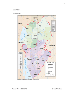

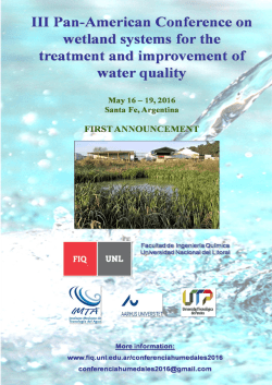
© Copyright 2026