
En Route Supplement International West (ERSIW)
01-West_book.book Page 1 Thursday, December 18, 2014 8:27 AM
ERSIW
AUSTRALIAN DEFENCE FORCE
FLIGHT INFORMATION PUBLICATION
(EN ROUTE)
EN ROUTE SUPPLEMENT
INTERNATIONAL WEST
Effective: 05 FEB 15
Next Issue: 30 APR 15
WARNING
Consult AIPAB and NOTAM for latest information
AIPAB
05 FEB 15
05 MAR 15
02 APR 15
AMENDED
SIGNED
01-West_book.book Page 2 Thursday, December 18, 2014 8:27 AM
© Commonwealth of Australia 2015
This work is copyright. Apart from any use as permitted under the
Copyright Act 1968, no part may be reproduced by any process without
prior written permission from the Commonwealth. Requests and inquiries
concerning reproduction and rights should be addressed to the
Commonwealth Copyright Administration, Attorney General’s Department,
National Circuit, Barton ACT 2600 or posted at http://www.ag.gov.au/cca.
Alternatively, contact the Department of Defence, AIS-AF, VBM-M-2,
Victoria Barracks, St Kilda Road, Southbank VIC 3006.
01-West_book.book Page 1 Thursday, December 18, 2014 8:27 AM
ERSIW
05 FEB 15
1
GEN 0.1 PREFACE
1.1 ERSIW is issued by AIS-AF under the authority of Chief of Air Force.
2. APPLICABLE DOCUMENTS
2.1 ERSIW is prepared in accordance with the Standards and Recommended Practices of the following ICAO
documents:
a.
Facilitation - Annex 9
b.
Aerodromes - Annex 14
c.
Aeronautical Information Services - Annex 15
d.
Aeronautical Information Services Manual (Doc 8126-AN/872)
e.
Aeronautical Charts - Annex 4
f.
Aeronautical Chart Manual (Doc 8697-AN/889/2)
3. ADF AIP - DOCUMENTS INVOLVED
3.1 ADF AIP is designed to be used as a complete package and component documents (including ERSIW) and
charts should not be used without reference to other applicable components of the package.
3.2 Refer to CAT and AIOB for a complete listing of ADF AIP components.
4. LAYOUT
4.1 Purpose. ERSIW provides details of selected aerodromes that have a maximum runway length greater
than 400M(1312FT) contained within the area of coverage. Aerodromes having more than one name are usually
identified by the city/aerodrome method, and where necessary cross reference is made between alternate names
and the name by which the aerodrome is listed. ERSIW also contains details of regional communications facilities
and procedures and regional emergency procedures. As a component of ADF AIP, ERSIW contains that
information which aircrew will require access to during pre-flight planning and in flight. It is produced in a bound A5
format suitable for both desktop and cockpit use.
4.2 The diagram on the back cover details the area of coverage of ERSIW.
4.3 Throughout ERSIW, the term “should” implies that all users are encouraged to conform with the applicable
procedure. The terms “must” and “shall” are synonymous and mean that the applicable procedure is mandatory and
supported by regulations or orders.
5. LANGUAGE
5.1 ERSIW is published only in the English language.
6. PROCUREMENT AND DISTRIBUTION
6.1 ERSIW and its amendment service are available from AIS-AF.
7. ORDERING PUBLICATIONS AND AMENDMENT SERVICES
7.1 Publications and amendment services can be obtained via Unit AIO/PUBSO/NAVO through the following
(preferred order of contact) :
a.
On-line - using the Product Order Form on either the Intranet (http://intranet.defence.gov.au/raafais/) or
the Internet (http://www.raafais.gov.au/)
b.
Email - orders can be placed to [email protected]
c.
Facsimile* - orders can be placed to +61 3 9282 6695
d.
Mail Order* - by writing to:
Distribution Coordinator
AIS-AF
VBM-M-2
Victoria Barracks
St Kilda Road
SOUTHBANK VIC 3006
e.
Telephone - orders will be accepted under exceptional circumstances only, to: +61 3 9256 4026
*Note.- All orders submitted by FAX or mail should be via the Product Order Form located in the Aeronautical
Information Order Booklet (AIOB). AIOB is available directly from AIS-AF or via the Intranet
(http://intranet.defence.gov.au/raafais) or the Internet (http://www.raafais.gov.au/).
7.2 Requests for amendments to procedures contained in ADF AIP are to be forwarded to the AIS-AF
Customer Liaison Officer through the originator's Wing Safety and Standards Officer (WSSO) or equivalent. The
originating authority of military specific material to be included within ADF AIP must ensure that it is thoroughly
checked before it is submitted to AIS-AF. This ensures that all necessary information has been included and is
correct in detail before distribution.
GEN 0
1. NAME OF PUBLISHING AUTHORITY
01-West_book.book Page 2 Thursday, December 18, 2014 8:27 AM
2
05 FEB 15
ERSIW
7.3. Credit Card Facilities
7.3.1 This section deleted.
GEN 0
7.4. Customer Change of Address
7.4.1 All customers shall promptly advise AIS-AF of any change of address.
7.4.2 Mail returned “Address Unknown” suspends the address record of the subscriber and no further mail will
be forwarded until advice is received of an address change.
8. AMENDMENTS
8.1 Product is amended by AIPAB and NOTAM, and is produced in accordance with the AIS-AF Production
Schedule available on the Intranet (http://intranet.defence.gov.au/raafais) or the Internet (http://raafais.gov.au/).
8.2 Any rescheduling of the above will be notified via AIPAB and/or, in certain circumstances, by NOTAM.
9. PACKAGES
9.1 This section deleted.
10. QUERIES ABOUT DOCUMENTATION
10.1 Contact with AIS-AF is generally to be via Unit AIO/PUBSO/NAVO during working hours (0800 - 1630h
AEST, MON-FRI), to the following appointments:
a.
Distribution
Distribution Coordinator
+61 3 9256 4026
b.
Technical advice
Customer Liaison Officer
c.
Feedback
Customer Liaison Officer
+61 3 9282 5426/5750
MOB +61 412 814 225
+61 3 9282 5426/5750
MOB +61 412 814 225
10.2 Written feedback may be submitted using the Feedback Form on either the
Intranet (http://intranet.defence.gov.au/raafais) or Internet (http://www.raafais.gov.au/).
10.3 All FAX requests are to be forwarded to +61 3 9282 6695 and marked for the attention of the relevant
appointment.
10.4 All e-mail requests are to be forwarded to [email protected] and marked for the attention of the
relevant appointment.
10.5 All mail requests are to be forwarded to the following address and marked for the attention of the relevant
appointment:
AIS-AF
VBM-M-2
Victoria Barracks
St Kilda Road
SOUTHBANK VIC 3006
10.6 All urgent after-hours requests are to be directed to +61 3 9282 5750. The call will be redirected to the
duty officer who will address the request. As AIS-AF does not maintain a formal after-hours capability, the majority
of requests will be dealt with on the next working day. Urgent operational matters will be dealt with in as timely a
manner as possible.
11. NON CATALOGUED PRODUCT REQUESTS
11.1 All requests for non-catalogued products are to be submitted to the AIS-AF Customer Liaison Officer
through the originator's CO and WSSO (or equivalent) using the Non Catalogued Product Form (PF20). Requests
may be mailed or faxed to AIS-AF. Form PF20 is available on the AIS-AF website.
GEN 0.2 RECORD OF AMENDMENTS
1. ERSIW consists only of a complete book, therefore no record of amendments is required.
GEN 0.3 RECORD OF AIP SUPPLEMENTS
1. ERSIW is amended by AIPAB and NOTAM. ADF users may also refer to the AIS-AF Intranet
(http://intranet.defence.gov.au/raafais/) to access information on current International AIP Supplements within the
AIS-AF area of coverage.
GEN 0.4 CHECKLIST OF PAGES
1. ERSIW consists only of a complete book, therefore no checklist of pages is required.
GEN 0.5 LIST OF HAND AMENDMENTS
1. The list of hand amendments to ERSIW can be found in AIPAB. AIPAB is published every 4 weeks, and is
available directly from AIS-AF, the Intranet (http://defweb.cbr.defence.gov.au/raafais) or the Internet
(http://raafais.gov.au/).
01-West_book.book Page 3 Thursday, December 18, 2014 8:27 AM
ERSIW
05 FEB 15
3
BRITISH INDIAN OCEAN TERRITORIES
DIEGO GARCIA NSF ..........................................
BRUNEI DARUSSALAM
ANDUKI ...............................................................
BRUNEI INTL/Bandar Seri Begawan ...................
MALAYSIA
ALOR STAR/Sultan Abdul Halim .........................
BAKELALAN ........................................................
BARIO ..................................................................
BATU PAHAT ......................................................
BELAGA ...............................................................
BENTA .................................................................
BINTULU ..............................................................
BUTTERWORTH .................................................
GONG KEDAK .....................................................
GRIK ....................................................................
IPOH/Sultan Azlan Shah ......................................
JENDERATA ........................................................
JEROCO ..............................................................
JOHOR BAHRU/Senai INTL ................................
KENINGAU ..........................................................
KERTEH ..............................................................
KLUANG ..............................................................
KONG KONG .......................................................
KOTA BELUD ......................................................
KOTA BHARU/Sultan Ismail Petra .......................
KOTA KINABALU FIC ..........................................
KOTA KINABALU INTL ........................................
KUALA LUMPUR ACC/FIC ..................................
KUALA LUMPUR INTL/Sepang ...........................
KUALA LUMPUR/Subang
/Sultan Abdul Aziz Shah ....................................
KUALA PENYU ....................................................
KUALA TERENGGANU/Sultan Mahmud .............
KUANTAN ............................................................
KUCHING INTL ....................................................
KUDAT .................................................................
LABUAN ...............................................................
LAHAD DATU ......................................................
LANGKAWI/Langkawi INTL .................................
LAWAS ................................................................
LIMBANG .............................................................
LONG AKAH ........................................................
LONG BANGA .....................................................
LONG LELLANG ..................................................
LONG PASIA .......................................................
LONG SEMADO ..................................................
LONG SERIDAN ..................................................
MALACCA ............................................................
MARUDI ...............................................................
MERSING ............................................................
MIRI .....................................................................
MUKAH ................................................................
MULU ...................................................................
PEKAN .................................................................
PENANG INTL .....................................................
PULAU PANGKOR ..............................................
PULAU REDANG .................................................
PULAU TIOMAN ..................................................
RANAU ................................................................
SANDAKAN .........................................................
SEGAMAT ...........................................................
SEMPORNA ........................................................
SIBU .....................................................................
18
19
20
21
21
21
22
22
22
22
23
24
24
25
25
25
26
26
27
27
28
28
28
28
29
30
30
32
33
33
34
35
35
36
37
37
38
38
38
39
39
39
39
39
40
40
40
41
41
42
42
42
43
43
44
44
44
45
45
45
SITIAWAN ............................................................
SUNGAI TIANG/Taman Negara ..........................
TAIPING ...............................................................
TANJUNG MANIS ................................................
TAWAU ................................................................
TOMMANGGONG ...............................................
SINGAPORE
PAPA UNIFORM ..................................................
PAYA LEBAR .......................................................
SELETAR .............................................................
SEMBAWANG .....................................................
SINGAPORE ACC ...............................................
SINGAPORE/Changi INTL ...................................
SINJON ................................................................
TENGAH ..............................................................
THAILAND
BANGKOK ACC/FIC ............................................
BANGKOK/Don Mueang INTL .............................
BANGKOK/Suvarnabhumi INTL ..........................
BURI RAM ............................................................
CHANTHABURI/Ban Noen Phloi Waen ...............
CHIANG MAI INTL ...............................................
CHIANG RAI/Mae Fah Luang-Chiang Rai INTL ..
CHIANG RAI/Rob Wiang .....................................
CHON BURI/Bang Phra .......................................
CHUM PHAE ........................................................
CHUMPHON ........................................................
KHON KAEN ........................................................
KRABI ..................................................................
LAMPANG ............................................................
LOEI .....................................................................
LOP BURI/Khok Kathiam .....................................
LOP BURI/Sa Pran Nak .......................................
MAE HONG SON .................................................
MAE HONG SON/Pai ...........................................
MAE SARIANG ....................................................
NAKHON PATHOM/Kamphaeng Saen ................
NAKHON PHANOM .............................................
NAKHON RATCHASIMA/Khorat ..........................
NAKHON RATCHASIMA/Nakhon Ratchasima ....
NAKHON SAWAN/Nakhon Sawan ......................
NAKHON SAWAN/Takhli .....................................
NAKHON SI THAMMARAT/Cha-Ian ....................
NAKHON SI THAMMARAT
/Nakhon Si Thammarat .....................................
NAM PHONG .......................................................
NAN ......................................................................
NARATHIWAT .....................................................
PATTANI ..............................................................
PHETCHABUN ....................................................
PHETCHABUN/Lom Sak .....................................
PHITSANULOK ....................................................
PHRAE .................................................................
PHUKET INTL ......................................................
PRACHIN BURI/Khao-E-To .................................
PRACHIN BURI/Watthana Nakhon ......................
PRACHUAP KHIRIKHAN/Hua Hin .......................
PRACHUAP KHIRIKHAN/Prachuap ....................
RANONG .............................................................
RAYONG ..............................................................
RAYONG/U-Tapao Pattaya INTL .........................
ROI ET .................................................................
ROI ET/Rob Muang ..............................................
SAKON NAKHON ................................................
46
46
46
46
47
47
48
48
49
50
51
51
54
55
56
56
59
60
60
61
62
63
63
63
63
64
65
65
66
67
67
68
68
68
69
69
70
71
71
71
72
73
73
74
75
75
76
76
77
78
78
79
80
80
81
81
82
82
83
83
84
GEN 0
GEN 0.6 TABLE OF CONTENTS
01-West_book.book Page 4 Thursday, December 18, 2014 8:27 AM
4
05 FEB 15
GEN 0
SARABURI/Ban Pahe .......................................... 84
SATUN/Khoun Khan ............................................ 84
SONGKHLA ......................................................... 85
SONGKHLA/Hat Yai INTL ................................... 85
SUKHOTHAI ........................................................ 86
SURAT THANI ..................................................... 87
SURAT THANI/Samui .......................................... 88
SURIN .................................................................. 89
TAK ...................................................................... 89
TAK/Khuan Phumiphon ....................................... 89
TAK/Mae Sot ........................................................ 89
TRANG ................................................................ 90
TRAT/Khao Saming ............................................. 91
TRAT/Khao Ta Khean .......................................... 91
UBON/Ubon Ratchathani ..................................... 92
UDON THANI ....................................................... 93
PAVEMENT
PAVEMENT DATA ................................................94
HF COMMUNICATIONS
ADF HIGH FREQUENCY COMMUNICATIONS
SYSTEM ............................................................97
TIME SIGNALS .....................................................98
GENERAL ABBREVIATIONS
GENERAL ABBREVIATIONS ...............................99
EMERGENCY PROCEDURES
ICAO ...................................................................113
ICAO COMM FAIL PROCEDURES ....................113
MALAYSIA ..........................................................114
SINGAPORE .......................................................117
THAILAND ..........................................................119
AIR DEFENCE IDENTIFICATION ZONE (ADIZ) 120
INTERCEPTION OF AIRCRAFT ........................120
ERSIW
01-West_book.book Page 5 Thursday, December 18, 2014 8:27 AM
ERSIW
05 FEB 15
5
GEN 0.7 TABLES AND CODES
1. General Symbology
GEN 0
1.1 Symbols used throughout this publication are as follows:
denotes a postal address.
denotes a telephone number or service.
* indicates that information is not available or that a runway is not usable in that direction.
± denotes that the direction of the RWY slope is unknown.
2. Aerodrome and Facilities Legend
1
3
4
5
6
GOJUPPUM/Taylor INTL (Ichini) (*1)
2
8
9
10
ELEV 33FT
GOKU
09 18’07”S 172 49’00”E UTC +7 H24 VAR 30°W
GOV: Nanji Port Authority.
PO Box 334 Gojuppum, Nanji, Ichini.
+61 2 339 6464. FAX +61 2 339 6465.
LCA abbreviation: GJM
*1. PPR.
MOVEMENT AREA
06/24
063 9756
16/34
160 12490
7
Bitumen
Bitumen
PCN 120/R/D/W/T
RWY
TORA
TODA
ASDA
LDA
06
3050(10007)
3950(12960) (5.0%) 3110(10204) 3050(10007)
24
3050(10007)
3650(11976) (5.0%) 3110(10204) 3050(10007)
Slope 0.3% down to NE. RWY WID 45M. RWS WID 220M. CWY: RWY 06 900M, RWY 24 600M.
RWY 16 Safe-bar 21.2 BEFAB 56.2 (B) (*1) ----------------BEFAB 56.2 (B) (*1) Safe-bar 21.2 (R) RWY 34
11 (100
OVRN)
(1360)
(1360)
(100 OVRN)
*1. Hookcable normally rigged across DEP end of RWY. 15 MIN notice is RQ to rig APCH end hookcable.
Special LDG, TKOF and TAX PROC apply when hookcable rigged.
12
SUPPLEMENTARY TKOF DIST
RWY 07 - 1683(5522)(2.5%)
RWY 25 - 862(2828)(2.5%)
13
LIGHTING (*1)
RWY
06 REIL HIAL HIRL VASIS 3 - MEHT 48FT RCLL RTHL
RWY
24 REIL HIAL HIRL VASIS 3 - MEHT 48FT RCLL RTHL
*1. SDBY PWR AVBL. Switchover-time 10 SEC.
14
NAVIGATION AIDS
VOR/DME
GOJ
VOR/DME
BOT
*1. 248/7.4.
15
113.6/CH83X
112.5/CH72X
AIR TRAFFIC SERVICES
APP
Gojuppum Approach
ARR
Gojuppum Arrivals
DEP
Gojuppum Departures
TWR
Gojuppum Tower
GND
Gojuppum Ground
S09 07.9’ E172 49.1’ (*1)
S09 07.9’ E172 49.1’
119.75
135.9
127.9
118.2
121.75
127.95
125.45
118.75
121.6
16
CTAF (*1)
124.2
*1. Outside TWR HR.
17
MBZ (*1, *2)
118.1 Gojuppum Traffic
17
18
GROUND SERVICES
REPLEN
F35. H24. ADI.
MET
H24.
22 2666.
RFF
CAT 5.
The AD OPR does not provide a marshalling service.
OTHER
AFRU.
SPECIAL PROCEDURES
1. In VMC, MIL ACFT can expect straight in visual APCH.
NOTICES
*1. Bird hazard exists.
01-West_book.book Page 6 Thursday, December 18, 2014 8:27 AM
6
05 FEB 15
ERSIW
3. Explanation
Aerodromes having more than one name are usually identified by the city/aerodrome
method, and where necessary cross reference is made between alternate names and the
name by which the aerodrome is listed. Where applicable a cross reference is provided by
listing the alternate aerodrome/aid identification.
1. Aerodrome Title.
GEN 0
2. Aerodrome Position. The position given is that of the Aerodrome Reference Point.
3. Time Conversion.
The time conversion indicates the number of hours to be added to UTC to obtain the
standard time applicable at the location. Allowances should be made for any daylight
saving that may be in force.
4. Operating Hours.
The operating hours are indicated by means of the following code:
AH
After Hours
D
Daily
E
Weekends
H+...
Hour plus Minutes past the Hour
H24
Continuous day and night service
HDS
Hours of Daylight Saving
HJ
Sunrise to Sunset
HN
Sunset to Sunrise
HO
Service available to meet operational requirements
HR
Hours
HS
Service available during hours of scheduled operations
HX
No specific working hours
JF
Saturday, Sunday and Public Holidays
JO
Monday to Friday except Public Holidays
O/R
On request
OT
Other times
PH
Public holidays
PN
Prior notice required
PPR
Prior permission required
SS
Sunset
W
Monday to Friday
WS
Monday to Saturday
Note 1.-Unless noted otherwise, all facilities are operational continuously
Note 2.-Unless noted otherwise, hours are shown in UTC.
5. Magnetic Variation. Magnetic variation will be shown where available.
6. Elevation.
The elevation given is shown in FT. When the elevation is sea level, it will be indicated as
0FT. When the elevation is below sea level, a minus sign will precede the figure.
7. Location Indicator. The ICAO location indicator is shown positioned beneath the Elevation figure. Where no
ICAO location indicator is assigned, the recognised abbreviation for the non-ICAO
location indicator is shown, on a separate line, below the Operating Agency and
designated ‘LCA abbreviation’.
8. Aerodrome Classification. The aerodrome classification is indicated by means of the following codes:
CIV
Civil Operator
GOV
National, Provincial or Local Government
JOINT
Joint Operators
MIL
Military Operator
PUB
Public Aerodrome
PVT
Private Operator
Note 1.-Specific information noted if known
9. Movement Area.
a.
b.
c.
d.
e.
Abbreviated runway details are provided as follows:
The runway designation as specified in State AIP.
The alignment (°M) of the centreline of the lower numbered runway.
The runway length (generally the take-off run available for both runway directions) in feet.
The runway surface will be described as, asphalt or bitumen; concrete; grass or clay, or
similar.
The ICAO standard method of reporting pavement strength known as Aircraft
Classification Number/Pavement Classification Number (ACN/PCN) has been
incorporated at some overseas airfields. For additional information refer to PVMT section
and FIHA AD 1.1.
01-West_book.book Page 7 Thursday, December 18, 2014 8:27 AM
ERSIW
05 FEB 15
7
10.1 Aerodrome Reference Code - Code Number (CN). This code number indicates the maximum field
length of the aeroplane that the RWY is designed for. Code numbers and associated field lengths are as follows:
1)
Field length of less than 800M
2)
Field length of 800M up to, but not including, 1200M
3)
Field length of 1200M up to, but not including 1800M
4)
Field length of 1800M and over.
10.2 Pilots should note that the field length of an aeroplane is based on the performance of an aeroplane during
certification and is not related to the actual RWY length provided at an aerodrome.
10.3 Use the code number to determine the applicable standards of obstacle-clear approach gradients, take-off
gradients and take-off survey areas for the RWY. The code number is not intended to limit aircraft operations at an
aerodrome. Aircraft operators and/or pilots must ensure that the published information meets requirements for their
aircraft operations.
10.4 Take-off Runway Survey Areas.
Take-off Climb Surface - Dimensions
Take-off Runways Code Number
1
2
3 or 4
MIL
Length of inner edge
60M
80M
180M
RWS WID
Minimum distance of inner edge from
RWY end @
30M
60M
60M
CWY DIST
Rate of divergence (each side)
10%
10%
12.5%
13.2%
Final width
380M
580M
1 200M
1 800M #
2 518M
Overall length
1 600M
2 500M
15 000M
15 000M $
# When the take-off procedure includes changes of heading greater than 15 DEG for operations conducted in IMC
or VMC by night
@ The take-off climb surface starts from the end of the clearway if a clearway is provided.
$ 3 000M for RWYs < 1 200M
10.5 Obstacle-Clear Take-off Gradients
10.5.1 Areas from the ends of runways, defined in accordance with the table above, are surveyed for obstacles.
The obstacle-clear take-off gradient is based on the greatest vertical angle with the horizontal subtended by an
obstacle within the surveyed area. This gradient information is shown in brackets immediately following the TODA
information. Liaise with the AD OPR if obstacle information is required.
10.5.2 Supplementary Take-Off Distance Available (STODA) are shown for obstacle-clear take-off gradients
(within the same defined area) of 1.6%, 1.9%, 2.2%, 2.5%, 3.3% and 5% if the TODA gradient exceeds these
figures and the resultant STODA is greater than 800M.
10.5.3 Where an existing fence or levee is located very close to the RWY end, the fence or levee may not be
taken into account in the assessment of the obstacle-clear take-off gradients for TODA and STODA purposes. In
such cases, information of the height and location of the fence or levee will be provided in a note under the relevant
declared distances entry.
10.5.4 If the survey area is not in accordance with the table above, details of the actual obstacle survey area
are provided below the relevant declared distances entry.
GEN 0
10. Declared Distances. When available, declared distances in metres (feet) are tabulated for each runway.
01-West_book.book Page 8 Thursday, December 18, 2014 8:27 AM
8
05 FEB 15
ERSIW
10.6 Obstacle-Clear Approach Gradients
GEN 0
10.6.1 The obstacle-clear approach gradient is normally based on the following standard:
a.
the threshold is located at least 60M from the intersection of the obstacle-clear approach surface with the
extended RWY centreline; and
b.
obstacle-clear approach gradients of:
1)
5% for a code 1 RWY or MIL Visual APCH RWY up to 800M length,
2)
4% for a code 2 RWY or MIL Visual APCH RWY 800M up to 1 200M length,
3)
3.3% for a code 3 and 4 RWY, and or MIL Visual APCH RWY 1 200M up to 1 800M length,
4)
2.5% for a MIL Visual APCH RWY 1 800M and over,
5)
3.3% for NPA Code 1, 2 or 3 RWY,
6)
2% for NPA Code 4 and precision APCH RWY,
(MIL RWYs: 2.0% for 3 000M, then 2.5% until outer horizontal surface, then horizontal).
10.6.2 Any variation to the standard is explained in a note under the relevant declared distances entry.
CLIMB/DESCENT GRADIENT GRAPH
EXAMPLE: At speed of 250 KT (470 KM/H) a gradient of 3%
corresponds to a rate of 760 FT/MIN (4 M/S)
KT
M/S
KM/H
FT/MIN
100
15
100
200
150
200
14
13
300
400
250
500
300
600
350
700
400
800
Speed
3000
2500
12
11
10%
9%
8%
7%
6%
5%
10
2000
9
8
1500
7
4%
6
3%
5
2%
1000
4
3
1%
2
500
1
200
Rate of climb/descent
Climb/descent gradient (%) vs rate of climb/descent
in FT/MIN (M/S) and at speed in KT (KM/H).
10.7 Slope. The slope listed is the average slope along the length of the runway, expressed as a percentage to
the nearest one-tenth of a percent. It is generally expressed as a “down” slope and its direction is tabulated in all
cases, e.g. “0.8% down to SE”. The symbol +/- indicates that the direction of the runway slope is unknown. Where
significant slope variations occur, additional data may be shown in notices, e.g. “E end level, centre section 0.5%
down to W, W end 0.1% down to E”. Where it is not possible to provide sufficient detail, the slope may be annotated
“undulating”.
10.8 Runway Strip Width. The width from side to side which contains the runway, and the graded and
ungraded portions of the runway strip.
01-West_book.book Page 9 Thursday, December 18, 2014 8:27 AM
05 FEB 15
9
11. Aircraft Arresting Systems (AAS).
Systems other than those detailed below, will be shown as A-Gear and amplified by a note.
a.
Tensioned Hookcable Arresting Systems
1)
BAK 12 Hookcable AAS. The BAK 12 AAS is a bi-directional Hookcable AAS. Energy is absorbed
by a rotary friction braking system which is connected to the runway hookcable by a nylon tape.
MAX tape runout is 365 M (1200 FT). MAX energy absorption is 98.5 million FT LB. MNM rewind
time is 3 minutes (nominal). Cycle rate for fighter type ACFT arrests is 12 ACFT per hour
(nominal).
2)
BAK 14. The BAK 14 is a spring/pneumatic system used for raising and lowering an AAS
hookcable from and into the runway. Within Australia, BAK 14 systems are installed, in conjunction
with BAK 12 hookcables, at YSNW, YSRI, YWLM, YAMB, YBTL, YPDN, YPED, YPTN and YPEA.
Normally selected up at departure end for arrestable ACFT OPS. ACFT captains are to request
"Cable Down" or alternatively request "Approach End Cable Up" if required.
Warning b.
In the event of power and or pneumatic failure, APP/DEP end cable will rise to a height of 100MM
(4 inches) and remain until failure rectified.
Aircraft Arresting Barriers
1)
M34B/243 MEN. Consists of two velocity-sensitive turbine-type rotary hydraulic (fluid turbulence
producing) energy absorbers, one installed on each side of the runway, and a multi-element nylon
(MEN) net suspended between retractable stanchions. It is a constant run-out, velocity-sensitive
system that adjusts automatically to accommodate aircraft of different weights, engaging speeds
and off-centre criteria. It has sufficient kinetic energy capacity to arrest jet type aircraft in the 10,000
to 20,000 KG (22,048 to 44,094 Pounds) weight range at speeds up to 180 knots. It is capable of
safely stopping an aircraft, operating in the system's performance envelope, within a run-out
distance of approximately 200 metres (656 feet), depending on system configuration.
Engagements should be made as close to centreline as possible and not more than 10.6 metres
(35 feet) from the centreline. Maximum engagement speeds (MES) are as follows:
Warning -
Aircraft Weight
MES
10,000 KG
160 KT
15,000 KG
160 KT
20,000 KG
135 KT
The Hawk 127 is not cleared for arrestor barrier engagement with 130 gallon external fuel tanks
and/or AAR probe fitted.
NOTES:- To ensure that the M34B brake cable payout does not occur until the net has deployed over the
engaging ACFT, a shear pin is used to connect the net suspension cable to the brake cable at each side of the
installation. These pins are intended to fail together shortly after engagement. If, however, the impact forces at
engagement are low it is possible for only one pin to shear. This could result in the ACFT being yawed and
subsequent damage being caused to it. Although the theoretical MNM engagement speed for both systems is zero
KT, it is, for that reason, desirable to keep engagement speeds ABV 50 KT for lightweight ACFT (BLW 60000 LB)
and 40 KT for heavier ACFT. Suffix (R) indicates remote control from control tower available. Barriers are not to be
used in winds above 35 KT except in the event of an EMERG.
c.
Flight Manuals.
When RAAF Flight Manuals are amended, this paragraph will refer RAAF OPR to Flight Manuals for
specific speed/weight configuration criteria for individual arresting systems. Other OPR should refer to
their respective Flight Manuals.
d.
Arresting System Clearance Details. The following ACFT are cleared to use the respective arresting
systems. (Safebar engagements are to be made with the canopy closed).
1)
M34B. Hawk 127 (see warning ABV), F/A18 variants (including Super Hornet). MAX weight speed
limits vary from 10,000 LB/160 KT to 25,000 LB/100 KT to 100,000 LB/50 KT.
Note 1.- Safebar engagements must be made with the canopy closed.
Note 2.- For M34B systems, the brake cable/brake drum attachment fitting is not designed to disengage itself
when MAX payout has been reached. If brake tape payout is exceeded the system will lock and a considerable
amount of tape stretch will occur, resulting in ACFT roll back up to 200 FT.
GEN 0
ERSIW
01-West_book.book Page 10 Thursday, December 18, 2014 8:27 AM
10
05 FEB 15
ERSIW
GEN 0
11.1 BAK 12 Hookcable.
a.
All hook equipped ACFT providing the weight and speed of the ACFT are within the parameters specified
in the ACFT flight manual. For 1200 FT runout systems with synchronised pressure of 2000 PSI at 780
RPM, general parameters are:
1)
Maximum engagement AUW is 95,000 LB (43,180 KG).
2)
Maximum engagement speed at 95,000 LB is 160 KT.
3)
Maximum engagement speed is 190 KT.
4)
Maximum AUW at 190 KT is 65,000 LB (29,550 KG).
5)
Minimum engagement AUW is 8,000LB (3,650KG)
b.
Trampling (Roll Over) Clearances BAK 12/14
This section is under review. Pilots should refer to the Pilot Operator Handbook or Flight Manual for specific
restrictions for each ACFT. In the absence of any reference to trampling in either the Handbook or Manual,
trampling is not authorised.
Note.Close formation trampling of the hookcable is not permitted. MNM time BTN successive ACFT
trampling the hookcable is five seconds.
c.
Location of Arresting Systems
1)
The arresting systems are shown as located on the RWY. The middle portion of the RWY is
indicated by a line and the distance of the arresting system from the end of the RWY (or into the
overrun) on the end on which the system is located is indicated (in feet) in brackets under the
applicable system.
Warning -
Up to 15 minutes notice may be required for rigging arresting gear for APCH end engagement.
EG:
RWY15
M34B (R)
(100 OVRN)
BAK 12/14 (*1) ---------- BAK 12/14 (1)
(1360)
(1360)
M34B (R)
RWY33
(100 OVRN)
*1. Hookcable normally rigged across DEP end of RWY for arrestable ACFT OPS.
*2. Suffix (R) indicates remote control from control Tower available.
*3. Suffix (B) indicates the arresting systems allows bi-directional engagement.
12. Supplementary TKOF DIST.
Supplementary Take-Off Distances Available (STODA) are shown for obstacle-clear take-off gradients
(within the same defined area) of 1.6%, 1.9%, 2.2%, 2.5%, 3.3% and 5% if the TODA gradient exceeds
these figures and the resultant STODA is greater than 800M.
01-West_book.book Page 11 Thursday, December 18, 2014 8:27 AM
ERSIW
05 FEB 15
11
AERODROME AND APPROACH LIGHTING
Codes
Description
ALS
Approach Lighting Systems
(Type and/or intensity is unknown)
LIAL
Low Intensity Approach Lights
MIAL
Medium Intensity Approach Lights
HIAL
High Intensity Approach Lights
OLS
Optical Landing System
Note.-
Runway Edge Lights
(Type and/or intensity is unknown)
LIRL
Low Intensity Runway Lights
MIRL
Medium Intensity Runway Lights
HIRL
High Intensity Runway Lights
VASIS
Visual Approach Slope Indicator Systems
Abbreviated (Single sided) Tee Visual Approach Slope
Indicator Systems
T-VASIS
Tee System Visual Approach Slope Indicator Systems
APAPI
CGL
Precision Approach Path Indicator
Abbreviated Precision Approach Path Indicator
Circling Guidance Lights
RAIL
Runway Alignment Indicator Lights
RLLS
Runway Lead-in Lighting
SFL
Sequence Flashing Lights
REIL
Runway End Identification Lights
RTIL
Runway Threshold Identification Lights
PTBL
Portable or Temporary
RCLL
Runway Centre Line Lights (White)
RENL
Runway End Lights (Red)
RTHL
Runway Threshold Lights
RTZL
Runway Touchdown Zone Lights (Red/white or White)
STWL
Stopway Lights (Red)
ABN
Aerodrome Beacon (FLG G or FLG G/W)
IBN
Identification Lights
HBN
Hazard Beacon
LIOL
Low Intensity Obstacle Lights
MIOL
Medium Intensity Obstacle Lights
HIOL
Note.-
Runway Edge Lights
(“White” or “Combination of
White and Amber/Yellow
Lights”)
If STAGE is known, it will be published. E.g. MIRL - Stage 3
(Available stages: Stage 1/Stage 2/Stage 3/Stage 4/Stage 5/Stage 6)
AT-VASIS
PAPI
Approach lights
If CATEGORY is known, it will be published. E.g. HIAL - CAT I
(Available category: CAT I, CAT II, CAT IIA, CAT IIB, CAT III)
REDL
Note.-
Type/Remarks
High Intensity Obstacle Lights
No standby power available unless annotated
Guidance and Lead-in Lights
Identification Lights
E.g. Flare, Gooseneck, etc.
Navigation Lights
Hazard and Obstacle Lights
GEN 0
13. Lighting. The lighting facilities are indicated by means of the following code:
01-West_book.book Page 12 Thursday, December 18, 2014 8:27 AM
12
05 FEB 15
a.
ERSIW
GEN 0
Pilot Activated Lighting.
On departure: Before taxi
On arrival: Within 15 NM of AD, and at or ABV LSALT select the appropriate VHF FREQ:
3 SEC
3 SEC
3 SEC
1 SEC
1 SEC
1)
Transmit pulse must be between 1 and 5 SECS.
2)
Three pulses must be transmitted within 25 SECS. Ensure that the third pulse ends before the 25th
second.
3)
Break between transmissions can be more or less than 1 SEC (no limit).
4)
Lights to illuminate for a minimum of 30 MINS, if not, keep transmitting 3 SEC pulses and check
frequency.
5)
When runway lights are about to extinguish, the wind indicator light will flash continuously.
REPEAT OPERATING PROCEDURE.
b.
Aerodrome Frequency Response Unit with PAL option (AFRU + PAL). PAL operation may be
provided as an optional function of the AFRU on the CTAF/MBZ FREQ associated with the aerodrome.
Aerodrome lighting enabled by AFRU + PAL is AVBL only during night hours or at other times of low
natural light levels. During periods of daylight, when the light intensity is above a preset level, the system
will not activate the lights.
1)
Where a discrete PAL FREQ is also provided, actuation of the aerodrome lights may be effected
either by using the PAL system on the discrete PAL FREQ or the AFRU + PAL system on the
CTAF/MBZ FREQ.
On receipt of the required ACFT transmission the AFRU will operate the aerodrome lighting
circuitry (RWY and wind indicator lights). The AFRU will transmit the standard reply (the
aerodrome name and MBZ or CTAF) immediately followed by the additional confirming message,
"RUNWAY LIGHTS ON". If the lights do not illuminate, the AFRU will transmit the message, "NO
RUNWAY LIGHTS". In this case, pilots should key the required transmission again or, alternatively,
change to the PAL FREQ and operate the lights via the PAL.
AFRU + PAL required transmission is:
1 SEC MAX
1 SEC MAX
1 SEC MAX
1 SEC MAX
1 SEC MAX
2)
After actuation, the aerodrome lights will remain illuminated for 30 minutes. After 20 minutes, the
windsock lights will flash at 1 second intervals and the AFRU will transmit the message, "RUNWAY
LIGHTS 10 MINUTES REMAINING". At any time, keying of the required transmission will reset the
lights for a period of 30 minutes.
3)
Aerodromes which have the AFRU + PAL option will have the entry "AFRU + PAL" included under
the "LIGHTING" heading.
c.
Circling Guidance Lighting. Circling guidance is achieved by either of two ground installations of
lighting display. The system installed is determined by either a need for positive tracking in terrain or
obstruction restricted areas, or a need to provide clear indication of the landing threshold location in the
latter portion of the downwind leg, or from base leg and final approach in reduced visibilities.
1)
Where terrain or obstructions restrict the circuit area, a racetrack pattern of lights may be laid out to
identify to a pilot the track he is required to follow. The system is normally used by night only.
2)
The second system identifies and locates the landing threshold in the latter part of the downwind
leg and on base leg, in order that a pilot may, by his own judgment, determine the point at which to
turn on to base leg and final approach respectively. This system employs high intensity uni-white
lights. Two lights are located outboard of the threshold and a further light is positioned at the outer
extremity of each crossbar of the approach light system. The lights at the threshold and on the two
innermost crossbars are aligned in the circuit direction and at 90° to the runway centre line. The
lights on the third, fourth and fifth crossbars are aligned in azimuth at 80°, 60° and 30° respectively
from the runway centre line. All lights are elevated at 6° above the horizontal so as to be visible in
the appropriate areas of the circuit. The system does not provide a fixing service but is intended to
signify the threshold position, from the circuit area only, in conditions of reduced visibilities by day
and by night.
3)
Where VASIS is installed, the azimuth coverage of the circling guidance lighting is restricted so as
not to be visible in the area of VASIS coverage.
d. Visual Approach Slope Indicator System (VASIS). VASIS installation may consist of either 2, 4, 6, 12 or 16
light units arranged in bars referred to as near, middle, and far bars.
1) Most VASIS installations consist of 2 bars, near and far, which consist of 2, 4 or 12 light units. These
installations provide one visual glide path which is normally set at 3°.
2) Three bars VASIS, near, middle, and far, provide an additional visual glide path to accommodate high
cockpit aircraft. These installations may consist of either 6 or 16 light units and provide two visual glide
paths. The lower glide path is provided by the near and middle bars and is normally set at 3° while the
upper glide path, provided by the middle and far bars, is normally 0.25° higher.
01-West_book.book Page 13 Thursday, December 18, 2014 8:27 AM
ERSIW
05 FEB 15
13
VASIS VARIATIONS
= Red
Near Bar
= White
Above Glide Path
On Glide Path
Below Glide Path
2-Bar VASIS 4 light units
Far Bar
Middle Bar
Near Bar
Below Both
Glide Paths
On Lower
Glide Path
3-Bar VASIS 6 light units
2-Bar 2 light units
On Glide Path
On Upper
Glide Path
2-Bar 12 light units
On Glide Path
Above Both
Glide Paths
3-Bar 16 light units
On Lower Glide Path
14. Navigation Aids. Bearing and distance provided is from the navigation aid to the aerodrome reference point,
(°M/NM) unless noted otherwise. Navigation aids operate continuously unless noted otherwise. To facilitate
programming of electronic navigation equipment, navigation aid positions are shown in degrees, minutes and
decimals of minutes.
The following table details the relationship between channel numbers and VHF frequencies for use with TACAN/
DME installations:
Frequency and Channel Pairing - ‘X’ Channels
MHZ
.00
.10
.20
.30
.40
.50
.60
.70
.80
.90
108
17
18
19
20
21
22
23
24
25
26
109
27
28
29
30
31
32
33
34
35
36
110
37
38
39
40
41
42
43
44
45
46
111
47
48
49
50
51
52
53
54
55
56
112
57
58
59
70
71
72
73
74
75
76
113
77
78
79
80
81
82
83
84
85
86
114
87
88
89
90
91
92
93
94
95
96
115
97
98
99
100
101
102
103
104
105
106
116
107
108
109
110
111
112
113
114
115
116
117
117
118
119
120
121
122
123
124
125
126
133
---
---
---
60
61
62
63
64
65
66
134
67
68
69
---
1
2
3
4
5
6
135
7
8
9
10
11
12
13
14
15
16
GEN 0
Far Bar
01-West_book.book Page 14 Thursday, December 18, 2014 8:27 AM
14
05 FEB 15
ERSIW
GEN 0
15. Air Traffic Services. Services are listed by Type, Call-sign and Frequency. Frequencies may be qualified by
the following suffixes:
CW
Continuous Wave/Carrier Wave
P
Primary frequency
R
Receives only - does not transmit on this frequency
S
Secondary frequency
T
Transmits only - does not receive on this frequency
Note.Unless otherwise noted, all communications frequencies shown are guarded during the hours of
operation of the unit concerned. Area frequencies are listed separately in the appropriate ACC/FIC entry for that
region/country.
16. Common Traffic Advisory Frequency (CTAF).
16.1 Frequencies to be used for operations at aerodromes are listed against locations under the heading
"CTAF".
16.2 Carriage of serviceable VHF radio, and being qualified to use it, are mandatory when operating at, or in
the vicinity of, all uncontrolled certified, registered and military aerodromes. However, a pilot may operate an aircraft
with an unserviceable VHF radio at, or in the vicinity of, an uncontrolled aerodrome where the carriage of
serviceable VHF radio is normally required if a radio failure occurs during the flight or if the purpose of the flight is to
take the radio to a place where it can be repaired. The pilot may continue to land at the aerodrome provided the
pilot activates the aircraft's anti-collision lights, landing lights and transponder (if any) whilst within the vicinity of the
aerodrome and, if arriving at the aerodrome, joins the circuit on the cross-wind leg. Note: A pilot should avoid
planning to arrive at or depart from an aerodrome for radio repairs during the known hours of scheduled regular
public transport (RPT) operations. For aerodromes where there is a UNICOM or CA/GRS, pilots should, by
alternative means, where possible, make contact and advise intentions before conducting operations.
16.3 A pilot may operate an aircraft that is not equipped with a serviceable aircraft VHF radio, or which is
equipped with such a radio but which the pilot is not qualified to use, to or from an uncontrolled aerodrome at which
the carriage of radio is normally required if the aircraft is flown:
a.
In VMC by day, and
b.
Arrives or departs in company with another aircraft which is radio-equipped and flown by a radio-qualified
pilot which will allow the latter to make radio calls on behalf of both aircraft. The radio equipped aircraft
should be manoeuvred to keep the no radio aircraft at a safe distance and in sight at all times in order to
accurately report its position.
16.4 Pilots of inbound traffic should monitor and communicate as appropriate on the designated CTAF from 10
miles to landing. Pilots of departing aircraft should monitor/communicate on the appropriate frequency from startup, during taxi, and until 10 miles from the airport unless local procedures require otherwise.
Note.Pilots of aircraft conducting other than arriving or departing operations at altitudes normally used by
arriving and departing aircraft should monitor/communicate on the appropriate frequency while within 10 miles of
the airport unless required to do otherwise by local procedures. Such operations include parachute jumping/
dropping, en route, practicing manoeuvres, etc.
17. Mandatory Broadcast Zone (MBZ).
17.1 MBZ are established to provide increased protection to aircraft in areas of uncontrolled airspace where
high density or special operations may occur.
17.2 A pilot is required to broadcast position and intention reports on a specified frequency on entry, when
joining an aerodrome traffic circuit, prior to entering a runway, and at regular specified intervals when operating
within the MBZ. As an extra safety measure, landing lights or anti-collision lights must be used when fitted.
17.3 Non-radio (NORDO) aircraft must not enter a MBZ unless they have another station, such as an ATS unit
or an aircraft, broadcasting the required reports on their behalf.
01-West_book.book Page 15 Thursday, December 18, 2014 8:27 AM
05 FEB 15
15
18. Ground Services.
a. Replenishment. The services available indicated by means of the following codes:
Fuel
F12
aviation gasoline, grade 80/87 AVGAS 80/8 7 (SG 0.713)
F18
aviation gasoline, grade 100/130 AVGAS 100/130 (SG 0.72)
F22
aviation gasoline, grade 115/145 AVGAS 115/145 (SG 0.705)
F34
aviation turbine kerosene
AVTUR 50 with FSII (S-1745) (-47C freeze point), (SG 0.80)
F35
aviation turbine kerosene
AVTUR 50 without FSII (S-1745)(-47C freeze point),(SG 0.80)
F40
aviation turbine gasoline
AVTAG with FSII (S748) (low vapour pressure), (SG 0.80)
F44
aviation turbine kerosene
AVCAT 48 (high flash point) (-46C freeze point), (SG 0.80)
F45
aviation turbine gasoline
AVTAG without FSII (S748) (-58C freeze point), (SG 0.80)
Lubricating Oil
O113
aviation piston engine lubricating oil 65 SUS
OM-107
O117
aviation piston engine lubricating oil 100 SUS
OM-270
O123
aviation piston engine lubricating oil (ashless dispersant) 80 SUS
OMD-160
O125
aviation piston engine lubricating oil (ashless dispersant) 100 SUS
OMD-250
O128
aviation piston engine lubricating oil (ashless dispersant) 120 SUS
OMD-370
O133
aviation turbine oil
OM-10
O135
aviation turbine lubricating oil, petroleum base 3cS
OM-11
O136
aviation turbine lubricating oil, petroleum base 9cS (EP)
OEP-71
O138
aviation turbine lubricating oil, petroleum base 9cS
OM-71
O142
general purpose (mineral) lubricating oil
OM-12
O147
instrument synthetic lubricating oil
OX-l4
O148
aviation turbine synthetic lubricating oil 3cS
OX-9
O149
aviation turbine synthetic lubricating oil 7.5cS
OX-38
O155
aviation gear (mineral) lubricating oil
OEP- 70
O156
aviation turbine synthetic lubricating oil 5cS
OX-27
O160
OX-26
OX-7
aviation turbine oil 390 3cS
Miscellaneous Fluids
C365
corrosion preventive compound, hydraulic system
OX-15
H515
mineral hydraulic oil
OM-15
H536
hydraulic oil
OX-50
H576
mineral hydraulic oil
OM-33
SKD5
Skydrol 500B
S735
inhibited ethylene glycol
AL-3
S737
isopropyl alcohol
AL-11
S738
denatured ethyl alcohol
AL-8
S745
glycol alcohol de-icing, defrosting fluid
AL-5
S746
isopropyl nitrate
avpin
S747
methyl alcohol
AL-9
S748
fuel system biocide & icing inhibitor (FSII)
AL-31
S1745 fuel system icing inhibitor, high flash type (FSII)
AL-41
ADI
50/50/1 methanol/water/inhibitor anti-detonant injection fluid (METHMIX) AL-37
MMX45 45/55/0 methanol/water thrust augmentation fluid
AL-28
MMX50 50/50/0 methanol/water thrust augmentation fluid
MMX60 60/40/0 methanol/water thrust augmentation fluid
WTA
demineralized water thrust augmentation fluid
Aviation Breathing Oxygen
HPOX High Pressure Oxygen
LHOX Low and High Pressure Oxygen
LOX
Liquid Oxygen
LPOX Low Pressure Oxygen
OXRB Oxygen Replacement Bottles (type of aircraft specified)
Note.-
Due to changes without notice, accuracy of REPLEN entries under “Ground Services”, cannot be
guaranteed.
GEN 0
ERSIW
01-West_book.book Page 16 Thursday, December 18, 2014 8:27 AM
16
05 FEB 15
b.
Power Units.
GEN 0
Electric.
E1
E2
E3
E4
E5
E6
E7
E8
E9
E10
E11
E12
E13
E14
E15
E16
c.
Note.d.
ERSIW
28VDC Battery Cart 120/208VAC 60KVA
28VDC 2.2KW 120/208VAC 45KVA
28VDC 7.5KW 120/208VAC 15KVA
28VDC 10KW 120/208VAC 75KVA
28VDC 15KW 120/208VAC 90KVA
Rectifier starting 28VDC 124/208VAC 30KVA 6KW/30KW Peak
Underground Power, 28VDC 15KW 124/208VAC 30KVA 120/208VAC 50KVA
28VDC 10KW, 120/208VAC 60KVA 120/208VAC 60KVA
28VDC 45 KW
28VDC 14KW
28VDC 15KW
28VAC 15KW
28VAC 15KW
28VDC 22.5KW
28VDC 25KW
28VDC 45KW
Air.
A1
Low pressure air starter (40PSI)
PRESAIR Compressed air replenishment (3000PSI or higher available)
Other Units.
Air Starting Units.
A1
40psi/1.5lb per SEC (Palouste, LPAS Mk 2A)
GTC-85
120lb/MIN at 45 psi
MA-1
150 Air HP, 115lb/MIN 50 psia
MA-1A
82lb/MIN (1123 cfm) at 130× air inlet temperature, 45 psia (MNM) air outlet pressure
Electrical Starting Units.
90G-20P AC115/200V 3 phase 400 Hz 90 KVA
A/M32A-86 AC115/200V 3 phase 90KVA 0.8pf 4 wire, DC28V 1500 amp 72KW (with TR pack)
Combined Air and Electrical Starting Units.
AM32A-60AAir: 150 ± 5 lb/MIN (2055 ± 68 cfm) at 51 ± 2 psia, AC120/208V 400 cycle, 3 phase,
75KVA, 0.75 pf, 4 wire, DC28V 200 amp, 5.6KW
The numeral preceding the type of unit indicates the number of units available. The absence of the
numeral indicates ten or more units available.
Meteorological Services.
Refer General Abbreviations section.
Note.Hours of service may vary on occasion without prior notification.
e.
Rescue Fire Fighting Services.
1)
Where indicated in State AIP, details of rescue and firefighting services will be provided. The
category listed will usually conform to those specified in ICAO Document 9137 Airport Services
Manual Part 1 - Rescue and Fire Fighting.
01-West_book.book Page 17 Thursday, December 18, 2014 8:27 AM
ERSIW
05 FEB 15
17
FUEL LOAD
LITRES
IMP GALLONS
U.S. GALLONS
113541 upwards
75701 - 113560
47401 - 75700
28401 - 47400
15101 - 28400
5681 - 15100
1891 - 5680
571 - 1890
Up to 570
25001 upwards
16667 - 25000
10411 - 16666
6251 - 10410
3334 - 6250
1251 - 3333
417 - 1250
126 - 416
Up to 125
300001 upwards
20001 - 30000
12501 - 20000
7501 - 12500
4001 - 7500
1501 - 4000
501 - 1500
151 - 500
Up to 150
POINTS
MAX design
passenger
capacity points
9
8
7
6
5
4
3
2
1
Over 225
151 - 225
126 - 150
101 - 125
76 - 100
41 - 64
11 - 40
6 - 10
Up to 5
9
8
7
6
5
4
3
2
1
TOTAL INDEX POINTS AERODROME CATEGORY
2)
2
I
10-11
VII
3-4
II
12-13
VIII
5
III
14
IX
6
IV
15-17
X
7
V
18
XI
8-9
VI
Rescue and Fire Fighting Facilities for United States of America. Aerodrome serving certain air carries under
14 CFR Part 139 are indicated by a CFR Index which relates to the availability of crash, fire, and rescue
equipment.
AIRPORT FIRE FIGHTING AND RESCUE EQUIPMENT REQUIREMENTS
Airport Index
Required
number of
vehicles
Aircraft Length
Agent & Water for Foam
A
1
< 90FT
500#DC or 450#DC + 100 gal H2O
B
1 or 2
≥ 90FT and < 126FT
Index A + 1500 gal H2O
C
2 or 3
≥ 126FT and < 159FT
Index A + 3000 gal H2O
D
3
≥ 159FT and < 200FT
Index A + 4000 gal H2O
E
3
≥ 200FT
Index A + 6000 gal H2O
> Greater Than; < Less Than; ≥ Equal To or Greater Than; H2O Water; # Pounds weight;
DC Dry Chemical.
NOTE: Vehicle and capacity requirements for airports holding limited operating certificates are
determined on a case by case basis.
f.
Customs, Immigration And Quarantine. Where indicated in State AIP, details of customs, immigration and
quarantine services will be provided.
GEN 0
ICAO CALCULATION OF INDEX POINTS AND AERODROME CATEGORY
01-West_book.book Page 18 Thursday, December 18, 2014 8:27 AM
FAC 18
05 FEB 15
ERSIW
____________________________________________________________________________________________________________________________________________________
BRITISH INDIAN OCEAN TERRITORIES
____________________________________________________________________________________________________________________________________________________
DIEGO GARCIA NSF (Chagos Archipelago) (*1, *2, *3)
*1.
*2.
*3.
British Indian
Ocean Territories
*1.
*2.
*1.
*2.
*3.
*1.
1.
2.
3.
4.
5.
1.
2.
3.
ELEV 14FT
07 18’48”S 072 24’40”E UTC +6 W 0100-1759 VAR 8° W
FJDG
MIL: US Navy
MSG address 'NAVSUPPFAC Diego Garcia//3//'
+246 370 3322/3301 FAX +246 370 3206.
RESTR AD, PPR, official business only, 72 HR PN RQ for all ACFT. DSN 315-370-3322, C011-246-370-3322.
PLN shall be filed 4HR in advance due to MSG TFC RLA DLA.
During an EMERG the PARL TWY can be used as an ALTN LDG SFC.
MOVEMENT AREA (*1)
13/31
130 12003 Concrete
PCN 97/R/A/W/T
Slope Nil. RWY WID 61M. SWY RWY 13 282M. SWY RWY 31 297M.
RWY 13 E28 (*2) -------------------------------------------------------------------------------------------------- E28 (*2) RWY 31
457(1500)
457(1500)
CAUTION: Potential exists for hydroplaning of some ACFT DRG XXRA.
20MIN PN for rigging.
LIGHTING
RWY 13
HIRL, ALS, VASIS, SFL
RWY 31
HIRL, ALS, VASIS, SFL
ABN
NAVIGATION AIDS
TACAN
NKW
112.0/CH57X
S07 19.0' E072 24.7'
NDB
NDG
300
S07 17.6' E072 23.1'
ILS (RWY 31)
INKW
109.3
S07 18.2' E072 23.7'
AIR TRAFFIC SERVICES
TWR (*1)
Diego Garcia Tower
126.2 340.2 360.2
SMC
Ground Control
118.4 299.6
A/G
*
13254
ATIS
*
134.1
* (*2, *3)
AMC OPS
128.0 349.4
No radar capability and provides no IFR separation. CTC TWR for ADZ WI 200NM, FL245 and BLW.
Air Mobility Control Centre. Email: [email protected]
All ACFT CTC AMC OPS 100NM out to pass load report and COOR transient SER. If unable to ESTAB CTC,
ADZ TWR.
GROUND SERVICES (*1)
REPLEN
F44.
MET
344.6 (CS "Metro").
RFF
AVBL.
CAUTION: No qualified personnel for fuelling of non AMC ACFT.
SPECIAL PROCEDURES
MAX HEL ALT in the TFC area 500FT.
Initial and Break ALT 1500FT.
CCT ALT 1000FT.
ACFT LDG must plan fuel for MNM 1HR HLDG DRG periods of XXRA.
Parallel TWY can be used as ALTN LDG SFC, 9000M X 150M.
NOTICES
CAUTION: Bird hazard. EXP MOD to SEV bird hazard 1HR prior to and AFT SR and SS.
TRAN ALERT: No transient MAINT AVBL. No qualified personnel for SER of non AMC ACFT.
Transient aircrews provide publications and supervise SER.
The islands at mouth of lagoon are designated nature reserves, do not FLY BLW 2000FT WI 3.0NM unless
ESTAB on FNA course or on DEP instruction.
__________________________________________ _____________________________________
01-West_book.book Page 19 Thursday, December 18, 2014 8:27 AM
ERSIW
05 FEB 15
FAC 19
____________________________________________________________________________________________________________________________________________________
BRUNEI DARUSSALAM
____________________________________________________________________________________________________________________________________________________
ANDUKI (*1, *2)
04 38’15”N 114 22’56”E UTC +8 2200-1000 VAR 0°
PVT: Anduki Airfield, Brunei Shell Petroleum Company Sdn Bhd.
Seria KB3534, Negara Brunei Darussalam.
+673 337 2203 FAX +673 337 2125.
*1. CLSD to FDWG ACFT.
*2. PPR.
MOVEMENT AREA
05/23
055 2657 Asphalt
Slope Nil. RWY WID 32M.
LIGHTING
RWY 05
REDL, ALS (*1), APAPI 3.50°
RWY 23
REDL, ALS (*1), APAPI 3.50°
*1. Single bar with running strobes.
NAVIGATION AIDS
NDB
AKI
250
N04 37.8' E114 22.3'
AIR TRAFFIC SERVICES
TWR
Anduki Tower
122.1
GROUND SERVICES
REPLEN
F35.
+673 337 2203.
MET
H24.
+673 2 33 0142/0143.
/FAX +673 2 33 2735.
RFF
CAT 3.
ELEV 9FT
WBAK
Brunei
____________________________________________________________________________________________________________________________________________________
01-West_book.book Page 20 Thursday, December 18, 2014 8:27 AM
FAC 20
05 FEB 15
BRUNEI INTL/Bandar Seri Begawan (*1)
*1.
*1.
*1.
*2.
*1.
*2.
*3.
*4.
*5.
Brunei
*1.
*2.
*3.
*4.
*5.
*6.
*7.
*8.
1.
2.
3.
4.
ERSIW
ELEV 73FT
04 56’39”N 114 55’42”E UTC +8 H24 VAR 0°
WBSB
CIV: DCAB.
Department of Civil Aviation,
Ministry of Communications, Brunei International Airport 2015, Negara Brunei Darussalam.
+673 2 33 0142/0143/2337 FAX +673 2 33 1706.
PPR for OPS BTN 1600-2300.
MOVEMENT AREA (*1)
03/21
031 12001 Asphalt
PCN 70/F/C/W/T
RWY
TORA
TODA
ASDA
LDA
03 3658(12001)
3993(13100)
3658(12001) 3658(12001)
21 3658(12001)
3962(12999)
3658(12001) 3658(12001)
Slope 0.5% down to SW. RWY WID 46M. RWS WID 300M. CWY RWY 03 335M. CWY RWY 21 304M.
RESA RWY 03/21 240M.
LIGHTING (*1)
RWY 03
HIRL (*2), HIAL-CAT I, PAPI 3.00° MEHT-59FT, RTHL, RCLL, RENL
RWY 21
HIRL (*2), HIAL-CAT I, PAPI 3.00° MEHT-61FT, RTHL, RCLL, RENL
ABN
OCC WG 3 SEC
N04 56.9' E114 56.0'
SDBY PWR AVBL.
W REDL VRB INST.
NAVIGATION AIDS (*1)
DVOR/DME
BRU
112.0/CH57X
N04 52.5' E114 53.1' (*5)
NDB
BR
318
N04 53.9' E114 54.1' (*3)
ILS (RWY 21)
BI
109.7
N04 55.6' E114 55.1' (*2, *4)
DME
BI
109.7/CH34X
N04 57.4' E114 56.0' (*4)
ILS (RWY 03)
BE
108.9
N04 57.6' E114 56.3' (*4)
DME
BE
108.9/CH26X
N04 56.0' E114 55.2' (*4)
SDBY PWR AVBL.
CAUTION: Momentary loss of LOC SGL may occur BLW 2500FT up to 10° left or right of EXTD CL beyond
18NM and more than 15° left of EXTD CL at 17NM.
MP: THU 0000-0400.
MP: TUE 0000-0400.
MP: WED 0000-0400.
AIR TRAFFIC SERVICES (*1)
APP
Brunei Radar
121.3 127.1 125.2 (*6) 123.1 (*7) 130.5 (*8) 128.0
TWR
Brunei Tower
118.7
SMC
Brunei Tower
121.9
ATIS
Brunei
126.8 (*2)
VOLMET (*3)
Singapore Radio
11387 (*5)
6676 (*4)
H24.
+673 2 33 0896/0454. FAX +673 2 33 1706.
RNG 100NM.
BCST H+20-H+25 and H+50-H+55.
1230-2230.
2230-1230.
Director.
SAR.
Area.
GROUND SERVICES
REPLEN
H24. F35. 0125. 0128. OX-7. MMX45. SHELL. Carnet.
+673 2 33 7577/6534. FAX +673 2 33 0538.
MET
H24.
+673 2 33 0142/0143. FAX +673 2 33 2735.
RFF
CAT 9. H24.
NOTICES
TWY and exits are fitted with reflective marker boards for HN OPS, pilots are REQ to switch on ACFT LDG or
Taxi LGT.
CAUTION: Turbine PWR plant causing TURB and CLD 1.2NM on FNA RWY 03/DEP RWY 21.
CAUTION: Bird hazard.
CAUTION: HEL OPS.
__________________________________________ _____________________________________
01-West_book.book Page 21 Thursday, December 18, 2014 8:27 AM
ERSIW
05 FEB 15
FAC 21
____________________________________________________________________________________________________________________________________________________
MALAYSIA
____________________________________________________________________________________________________________________________________________________
ALOR STAR/Sultan Abdul Halim (Peninsular) (*1)
*1.
*2.
*1.
*2.
*1.
*2.
*3.
*1.
1.
2.
1.
ELEV 15FT
WMKA
____________________________________________________________________________________________________________________________________________________
BAKELALAN (Sarawak) (*1)
03 58’26”N 115 37’02”E UTC +8 HX VAR 0°
CIV: MAB.
*1. SKED and notified MOV only.
MOVEMENT AREA
05/23
*
1801 Bitumen
DHC 6
Slope 2.3% down to NE. RWY WID 23M. RWS WID 38M. SWY RWY 05 62M.
SPECIAL PROCEDURES
1. RESTR: LDG RWY 23. TKOF RWY 05.
ELEV 2900FT
WBGQ
____________________________________________________________________________________________________________________________________________________
BARIO (Sarawak) (*1)
ELEV 3450FT
03 44’11”N 115 28’32”E UTC +8 HX VAR 1° E
WBGZ
CIV: MAB.
*1. AD AVBL for SKED and notified MOV only.
MOVEMENT AREA
11/29
108 2198 Bitumen
RWY WID 18M.
NAVIGATION AIDS (*1)
L
RI
322.5
N03 43.8' E115 28.8'
*1. 279/218M to THR RWY 11.
AIR TRAFFIC SERVICES
AFIS
Bario Radio
6825
SPECIAL PROCEDURES
1. RWY 11/29 CLSD to all FDWG ACFT exceeding 5700KG(12500LB) when RWY SFC is COV with or has
patches of water on it.
____________________________________________________________________________________________________________________________________________________
Malaysia
*1.
06 11’40”N 100 24’03”E UTC +8 2230-1430 VAR 0°
CIV: MAB.
Sultan Abdul Halim Airport, 06550 Alor Star, Kedah Darul Aman, Malaysia.
+60 4 714 2994/6876 FAX +60 4 714 5345.
OT for notified MOV only.
MOVEMENT AREA (*1, *2)
04/22
043 9006 Asphalt
PCN 96/F/C/X/T
RWY
TORA
TODA
ASDA
LDA
04
*
*
*
2745(9006)
22 2745(9006)
2745(9006)
2805(9203)
*
Slope Nil. RWY WID 45M. RWS WID 300M. SWY RWY 22 60M.
RESA RWY 04/22 90M.
TWY K and L for ACFT BLW 7000KG MTOW only.
LIGHTING (*1)
RWY 04
REDL-White/Yellow, HIAL-CAT I, PAPI 3.00°, RTHL, RENL
RWY 22
REDL-White/Yellow, RENL, STWL
ABN (*2)
FLG W/G
SDBY PWR AVBL. Switch-over time 15 SEC.
On during bad weather.
NAVIGATION AIDS
DVOR/DME
VAS
113.6/CH83X
N06 11.1' E100 23.8'
ILS (RWY 04)
IAS
111.7
N06 12.1' E100 24.5'
DME
IAS
111.7/CH54X
N06 10.9' E100 23.6'
AIR TRAFFIC SERVICES (*1, *2)
APP/TWR
Alor Star Tower
122.3 282.5 129.1 (*3)
SMC
Alor Star Ground
121.6
ATIS
128.65
2200-1600.
+60 4 714 5413/5414. FAX +60 4 714 3970.
Use while OPR in Alor Star CTR training areas.
GROUND SERVICES (*1)
MET
/FAX +60 4 714 4212.
RFF
CAT 6.
CIQ
CUST 2200-1600. IMG by prior arrangement.
Other GND SER AVBL to MIL ACFT only.
SPECIAL PROCEDURES
LHC RWY04 1500FT QNH, or 1000FT for LGT ACFT.
RESTR: LDG RWY 04. TKOF RWY 22.
NOTICES
CAUTION: Bird hazard.
01-West_book.book Page 22 Thursday, December 18, 2014 8:27 AM
FAC 22
05 FEB 15
ERSIW
BATU PAHAT (Peninsular) (*1)
01 52’00”N 102 56’00”E UTC +7.5 HX VAR 0°
*1. No AD.
NAVIGATION AIDS
NDB
BP
276
N01 52.0' E102 56.0'
____________________________________________________________________________________________________________________________________________________
BELAGA (Sarawak) (*1)
02 38’48”N 113 46’31”E UTC +8 HX VAR 1° E
*1. Unattended.
MOVEMENT AREA
05/23
*
1401 Bitumen
RWY WID 18M.
ELEV 200FT
WBGC
____________________________________________________________________________________________________________________________________________________
BENTA (Peninsular) (*1)
04 02’52”N 101 59’06”E UTC +8 HX VAR 0°
MIL: MINDEF.
*1. Unattended AD.
MOVEMENT AREA
04/22
036 1601 Grass and tarmac
RWY WID 23M. SWY RWY 04 91M.
NOTICES
1. CAUTION: AD floods AFT XXRA.
ELEV 250FT
WMAC
____________________________________________________________________________________________________________________________________________________
BINTULU (Sarawak)
*1.
*2.
*3.
*4.
*5.
Malaysia
*1.
*1.
*2.
ELEV 74FT
03 07’27”N 113 01’11”E UTC +8 2245-1230 VAR 1° E
WBGB
CIV: MAB
Bintulu Airport, P.O. Box 2787, 97008 Bintulu, Sarawak, Malaysia.
+60 86 33 3844 FAX +60 86 33 7011.
MOVEMENT AREA (*1, *2, *3, *4, *5)
17/35
167 9006 Asphalt
PCN 79/F/C/X/T
RWY
TORA
TODA
ASDA
LDA
17 2745(9006)
2805(9203)
2745(9006)
2745(9006)
35 2745(9006)
2805(9203)
2805(9203)
2745(9006)
Slope 0.4% down to N. RWY WID 45M. RWS WID 300M. SWY RWY 35 60M. CWY RWY 17 60M.
CWY RWY 35 60M.
RESTR: Locked wheel turns not permitted on RWY.
RESA RWY 17/35 90M.
ARR ACFT shall enter the main TERM PRKG APN FM the RWY via TWY Alpha whilst DEP ACFT shall use
TWY Bravo or as directed by ATC.
DEP ACFT:
a. Shall CTC Bintulu Ground 121.8 for start-up CLR at least 10MIN BFR DEP.
b. Shall obtain start-up, push back and TAX CLR FM Bintulu Ground on 121.8.
c. Shall push out onto the APN CL with nose facing NNE or as directed by ATC.
ENG run PROC for ACFT:
a. Fitted with APU:
i.) ACFT shall start-up one ENG.
ii.) Push back shall commence AFT one ENG has started up and shall be on idle PWR at push back.
iii.) Start-up of other ENG shall be made AFT push back and when ACFT is in PSN on the APN TWY line.
b. Not fitted with APU or when the APU is U/S:
i.) Shall be permitted to start all ENG BFR push back, EXC for wide body ACFT.
LIGHTING (*1)
RWY 17
REDL, HIAL-CAT I, PAPI 3.00°, RTHL, RENL
RWY 35
REDL, ALS, PAPI 3.00°, RTHL, RENL, STWL
ABN
FLG G/W EV 2 SEC.
SDBY PWR AVBL. Switch-over time 10-15 SEC.
NAVIGATION AIDS
DVOR/DME
VBU
112.6/CH73X
N03 09.2' E113 00.8'
NDB
BTU
368
N03 06.1' E113 01.5'
ILS (RWY 17)
ILU
108.7
N03 06.6' E113 01.4'
DME
ILU
108.7/CH24X
N03 08.0' E113 01.0'
AIR TRAFFIC SERVICES (*1)
TWR
Bintulu Tower
122.3P 119.25S
SMC
Bintulu Ground
121.8
ATIS (*2)
Bintulu Information
127.8
+60 86 33 2561/1331. FAX +60 86 33 0501. E-mail: [email protected]
2230 METAR AVBL.
GROUND SERVICES
REPLEN
F35. PETRONAS. 2200-1200. OT 2HR PN.
+60 86 31 2463.
MET
H24.
+60 86 33 4148/2095. FAX +60 86 31 4386.
RFF
CAT 6. CAT 8 with 7 days PN to MAB.
CIQ
CUST 0000-1200. IMG 0000-0900 SUN/PH 0030-0730.
01-West_book.book Page 23 Thursday, December 18, 2014 8:27 AM
ERSIW
3.
1.
2.
3.
SPECIAL PROCEDURES
RESTR: RWY 17 - RHC.
CCT HGT: 1500FT.
Light ACFT and HEL: 1000FT.
For VFR PROC CTC RAAF AIS
+61 3 9282 6400.
NOTICES
CAUTION: Gas stacks WI a RAD of 3NM FM 03 16.2'N 113 04.2'E (018/9.2 FM ARP). Flares may shoot up to
a HGT of 1000FT. All ACFT are to avoid this area.
CAUTION: Bird hazard.
CAUTION: MET RDO sonde released at 2330 and 1130, PSN 03 07.3'N 113 01.3'E.
____________________________________________________________________________________________________________________________________________________
BUTTERWORTH (Peninsular) (*1, *2)
*1.
*2.
*1.
*2.
*1.
*2.
*3.
*1.
*1.
*2.
*3.
*4.
1.
2.
1.
FAC 23
ELEV 11FT
05 28’03”N 100 23’30”E UTC +8 H24 VAR 0°
WMKB
MIL: RMAF.
Pangkalan Udara Butterworth, 12990 Butterworth, Penang, Malaysia.
+60 4 320 4333/4355 FAX +60 4 323 2122.
PPR for all non RMAF ACFT.
19SQN:
+60 4 314 2160 FAX +60 4 314 2176
MOVEMENT AREA (*1)
18/36
184 7999 Asphalt
LCN 80
RWY
TORA
TODA
ASDA
LDA
18 2438(7999)
2438(7999)
2701(8862)
2438(7999)
36 2438(7999)
2438(7999)
2701(8862)
2438(7999)
Slope Nil. RWY WID 45M. RWS WID 300M. SWY RWY 18 263M. SWY RWY 36 263M.
RWY 18 Safe Bar 21.2 BAK 12 (B) (*2)----------------------------------------- BAK 12 (B) Safe Bar 21.2 (*2) RWY 36
30(100)
460(1510)
524(1720)
30(100)
CAUTION: Reports indicate arresting barrier for RWY 36 (LCA THR RWY 18) not fully retractable, and unidentified OBST LCA WI SWY RWY 36, 680FT FM THR RWY 18. Aircrew should consider whether SWY RWY 36
suitable for their ACFT OPS.
Safebar 21.2: Barrier LCA in OVRN.
LIGHTING (*1)
RWY 18
HIRL (*3) SALS, PAPI Both 3.00°, RTHL, RENL (*2)
RWY 36
HIRL (*3), HIAL, PAPI Both 3.00°, RTHL, RENL (*2)
SDBY PWR AVBL. Switch-over time 10 SEC.
R and G WBAR.
White with last 2000FT Amber.
NAVIGATION AIDS
VORTAC
VBT
113.3/CH80X
N05 28.6' E100 23.6' (*1)
ILS (RWY 36)
IBW
108.3
N05 28.8' E100 23.5'
DME
IBW
108.3/CH20X
N05 27.5' E100 23.5'
LTD RNG and UNREL BTN R230 & R270 BLW 7100FT, due to terrain shielding.
AIR TRAFFIC SERVICES
APP
Butterworth Approach 125.8 253.9
APP
Butterworth Traffic
120.8 274.3
DEP
Butterworth Departure 128.5 268.4
PAR (*1)
Butterworth Finals
123.2 290.8 344.0
TWR
Butterworth Tower
118.3 257.2
SMC
Butterworth Ground
134.6 263.8
ATIS (*2)
Butterworth Terminal Information 122.75 230.1
MRX (*3, *4)
MRX (Rescue Sub Centre) 3023P 3095P 9027P 5695.5S 6693S
MON-FRI 0001-0900.
MON-FRI 2300-1200.
HO.
MRX may maintain a listening watch on RAAF/RNZAF AOCCAK GPN FREQ: 2100-0900: 8974KHz,
11235KHz, 13206KHz. 0900-2100: 3032KHz, 5687KHz, 8974KHz.
GROUND SERVICES
REPLEN
F18. F34. O117. O128. O133. O135. O156. H515. S738. HPOX. LHOX. LOX. LPOX. E4. E5.
E11. E12. E13. E14. PRESAIR.
MET
+60 4 331 4633 FAX +60 4 331 9897.
RFF
CAT 6.
CIQ
24 HR PN.
SPECIAL PROCEDURES
RESTR: RWY 36 - RHC.
CCT HGT: Jet - 1500FT, FDWG - 1500FT, HEL - 700FT HJ, 1000FT HN.
NOTICES
CAUTION: Bird hazard especially BFR 1000 LMT. MOV BFR this time should be avoided if POSS.
____________________________________________________________________________________________________________________________________________________
Malaysia
1.
2.
05 FEB 15
01-West_book.book Page 24 Thursday, December 18, 2014 8:27 AM
FAC 24
GONG KEDAK (Peninsular) (*1)
*1.
*1.
*2.
*3.
*4.
*1.
1.
1.
2.
05 FEB 15
ERSIW
ELEV 20FT
05 47’56”N 102 29’25”E UTC +8 VAR 0°
WMGK
MIL: RMAF.
Royal Malaysian Air Force Gong Kedak, 22000 Jertih, Terengganu Darul Iman.
+60 9 697 2609 FAX +60 9 697 4351.
48 HR PPR for non SKED ACFT. DRG Gong Kedak OPR HR REQ THRU FPO/OPS
+60 9 697 2609.
OT THRU Markas Tentera Udara (POTU), Wisma Pertahanan, Jalan Padang Tembak, 50634, Kuala Lumpur
+60 3 231 4417. REQ to be made BFR noon on a working day.
MOVEMENT AREA
08/26
082 8521 Asphalt
LCN 35
Slope Nil. RWY WID 46M.
RWY 08 BAK 13 ---------------------------------------------------------------------------------------------------- BAK 13 RWY 26
28(91)
425(1393)
34(112)
LIGHTING (*1)
RWY 08
HIRL (*4), HIAL T-bars, R, PAPI 2.75°, RTHL, RENL (*3)
RWY 26
HIRL (*4), HIAL T-bars, R, PAPI 2.75°, RTHL, RENL (*3)
IBN (*2)
R
SDBY PWR AVBL. Switch over WI 10 SEC.
OPR when REQ.
WBAR, G
White last 2000FT Amber.
NAVIGATION AIDS
NDB
GK
520
N05 47.9' E102 29.4'
VORTAC
VGK
116.6/CH113X
N05 47.8' E102 28.7'
AIR TRAFFIC SERVICES (*1)
APP
Gong Kedak
227.6P 129.9
TWR
Gong Kedak Tower
226.1P 242.2S 118.4
SMC
Gong Kedak Ground
225.2P 240.9S 121.9
MON-THU 2300-1100, FRI 2300-0500 and 0600-1100, SAT 2300-0500, SUN and PH 48HR PPR.
NGT FLY MON-WED 1100-1500.
GROUND SERVICES
REPLEN
F18. F35. No fuelling FAC AVBL for CIV ACFT.
MET
H24.
+60 9 690 2460. FAX +60 9 690 2461.
RFF
CAT 6. MIL STD.
CIQ
H24 PN.
SPECIAL PROCEDURES
CCT HGT: Jet - 1500FT, FDWG - 1000FT, HEL - 700FT QNH HJ, 1000FT QNH HN.
NOTICES
CAUTION: Bird hazard.
CAUTION: Kites in VCY.
____________________________________________________________________________________________________________________________________________________
GRIK (Peninsular) (*1)
ELEV 420FT
Malaysia
05 25’55”N 101 07’22”E UTC +8 HX VAR 1° W
WMAH
MIL: MINDEF
Secretary General, Ministry of Defence Jalan Padang Tembak, Kuala Lumpur, Malaysia
+60 3 235 2073/4
*1. Unattended. PPR THRU Defence OPR Room. 72HR PN with the following INFO:
a. ACFT type.
b. REG and CS.
c. POB.
d. RTE and Time.
e. Planned LVL.
f. EQPT carried and purpose of FLT.
MOVEMENT AREA
01/19
016 1699 Tarmac
RWY WID 30M. SWY RWY 01 30M.
LIGHTING
HBN
GROUND SERVICES
REPLEN
F18. 300 GAL, PN to MIL.
NOTICES
1. CAUTION: Animal hazard.
____________________________________________________________________________________________________________________________________________________
01-West_book.book Page 25 Thursday, December 18, 2014 8:27 AM
ERSIW
05 FEB 15
IPOH/Sultan Azlan Shah (Peninsular)
*1.
*1.
*2.
*3.
*4.
*1.
1.
1.
FAC 25
ELEV 130FT
04 34’09”N 101 05’35”E UTC +8 2300-1300 VAR 0°
WMKI
CIV: MAB.
Sultan Azlan Shah Airport, 31350 Ipoh, Perak Darul Ridzuan, Malaysia
+60 5 318 8203/8216 FAX +60 5 312 2295.
MOVEMENT AREA (*1)
04/22
042 6562 Tarmac
PCN 77
RWY
TORA
TODA
ASDA
LDA
04
*
*
*
1800(5906)
22 2000(6562)
2000(6562)
2000(6562)
*
Slope 0.1% down to NE. RWY WID 45M. RWS WID 300M. DTHR RWY 04 120M. DTHR RWY 22 80M.
RESA RWY 04/22 90M.
LIGHTING (*1)
RWY 04
REDL (*4), HIAL, PAPI Left side 3.00°, RTHL, RENL
RWY 22
REDL (*4), RTHL, RENL
ABN (*3)
G/W
HBN (*2)
SDBY PWR AVBL. Switch-over time 15SEC.
Numerous.
ATS OPS HR.
W/Y last 600M.
NAVIGATION AIDS
VOR/DME
VIH
117.3/CH120X
N04 34.4' E101 05.6'
ILS (RWY 04)
IPO
110.5
N04 34.6' E101 06.0'
DME
IPO
110.5/CH42X
N04 33.8' E101 05.4'
AIR TRAFFIC SERVICES
TWR (*1)
Ipoh Tower
122.1
SMC
Ipoh Ground
121.6
+60 5 308 8602. FAX +60 5 318 8605.
GROUND SERVICES
REPLEN
AVBL O/R.
MET
+60 5 313 3897.
RFF
CAT 6. 2300-1300.
+60 5 548 5835 / 019 556 9240.
CIQ
2300-1300. CUST
/FAX +60 5 312 6114
IMG
+60 5 311 4603 / 501 7141 / 7158 FAX +60 5 501 7122
SPECIAL PROCEDURES
RESTR: LDG RWY 04, TKOF RWY 22.
NOTICES
CAUTION: Bird hazard.
____________________________________________________________________________________________________________________________________________________
JENDERATA (Peninsular)
03 54’42”N 100 56’53”E UTC +8 HX VAR 0°
CIV: United Plantation Limited.
MOVEMENT AREA
03/21
031 2746 Asphalt
RWY WID 16M.
ELEV 8FT
WMAJ
ELEV 60FT
05 24’22”N 118 23’47”E UTC +8 HJ VAR 0°
CIV: Group Estate Manager
Jeroco Plantations Sendirian Berhad. Wisma Hap Seng, Km 2.7 Jalan Leila 9000 Sandakan Sabah.
+60 19 813 9267/89 821 304 FAX +60 89 821304.
*1. PPR.
MOVEMENT AREA (*1, *2)
04/22
040 2802 Gravel
AUW 6150KG
RWY WID 24M. DTHR RWY 22 146M.
*1. CAUTION: Hill and trees on FNA RWY 22.
*2. CAUTION: Mast 112FT AGL LCA 300M NE of RWY 04 THR, 28M W of RWY edge.
GROUND SERVICES
RFF
PTBL fire extinguisher. Plantation medical clinic 5KM FM AD.
____________________________________________________________________________________________________________________________________________________
Malaysia
____________________________________________________________________________________________________________________________________________________
JEROCO (*1)
01-West_book.book Page 26 Thursday, December 18, 2014 8:27 AM
FAC 26
05 FEB 15
JOHOR BAHRU/Senai INTL (Peninsular) (*1, *2, *3)
*1.
*2.
*3.
*1.
*2.
*3.
*1.
*2.
*1.
*2.
*3.
*1.
*2.
*3.
Malaysia
1.
2.
1.
ERSIW
ELEV 135FT
01 38’26”N 103 40’13”E UTC +8 2230-1600 VAR 0°
WMKJ
CIV: Senai Airport Terminal Services Sdn. Bhd.
Senai International Airport, 81250 Johor Bahru, Johor Darul Takzim.
+60 7 599 4500 FAX +60 7 599 6624. Email:[email protected].
Non-SKED ACFT, at least 12 HR PN BFR ETD for Johor Bahru. PPR for Non-RDO ACFT.
1400-2230 for cargo OPS only.
PPR for OPS outside OPR HR. COOR BTN AD OPR and DCA
+60 7 599 4788/4789. FAX +60 7 599
4280.
MOVEMENT AREA (*1, *2, *3)
16/34
159 12467 Sealed
PCN 70/F/C/X/T
RWY
TORA
TODA
ASDA
LDA
16 3800(12467)
3800(12467)
3800(12467) 3800(12467)
34 3800(12467)
3800(12467)
3800(12467) 3800(12467)
Slope 0.1% down to SE. RWY WID 45M. RWS WID 300M.
RESTR: Locked wheel turns not permitted on RWY.
RESA RWY 16/34 240M.
Intermediate turn pads CLSD. Wide-bodied ACFT must use turn pads at RWY ends.
LIGHTING (*1)
RWY 16
REDL (*2), HIAL-CAT I, PAPI Left side 3.00°, RTHL
RWY 34
REDL (*2) SALS, PAPI Right side 3.00°, RTHL
SDBY PWR AVBL. Switch-over time 15 SEC.
VRB INTST white with last 600M amber.
NAVIGATION AIDS
DVOR/DME
VJB
112.5/CH72X
N01 39.8' E103 39.7'
NDB
JR
245
N01 40.4' E103 39.4' (*1)
NDB
JB(Jaybee)
400
N01 30.0' E103 42.7' (*3)
ILS (RWY 16)
IJB
109.9
N01 37.2' E103 40.6' (*2)
DME
IJB
109.9/CH36X
N01 39.2' E103 40.0'
168/2.1 to ARP.
CAUTION: Back beam not flyable.
343/8.8 to ARP.
AIR TRAFFIC SERVICES (*2)
APP (*1, *3)
Johor Approach
124.7P 121.05S
TWR
Johor Tower
118.15
SMC
Johor Ground
121.8
ATIS
Johor Terminal Information 123.05
BTN 1600-2230 all Johor airspace released to Lumpur Control. ACFT to CTC Lumpur Control on 123.75.
TWR:
+60 7 598 2802. FAX: +60 7 598 2801. DCA:
+60 7 599 4788/4789. FAX +60 7 599 4280.
Email: [email protected]
0000-0900 MON-FRI. OT CTC Johor Tower.
GROUND SERVICES
REPLEN
F18. F35. PETRONAS. By prior arrangement.
+60 7 599 8977. FAX +60 7 598 2911.
MET
H24.
+60 7 599 4739. FAX +60 7 599 4521.
RFF
CAT 8. HS.
CIQ
CUST & IMG 2230-1600, Health MON-FRI 0000-0900.
SPECIAL PROCEDURES
RESTR: RWY 34 - RHC.
CCT ALT: Light/Medium ACFT - 1000FT, Heavy ACFT - 1500FT/2000FT.
NOTICES
CAUTION: Bird hazard.
____________________________________________________________________________________________________________________________________________________
KENINGAU (Sabah) (*1)
05 21’24”N 116 09’55”E UTC +8 HJ VAR 0°
CIV: Sabah Flying Club.
+60 88 21 9406 AH +60 88 72 3369 FAX +60 88 21 9626.
*1. PPR.
MOVEMENT AREA
17/35
168 2861 Grass
AUW 6132KG
Slope 1.3% down to S. RWY WID 24M. RWS WID 67M.
SPECIAL PROCEDURES
1. RESTR: LDG RWY 17, TKOF RWY 35.
2. All TFC to WBKG are to make full uncontrolled AD circuit at 2100FT (1000FT AGL).
NOTICES
1. CAUTION: HEL OPS 200FT E THR RWY 35.
2. CAUTION: HEL prohibited FM parking and shutting down on RWY.
3. CAUTION: Hovering over APRON of TERM prohibited.
ELEV 1036FT
____________________________________________________________________________________________________________________________________________________
WBKG
01-West_book.book Page 27 Thursday, December 18, 2014 8:27 AM
ERSIW
05 FEB 15
KERTEH (Peninsular) (*1)
*1.
*1.
*1.
1.
2.
3.
1.
2.
3.
4.
5.
____________________________________________________________________________________________________________________________________________________
KLUANG (Peninsular) (*1, *2)
*1.
*2.
*1.
*1.
*1.
*2.
*3.
1.
ELEV 18FT
04 32’15”N 103 25’36”E UTC +8 2245-1100 VAR 0°
WMKE
CIV: Petronas Wilayah Pantai Timur
Kerteh Airport, 24300 Kerteh, Terengganu Darul Iman
+60 9 826 1566 FAX +60 9 826 1615.
PPR.
MOVEMENT AREA (*1)
16/34
162 4469 Asphalt
LCN 40
RWY
TORA
TODA
ASDA
LDA
16 1362(4469)
1362(4469)
1362(4469)
1362(4469)
34 1362(4469)
1362(4469)
1400(4593)
1362(4469)
Slope Nil. RWY WID 30M. RWS WID 300M. SWY RWY 34 38M.
RESTR: Locked wheel turns not permitted on RWY for F50 ACFT and ABV. ACFT to use turning pad.
LIGHTING (*1)
RWY 16
REDL, PAPI Both 3.00°, RTHL, RENL
RWY 34
REDL, ALS, PAPI Both 3.00°, RTHL, RENL
SDBY PWR AVBL. Switch-over time 5 SEC.
NAVIGATION AIDS
DVOR/DME
VKP
113.3/CH80X
N04 32.0' E103 25.8'
ILS (RWY 34)
IKE
108.7
N04 32.7' E103 25.5'
DME
IKE
108.7/CH24X
N04 32.1' E103 25.7'
AIR TRAFFIC SERVICES (*1)
TWR
Kerteh Tower
123.3 258.5
SMC
Kerteh Ground
121.8
ATIS
Kerteh Information
128.25
+60 9 826 2601. FAX +60 9 826 2501.
GROUND SERVICES
REPLEN
F35. HS.
MET
2300-1100.
+60 9 826 1300. FAX +60 9 826 1301.
RFF
CAT 4.
CIQ
CUST and IMG AVBL O/R.
SPECIAL PROCEDURES
Western CCT applicable to FDWG ACFT in VMC by day at 1800FT.
Eastern CCT applicable to HEL in VMC at 1500FT.
FLT on visual APCH for RWY 16 to avoid OVFT petrochemical complex at Santong,
Paka (7.3NM on EXTD CL).
NOTICES
HEL OPS to/FM offshore oil LCA 100-150NM NNE and E of AD.
CAUTION: Bird hazard.
CAUTION: NGT FLY takes place frequently at irregular times.
Offshore FLT are carried out at ALT BTN 500FT and 6500FT VMC or IMC.
CAUTION: Flare stack emitting thermal effect up to 3000FT. Marked/lit. LCA 2.2NM NE RWY 16 THR.
02 02’38”N 103 18’27”E UTC +8 MON-FRI 2300-1030, SAT 2300-0430 VAR 0°
MIL: 881 Army Aviation Regiment.
Mahkota Camp, 86000 Kluang, Johor.
+60 7 771 9022, 778 8389/99/97 FAX +60 7 773 2318.
SUN and PH 24HR PPR.
AD RESTR for HEL OPS only EXC for EMERG, due to NIL LCN and soggy area.
MOVEMENT AREA (*1)
05/23
049 4101 Grass
Slope Nil. RWY WID 37M.
CAUTION: Concrete RWY NR protruding APRX 10CM ABV GND, on RCL at beginning of
RWY 05/23 painted W. Area 16FT by 11FT. WID of NR 1.5FT.
LIGHTING
RWY 05
REDL
RWY 23
REDL
NAVIGATION AIDS
NDB
AP
331
N02 02.6' E103 18.4' (*1)
RNG 60NM. OPR for homing only.
AIR TRAFFIC SERVICES (*1)
TWR
Kluang Tower
128.3 (*2) 122.4 278.0 (*3)
HS.
CCT FREQ.
MIL SDBY FREQ.
GROUND SERVICES
MET
H24.
/FAX +60 7 772 7177.
RFF
CAT 4.
NOTICES
CAUTION: Animal hazard.
ELEV 142FT
____________________________________________________________________________________________________________________________________________________
WMAP
Malaysia
*1.
FAC 27
01-West_book.book Page 28 Thursday, December 18, 2014 8:27 AM
FAC 28
05 FEB 15
ERSIW
KONG KONG (Peninsular) (*1)
01 31’18”N 103 59’24”E H24 VAR 0°
*1. No AD.
NAVIGATION AIDS
NDB
KK
286
N01 31.3' E103 59.4'
____________________________________________________________________________________________________________________________________________________
KOTA BELUD (Sabah)
ELEV 46FT
06 21’56”N 116 28’10”E UTC +8 HX VAR 0°
MIL: Royal Malaysian Army.
MOVEMENT AREA
18/36
183 4498 Grass
RWY WID 46M.
WBKB
____________________________________________________________________________________________________________________________________________________
KOTA BHARU/Sultan Ismail Petra (Peninsular) (*1)
*1.
*1.
*2.
*1.
*2.
*3.
*1.
*2.
Malaysia
1.
ELEV 17FT
06 09’58”N 102 17’33”E UTC +8 2200-1600 VAR 0°
WMKC
CIV: MAB.
Sultan Ismail Petra Airport, Pengkalan Chepa, 16100 Kota Bharu, Kelantan Darul Naim.
+60 9 773 7400/02/03 FAX +60 9 773 2852/2325
CTR and AD CLSD to all TRNG FLT EV FRI BTN 0430-0600.
MOVEMENT AREA (*1, *2)
10/28
100 7874 Asphalt
PCN 51/F/A/W/T
RWY
TORA
TODA
ASDA
LDA
10 2400(7874)
2400(7874)
2400(7874)
2400(7874)
28 2400(7874)
2400(7874)
2400(7874)
2400(7874)
Slope Nil. RWY WID 45M. RWS WID 300M.
Turning pan RWY 10 and 28 CLSD, marked.
RESA RWY 10/28 90M.
LIGHTING (*1)
RWY 10
HIRL (*2), HIAL-CAT I, PAPI Both, RTHL, RENL
RWY 28
HIRL (*2), HIAL, PAPI Left side, RTHL, RENL
ABN (*3)
SDBY PWR AVBL. Switch-over time 12SEC.
W/Y on the last 600M.
FLG G/W. SS TIL 1600.
NAVIGATION AIDS
DVOR/DME
VKB
112.3/CH70X
N06 09.8' E102 18.9'
ILS (RWY 10)
IKB
109.3
N06 09.8' E102 18.5'
DME
IKB
109.3/CH30X
N06 10.0' E102 17.2'
AIR TRAFFIC SERVICES (*1)
TWR
Kota Bharu Tower
122.5
SMC
Kota Bharu Ground
121.6
APP (*2)
Kota Bharu Approach
120.85P 130.3S
ATIS
Kota Bharu
128.85
+60 9 773 4197/9026. FAX +60 9 773 0046.
0000-0900 EXC SAT and PH. OT CTC Kota Bharu Tower.
GROUND SERVICES
REPLEN
F35. SHELL. HS.
+60 9 738271 or Kota Bharu +60 9 782096.
MET
H24.
+60 9 773 7490.
RFF
CAT 6.
CIQ
CUST and IMG AVBL. 2200-1530.
NOTICES
CAUTION: Kite FLY around AD. Pilots to EXER extreme CTN especially at base, downwind and FNA.
____________________________________________________________________________________________________________________________________________________
KOTA KINABALU FIC (Sabah)
AIR TRAFFIC SERVICES
ACC
Kinabalu Control
ACC (*1)
Kuching Radar
FIS
Kinabalu Information
FIS
Kinabalu Radio
*1. 108° E to ABM VBU WI WBFC FIR.
126.1P 128.3P 132.45P 125.95S 128.75S 6825
134.5P 125.35S
133.3
6825
____________________________________________________________________________________________________________________________________________________
01-West_book.book Page 29 Thursday, December 18, 2014 8:27 AM
KOTA KINABALU INTL (Sabah)
*1.
*2.
*1.
*2.
*1.
*1.
*2.
*3.
*4.
1.
2.
3.
4.
1.
2.
3.
4.
05 FEB 15
05 56’41”N 116 03’11”E UTC +8 H24 VAR 0°
CIV: MAB.
Kota Kinabalu International Airport, 88740 Kota Kinabalu, Sabah, Malaysia.
+60 88 32 5555 FAX +60 88 32 5551.
MOVEMENT AREA (*1, *2)
02/20
023 12402 Asphalt
PCN 82/F/C/X/T
RWY
TORA
TODA
ASDA
LDA
02 3780(12402)
3840(12598)
3780(12402) 3780(12402)
20 3780(12402)
3840(12598)
3780(12402) 3510(11516)
Slope Nil. RWY WID 45M. RWS WID 300M. DTHR RWY 20 270M. CWY RWY 02 60M.
CWY RWY 20 60M.
RESA RWY 02 220M.
RESA RWY 20 210M.
LIGHTING (*1)
RWY 02
HIRL, HIAL-CAT I, PAPI Both 3.00°, RTHL, RCLL, RENL
RWY 20
HIRL, HIAL-CAT I (*2), PAPI Both 3.00°, RTHL, RCLL, RENL
ABN
FLG W/G on TWR roof.
SDBY PWR AVBL. Switch-over time 15SEC.
LEN 690M.
NAVIGATION AIDS
DVOR/DME
VJN
113.1/CH78X
N05 54.0' E116 02.0'
L
JSL
400
N05 54.0' E116 02.0' (*1)
ILS (RWY 02)
IKKP
108.1
N05 57.1' E116 03.5'
DME
IKKP
108.1/CH18X
N05 55.3' E116 02.6'
ILS (RWY 20)
IKKD
111.1
N05 54.9' E116 02.5'
DME
IKKD
111.1/CH48X
N05 56.7' E116 03.2'
Co-located with DVOR/DME.
AIR TRAFFIC SERVICES
APP
Kinabalu Radar
119.1
TWR (*4)
Kinabalu Tower
118.3
SMC
Kinabalu Ground
121.6
ATIS
Kinabalu Terminal Information 127.4
VOLMET (*1)
Singapore Radio
6676 (*2) 11387 (*3)
BCST H+20-H+25 and H+50-H+55.
1230-2230.
2230-1230.
+60 88 32 5569. FAX +60 88 41 3346.
GROUND SERVICES
REPLEN
F35. PETRONAS. 2100-1300.
+60 88 21 5411. FAX +60 88 21 5412.
F35. SHELL. Carnet. 2100-1230.
+60 88 23 0804/0805. FAX +60 88 23 7437.
MET
H24.
+60 88 41 3690/3691. FAX +60 88 41 3696.
RFF
CAT 9.
CIQ
AVBL.
SPECIAL PROCEDURES
RESTR: RWY 20 - RHC.
ACFT are to avoid OVFT town.
DEP IFR ACFT CTC Radar as soon as practicable airborne.
CTC Kinabalu Ground for start-up CLR.
NOTICES
CAUTION: Bird hazard.
CAUTION: Balloon with RDO sonde attached released BTN 0000-0300 and 1200-1500 UTC.
ROC 1000FPM. MAX HGT UNL.
CAUTION: Grass HEL area, ADJ to NW corner of APN.
CAUTION: Parasailing ACT at the W side of the RWY; SFC to 500FT.
FAC 29
ELEV 18FT
____________________________________________________________________________________________________________________________________________________
WBKK
Malaysia
ERSIW
01-West_book.book Page 30 Thursday, December 18, 2014 8:27 AM
FAC 30
05 FEB 15
ERSIW
KUALA LUMPUR ACC/FIC
AIR TRAFFIC SERVICES (*12)
ACC (*1)
Lumpur Control
132.8P 133.55S
ACC (*2)
Lumpur Control
123.75
ACC (*3)
Lumpur Control
132.6P 133.65S
ACC (*4)
Lumpur Control
133.4P 132.55S
ACC (*5)
Lumpur Control
134.25P 129.75S
FIS (*11)
Lumpur Information
126.1
A/G (*6)
Lumpur Radio
3470 5670 6556 11285 13318 17907
A/G (*7)
Lumpur Radio
5655 8942 11396
VOLMET (*8)
Singapore Radio
6676 (*9) 11387 (*10)
*1. A457 N of VKL, A464 N of VKL, B335, B466 (A/VKL-GUNIP), B579, G468, G582 (PUGER-VBA), N571,
R325 (DUBAX- ANSOM), R461, R467, Y337 (VPG-A/VPL).
*2. A464 (VKL-ARAMA), A457 (VKL-VJR), A576 (SALAX-BONSU), B466 (VJR-A/VKL), R325 (LATUK-VJR),
R579.
*3. G334, G582 (VBA-VPK), G584, M751(S OF VKN), R325 (A/VBA-LATUK) ,Y331, Y332, Y333, Y334, Y335,
Y336 (PADLI-ISTAN, Singapore 133.8 OBDAB-PADLI).
*4. A327, B466 (GUNIP-ANOKO), L510, L645, N571, P574, P628, Y337 (A/VPL-GIVAL).
*5. B219 (50nm E VPG-VKB), B463, G466, G582 (PIBOS-VBA), M644, M751 (N of VKN), M765 (VKB-VENLI),
R208, R325 (ANSOM-A/VBA).
*6. SEA 1-1B, SELCAL AVBL.
*7. SEA 2, SELCAL ABVL.
*8. BCST H+20-H+25 and H+50-H+55. Contents: SIGMET Singapore. METAR/SPECI as ABVL and including
trend statement when appended. AD included: Singapore, Kuala Lumpur INTL (WMKK),
Kuala Lumpur (WMSA), Jakarta (WIII), Kuching, Brunei, Kota Kinabalu, Bali and Penang.
TAF Singapore and Kuala Lumpur INTL (WMKK).
*9. 1230-2230.
*10. 2230-1230.
*11. 0000-1200.
*12. If unable to CTC Lumpur Control on VHF, CTC Lumpur Radio on HF.
____________________________________________________________________________________________________________________________________________________
KUALA LUMPUR INTL/Sepang (Peninsular) (*1, *2)
*1.
*2.
Malaysia
*1.
*2.
*3.
*4.
*5.
*6.
*7.
*8.
*9.
ELEV 70FT
02 44’36”N 101 41’53”E UTC +8 H24 VAR 0°
WMKK
CIV: MAB
Malaysia Airports (Sepang) Sdn Bhd, KL International Airport,
64000 KLIA Sepang, Selangor Darul Ehsan, Malaysia
+60 3 8776 9106 FAX +60 3 8926 5012.
AD AVBL for IFR SKED commercial INTL and DOM regular public air transport OPS.
All other OPS SUBJ to prior APV FM the Ministry of Transport.
MOVEMENT AREA (*1, *2, *3, *4, *8, *9)
14L/32R 146 13186 Concrete/asphalt
PCN 100/F/C/W/T (*5)
14R/32L 146 13123 Concrete/asphalt
PCN 100/F/C/W/T (*6)
15/33
146 12992 Concrete/asphalt
PCN 100/F/C/W/T (*7)
RWY
TORA
TODA
ASDA
LDA
14L 4019(13186)
4019(13186)
4019(13186) 4019(13186)
32R 4019(13186)
4019(13186)
4019(13186) 4019(13186)
Slope 0.1% down to NW. RWY WID 60M. RWS WID 300M.
14R 4000(13123)
4000(13123)
4000(13123) 4000(13123)
32L 4000(13123)
4000(13123)
4000(13123) 4000(13123)
Slope 0.1% down to SE. RWY WID 60M. RWS WID 300M.
15 3960(12992)
3960(12992)
3960(12992) 3960(12992)
33 3960(12992)
3960(12992)
3960(12992) 3960(12992)
Slope Nil. RWY WID 60M. RWS WID 300M.
First 240M RWY 14L/32R and RWY 14R/32L PCN 90/R/C/W/T.
First 550M RWY 15 PCN 90/R/C/W/T.
First 321M RWY 33 PCN 90/R/C/W/T.
HLS N of TWR.
RESA RWY 14L 225M, RWY 32R 120M.
RESA RWY 14R 120M, RWY 32L 176M.
RESA RWY 15/33 240M.
All DEP ACFT shall REQ AWY CLR FM Lumpur Delivery 5 MIN BFR ENG start. Slot DEP times, if in effect, will
also be provided.
Start and Push Back:
a. ACFT shall CTC ATC for ENG start and push back APV. Pilots are to ensure that the transponder is switched
on only AFT push back CLR has been given.
b. Idle PWR ENG runs are permitted at the Main, Satellite, and Cargo TERM provided the area of the blast
cone is CLR and there is no other ACFT TAX on the taxilane behind it.
c. PWR back is not permitted at AD.
d. Jet Blast PROC are as follows:
i.) ACFT at B2 & B4 are to be pushed back and towed forward to breakaway PT abeam B6 before TAX out.
ii.) ACFT at Bay A3 & A5 are to be pushed back and towed forward to breakaway PT 100M FM blast fence
BFR TAX out.
iii.) ACFT on Bay B3 & B5 are to be pushed back and towed forward to breakaway PT 100M FM blast fence
BFR TAX out.
e. ACFT with ATC time RESTR will be given priority for start and push back.
01-West_book.book Page 31 Thursday, December 18, 2014 8:27 AM
LIGHTING (*1)
RWY 14L
RWY 32R
RWY 14R
05 FEB 15
FAC 31
HIRL, HIAL-CAT II, PAPI Both 3.00° MEHT-71FT, SFL, RTHL, RTZL, RCLL, RENL (*2)
HIRL, HIAL-CAT II, PAPI Both 3.00° MEHT-71FT, SFL, RTHL, RTZL, RCLL, RENL (*2)
HIRL, HIAL-CAT II, PAPI Left side 3.00° MEHT-71FT, SFL, RTHL, RTZL, RCLL, RENL
(*2)
HIRL, HIAL-CAT II, PAPI Both 3.00° MEHT-71FT, SFL, RTHL, RTZL, RCLL, RENL (*2)
HIRL, HIAL-CAT I, PAPI Right side 3.00° MEHT-71FT, RTHL, RCLL, RENL (*2)
HIRL, HIAL-CAT I, PAPI Left side 3.00° MEHT-71FT, RTHL, RCLL, RENL (*2)
RWY 32L
RWY 15
RWY 33
*1. SDBY PWR AVBL.
*2. WBAR.
NAVIGATION AIDS
DVOR/DME
VKL
116.1/CH108X
N02 43.5' E101 44.3'
ILS (RWY 14L)
IEL
108.5
N02 44.8' E101 43.4'
DME
IEL
108.5/CH22X
N02 46.6' E101 42.3'
ILS (RWY 32R)
IER
109.1
N02 46.8' E101 42.0'
DME
IER
109.1/CH28X
N02 45.1' E101 43.3'
ILS (RWY 14R)
IWR
110.7
N02 42.7' E101 43.2'
DME
IWR
110.7/CH44X
N02 44.4' E101 41.9'
ILS (RWY 32L)
IWL
111.9
N02 44.7' E101 41.8'
DME
IWL
111.9/CH56X
N02 42.9' E101 42.9'
ILS (RWY 15)
IWK
110.1
N02 42.4' E101 41.9'
DME (RWY 15)
IWK
110.1/CH38X
N02 44.1' E101 40.7'
ILS (RWY 33)
IWM
111.5
N02 44.4' E101 40.6'
DME (RWY 33)
IWM
111.5/CH52X
N02 42.6' E101 41.7'
AIR TRAFFIC SERVICES (*1, *2)
APP
Lumpur Radar
118.65 121.25 124.2 125.85
APP
Lumpur Arrival
119.45 120.35 124.65 125.1 135.75
APP
Lumpur Departure
135.25
TWR (*6)
Lumpur Tower
118.5 (*3) 118.8 (*4) 229.0 119.8 (*5)
SMC
Lumpur Ground
118.05 121.65 121.725 121.8 122.15 122.275
122.525 122.55 122.85 123.25 130.75 229.0
ACD
Lumpur Delivery
126.0
ATIS
Lumpur Terminal Information 128.05 (*10) 126.45 (*11)
VOLMET (*7)
Singapore Radio
6676 (*8) 11387 (*9)
*1. UHF COM AVBL for non VHF equipped ACFT, with PN.
*2.
+60 3 8778 4000. FAX +60 3 8778 4011.
*3. For RWY 14R/32L only.
*4. For RWY 14L/32R only.
*5. For RWY 15/33 only.
*6.
+60 3 8778 4080. FAX +60 3 8778 4022.
*7. BCST H+20-H+25 and H+50-H+55.
*8. 1230-2230.
*9. 2230-1230.
*10. ARR ACFT.
*11. DEP ACFT.
GROUND SERVICES
REPLEN
F18. F35. PETRONAS. H24.
F18. F35. SHELL. H24.
+60 3 8787 2289. FAX +60 3 8787 2160.
F18. F35. PETRON. H24.
MET
H24.
+60 3 8787 2388. FAX +60 3 8787 1019/1020.
RFF
CAT 10.
CIQ
AVBL.
SPECIAL PROCEDURES
1. Lumpur Tower will issue TKOF CLR without specifying the initial ALT to climb to and the DEP FREQ.
Unless otherwise notified by Lumpur Tower, pilots of DEP ACFT shall follow the FLW PROC after receiving
TKOF CLR:
a. Contact Lumpur Departure airborne as soon as practicable BFR passing 2000FT.
b. On first contact with Lumpur Departure after becoming airborne, advise the SID identifier or
assigned heading, the ALT passing to the nearest 100FT and the initial climbing to ALT.
2. Normal RWY OPS mode:
a. RWY 32L ARR, RWY 32R DEP, RWY 33 ARR and DEP.
b. RWY 14L ARR, RWY 14R DEP, RWY 15 ARR and DEP.
NOTICES
1. CAUTION: Bird hazard.
2. Touch and go LDG not permitted.
____________________________________________________________________________________________________________________________________________________
Malaysia
ERSIW
01-West_book.book Page 32 Thursday, December 18, 2014 8:27 AM
FAC 32
05 FEB 15
KUALA LUMPUR/Subang/Sultan Abdul Aziz Shah (Peninsular) (*1, *2)
*1.
*2.
*1.
*2.
*3.
*4.
*1.
*1.
*2.
Malaysia
*1.
*2.
*3.
*4.
*5.
*6.
1.
2.
ERSIW
ELEV 90FT
03 07’52”N 101 32’53”E UTC +8 H24 VAR 0°
WMSA
CIV: MAB
Terminal 3 Sultan Abdul Aziz Shah Airport, 47200 Subang, Selangor Darul Ehsan
+60 3 7845 3251 FAX +60 3 7846 3679.
PPR for non-RDO ACFT.
AIS
+60 3 7846 5602/5233 Ext. 119. FAX +60 3 7847 1089.
MOVEMENT AREA (*1, *2, *3, *4)
15/33
149 12402 Asphalt
PCN 59/F/B/X/U
RWY
TORA
TODA
ASDA
LDA
15 3780(12402)
3841(12602)
3841(12602) 3780(12402)
33 3780(12402)
3841(12602)
3841(12602) 3780(12402)
Slope 0.2% down to NW. RWY WID 45M. RWS WID 304M. SWY RWY 15 61M. SWY RWY 33 61M.
CAUTION: SWY unusable.
CAUTION: TWY B, F, G and J HJ only.
CAUTION: Uneven SFC BTN end of TWY Y and Hangar No. 1 Squadron. Area will be marked and lit at NGT.
The FLW areas are not visible FM TWR:
TWY S FM ABM DCA hangar to Wira Kris hangar.
Taxi lane BTN TWY R and DCA old hangar.
TWY T BTN TWY D and TWY Q.
TWY T BTN TWY G and TWY J.
Central APN.
N APN BTN Bays 31 and 32 and BTN bays 37 and 38.
EXER CAUTION in those areas.
LIGHTING (*1)
RWY 15
REDL, HIAL-CAT I, PAPI 3.00°, RTHL, RENL
RWY 33
REDL, HIAL-CAT I, PAPI 3.00°, RTHL, RENL
SDBY PWR AVBL.
NAVIGATION AIDS
DVOR/DME
VBA(Batu Arang) 114.7/CH94X
N03 19.5' E101 27.4'
NDB
CE(Caledonian)
205
N03 17.7' E101 27.1' (*2)
L
NM
338
N03 12.0' E101 30.5'
L
SM
355
N03 05.3' E101 34.4'
ILS (RWY 33)
IKL
109.9
N03 08.8' E101 32.4' (*1)
DME
IKL
109.9/CH36X
N03 07.1' E101 33.3'
ILS (RWY 15)
ISB
110.3
N03 06.9' E101 33.5'
DME
ISB
110.3/CH40X
N03 08.5' E101 32.5'
Aligned with PAPI. ILS MP 0200-0600 MON and THU. CAUTION: No back beam.
330/11.5NM FM ARP.
AIR TRAFFIC SERVICES (*2)
APP
Lumpur Radar
118.65 121.25 124.2 125.85
APP
Lumpur Arrival
119.45 120.35 124.65 125.1 135.75
APP
Lumpur Departure
135.25
TWR (*1)
Subang Tower
118.2
ACD
Lumpur Delivery
126.0
SMC
Airforce Ground
125.2P 273.6P 120.3S 245.3S
SMC
Subang Ground
121.9
ATIS
Subang Information
127.6 (*3)
VOLMET (*4)
Singapore Radio
6676 (*5) 11387 (*6)
+60 3 7846 5602. FAX +60 3 7847 1089.
All IFR DEP will CTC Lumpur Radar on 124.2 AFT airborne unless instructed otherwise.
2130-1630.
BCST H+20-H+25 and H+50-H+55.
1230-2230.
2230-1230.
GROUND SERVICES
REPLEN
F18. F35. PETRONAS. H24.
+60 3 7846 1733/7847 3726.
FAX +60 3 7846 1687.
MET
H24.
+60 3 7846 1441. FAX +60 3 7846 4982.
RFF
CAT 7. H24.
CIQ
2300-1500.
SPECIAL PROCEDURES
RESTR: RWY 15 - RHC.
RESTR: CCT HGT: HEL 600FT.
LGT ACFT 1000FT.
Other ACFT 1500FT.
____________________________________________________________________________________________________________________________________________________
01-West_book.book Page 33 Thursday, December 18, 2014 8:27 AM
ERSIW
05 FEB 15
KUALA PENYU (Sabah) (*1, *2)
05 35’51”N 115 35’09”E UTC +8 HJ VAR 0°
CIV: EMDCA.
*1. Unattended AD.
*2. LGT ACFT only.
MOVEMENT AREA
03/21
031 1801 Gravel/sand
Slope ± 0.1%. RWY WID 23M.
FAC 33
ELEV 6FT
WBKU
____________________________________________________________________________________________________________________________________________________
*1.
*1.
*2.
*1.
1.
2.
3.
1.
2.
ELEV 20FT
05 22’53”N 103 06’17”E UTC +8 2300-1400 VAR 0°
WMKN
CIV: Malaysia Airports Berhad.
Sultan Mahmud Airport, 21300 Kuala Terengganu, Terengganu Darul Iman.
+60 9 667 3666 FAX +60 9 662 6670.
MOVEMENT AREA (*1)
04/22
044 11417 Asphalt
PCN 75/F/B/X/T
RWY
TORA
TODA
ASDA
LDA
04 3480(11417)
3652(11982)
3480(11417) 3480(11417)
22 3480(11417)
3540(11614)
3480(11417) 3480(11417)
Slope Nil. RWY WID 45M. RWS WID 300M. CWY RWY 04 172M. CWY RWY 22 60M.
RESA RWY 04/22 240M.
LIGHTING (*1)
RWY 04
HIRL, HIAL-CAT I, PAPI Both 3.00°, RTHL, RENL
RWY 22
HIRL SALS, PAPI Both 3.00°, RTHL, RENL, STWL
ABN (*2)
G/W
SDBY PWR AVBL. Switch-over time 15 SEC.
SS-1400.
NAVIGATION AIDS
DVOR/DME
VKR
112.9/CH76X
N05 21.6' E103 04.9'
ILS (RWY 04)
IKTA
108.1
N05 23.7' E103 06.9'
DME
IKTA
108.1/CH18X
N05 22.4' E103 05.5'
AIR TRAFFIC SERVICES (*1)
APP
Terengganu Approach 123.60 235.325
TWR
Terengganu Tower
119.05
SMC
Terengganu Ground
121.6
ATIS
126.65
+60 9 667 0271. FAX +60 9 667 5277.
GROUND SERVICES
MET
H24.
+60 9 666 4743. FAX +60 9 666 0304.
RFF
CAT 9.
CIQ
2300-1300. IMG prior arrangement.
SPECIAL PROCEDURES
RESTR: Visual circling prohibited beyond 3NM FM RWY 04 THR due to high terrain 1145FT APRX 4.8NM SW
of AD.
RESTR: Visual circling SW of RWY is prohibited for CAT C and D ACFT.
DEP IFR ACFT CTC SMC for start up and push back CLR.
NOTICES
CAUTION: Kite FLY at APCH path RWY 04 and VCY of AD.
CAUTION: Bird hazard.
____________________________________________________________________________________________________________________________________________________
Malaysia
KUALA TERENGGANU/Sultan Mahmud (Peninsular)
01-West_book.book Page 34 Thursday, December 18, 2014 8:27 AM
FAC 34
KUANTAN (Peninsular) (*1, *2, *3)
*1.
*2.
*3.
*1.
*1.
*2.
*3.
*4.
*5.
1.
2.
1.
2.
3.
05 FEB 15
ERSIW
ELEV 58FT
03 46’11”N 103 12’34”E UTC +8 H24 VAR 0°
WMKD
MIL: RMAF. Kuantan Base OPS
Lapangan Terbang Sultan Ahmad Shah,
25990 Kuantan, Pahang Darul Makmur, Malaysia
+60 9 540 4000 FAX +60 9 538 3907.
PPR THRU Kuantan Base OPS, 48HR PN.
+60 9 58 4588 EXTN 4001.
Outside HR of OPS PPR THRU Markas Tentera Udara (POTU), Kementerian Pertahanan,
Jalan Padang Tembak, 50634 Kuala Lumpur.
+60 3 231 4471. Non-RMAF ACFT PPR.
FLT outside AD HR with PPR BFR noon will be ACPT as VFR FLT.
RESTR: No CCT FLY BTN 0500-0600 EV FRI.
MOVEMENT AREA
18/36
183 9002 Tarmac
LCN 48
Slope Nil. RWY WID 46M. SWY RWY 18 91M. SWY RWY 36 61M.
RWY 18 44B/NET/STANCHION BAK 14 ------------------------------------- BAK 14 44B/NET/STANCHION RWY 36
442(1450)
503(1650)
LIGHTING (*1)
RWY 18
REDL, ALS, PAPI Left side 3.00°, RTHL, RENL
RWY 36
REDL, HIAL, PAPI Right side 3.00°, RTHL, RENL
SDBY PWR AVBL, Switch-over time 5 SEC.
NAVIGATION AIDS
VORTAC
VKN
113.7/CH84X
N03 46.4' E103 12.7'
ILS (RWY 36)
IKN
109.5
N03 47.4' E103 12.6'
DME
IKN
109.5/CH32X
N03 45.9' E103 12.6'
AIR TRAFFIC SERVICES (*1, *3, *5)
APP
Kuantan Approach
119.7 249.3 (*2)
APP
Kuantan Director
118.7 261.6 (*2, *4)
TWR
Kuantan Tower
118.1 238.1
SMC
Kuantan Ground
120.4 263.9
ATIS
127.5
UHF/VHF TX/RX Re-transmit.
O/R.
MAINT: EV SUN.
MON-FRI 0001-0900, SAT 0001-0600.
TWR
+60 9 540 4403.
GROUND SERVICES
REPLEN
Nil for CIV ACFT.
MET
H24.
+60 9 538 1216 / 540 4005. FAX +60 9 538 4673.
RFF
CAT 7.
SPECIAL PROCEDURES
RESTR: RWY 18 - RHC.
CCT HGT: FDWG: Jet ACFT 1600FT. Piston and Turbo-prop 1100FT. HEL 700FT.
NOTICES
CAUTION: Bird hazard.
RESTR: NGT FLY TIL 1559 EXC THU.
CAUTION: MET RDO sonde and balloons released at PSN N03 47.0 E103 13.0 to a MAX HGT of 130 000FT
BTN 0001 and 0230.
____________________________________________________________________________________________________________________________________________________
Malaysia
01-West_book.book Page 35 Thursday, December 18, 2014 8:27 AM
05 FEB 15
KUCHING INTL (Sarawak)
*1.
*2.
*3.
*4.
*5.
*1.
*1.
*1.
*2.
*3.
*4.
*5.
1.
2.
3.
1.
2.
FAC 35
ELEV 89FT
01 29’06”N 110 20’41”E UTC +8 H24 VAR 1° E
WBGG
CIV: MAB.
Kuching International Airport, PO Box 1070, 93728 Kuching, Sarawak.
+60 82 45 4242 FAX +60 82 45 8587.
MOVEMENT AREA (*1, *2, *3, *4, *5)
07/25
068 12402 Asphalt
PCN 82/F/C/X/T
RWY
TORA
TODA
ASDA
LDA
07 3780(12402)
3840(12598)
3780(12402) 3780(12402)
25 3780(12402)
3840(12598)
3780(12402) 3780(12402)
Slope 0.4% down to NE. RWY WID 46M. RWS WID 300M. CWY RWY 07 60M. CWY RWY 25 60M.
RESTR: Locked wheel turns not permitted on RWY.
RESTR: Insufficient wingtip CLR for Code C ACFT with wingspan BTN 35.5M and 36M when PRKG SIMUL at
Bay 2 and Bay 3.
RESA RWY 07/25 90M.
APN 7B and APN 8B for ACFT type A320, B737 and BLW.
Bays 7, 8 and 9 AVBL for wide body ACFT EXC when Bays 7B and 8B are occupied. Pilot to follow marshaller.
LIGHTING (*1)
RWY 07
HIRL-W/Y, PAPI 3.00°, RTHL, RENL
RWY 25
HIRL-W/Y, HIAL-CAT I, PAPI 3.00°, RTHL, RENL
ABN
FLG GW
SDBY PWR AVBL. Switch-over time 15 SEC.
NAVIGATION AIDS
DVOR/DME
VKG
114.5/CH92X
N01 28.4' E110 18.7' (*1)
ILS (RWY 25)
IKG
110.3
N01 28.8' E110 20.1'
DME
IKG
110.3/CH40X
N01 29.5' E110 22.0'
VOR/DME codes 5 times, VOR codes 4 times then short pulse, DME codes once then long pulse.
AIR TRAFFIC SERVICES (*1)
APP
Kuching Director
120.2P 123.85S
TWR
Kuching Tower
118.1P 121.7S
SMC
Kuching Ground
121.9
RADAR (*2)
Kuching Radar
134.5P 125.35S
ATIS
Kuching Information
128.4
VOLMET (*3)
Singapore Radio
6676 (*4) 11387 (*5)
+60 82 45 5572/ 7979, 61 6532/ 35/ 36/ 37.
FAX +60 82 45 3199/4523, 57 1524.
108° E to ABM VBU WI WBFC FIR.
BCST H+20-H+25 and H+50-H+55.
1230-2230.
2230-1230.
GROUND SERVICES
REPLEN
F35. SHELL.
+60 82 46 0512. FAX +60 82 45 2089. 2045-1600.
F35. O-156. PETRONAS. 2100-1300.
MET
+60 82 61 7730/7736. FAX +60 82 61 7730/7703.
RFF
CAT 9.
CIQ
CUST 2300-1700, IMG H24, Health: AVBL O/R.
SPECIAL PROCEDURES
RESTR: Not less than 1500FT over Kuching town, unless using marine alighting area.
DEP ACFT:
a. CTC Kuching Ground on 121.9 for ATC CLR 5MIN BFR ENG start.
b. All IFR DEP will be issued with SID or SRD with initial ALT 6000FT.
c. To regulate the MOV of ACFT with respect to other ACFT on the APN, CTC Kuching Ground for start-up and
push back.
d. Prior to and DRG ENG start-up, the pilot-in-command and ACFT marshallers shall be responsible for
ensuring that the ACFT is towed to the correct PSN for ENG start-up and that the appropriate blast zone
behind the ACFT is clear during ENG start-up.
e. Clearance to enter ACT RWY and DEP clearance shall be issued by the TWR on 118.1.
f. CTC Kuching Director on 120.2 AFT airborne BFR PSG 2000FT with SID ID or assigned HDG,
last LVL vacated to the nearest 100FT, and assigned ALT unless instructed otherwise.
ARR foreign state ACFT (INCL foreign military ACFT) intending to park at the RMAF APN shall make
their own arrangement.
NOTICES
CAUTION: Bird hazard.
CAUTION: MET RDO sonde released at 2300 and 1100.
____________________________________________________________________________________________________________________________________________________
KUDAT (Sabah)
06 55’24”N 116 50’14”E UTC +8 HJ VAR 0°
CIV: MAB.
MOVEMENT AREA (*1)
04/22
041 2395 Asphalt
Slope ± 0.1%. RWY WID 12M. SWY RWY 04 22M. SWY RWY 22 61M.
*1. RWY 22 WID 18M, first 442M, remainder 12M.
ELEV 10FT
____________________________________________________________________________________________________________________________________________________
WBKT
Malaysia
ERSIW
01-West_book.book Page 36 Thursday, December 18, 2014 8:27 AM
FAC 36
LABUAN (Sabah) (*1)
*1.
*1.
*2.
*3.
*4.
*1.
*1.
1.
2.
3.
Malaysia
1.
2.
3.
4.
05 FEB 15
ERSIW
ELEV 102FT
05 18’06”N 115 14’54”E UTC +8 2200-1400 VAR 0°
WBKL
CIV/MIL: Malaysia Airports Berhad.
Labuan Airport, PO Box 80569, 87015 Labuan Federal Territory, Sabah.
+60 87 41 6007/5015 FAX +60 87 41 0129.
AD CLSD FRI 0430-0530.
MOVEMENT AREA (*1, *2, *3, *4)
14/32
145 9006 Asphalt/Concrete
PCN 79/F/C/X/T
RWY
TORA
TODA
ASDA
LDA
14 2745(9006)
2745(9006)
2745(9006)
2745(9006)
32 2745(9006)
2805(9203)
2745(9006)
2745(9006)
Slope 0.1% down to SE. RWY WID 45M. RWS WID 300M. CWY RWY 32 60M.
RWY 14 Type Unknown Type Unknown --------------------------------------- Type Unknown Type Unknown RWY 32
Barrier LCA at THR916(3005)
457(1499) Barrier LCA at THR
RESTR: Locked wheel turns not permitted on RWY.
CAUTION: Uneven RWY SFC first 3000FT of RWY 14, and first 1500FT of RWY 32.
RESA RWY 14 195M, RWY 32 150M.
TWY A, B, C, D, E, F and G not AVBL to CIV ACFT.
LIGHTING (*1)
RWY 14
REDL-W/Y, HIAL-CAT I, PAPI 3.00°, RTHL, RENL
RWY 32
REDL-W/Y SALS, PAPI 3.00°, RTHL, RENL
ABN
FLG W/G on TWR roof H24.
SDBY PWR AVBL. Switch-over time 15 SEC.
NAVIGATION AIDS
DVOR/DME
VLB
116.3/CH110X
N05 17.4' E115 15.5'
NDB
LAB
260
N05 17.0' E115 15.7'
ILS (RWY 14)
ILB
111.1
N05 17.4' E115 15.5'
DME
ILB
111.1/CH48X
N05 18.6' E115 14.7'
AIR TRAFFIC SERVICES (*1)
APP
Labuan Approach
119.7 249.3
TWR
Labuan Tower
118.1 238.1
SMC
Labuan Ground
118.35 235.1
ATIS
Labuan Terminal Information 126.85
RMAF OPS WG
+60 87 41 8512. FAX +60 87 41 2459.
GROUND SERVICES
REPLEN
F34. F35. SHELL.
+60 87 41 2851. FAX +60 87 41 8245.
MET
H24.
+60 87 42 3112/1440. FAX +60 87 41 2109.
RFF
CAT 7. HO.
CIQ
HS.
SPECIAL PROCEDURES
RESTR: RWY 32 - RHC
CCT HGT: 1600FT - Jet/Turbo fixed wing.
1100FT - Piston and other LGT ACFT.
1000FT - Rotary Wing.
500FT - Low Level, all ACFT.
For VFR PROC CTC RAAF AIS
+61 3 9282 6400.
NOTICES
CAUTION: Line of trees on ridges across APCH.
CAUTION:
Vent stack: HGT 252FT AMSL, PSN 05 15.0'N 115 14.4'E, will release flammable gas WI 1000M RAD, lit.
Safety HGT 2000FT AMSL.
Vent stack: HGT 263FT AMSL, PSN 05 16.1'N 115 10.1'E, will release flammable gas WI 1000M RAD, painted
R/W, lit. Safety HGT 2000FT AMSL.
CAUTION: Kite FLY in VCY of AD.
CAUTION: Bird hazard.
____________________________________________________________________________________________________________________________________________________
01-West_book.book Page 37 Thursday, December 18, 2014 8:27 AM
ERSIW
05 FEB 15
LAHAD DATU (Sabah) (*1, *2)
*1.
*2.
*1.
*1.
*2.
*1.
*2.
1.
2.
3.
FAC 37
ELEV 45FT
05 01’59”N 118 19’16”E UTC +8 0000-0900 VAR 0°
WBKD
CIV: MAB
Lahad Datu Airport, PO Box 60928, 91118 Lahad Datu, Sabah
+60 89 88 1033/1491 FAX +60 89 88 1618.
HJ for notified & SKED MOV. Others PPR FM Kinabalu BFR 0800.
AD not AVBL to ACFT with multiple wheel undercarriages.
MOVEMENT AREA
11/29
114 4498 Sealed
LCN 20
RWY
TORA
TODA
ASDA
LDA
11 1371(4498)
1417(4649)
1417(4649)
1371(4498)
29 1371(4498)
1432(4698)
1432(4698)
1371(4498)
Slope ± 0.2%. RWY WID 30M. SWY RWY 11 46M. SWY RWY 29 61M.
LIGHTING (*1)
RWY 11
PAPI Left side
RWY 29
PAPI Right side
SDBY PWR AVBL. Switchover in 5-18 SEC.
NAVIGATION AIDS (*2)
NDB
LHD
334
N05 01.4' E118 20.5' (*1)
114/0.8NM to THR RWY 29. 100W.
HJ.
AIR TRAFFIC SERVICES (*1, *2)
TWR
Lahad Datu Tower
122.3
SMC
Lahad Datu Ground
121.9
HJ.
+60 89 88 2851. FAX +60 89 88 1511.
GROUND SERVICES
RFF
CAT 5. HJ.
CIQ
CUST and IMG O/R.
NOTICES
CAUTION: Bird hazard.
CAUTION: Kite FLY in VCY of AD.
CAUTION: Numerous PWR transmission line towers running SW to NE commencing APRX 1NM ESE of
RWY29 THR. HGT to 343FT AMSL.
____________________________________________________________________________________________________________________________________________________
*1.
*1.
*2.
*3.
*1.
*2.
*1.
*2.
*3.
ELEV 29FT
06 20’00”N 099 44’00”E UTC +8 2300-1500 VAR 0°
WMKL
CIV: MAB.
Langkawi International Airport, 07100 Padang Matsirat, Langkawi, Kedah Darul Aman.
+60 4 955 1311 FAX +60 4 955 1314.
OPS AFT 1500 RQ 8 HR PN to MAB
+60 4 955 1311 and DCA
+60 4 955 2191.
MOVEMENT AREA (*1, *2, *3)
03/21
034 12500 Asphalt
PCN 77/F/C/W/T
RWY
TORA
TODA
ASDA
LDA
03
*
*
*
3200(10499)
21 3810(12500)
3810(12500)
3810(12500)
*
Slope 0.1% down to SW. RWY WID 45M. RWS WID 300M. DTHR RWY 03 610M.
CAUTION: Trees infringe RWY transitional SFC.
RESA RWY 03/21 90M.
Turnpad and marking RWY 21 to cater for CAT C ACFT and BLW.
LIGHTING (*1)
RWY 03
HIRL-W/Y, HIAL-CAT I, PAPI 3.00°, RTHL, RENL
RWY 21
HIRL-Y/R
HBN (*2)
FLG R
ABN
FLG ALTN G/W
SDBY PWR AVBL.
Multiple HBN.
NAVIGATION AIDS
DVOR/DME
VPL
114.1/CH88X
N06 21.3' E099 44.7'
ILS (RWY 03)
ILK
110.7
N06 20.7' E099 44.4'
DME
ILK
110.7/CH44X
N06 19.3' E099 43.5'
AIR TRAFFIC SERVICES (*2)
APP (*1)
Langkawi Approach
119.4 257.8 (*3)
TWR
Langkawi Tower
118.5 281.1
SMC
Langkawi Ground
121.8
ATIS
Langkawi Terminal Information 128.2
Radar service AVBL 0100-0900
+60 4 955 2191. FAX +60 4 955 2195.
EMERG FREQ.
GROUND SERVICES
REPLEN
F35. F18 (AVBL only in drums). PETRONAS. 2200-1400, AVBL O/R AFT 1400.
+60 4 955
2001.
MET
H24.
+60 4 955 1277. FAX +60 4 955 4852.
RFF
CAT 8. 2300-1500.
CIQ
CUST and IMG AVBL HS and O/R.
Malaysia
LANGKAWI/Langkawi INTL (Peninsular) (*1)
01-West_book.book Page 38 Thursday, December 18, 2014 8:27 AM
FAC 38
1.
2.
3.
1.
2.
3.
05 FEB 15
ERSIW
SPECIAL PROCEDURES
RESTR: LDG RWY 03.
TKOF RWY 21
RESTR: RWY 21 - RHC.
CCT HGT: 1500FT - HVY/medium ACFT.
1000FT - LGT ACFT.
800FT - Ultralight ACFT.
500FT - Low Level.
NOTICES
CAUTION: Bird hazard.
CAUTION: Kite FLY in VCY of AD.
CAUTION: Rock blasting WI 1NM RAD, PSN 06 25.0'N 099 45.5'E, 021/5.8NM FM ARP.
Chimney flame discharges at irregular intervals (Cement Quarry), 025/6.1NM FM ARP.
____________________________________________________________________________________________________________________________________________________
LAWAS (Sarawak) (*1)
04 50’56”N 115 24’25”E UTC +8 HJ VAR 0°
CIV: MAB
+60 85 28 4023
*1. AD AVBL for SKED and Notified ACFT MOV only.
MOVEMENT AREA (*1)
01/19
008 2251 Bitumen
AUW 6123KG
Slope ± 0.1%. RWY WID 18M. SWY RWY 01 61M. SWY RWY 19 21M.
*1. CAUTION: Ducts and drainage pipes at 200FT intervals abutting RWY.
AIR TRAFFIC SERVICES
TWR
Lawas Tower
122.2P 133.3S 121.9S
NOTICES
1. CAUTION: Bird hazard.
ELEV 5FT
WBGW
____________________________________________________________________________________________________________________________________________________
LIMBANG (Sarawak)
*1.
*1.
*2.
Malaysia
*1.
1.
1.
ELEV 14FT
04 48’29”N 115 00’37”E UTC +8 2230-1030 VAR 1° E
WBGJ
CIV: MAB.
Limbang Airport, 98700 Limbang, Sarawak
+60 85 21 2090 FAX +60 85 21 4979.
MOVEMENT AREA (*1)
04/22
036 4921 Asphalt
PCN 15/F/C/W/T
RWY
TORA
TODA
ASDA
LDA
04 1500(4921)
1560(5118)
1560(5118)
1500(4921)
22 1500(4921)
1560(5118)
1560(5118)
1500(4921)
Slope Nil. RWY WID 30M. RWS WID 300M. SWY RWY 04 60M. SWY RWY 22 60M. CWY RWY 04 60M.
CWY RWY 22 60M.
RESTR: Locked wheel turns not permitted on RWY.
LIGHTING (*1)
RWY 04
REDL-W, 1/3 Y, HIAL, PAPI Left side 3.00°, RTHL, RENL, STWL
RWY 22
REDL-W, 1/3 Y, HIAL, PAPI Left side 3.00°, RTHL, RENL, STWL
ABN (*2)
FLG W/G
SDBY PWR AVBL. Switch-over time 15 SEC.
SS TIL AD CLSD.
NAVIGATION AIDS
DVOR/DME
VLG
113.4/CH81X
N04 47.8' E115 00.1'
AIR TRAFFIC SERVICES
TWR (*1)
Limbang Tower
124.3P 118.5S
SMC
Limbang Ground
121.95
+60 85 21 7679. FAX +60 85 21 7680.
GROUND SERVICES
MET
H24.
/FAX +60 85 21 5839.
RFF
CAT 5. 2230-1030.
CIQ
CUST 2200-1000. IMG HS and O/R.
SPECIAL PROCEDURES
RESTR: RWY 04 - RHC.
NOTICES
CAUTION: Bird hazard.
____________________________________________________________________________________________________________________________________________________
LONG AKAH (Sarawak) (*1)
03 18’44”N 114 47’10”E UTC +8 HJ VAR 0°
CIV: MAB.
*1. For notified MOV only.
MOVEMENT AREA
03/21
032 2231 Bitumen
PCN 12/F/C/Y/U
RWY
TORA
TODA
ASDA
LDA
03
680(2231)
680(2231)
680(2231)
680(2231)
21
680(2231)
680(2231)
680(2231)
680(2231)
RWY WID 18M. RWS WID 60M.
SPECIAL PROCEDURES
1. RECC: LDG RWY 21, TKOF RWY 03.
ELEV 289FT
____________________________________________________________________________________________________________________________________________________
WBGL
01-West_book.book Page 39 Thursday, December 18, 2014 8:27 AM
ERSIW
05 FEB 15
LONG BANGA (Sarawak) (*1, *2)
03 12’08”N 115 24’07”E UTC +8 HJ VAR 1° E
CIV: MAB.
*1. For SKED and notified ACFT MOV only.
*2. 24HR PN FM Kota Kinabalu FIC.
MOVEMENT AREA
09/27
092 1804 Bitumen
DHC6
RWY WID 18M.
AIR TRAFFIC SERVICES
A/G
Kinabalu
6825
SPECIAL PROCEDURES
1. ACFT RQ to notify Kota Kinabalu FIC prior LDG/TKOF on FREQ 6825.
2. RECC: LDG RWY 09, TKOF RWY 27.
3. HEL to park on grass area at old FLD.
FAC 39
ELEV 1425FT
____________________________________________________________________________________________________________________________________________________
LONG LELLANG (Sarawak) (*1)
03 25’18”N 115 09’15”E UTC +8 HX VAR 0°
CIV: MAB.
*1. For SKED and notified ACFT MOV only.
MOVEMENT AREA
04/22
041 2559 Bitumen
RWY WID 18M. CWY RWY 04 51M. CWY RWY 22 152M.
ELEV 1545FT
WBGF
____________________________________________________________________________________________________________________________________________________
LONG PASIA (Sabah)
1.
04 24’34”N 115 43’08”E UTC +8 HX VAR 0°
CIV: MAB.
MOVEMENT AREA
18/36
178 2001 Grass over gravel
RWY WID 23M.
SPECIAL PROCEDURES
RESTR: LDG RWY 36, TKOF RWY 18.
ELEV 3175FT
WBKN
____________________________________________________________________________________________________________________________________________________
LONG SEMADO (Sarawak) (*1, *2)
04 12’50”N 115 35’25”E UTC +8 HX VAR 0°
CIV: MAB.
*1. For notified MOV only.
*2. Unattended.
MOVEMENT AREA
02/20
021 1598 Crushed stone
RWY WID 18M. SWY RWY 02 40M.
ELEV 2150FT
WBGD
____________________________________________________________________________________________________________________________________________________
03 58’34”N 115 04’02”E UTC +8 HX VAR 0°
CIV: MAB.
*1. For SKED and notified MOV only.
MOVEMENT AREA (*1)
04/22
036 1798 Bitumen
RWY WID 18M. SWY RWY 04 46M. SWY RWY 22 30M.
*1. CAUTION:
Long house to left of APCH RWY 22.
Hill: HGT APRX 700FT, 0.4NM on FNA RWY 22.
NOTICES
1. CAUTION: S APCH is THRU a narrow valley.
ELEV 607FT
____________________________________________________________________________________________________________________________________________________
WBGI
Malaysia
LONG SERIDAN (Sarawak) (*1)
01-West_book.book Page 40 Thursday, December 18, 2014 8:27 AM
FAC 40
05 FEB 15
MALACCA (Peninsular)
*1.
*2.
*3.
*4.
*1.
*2.
*1.
1.
2.
3.
4.
5.
Malaysia
1.
2.
ERSIW
ELEV 40FT
02 15’47”N 102 15’09”E UTC +8 2300 - 1100 VAR 0°
WMKM
CIV: MAB.
Malacca Airport, Hang Tuah Jaya, 75350 Batu Berendam, Malacca, Malaysia.
+60 6 317 5860 FAX +60 6 317 5214.
MOVEMENT AREA (*1, *2, *3, *4)
03/21
030 7005 Asphalt
PCN 47/F/D/X/T
RWY
TORA
TODA
ASDA
LDA
03 2135(7005)
2195(7201)
2135(7005)
2135(7005)
21 2135(7005)
2195(7201)
2135(7005)
2135(7005)
Slope 0.3% down to SW. RWY WID 45M. RWS WID 300M. CWY RWY 03 60M. CWY RWY 21 60M.
CAUTION: Jet and C130 ACFT shall TAX on MNM PWR FM main APN TIL ESTAB on TWY A.
RESA RWY 03/21 90M.
Due to close proximity of TERM BLDG to APN, pilots to EXER CTN while TAX.
Turnpad and marking RWY 21.
LIGHTING (*1)
RWY 03
LIRL, HIAL-CAT I, PAPI Left side 3.00°, RTHL, RENL
RWY 21
LIRL SALS, PAPI Left side 3.00°, RTHL, RENL
ABN (*2)
FLG W/G.
SDBY PWR AVBL. Switch-over time 15 SEC.
DRG TWR OPR HR.
NAVIGATION AIDS
DVOR/DME
VMK
117.4/CH121X
N02 15.5' E102 14.8'
ILS (RWY 03)
IKKM
111.7
N02 16.6' E102 15.5'
DME
IKKM
111.7/CH54X
N02 15.6' E102 14.9'
AIR TRAFFIC SERVICES (*1)
APP/TWR
Malacca Tower
118.0
SMC
Malacca Ground
121.6
ATIS
Malacca Information
127.45
+60 6 317 4759 / 4895. TWR
+60 6 317 1026. FAX +60 6 317 4484.
GROUND SERVICES
MET
H24.
+60 6 317 5773. FAX +60 6 317 6646.
RFF
CAT 5. HS.
CIQ
HJ. OT 24 HR PN.
SPECIAL PROCEDURES
RESTR: Over Malacca City:
a. LGT ACFT not BLW 1000FT.
b. Medium ACFT not BLW 1500FT.
RESTR: RWY 21 - RHC.
RESTR: ACFT OPR COT must not FLY BLW 1000FT BTN Terendak Camp (LCA APRX 280/10NM FM ARP)
and Petronas Oil Refinery (LCA APRX 270/7NM FM ARP).
CCT HGT: LGT ACFT 1000FT, Medium ACFT 1500FT.
DEP ACFT:
a. CTC Malacca Ground on 121.6 for start up.
b. ATC CLR shall be issued on TAX.
c. CLR to enter ACT RWY and DEP CLR shall be issued by the TWR on 118.0.
NOTICES
CAUTION: Bird hazard.
CAUTION: Kite FLY in VCY of AD.
____________________________________________________________________________________________________________________________________________________
MARUDI (Sarawak) (*1)
ELEV 103FT
04 10’41”N 114 19’53”E UTC +8 VAR 0°
WBGM
CIV: MAB
+60 85 755 220
*1. AVBL for SKED and notified MOV, DHC6 and BLW.
MOVEMENT AREA
10/28
103 3422 Asphalt
AUW 6123KG
Slope ± 0.2%. RWY WID 24M. SWY RWY 28 61M. DTHR RWY 28 211M.
NAVIGATION AIDS
NDB
MDI
404
N04 10.9' E114 18.9'
AIR TRAFFIC SERVICES (*1)
TWR
Marudi Tower
122.4
*1. MON 2300-0815, TUE 2330-1030, WED 0030-0640, THU, FRI and SUN 0030-1030, SAT 2300-0630.
____________________________________________________________________________________________________________________________________________________
MERSING (Peninsular) (*1)
02 23’21”N 103 52’29”E UTC +8 HX VAR 0°
CIV: University Technology Malaysia.
*1. Unattended.
MOVEMENT AREA
15/33
148 1640 Grass
RWY WID 30M. SWY RWY 15 61M. SWY RWY 33 30M.
NAVIGATION AIDS
DVOR/DME
VMR
116.8/CH115X
N02 23.3' E103 52.3'
SPECIAL PROCEDURES
1. CAUTION: All OPS to be confined WI area marked by OR and W GND markings.
2. ACFT FM S to avoid touch down on W sandy area marked by OR/W GND marking.
ELEV 10FT
____________________________________________________________________________________________________________________________________________________
WMAU
01-West_book.book Page 41 Thursday, December 18, 2014 8:27 AM
05 FEB 15
MIRI (Sarawak) (*1)
*1.
*1.
*2.
*1.
*2.
*1.
1.
2.
3.
4.
5.
1.
2.
FAC 41
ELEV 59FT
04 19’31”N 113 59’18”E UTC +8 2200-1530 VAR 1° E
WBGR
CIV: MAB.
Miri Airport, PO Box 851, 98007 Miri, Sarawak, Malaysia
+60 85 61 5204 FAX +60 85 61 5537.
PPR FM FIC Kota Kinabalu BFR 0400 for non-SKED MOV.
+60 8 822 4911.
MOVEMENT AREA (*1, *2)
02/20
024 9006 Asphalt
PCN 79/F/C/X/T
RWY
TORA
TODA
ASDA
LDA
02 2745(9006)
2805(9203)
2745(9006)
2745(9006)
20 2745(9006)
2805(9203)
2805(9203)
2745(9006)
Slope Nil. RWY WID 60M. RWS WID 300M. SWY RWY 20 60M. CWY RWY 02 60M. CWY RWY 20 60M.
RESTR: Locked wheel turns not permitted on RWY.
APN B MAX wingspan 29M.
LIGHTING (*1)
RWY 02
LIRL, HIAL-CAT I, PAPI 3.00°, RTHL, RENL
RWY 20
LIRL, HIAL Simple, PAPI 3.00°, RTHL, RENL, STWL
ABN (*2)
FLG G/W
SDBY PWR AVBL. Switch-over time 15 SEC.
SS TIL AD CLSD.
NAVIGATION AIDS
DVOR/DME
VMI
112.4/CH71X
N04 20.3' E113 59.7'
NDB
MYY
209
N04 18.0' E113 58.6'
ILS (RWY 02)
IMR
110.1
N04 20.1' E113 59.6'
DME
IMR
110.1/CH38X
N04 18.8' E113 59.0'
AIR TRAFFIC SERVICES (*1)
APP
Miri Radar
129.9P 122.7S
TWR
Miri Tower
123.3
SMC
Miri Ground
121.9
ATIS
Miri Information
127.0
2230-1500.
+60 85 61 4991/4992/1500. FAX +60 85 61 3860/2860.
GROUND SERVICES
REPLEN
F35. SHELL. 2200-1330, HN SER AVBL on 2HR PN BFR 1200.
/FAX +60 85 61 5560.
F35. PETRONAS. 2200-1200.
MET
H24.
+60 85 61 7712. FAX +60 85 61 4969.
RFF
CAT 7.
CIQ
SKED FLT only.
SPECIAL PROCEDURES
MNM HGT over Miri town is 1500FT.
CCT HGT 1500FT. Light ACFT and HEL 1000FT.
DEP ACFT shall CTC SMC on 121.9 for start-up CLR at least 10 MIN BFR DEP. DEP ACFT shall obtain
push-back CLR, TAX instruction and ATC CLR FM SMC on 121.9.
DEP ACFT shall be pushed out on to the APN CL and face N or as directed by ATC.
ENG run PROC for ACFT:
a. Fitted with Auxiliary Power Unit (APU)
i.) ACFT shall start-up one ENG.
ii.) Push back shall commence AFT one ENG has started up. Such ENG shall be on idle PWR at push-back.
iii.) Start-up of the other ENG shall be made AFT push back and when ACFT is in PSN on the APN TWY CL.
b. Not fitted with APU or when the APU is U/S.
i.) Shall be permitted to start all ENG BFR push back, EXC for wide-body ACFT.
NOTICES
CAUTION: Bird hazard.
CAUTION: HEL OPS at Lambir Water Works, PSN 04 22.1'N 113 58.6'E.
____________________________________________________________________________________________________________________________________________________
MUKAH (Sarawak) (*1)
02 54’25”N 112 04’30”E UTC +8 HJ VAR 0°
CIV: MAB.
*1. SUN PPR.
MOVEMENT AREA
08/26
079 4916 Bitumen
Slope ± 0.1%. RWY WID 20M.
NOTICES
1. CAUTION: Bird hazard.
ELEV 0FT
WBGK
AUW 6123KG
____________________________________________________________________________________________________________________________________________________
Malaysia
ERSIW
01-West_book.book Page 42 Thursday, December 18, 2014 8:27 AM
FAC 42
05 FEB 15
ERSIW
MULU (Sarawak)
ELEV 98FT
04 03’02”N 114 48’34”E UTC +8 0000 - 0900 VAR 1° E
WBMU
CIV: MAB.
Mulu Airport, Mulu, Sarawak, Malaysia.
+60 85 79 2102/2103
MOVEMENT AREA (*1)
03/21
034 4921 Asphalt
PCN 19/F/C/X/T
RWY
TORA
TODA
ASDA
LDA
03 1500(4921)
1500(4921)
1500(4921)
1450(4757)
21 1500(4921)
1560(5118)
1560(5118)
1500(4921)
Slope 0.2% down to SW. RWY WID 30M. RWS WID 300M. SWY RWY 21 60M. DTHR RWY 03 50M.
CWY RWY 21 60M.
*1. CAUTION: Hill: HGT 1000FT AMSL, PSN 04 03.8'N 114 48.5'E, 354/0.8NM FM ARP, unlit.
LIGHTING (*1)
RWY 03
HIAL SALS, PAPI 3.00°
*1. SDBY PWR AVBL. Switch-over time 12 SEC.
NAVIGATION AIDS
DVOR/DME
VZU
112.8/CH75X
N04 02.0' E114 47.7'
NDB
MZU
505
N04 02.0' E114 47.9'
AIR TRAFFIC SERVICES (*1)
TWR
Mulu Tower
129.2P 121.7S
*1.
+60 85 79 2104. FAX +60 85 79 2105.
GROUND SERVICES
MET
2300-1000.
RFF
CAT 5.
CIQ
CUST 2200-1000. IMG O/R.
SPECIAL PROCEDURES
1. RESTR: RWY 21 RHC.
2. Circuit ALT: 1750FT.
3. RWY 03 VIS DEP only.
4. RWY 21 VIS LDG for CAT A ACFT only.
NOTICES
1. CAUTION: Animal and bird hazard.
____________________________________________________________________________________________________________________________________________________
PEKAN (*1)
03 22’59”N 103 25’24”E H24
*1. No AD.
NAVIGATION AIDS
DVOR/DME
VPK
115.6/CH103X
N03 23.0' E103 25.4'
____________________________________________________________________________________________________________________________________________________
PENANG INTL (Peninsular) (*1)
*1.
Malaysia
*1.
*1.
*1.
*2.
*3.
*4.
1.
2.
ELEV 11FT
05 17’50”N 100 16’36”E UTC +8 H24 VAR 0°
CIV: MAB.
Penang International Airport, 11900 Bayan Lepas, Penang.
+60 4 643 4411 FAX +60 4 643 5339.
AD lies in WMKB CTR, BRG 205/7.5NM FM city.
MOVEMENT AREA (*1)
04/22
042 10997 Asphalt
PCN 105/F/B/X/U
RWY
TORA
TODA
ASDA
LDA
04 3352(10997)
3352(10997)
3352(10997) 3352(10997)
22 3352(10997)
3352(10997)
3352(10997) 3352(10997)
Slope Nil. RWY WID 46M. RWS WID 300M.
TWY C not AVBL for wide bodied ACFT AFT LDG due acute turn to TWY A.
LIGHTING (*1)
RWY 04
HIRL, HIAL, PAPI, RTHL, RENL
RWY 22
HIRL, ALS, PAPI, RTHL, RENL
SDBY PWR AVBL.
NAVIGATION AIDS
DVOR/DME
VPG
116.2/CH109X
N05 16.8' E100 15.6'
ILS (RWY 04)
IPG
109.9
N05 18.7' E100 17.4'
DME
IPG
109.9/CH36x
N05 17.2' E100 16.2'
AIR TRAFFIC SERVICES (*1)
TWR
Penang Tower
121.1
SMC
Penang Ground
121.6
ATIS
Penang Information
126.4
VOLMET (*2)
Singapore Radio
6676 (*3) 11387 (*4)
+60 4 644 4911. FAX +60 4 640 4287. E-mail: [email protected]
BCST H+20-H+25 and H+50-H+55.
1230-2230.
2230-1230.
GROUND SERVICES
REPLEN
F18. F35. Oil. PETRONAS. H24.
+60 4 643 0901. FAX +60 4 644 0044.
MET
+60 4 643 8302/645 6194. FAX +60 4 644 9076/6804.
RFF
CAT 9.
CIQ
2200-1500. OT AVBL on REQ.
SPECIAL PROCEDURES
RESTR: RWY 04 - RHC.
RESTR: CCT HGT for LGT ACFT 1000FT WI 5NM of ARP, other ACFT 1500FT WI 7NM of ARP.
____________________________________________________________________________________________________________________________________________________
WMKP
01-West_book.book Page 43 Thursday, December 18, 2014 8:27 AM
ERSIW
PULAU PANGKOR (Peninsular) (*1)
05 FEB 15
FAC 43
ELEV 19FT
04 14’41”N 100 33’12”E UTC +8 0100-0900 VAR 0°
WMPA
CIV: MAB
+60 5 685 2594
*1. VMC OPS only.
MOVEMENT AREA (*1, *2)
04/22
036 2405 Semi Grout
PCN 12/F/C/Y/T
RWY WID 30M.
*1. RESTR: Locked wheel turns not permitted on RWY.
*2. APN can accommodate 2 DHC7 ACFT.
GROUND SERVICES
RFF
CAT 5.
SPECIAL PROCEDURES
1. RESTR: LDG RWY 22, TKOF RWY 04.
2. RESTR: RWY 22 - RHC.
3. Pilots are RQ to OVFT RWY BFR attempting to land.
4. ATC PROC:
a. DRG OPR HR of Lumut Tower (Naval base E of AD):
i.) ACFT OPR into WMPA are to CTC Lumut Tower 123.5 as directed by Lumpur FIS and REP 3MIN BFR LDG
at WMPA to Lumut Tower.
ii.) DEP ACFT shall CTC Lumut Tower
+60 5 681 8403/8413 for ATC CLR or FLT INFO prior to DEP.
b. When Lumut Tower is not OPR:
i.) ACFT OPR into WMPA shall REP 5MIN BFR LDG at WMPA to Lumpur FIS or Ipoh
Tower. If LDG REP is not acknowledged by the representative ATC unit, the pilot in command, on LDG, shall
inform Lumpur ATCC or Ipoh Tower by telephone WI 30MIN of ARR.
ii.) DEP ACFT shall CTC Lumpur FIS or Ipoh Tower for ATC CLR or FLT INFO prior to DEP.
c. INBD ACFT OPR into WMPA FM Ipoh and N shall track via Pantai Remis and then final for RWY 22. For
DEP vice-versa.
d. INBD FM S track via Pangkor Laut for right base RWY 22. DEP make left turn to Pangkor Laut then set
course.
5. ARR ACFT may pass DEP details to Lumpur Flight Information Service prior to LDG at WMPA. Pilots must
adhere as close as POSS to the ETD.
NOTICES
1. CAUTION: MIL HEL TRNG area E of AD.
2. CAUTION: RWS perimeter fence, HGT 8FT to 12FT.
3. ACFT are not permitted to overfly Lumut Naval Base E of AD.
____________________________________________________________________________________________________________________________________________________
*1.
*2.
*1.
*2.
*1.
1.
2.
3.
4.
1.
2.
ELEV 10FT
05 45’53”N 103 00’17”E UTC +8 HJ 0001-0900 VAR 0°
WMPR
CIV: MAB.
Sultan Mahmud Airport, 21300 Kuala Terengganu, Terengganu Darul Iman
+60 9 666 3666/4201 FAX +60 9 666 3084.
VFR OPS only.
4 HR PN RQ for normal HR extension. MAX OPS til SS.
MOVEMENT AREA (*1, *2)
02/20
020 4003 Tarmac
PCN 14/F/C/Y/T
Slope 0.3% down to NE. RWY WID 30M. DTHR RWY 02 60M. DTHR RWY 20 60M.
RESTR: Locked wheel turns not permitted on RWY and apron.
CAUTION Trees and BLDG HGT APRX 138FT AMSL, LCA 80M FM APCH path and 500M FM THR RWY 02.
AIR TRAFFIC SERVICES (*1)
FIS
Terengganu Tower
119.05
Terengganu TWR
+60 9 667 0271. FAX +60 9 667 5277.
GROUND SERVICES
RFF
CAT 4. HJ.
CIQ
0000-0900
SPECIAL PROCEDURES
RESTR: LDG RWY 02, TKOF RWY 20.
ARR ACFT: Track on RDL 349 FM VKR VOR/DME and obtain descent CLR FM Terengganu TWR.
DEP ACFT:
Make L turn AFT DEP and TR for Pulau Bidong (9NM E of Pulau Redang). Climb not ABV 2500FT and CTC
Terengganu TWR for ATC CLR.
a. RSTD area WMR106 is situated ABV Pulau Redang, LL is 5500FT and UL is FL550.
(Pilots are ADZ to keep listening watch on Gong Kedak APCH FREQ, 227.6).
b. Pilots to notify Terengganu TWR if there is any delay in DEP FM Pulau Redang.
c. TFC ADZ transmission to be BCST blind on 126.1.
Limited ramp area for PRKG.
NOTICES
CAUTION: Hilly terrain up to 1148FT AMSL to the W and E side surrounding AD.
WDI LCA at mid point of RWY on E side.
____________________________________________________________________________________________________________________________________________________
Malaysia
PULAU REDANG (*1, *2)
01-West_book.book Page 44 Thursday, December 18, 2014 8:27 AM
FAC 44
05 FEB 15
PULAU TIOMAN (Peninsular)
*1.
*2.
*3.
*1.
*1.
*2.
1.
1.
2.
3.
ERSIW
ELEV 13FT
02 49’09”N 104 09’36”E UTC +8 0000-0900 VAR 0°
WMBT
CIV: Malaysia Airports Berhad.
Lapangan Terbang Pulau Tioman, 86800 Rompin, Pahang Darul Makmur.
+60 9 419 1606 FAX +60 9
419 1395.
MOVEMENT AREA (*1, *2, *3)
02/20
026 3255 Asphalt
RWY
TORA
TODA
ASDA
LDA
02
992(3255)
992(3255)
992(3255)
*
20
*
*
*
992(3255)
RWY WID 30M.
CAUTION:
Palms: HGT 50FT-80FT AGL, along sides of strip.
Hills: HGT 250FT-1000FT at 0.7 NM and 0.9 NM NNE of AD.
RESTR: Locked wheel turns not permitted on RWY and APN.
GND markers PSN on both sides of RWY 20 denotes TDZ.
NAVIGATION AIDS
DVOR/DME
VPT
114.0/CH87X
N02 54.7' E104 06.1' (*1)
327/7NM FM ARP.
AIR TRAFFIC SERVICES (*1)
AFIS
Tioman Information
122.8 (*2) 6781
0000-1000
/ FAX +60 9 419 1790
HS.
GROUND SERVICES
RFF
CAT 3.
SPECIAL PROCEDURES
RESTR: LDG RWY 20, TKOF RWY 02.
NOTICES
ACFT remaining overnight should have their tail-planes pushed onto the turfed area to allow room for other
ACFT to manoeuvre.
CAUTION: Animal hazard.
CAUTION: Due to high terrain E of the island communication with Tioman Information not AVBL.
____________________________________________________________________________________________________________________________________________________
RANAU (Sabah) (*1, *2)
05 57’26”N 116 40’35”E UTC +8 HX VAR 0°
*1. Unattended.
*2. CLSD to FDWG ACFT OPS.
MOVEMENT AREA
03/21
*
1798 Gravel/grass
Slope ± 0.8%. RWY WID 21M.
NOTICES
1. CAUTION: Poles: Across APCH area, HGT 35FT AGL, 183M FM THR RWY 03.
ELEV 1800FT
WBKR
____________________________________________________________________________________________________________________________________________________
SANDAKAN (Sabah) (*1)
Malaysia
*1.
*1.
*2.
*3.
*1.
*1.
*1.
05 54’04”N 118 03’17”E UTC +8 2300-1400 VAR 0°
CIV: MAB.
Sandakan Airport, 90008 Sandakan, Sabah, Malaysia.
+60 89 66 7786/7782/0405 FAX +60 89 66 7778.
Non-SKED MOV PPR FM ATCC Kota Kinabalu BFR 1300.
+60 88 22 4404.
MOVEMENT AREA (*1, *2, *3)
08/26
081 6998 Asphalt/concrete
PCN 55/F/B/W/T
RWY
TORA
TODA
ASDA
LDA
08 2133(6998)
2133(6998)
2193(7195)
2133(6998)
26 2133(6998)
2133(6998)
2193(7195)
2133(6998)
Slope 0.3% down to E. RWY WID 45M. SWY RWY 08 60M. SWY RWY 26 60M.
HLS (30M X 30M) 62M E of APN.
No back tracking on RWY for ACFT type B737 and ABV, use turning pan.
RESA RWY 08/26 90M.
LIGHTING (*1)
RWY 08
LIRL, HIAL-CAT I, PAPI 3.00°, RTHL, RENL, STWL
RWY 26
LIRL, HIAL SALS, PAPI 3.00°, RTHL, RENL, STWL
ABN
W/G
SDBY PWR AVBL.
NAVIGATION AIDS
DVOR/DME
VSN
114.0/CH87X
N05 54.2' E118 04.5'
NDB
SN
340
N05 53.5' E118 00.3' (*1)
ILS (RWY 08)
ISKN
109.3
N05 54.2' E118 04.3'
DME
ISKN
109.3/CH30X
N05 54.1' E118 03.2'
260/2.7 FM THR RWY 08.
AIR TRAFFIC SERVICES
APP
Sandakan Approach
123.2
TWR (*1)
Sandakan Tower
122.05
SMC
Sandakan Ground
121.9
ATIS
Sandakan Information 128.2
+60 89 66 7703. FAX +60 89 67 2959.
ELEV 46FT
WBKS
01-West_book.book Page 45 Thursday, December 18, 2014 8:27 AM
ERSIW
1.
2.
05 FEB 15
GROUND SERVICES
REPLEN
F35. O128. O149. O156. PETRONAS. HN O/R BFR 0600.
89 66 8315.
MET
+60 89 66 0535. FAX +60 89 66 9479.
RFF
CAT 6.
CIQ
CUST 2330-1400, IMG 0100-1400.
NOTICES
CAUTION: Bird hazard.
CAUTION: Kite FLY WI the VCY of AD.
FAC 45
+60 89 66 8317/0425. FAX +60
____________________________________________________________________________________________________________________________________________________
SEGAMAT (Peninsular)
02 29’53”N 102 50’22”E UTC +8 HJ VAR 0°
CIV: Department of Civil Aviation, Malaysia.
MOVEMENT AREA
09/27
095 2060 Laterite
RWY WID 23M.
ELEV 50FT
WMAZ
____________________________________________________________________________________________________________________________________________________
SEMPORNA (Sabah) (*1)
04 27’17”N 118 35’45”E UTC +8 HX VAR 0°
CIV: MAB.
*1. Unattended.
MOVEMENT AREA
18/36
*
1998 Gravel
RWY WID 23M.
ELEV 60FT
WBKA
____________________________________________________________________________________________________________________________________________________
*1.
*1.
*2.
*3.
*1.
*2.
*1.
*2.
*3.
1.
2.
1.
ELEV 122FT
02 15’51”N 111 58’57”E UTC +8 2230-1330 VAR 0°
WBGS
CIV: MAB
Sibu Airport, PO Box 645, 96007 Sibu, Sarawak
+60 84 30 7770 FAX +60 84 30 7709.
PPR for non-RDO ACFT.
MOVEMENT AREA (*1, *2, *3)
13/31
129 9006 Asphalt
PCN 61/F/C/X/T
RWY
TORA
TODA
ASDA
LDA
13 2745(9006)
2805(9203)
2745(9006)
2745(9006)
31 2745(9006)
2805(9203)
2745(9006)
2745(9006)
Slope 0.4% down to NW. RWY WID 45M. RWS WID 300M. CWY RWY 13 60M. CWY RWY 31 60M.
RESTR: Locked wheel turns not permitted on RWY.
RESA RWY 13/31 90M.
Designated areas for ENG GND run are at Bay 1 and Bay 6.
LIGHTING (*1)
RWY 13
REDL, HIAL-CAT I, PAPI 3.00°, RTHL, RENL
RWY 31
REDL, ALS, PAPI 3.00°, RTHL, RENL
ABN (*2)
FLG G/W
SDBY PWR AVBL. Switch-over time 15 SEC.
HN and DRG bad WX.
NAVIGATION AIDS
DVOR/DME
VSI
112.2/CH59X
N02 14.8' E112 00.2'
NDB
NIS
203
N02 14.9' E112 00.1'
ILS (RWY 13)
ISU
110.5
N02 15.1' E111 59.9'
DME
ISU
110.5/CH42X
N02 16.1' E111 58.7'
AIR TRAFFIC SERVICES (*1)
TWR
Sibu Tower
123.2
APP (*2)
Sibu Director
122.6
SMC
Sibu Ground
121.9
ATIS (*3)
Sibu Information
127.65
+60 84 30 7764. FAX +60 84 30 7708.
JO 0100-1000.
2230-1300.
GROUND SERVICES
REPLEN
F35. PETRONAS. 2200-1300.
+60 84 30 7718.
MET
H24.
+60 84 30 7730. FAX +60 84 30 7705.
RFF
CAT 7.
CIQ
CUST 2200-1330. IMG 2200-1230.
SPECIAL PROCEDURES
CCT ALT: HEL - 600FT.
Light ACFT - 1000FT.
Other - 1500FT.
DEP ACFT:
a. CTC Sibu Ground on 121.9 for ATC CLR 5MIN BFR ENG start.
b. All IFR DEP will be issued with SID or SRD with initial ALT 6000FT.
c. When Sibu APP radar is OPR, CTC Sibu Director on 122.6 AFT airborne BFR PSG 2000FT with SID ID or
assigned HDG, last LVL vacated to the nearest 100FT, and assigned ALT unless instructed otherwise.
NOTICES
All ACFT to avoid OVFT the ammunition depot at 500FT or BLW. PSN APRX 3.7 NM on RAD 328° FM VSI
VOR/DME.
____________________________________________________________________________________________________________________________________________________
Malaysia
SIBU (Sarawak) (*1)
01-West_book.book Page 46 Thursday, December 18, 2014 8:27 AM
FAC 46
05 FEB 15
SITIAWAN (Peninsular) (*1)
*1.
*1.
*2.
*3.
*4.
1.
1.
04 13’19”N 100 41’57”E UTC +8 HX VAR 0°
CIV: PMDCA.
Unattended.
MOVEMENT AREA (*1, *2, *3, *4)
03/21
035 1801 Grass
RWY WID 69M. SWY RWY 03 183M.
CAUTION: 4 LGT TWR 43FT, erected on EXTD C/L RWY 03, APRX 195M FM THR.
CAUTION: Loose pebbles and stones scattered on RWY.
CAUTION: AFT RA standing water on RWY.
RWY 03 APCH gradient 7.0%.
GROUND SERVICES
MET
+60 5 691 1516.
SPECIAL PROCEDURES
Pilots REQ to OVFT RWY BFR LDG.
NOTICES
CAUTION: Floodlight mast: HGT 120FT AMSL, LCA APRX 150M FM end RWY 03, unlit.
ERSIW
ELEV 25FT
WMBA
____________________________________________________________________________________________________________________________________________________
SUNGAI TIANG/Taman Negara (Peninsular) (*1)
04 19’45”N 102 23’50”E UTC +8 HJ VAR 1° W
CIV: PMDCA.
*1. Unattended.
MOVEMENT AREA
03/21
*
2819 Laterite
RWY WID 30M. SWY RWY 03 30M.
ELEV 233FT
WMAN
____________________________________________________________________________________________________________________________________________________
TAIPING (Peninsular) (*1)
*1.
*1.
*2.
*3.
1.
1.
Malaysia
*1.
*1.
*2.
1.
WMBI
____________________________________________________________________________________________________________________________________________________
TANJUNG MANIS (Sarawak) (*1)
*1.
ELEV 40FT
04 52’01”N 100 43’01”E UTC +8 HX VAR 0°
MIL: MINDEF.
+60 5 254 3555 EXTN 2144 FAX +60 5 255 7759.
Unattended.
MOVEMENT AREA (*1, *2, *3)
18/36
175 4331 Tarmac/grass
AUW 16329KG
RWY WID 46M. SWY RWY 18 18M. SWY RWY 36 36M.
RWY 18 first 326M tarmac. RWY 36 first 250M tarmac.
CAUTION: Public road X RWY at SW end.
CAUTION: Crane: HGT 110FT AGL, FNA RWY 36, 0.6NM FM THR RWY 36, upper 50FT lit/painted.
GROUND SERVICES
REPLEN
F18. MIL.
SPECIAL PROCEDURES
Pilots are REQ to OVFT RWY BFR LDG.
NOTICES
CAUTION: Vehicle and pedestrian hazard.
ELEV 15FT
02 10’40”N 111 12’07”E UTC +8 HJ VAR 1° E
WBTM
CIV: Sarawak Timber Industry Development Corporation.
Unattended.
MOVEMENT AREA (*1)
05/23
048 4921 Bitumen
PCN 12/F/C/Z/U
RWY
TORA
TODA
ASDA
LDA
05 1500(4921)
1500(4921)
1500(4921)
1500(4921)
23 1500(4921)
1500(4921)
1500(4921)
1500(4921)
RWY WID 30M. RWS WID 150M.
RESA RWY 05/23 150M.
NAVIGATION AIDS
NDB
TMS
264
N02 10.6' E111 12.0'
AIR TRAFFIC SERVICES (*1)
APP (*2)
Sibu Director
122.6
TWR
Sibu Tower
123.2
Unattended
*
118.2 121.8
FIS
*
6825
All ACFT ARR or DEP Tanjung Manis are to CTC Sibu Director on 122.6 PRI or Sibu TWR on 123.2 SEC.
JO 0000-0900.
NOTICES
CAUTION: Telecom towers: HGT 250FT, LCA 1.2NM NE FM THR RWY 23. Painted R/W, lit.
____________________________________________________________________________________________________________________________________________________
01-West_book.book Page 47 Thursday, December 18, 2014 8:27 AM
05 FEB 15
TAWAU (Sabah) (*1, *2)
*1.
*2.
*1.
*1.
*2.
*1.
*2.
1.
2.
3.
4.
1.
ELEV 57FT
04 18’48”N 118 07’19”E UTC +8 2300-1400 VAR 1° E
WBKW
CIV: MAB.
Tawau Airport, PO Box 60132, 91011 Tawau, Sabah, Malaysia.
+60 89 95 0777 FAX +60 89 95 0780.
PPR FM FIC Kota Kinabalu FIC BFR 0400 for non-SKED MOV.
+60 88 22 4911.
AD LCA 15NM ENE of Tawau.
MOVEMENT AREA (*1)
06/24
058 8809 Asphalt
PCN 69/F/C/W/T
RWY
TORA
TODA
ASDA
LDA
06 2685(8809)
2865(9400)
2745(9006)
2685(8809)
24 2685(8809)
2865(9400)
2745(9006)
2685(8809)
Slope 0.2% down to NE. RWY WID 47M. RWS WID 300M. SWY RWY 06 60M. SWY RWY 24 60M.
CWY RWY 06 180M. CWY RWY 24 180M.
HLS (90X40M) LCA NE side of the main APN.
LIGHTING (*1)
RWY 06
HIRL-W/A, ALS, PAPI 3.00°, RTHL, RENL (*2), STWL
RWY 24
HIRL-W/A, HIAL-CAT I, PAPI 3.00°, RTHL, RENL (*2), STWL
ABN
G/W
SDBY PWR AVBL. Switch-over time 10 SEC.
WBAR
NAVIGATION AIDS
DVOR/DME
VTW
115.6/CH103X
N04 19.5' E118 08.4'
NDB
TWU
278
N04 18.0' E118 06.0'
ILS (RWY 24)
ITWU
111.3
N04 18.3' E118 06.5'
DME
ITWU
111.3/CH50X
N04 19.0' E118 07.8'
AIR TRAFFIC SERVICES
APP (*2)
Tawau Radar
123.55
TWR (*1)
Tawau Tower
122.5
SMC
Tawau Ground
121.9
ATIS
Tawau Terminal Information 126.25
+60 89 95 0113. FAX +60 89 95 0100.
0100-1000 JO.
GROUND SERVICES
REPLEN
F35. SHELL. 2200-1230.
+60 89 95 0300. FAX +60 89 95 0301.
MET
+60 89 95 0566. FAX +60 89 95 0571.
RFF
CAT 6. AVBL 2300-1400.
CIQ
CUST/IMG AVBL 2200-1230.
SPECIAL PROCEDURES
RESTR: RWY 06 - RHC.
ENG run PROC for ACFT:
a. Fitted with APU:
i.) ACFT shall start up one ENG
ii.) Push back shall commence AFT one ENG has started up. ENG shall be on idle PWR at push back.
iii.) Start up of other ENG shall be made AFT push back and when the ACFT is in PSN on the APN TWY line.
b. Not fitted with APU or when APU is U/S:
i.) Shall be permitted to start all ENG BFR push back.
DEP ACFT shall be push out onto the APN CL and face NE or SW as directed by ATC.
HEL LDG/TKOF are confined to either RWY or TWY SUBJ air TFC RQMNTS, thereafter air TAX to the HEL
stand.
NOTICES
CAUTION: Bird hazard.
____________________________________________________________________________________________________________________________________________________
TOMMANGGONG (Sabah)
1.
FAC 47
05 23’57”N 118 39’09”E UTC +8 HX VAR 0°
PVT: Tommanggong Estate.
MOVEMENT AREA
11/29
*
2198 Gravel
RWY WID 22M.
SPECIAL PROCEDURES
RESTR: LDG RWY 11.
TKOF RWY 29.
ELEV 26FT
WBKM
AUW 6120KG
__________________________________________ _____________________________________
Malaysia
ERSIW
01-West_book.book Page 48 Thursday, December 18, 2014 8:27 AM
FAC 48
05 FEB 15
ERSIW
____________________________________________________________________________________________________________________________________________________
SINGAPORE
____________________________________________________________________________________________________________________________________________________
PAPA UNIFORM (*1)
01 25’24”N 103 56’00”E H24 VAR 0°
*1. No AD.
NAVIGATION AIDS
DVOR/DME
PU
115.1/CH98X
N01 25.4' E103 56.0' (*1)
*1. 020/4.8 FM THR RWY 02 Paya Lebar. RNG 200NM. MP third WED of EV month 0200-0600.
____________________________________________________________________________________________________________________________________________________
PAYA LEBAR (*1, *2, *3, *4, *5)
*1.
*2.
*3.
*4.
*5.
ELEV 65FT
01 21’21”N 103 54’10”E UTC +8 VAR 0°
WSAP
MIL: RSAF.
Paya Lebar Airport, Singapore 539906.
+65 63813222
AD HR 2300-1100 MON-FRI, 2300-0500 SAT; PH and OT PPR for visiting ACFT FM HQ RSAF OPS.
EMERG DIV for Singapore Changi, on 10 MIN PN DRG AD HR; OT 30 MIN PN.
AD may be CLSD due FOD walk, EMERG/DIV 30 MIN PN, NOTAM will be issued.
WARNING: Due to the close proximity of Changi and Seletar, correct APCH is vital.
REF NOTES under Singapore ACC/FIC for RECC procedures.
The AD may hold off all DEP/ARR when the AD VIS falls BLW 3KM or the prevailing CLD base is
lower than 500FT.
MOVEMENT AREA (*3, *4, *5)
02/20
023 12402 Bituminous concrete
PCN 72/F/B/W/U
RWY
TORA
TODA
ASDA
LDA
02 3780(12402)
4080(13386)
4080(13386) 3780(12402)
20 3780(12402)
4080(13386)
4080(13386) 3780(12402)
Slope 0.2% down to S. RWY WID 61M. SWY RWY 02 300M. SWY RWY 20 300M. CWY RWY 02 300M.
CWY RWY 20 300M.
RWY 02 Safe-Bar 6:3 (R) Hookcable (*1, *2) -------------------------- Hookcable Safe-Bar 6:3 (R) (*1, *2) RWY 20
Singapore
*1. Safe-Bar 6:3: All ACFT to land MNM 150M FM THR of RWY in use.
*2. Hookcable 335M inwards FM RWY 20 THR and 360M inwards FM RWY 02 THR.
*3. Mobile A-GEAR, HGT 7FT, LCA 415M S of TWY W1, 12M FM edge of western TWY. Lit at NGT. TWY BTN W1
and W2 CLSD to Code C and ABV ACFT.
*4. PTBL A-GEAR, HGT 7FT, LCA 91M S of THR RWY 20, 10M FM edge of RWY both sides. All RWY 20 INBD
ACFT shall land 153M up FM THR RWY 20, LDA 3627M.
*5. CAUTION: RWY undulating.
LIGHTING
RWY 02
REDL-W/A, HIAL, PAPI 3.00°, SFL, RTHL (*2), REIL, STWL
RWY 20
REDL-W/A, HIAL, PAPI 3.00°, SFL, RTHL (*2), REIL, STWL
IBN (*1)
FLG R 'PL' EV 12 SEC
N01 21.3' E103 54.2'
*1. HN and IMC.
*2. WBAR
NAVIGATION AIDS
TACAN
PLA
116.3/CH110X
N01 22.4' E103 54.9' (*1, *2)
ILS (RWY 02)
IPN
109.3
N01 22.8' E103 55.1' (*3)
DME
IPN
109.3/CH30X
N01 20.8' E103 54.2'
ILS (RWY 20)
IPS
111.5
N01 20.5' E103 54.1' (*4)
DME
IPS
111.5/CH52X
N01 22.5' E103 54.9'
*1. HR 2300-1100 MON-FRI, 2300-0500 SAT. OT PPR from RSAF HQ via Paya Lebar OPS.
*2. MAINT: Second SAT of EV month 0001-0900.
*3. MAINT: First SUN of EV month 0001-0900.
*4. MAINT: Second SUN of EV month 0001-0900.
AIR TRAFFIC SERVICES
APP
Paya Lebar Approach 119.9 127.7 (*1) 255.8 (*2) 298.0
APP (*3)
Singapore Approach
120.3P 124.6S
TWR
Paya Lebar Tower
118.05 263.1 121.7
GND
Paya Lebar Ground
296.0 121.7
PAR (*4)
Paya Lebar Talkdown
119.9 269.0 (*5) 240.5 (*6)
APP (*7)
Paya Lebar Director
283.0
ATIS
Paya Lebar Information 148.9
*1. MNT ACFT OPR in LGT ACFT TRNG Areas and Seletar OUBD/INBD TFC.
*2. MNT ACFT OPR in LGT ACFT TRNG Areas.
*3. H24.
*4. MAINT First THU of EV month 0001-1100.
*5. For Talkdown 1.
*6. For Talkdown 2.
*7. MAINT Second THU of EV month 0001-1100.
GROUND SERVICES
REPLEN
F34. Oil. SHELL. Shell Eastern Petroleum Pty Ltd. MON-THU 0000-0830, FRI 0000-0800,
SAT 0000-0430, CLSD SUN and PH.
+65 6284 5769 +65 6383 4521. FAX +65 6382 5911.
MET
H24.
+65 6381 3156.
RFF
CAT 9.
CIQ
By prior arrangement.
01-West_book.book Page 49 Thursday, December 18, 2014 8:27 AM
ERSIW
1.
2.
3.
4.
1.
2.
3.
4.
05 FEB 15
FAC 49
SPECIAL PROCEDURES
Diplomatic CLR into Malaysian airspace is RQ for ARR and DEP due to the close proximity of Paya Lebar to
Malaysian airspace.
CAUTION: There is a history of erroneous APCH and LDG at Changi and Paya Lebar. Pilots are ADZ to study
the characteristics of each AD prior to ARR in the Singapore TMA. Each AD RWY is 02/20.
Significant difference is the IDENT of the IBN, and different NR of APCH X bars.
Additionally, Changi has two APCH BCN.
RESTR: RWY 20 - RHC.
VIS CCT to the W of RWY.
Facilitation
Arrivals: Aircrew will be met by an AMO who will organise Servicing RQMNTS, PLN, CUST and IMG.
Departures: Aircrew will report to Air Movements for CUST IMG and PLN and will then be escorted by
an AMO to ACFT. PLN to be submitted 1HR prior to ETD.
Dangerous Cargo: Due to built-up area WI and around Paya Lebar, all ACFT OPR which have been CLR by
HQ RSAF to ferry dangerous cargo whilst transiting THRU Paya Lebar are to declare details of dangerous
cargo to Base OPS or Air Movements CTL for appropriate PRKG arrangements prior to ARR.
NOTICES
HEL zone ADJ W of RWY up to 800FT QNH.
CAUTION: Intense bird ACT AFT RA and up to 2HR AFT dusk and dawn.
CAUTION: Intensive FDWG OPS W of RWY.
CAUTION: Searchlight and laser ACT, SFC to UNL, 210/5 FM ARP, at 1200 and 1330 D, and additionally at
1500 FRI and SAT, for 15MIN.
____________________________________________________________________________________________________________________________________________________
*1.
*2.
*1.
*2.
*3.
*1.
*2.
*3.
*4.
*1.
*1.
ELEV 46FT
01 25’01”N 103 52’04”E UTC +8 H24 VAR 0°
WSSL
CIV: Changi Airport Group (Singapore) Pty Ltd.
Singapore Seletar Airport, BLDG 556, West Camp, Singapore 797794.
+65 6481 0017 FAX +65 6481 1190.
PPR for non-RDO ACFT.
VFR OPS only.
MOVEMENT AREA (*1, *2, *3)
03/21
033 6024 Bituminous concrete
PCN 47/F/C/X/U
RWY
TORA
TODA
ASDA
LDA
03 1836(6024)
1896(6220)
1836(6024)
1836(6024)
21 1836(6024)
1896(6220)
1836(6024)
1836(6024)
Slope 0.5% down to NE. RWY WID 46M. RWS WID 150M. CWY RWY 03 60M. CWY RWY 21 60M.
RWY CLSD for MAINT and inspection:
a. BTN 1600-2300 first FRI of EV month (or where it falls on a PH, the second FRI of that month). RQ 30MIN
prior notice for EMERG use.
b. BTN 0500-0515, 1030-1045, 1600-1615, and 2300-2315.
c. BTN 1600-1800 EV TUE and FRI of EV month. RQ 30MIN prior notice for EMERG use.
RESA RWY 03 90M, RWY 21 240M.
Turn pad with CL marking AVBL at THR RWY 03 for ACFT up to B757-200, lit.
LIGHTING (*1)
RWY 03
REDL-W. Y last 600M (*4) SALS, PAPI Both 3.00° MEHT-58FT, RTHL, RTZL, RENL,
RTIL
RWY 21
REDL-W. Y last 600M (*4) SALS, PAPI Both 3.50° MEHT-58FT, RTHL, RTZL, RENL,
RTIL
ABN (*2)
ALTN W/G EV 2.5 SEC
N01 24.8' E103 52.1'
IBN (*2, *3)
FLG G
N01 25.2' E103 51.9'
TWY CL LGT Y.
HN and IMC.
Morse IDENT: "SL".
Elevated, Omni-directional and brilliancy controlled.
NAVIGATION AIDS
NDB
SEL
220
N01 24.8' E103 52.2' (*1)
RNG 50NM.
AIR TRAFFIC SERVICES
APP
Singapore Approach
120.3P 124.6S
TWR (*1)
Seletar Tower
118.45P 130.2S 270.4
SMC
Seletar Ground
121.6
TWR
+65 6481 2893. FAX +65 6483 1656. AIS
+65 6481 2909. FAX +65 6483 3044.
GROUND SERVICES
REPLEN
F18. F35. MON-FRI 0030-1030, JF 0030-0930.
+65 6481 1522/6484 6681. FAX +65 6481 2159. AH
+65 9129 4161/9128 4143.
MET
H24.
+65 6481 5978.
RFF
CAT 7. No foaming FAC.
CIQ
H24.
OTHER
All ARR and DEP ACFT are RQ to appoint a licenced Ground Handling Agent.
Internet: www.seletarairport.com/ground-handling-agents-at-seletar-airport.html
Singapore
SELETAR (*1, *2)
01-West_book.book Page 50 Thursday, December 18, 2014 8:27 AM
FAC 50
1.
2.
3.
4.
5.
6.
7.
8.
1.
2.
3.
4.
5.
6.
7.
8.
*1.
*1.
*1.
*1.
1.
Singapore
1.
2.
3.
ERSIW
SPECIAL PROCEDURES
Diplomatic CLR into Malaysian airspace is RQ for ARR and DEP due to the close proximity of
Seletar to Malaysian airspace.
CCT FLY, TRNG OPS and ENG run-ups not permitted BTN 1400-2300.
RESTR: RWY 21 - RHC.
CCT HGT: HEL 600FT.
Light ACFT 800FT.
Other ACFT 1000FT-1500FT.
HEL only area E of RWY up to 600FT AGL.
APCH into Seletar are RQ to keep CLR of Sembawang ATZ.
DEP on RWY 21 RQ to keep CLR of Sembawang ATZ.
NAP: All ACFT on AWY G579 BTN Sinjon (SJ) and Jaybee (JB) shall OPR at/ABV 5000FT.
RESTR: No OVFT BLW 1500FT due residential areas to the SW and W of AD.
NOTICES
CAUTION: Due close proximity of Sembawang, Changi and Paya Lebar AD, COR APCH is vital.
RSAF Sembawang LCA 3NM W of AD has similar RWY configuration.
CAUTION: Animal and bird hazard.
CAUTION: Intensive TRNG ACT occurs.
CAUTION: Searchlight and laser ACT, SFC to UNL, 183/8 FM ARP, at 1200 and 1330 D, and additionally at
1500 FRI and SAT, for 15MIN.
CAUTION: BLDG: Near RWY strip (TKOF RWY 21) and penetrating 14.3% slope.
CAUTION: Masts: HGT ABV 100FT, LCA shipping channel APRX 1525M FM THR RWY 21.
All FLT EXC pre-notified TRNG/test/MAINT OPS RQ FLT notification. Submission by RTF to be avoided.
TRNG/test/MAINT OPS RQ 2 days PN to Seletar TWR.
____________________________________________________________________________________________________________________________________________________
SEMBAWANG (*1, *2)
*1.
*2.
05 FEB 15
ELEV 86FT
01 25’36”N 103 48’58”E UTC +8 2300-1100 MON-FRI, 2300-0500 SAT. VAR 0°
MIL: RSAF
Head Air OPS, HQ RSAF, RSAF Sembawang Airbase, Sembawang Road, Singapore 669638
+65 6750 8036 (Base OPS)
AD for Helicopter use only.
PPR for non-SKED ACFT.
MOVEMENT AREA
04/22
043 6255 Asphalt
(*1)
RWY WID 30M. DTHR RWY 04 152M. DTHR RWY 22 235M.
05/23
046 2953 Asphalt
LCN 26
05
900(2953)
1021(3350)
1021(3350)
900(2953)
23
900(2953)
1021(3350)
1021(3350)
900(2953)
Slope 1.1% down to NE. RWY WID 30M.
RWY not fully OPR.
LIGHTING
RWY 05
PTBL
RWY 23
PTBL
IBN (*1)
FLG R 'AG' 20 SEC
N01 25.0' E103 48.9'
HN and IMC.
NAVIGATION AIDS
NDB
AG
325
N01 25.4' E103 49.4' (*1)
RNG 30NM. MP: Second FRI EV month 0200-0400.
AIR TRAFFIC SERVICES
APP (*1)
Singapore Approach
120.3P 124.6S
TWR
Sembawang Tower
239.0 129.7
SMC
Sembawang Ground
277.1
APP
Paya Lebar Approach 127.7 255.8
H24.
GROUND SERVICES
REPLEN
F34. F18.
MET
H24.
RFF
CAT 4.
SPECIAL PROCEDURES
RESTR: RWY 23 - RHC.
NOTICES
CAUTION: Due to close proximity of Seletar AD, COR APCH is vital. Seletar AD LCA 3NM E of AD
has similar RWY configuration.
CAUTION: Aeromodelling ACT, GFY and PJE.
CAUTION: Animal and bird hazard.
____________________________________________________________________________________________________________________________________________________
WSAG
01-West_book.book Page 51 Thursday, December 18, 2014 8:27 AM
ERSIW
05 FEB 15
FAC 51
SINGAPORE ACC
CAAS/RSAF
AIR TRAFFIC SERVICES (*10, *13, *14)
ACC (*3)
Singapore Radar
123.7P 127.3S
ACC (*3, *6)
Singapore Radar
133.8
ACC (*1)
Singapore Radar
133.25P 135.8S
ACC (*4)
Singapore Radar
134.2P 133.35S
ACC (*2)
Singapore Radar
134.4P 128.1S 255.4
ACC (*7)
Singapore Radar
124.05
ACC (*5)
Singapore Radar
134.35P 133.6S
ACC (*8)
Singapore Radio
5655 6556 8942 11297 11396
VOLMET (*9)
Singapore Radio
6676 (*11) 11387 (*12)
*1. AWY A457, A464, A576, B466, R325 (all N bound) and R469.
*2. AWY A464,A576, G579 (all S bound), B470, N875, L644 and area in the IMT VCY of Singapore.
*3. AWY B469, G219, G334, R208, L625, L629, L635, L642, L644, M751, M753, M758, M761, M763, M771,
N884, N891 and N892.
*4. AWY B348, G580 L644 and M767.
*5. ADS-B airspace at or ABV FL290 on AWY L642, L644, M753, M771 (N of DOLOX), M904, N891 (N of ENREP)
and N892 (N of MABLI).
*6. 0000-1430.
*7. Flow CTL 0000-1530.
*8. SSB suppressed carrier. SATCOM SER AVBL.
*9. BCST H+20-H+25 and H+50-H+55. Contents: SIGMET Singapore. METAR as ABVL including trend
statement when appended. AD included: Singapore, Kuala Lumpur INTL (WMKK), Kuala Lumpur (WMSA),
Jakarta (WIII), Kuching, Brunei, Kota Kinabalu, Bali and Penang. TAF Singapore and
Kuala Lumpur INTL (WMKK).
*10. ADS and CPDLC SER AVBL to suitably equipped ACFT OPR outside radar COV over the S China Sea. H24.
Suitably equipped ACFT intending to OPR over the S China Sea should logon to Singapore's AFN LOGON
address WSJC at least 10 MIN prior to entering Singapore FIR. ACFT DEP FM an AD WI Singapore FIR
should logon prior to DEP.
*11. 1230-2230.
*12. 2230-1230.
*13. ACC Radar head MAINT: Third SAT of EV month 1601-2359.
*14. ACC
+65 6541 2668, +65 6541 2698. FAX +65 6545 6252.
____________________________________________________________________________________________________________________________________________________
*1.
*2.
*3.
*4.
*1.
*2.
ELEV 22FT
01 21’33”N 103 59’22”E UTC +8 H24 VAR 0°
WSSS
JOINT: CIV: RWY 02L/20R and RWY 02C/20C: Changi Airport Group (Singapore) Pty Ltd.
Singapore Changi Airport, PO Box 168, Singapore 918146.
MIL: RWY 02R/20L: RSAF Headquarters, Changi Air Base 508A Cranwell Road Singapore 509863.
ADMIN HR 2300-1100 MON-FRI
CIV: +65 6595 6868, +65 6542 3223 MIL: +65 6586 4033
Not AVBL to non SKED CIV ACFT of 40 seat or BLW EXC in special circumstances. ACFT heavier than the
ABV CAT should not plan ARR BTN 0900/1559.
PPR for ACFT not equipped with RTF.
CAUTION: Due close proximity of Paya Lebar and Seletar, COR APCH is vital.
CAUTION: RWY 02R/20L - RSAF use only LCA 1800M E of RWY 02C/20C.
MOVEMENT AREA (*1, *2, *3, *4, *5, *6, *7, *8, *9, *10, *11, *12, *13)
02L/20R 023 13123 Bituminous concrete
PCN 72/F/B/W/U
02C/20C 023 13123 Bituminous concrete
PCN 72/F/B/W/U
02R/20L 023 9022 Asphalt
PCN 72/F/B/W/U
RWY
TORA
TODA
ASDA
LDA
02L 4000(13123)
4270(14009)
4060(13320) 4000(13123)
20R 4000(13123)
4270(14009)
4060(13320) 3260(10696)
Slope 0.1% down to NE RWY WID 60M. RWS WID 300M. SWY RWY 02L 60M. SWY RWY 20R 60M.
DTHR RWY 20R 740M. CWY RWY 02L 270M. CWY RWY 20R 270M.
02C 4000(13123)
4270(14009)
4060(13320) 4000(13123)
20C 4000(13123)
4270(14009)
4060(13320) 4000(13123)
Slope Nil RWY WID 60M. RWS WID 300M. SWY RWY 02C 60M. SWY RWY 20C 60M. CWY RWY 02C
270M. CWY RWY 20C 270M.
02R 2750(9022)
2750(9022)
2900(9514)
2750(9022)
20L 2750(9022)
2750(9022)
2900(9514)
2750(9022)
Slope Nil. RWY WID 60M. RWS WID 150M. SWY RWY 02R 150M. SWY RWY 20L 150M.
RWY 02R A-GEAR---------------------------------------------------------------------------------------------- A-GEAR RWY 20L
450(1476)
457(1500)
RWY 02R/20L solely used by RSAF aircraft.
TWY A2 is a one-way TWY for ACFT TAX FM TWY EP to TWY A7 only. No-entry signs are mounted and TWY
CL LGT along TWY A2 is shielded to provide guidance only FM TWY EP in the DIR of A7.
Singapore
SINGAPORE/Changi INTL (*1, *2, *3, *4)
01-West_book.book Page 52 Thursday, December 18, 2014 8:27 AM
FAC 52
05 FEB 15
ERSIW
Singapore
*3. RWY CLSD due MAINT and inspection as FLW:
a. RWY 02L/20R:
i.) BTN 1700-2300 first FRI, third MON and third WED EV month. (In EMERG - RWY re-opened in 30MIN).
ii.) BTN 0225-0240, 0630-0635, 1005-1005, and 2300-2305. (In EMERG - RWY re-opened in 5MIN).
iii.) BTN 1745-1915. (In EMERG - RWY re-opened in 30MIN).
b. RWY 02C/20C:
i.) BTN 1700-2300 second FRI, fourth MON and fourth WED EV month. (In EMERG - RWY re-opened in
30MIN).
ii.) BTN 0300-0315, 0650-0655, 1020-1025, 1720-1730, and 2320-2325. (In EMERG - RWY re-opened in
5MIN).
iii.) BTN 1930-2100. (In EMERG - RWY re-opened in 30MIN).
*4. REP BA by ATS:
a. RWY in thirds, numbered FM LDG THR.
b. BRKG characteristics: 5=GOOD, 4/3=MEDIUM, 2/1=POOR.
c. Notified via ATIS BCST and/or NOTAM.
*5. RESTR: Pilots are advised to apply speed limit of 20KT on TWY SC1 and TWY SC2.
*6. CAUTION: Pilots are advised to apply MNM thrust when turning FM Taxilane A6 into TWY A1, A3, A4 and
Taxilane A5, and thereafter when TAX along TWY A1 up to and including the TWY A7/A1 junction.
*7. CAUTION: Pilots are advised to apply MNM thrust when turning into TWY WA from APN taxilane V6.
*8. ACFT with wheel base longer than B747 or 26M may RQ judgemental oversteering when manoeuvring
round TWY turns.
*9. TWY NC3 can only be used by ACFT with MAX wingspan 65M.
TWY L5 and L8 can only be used by ACFT with MAX wingspan 36M.
*10. APN taxilane V8 can only be used by ACFT with MAX wingspan 61M.
*11. Due to MNM in-trail separation BTN ARR ACFT it is imperative that pilots vacate the RWY expeditiously
after LDG.
*12. Reverse thrust and variable pitch propellers are not to be used for pushback or PRKG. OPR must ensure
appropriate tow-bar facilities are AVBL.
*13. No pilot shall TAX an ACFT on its own into a gate/stand without the aid of a docking guidance system or a marshaller.
LIGHTING (*5, *11)
RWY 02C
HIRL (*13), HIAL-CAT I (*9), PAPI Both 3.00° (*2, *4), SFL, RCLL (*10), STWL (*14)
RWY 20C
HIRL (*13), HIAL-CAT II (*8), PAPI Left side 3.00° (*2, *4), SFL, RTZL, RCLL (*10),
STWL (*14)
RWY 02L
HIRL (*13), HIAL-CAT II (*8), PAPI Both 3.00° (*1, *4), SFL, RTZL, RCLL (*10), STWL
(*14)
RWY 20R
HIRL (*6, *13), HIAL-CAT I (*7), PAPI Both 3.00° (*3, *4), RCLL (*10), STWL (*14)
RWY 02R
HIRL (*13), HIAL-CAT I, PAPI Both 3.00°, STWL (*14)
RWY 20L
HIRL (*13), HIAL-CAT I, PAPI Right side 3.00°, STWL (*14)
IBN (*12)
FLG G 'CH' EV 7 SEC
N01 23.0' E103 60.0'
ABN (*12)
ALTN FLG W/G EV 2.3 SEC N01 22.2' E103 59.0'
*1. RWY 02L MEHT is : 2 white - 68FT.
3 white - 76FT.
4 white - 84FT.
*2. RWY 02C/20C MEHT is : 2 white - 67FT.
3 white - 76FT.
4 white - 84FT.
*3. RWY 20R MEHT is : 2 white - 66FT.
3 white - 74FT.
4 white - 82FT.
*4. ACFT with Eye to Wheel HGT ABV 8M(26.3FT) are ADZ to fly with 2 W LGT VIS to achieve sufficient wheel
CLR.
*5. SDBY LGT AVBL with switch-over time 1SEC during CAT II low VIS OPS.
*6. RWY 20R R edge LGT in the direction of RWY 20R BFR the DTHR.
*7. RWY 20R DIST coded CL LGT showing VRB W and Xbars.
*8. RWY 02L and RWY 20C extended CL and side row barrettes. Two Xbars, two APCH BCN.
*9. RWY 02C CL barrettes showing VRB W, one Xbar, two APCH BCN.
*10. ALTN R/W FM 900M to 300M FM RWY end, R LGT FM 300M to RWY end. High INTST.
*11. R stop-bar at TWY INT, and TWY HLDG PSN entrances to both RWY are controlled on/off.
*12. HN and IMC.
*13. Bi-directional raised A/W
*14. Elevated R.
NAVIGATION AIDS
DVOR/DME
VTK(Tekong)
116.5/CH112X
N01 24.9' E104 01.3' (*6)
NDB
BED(Bedok)
232
N01 19.0' E103 57.8' (*1)
ILS (RWY 20C)
ICC
109.7
N01 19.6' E103 59.0' (*2)
DME
ICC
109.7/CH34X
N01 21.5' E103 59.9' (*2)
ILS (RWY 02C)
ICE
108.3
N01 21.8' E103 60.0' (*3)
DME
ICE
108.3/CH20X
N01 19.9' E103 59.2' (*3)
ILS (RWY 20R)
ICH
108.9
N01 20.8' E103 58.6' (*4)
DME
ICH
108.9/CH26X
N01 22.4' E103 59.2' (*4)
ILS (RWY 02L)
ICW
110.9
N01 23.1' E103 59.6' (*5)
DME
ICW
110.9/CH46X
N01 21.1' E103 58.6' (*5)
*1. RNG 25NM.
*2. MAINT(LOC/GP/DME): MAY-OCT - 2nd FRI of EV month 1600-2300, NOV-APR - 2nd FRI of EV month
0200-0900.
01-West_book.book Page 53 Thursday, December 18, 2014 8:27 AM
ERSIW
05 FEB 15
FAC 53
*3. MAINT(LOC/GP/DME): MAY-OCT - 2nd FRI of EV month 0200-0900, NOV-APR - 2nd SAT of EV month
0200-0900.
*4. MAINT(LOC/GP/DME): MAY-OCT - 1st SAT of EV month 0200-0900, NOV-APR - 1st FRI of EV month
0200-0900.
*5. MAINT(LOC/GP/DME): MAY-OCT - 1st FRI of EV month 0200-0900, NOV-APR - 1st SAT of EV month
0200-0900.
*6. 023/3.4 FM THR RWY 20C (WSSS). ANT HGT 150FT AMSL. RNG 200NM. MP third FRI of EV month
0200-0600.
AIR TRAFFIC SERVICES
APP
Singapore Approach
120.3P 124.6S
ARR
Singapore Arrival
119.3
TWR (*1)
Singapore Tower
118.6 118.25 257.8 (*6)
SMC
Singapore Ground
121.725 (*5) 124.3 (*3) 121.85 (*10)
SMC
Changi Apron
121.9 (*11)
ACD
Singapore Delivery
121.65 (*4)
ATIS
Changi Information
128.6 (*2)
VOLMET (*7)
Singapore Radio
11387 (*9) 6676 (*8)
*1. Two RWY Controller OPS take place BTN 0000-1600. Provision of ATS to ACFT OPR on RWY 02L/20R will be
on 118.6, for ACFT OPR on RWY 02C/20C, the provision of ATS will be on 118.25. TWR
+65 6541 2420/2410/2416. FAX +65 6545 6224.
*2. Data updating H+00 to H+10 and H+30 to H+40. RNG 100NM. Data link SER H24.
MSG comply with ARINC 623 STD.
*3. Start-up/push back/TAX of all ACFT 1600-0000, GND MOV of ACFT W of TERM 2 0000-1600.
*4. Pre-FLT CK/ATC clearance.
*5. GND MOV of ACFT E of TERM 2 0000-1600.
*6. RSAF FREQ.
*7. BCST H+20-H+25 and H+50-H+55.
*8. 1230-2230.
*9. 2230-1230.
*10. Spare FREQ.
*11. Towing of ACFT and REQ for ENG runs on APN and TWY.
GROUND SERVICES
REPLEN
F35. OIL. O149. O156. O160. Oxygen and GND PWR units. H24.
F35. SHELL. Shell Eastern Petroleum Pty Ltd. H24.
+65 6542 5046. FAX +65 6542 8626.
Carnet.
MET
MET Office
+65 6542 2837.
RFF
CAT 10. (No facilities for foaming of runways). CAT 7 RWY 02R/20L. Medical Clinic at AD.
SPECIAL PROCEDURES
1. Diplomatic CLR into Malaysian airspace is RQ for ARR and DEP due to the close proximity of
Changi to Malaysian airspace.
2. Pilots shall notify ATC when ready to push back WI 5 MIN using the FLW phraseology:
CS, DEST, proposed FL and ALTN FL, and PRKG PSN.
3. CMB gradient RQMNTS for DEP ACFT:
RWY 02L:
a. When there are no reports of vessel MOV along the N shipping channel or where the REP vessel HGT is less
than 35M AMSL, the ACFT MNM net CMB gradient shall be 3.3%.
b. Where the REP vessel HGT is 35M or higher, ATC shall advise DEP pilots of the vessel HGT. Pilots on receipt
of this INFO shall apply the MNM net CMB gradient in accordance with the FLW:
c.
Gradient (%)
MNM crossing ALT over vessel
35
3.4
44M
142FT
40
3.9
49M
158FT
50
4.8
59M
191FT
60
5.8
69M
224FT
70
6.8
79M
257FT
80
7.8
89M
290FT
90
8.8
99M
322FT
100
9.7
109M
355FT
110
10.7
119M
388FT
120
11.7
129M
421FT
130
12.7
139M
454FT
140
13.7
149M
486FT
After the ACFT has reached or passed the MNM XNG ALT over the vessel, the MNM net CMB gradient shall
be 3.3%.
Singapore
HGT of vessel
01-West_book.book Page 54 Thursday, December 18, 2014 8:27 AM
FAC 54
d.
e.
f.
g.
4.
5.
6.
7.
8.
1.
2.
05 FEB 15
ERSIW
RWY 02C:
When there are no REP of vessel MOV along the N shipping channel or where the REP vessel HGT is less
than 70M AMSL, the ACFT MNM net CMB gradient shall be 3.3%.
Where the REP vessel HGT is 70M or higher, ATC shall advise DEP pilots of the vessel HGT. Pilots on receipt
of this INFO shall apply the MNM net CMB gradient in accordance with the FLW:
HGT of vessel
Gradient (%)
70
3.4
MNM crossing ALT over vessel
89M
292FT
80
3.8
99M
325FT
358FT
90
4.3
109M
100
4.7
119M
390FT
110
5.1
129M
423FT
120
5.5
139M
456FT
130
6.0
149M
489FT
140
6.4
159M
522FT
After the ACFT has reached or passed the MNM XNG ALT over the vessel, the MNM net CMB gradient shall
be 3.3%.
RWY 20C and RWY 20R:
All DEP on RWY 20C and RWY 20R shall be on a MNM net CMB gradient of 5.0% TIL reaching or passing
400FT. Thereafter, the MNM net CMB gradient shall be 3.3%.
NAP:
a. To alleviate the problem of noise, all ACFT on AWY G579 BTN Sinjon (SJ) and Jaybee (JB) shall OPR
at/ABV 5000FT.
b. DEP on RWY 20R not permitted BTN 1600-2200 EXC when RWY 02C/20C is not AVBL.
c. ARR RWY 02L/20R: Reverse thrust ABV idle may not be used BTN 1600-2200 unless necessary for OPR or
safety reasons.
Upon LDG, pilots shall REP to Changi Tower once the ACFT has CLR the RWY and has passed the
ILS sensitive areas demarcated by ALTN Y and G LGT along the CL of Rapid Exit TWY and X TWY.
An IFR FLT may be CLR for a VIS APCH SUBJ to the FLW COND:
a. The pilot has the AD in sight and can conduct the APCH with VIS REF terrain;
b. The FLT will not cause DLA to other TFC;
c. There is no conflicting tall vessel MOV;
d. The CLD CLG at the AD is 4000FT or more for LDG RWY 20 and 3000FT or more for LDG RWY 02; and
e. VIS at AD is 5KM or more.
CAT II ILS approaches are AVBL only on RWY 02L and RWY 20C. For authorisation, pilots are required to
submit the FLW documents to the Airworthiness/Flight Operations Division of the Civil Aviation Authority of
Singapore at least one month before the commencement of the OPS:
a. Authorisation for Category II ILS OPS by the relevant authority of the State of Registry/Operator of
the operators;
b. Operators' minima for CAT II ILS OPS; and
c. Operators' method of verifying its pilots' CAT II qualification and currency.
a. DEP ACFT:
Pilots are RQ to commence TKOF roll IMT after TKOF CLR is issued to maximise RWY utilisation and
minimise RWY occupancy time.
b. ARR ACFT:
Pilots shall vacate the LDG RWY as soon as practicable to enable ATC to apply MNM spacing on FNA and
minimise the occurrence of go-arounds.
NOTICES
CAUTION: Bird hazard.
CAUTION: Searchlight and laser ACT, SFC to UNL, 239/9 FM ARP, at 1200 and 1330 D, and additionally at
1500 FRI and SAT, for 15MIN.
____________________________________________________________________________________________________________________________________________________
Singapore
SINJON (*1)
01 13’22”N 103 51’16”E H24 VAR 0°
*1. No AD.
NAVIGATION AIDS
DVOR/DME
SJ
113.5/CH82X
*1. 201/7.8 FM THR RWY 02 WSAP. RNG 200NM.
MP: Third THU of EV month 0200-0600.
N01 13.4' E103 51.3' (*1)
____________________________________________________________________________________________________________________________________________________
01-West_book.book Page 55 Thursday, December 18, 2014 8:27 AM
ERSIW
TENGAH (*1, *2)
*1.
*2.
*3.
*4.
*5.
*1.
*1.
*2.
*1.
*2.
1.
2.
3.
1.
2.
3.
4.
FAC 55
ELEV 50FT
01 23’15”N 103 42’30”E UTC +8 2300-1100 JO. VAR 0°
WSAT
MIL: RSAF
RSAF Tengah Airbase, Choa Chu Kang RD, Singapore 669638
+65 6761 2222
OT PPR FM RSAF HQ via Tengah OPS. 2HR PN.
AD should not be PLN as ALTN for Changi. EMERG DIV only (2HR PN).
MOVEMENT AREA (*1, *2, *3, *4)
18/36
185 9000 Asphalt
PCN 110/F/A/W/T
RWY
TORA
TODA
ASDA
LDA
18 2743(9000)
3115(10220)
2743(9000)
2743(9000)
36 2743(9000)
3030(9941)
2743(9000)
2743(9000)
Slope Nil. RWY WID 46M.
RWY 18 Safe-bar 6:3(R) A-Gear (*2, *5) ------------------------------------ Safe-bar 6:3(R) A-Gear (*2, *5) RWY 36
30(100)
366(1200)
366(1200)
30(100)
CAUTION: D areas WI 5NM to W and E. ELEV RWY & TWY LGT. Illuminated DIST marker boards.
Due FOD, four engined ACFT TAX on inboard ENG only.
BAK 13. Rotary hydraulic, Cable rigged in the up position for DEP.
RTE ACFT (eg C130, C141, P3 etc) OPR in Tengah Air Base are not to carry out ENG run-up WI dispersals.
ENG run-up are to be made on the THR SUBJ ATC CLR. Other areas WI dispersals may be allocated by ATC
for ENG run-ups. RTE ACFT OPR in and out of Tengah are to put their outboard ENG on idle PWR while TAX.
LCN TWY E 80.
Barrier LCA in OVRN.
LIGHTING
RWY 18
HIRL, HIAL, PAPI Both 3.00°, SFL, RCLL, REIL (*1)
RWY 36
HIRL, HIAL, PAPI Both 3.00°, SFL, RCLL, REIL (*1)
IBN
FLG R 'TN'
N01 24.0' E103 42.9'
HN.
NAVIGATION AIDS
TACAN
TNG
113.9/CH86X
N01 23.6' E103 42.7' (*1, *2)
ILS (RWY 18)
ITS
111.3
N01 22.4' E103 42.4'
DME (RWY 18)
ITS
111.3/CH50X
N01 23.8' E103 42.6'
ILS (RWY 36)
ITN
108.1
N01 24.1' E103 42.6'
DME (RWY 36)
ITN
108.1/CH18X
N01 22.7' E103 42.5'
MP: Second SAT 0001-0900 EV month.
2300-1100 MON-FRI, 2300-0500 SAT, OT PPR FM RSAF HQ via Tengah OPS.
AIR TRAFFIC SERVICES
APP
Tengah Approach
263.4P 130.0P 122.0S
APP (*2)
Singapore Approach
120.3P 124.6S
TWR
Tengah Tower
122.0P 282.5P 263.4S
SMC
Tengah Ground
337.8 122.0
APP
Tengah Director
274.3 130.0
PAR (*1)
Tengah Talkdown
290.8 328.5 130.0
ATIS
Tengah Information
142.55
MP: Third SAT 0001-0900 EV month.
H24.
GROUND SERVICES
REPLEN
F34. Oil. 2300-1100 MON-FRI, 2300-0500 SAT, OT PPR FM HQ RSAF via Tengah OPS.
MET
H24.
RFF
CAT 7.
CIQ
CUST, Health and IMG AVBL PN only.
SPECIAL PROCEDURES
RESTR: RWY 36 - RHC.
All CCTS E of AD within 3NM up to 1500FT.
HEL zone established on AD ADJ to, and E of RWY 18/36, VER Limits: 800FT, fixed wing ACFT not to
penetrate without ATC CLR. HEL OPR in Helizone are to EXER extreme CTN.
NOTICES
CAUTION: Intense bird ACT AFT RA and up to 2 HR AFT dawn & dusk.
CAUTION: GFY WI ATZ 0100-1000 SUN, PH.
CAUTION: Intensive FDWG flying OPS E of RWY.
CAUTION: Animal hazard.
__________________________________________ _____________________________________
Singapore
*1.
*2.
05 FEB 15
01-West_book.book Page 56 Thursday, December 18, 2014 8:27 AM
FAC 56
05 FEB 15
ERSIW
____________________________________________________________________________________________________________________________________________________
THAILAND
____________________________________________________________________________________________________________________________________________________
Thailand
BANGKOK ACC/FIC
*1.
*2.
*3.
*4.
AIR TRAFFIC SERVICES
ACC
Bangkok Control
120.5 256.6 Sector 1
ACC
Bangkok Control
133.1 285.3 Sector 2
ACC
Bangkok Control
135.5 285.5 Sector 3
ACC
Bangkok Control
128.1 263.8 Sector 4
ACC
Bangkok Control
125.7 268.5 Sector 5
ACC
Bangkok Control
123.95 265.9 Sector 6
ACC
Bangkok Control
124.5 246.5 Sector 7
ACC
Bangkok Control
132.1 268.5 Sector 8
VOLMET (*1)
Bangkok Radio
2965 (*2) 6676 (*3) 11387 (*4)
BCST H+10-H+15 and H+40-H+45. Contents: SIGMET, TAF Bangkok (VTBD). METAR/SPECI with trend
Bangkok (VTBD), Yangon, Ha Noi (VVNB), Ho Chi Minh, Phnom Penh, Vientiane, Chiang Mai, Rayong,
Phuket, Songkhla.
1210-2245.
H24.
2310-1145.
____________________________________________________________________________________________________________________________________________________
BANGKOK/Don Mueang INTL (*1, *2)
*1.
*2.
*1.
*2.
*3.
*4.
*5.
*6.
*7.
*1.
*2.
*3.
ELEV 9FT
13 54’52”N 100 36’20”E UTC +7 H24 VAR 0°
VTBD
JOINT: Airports of Thailand Public Company Limited (AOT).
Don Mueang International Airport,
222 Vibhavadi Rangsit Road, Don Mueang, Bangkok 10210, Thailand.
+66 2 535 1515/1516 FAX +66 2 535 1065/1306 Email:[email protected].
Open for technical LDG, GA and MIL flights.
Internet: www.airportthai.co.th
MOVEMENT AREA (*1, *2, *3, *4, *5, *6, *7)
03L/21R 029 12139 Asphalt/concrete
PCN 126/F/D/W/T
03R/21L 029 11483 Asphalt/concrete
PCN 126/F/D/W/T
RWY
TORA
TODA
ASDA
LDA
03L 3700(12139)
3850(12631)
3850(12631) 3700(12139)
21R 3700(12139)
3850(12631)
3850(12631) 3700(12139)
Slope Nil. RWY WID 60M. RWS WID 260M. SWY RWY 03L 150M. SWY RWY 21R 150M.
CWY RWY 03L 150M. CWY RWY 21R 150M.
03R 3500(11483)
3650(11975)
3500(11483) 3500(11483)
21L 3500(11483)
3650(11975)
3600(11811) 3150(10335)
Slope Nil. RWY WID 45M. RWS WID 160M. SWY RWY 21L 100M. DTHR RWY 21L 350M.
CWY RWY 03R 150M. CWY RWY 21L 150M.
ARR ACFT RWY 21L, when vacating the RWY to the right on TWY S must hold short of RWY 21R
at the holding PSN and remain on TWR FREQ 118.1MHz for permission to cross the RWY.
Don't CHG FREQ until advised.
RESTR: Wide body ACFT will not be permitted to taxi on TWY T BTN TWY U and TWY V while other wide
body ACFT are LDG RWY 03R/21L.
RESTR: All ACFT to use MNM PWR on TWY B (North).
Pilots should exercise extreme CTN when manoeuvring on the APN due to the proximity of other ACFT,
GND staff and EQPT. In case the point that ACFT assigned to park at TERM CTC gates, ENG PWR should be
RSTD to the absolute minimum RQ to reduce the adverse effect of jet blast when making the turn to PRKG
bay. Pilots who cannot FLW this PROC must stop BFR making the turn then REQ ATC for towing-in.
If an accident occurs during ACFT TAX or turning, pilots and operators must take responsibility for all damages.
RESTR: APU can be used at gate for MAX of 5MIN AFT PRKG and for 10MIN prior to DEP.
RESTR: Taxilane T BTN TWY V and TWY W, only AVBL to ACFT code A, B, C and D.
RESA RWY 03L/21R 120M.
RESA RWY 03R/21L 90M.
LIGHTING (*1, *2)
RWY 03L
HIRL, HIAL SALS, PAPI Both 3.00° MEHT-71FT, RTHL, RCLL, RENL, STWL
RWY 21R
HIRL, HIAL-CAT II, PAPI Both 3.00° MEHT-65FT, RTHL, RTZL, RCLL, RENL, STWL
RWY 03R
HIRL, HIAL SALS (5 Bars), PAPI Both 3.00° MEHT-64FT, RTHL, RENL
RWY 21L
HIRL, HIAL-CAT I, PAPI Both 3.00° MEHT-62FT, RTHL, RENL
ABN (*3)
FLG W/G EV 4SEC
RWY 03L/21R UPS.
RWY 03R/21L SDBY PWR AVBL, 13 SEC switch-over time.
HN and IMC.
01-West_book.book Page 57 Thursday, December 18, 2014 8:27 AM
05 FEB 15
FAC 57
NAVIGATION AIDS
VOR/DME
BKK
117.7/CH124X
N13 53.6' E100 35.8' (*1)
NDB (RWY 21R)
BK
293
N13 59.7' E100 39.1'
ILS (RWY 03L)
IBKD
109.7
N13 55.7' E100 36.8' (*2)
DME
IBKD
109.7/CH34X
N13 55.7' E100 36.8'
ILS (RWY 21R)
IBKK
109.3
N13 53.7' E100 35.7' (*2)
DME
IBKK
109.3/CH30X
N13 55.4' E100 36.7'
L/MM (RWY 21R) KK
276
N13 56.1' E100 37.0'
ILS (RWY 21L)
IDMG
110.3
N13 53.9' E100 36.0' (*2)
DME
IDMG
110.3/CH40X
N13 53.9' E100 36.0'
*1. RESTR: VOR/DME BKK unusable areas beyond 40NM:
BTN R001 & R009 BLW 2000FT
BTN R010 & R049 BLW 2500FT
BTN R050 & R209 BLW 3000FT
BTN R210 & R229 BLW 2500FT
BTN R230 & R320 BLW 3000FT
BTN R321 & R360 BLW 2000FT.
*2. No Back Course.
AIR TRAFFIC SERVICES
APP (*1)
Bangkok Approach
122.35 262.5
APP (*2)
Bangkok Approach
124.35 262.5
APP (*3)
Bangkok Approach
125.2 262.5
APP (*4)
Bangkok Approach
121.7 262.5
APP
Bangkok Approach
118.4 262.5
APP
Don Mueang Approach 119.4 262.5
ARR (*11)
Don Mueang Arrival
125.5 262.5
TWR
Don Mueang Tower
118.1 236.6
SMC
Don Mueang Ground
121.9 (*8) 122.5 (*9) 257.8
ACD (*10)
Don Mueang Delivery
127.7
ATIS (*12)
Don Mueang International Airport 126.4 344.6
VOLMET
Bangkok Radio
2965 (*5) 6676 (*6) 11387 (*7)
*1. E Sector (SVB R020/58DME to R163/33DME). Encompasses ATS RTE A1, A202, G474, N891, R468 and W1.
*2. S Sector (SVB R163/33DME to R236/45DME). Encompasses ATS RTE A464, G458, M751,
R201, W19 and W31.
*3. W Sector (SVB R236/45DME to R329/67DME). Encompasses ATS RTE A1, G463, L507, P646 and R468.
*4. N Sector (SVB R329/67DME to R020/58DME). Encompasses ATS RTE A464, B346, R474, W9 and W21.
*5. H+10-15, H+40-45. 1210-2245.
*6. H+10-15, H+40-45. H24.
*7. H+10-15, H+40-45. 2310-1145.
*8. E APN and E TWY, E side of RWY 03R/21L.
*9. W APN and W TWY, W side of RWY 03L/21R.
*10. REF Special Procedures for Start-up Procedures.
*11. 0100-1300.
*12. D-ATIS Synthesised voice BCST.
GROUND SERVICES (*1, *2)
REPLEN
F18. F35. SHELL. Shell Company of Thailand Ltd. Carnet. H24.
+66 2 249 0491 Ext 1620/1328/1457.
F18. F35. LHOX. O125. O156. OX-7. Bangkok Aviation Fuel Service.
+66 2 565 3801. FAX +66 2 565 3807.
F18. MOBIL. Mobil Oil Thailand Ltd.
12+14 Floors, Suntower Building B,
123 Vibhavadi-Rangsit Road, Lardyao Sub District, Bangkok 10900, Thailand. PN.
+66 2 617 8222. FAX +66 2 617 8259.
MET
Bangkok. H24.
RFF
CAT 9.
CIQ
CUST AVBL.
*1. LHOX 24HR PN.
*2. SHELL F18 PN.
SPECIAL PROCEDURES
1. RESTR: CCT HGT: HEL 500FT.
LGT ACFT 1000FT.
Jet ACFT 1500FT.
2. Speed CTL will be in force for ARR into Bangkok/Don Mueang as follows, unless instructed otherwise by ATC:
a. MAX IAS 250 KT BLW 10000FT unless previously removed by ATC.
b. PROC RQ that ACFT should fly at 210KT during the intermediate APCH phase. ATC will REQ speed reductions to WI the band 160KT to 180KT on, or shortly before closing HDG to the ILS, and 160KT when ESTAB on
the ILS to FNA points.
c. ACFT unable to comply with these speeds should inform ATC and state speed to be used.
d. OT, speed control may be applied on a tactical basis as determined by the Radar Controller. ACFT unable to
comply with speeds specified by the Radar Controller should inform ATC and state speed to be used.
e. Except as detailed in paragraphs above, all ACFT navigating under RNAV (GNSS), SID and STAR shall
comply to speed limitation as published in the PROC.
Thailand
ERSIW
01-West_book.book Page 58 Thursday, December 18, 2014 8:27 AM
FAC 58
3.
Thailand
4.
5.
6.
1.
2.
3.
05 FEB 15
ERSIW
Start Up Procedures:
a. When FLT formalities have been completed and ACFT is ready for start-up, all IFR ACFT are to call Don
Mueang Delivery on 127.7 for ATC CLR, giving PRKG stand NR or LCA and proposed FL.
b. Push back RQMNTS:
Pilots are to call Don Mueang Ground on 121.9 for push back and start up giving PRKG stand NR or LCA and
receipt of ATIS INFO. Self-manoeuvring not permitted, use of tow bar RQ. Use MNM PWR for ENG start and
manoeuvring WI APN area.
i.) Unless another ATC RESTR is imposed, the ACFT must be pushed back WI 5 MIN (not RQ for DOM DEP)
FM the time ATC CLR is received, otherwise ATC CLR will be CNL.
ii.) If ATC CLR includes a DEP time RESTR in order to establish LONG separation, pilots shall:
(1) Keep listening watch on Don Mueang Ground FREQ at all times for additional or revised ATC CLR and in
readiness for push back, and
(2) Call Don Mueang Ground in the appropriate time with the DEP time RESTR.
Pilots who fail to comply with (b.ii.) will result in cancellation of ATC CLR.
NAP: Any deviation from the procedures should be subject to ATC APV.
DEP ACFT. Pilots are to adopt one of the two FLW PROC:
a. PROC for alleviation of noise close to the AD:
i.) The NAP is not to be initiated at less than 800FT ABV AD ELEV.
ii.) The initial CMB speed to the noise abatement initiation PT shall not be less than V2 plus 10KT.
iii.) On reaching an ALT at or above 800FT, adjust and MNTN ENG PWR/thrust in accordance with the noise
abatement PWR/thrust SKED. MNTN a CMB speed of V2 plus 10-20KT with flaps and slats in the TKOF configuration.
iv.) At no more than an ALT equivalent to 3000FT while MNTN a positive ROC, accelerate and retract
flaps/slats on SKED, at 3000FT accelerate to ENR CMB speed.
b. PROC for alleviating noise distant from the aerodrome:
i.) The NAP is not to be initiated at less than 800FT above AD ELEV.
ii.) The initial CMB speed to the noise abatement initiation point is V2 plus 10-20KT.
iii.) On reaching an ALT equivalent to at least 800FT decrease ACFT body angle/angle of pitch whilst MNTN a
positive ROC, accelerate towards VZF and reduce PWR with the initiation of the first flaps/slat retraction.
iv.) MNTN a positive ROC and accelerate to MNTN a CMB speed of VZF plus 10-20KT, on reaching 3000FT
transition to normal ENR CMB speed.
ARR ACFT: Reverse thrust ABV idle shall not be used BTN 1800-2200 EXC for safety reasons.
a. Low VIS PROC (LVP) AVBL for RWY 21R only.
b. RWY 21R EQPT and APV for ILS CAT ll OPS and low VIS TKOF (LVTO).
c. LVP will be ESTAB when VIS less than RVR 550M or cloud base less than 200FT.
d. RWY exits.
i.) All RWY exits are EQPT with Y/G coded TWY CL LGT to indicate BDRY of LOC sensitive area.
ii.) Pilots should select first convenient exit and continue on the TWY CL lead-off LGT to TWY B for a designated PRKG stand.
iii.) The FLW RTE RESTR shall be used during low VIS OPS:
(1) When vacating on TWY O taxi RTE is O-B or O-N and B.
(2) When vacating on TWY R taxi RTE is R-B.
(3) When vacating on TWY S taxi RTE is S-B.
(4) When vacating on TWY C South taxi RTE is C(S)-B.
iv.) Pilots are RQ to make "RWY vacated" call allowing for ACFT size, to ensure entire ACFT has vacated LOC
sensitive area.
e. RWY HLDG positions.
i.) DEP ACFT are RQ to use TWY D and TWY B North, which are CAT ll HLDG positions.
ii.) INT TKOF not permitted.
f. CAT ll APCH and LDG.
i.) Low VIS OPS ADZ by ATIS or RTF.
ii.) Pilots must REQ ILS CAT ll APCH on first CTC with Bangkok APCH.
iii.) ACFT will be vectored to INTCP the LOC at least 10NM from touchdown.
iv.) Special PROC and safeguarding will be applied during CAT ll OPS to protect ACFT OPR in low VIS and to
avoid interference to ILS signals.
g. Low VIS TKOF. Pilots REQ ILS guided TKOF shall inform ATC on start-up to ensure protection of LOC sensitive area.
h. RWY 21L is not permitted for LDG and TKOF in LVP.
Pilot PROC to enhance RWY capacity:
RWY occupancy times shall be reduced to a MNM.
a. DEP ACFT.
i.) Commensurate with safety and standard OPR PROC, on receipt of line up CLR, pilots should ensure that
they are able to TAX into the correct hold and line up PSN on the RWY as soon as the preceding ACFT has
commenced its TKOF roll.
ii.) Cockpit checks should be completed before line up, any further checks RQ completion whilst on the RWY
shall be kept to a MNM. Pilots shall ensure that they are able to commence the TKOF roll IMT after TKOF CLR
is issued.
iii.) Pilots unable to comply with these PROC shall inform ATC prior to passing the RWY HLDG PSN.
b. ARR ACFT.
Pilots are reminded that rapid exit from the LDG RWY enables ATC to apply MNM spacing on FNA,
to achieve MAX RWY utilization as well as minimize the occurrence of go-arounds.
NOTICES
CAUTION: Bird hazard.
CAUTION: HWY NW of THR RWY 21R may be mistaken for RWY in poor VIS.
CAUTION: WX balloon/radiosonde launched FM PSN 13 44.0'N 100 34.0'E, 192/11.0NM FM ARP at 0001,
0600, 1200 and 1800 D.
____________________________________________________________________________________________________________________________________________________
01-West_book.book Page 59 Thursday, December 18, 2014 8:27 AM
05 FEB 15
BANGKOK/Suvarnabhumi INTL (*1, *2)
FAC 59
ELEV 5FT
13 41’09”N 100 44’56”E UTC +7 H24 VAR 1° W
VTBS
CIV: Airports of Thailand Public Company Limited.
999 Moo 1 Nong Prue, Bangphli, Samut Prakan 10540, Thailand.
+66 2 132 1888/5140, 723 0000 FAX +66 2 132 1885/5105 Email:[email protected].
*1. AVBL for ACFT CAT B or ABV with the MNM APCH speed of 110KT.
*2. For comprehensive instructions and PROC in Special PROC, GND MOV, ATS and PRKG,
CTC RAAF AIS
+61 3 9282 6400.
MOVEMENT AREA (*1, *2, *3, *4)
01L/19R 015 12139 Asphalt
PCN 137/F/D/X/T
01R/19L 015 13123 Asphalt
PCN 137/F/D/X/T
RWY
TORA
TODA
ASDA
LDA
01L 3500(11483)
4600(15092)
3500(11483) 3700(12139)
19R 3500(11483)
4200(13780)
3500(11483) 3700(12139)
Slope Nil. RWY WID 60M. RWS WID 300M. CWY RWY 01L 1100M. CWY RWY 19R 700M.
01R 3800(12467)
3800(12467)
3800(12467) 4000(13123)
19L 3800(12467)
4350(14272)
3800(12467) 4000(13123)
Slope Nil. RWY WID 60M. RWS WID 300M. CWY RWY 19L 550M.
*1. TORA, TODA, AND ASDA DIST take account of the loss of RWY LEN AVBL for TKOF due to alignment of the
ACFT on the RWY prior to TKOF.
*2. Paved jet blast protection areas at RWY ends; 120M X 75M.
*3. RWY 01L/19R SFC grooved. RWY 01R/19L SFC not grooved.
*4. RESA all RWY 240M.
LIGHTING (*1)
RWY 01L
REDL-5 Stage, HIAL FLG-CAT II, PAPI Left side 3.00° MEHT-64FT, RTHL, RTZL,
RCLL, RENL
RWY 19R
REDL-5 Stage, HIAL FLG-CAT II, PAPI Left side 3.00° MEHT-64FT, RTHL, RTZL,
RCLL, RENL
RWY 01R
REDL-5 Stage, HIAL FLG-CAT II, PAPI Left side 3.00° MEHT-64FT, RTHL, RTZL,
RCLL, RENL
RWY 19L
REDL-5 Stage, HIAL FLG-CAT II, PAPI Left side 3.00° MEHT-64FT, RTHL, RTZL,
RCLL, RENL
ABN
FLG W/G EV 4 SEC.
N13 41.8' E100 45.0'
*1. SEC PWR supply AVBL. Switch over time 0 SEC (UPS).
NAVIGATION AIDS
DVOR/DME
SVB
111.4/CH51X
N13 39.5' E100 43.9'
ILS/DME (RWY 01L) ISWS
109.1/CH28X
N13 42.4' E100 44.6'
ILS/DME (RWY 19R) ISWN
109.5/CH32X
N13 40.1' E100 44.0'
ILS/DME (RWY 01R) ISES
110.1/CH38X
N13 41.7' E100 45.7'
ILS/DME (RWY 19L) ISEN
110.5/CH42X
N13 39.3' E100 45.1'
AIR TRAFFIC SERVICES (*17)
APP (*4)
Bangkok Approach
122.35 262.5
APP (*5)
Bangkok Approach
124.35 262.5
APP (*6)
Bangkok Approach
125.2 262.5
APP (*7)
Bangkok Approach
121.7 262.5
ARR
Suvarnabhumi Arrival
133.6 126.3 133.4
DEP (*11)
Suvarnabhumi Departure 119.25
TWR
Suvarnabhumi Tower
118.2 (*1) 119.0 (*2) 274.5
SMC
Suvarnabhumi Ground 121.65 (*8) 121.75 (*10) 121.95 (*9) 275.8
ACD
Bangkok Control
120.8 (*12) 133.8 (*13) 135.8 (*14) 128.7 (*15)
ACD (*16)
Bangkok Approach
125.8
ATIS (*3)
Suvarnabhumi Airport 127.8 278.6
*1. RWY 01R/19L.
*2. RWY 01L/19R.
*3. D-ATIS Synthesised Voice BCST.
*4. E Sector (SVB R020/58DME to R163/33DME). Encompasses ATS RTE A1, A202, G474, N891, R468 and W1.
*5. S Sector (SVB R163/33DME to R236/45DME). Encompasses ATS RTE A464, G458, M751,
R201, W19 and W31.
*6. W Sector (SVB R236/45DME to R329/67DME). Encompasses ATS RTE A1, G463, L507, P646 and R468.
*7. N Sector (SVB R329/67DME to R020/58DME). Encompasses ATS RTE A464, B346, R474, W9 and W21.
*8. East APN.
*9. West APN.
*10. Main APN.
*11. RQMNTS: Departing ACFT, CTC DEP immediately becoming airborne (prior to CTC relevant APP FREQ).
TKOF clearance FM ATC will not include DEP FREQ.
*12. For ATS RTE A464 (southbound), M751, W19 and G458.
*13. For ATS RTE A1, A202 and W1 (eastbound).
*14. For ATS RTE G474, M904, R468 and N891 RYN M644 or N891 RYN R334 (eastbound) except via N891 RYN
N891 BENSA.
*15. For ATS RTE A464 (northbound), R474, W9, W21 and B346.
*16. Clearance Delivery for IFR ACFT DEP to Don Mueang INTL, Rayong/U-Taphao INTL,
Nakhon Pathom/Kamphaeng Saen, Lop Buri/Khok Kathiam, Nakhon Sawan/Takhli,
Prachuap Khiri Khan/ Hua Hin at or BLW FL160 and HEL OPR WI Bangkok CTR.
*17. MAINT: ASR third SAT EV month 1900-2100.
MAINT: SSR first SAT EV month 2000-2200.
Thailand
ERSIW
01-West_book.book Page 60 Thursday, December 18, 2014 8:27 AM
FAC 60
Thailand
1.
2.
3.
1.
2.
05 FEB 15
GROUND SERVICES
REPLEN
F35 AVBL FM BAFS and ASIG.
MET
H24.
+66 2 134 0000/0010.
RFF
CAT 10.
CIQ
H24.
SPECIAL PROCEDURES
For details on IFR/VFR PROC CTC RAAF AIS
+61 3 9282 6400.
RWY utilisation:
RWY 01R and RWY 19R for ARR.
RWY 01L and RWY 19L for DEP.
ALTN RWY use O/R.
NAP: Strict adherence RQ.
a. TKOF.
All DEP ACFT are required to apply NAP with thrust reduction at 1500FT AGL, and
acceleration at 3000FT AGL.
b. LDG.
i) Flap setting: Set MNM certified LDG flaps according to the airplane FLT manual for the applicable COND.
ii) Thrust reverser: After LDG, limit the use of reverse thrust to idle BTN 1900 to 2300 UTC, unless it adversely
affects the safety of ACFT OPS.
NOTICES
CAUTION: Bird hazard.
Bangkok/Don Mueang (VTBD) remains open for GA and MIL FLT.
____________________________________________________________________________________________________________________________________________________
BURI RAM (*1)
*1.
*1.
*2.
*1.
*2.
*1.
1.
1.
ERSIW
ELEV 590FT
15 13’36”N 103 15’04”E UTC +7 2300-1300 VAR 0°
VTUO
CIV: TDOA
Director of Buri Ram Airport, Buri Ram Airport, Buri Ram Province, Thailand.
+66 44 68 0077, 82, 86, 87 FAX +66 44 68 0079, 102
OT 1HR PN to ATC.
MOVEMENT AREA
04/22
036 6890 Asphaltic Concrete
PCN 42/F/C/X/T
RWY
TORA
TODA
ASDA
LDA
04 2100(6890)
2100(6890)
2550(8367)
2100(6890)
22 2100(6890)
2100(6890)
2550(8367)
2100(6890)
Slope 0.4% down to NE. RWY WID 45M. RWS WID 300M. SWY RWY 04 450M. SWY RWY 22 450M.
LIGHTING (*1)
RWY 04
HIRL, PAPI 3.00°, RTHL (*2), RENL
RWY 22
HIRL, PAPI 3.00°, RTHL (*2), RENL
ABN
FLG W/G EV 3 SEC
SDBY PWR AVBL. Switch-over time 12 SEC.
WBAR
NAVIGATION AIDS
DVOR/DME
BRM
117.2/CH119X
N15 14.4' E103 15.5'
NDB
BR
303
N15 14.3' E103 15.2'
ILS (RWY 04)
IBRM
109.3
N15 14.5' E103 15.7' (*1, *2)
DME
IBRM
109.3/CH30X
N15 14.5' E103 15.7'
CAT 1.
RNG 18NM, 7000FT AMSL.
AIR TRAFFIC SERVICES (*1)
APP
Buri Ram Approach
125.55
TWR
Buri Ram Tower
122.5 236.6
ATIS
*
303
2300-1100.
GROUND SERVICES
MET
0500-1100.
RFF
CAT 5.
SPECIAL PROCEDURES
For IFR PROC CTC RAAF AIS
+61 3 9282 6400.
NOTICES
CAUTION: POSS ultralight ACT in VCY.
____________________________________________________________________________________________________________________________________________________
CHANTHABURI/Ban Noen Phloi Waen
12 37’56”N 102 01’32”E UTC +7 VAR 0°
MIL: RTAF.
Chanthaburi, Amphoe Tha Mai, Tambon None-phloi-whaen.
MOVEMENT AREA
18/36
182 3250 Grass
RWY WID 72M.
GROUND SERVICES
REPLEN
F18.
ELEV 120FT
____________________________________________________________________________________________________________________________________________________
VTBC
01-West_book.book Page 61 Thursday, December 18, 2014 8:27 AM
CHIANG MAI INTL (*1, *2, *3)
*1.
*2.
*3.
*1.
*2.
*3.
*1.
*1.
*2.
*1.
*2.
*3.
*4.
*1.
1.
2.
1.
2.
05 FEB 15
FAC 61
ELEV 1036FT
18 46’17”N 098 57’46”E UTC +7 H24 VAR 0°
VTCC
JOINT: Airports of Thailand Public Company LTD.
Chiang Mai International Airport, 60 Mahidol Road, Suthep Subdistrict, Mueang District,
Chiang Mai. 50200 Thailand.
+66 53 27 0222/0233, +66 53 20 3300/3319 FAX +66 53 27 7284.
1HR PN for all OPS.
All ACFT planning to land or use AD as an ALTN RQ handling agent. Refer Ground Services.
OPS outside published HR of SER will incur ADDN expenses.
MOVEMENT AREA (*1, *2, *3)
18/36
180 11155 Asphaltic Concrete
PCN 59/F/A/X/T
RWY
TORA
TODA
ASDA
LDA
18 3400(11155)
3400(11155)
3500(11483) 3100(10171)
36 3100(10171)
3100(10171)
3100(10171) 3100(10171)
Slope 0.3% down to S. RWY WID 45M. RWS WID 150M. SWY RWY 18 100M. DTHR RWY 18 300M.
TWY F not AVBL to ACFT ABV B737.
Nose-in PRKG only.
Provision of own tow bar RQ. ACFT BLW code C permitted to self-manoeuvre with PN to ATC.
LIGHTING (*1)
RWY 18
HIRL, HIAL SALS, PAPI 3.00° MEHT-60FT, RTHL, RENL, STWL
RWY 36
HIRL, HIAL SALS, PAPI 3.00° MEHT-60FT, RTHL, RENL
ABN
FLG W/G EV 7 SEC
SDBY PWR AVBL. Switch-over time 15SEC.
NAVIGATION AIDS
DVOR/DME
CMA
116.9/CH116X
N18 46.0' E098 57.7' (*1)
TACAN
CHM
116.2/CH109X
N18 46.3' E098 58.0' (*2)
L/MM
MA
201
N18 44.7' E098 57.8'
ILS (RWY 36)
ICMA
109.9
N18 47.1' E098 57.8'
DME
ICMA
109.9/CH36X
N18 45.4' E098 57.7'
RESTR: DVOR/DME CMA unusable in the FLW areas:
beyond 40NM, BTN R350 & R080 BLW 8000FT;
beyond 40NM, BTN R081 & R180 BLW 7000FT;
beyond 40NM, BTN R181 & R240 BLW 9000FT; and
beyond 20NM, BTN R241 & R349 BLW 12000FT.
W 0200-0500. OT AVBL 24HR PN to ATC.
AIR TRAFFIC SERVICES (*4)
APP
Chiang Mai Approach 129.6 305.4
TWR
Chiang Mai Tower
118.1 236.6
GND
Ground Control
121.9 275.8
ATIS
Chiang Mai International Airport 127.2 301.5
VOLMET (*1)
Bangkok Radio
2965 (*2) 6676 11387 (*3)
BCST H+10-H+15 and H+40-H+45.
1210-2245.
2310-1145.
MAINT: SSR second and fourth THU EV month 1600-1800.
GROUND SERVICES (*1)
REPLEN
H24. F35.
MET
H24.
RFF
CAT 9.
CIQ
2300-1630. OT 1HR PN to ATC.
OTHER
Ground Handling Agents:
1. Thai Airways International Public Co. Ltd (TG).
Internet: www.thaiairways.com
: +66 5392 2264, 2284.
2. BAGS Ground Services Co. Ltd.
Internet: www.bags-groundservices.com
: +66 5392 2461.
3. Chiang Mai Ground Handling Services Co. Ltd.
: +66 81472 2335.
4. HS Aviation Co. Ltd.
: +66 8548 53305.
5. Thai Ground Handling.
Internet: www.thaigroundservices.com
: +66 8050 25184.
JASU AVBL 2(A1), 1(C26).
SPECIAL PROCEDURES
RESTR: RWY 36 - RHC.
Start Up Procedures.
a. All IFR ACFT are to call GND CTL 5 MIN prior to start up, to REQ ATC CLR.
b. Pilots shall ADZ GND CTL CS and FLT LVL if different from FLT PLN.
c. Once FLT LVL ACPT and ATC CLR issued, ACFT must be ready to taxi WI 5 MIN (not RQ for DOM DEP)
from time ATC CLR ACPT, otherwise ATC CLR will be CNL.
NOTICES
CAUTION: TV Mast: HGT 1726FT AMSL, LCA 2.3NM NNW FM DTHR RWY 18, lit.
CAUTION: High terrain to W.
____________________________________________________________________________________________________________________________________________________
Thailand
ERSIW
01-West_book.book Page 62 Thursday, December 18, 2014 8:27 AM
FAC 62
05 FEB 15
CHIANG RAI/Mae Fah Luang-Chiang Rai INTL (*1, *2)
Thailand
*1.
*2.
*1.
*2.
*1.
*1.
*2.
*3.
*1.
1.
ERSIW
ELEV 1280FT
19 57’08”N 099 52’59”E UTC +7 2300-1500 VAR 0°
VTCT
CIV: Airports of Thailand Public Company LTD.
Director of Mae Fah Luang-Chiang Rai Airport,
Mae Fah Luang-Chiang Rai International Airport, 404 Chiang Rai-Maechan Road,
Rimkok-Baan Doo Sub-District, Amphoe Muang, Chiang Rai, 57100 Thailand.
+66 53 79 8151/8000 FAX +66 53 79 3071.
OT 1 HR PN to ATC.
CAUTION: MIL AD VTCR WI close proximity, 218/5.0NM FM AD.
MOVEMENT AREA (*1, *2)
03/21
030 9843 Asphalt
PCN 84/F/D/X/T
RWY
TORA
TODA
ASDA
LDA
03 3000(9843)
3000(9843)
3060(10040)
3000(9843)
21 3000(9843)
3000(9843)
3060(10040)
3000(9843)
Slope 0.1% down to NE. RWY WID 45M. RWS WID 300M. SWY RWY 03 60M. SWY RWY 21 60M.
ACFT code C or higher shall conduct 180° turns at RWY end turning nodes only.
RESTR: TAX in APN area not permitted behind designated stands in the FLW circumstances.
a. When Stand 2 occupied by B737-800, Code E ACFT not permitted to taxi behind.
b. When Stand 2 occupied by B747-400, Codes C, D and E ACFT not permitted to taxi behind.
c. When Stand 2 occupied by A300-600, Code D ACFT with wingspan greater than 46M and
Code E ACFT not permitted to taxi behind.
d. When Stand 3 occupied by B747-400, Code C ACFT with wingspan greater than 30M and
Codes D and E ACFT not permitted to taxi behind.
e. When Stand 3 occupied by B777-300, Codes C, D and E ACFT not permitted to taxi behind.
f. When Stand 3 occupied by A300-600, Code D ACFT with wingspan greater than 50M and
Code E ACFT not permitted to taxi behind.
g. When Stand 4 or 5 occupied by A300-600, Code E ACFT not permitted to taxi behind.
LIGHTING (*1)
RWY 03
HIRL, HIAL-CAT I, PAPI 3.00° MEHT-65FT, RTHL, RENL, STWL
RWY 21
HIRL, HIAL SALS, PAPI 3.00° MEHT-61FT, RTHL, RENL, STWL
ABN
FLG W/G 3 SEC
SDBY PWR AVBL. Switch-over time 12 SEC.
NAVIGATION AIDS
DVOR/DME
CTR
116.5/CH112X
N19 56.9' E099 53.0' (*1)
NDB
CT
277
N19 57.6' E099 53.0' (*2)
ILS/DME (RWY 03) ICTR
109.5/CH32X
N19 58.0' E099 53.5' (*3)
RESTR: DVOR/DME CTR unusable in the FLW areas due to terrain:
to 40NM BTN R341 & R140 BLW 5000FT;
to 40NM BTN R141 & R180 BLW 5000FT;
to 40NM BTN R181 & R210 BLW 7500FT;
to 40NM BTN R211 & R240 BLW 9000FT;
to 40NM BTN R241 & R260 BLW 12000FT;
to 40NM BTN R261 & R270 BLW 10000FT; and
to 20NM BTN R271 & R340 BLW 6500FT.
ADDN unusable on the FLW radials due roughness:
BTN 7-9 DME on R340 at 6000FT: and
BTN 13-15 DME on R143 at 4500FT.
RESTR: NDB CT unusable in the following areas:
beyond 25NM BTN 140° & 360° at 5500FT;
beyond 25NM BTN 360° & 280° at 7500FT;
beyond 40NM BTN 280° & 180° at 7500FT; and
beyond 40NM BTN 180° & 140° at 6000FT.
CAT 1. No back course.
AIR TRAFFIC SERVICES
APP (*1)
Chiang Rai Approach
120.05 257.8
TWR (*1)
Chiang Rai Tower
118.4 236.6
A/G (*1)
Chiang Rai Radio
6667P 5520S
ATIS (*1)
Chiang Rai INTL
277
2300-1430.
GROUND SERVICES
REPLEN
H24. F35.
RFF
CAT 9.
CIQ
CUST: 0130-0930. OT O/R.
IMG: AVBL WI AD OPR HR.
SPECIAL PROCEDURES
Noise Abatement Procedures:
RWY 03 shall be used for DEP BTN 1500-2259, unless it would affect the safety of the FLT.
____________________________________________________________________________________________________________________________________________________
01-West_book.book Page 63 Thursday, December 18, 2014 8:27 AM
05 FEB 15
CHIANG RAI/Rob Wiang (*1, *2)
*1.
*2.
*1.
*1.
*2.
19 53’05”N 099 49’35”E UTC +7 VAR 0°
MIL: RTAF.
OPR STS unknown.
CAUTION: INTL AD VTCT WI close proximity, 038/5.0NM FM AD.
MOVEMENT AREA
18/36
182 5493 Asphalt
PCN 31/F/C/X/U
RWY WID 30M.
LIGHTING (*1)
RWY 36
PAPI
ABN
Flares 2HR PN.
AIR TRAFFIC SERVICES
APP (*1)
Chiang Rai Approach
120.05 257.8
TWR (*2)
Rob Wiang Tower
121.9 122.3 236.6
A/G (*1)
Chiang Rai Radio
6667P 5520S
2330-1430. OT 1 HR PN.
2300-1500. OT 1 HR PN.
GROUND SERVICES
REPLEN
F34.
CIQ
CUST AVBL.
FAC 63
ELEV 1312FT
VTCR
Thailand
ERSIW
____________________________________________________________________________________________________________________________________________________
CHON BURI/Bang Phra
1.
2.
13 13’58”N 100 57’26”E UTC +7 HJ VAR 0°
CIV: Thai Flying Club
Bang Phra Airport. Sri Racha, 20111, Thailand
+66 38 77 7348 FAX +66 38 77 7348. Email:[email protected].
MOVEMENT AREA
05/23
054 3028 Asphalt
RWY WID 30M. DTHR RWY 05 104M. DTHR RWY 23 113M.
AIR TRAFFIC SERVICES
AFIS
*
122.3
NOTICES
CAUTION: Powerlines parallel to railway line immediately S of RWY 05 THR.
CAUTION: High tension powerlines parallel to railway line APRX 300M S of RWY 05 THR.
ELEV 72FT
VTBT
____________________________________________________________________________________________________________________________________________________
CHUM PHAE (*1)
16 38’11”N 101 59’05”E H24 VAR 0°
*1. No AD.
NAVIGATION AIDS (*1, *2)
DVOR/DME
CMP
112.9/CH76X
N16 38.2' E101 59.1'
*1. RESTR: DVOR/DME CMP unusable as follows:
R102 BTN 9.5 & 10.5 DME BLW 4500FT;
R223 BTN 11.0 & 12.0 DME BLW 5000FT;
R273 BTN 13.0 & 14.0 DME BLW 6000FT; and
R343 BTN 6.0 & 8.5 DME BLW 5500FT.
*2. RESTR: DVOR/DME CMP unusable WI 40NM in FLW areas due terrain:
BTN R001 & R010 BLW 5500FT;
BTN R011 & R080 BLW 4500FT;
BTN R081 & R105 BLW 7000FT;
BTN R106 & R120 BLW 6000FT;
BTN R121 & R190 BLW 5000FT;
BTN R191 & R230 BLW 6000FT;
BTN R231 & R260 BLW 8000FT;
BTN R261 & R310 BLW 7000FT;
BTN R311 & R330 BLW 8000FT;
BTN R331 & R350 BLW 5500FT; and
BTN R351 & R360 BLW 6500FT.
____________________________________________________________________________________________________________________________________________________
CHUMPHON
ELEV 18FT
10 42’40”N 099 21’42”E UTC +7 2300-1430 VAR 0°
CIV: TDOA.
Director of Chumphon Airport, Chumphon Airport, Amphoe Pathiu, Chumphon, 86160, Thailand.
+66 77 59 1263-9 FAX +66 77 59 1272/1265
MOVEMENT AREA
06/24
061 6890 Asphaltic Concrete
PCN 42/F/C/X/T
RWY
TORA
TODA
ASDA
LDA
06 2100(6890)
2100(6890)
2160(7087)
2100(6890)
24 2100(6890)
2100(6890)
2160(7087)
2100(6890)
Slope Nil. RWY WID 45M. RWS WID 300M. SWY RWY 06 60M. SWY RWY 24 60M.
LIGHTING (*1)
RWY 06
HIRL, PAPI Left side 3.00°, RTHL, RENL
RWY 24
HIRL SALS, PAPI Left side 3.00°, RTHL, RENL
ABN
FLG W/G EV 7 SEC
*1. SDBY PWR AVBL.
VTSE
01-West_book.book Page 64 Thursday, December 18, 2014 8:27 AM
FAC 64
Thailand
*1.
*2.
*3.
*4.
*1.
*2.
1.
*1.
*2.
*1.
*2.
*3.
1.
2.
3.
1.
2.
3.
ERSIW
NAVIGATION AIDS
DVOR/DME
CPN
110.0/CH37X
N10 42.7' E099 21.9' (*2)
NDB
CP
279
N10 43.1' E099 22.0' (*1)
ILS (RWY 24)
ICPN
109.9
N10 42.3' E099 21.1' (*3, *4)
DME
ICPN
109.9/CH36X
N10 42.3' E099 21.0'
RESTR: NDB CP unusable WI 50NM in the following areas:
BTN 016° and 200° BLW 1500FT
BTN 201° and 225° BLW 5000FT
BTN 226° and 015° FLT checks not conducted due border limitations.
RESTR: DVOR/DME CPN unusable in the FLW areas due to terrain:
beyond 40NM BTN R011 to R190 BLW 2000FT
beyond 40NM BTN R191 to R240 BLW 3500FT
BTN R241 to R010 not FLT tested due border limitations.
CAT 1.
RNG 18NM, 6300FT AMSL.
AIR TRAFFIC SERVICES
APP (*1)
Chumphon Approach
119.75P 129.6S 305.4S
TWR (*2)
Chumphon Tower
122.15 236.6
2330-1430.
2300-1100.
GROUND SERVICES
RFF
CAT 5.
CIQ
CUST and IMG AVBL O/R
NOTICES
Helipads (2) NE end of APN.
____________________________________________________________________________________________________________________________________________________
KHON KAEN (*1)
*1.
05 FEB 15
ELEV 670FT
16 27’52”N 102 46’56”E UTC +7 2300-1500 VAR 0°
VTUK
CIV: TDOA
Director of Khon Kean Airport, Khon Kean Airport, 68/24 Moo 5,
Tambon Banped, Amphoe Muang, Khon Kaen Province, 40000, Thailand
+66 43 24 6662 FAX +66 43 24 4123.
OT 1 HR PN to ATC.
MOVEMENT AREA
03/21
033 10007 Asphaltic Concrete
PCN 65/F/C/X/T
RWY
TORA
TODA
ASDA
LDA
03 3050(10007)
3050(10007)
3050(10007)
2900(9514)
21 3050(10007)
3050(10007)
3050(10007)
2900(9514)
Slope 0.7% down to SW. RWY WID 45M. RWS WID 300M. DTHR RWY 03 150M. DTHR RWY 21 150M.
LIGHTING (*1)
RWY 03
HIRL, PAPI Left side 3.00° MEHT-52FT, RTHL, PTBL (*2), RENL, RTIL
RWY 21
HIRL, PAPI Left side 3.00° MEHT-52FT, RTHL, PTBL (*2), RENL, RTIL
ABN
FLG W/G EV 7 SEC
SDBY PWR AVBL. Switch-over time 15 SEC.
Flares 2HR PN.
NAVIGATION AIDS
NDB
KN
393
N16 27.7' E102 47.1'
DVOR/DME
KKN
114.9/CH96X
N16 28.2' E102 47.3'
AIR TRAFFIC SERVICES
APP (*1, *2)
Khon Kaen Approach
123.4 240.0
TWR (*1, *2)
Khon Kaen Tower
122.25 236.6
ATIS (*3)
Khon Kaen Airport
393
SMC (*1)
Khon Kaen Ground Control 121.9
2300-1500.
OT 3HR PN to ATC.
2300-1400.
GROUND SERVICES
REPLEN
F18. F35. 0100-1300.
MET
2300-1400.
RFF
CAT 8.
CIQ
CUST and IMG AVBL O/R
SPECIAL PROCEDURES
RECC: LDG RWY 21, TKOF RWY 03.
For details on IFR/VFR PROC CTC RAAF AIS
+61 3 9282 6400.
AD lies WI VT D65. CTC Khon Kaen Tower BFR entering.
NOTICES
CAUTION: Animal hazard.
CAUTION: MIL TRNG FLT W 0000-1000 .
CAUTION: Radio Mast: HGT 500FT AGL, LCA 1700M W THR RWY 21.
____________________________________________________________________________________________________________________________________________________
01-West_book.book Page 65 Thursday, December 18, 2014 8:27 AM
KRABI (*1)
*1.
*1.
*2.
*3.
*1.
*1.
*2.
*3.
*4.
*5.
1.
05 FEB 15
FAC 65
ELEV 93FT
08 06’01”N 098 59’07”E UTC +7 2330-1300 VAR 0°
VTSG
CIV: TDOA.
Director of Krabi Airport, Krabi Airport, Amphoe Naua Khlong, Krabi Province, 81130, Thailand.
+66 75 63 6541/6542. FAX +66 75 63 6549..
OT 1HR PN to ATC.
MOVEMENT AREA (*1, *2, *3)
14/32
141 9843 Asphaltic concrete
PCN 72/F/C/X/T
RWY
TORA
TODA
ASDA
LDA
14 3000(9843)
3000(9843)
3060(10039)
3000(9843)
32 3000(9843)
3000(9843)
3060(10039)
3000(9843)
Slope 0.1% down to NW. RWY WID 45M. RWS WID 300M. SWY RWY 14 60M. SWY RWY 32 60M.
CAUTION: Ditch WI 100M, PARL to RWY both sides.
RESTR: To prevent structural damage, ACFT B737/A319 or heavier prohibited to make 180° turns on RWY.
Turnpad LCA THR RWY 32.
RESA RWY14/32 90M.
LIGHTING (*1)
RWY 14
HIRL SALS, PAPI Left side 3.60° MEHT-93FT, RTHL, RENL
RWY 32
HIRL SALS, PAPI Left side 3.20° MEHT-83FT, RTHL, RENL
ABN
FLG W EV 7SEC
SDBY PWR AVBL.
NAVIGATION AIDS
DVOR/DME
KBI
111.0/CH47X
N08 06.5' E098 58.7' (*5)
NDB
KB
299
N08 06.3' E098 58.5' (*4)
ILS (RWY 32)
IKBI
110.1
N08 06.5' E098 58.7' (*1, *2, *3)
DME
IKBI
110.1/CH38X
N08 06.5' E098 58.7'
GP 3.2°.
CAT 1.
RNG 18NM, 6300FT AMSL.
RESTR: NDB KB unusable in the FLW areas WI 50NM,
BTN 090° & 160° BLW 4000FT;
BTN 161° & 270° BLW 1500FT;
BTN 271° & 300° BLW 5000FT; and
BTN 351° & 089° BLW 7000FT.
BTN 301° & 350° excessive needle oscillation out of tolerances.
RESTR: DVOR/DME KBI unusable in the FLW areas:
beyond 40NM BTN R001 & R039 BLW 3500FT;
beyond 40NM BTN R040 & R270 BLW 3000FT;
beyond 40NM BTN R271 & R300 BLW 5000FT;
beyond 30NM BTN R301 & R350 BLW 7000FT; and
beyond 40NM BTN R351 & R360 BLW 4000FT.
AIR TRAFFIC SERVICES
APP
Krabi Approach
120.05
TWR
Krabi Tower
122.5 236.6
GND
Krabi Ground Control
121.9
ATIS
*
132.4
GROUND SERVICES
REPLEN
F35. 0100-1000.
MET
2330-1300.
+66 75 63 6541/6542 Ext 221.
RFF
CAT 9.
CIQ
2330-1300.
SPECIAL PROCEDURES
For IFR PROC CTC RAAF AIS
+61 3 9282 6400.
____________________________________________________________________________________________________________________________________________________
LAMPANG
ELEV 811FT
18 16’20”N 099 30’15”E UTC +7 2300-1100 VAR 0°
VTCL
CIV: TDOA.
Director of Lampang Airport, Lampang Airport,
175 Thanon Sanambin 1, Tambon Phrabaht, Amphoe Muang, Lampang Province, 52000, Thailand.
+66 54 22 6346/6259/6483 FAX +66 54 22 6350.
MOVEMENT AREA
18/36
176 6480 Asphalt
PCN 41/F/C/X/T
RWY
TORA
TODA
ASDA
LDA
18 1875(6152)
1875(6152)
1975(6480)
1775(5823)
36 1775(5823)
1775(5823)
2035(6677)
1875(6152)
Slope 0.3% down to N. RWY WID 30M. RWS WID 106M. SWY RWY 36 60M. DTHR RWY 18 200M.
DTHR RWY 36 100M.
LIGHTING (*1)
RWY 18
HIRL, PAPI Left side 3.00° MEHT-52FT, RTHL, RENL
RWY 36
HIRL, PAPI Left side 3.00° MEHT-52FT, RTHL, RENL, RTIL
ABN
FLG W/G EV 7SEC
*1. SDBY PWR AVBL. Switch-over time 15 SEC.
Thailand
ERSIW
01-West_book.book Page 66 Thursday, December 18, 2014 8:27 AM
FAC 66
Thailand
*1.
*2.
*1.
*2.
1.
1.
*1.
*2.
*1.
1.
ERSIW
NAVIGATION AIDS
DVOR/DME
LPN
114.7/CH94X
N18 16.6' E099 30.1' (*1)
NDB
LP
395
N18 16.7' E099 30.4'
LOC (RWY 36)
ILPN
109.7
N18 16.9' E099 30.2' (*2)
DME
ILPN
109.7/CH34X
N18 16.9' E099 30.2'
RESTR: DVOR/DME unusable in the FLW areas due to terrain:
beyond 40NM BTN R351 to R070 BLW 6000FT
beyond 30NM BTN R071 to R130 BLW 6000FT
beyond 40NM BTN R131 to R320 BLW 6000FT
beyond 30NM BTN R321 to R350 BLW 6000FT
RNG 18NM, 7000FT AMSL.
AIR TRAFFIC SERVICES
APP
Lampang Approach
119.3 (*1, *2)
TWR
Lampang Tower
122.3 (*1, *2) 236.6 (*1)
ATIS
*
395 (*1)
2300-1100.
OT 3HR PN to ATC.
GROUND SERVICES
MET
0130-1130
RFF
CAT 5.
SPECIAL PROCEDURES
For IFR PROC CTC RAAF AIS
+61 3 9282 6400.
NOTICES
CAUTION: RDO Mast: HGT 410FT, PSN 18 17.0'N 099 31.0'E, LCA 0.8NM NE RWY 18 THR, marked/lit.
____________________________________________________________________________________________________________________________________________________
LOEI
*1.
05 FEB 15
ELEV 860FT
17 26’21”N 101 43’19”E UTC +7 HX VAR 0° W
CIV: TDOA
Director of Loei Airport, Loei Airport, Loei Province 42000, Thailand
+66 42 81 2654/81 1521 FAX +66 42 81 2654.
MOVEMENT AREA
01/19
017 6890 Asphaltic concrete
PCN 42/F/C/X/T
RWY
TORA
TODA
ASDA
LDA
01 2100(6890)
2100(6890)
2160(7087)
2100(6890)
19 2100(6890)
2100(6890)
2160(7087)
2100(6890)
Slope 0.6% down to S. RWY WID 45M. RWS WID 150M. SWY RWY 01 60M. SWY RWY 19 60M.
LIGHTING (*1)
RWY 01
MIRL SALS, PAPI Left side 3.00°, RTHL, RENL
RWY 19
MIRL, PAPI Left side 3.00°, RTHL, RENL, RTIL
ABN
FLG W/G EV 7SEC
SDBY PWR AVBL.
NAVIGATION AIDS
NDB
LY
325
N17 26.9' E101 43.6' (*1)
DVOR/DME
LOY
115.9/CH106X
N17 26.8' E101 43.4' (*2)
RESTR: NDB unusable due to excessive needle swing BRG 255° to 205° CCW, BLW 8000FT.
RESTR: DVOR/DME LOY unusable in the FLW areas:
beyond 40NM, BTN R030 & R050 BLW 10000FT;
beyond 40NM, BTN R051 & R100 BLW 7000FT;
beyond 40NM, BTN R101 & R130 BLW 10000FT;
beyond 40NM, BTN R131 & R200 BLW 5000FT;
beyond 40NM, BTN R201 & R250 BLW 12000FT;
beyond 40NM, BTN R251 & R270 BLW 13000FT; and
beyond 20NM, BTN R271 & R029 BLW 4500FT.
AIR TRAFFIC SERVICES (*1)
APP
Loei Approach
122.55
TWR
Loei Tower
118.35
AVBL O/R 4HR PN to Udon Thani TWR and Loei APP. FAX +66 2 285 9610.
GROUND SERVICES
RFF
CAT 5.
NOTICES
CAUTION: Erratic wind COND.
____________________________________________________________________________________________________________________________________________________
VTUL
01-West_book.book Page 67 Thursday, December 18, 2014 8:27 AM
05 FEB 15
LOP BURI/Khok Kathiam (*1)
*1.
*1.
*1.
*2.
*1.
1.
2.
3.
1.
2.
14 52’29”N 100 39’48”E UTC +7 2300-1100 or O/R VAR 0°
MIL: RTAF.
Wing 2, Khok Kathiam Air Force Base, Muang District, Lop Buri Province.
+66 36 48 6380-6382 Ext 50520-50521
VFR OPS.
MOVEMENT AREA
05/23
*
4331 Concrete
PCN 35/R/C/X/T
16/34
*
7136 Asphaltic Concrete
PCN 11/F/D/Y/T
RWY
TORA
TODA
ASDA
LDA
05 1320(4331)
1320(4331)
1545(5069)
1320(4331)
23 1320(4331)
1320(4331)
1545(5069)
1320(4331)
RWY WID 45M.
16 2175(7136)
2175(7136)
2175(7136)
2175(7136)
34 2175(7136)
2175(7136)
2175(7136)
2175(7136)
RWY WID 45M.
LIGHTING (*1)
RWY 05
LIRL, PAPI Left side 3.00°, RTHL
RWY 23
LIRL, PAPI Left side 3.00°, RTHL
RWY 16
LIRL, PAPI Left side 3.00°, RTHL
RWY 34
LIRL, PAPI Left side 3.00°, RTHL
ABN
W/G
SDBY PWR AVBL.
NAVIGATION AIDS
TACAN
LOB
116.8/CH115X
N14 52.6' E100 39.6' (*2)
NDB
LB
280
N14 52.3' E100 39.3' (*1)
2300-1100.
0100-0900 JO or O/R.
AIR TRAFFIC SERVICES
TWR (*1)
Khok Kathiam Tower
122.6 238.6
GND
Ground Control
121.75 257.8
IFR ACFT CTC TWR 5MIN prior to start up for CLR.
GROUND SERVICES
REPLEN
F18, F34.
MET
HS.
RFF
CAT 6. H24.
SPECIAL PROCEDURES
VFR TFC with comprehensive PROC established. PROC AVBL FM RAAF AIS or AD OPR.
RESTR: RWY 16 and RWY 23 - RHC.
CCT ALT: FDWG 1000FT, HEL 500FT.
NOTICES
CAUTION: High terrain FM W to NNW, and N to SSE of AD.
CAUTION:
RDO Mast: HGT 518FT, LCA 2.4NM SSE FM THR RWY 34, unlit.
RDO Mast: HGT 377FT, LCA 1.1NM WNW FM THR RWY 05, lit.
RDO Mast: HGT 305FT, LCA 1.0NM WNW FM THR RWY 05, lit.
FAC 67
ELEV 123FT
VTBL
Thailand
ERSIW
____________________________________________________________________________________________________________________________________________________
LOP BURI/Sa Pran Nak
14 57’00”N 100 38’37”E UTC +7 2300-1100 VAR 0°
MIL: RTA.
MOVEMENT AREA
01/19
009 3295 Asphalt
C130
RWY WID 30M.
06/24
059 3890 Asphalt
C130
Slope 0.4% down to SW. RWY WID 30M.
LIGHTING
RWY 01
LIRL
RWY 19
LIRL
RWY 06
LIRL
RWY 24
LIRL
ABN
NAVIGATION AIDS
VOR
SPN
117.3
N14 57.0' E100 38.5' (*1)
*1. HS.
AIR TRAFFIC SERVICES
TWR
Sa Pran Nak Tower
122.1 234.5
A/G
Sa Pran Nak Radio
5520 6667 6799
GROUND SERVICES
REPLEN
F40.
ELEV 99FT
____________________________________________________________________________________________________________________________________________________
VTBH
01-West_book.book Page 68 Thursday, December 18, 2014 8:27 AM
FAC 68
05 FEB 15
MAE HONG SON
Thailand
*1.
*1.
*2.
*1.
*2.
*3.
*4.
*1.
*2.
1.
2.
3.
1.
ELEV 929FT
19 18’06”N 097 58’30”E UTC +7 HJ VAR 0°
VTCH
CIV: TDOA.
Director of Mae Hong Son Airport, Mae Hong Son Airports, Niwet Pisan Road,
Amphoe Muang, Mae Hong Son 58000, Thailand.
+66 53 61 2057/1499 FAX +66 53 61 1499.
MOVEMENT AREA (*1)
11/29
109 6562 Asphalt
PCN 41/F/C/X/T
RWY
TORA
TODA
ASDA
LDA
11
*
*
*
2000(6562)
29 2000(6562)
2000(6562)
2000(6562)
*
Slope 1.0% down to W. RWY WID 30M. RWS WID 80M.
ACFT ATR or larger are to back TR at the end of RWY.
LIGHTING (*1)
RWY 11
MIRL-White, PAPI Both 3.00° MEHT-45FT (*2), RTHL, RENL, RTIL
RWY 29
MIRL-White, RENL
ABN
FLG W/G EV 4 SEC
SDBY PWR AVBL. Switch-over time 15SEC.
Unusable beyond 2.5NM FM THR due MT terrain. Usable by day and LHC only.
NAVIGATION AIDS
NDB
MH
384
N19 17.9' E097 58.5' (*1)
DVOR/DME
MHS
115.5/CH102X
N19 19.2' E097 54.7' (*2, *3, *4)
RESTR: NDB unusable due to excessive needle swing during low APP on BRG 020° at 8.0NM FM RWY.
RESTR: DVOR/DME unusable in the FLW areas:
beyond 40NM, BTN R060 & R080 BLW 8500FT;
beyond 40NM, BTN R081 & R120 BLW 11000FT;
beyond 40NM, BTN R121 & R180 BLW 9000FT;
BTN R181 & R059 are not tested due to border limitations.
DME unusable in the FLW areas:
beyond 30NM, BTN R080 & R120 BLW 10000FT.
RESTR: DVOR/DME unusable due scalloping in the FLW areas:
BTN 10 to 12NM on R040,
BTN 8 to 9NM on R090,
BTN 8 to 10NM on R119.
AIR TRAFFIC SERVICES
APP (*1, *2)
Mae Hong Son Approach 126.2
TWR (*1, *2)
Mae Hong Son Tower 122.3 236.6
ATIS (*1)
*
384
2300-1100.
OT 3HR PN to ATC.
GROUND SERVICES
MET
0200-0900.
RFF
CAT 6.
CIQ
AVBL O/R
SPECIAL PROCEDURES
RESTR: LDG RWY 11.
RESTR: TKOF RWY 29.
For IFR PROC CTC RAAF AIS
+61 3 9282 6400.
NOTICES
CAUTION: Vehicle and pedestrian hazard.
____________________________________________________________________________________________________________________________________________________
MAE HONG SON/Pai
1.
ERSIW
ELEV 1676FT
19 22’19”N 098 26’09”E UTC +7 HJ VAR 1° W
VTCI
CIV: Director Mae Hong Son Airport.
Mae Hong Son Airport, Niwet Pisan Road,
Amphoe Muang, Mae Hong Son Province 58000. Thailand.
+66 53 61 2057/1499 FAX +66 53 61 1499.
MOVEMENT AREA
01/19
016 2329 Asphalt
5700KG
RWY
TORA
TODA
ASDA
LDA
01
710(2329)
710(2329)
710(2329)
625(2051)
19
625(2051)
625(2051)
710(2329)
710(2329)
Slope ± 0.7%. RWY WID 18M. RWS WID 60M. DTHR RWY 01 85M.
AIR TRAFFIC SERVICES
Unattended
123.0
SPECIAL PROCEDURES
RQMNTS: VFR Reporting Points.
All ACFT ARR or DEP Pai shall PCD and BCST over either PT JULIET 19 13' 06"N 098 25' 52"E (Wat Jan), or
PT YANKEE 19 14' 59"N 098 37' 36"E (Doi Mae Ya).
____________________________________________________________________________________________________________________________________________________
MAE SARIANG
18 11’03”N 097 55’43”E UTC +7 HJ VAR 0°
MIL: RTAF
Maehongson/Amphoe Mae Sariang/Tambon Bantad
MOVEMENT AREA (*1)
01/19
010 3511 Grass/gravel
RWY WID 30M. SWY RWY 01 60M. SWY RWY 19 60M.
*1. RWY SFC unspecified.
ELEV 722FT
____________________________________________________________________________________________________________________________________________________
VTCS
01-West_book.book Page 69 Thursday, December 18, 2014 8:27 AM
05 FEB 15
NAKHON PATHOM/Kamphaeng Saen (*1)
*1.
*1.
*1.
*2.
*3.
*4.
*1.
1.
14 06’07”N 099 55’02”E UTC +7 H24 VAR 0°
MIL: RTAF.
Flying Training School, Kamphaeng Saen AFB,
Kamphaeng Saen District, Nakhon Pathom Province.
+66 534 5201 FAX +66 534 5603.
PPR.
MOVEMENT AREA
03/21
031 8999 Concrete
PCN 30/R/B/X/T
RWY
TORA
TODA
ASDA
LDA
03 2700(8858)
2700(8858)
2925(9596)
2700(8858)
21 2700(8858)
2700(8858)
2925(9596)
2700(8858)
Slope Nil. RWY WID 45M. SWY RWY 03 225M. SWY RWY 21 225M.
LIGHTING (*1)
RWY 03
HIRL, PAPI Left side 3.00°, RTHL, RENL
RWY 21
HIRL, PAPI Both 3.00°, RTHL, RENL
ABN
SDBY PWR AVBL. Switch-over time 3 SEC.
NAVIGATION AIDS
VOR/DME
KPS
114.5/CH92X
N14 10.0' E099 57.1' (*1, *3)
TACAN
KPS
115.1/CH98X
N14 05.5' E099 54.7' (*1)
NDB
KPS
251
N14 10.2' E099 57.4' (*1, *4)
ILS (RWY 21)
IKPS
109.9
N14 05.3' E099 54.6' (*2)
2300-1100.
0100-0900.
PSN: 027/3.6NM FM THR RWY 21.
PSN: 030/4.0NM FM THR RWY 21.
AIR TRAFFIC SERVICES
APP
Kamphaeng Saen Approach 347.2P 127.75S
ARR (*1)
Arrival
347.2P 127.75S
DEP (*1)
Departure
237.0P 134.1S
SRA (*1)
Final Controller
382.4P 125.0S
TWR
Kamphaeng Saen Tower 237.5P 123.3P 119.7S
GND
Ground Control
257.8P 121.75S
Radar APP, PRI OPR JO 0000-0900. OT 1HR PN to ATC.
GROUND SERVICES
REPLEN
F18. F34.
MET
W 0100-0900.
RFF
CAT 9.
SPECIAL PROCEDURES
AD lies WI VT D17 Kanchanaburi. CTC Kamphaeng Saen TWR BFR entering.
*1.
*2.
*3.
ELEV 30FT
VTBK
____________________________________________________________________________________________________________________________________________________
NAKHON PHANOM
*1.
FAC 69
ELEV 587FT
17 23’07”N 104 38’31”E UTC +7 2300-1100 VAR 0° W
VTUW
CIV: TDOA.
Director of Nakhon Phanom Airport,
Nakhon Phanom Airport, Tambon Photak, Amphoe Muang, Nakhon Phanom Province, 48000, Thailand.
+66 42 531586 FAX +66 42 531587.
MOVEMENT AREA
15/33
146 8202 Asphaltic Concrete
PCN 61/F/C/X/T
RWY
TORA
TODA
ASDA
LDA
15 2500(8202)
2500(8202)
2560(8399)
2500(8202)
33 2500(8202)
2500(8202)
2560(8399)
2500(8202)
Slope 0.4% down to SE. RWY WID 45M. RWS WID 300M. SWY RWY 15 60M. SWY RWY 33 60M.
LIGHTING (*1)
RWY 15
HIRL, HIAL-CAT I, PAPI Left side 3.00°, RTHL, RENL
RWY 33
HIRL, HIAL SALS, PAPI Left side 3.00°, RTHL, RENL
ABN
FLG W/G EV 7 SEC
SDBY PWR AVBL.
NAVIGATION AIDS
DVOR/DME
NKP
111.6/CH53X
N17 23.3' E104 38.3' (*1)
NDB
NP
383
N17 23.5' E104 38.6'
ILS (RWY 15)
INKP
109.7
N17 22.3' E104 39.1' (*2, *3)
DME
INKP
109.7/CH34X
N17 22.3' E104 39.1'
RESTR: DVOR/DME NKP unusable in the FLW areas:
beyond 40NM, BTN R181 & R250 BLW 3500FT;
beyond 40NM, BTN R251 & R320 BLW 2000FT;
BTN R321 & R180 not FLT tested due border limitations.
CAT 1.
RNG not checked 10NM-18NM between 010° and 035° due border limitations. 6000FT AMSL.
AIR TRAFFIC SERVICES
APP
Sakon Nakhon Approach 123.35 284.0
TWR
Nakhon Phanom Tower 122.5 236.6
SMC
Nakhon Phanom Ground 121.9
ATIS
Nakhon Phanom
383
Thailand
ERSIW
01-West_book.book Page 70 Thursday, December 18, 2014 8:27 AM
FAC 70
05 FEB 15
ERSIW
Thailand
GROUND SERVICES
MET
AVBL W 0100-1000. E 0200-0500, 0700-1000.
RFF
CAT 7.
CIQ
AVBL O/R.
____________________________________________________________________________________________________________________________________________________
NAKHON RATCHASIMA/Khorat
*1.
*1.
*2.
*1.
*2.
*3.
*1.
1.
1.
ELEV 729FT
14 56’00”N 102 5’00”E UTC +7 H24 VAR 0°
VTUN
MIL: RTAF.
Wing 1, Khorat AFB, Royal Thai Air Force, Nakhon Ratchasima Province, Thailand.
+66 44 35 8051 FAX +66 2 534 6000 Ext
MOVEMENT AREA
06/24
063 9843 Concrete
PCN 75/R/B/Y/U
RWY
TORA
TODA
ASDA
LDA
06 3000(9843)
3000(9843)
3300(10827)
3000(9843)
24 3000(9843)
3000(9843)
3300(10827)
3000(9843)
Slope 0.4% down to NE. RWY WID 45M. SWY RWY 06 300M. SWY RWY 24 300M.
RWY 06 MA-1A MOD BAK 14 (*1)----------------------------------------------------- BAK 14 MA-1A MOD (*1) RWY 24
35(115)
431(1415)
382(1252)
25(82)
Barrier LCA in OVRN.
LIGHTING
RWY 06
HIRL, HIAL ALSF - I, PAPI 3.00°, RTHL
RWY 24
HIRL, HIAL ALSF - I, PAPI 3.00°, RTHL
ABN
ALTN W/G
NAVIGATION AIDS
DVOR/DME
KRT
113.7/CH84X
N14 55.0' E102 08.4'
TACAN
KRT
117.8/CH125X
N14 56.1' E102 04.4' (*2)
ILS (RWY 24)
IKRT
109.9
N14 55.6' E102 03.8' (*1)
DME
IKRT
109.9/CH36X
N14 55.6' E102 03.8'
0100-0900.
2300-1100.
AIR TRAFFIC SERVICES
APP (*1)
Khorat Approach
129.75 285.0
ARR (*2)
Khorat Arrival
129.75 349.0
DEP (*2)
Khorat Departure
134.1 285.0
SRA (*2)
Final Controller
382.4
TWR
Khorat Tower
122.2 240.5
GND
Khorat Ground
121.75 257.8
ATIS
Khorat Aerodrome
390.6 (*3)
When ARR/DEP not AVBL.
JO 0100-0900. OT 1 HR PN.
2300-1100.
GROUND SERVICES (*1)
REPLEN
F18. F34. F40. Oil. W 0100-0900.
MET
W 0100-0900.
RFF
CAT 6.
JASU 5 (MA-1A).
SPECIAL PROCEDURES
Pilot report RHC RWY 06.
NOTICES
CAUTION: Bird hazard.
____________________________________________________________________________________________________________________________________________________
01-West_book.book Page 71 Thursday, December 18, 2014 8:27 AM
05 FEB 15
NAKHON RATCHASIMA/Nakhon Ratchasima
*1.
*1.
*2.
*1.
1.
2.
3.
1.
FAC 71
ELEV 765FT
14 56’58”N 102 18’46”E UTC +7 2300-1200 VAR 0°
VTUQ
CIV: TDOA
Director of Nakhon Ratchasima Airport,
Nakhon Ratchasima Airport, Amphoe Chalermprakiat, Nakhon Ratchasima Province, Thailand
+66 44 25 5899/9534/9686/9688 FAX +66 44 25 9689.
MOVEMENT AREA
06/24
062 6890 Asphaltic Concrete
PCN 42/F/C/X/T
RWY
TORA
TODA
ASDA
LDA
06 2100(6890)
2100(6890)
2160(7087)
2100(6890)
24 2100(6890)
2100(6890)
2160(7087)
2100(6890)
Slope 0.4% down to NE. RWY WID 45M. RWS WID 300M. SWY RWY 06 60M. SWY RWY 24 60M.
LIGHTING (*1)
RWY 06
HIRL, ALS SALS, PAPI 3.00°, RTHL, RENL
RWY 24
HIRL, PAPI 3.00°, RTHL, RENL
ABN
FLG W/G EV 7 SEC
SDBY PWR AVBL.
NAVIGATION AIDS
ILS (RWY 06)
INKR
109.7
N14 57.3' E102 19.4' (*1, *2)
DME
INKR
109.7/CH34X
N14 57.3' E102 19.4'
DVOR/DME
NKR
110.2/CH39X
N14 56.8' E102 18.7'
NDB
KR
399
N14 57.4' E102 18.9'
CAT 1.
RNG 18NM, 7000FT AMSL.
AIR TRAFFIC SERVICES (*1)
APP
Ratchasima Approach 123.6
TWR
Ratchasima Tower
119.8 236.6
ATIS
*
399
2300-1100.
GROUND SERVICES
MET
2330-0130 MON-THU, 0500-0700 FRI, 0900-1100 SAT.
+66 44 25 8532.
RFF
CAT 5.
CIQ
AVBL O/R.
SPECIAL PROCEDURES
AD lies WI VT D32. CTC OSCAR Control FREQ 127.0 or 331.3MHz, if unable, CTC Korat Approach
BFR entering.
RESTR: RWY 06 - RHC.
For IFR/VFR PROC CTC RAAF AIS
+61 3 9282 6400.
NOTICES
CAUTION: WX balloon/radiosonde launched up to 5000FT FM PSN 14 58.0'N 102 05.0'E, 274/13.3NM FM
ARP at 0001, 0600, 1200 and 1800 DLY.
____________________________________________________________________________________________________________________________________________________
NAKHON SAWAN/Nakhon Sawan (*1, *2)
15 40’14”N 100 08’21”E UTC +7 JO 0130-0900 VAR 0°
CIV: TDOA.
Director of Nakhon Sawan Airport,
Nakhon Sawan Airport, Amphoe Muang, Nakhon Sawan Province, 60000, Thailand.
+66 56 25 5030 FAX +66 56 25 5601.
*1. VFR OPS only.
*2. OT 48HR PN.
MOVEMENT AREA
05/23
054 3937 Asphalt
PCN 22/F/D/Y/T
RWY WID 30M. CWY RWY 05 40M. CWY RWY 23 125M.
LIGHTING
RWY 05
PAPI Left side 3.70°
RWY 23
PAPI Left side 3.00°
AIR TRAFFIC SERVICES
TWR
Nakhon Sawan Tower 122.8P 236.6S 122.3
ELEV 113FT
VTPN
____________________________________________________________________________________________________________________________________________________
NAKHON SAWAN/Takhli (*1, *2)
ELEV 107FT
15 16’42”N 100 18’00”E UTC +7 H24 VAR 0°
VTPI
MIL: RTAF.
Wing 4, Takhli AFB, Takhli District, Nakhon Sawan Province.
+66 56 26 1071/1072 Ext. 53540/53545. FAX 534 4234.
*1. MON-FRI 0100-0900.
*2. LCA 3.0NM WNW of Takhli.
MOVEMENT AREA
18/36
*
9843 Concrete
PCN 80/R/D/X/T
RWY
TORA
TODA
ASDA
LDA
18 3000(9843)
3000(9843)
3300(10827)
3000(9843)
36 3000(9843)
3000(9843)
3300(10827)
3000(9843)
Slope 0.4% down to S. RWY WID 45M. SWY RWY 18 300M. SWY RWY 36 300M.
RWY 18 BAR BAK 14 -------------------------------------------------------------------------------------- BAK 14 BAR RWY 36
25(82)
396(1299)
396(1299)
25(82)
Thailand
ERSIW
01-West_book.book Page 72 Thursday, December 18, 2014 8:27 AM
FAC 72
Thailand
*1.
*1.
*2.
*1.
*2.
*3.
1.
05 FEB 15
LIGHTING (*1)
RWY 18
HIRL, HIAL-CAT I, PAPI Both 3.00°
RWY 36
HIRL, HIAL-CAT I, PAPI Both 3.00°
ABN
ALTN W/G
SDBY PWR AVBL.
NAVIGATION AIDS
TACAN
TKL
114.8/CH95X
N15 16.5' E100 17.9' (*1)
NDB
TL
350
N15 16.1' E100 17.9'
ILS (RWY 18)
ITKL
109.9
N15 15.7' E100 17.7' (*2)
DME
ITKL
109.9/CH36X
N15 17.3' E100 17.9' (*2)
2300-1100.
MON-FRI 0100-0900.
AIR TRAFFIC SERVICES
ARR (*2)
Takhli Arrival
124.0 325.0
DEP (*2)
Takhli Departure
134.1 282.5
APP (*1)
Takhli Approach
124.0 325.0
SRA
Final Controller
382.4
TWR
Takhli Tower
133.25 241.5
GND
Takhli Ground
121.75 236.6 257.8
ATIS (*3)
253.0
When ARR/DEP not AVBL.
JO 0100-0900. OT 1HR PN.
HRS OPS: 0100-0900 MON-FRI.
GROUND SERVICES
REPLEN
F18. F34. F40. Oil.
MET
HS.
RFF
CAT 9.
NOTICES
CAUTION: 8 ANT, MAX HGT 50FT AGL, LCA WI MOV area, lit.
____________________________________________________________________________________________________________________________________________________
NAKHON SI THAMMARAT/Cha-Ian (*1, *2)
*1.
*2.
*1.
*1.
*2.
*3.
ERSIW
ELEV 44FT
08 27’50”N 099 57’30”E UTC +7 HJ VAR 0°
CIV: TDOA.
Director of Nakhon Si Thammarat Airport,
Nakhon Si Thammarat Airport, Amphoe Muang,Nakhon Si Thammarat Province, 80000, Thailand.
+66 75 34 3052 FAX +66 75 34 3052.
CAUTION: VTSF in close proximity, 352/4.5NM FM ARP.
VFR OPS.
MOVEMENT AREA (*1)
18/36
*
7546 Asphaltic Concrete
PCN 20/F/B/Y/T
RWY WID 45M. SWY RWY 18 100M. SWY RWY 36 150M.
CAUTION:
BLDG: HGT 13FT AGL, left side of APCH end RWY 36 in APCH SFC, 53M FM THR, 75M FM RCL.
Row of trees: HGT 13FT AGL, left side RWY 18, 50M FM RWY edge.
Fence: HGT 7FT AGL, right side RWY 18, 33M FM RWY edge.
Trees: HGT 102FT AGL, 350M FM THR RWY 36.
Mast: HGT 197FT AGL, 360M FM THR RWY 18, 450M FM RCL.
Tank: HGT 82FT AGL, 800M FM THR RWY 18.
Mast: HGT 308FT AGL, 800M FM THR RWY 18, 320M FM RCL.
LIGHTING
ABN
AIR TRAFFIC SERVICES
APP (*1, *2)
Nakhon Si Thammarat Approach 119.75P 129.6S 305.4S
TWR (*3)
Nakhon Si Thammarat Tower 122.7 236.6
A/G (*3)
Nakhon Si Thammarat Radio 121.9 6577P 5490S
If unable to CTC Approach Control Centre, CTC Nakhon Si Thammarat Tower.
2330-1430.
HJ.
GROUND SERVICES
RFF
CAT 4.
____________________________________________________________________________________________________________________________________________________
VTSN
01-West_book.book Page 73 Thursday, December 18, 2014 8:27 AM
05 FEB 15
NAKHON SI THAMMARAT/Nakhon Si Thammarat (*1)
*1.
*1.
*1.
*1.
*2.
*3.
*1.
*2.
FAC 73
ELEV 13FT
08 32’23”N 099 56’41”E UTC +7 2300-1430 VAR 0°
CIV: TDOA
Director of Nakhon Si Thammarat Airport,
Nakhon Si Thammarat Airport, Amphoe Muang, Nakhon Si Thammarat Province, 80000, Thailand
+66 75 36 9540/9541/9543 FAX +66 75 36 9542.
CAUTION: VTSN in close proximity, 172/4.5NM FM ARP.
MOVEMENT AREA (*1)
01/19
007 6890 Asphaltic Concrete
PCN 42/F/C/X/T
RWY
TORA
TODA
ASDA
LDA
01 2100(6890)
2100(6890)
2160(7087)
2100(6890)
19 2100(6890)
2100(6890)
2160(7087)
2100(6890)
Slope Nil. RWY WID 45M. RWS WID 300M. SWY RWY 01 60M. SWY RWY 19 60M.
CAUTION: Ditch on both sides of RWS, PARL with RWY.
LIGHTING (*1)
RWY 01
MIRL, HIAL SALS, PAPI 3.00°, RTHL, RENL
RWY 19
MIRL SALS, PAPI 3.00°, RTHL, RENL
ABN
FLG W/G EV 7 SEC
SDBY PWR AVBL. Switch-over time 15 SEC.
NAVIGATION AIDS
DVOR/DME
NKS
117.4/CH121X
N08 32.5' E099 56.8' (*1)
NDB
NK
289
N08 32.8' E099 56.4' (*3)
ILS (RWY 19)
INKS
109.7
N08 31.6' E099 56.6' (*2)
DME
INKS
109.7/CH34X
N08 32.8' E099 56.8'
RESTR: DVOR/DME NKS unusable in the following areas,
beyond 40NM BTN R001 and R190 BLW 2500FT
beyond 40NM BTN R191 and R240 BLW 7000FT
beyond 25NM BTN R241 and R280 BLW 8000FT
beyond 40NM BTN R281 and R320 BLW 7000FT
beyond 40NM BTN R321 and R360 BLW 5000FT
CAT 1.
RESTR: NDB NK unusable BTN 330° and 340° due to excessive needle swing.
AIR TRAFFIC SERVICES
APP (*1)
Nakhon Si Thammarat Approach 119.75P 129.6S 305.4S
TWR (*2)
Nakhon Si Thammarat Tower 122.55 236.6
SMC (*2)
Nakhon Si Thammarat Ground 121.9
ATIS (*2)
Nakhon Si Thammarat 123.4
2330-1430.
2300-1100.
GROUND SERVICES
MET
2300-0100 and 0900-1200.
RFF
CAT 7.
CIQ
O/R.
VTSF
____________________________________________________________________________________________________________________________________________________
NAM PHONG
16 39’10”N 102 58’04”E UTC +7 HJ VAR 0°
MIL: RTAF.
Khon Kaen/Amphoe Nam Phong/Tambon Bua Yai.
MOVEMENT AREA
01/19
008 10318 Concrete
LCN 75
Slope 0.9% down to S. RWY WID 45M. SWY RWY 01 250M. SWY RWY 19 250M.
GROUND SERVICES
REPLEN
F18.
ELEV 805FT
____________________________________________________________________________________________________________________________________________________
Thailand
ERSIW
01-West_book.book Page 74 Thursday, December 18, 2014 8:27 AM
FAC 74
NAN
Thailand
*1.
*1.
*2.
*1.
*2.
*3.
*1.
*2.
*3.
1.
1.
05 FEB 15
18 48’28”N 100 47’00”E UTC +7 HJ VAR 0°
CIV: TDOA.
Director of Nan Airport, Nan Airport,
Nan-Thung Chang Road, Moo 2 Tambon pasing, Amphoe Muang, Nan, 55000, Thailand.
+66 54 77 1308, 54 71 0270 FAX +66 54 77 1650.
MOVEMENT AREA (*1)
02/20
021 6562 Asphaltic Concrete
PCN 42/F/C/X/T
RWY
TORA
TODA
ASDA
LDA
02 2000(6562)
2150(7054)
2000(6562)
2000(6562)
20 2000(6562)
2150(7054)
2000(6562)
2000(6562)
Slope Nil. RWY WID 45M. RWS WID 150M. CWY RWY 02 150M. CWY RWY 20 150M.
CAUTION: PARL TWY and APN have numerous ruts and soft spots.
LIGHTING (*1)
RWY 02
MIRL, PAPI Both 3.40° MEHT-53FT, RTHL, PTBL (*2), RENL, RTIL
RWY 20
MIRL, PAPI Left side 3.00°, RTHL, PTBL (*2), RENL, RTIL
ABN
FLG W/G 7SEC.
SDBY PWR AVBL. Switch-over time 15 SEC.
Flares, 2HR PN.
NAVIGATION AIDS
DVOR/DME
NAN
115.7/CH104X
N18 48.5' E100 47.0' (*1)
NDB
NN
355
N18 48.4' E100 47.2' (*2)
ILS (RWY 02)
INAN
110.3
N18 49.1' E100 47.2' (*3)
DME
INAN
110.3/CH40X
N18 49.1' E100 47.2'
RESTR: DVOR/DME NAN unusable due terrain in the FLW areas:
beyond 20NM, BTN R021 & R110 BLW 8000FT;
beyond 20NM, BTN R111 & R160 BLW 6000FT;
beyond 40NM, BTN R161 & R230 BLW 7000FT;
beyond 40NM, BTN R231 & R250 BLW 9000FT;
beyond 40NM, BTN R251 & R290 BLW 11000FT;
beyond 40NM, BTN R291 & R350 BLW 9000FT; and
beyond 40NM, BTN R351 & R020 BLW 8000FT.
RESTR: NDB NN unusable in the FLW areas:
beyond 40NM, BTN 331° & 045° BLW 8000FT;
beyond 20NM, BTN 046° & 160° BLW 6500FT; and
beyond 50NM, BTN 161° & 330° BLW 7500FT.
CAT 1. RNG 18NM, 7000FT AMSL.
AIR TRAFFIC SERVICES
APP (*1)
Nan Approach
120.25
TWR (*1, *2)
Nan Tower
118.55 236.6
ATIS (*3)
*
355
2300-1100.
OT and PH 3HR PN to ATC.
H24.
GROUND SERVICES
MET
0130-1130.
RFF
CAT 5.
CIQ
O/R.
SPECIAL PROCEDURES
For IFR PROC CTC RAAF AIS
+61 3 9282 6400.
NOTICES
CAUTION: Animal, pedestrian and vehicle hazard.
ERSIW
ELEV 685FT
____________________________________________________________________________________________________________________________________________________
VTCN
01-West_book.book Page 75 Thursday, December 18, 2014 8:27 AM
NARATHIWAT
*1.
*2.
*1.
*2.
*3.
*1.
1.
05 FEB 15
FAC 75
ELEV 18FT
06 31’24”N 101 44’41”E UTC +7 2300-1100 VAR 0°
VTSC
CIV: TDOA.
Director of Narathiwat Airport,
Narathiwat Airport, Main Office, Narathiwat Province, Thailand.
+66 73 51 1595 FAX +66 73 51 2572.
MOVEMENT AREA
02/20
023 8202 Asphaltic Concrete
PCN 65/F/C/X/T
RWY
TORA
TODA
ASDA
LDA
02 2500(8202)
2500(8202)
2560(8399)
2500(8202)
20 2500(8202)
2500(8202)
2560(8399)
2500(8202)
Slope Nil. RWY WID 45M. RWS WID 300M. SWY RWY 02 60M. SWY RWY 20 60M.
LIGHTING (*1)
RWY 02
HIRL-60M, White., HIAL-CAT I, PAPI Both 3.00°, RTHL, PTBL (*2), RENL
RWY 20
HIRL-60M, White., PAPI Left side 3.00°, RTHL, PTBL (*2), RENL, RTIL
ABN
FLG W/G EV 7 SEC
SDBY PWR AVBL. Switch-over time 15 SEC.
Flares, 2HR PN.
NAVIGATION AIDS
DVOR/DME
NTW
116.3/CH110X
N06 31.6' E101 44.7' (*2)
NDB
NT
383
N06 31.3' E101 44.9' (*1)
ILS (RWY 02)
INTW
110.1
N06 31.8' E101 44.9' (*3)
DME
INTW
110.1/CH38X
N06 30.8' E101 44.5'
RESTR: NDB NT unusable in the FLW area,
beyond 50NM, BTN 260° & 300° BLW 5500FT,
beyond 50NM, BTN 301° & 055° BLW 1500FT,
BTN 056° & 259° not FLT tested due border limitations.
RESTR: DVOR/DME NTW unusable in the FLW areas,
beyond 20NM, BTN R021 & R130 BLW 2000FT;
beyond 20NM, BTN R131 & R270 BLW 5000FT;
beyond 40NM, BTN R270 & R290 BLW 9000FT;
beyond 40NM, BTN R291 & R300 BLW 4000FT;
beyond 40NM, BTN R301 & R020 BLW 2000FT.
No back course and voice FAC.
AIR TRAFFIC SERVICES
APP (*1)
Narathiwat Approach
125.55 284.0
TWR
Narathiwat Tower
122.7 236.6
A/G
Narathiwat Radio
6577P 5490S
ATIS
*
383
2330-1130.
GROUND SERVICES
MET
0000-0900
RFF
CAT 6.
CIQ
AVBL O/R
SPECIAL PROCEDURES
For IFR PROC CTC RAAF AIS
+61 3 9282 6400.
____________________________________________________________________________________________________________________________________________________
PATTANI (*1)
ELEV 8FT
06 47’09”N 101 09’13”E UTC +7 2300-1100 VAR 0°
MIL: RTAF.
Air Task Force 9, Royal Thai Air Force, Pattani Airport,
Amphoe Nongjig, Pattani Province, 94170, Thailand.
+66 73 43 1190/7023 FAX +66 73 43 1195.
*1. OT 1HR PN to Pattani TWR. FAX +66 73 34 0130.
MOVEMENT AREA
08/26
085 4593 Asphaltic Concrete
PCN 27/F/A/Y/T
RWY
TORA
TODA
ASDA
LDA
08 1400(4593)
1400(4593)
1430(4692)
1400(4593)
26 1400(4593)
1400(4593)
1550(5086)
1400(4593)
Slope Nil. RWY WID 40M. RWS WID 300M. SWY RWY 08 30M. SWY RWY 26 150M.
LIGHTING (*2)
RWY 08
LIRL, PTBL (*1)
RWY 26
LIRL, PTBL (*1)
ABN
FLG W/G EV 7 SEC
*1. Flares, 2HR PN.
*2. SDBY PWR AVBL.
NAVIGATION AIDS
NDB
PT
201
N06 47.3' E101 08.9'
AIR TRAFFIC SERVICES
APP
Pattani Approach
126.0 284.0
TWR
Pattani Tower
119.3 236.6
GROUND SERVICES
CIQ
AVBL O/R.
SPECIAL PROCEDURES
1. For IFR PROC CTC RAAF AIS
+61 3 9282 6400.
NOTICES
1. CAUTION: Animal hazard.
____________________________________________________________________________________________________________________________________________________
VTSK
Thailand
ERSIW
01-West_book.book Page 76 Thursday, December 18, 2014 8:27 AM
FAC 76
05 FEB 15
PHETCHABUN
Thailand
*1.
*2.
*1.
*2.
*3.
*1.
16 40’34”N 101 11’42”E UTC +7 HJ VAR 0°
CIV: TDOA
Director of Phetchabun Airport, Phetchabun Airport,
Tambon Lanbah, Amphoe Lomsak,Phetchabun Province 67110, Thailand
+66 56 82 4326/4327/4328/4329 FAX +66 56 82 4326.
MOVEMENT AREA
18/36
181 6890 Asphaltic Concrete
PCN 42/F/C/X/T
RWY
TORA
TODA
ASDA
LDA
18 2100(6890)
2100(6890)
2160(7087)
2100(6890)
36 2100(6890)
2100(6890)
2160(7087)
2100(6890)
Slope Nil. RWY WID 45M. RWS WID 300M. SWY RWY 18 60M. SWY RWY 36 60M.
LIGHTING (*1)
RWY 18
HIRL, PAPI Left side 3.30° MEHT-52FT, RTHL, RENL
RWY 36
HIRL, HIAL SALS, PAPI Left side 3.00° MEHT-52FT, RTHL, RENL
ABN (*2)
FLG W/G EV 2.5 SEC
SDBY PWR AVBL. Switch-over time 10 SEC.
HO, HS.
NAVIGATION AIDS
DVOR/DME
PCB
115.4/CH101X
N16 40.6' E101 11.8' (*1)
NDB
PH
283
N16 39.7' E101 11.4' (*2)
ILS (RWY 36)
IPCB
109.1
N16 41.3' E101 11.7' (*3)
DME
IPCB
109.1/CH28X
N16 41.3' E101 11.7'
RESTR: DVOR/DME PCB unusable in the following areas:
beyond 30NM BTN R061 and R230 BLW 6500FT
beyond 30NM BTN R231 and R320 BLW 8000FT
beyond 40NM BTN R321 and R060 BLW 7500FT
RESTR: NDB PH unusable in the FLW areas:
beyond 50NM, BTN 016° & 040° BLW 7000FT
beyond 50NM, BTN 041° & 180° BLW 7000FT
beyond 50NM, BTN 181° & 270° BLW 7100FT
beyond 50NM, BTN 271° & 340° BLW 8500FT
beyond 45NM, BTN 341° & 015° BLW 8500FT
CAT 1. RNG 18NM, 7000FT AMSL.
AIR TRAFFIC SERVICES
APP (*1)
Phetchabun Approach 126.7
TWR (*1)
Phetchabun Tower
122.3 236.6
2300-1100.
GROUND SERVICES
MET
MON-WED 0330-0600, SAT 0200-0500.
RFF
CAT 5.
ERSIW
ELEV 450FT
VTPB
____________________________________________________________________________________________________________________________________________________
PHETCHABUN/Lom Sak (*1)
16 49’27”N 101 15’04”E UTC +7 VAR 0°
MIL: RTAF.
Phetchabun/Amphoe Lomsak/Tambon Saklong.
*1. CAUTION: VTPB AD (Phetchabun/Phetchabun) in close proximity, 201/9.5NM FM ARP.
MOVEMENT AREA
18/36
189 3281 Asphalt
RWY WID 18M. SWY RWY 18 30M. SWY RWY 36 30M.
AIR TRAFFIC SERVICES
TWR
122.3
ELEV 510FT
____________________________________________________________________________________________________________________________________________________
VTPL
01-West_book.book Page 77 Thursday, December 18, 2014 8:27 AM
PHITSANULOK
*1.
*2.
*1.
*2.
*1.
*2.
*3.
*4.
*5.
*1.
*2.
1.
1.
05 FEB 15
FAC 77
ELEV 145FT
16 46’59”N 100 16’45”E UTC +7 H24 VAR 0°
VTPP
CIV: TDOA.
Director of Phitsanulok Airport,
Phitsanulok Airport, Phitsanulok Province, Thailand.
+66 55 30 1010/1011/1012/1013 FAX +66 55 30 1009.
MOVEMENT AREA (*1, *2)
14/32
144 9843 Asphaltic Concrete
PCN 61/F/C/X/T
RWY
TORA
TODA
ASDA
LDA
14 3000(9843)
3000(9843)
3000(9843)
3000(9843)
32 3000(9843)
3000(9843)
3060(10040)
3000(9843)
Slope Nil. RWY WID 45M. RWS WID 300M. SWY RWY 32 60M.
CAUTION: Road XNG RWY 650M S of THR RWY 14.
CAUTION: WX balloon/radiosonde launched FM PSN 16 47.0'N 100 16.0'E, 256/0.7NM FM ARP at 0001,
0600, 1200 and 1800 D.
LIGHTING (*1)
RWY 14
MIRL, PAPI Left side 3.00°, RTHL, PTBL (*2), RENL
RWY 32
MIRL, HIAL-CAT I, PAPI Left side 3.00° MEHT-52FT, RTHL, PTBL (*2), RENL
ABN
FLG W/G EV 6 SEC
SDBY PWR AVBL. Switch-over time 15 SEC.
Flares, 2HR PN.
NAVIGATION AIDS
DVOR/DME
PSL
114.1/CH88X
N16 46.2' E100 17.5' (*2)
TACAN
PSL
115.2/CH99X
N16 47.5' E100 16.5' (*1)
NDB
PL
263
N16 47.8' E100 16.5' (*3)
ILS (RWY 32)
IPSL
110.1
N16 47.8' E100 16.1' (*4, *5)
DME
IPSL
110.1/CH38X
N16 46.5' E100 17.2'
MIL FAC, O/R 30 MIN PN to ATC.
RESTR: DVOR/DME PSL unusable in the FLW areas:
beyond 40NM BTN R001 and R130 BLW 5500FT
beyond 40NM BTN R131 and R260 BLW 3000FT
beyond 40NM BTN R261 and R360 BLW 5000FT
RESTR: NDB PL unusable 076° beyond 5.0NM. Excessive needle FLUC BTN 100° -120°.
No back course.
RESTR: GP unusable beyond 7° right side of LOC course line.
AIR TRAFFIC SERVICES (*2)
APP (*1)
Phitsanulok Approach 120.7 284.0
TWR
Phitsanulok Tower
118.9 236.6
GND
Ground Control
121.9
ATIS
Phitsanulok Airport
263
+66 1 928 5011.
MAINT: ASR second and fourth FRI EV month 0700-1000.
GROUND SERVICES
REPLEN
F18. F35 0100-1430.
MET
2300-1300
RFF
CAT 6.
CIQ
AVBL O/R
SPECIAL PROCEDURES
For details on IFR/VFR PROC CTC RAAF AIS
+61 3 9282 6400.
NOTICES
CAUTION: Vehicle and pedestrian hazard.
____________________________________________________________________________________________________________________________________________________
Thailand
ERSIW
01-West_book.book Page 78 Thursday, December 18, 2014 8:27 AM
FAC 78
PHRAE
Thailand
*1.
*2.
*1.
*2.
*1.
1.
*5.
*1.
*1.
*2.
*3.
ERSIW
ELEV 538FT
18 07’54”N 100 09’53”E UTC +7 HJ VAR 0°
VTCP
CIV: TDOA.
Director of Phrae Airport,
Phrae Airport, 104 Chohae Road, Tambon Nachack, Amphoe Muangphrae, Phrae Province, 54000, Thailand.
+66 5451 1184, +66 5452 2706 FAX +66 5452 2705.
MOVEMENT AREA
01/19
006 4921 Asphaltic Concrete
PCN 20/F/C/X/T
RWY
TORA
TODA
ASDA
LDA
01 1500(4921)
1500(4921)
1575(5167)
1500(4921)
19 1500(4921)
1500(4921)
1575(5167)
1500(4921)
Slope 0.1% down to N. RWY WID 30M. RWS WID 150M. SWY RWY 01 75M. SWY RWY 19 75M.
LIGHTING (*1)
RWY 01
MIRL, PAPI Left side 3.50°, RTHL, PTBL (*2), RENL
RWY 19
MIRL, PAPI Both 3.20°, RTHL, PTBL (*2), RENL
ABN
FLG W/G EV 7 SEC
SDBY PWR AVBL. Switch-over time 15 SEC.
Flares, 2HR PN.
NAVIGATION AIDS
NDB
PR
340
N18 07.8' E100 09.7' (*1)
DVOR/DME
PAE
111.8/CH55X
N18 08.0' E100 010.0' (*2)
RESTR: NDB PR unuseable in the FLW areas:
BTN 360° & 039° BLW 7000FT;
BTN 039° & 180° BLW 8000FT;
BTN 180° & 200° BLW 5000FT;
BTN 200° & 260° BLW 8000FT; and
BTN 260° & 360° BLW 6000FT.
RESTR: DVOR/DME PAE unuseable in the FLW areas due terrain:
beyond 40NM BTN R055 & R080 BLW 9000FT;
beyond 40NM BTN R081 & R160 BLW 11000FT;
beyond 40NM BTN R161 & R180 BLW 8000FT;
beyond 40NM BTN R181 & R350 BLW 6000FT; and
beyond 40NM BTN R351 & R054 BLW 6500FT.
AIR TRAFFIC SERVICES
APP (*1)
Phrae Approach
120.1
TWR (*1)
Phrae Tower
118.6 236.6
A/G (*1)
Phrae Radio
6667P 5520S
ATIS (*1)
*
340
2300-1100.
GROUND SERVICES
MET
0100-0600.
RFF
CAT 4.
SPECIAL PROCEDURES
For IFR PROC CTC RAAF AIS
+61 3 9282 6400.
____________________________________________________________________________________________________________________________________________________
PHUKET INTL
*1.
*2.
*3.
*4.
05 FEB 15
ELEV 82FT
08 06’45”N 098 18’33”E UTC +7 H24 VAR 0°
VTSP
CIV: Airports of Thailand Public Company LTD.
Phuket International Airport, Phuket. 83111 Thailand.
+66 76 32 7230/7237 FAX +66 76 32 7478.
MOVEMENT AREA (*1, *2, *3, *4, *5)
09/27
085 9843 Asphaltic Concrete
PCN 59/F/A/X/T
RWY
TORA
TODA
ASDA
LDA
09 3000(9843)
3000(9843)
3060(10039)
3000(9843)
27 3000(9843)
3000(9843)
3060(10039)
3000(9843)
Slope 0.6% down to W. RWY WID 45M. RWS WID 150M. SWY RWY 09 60M. SWY RWY 27 60M.
RESTR: TWY C and TWY D for LGT ACFT only.
RESTR: TWY P, BTN TWY E and TWY G not AVBL when code C, D and E ACFT are LDG or TKOF.
CAUTION: Separation DIST BTN RCL and TWY P CL is 150M.
CAUTION: Most of the area BTN APN Alpha to Charlie is in a blind spot. When ATC clearance is issued,
ACFT are to manoeuvre at pilot discretion.
CAUTION: TAX on TWY P near the junction with TWY E, MNM separation DIST BTN TWY CL and LCA
OBSTR is 39.5M; ACFT are to TAX with extreme caution.
LIGHTING (*1)
RWY 09
HIRL, PAPI 3.00° MEHT-64FT, RTHL, RENL, RTIL
RWY 27
HIRL, HIAL SALS 7 Bar, PAPI 3.20° MEHT-65FT, RTHL, RENL
ABN
FLG W/G EV 4 SEC
SDBY PWR AVBL. Switch-over time 8 SEC.
NAVIGATION AIDS
DVOR/DME
PUT
116.9/CH116X
N08 06.9' E098 18.4' (*1)
ILS/DME (RWY 27) IPKT
109.9/CH36X
N08 06.8' E098 18.3' (*2, *3)
RESTR: DVOR/DME PUT unusable in the FLW areas:
beyond 40NM, BTN R360 & R030 BLW 5500FT;
beyond 40NM, BTN R031 & R170 BLW 9000FT;
beyond 40NM, BTN R171 & R220 BLW 7000FT; and
beyond 40NM, BTN R221 & R359 BLW 3000FT.
No back course and voice FAC. GP 3.2°.
GP unusable BTN MM (2.0 DME) and RWY THR, shall not be used when DME U/S.
01-West_book.book Page 79 Thursday, December 18, 2014 8:27 AM
*1.
*2.
*3.
*4.
*5.
*6.
1.
2.
3.
1.
2.
*1.
*2.
*1.
*2.
*1.
FAC 79
AIR TRAFFIC SERVICES (*6)
APP
Phuket Approach
124.7 284.0
APP (*1)
Phuket Arrival
120.7
TWR
Phuket Tower
118.1 236.6 (*2)
GND
Ground Control
121.9
ATIS
Phuket International Airport 128.0
VOLMET (*3)
Bangkok Radio
2965 (*4) 6676 11387 (*5)
Radar SER only in the FLW areas:
LDG RWY 09 - Airspace WI R220 & R310. SFC-6000FT to 10NM, thence 2000FT-6000FT to 30NM.
LDG RWY 27 - Airspace WI R040 & R130. SFC-6000FT to 10NM, thence 2000FT-6000FT to 30NM.
Blind spot on RDL 130, 170 and 210 at 15NM and 2500FT.
BCST H+10-H+15 and H+40-H+45.
1210-2245.
2310-1145.
MAINT: ASR second and fourth FRI EV month 1230-1500.
GROUND SERVICES
REPLEN
F18. F35.
MET
H24.
RFF
CAT 9.
CIQ
H24.
SPECIAL PROCEDURES
Start Up and Push Back Procedures.
a. All IFR ACFT are to call GND CTL 5 MIN prior to start up, to REQ ATC CLR.
b. Pilots shall ADZ GND CTL CS and FLT LVL if different from FLT PLN.
c. Once FLT LVL ACPT and ATC CLR issued, ACFT must be ready to taxi WI 5 MIN (not RQ for DOM DEP)
from time ATC CLR ACPT, otherwise ATC CLR will be CNL.
d. All ACFT shall start up and push back with MNM PWR.
PRKG PROC:
a. Nose-in PRKG system except stands 21 to 28.
b. GND services are provided by ACFT OPR agency. For non-agency ACFT, CTC THAI INTER TFC on 131.5
or TAGS on 135.4, 15 MIN prior to ARR or notify by PLN.
For IFR/VFR PROC CTC RAAF AIS
+61 3 9282 6400.
NOTICES
CAUTION: WX balloon/radiosonde launched up to 75000FT FM PSN 08 07.0'N 098 19.0'E at 0001, 0600,
1200, and 1800 D.
CAUTION: WS.
____________________________________________________________________________________________________________________________________________________
PRACHIN BURI/Khao-E-To (*1)
*1.
05 FEB 15
14 04’40”N 101 22’48”E UTC +7 VAR 0°
MIL: RTA.
OPR STS unknown.
MOVEMENT AREA (*1, *2)
17/35
*
3280 Asphalt
C130
Slope Nil. RWY WID 34M.
CAUTION:
Trees: HGT 15FT, FNA RWY 17.
Poles: HGT 350FT, FNA RWY 17.
TWR: HGT 250FT, FNA RWY 35, 0.5NM to AD.
CAUTION: Road 225FT prior to RWY end, FNA RWY 17.
NAVIGATION AIDS
NDB
PB
201
N14 07.2' E101 22.1' (*1, *2)
166/2.6.
RESTR: NDB unusable beyond 15NM BTN 360° to 030°.
AIR TRAFFIC SERVICES
TWR
*
122.0 (*1)
HJ
GROUND SERVICES
REPLEN
F18. F40.
ELEV 80FT
____________________________________________________________________________________________________________________________________________________
VTBI
Thailand
ERSIW
01-West_book.book Page 80 Thursday, December 18, 2014 8:27 AM
FAC 80
PRACHIN BURI/Watthana Nakhon
05 FEB 15
ERSIW
ELEV 200FT
Thailand
13 46’08”N 102 18’56”E UTC +7 HJ VAR 0°
VTBW
MIL: RTAF
Sakhaeo/Amphoe Watthana Nakhon, Tambon Watthana Nakhon
+66 037 26 1497
MOVEMENT AREA
05/23
*
4922 Asphalt
C130
RWY WID 35M. SWY RWY 05 100M. SWY RWY 23 100M.
LIGHTING
RWY 05
VASIS (*1)
RWY 23
VASIS (*1)
*1. Tri-coloured.
NAVIGATION AIDS (*1)
NDB
WN
270
N13 46.1' E102 18.7'
*1. 2300-1100. OT 1HR PN.
AIR TRAFFIC SERVICES
TWR
Watthana Tower
118.1 236.6
GROUND SERVICES
REPLEN
F34.
SPECIAL PROCEDURES
1. AD lies WI VT D40:
a. CTC Bangkok APP FREQ 119.1 or 284.0 for FL BTN 5000FT and 10000FT BFR entering.
b. CTC VTBW TWR for FL BLW 5000FT BFR entering.
____________________________________________________________________________________________________________________________________________________
PRACHUAP KHIRIKHAN/Hua Hin
*1.
*2.
*1.
*1.
*2.
1.
ELEV 62FT
12 37’49”N 099 57’12”E UTC +7 2300-1100 VAR 0°
VTPH
CIV: TDOA
Director of Hua Hin Airport,
Hua Hin Airport, Phetkasem Road, Amphoe Hua Hin, Prachuap Khirikhan Province, Thailand
+66 32 52 0181 FAX +66 32 52 0378.
MOVEMENT AREA
16/34
160 6890 Asphaltic concrete
PCN 42/F/B/Y/T
RWY
TORA
TODA
ASDA
LDA
16 2100(6890)
2100(6890)
2129(6985)
2100(6890)
34 2100(6890)
2100(6890)
2160(7087)
1950(6398)
Slope 0.7% down to SE. RWY WID 35M. RWS WID 150M. SWY RWY 16 29M. SWY RWY 34 60M.
DTHR RWY 34 150M.
LIGHTING (*1)
RWY 16
HIRL, PAPI Left side 3.00° MEHT-52FT (*2), RENL
RWY 34
HIRL, RENL
ABN
FLG W/G EV 7 SEC
SDBY PWR AVBL. Switch-over time 12 SEC.
CAUTION: RWY 16 PAPI RESTR, due mountain on right side of APCH path, DIST APRX 6NM FM RWY, HGT
1300FT.
NAVIGATION AIDS
DVOR/DME
HHN
113.3/CH80X
N12 38.1' E099 57.1' (*1)
NDB
HN
213
N12 38.6' E099 57.0'
RESTR: DVOR/DME HHN unusable in the FLW areas:
beyond 40NM BTN R001 & R070 BLW 4000FT;
beyond 40NM BTN R071 & R170 BLW 2000FT;
beyond 40NM BTN R171 & R220 BLW 5000FT;
beyond 30NM BTN R221 & R300 BLW 8000FT; and
beyond 40NM BTN R301 & R360 BLW 5500FT.
AIR TRAFFIC SERVICES (*2)
APP (*1)
Hua Hin Approach
126.2
TWR (*1)
Hua Hin Tower
122.7 236.6
GND (*1)
Ground Control
121.9
ATIS
*
213
2300-1100. OT 3HR PN to ATC.
MAINT: ASR second and fourth THU EV month 1400-1700.
GROUND SERVICES
REPLEN
F18. F35. 2330-1530. OT 1HR PN to AD.
MET
0000-1200.
RFF
CAT 6.
CIQ
O/R.
SPECIAL PROCEDURES
For details on IFR/VFR PROC CTC RAAF AIS
+61 3 9282 6400.
____________________________________________________________________________________________________________________________________________________
01-West_book.book Page 81 Thursday, December 18, 2014 8:27 AM
05 FEB 15
PRACHUAP KHIRIKHAN/Prachuap (*1, *2)
*1.
*2.
*1.
*1.
*1.
*2.
*1.
*1.
*1.
ELEV 10FT
11 47’12”N 099 48’18”E UTC +7 2300-1100 VAR 0°
MIL: RTAF.
Wing 53, Prachuap Air Force Base, Prachuap Khirikhan Province, Thailand.
+66 2534 6000 EXT 60011 FAX +66 2534 6000 EXT 6
VFR OPS.
OT O/R to TWR BFR 0900.
MOVEMENT AREA (*1)
08/26
078 6562 Asphalt
PCN 55/F/D/X/T
18/36
180 3281 Asphalt
PCN 34/F/C/X/U
RWY
TORA
TODA
ASDA
LDA
08 2000(6562)
2000(6562)
2000(6562)
2000(6562)
26 2000(6562)
2000(6562)
2000(6562)
2000(6562)
RWY WID 40M.
18 1000(3281)
1000(3281)
1050(3445)
1000(3281)
36 1000(3281)
1000(3281)
1000(3281)
1000(3281)
RWY WID 40M. SWY RWY 18 50M.
CAUTION: Terrain: HGT 902FT AMSL, PSN 11 47.0'N 099 49.2'E, 117/0.8NM FM THR RWY 26.
LIGHTING
RWY 08
HIRL, RTHL, RENL
RWY 26
HIRL, RTHL, RENL
ABN
NAVIGATION AIDS
TACAN
PCK
113.7/CH84X
N11 47.2' E099 47.5' (*1)
NDB
PCK
320
N11 47.5' E099 48.0' (*1)
2300-1100.
AIR TRAFFIC SERVICES
TWR (*1)
Prachuap Tower
351.1P 135.9S 236.6S
GND (*1)
Prachuap Ground
257.8P 121.75S
ATIS (*2)
Prachuap Airport
390.6
2300-1100.
0001-1100.
GROUND SERVICES (*1)
REPLEN
F18. F34. O123. O156. H520. W 0100-0900.
MET
2300-1100.
RFF
2300-1100.
OT O/R to TWR BFR 0900.
VTBP
____________________________________________________________________________________________________________________________________________________
RANONG
*1.
*2.
FAC 81
ELEV 57FT
09 46’39”N 098 35’08”E UTC +7 HJ VAR 0°
VTSR
CIV: TDOA
Director of Ranong Airport, Ranong Airport, Phetchakasem Road,
Ranong Province, 85000 Thailand
+66 77 82 4581/4583 FAX +66 77 82 4580.
MOVEMENT AREA
02/20
024 6562 Asphaltic Concrete
PCN 41/F/C/X/T
RWY
TORA
TODA
ASDA
LDA
02 2000(6562)
2000(6562)
2060(6758)
2000(6562)
20 2000(6562)
2000(6562)
2060(6758)
2000(6562)
Slope 0.3% down to SW. RWY WID 45M. RWS WID 300M. SWY RWY 02 60M. SWY RWY 20 60M.
LIGHTING (*1)
RWY 02
HIRL SALS, PAPI Left side 3.00°, RTHL (*2), RENL
RWY 20
HIRL, RTHL (*2), RENL
ABN
FLG W/G EV 7 SEC
SDBY PWR AVBL. Switch-over time 15 SEC.
WBAR, LIH
NAVIGATION AIDS
NDB
RN
375
N09 47.0' E098 35.5'
DVOR/DME
RAN
113.4/CH81X
N09 46.7' E098 35.0' (*1)
ILS/DME (RWY 02) IRAN
110.5/CH42X
N09 47.3' E098 35.4'
RESTR: DVOR/DME RAN unusable in the FLW areas:
beyond 40NM BTN R020 and R120 BLW 14000FT
beyond 40NM BTN R121 and R170 BLW 11000FT
beyond 40NM BTN R171 and R200 BLW 6500FT
BTN R201 and R019 not checked due border limitations.
AIR TRAFFIC SERVICES (*1)
APP
Ranong Approach
125.1
TWR
Ranong Tower
122.25 236.6
ATIS
*
375
2300-1100.
GROUND SERVICES
RFF
CAT 6.
CIQ
AVBL O/R.
____________________________________________________________________________________________________________________________________________________
Thailand
ERSIW
01-West_book.book Page 82 Thursday, December 18, 2014 8:27 AM
FAC 82
05 FEB 15
ERSIW
RAYONG (*1)
Thailand
12 46’48”N 101 40’42”E H24 VAR 1° W
*1. No AD.
NAVIGATION AIDS
DVOR/DME
RYN
112.5/CH72X
*1. RESTR: DVOR/DME RYN unusable in the FLW areas:
beyond 40NM, BTN R011 & R030 BLW 6000FT;
beyond 40NM, BTN R031 & R050 BLW 3000FT;
beyond 40NM, BTN R051 & R080 BLW 5000FT; and
beyond 40NM, BTN R081 & R010 BLW 3000FT.
N12 46.8' E101 40.7' (*1)
____________________________________________________________________________________________________________________________________________________
RAYONG/U-Tapao Pattaya INTL (*1)
*1.
*1.
*2.
*1.
*2.
*1.
*2.
*3.
*4.
*1.
1.
2.
3.
4.
5.
1.
2.
ELEV 59FT
12 40’47”N 101 00’18”E UTC +7 H24 VAR 0°
VTBU
MIL: RTN.
Royal Thai Naval Air Division, U-Tapao Pattaya International Airport,
Banchang Rayong 21130, Thailand.
+66 38 245 193/600
VFR OPS HN not permitted.
MOVEMENT AREA
18/36
184 11499 Asphaltic Concrete
PCN 59/F/B/X/T
RWY
TORA
TODA
ASDA
LDA
18 3505(11499)
3810(12500)
3810(12500) 3505(11499)
36 3505(11499)
3810(12500)
3810(12500) 3505(11499)
Slope 0.3% down to S. RWY WID 60M. RWS WID 300M. SWY RWY 18 305M. SWY RWY 36 305M.
CWY RWY 18 305M. CWY RWY 36 305M.
LIGHTING (*1)
RWY 18
HIRL, HIAL-CAT I, PAPI Both 3.00°, SFL, RTHL, RENL
RWY 36
HIRL, HIAL SALS, PAPI Left side 3.00°, RTHL, RENL
ABN (*2)
ALTN W/G EV 7 SEC
SDBY PWR AVBL.
HN and low VIS.
NAVIGATION AIDS
DVOR/DME
BUT
110.8/CH45X
N12 40.0' E101 00.0' (*1)
TACAN
BUT
115.8/CH105X
N12 40.5' E101 00.4' (*2)
NDB
UP
414
N12 39.7' E100 59.7'
L/MM
UT
234
N12 42.4' E101 00.4'
ILS/DME (RWY 18) IBUT
111.1/CH48X
N12 39.6' E101 00.2'
RESTR: DVOR/DME BUT unusable in the FLW areas,
beyond 40NM, BTN R041 & R090 BLW 3500FT;
beyond 40NM, BTN R091 & R110 BLW 4500FT;
beyond 40NM, BTN R111 & R200 BLW 2000FT;
beyond 40NM, BTN R201 & R240 BLW 4000FT;
beyond 40NM, BTN R321 & R040 BLW 4500FT;
beyond 25NM, BTN R241 & R280 BLW 2500FT;
beyond 25NM, BTN R281 & R320 BLW 3000FT;
MIL FAC 2300-1100. 30 MIN PN to ATC.
AIR TRAFFIC SERVICES (*4)
APP
U-Tapao Approach
119.7 134.5 238.3 273.3
TWR
U-Tapao Tower
118.1 118.3 227.0
GND
U-Tapao Ground Control 121.9 275.8
ATIS
U-Tapao
414
VOLMET (*1)
Bangkok Radio
2965 (*2) 6676 11387 (*3)
BCST H+10-H+15 and H+40-H+45.
1210-2245.
2310-1145.
MAINT: SSR 2300-1100. OT 1HR PN TO ATC.
GROUND SERVICES (*1)
REPLEN
F18. F34. F35.
MET
H24.
RFF
CAT 10 H24.
CIQ
H24.
JASU AVBL (MD-3), (MA-1A), 1(MD-3A), 1(MD-3M), 1(MC-2A) and 1(MC-1A).
SPECIAL PROCEDURES
No OVFT of parked ACFT.
INBD VFR ACFT CTC APP 30NM out for TFC and LDG instructions.
All TFC call GND CTL 5MIN prior to start up to REQ ATC CLR.
COM FAILURE: MNTN listening watch on VOR FREQ 110.8 and comply with ATC instructions.
For IFR/VFR PROC CTC RAAF AIS
+61 3 9282 6400.
NOTICES
RESTR: ACFT avoid OVFT gas separation plant BLW 2000FT, 3.5NM RAD, PSN 12 41.7'N 101 09.2'E,
083/8.5NM FM ARP.
CAUTION: Hill: HGT 896FT AMSL, 2.2NM NNE of RWY, unlit.
____________________________________________________________________________________________________________________________________________________
01-West_book.book Page 83 Thursday, December 18, 2014 8:27 AM
05 FEB 15
ROI ET
*1.
*1.
*2.
*1.
1.
1.
FAC 83
ELEV 451FT
16 07’00”N 103 46’26”E UTC +7 HJ VAR 0°
VTUV
CIV: TDOA
Director of Roi Et Airport,
Roi Et Airport, Roi Et-Phonthong Road, Tambon Nongphok,
Amphoe Thawatchaburi Roi Et Province, 45170, Thailand
+66 43 51 8246/8255 FAX +66 43 51 8253.
MOVEMENT AREA
18/36
183 6890 Asphaltic Concrete
PCN 42/F/D/X/T
RWY
TORA
TODA
ASDA
LDA
18 2100(6890)
2100(6890)
2160(7087)
2100(6890)
36 2100(6890)
2100(6890)
2160(7087)
2100(6890)
Slope Nil. RWY WID 45M. RWS WID 300M. SWY RWY 18 60M. SWY RWY 36 60M.
LIGHTING (*1)
RWY 18
HIRL, PAPI 3.00°, RTHL, RENL
RWY 36
HIRL, ALS SALS, PAPI 3.00°, RTHL, RENL
ABN
FLG W/G EV 7 SEC
SDBY PWR AVBL.
NAVIGATION AIDS
DVOR/DME
ROT
111.2/CH49X
N16 07.0' E103 46.3'
NDB
RE
319
N16 06.6' E103 46.7'
ILS (RWY 36)
IROT
109.5
N16 07.7' E103 46.5' (*1, *2)
DME
IROT
109.5/CH32X
N16 07.7' E103 46.4'
CAT 1.
RNG 18NM, 6700FT AMSL.
AIR TRAFFIC SERVICES (*1)
APP
Roi Et Approach
125.4
TWR
Roi Et Tower
119.75 236.6
ATIS
*
319
2300-1100.
GROUND SERVICES
MET
2HR BFR TKOF-2HR AFT TKOF.
RFF
CAT 7.
SPECIAL PROCEDURES
For IFR PROC CTC RAAF AIS
+61 3 9282 6400.
NOTICES
CAUTION: Bird hazard.
____________________________________________________________________________________________________________________________________________________
ROI ET/Rob Muang (*1)
16 04’13”N 103 38’45”E UTC +7 HJ VAR 0°
MIL: RTA.
Roiet/Amphhoe Muang.
+66 043 51 5367/8408
*1. CAUTION: VTUV AD (ROI ET) in close proximity, 070/7.9NM FM ARP.
MOVEMENT AREA
17/35
171 3065 Asphalt
RWY WID 30M.
NAVIGATION AIDS
DVOR/DME
ROT
111.2/CH49X
N16 07.0' E103 46.3'
NDB
RE
319
N16 06.6' E103 46.7'
AIR TRAFFIC SERVICES (*1)
APP
Roi Et Approach
125.4
TWR
Roi Et Tower
119.75 236.6
*1. 2300-1100. Common FREQ with ROI ET.
GROUND SERVICES
REPLEN
F18.
ELEV 459FT
____________________________________________________________________________________________________________________________________________________
VTUR
Thailand
ERSIW
01-West_book.book Page 84 Thursday, December 18, 2014 8:27 AM
FAC 84
05 FEB 15
ERSIW
SAKON NAKHON
Thailand
*1.
*1.
*2.
*3.
*4.
*5.
*1.
1.
2.
17 11’43”N 104 07’07”E UTC +7 HJ VAR 0°
CIV: TDOA.
Director of Sakon Nakhon Airport,
Sakon Nakhon Airport, Sakon Nakhon-Nakhon Phanom Road, Amphoe Muang,
Sakon Nakhon Province, 47000, Thailand.
+66 42 71 2602 FAX +66 42 71 2602.
MOVEMENT AREA
05/23
046 8530 Asphaltic Concrete
PCN 35/F/D/X/T
RWY
TORA
TODA
ASDA
LDA
05 2600(8530)
2600(8530)
2750(9022)
2600(8530)
23 2600(8530)
2600(8530)
2750(9022)
2600(8530)
Slope Nil. RWY WID 45M. RWS WID 300M. SWY RWY 05 150M. SWY RWY 23 150M.
LIGHTING (*1)
RWY 05
HIRL, PAPI Left side 3.00°, RTHL, RENL, RTIL
RWY 23
HIRL, ALS SALS, PAPI Left side 3.00°, RTHL, RENL
ABN
FLG W/G EV 7 SEC
SDBY PWR AVBL. Switch-over time 15 SEC.
NAVIGATION AIDS
DVOR/DME
SKN
114.2/CH89X
N17 12.8' E104 08.2' (*1)
NDB
SN
365
N17 11.8' E104 06.9' (*4)
ILS (RWY 23)
ISKN
110.3
N17 11.1' E104 06.5' (*2, *3, *5)
DME
ISKN
110.3/CH40X
N17 11.1' E104 06.5'
RESTR: DVOR/DME SKN unusable due terrain in the FLW areas.
beyond 30NM, BTN R360 & R130 BLW 2100FT; and
beyond 30NM, BTN R131 & R280 BLW 5500FT.
No Back Course.
CAT 1.
RESTR: NDB SN unusable beyond 15NM BTN 140° & 180°.
RNG 18NM, 6800FT AMSL.
AIR TRAFFIC SERVICES (*1)
APP
Sakon Nakhon Approach 123.35 284.0
TWR
Sakon Nakhon Tower
119.65 236.6
ATIS
*
365
2300-1100.
GROUND SERVICES
MET
AVBL.
RFF
CAT 6.
SPECIAL PROCEDURES
All ACFT ADZ TWR 30 MIN prior to LDG.
For details on IFR/VFR PROC CTC RAAF AIS
+61 3 9282 6400.
ELEV 529FT
VTUI
____________________________________________________________________________________________________________________________________________________
SARABURI/Ban Pahe
14 30’52”N 100 55’01”E UTC +7 VAR 1° W
MIL: RTA.
Saraburi/Amphoe Muang/Tambon Pakpieo.
MOVEMENT AREA
17/35
170 1641 Grass
RWY WID 70M.
AIR TRAFFIC SERVICES
A/G
*
122.3
GROUND SERVICES
REPLEN
F18.
ELEV 100FT
VTBE
+66 036 30 2400
____________________________________________________________________________________________________________________________________________________
SATUN/Khoun Khan (*1)
06 39’41”N 100 04’49”E UTC +7 VAR 0°
MIL: RTAF.
Satun/Amphoe Muang/Tambon Khlong-khut.
*1. OPR STS unknown.
MOVEMENT AREA
17/35
174 3609 Sealed
RWY WID 34M. SWY RWY 17 100M. SWY RWY 35 100M.
ELEV 18FT
____________________________________________________________________________________________________________________________________________________
VTSA
01-West_book.book Page 85 Thursday, December 18, 2014 8:27 AM
SONGKHLA (*1)
*1.
*1.
*1.
*2.
*1.
1.
2.
1.
07 11’09”N 100 36’32”E UTC +7 HJ VAR 0°
MIL: RTN
Naval Air Station, Songkhla Airport, Saiburi Road,
Amphoe Muang, Songkhla, 90000, Thailand
+66 74 31 1085
VFR OPS.
MOVEMENT AREA (*1)
13/31
135 4954 Asphaltic Concrete
PCN 10/F/C/Y/U
RWY
TORA
TODA
ASDA
LDA
13 1510(4954)
1510(4954)
1510(4954)
1510(4954)
31 1510(4954)
1510(4954)
1510(4954)
1510(4954)
RWY WID 45M. RWS WID 150M.
CAUTION:
Hill: HGT 295FT, 0.4NM left of RWY 31 FNA.
Hill: HGT 350FT, 1.0NM left of RWY 13 FNA, lit.
LIGHTING (*1)
RWY 13
HIRL, RTHL, RENL
RWY 31
HIRL, MIAL, RTHL, RENL
ABN (*2)
FLG W/G EV 3 SEC
SDBY PWR AVBL. Switch-over time 3 SEC.
HO and IMC.
NAVIGATION AIDS
NDB
SK
410
N07 11.3' E100 36.3' (*1)
VOR/DME
SKL
113.5/CH82X
N07 11.3' E100 36.3'
2300-1100.
AIR TRAFFIC SERVICES
TWR
Songkhla Tower
126.2 227.0
GROUND SERVICES
REPLEN
F18. F34. HJ.
MET
0000-1200.
+66 74 31 1085. HJ.
+66 74 31 1451 Ext 2653/2654.
RFF
CAT 6. HJ.
SPECIAL PROCEDURES
APCH RWY 13 over village and trees.
APCH RWY 31 over 200FT hill left of APCH, 0.4NM FM AD.
NOTICES
CAUTION: Strong gusty winds.
*2.
*3.
*4.
*1.
*1.
FAC 85
ELEV 12FT
VTSH
____________________________________________________________________________________________________________________________________________________
SONGKHLA/Hat Yai INTL
*1.
05 FEB 15
Thailand
ERSIW
ELEV 90FT
06 55’58”N 100 23’42”E UTC +7 H24 VAR 0°
VTSS
CIV: Airports of Thailand Public Company LTD.
Hat Yai International Airport, Hat Yai, Songkhla. 90115 Thailand.
+66 74 22 7000 FAX +66 74 25 1334.
MOVEMENT AREA (*1, *2, *3, *4)
08/26
082 10007 Asphaltic Concrete
PCN 60/F/C/X/T
RWY
TORA
TODA
ASDA
LDA
08 3050(10007)
3050(10007)
3110(10204) 3050(10007)
26 3050(10007)
3050(10007)
3110(10204) 3050(10007)
Slope RWY 08 slope up 0.5% first 1510M then down 0.6% to end. RWY WID 45M. RWS WID 300M. SWY
RWY 08 60M. SWY RWY 26 60M.
CAUTION: DIST BTN RCL and CL TWY A 120M.
DIST BTN RCL and CL MIL TWY J 150M.
RESTR: TWY A and J not AVBL when Code C, D and E ACFT TKOF or LDG.
RESTR: In IMC, ACFT TAX on MIL TWY J, MAY be REQ to hold on APN for wide body ACFT LDG and TKOF.
RESTR: Taxilane N not AVBL for ACFT code E TAX behind ACFT stands 2, 3 and 4, when ACFT code E
parked at stands 2, 3 and 4.
LIGHTING (*1)
RWY 08
HIRL, PAPI 3.00° MEHT-64FT, RTHL, RENL, STWL
RWY 26
HIRL, HIAL SALS, PAPI 3.00° MEHT-61FT, RTHL, RENL, STWL
ABN
FLG W/G EV 8 SEC.
SDBY PWR AVBL. Switch-over time 15 SEC.
NAVIGATION AIDS
DVOR/DME
HTY
115.3/CH100X
N06 56.0' E100 23.3' (*1)
TACAN
HTY
115.7/CH104X
N06 55.8' E100 23.5' (*2)
NDB
HY
328
N06 56.2' E100 23.3'
L/MM
TY
303
N06 56.1' E100 24.9'
ILS/DME (RWY 26) IHTY
109.9/CH36X
N06 55.8' E100 22.5' (*3)
RESTR: DVOR/DME HTY unusable on the FLW radials due to roughness:
on RDL 090 BTN 13NM and 13.5NM at 3000FT; and
on RDL 266 BTN 9.5NM and 10.5NM at 4000FT;
and unusable in the FLW areas due to terrain:
beyond 10NM, BTN R171 & R240 BLW 5000FT;
beyond 20NM, BTN R131 & R170 BLW 4000FT;
beyond 40NM, BTN R031 & R130 BLW 5000FT;
beyond 40NM, BTN R241 & R270 BLW 7000FT;
beyond 40NM, BTN R271 & R300 BLW 10000FT;
beyond 40NM, BTN R301 & R330 BLW 6000FT; and
beyond 40NM, BTN R331 & R030 BLW 3000FT.
01-West_book.book Page 86 Thursday, December 18, 2014 8:27 AM
FAC 86
05 FEB 15
ERSIW
Thailand
*2. 30 MIN PN to ATC.
*3. GP tolerances are exceeded at a specific point on the glide path starting at the MM (2.4 DME) to RWY THR.
RWY 26 ILS glide slope unusable BLW 250FT.
AIR TRAFFIC SERVICES (*4)
APP
Hat Yai Approach
126.7 301.5
TWR
Hat Yai Tower
118.1 275.8
GND
Ground Control
121.9 257.8
ATIS
Hat Yai International Airport 128.8
VOLMET (*1)
Bangkok Radio
2965 (*2) 6676 11387 (*3)
*1. BCST H+10-H+15 and H+40-H+45.
*2. 1210-2245.
*3. 2310-1145.
*4. MAINT: ASR fourth FRI EV month 1500-1700.
GROUND SERVICES
REPLEN
H24. F18 and F35.
MET
H24.
RFF
CAT 9.
CIQ
Customs 2300-1700.
Immigration H24.
OTHER
Handling RQMNTS.
Handling HR: 2300-1400. FM 1400-1700 3HR PN.
OPS of ACFT outside handling HR shall adhere to FLW PROC:
a. ADZ Airport Authority. APV RQ prior to OPR.
b. All SKED and non SKED FLT including those FLT using AD as an ALTN, shall have a handling
agent.
c. Nose-in PRKG applicable to all ACFT.
d. ACFT ready to TAX shall prepare their own tow bars.
e. ACFT BLW code C permitted to self manoeuvre. ADZ AD OPR prior to OPS.
SPECIAL PROCEDURES
1. RWY 08 RHC for OHD ARR.
2. Start Up Procedures.
a. All IFR ACFT are to call GND CTL 5 MIN prior to start up, to REQ ATC CLR.
b. Pilots shall ADZ GND CTL CS and FLT LVL if different from FLT PLN.
c. Once FLT LVL ACPT and ATC CLR issued, ACFT must be ready to taxi WI 5 MIN (not RQ for DOM DEP)
from time ATC CLR ACPT, otherwise ATC CLR will be CNL.
3. For details on IFR/VFR PROC CTC RAAF AIS
+61 3 9282 6400.
NOTICES
1. CAUTION: Bird hazard.
2. Helipad ADJ to APN, near TERM BLDG.
____________________________________________________________________________________________________________________________________________________
SUKHOTHAI
*1.
*1.
*2.
*1.
1.
ELEV 179FT
17 14’16”N 099 49’06”E UTC +7 0000-1000 VAR 0°
CIV: Bangkok Airways Company LTD.
Director of Sukhothai Airport,
Sukhothai Airport, 99 Moo 4 Klong Krachong, Swankhalok District, Sukhothai, 64110 Thailand.
+66 55 64 7225/7226 FAX +66 55 64 7225.
MOVEMENT AREA (*1)
18/36
180 6890 Asphalt
PCN 40/F/C/X/T
RWY
TORA
TODA
ASDA
LDA
18 2100(6890)
2160(7087)
2100(6890)
2100(6890)
36 2100(6890)
2250(7382)
2100(6890)
2100(6890)
Slope Nil. RWY WID 45M. RWS WID 150M. CWY RWY 18 60M. CWY RWY 36 150M.
RESA RWY 18/36 90M.
LIGHTING
ABN
FLG W/G EV 3 SEC.
NAVIGATION AIDS
NDB/DME
THS
292/CH40X
N17 14.1' E099 49.3'
ILS (RWY 36)
ISKT
109.5
N17 15.0' E099 49.1' (*1, *2)
DME
ISKT
109.5/CH32X
N17 15.0' E099 49.2'
CAT 1.
RNG 18NM, 6500FT AMSL.
AIR TRAFFIC SERVICES (*1)
APP
Phitsanulok Approach 120.7
TWR
Sukhothai Tower
118.7
2300-1100.
GROUND SERVICES
REPLEN
F35. 2300-1100.
MET
TUE/THU/FRI 0100-1000, SUN/MON/WED/FRI 2300-0600.
RFF
CAT 5.
CIQ
CUST and IMG AVBL.
SPECIAL PROCEDURES
Due to no PRKG area, ACFT not permitted to land when the preceding ACFT parked on the RWS.
____________________________________________________________________________________________________________________________________________________
VTPO
01-West_book.book Page 87 Thursday, December 18, 2014 8:27 AM
SURAT THANI
*1.
*1.
*2.
*1.
*2.
*3.
*1.
*2.
*3.
1.
1.
2.
05 FEB 15
FAC 87
ELEV 20FT
09 08’10”N 099 08’21”E UTC +7 H24 VAR 0°
VTSB
CIV: TDOA.
Director of Surat Thani Airport,
Surat Thani Airport, Tambon Huatoi, Amphoe Phunphin, Surat Thani Province, 84130, Thailand.
+66 77 44 1230, 1349 FAX +66 77 44 1225.
MOVEMENT AREA (*1)
04/22
044 9843 Asphaltic Concrete
PCN 65/F/C/X/T
RWY
TORA
TODA
ASDA
LDA
04 3000(9843)
3000(9843)
3060(10040)
3000(9843)
22 3000(9843)
3000(9843)
3060(10040)
3000(9843)
Slope Nil. RWY WID 45M. RWS WID 300M. SWY RWY 04 60M. SWY RWY 22 60M.
RWY 04 BAK 14 ---------------------------------------------------------------------------------------------------- BAK 14 RWY 22
400(1312)
400(1312)
RESTR: ACFT code C and ABV, not permitted to make 180° turns on RWY.
Turns shall be made at THR RWY 22, and turn node at INT RWY 04 and TWY E.
LIGHTING (*1)
RWY 04
HIRL, PAPI Left side 3.00°, RTHL, PTBL (*2), RENL
RWY 22
HIRL, HIAL-CAT I, PAPI Left side 3.00°, RTHL, PTBL (*2), RENL
ABN
FLG W/G EV 7 SEC
SDBY PWR AVBL. Switch-over time 20 SEC.
Flares, 2HR PN.
NAVIGATION AIDS
DVOR/DME
STN
110.6/CH43X
N09 07.8' E099 08.1' (*3)
TACAN
SRT
113.2/CH79X
N09 08.0' E099 07.9' (*2)
NDB
SR
338
N09 08.0' E099 08.7'
ILS (RWY 22)
ISTN
109.5
N09 07.3' E099 07.4' (*1)
DME
ISTN
109.5/CH32X
N09 08.4' E099 08.6'
No back course.
2300-1100.
RESTR: DVOR/DME STN unusable in the FLW areas,
beyond 40NM, BTN R001 & R070 BLW 1500FT;
beyond 40NM, BTN R071 & R090 BLW 3500FT;
beyond 40NM BTN R091 & R150 BLW 5000FT;
beyond 40NM, BTN R151 & R190 BLW 1500FT;
beyond 40NM, BTN R191 & R360 BLW 4000FT
R227 APRX 10-13NM out of tolerance, roughness and scalloping.
AIR TRAFFIC SERVICES (*3)
APP (*1)
Surat Approach
129.6P 305.4P 123.35S 240.0S
ARR (*2)
Surat Arrivals
123.6 134.75 342.5 382.4
DEP (*2)
Surat Departures
134.1 335.5
TWR
Surat Thani Tower
122.7 274.5
GND
Ground Control
121.9 275.8
A/G
Surat Thani Radio
6577P 5490S
ATIS
Surat Thani
125.95
2330-1430.
W 0100-0900. ASR/SSR.
MAINT: SSR third WED EV month 1900-2100.
GROUND SERVICES
REPLEN
F18. F35. 0100-1200. OT O/R, 1HR PN.
MET
2300-1500, OT O/R.
Wind Shear alert system INSTL.
RFF
CAT 8.
CIQ
AVBL O/R.
SPECIAL PROCEDURES
RESTR: RWY 22 - RHC.
NOTICES
CAUTION: WX balloon/radiosonde launched FM a PSN 09 07.0'N 099 21.0'E, 094/12.5NM FM ARP
at 0001, 0600, 1200, and 1800 D.
CAUTION: Radio mast 197FT AGL LCA 2590M NE THR RWY 22 130M left of RCL.
____________________________________________________________________________________________________________________________________________________
Thailand
ERSIW
01-West_book.book Page 88 Thursday, December 18, 2014 8:27 AM
FAC 88
05 FEB 15
SURAT THANI/Samui (Samui Island) (*1)
Thailand
*1.
*1.
*1.
*1.
*1.
1.
1.
2.
ERSIW
ELEV 64FT
09 32’57”N 100 03’45”E UTC +7 2300-1500 VAR 0°
VTSM
CIV: Bangkok Airways Company LTD.
Director of Samui Airport, Samui Airport, Amphoe Ko. Samui, Surat Thani Province. 84140 Thailand.
+66 77 42 8581 FAX +66 77 42 5611.
OT 1 HR PN to ATC.
MOVEMENT AREA (*1)
17/35
175 6890 Asphaltic Concrete
PCN 38/F/B/W/T
RWY
TORA
TODA
ASDA
LDA
17 1860(6102)
1860(6102)
2100(6890)
1900(6234)
35 1960(6430)
1960(6430)
2100(6890)
1800(5906)
Slope 0.8% down to N for 800M, then nil to end. RWY WID 45M. RWS WID 150M. DTHR RWY 17 200M.
DTHR RWY 35 300M.
RESTR: Type C ACFT.
a) When PRKG, Type C ACFT not permitted to be passed at the rear by the same type of ACFT.
b) ACFT stands 1 and 8 not AVBL to Type C ACFT.
LIGHTING (*1)
RWY 17
LIRL, PAPI Right side 3.00°, RTHL, RCLL, RENL
RWY 35
LIRL, PAPI Left side 3.20°, RTHL, RCLL, RENL
ABN
FLG W/G EV 7SEC.
SDBY PWR AVBL, 12SEC switch-over time.
NAVIGATION AIDS
DVOR/DME
SMU
117.6/CH123X
N09 32.8' E100 03.7' (*1)
RESTR: DVOR/DME SMU unusable in the following areas due to terrain:
beyond 25NM BTN R001 & R060 BLW 4000FT;
beyond 40NM BTN R061 & R160 BLW 3000FT;
beyond 40NM BTN R161 & R180 BLW 5500FT;
beyond 40NM BTN R181 & R250 BLW 10000FT;
beyond 24NM BTN R251 & R280 BLW 4000FT; and
beyond 40NM BTN R281 & R360 BLW 4000FT.
AIR TRAFFIC SERVICES
APP (*1)
Samui Approach
129.6P 305.4P 119.75S 240.0S
TWR
Samui Tower
118.9
GND
Samui Ground
121.9
ATIS
Samui Airport Information 128.6
If unable to CTC Samui Approach, CTC Samui Tower.
GROUND SERVICES
REPLEN
F35. 2300-1500.
MET
0000-1430.
+66 2 339 4566-75 (Bangkok MO H24).
RFF
CAT 6.
CIQ
CUST/IMG. 2300-1500.
SPECIAL PROCEDURES
NAP:
a. Preferred RWY - LDG RWY 17 and TKOF RWY 35, except when this affects the safety of ACFT OPS.
b. APU RESTR - MNM use only, MAX RECC run time 30MIN.
c. Reverse Thrust - use MNM RQ for safe OPR in consideration of RWY COND and AVBL LEN.
d. Turboprop and Propeller - ACFT to use airpseed giving best ROC.
e. RESTR - ACFT to be certified in compliance with ICAO Annex 16 Volume 1, ACFT Noise.
1) Chapter 2 noise certification ACFT not permitted to OPR.
2) Jet ACFT must be certified Chapter 3 or Chapter 4.
3) Chapter 3 ACFT that are marginally compliant, not permitted to OPR BTN 1100-2359, except if OPR as
EMERG, MED or humanitarian FLT.
NOTICES
CAUTION: High terrain (hill) 2133FT, 0.7NM E DTHR RWY 17.
CAUTION: Trees on FNA RWY 17 and RWY 35.
____________________________________________________________________________________________________________________________________________________
01-West_book.book Page 89 Thursday, December 18, 2014 8:27 AM
05 FEB 15
SURIN
FAC 89
14 52’09”N 103 29’20”E UTC +7 VAR 0°
CIV: Director of Surin Airport
Tambon Nookmuang,
Amphoe Muang, Surin Province 32000 Thailand
+66 44 51 5681/+66 01 976 6743
MOVEMENT AREA
01/19
*
5039 Asphaltic Concrete
PCN 15/F/C/Y/U
RWY
TORA
TODA
ASDA
LDA
01
*
*
*
1536(5039)
19 1536(5039)
1536(5039)
1716(5630)
*
Slope 0.1% down to N. RWY WID 35M. RWS WID 65M. SWY RWY 19 180M.
AIR TRAFFIC SERVICES
APP
Buri Ram Approach
123.6 (*1)
TWR
Surin Tower
122.7 (*2)
*1. 2300-1430
*2. 2300-1100
GROUND SERVICES
MET
2300-0230.
RFF
CAT 3.
SPECIAL PROCEDURES
1. RESTR: LDG RWY 01.
TKOF RWY 19.
2. RESTR: RWY 01 - RHC.
ELEV 499FT
VTUJ
Thailand
ERSIW
____________________________________________________________________________________________________________________________________________________
TAK (*1)
*1.
*1.
*2.
*1.
ELEV 478FT
16 53’46”N 099 15’13”E UTC +7 HJ VAR 0°
VTPT
CIV: TDOA.
Director of Tak Airport,
Tak Airport, Amphoe Muang, Tak Province, 63000, Thailand.
+66 55 51 2603 FAX +66 55 54 1059.
VFR OPS.
MOVEMENT AREA
09/27
091 4921 Asphaltic Concrete
PCN 16/F/C/X/T
RWY
TORA
TODA
ASDA
LDA
09 1500(4921)
1500(4921)
1575(5167)
1500(4921)
27 1500(4921)
1500(4921)
1575(5167)
1500(4921)
Slope 0.2% down to W. RWY WID 30M. RWS WID 150M. SWY RWY 09 75M. SWY RWY 27 75M.
LIGHTING (*1, *2)
RWY 09
LIRL, Flares
RWY 27
LIRL, PAPI 3.00°, Flares
ABN
FLG W/G EV 7 SEC
SDBY PWR AVBL.
Flares 2HR PN.
NAVIGATION AIDS
NDB
TK
332
N16 54.0' E099 15.1'
AIR TRAFFIC SERVICES
APP
Tak Approach
126.0
TWR (*1)
Tak Tower
118.8 236.6
3HR PN to Phitsanulok Approach Control Centre. FAX +66 55 25 3016.
____________________________________________________________________________________________________________________________________________________
TAK/Khuan Phumiphon
17 14’05”N 099 03’30”E UTC +7 VAR 0°
CIV: EGAT.
Tak/Amphoe Samngoa/Tambon Samngao.
MOVEMENT AREA
05/23
048 4323 Bitumen
RWY WID 30M.
AIR TRAFFIC SERVICES
TWR
Khuan Phumiphon
122.3
ELEV 492FT
+66 55 59 9093/9096 Ext. 2300
VTPY
____________________________________________________________________________________________________________________________________________________
TAK/Mae Sot
ELEV 690FT
16 41’59”N 098 32’37”E UTC +7 HJ VAR 0°
CIV: TDOA.
Director of Mae Sot Airport,
Mae Sot Airport, Amphoe Mae Sot, Tak Province, Thailand
+66 55 563620 FAX +66 55 544593.
MOVEMENT AREA
09/27
090 4921 Asphalt
PCN 16/F/C/X/T
RWY
TORA
TODA
ASDA
LDA
09 1500(4921)
1500(4921)
1560(5118)
1500(4921)
27 1500(4921)
1500(4921)
1560(5118)
1500(4921)
Slope 0.3% down to E. RWY WID 30M. RWS WID 130M. SWY RWY 09 60M. SWY RWY 27 60M.
LIGHTING (*1, *2)
RWY 09
MIRL, PAPI Left side 3.00° (*3), RTHL, RENL, Flares
RWY 27
MIRL, PAPI Left side 3.00°, RTHL, RENL, Flares
ABN
FLG W/G EV 7 SEC
*1. SDBY PWR AVBL. Switch-over time 15SEC.
*2. Flares 2HR PN.
*3. RWY 09 unusable beyond 1.7NM.
VTPM
01-West_book.book Page 90 Thursday, December 18, 2014 8:27 AM
FAC 90
05 FEB 15
ERSIW
Thailand
NAVIGATION AIDS
NDB
MS
316
N16 42.1' E098 32.4'
DVOR/DME
MST
116.7/CH114X
N16 41.9' E098 32.5' (*1)
*1. RESTR: DVOR/DME MST unusable in the following areas due to terrain,
beyond 40NM BTN R001 & R030 BLW 7000FT;
beyond 40NM BTN R031 & R060 BLW 6500FT;
beyond 40NM BTN R061 & R100 BLW 6000FT;
beyond 40NM BTN R101 & R120 BLW 7000FT;
BTN R121 & R360 not tested due border limitation.
AIR TRAFFIC SERVICES (*1)
APP
Mae Sot Approach
120.65
TWR
Mae Sot Tower
118.35 236.6
ATIS
*
316
*1. 2300-1100.
GROUND SERVICES
MET
0100-1000.
RFF
CAT 4.
CIQ
O/R.
SPECIAL PROCEDURES
1. All ACFT FLY to VTPM are REQ to use RWY 27 for LDG. RWY 09 unsuitable due possible crossing of Yangon
FIR while on APCH to LDG.
NOTICES
1. CAUTION OBSTR:
RDO mast: HGT 197FT, LCA 595M N FM THR RWY 09, lit.
RDO mast: HGT 197FT, LCA 2478M NW FM THR RWY 09, lit.
RDO mast: HGT 197FT, LCA 1528M SW FM THR RWY 09, lit.
Water TWR: HGT 140FT, LCA 1173M NW FM THR RWY 27.
____________________________________________________________________________________________________________________________________________________
TRANG
*1.
*2.
*1.
*2.
*3.
*1.
ELEV 67FT
07 30’31”N 099 36’57”E UTC +7 2330-1130 VAR 0°
CIV: TDOA.
Director of Trang Airport, Trang Airport, Trang-Palian Road,
Amphoe Muang, Trang Province, 92000, Thailand.
+66 7557 2151-2153 FAX +66 7557 2154.
MOVEMENT AREA
08/26
081 7612 Asphaltic Concrete
PCN 42/F/C/X/T
RWY
TORA
TODA
ASDA
LDA
08 2100(6890)
2100(6890)
2320(7612)
2320(7612)
26 2320(7612)
2320(7612)
2320(7612)
2100(6890)
Slope 0.2% down to E. RWY WID 45M. RWS WID 150M. DTHR RWY 26 220M.
LIGHTING (*1, *2)
RWY 08
HIRL, HIAL SALS, PAPI Both 3.50°, RTHL, RENL, Flares
RWY 26
HIRL, PAPI Both 3.50°, RTHL, RENL, Flares
ABN
FLG W/G EV 7 SEC
SDBY PWR AVBL. Switch-over time 15SEC.
Flares 2 HR PN.
NAVIGATION AIDS
DVOR/DME
TRN
116.6/CH113X
N07 30.5' E099 37.6' (*1)
NDB
TR
248
N07 30.7' E099 37.2'
ILS (RWY 08)
ITRN
110.3
N07 30.6' E099 37.7' (*2, *3)
DME
ITRN
110.3/CH40X
N07 30.7' E099 37.7'
RESTR: DVOR/DME TRN unusable due terrain in the FLW area:
beyond 20NM BTN R081 & R130 BLW 6000FT;
beyond 40NM BTN R131 & R350 BLW 4000FT;
beyond 40NM BTN R351 & R030 BLW 6000FT; and
beyond 40NM BTN R031 & R080 BLW 7000FT.
CAT 1. RNG 18NM, 6300FT AMSL.
GP 3.5° , Reference datum height 58FT.
AIR TRAFFIC SERVICES (*1)
APP
Trang Approach
125.3
TWR
Trang Tower
118.4 236.6
ATIS
*
134.5
2330-1130. OT 1HR PN to ATC.
+66 81 8947207.
GROUND SERVICES
MET
2300-1100.
RFF
CAT 6.
CIQ
CUST and IMG AVBL O/R.
____________________________________________________________________________________________________________________________________________________
VTST
01-West_book.book Page 91 Thursday, December 18, 2014 8:27 AM
05 FEB 15
TRAT/Khao Saming
*1.
*1.
*2.
*1.
FAC 91
ELEV 105FT
12 16’31”N 102 19’12”E UTC +7 2300-1100 VAR 0°
VTBO
CIV: Bangkok Airways CO. LTD.
Trat Airport, 99 Moo 3 Tambon Tasom, Khao Saming District, Trat, Thailand.
+66 39 52 5777 FAX +66 39 52 5778.
MOVEMENT AREA
05/23
052 5906 Asphalt/Concrete
PCN 12/F/B/Y/U
RWY
TORA
TODA
ASDA
LDA
05 1800(5906)
1860(6102)
1800(5906)
1800(5906)
23 1800(5906)
1860(6102)
1800(5906)
1800(5906)
Slope 0.7% down to NE. RWY WID 45M. RWS WID 150M. CWY RWY 05 60M. CWY RWY 23 60M.
LIGHTING (*1)
RWY 05
LIRL, PAPI Left side 4.00°, RTHL, RCLL, RENL
RWY 23
LIRL, PAPI Left side 3.00°, RTHL, RCLL, RENL
ABN
FLG W/G EV 3 SEC
SDBY PWR AVBL. Switch-over time 17 SEC.
NAVIGATION AIDS
NDB/DME
TRT
384/CH36X
N12 16.5' E102 18.8' (*1, *2)
RESTR: NDB TRT unusable in the FLW areas:
BTN 001° & 130°;
BTN 131° & 320° BLW 5000FT; and
BTN 321° & 360° BLW 8000FT.
RESTR: DME TRT unusable in the FLW areas:
beyond 10NM, BTN 001° & 060° BLW 2000FT;
beyond 10NM, BTN 061° & 120° BLW 4000FT;
beyond 10NM, BTN 121° & 140° BLW 4000FT;
BTN 141° & 260° BLW 9000FT;
BTN 261° & 330° BLW 5000FT; and
BTN 331° & 360° BLW 12000FT.
AIR TRAFFIC SERVICES (*1)
APP
118.6
TWR
122.9
2300-1100. O/T 3HR PN to Bangkok ACC.
+66 2 285 9695.
GROUND SERVICES
MET
From U-Taphao (VTBU) 2300-1100.
+66 2 399 4566/4575.
RFF
CAT 5.
____________________________________________________________________________________________________________________________________________________
TRAT/Khao Ta Khean
12 15’15”N 102 31’07”E UTC +7 VAR 1° W
MIL: RTAF.
Trat/Amphoe Muang, Tambon Bangkachae.
MOVEMENT AREA
16/34
162 1608 Bitumen
RWY WID 27M.
ELEV 30FT
____________________________________________________________________________________________________________________________________________________
VTBV
Thailand
ERSIW
01-West_book.book Page 92 Thursday, December 18, 2014 8:27 AM
FAC 92
UBON/Ubon Ratchathani
Thailand
*1.
*1.
*2.
*3.
*4.
*1.
*2.
*1.
*2.
*3.
*4.
*1.
1.
2.
05 FEB 15
ERSIW
ELEV 406FT
15 15’05”N 104 52’13”E UTC +7 H24 VAR 0°
VTUU
CIV: TDOA.
Director of Ubon Ratchathani Airport,
Ubon Ratchathani Airport, Amphoe Muang, Ubon Ratchathani Province 34000, Thailand.
+66 45 24 5612/5613 FAX +66 45 24 4406.
MOVEMENT AREA (*1)
05/23
052 9843 Asphaltic Concrete
PCN 61/F/C/X/T
RWY
TORA
TODA
ASDA
LDA
05 3000(9843)
3000(9843)
3060(10040)
3000(9843)
23 3000(9843)
3000(9843)
3060(10040)
3000(9843)
Slope 0.1% down to NE. RWY WID 45M. RWS WID 75M. SWY RWY 05 60M. SWY RWY 23 60M.
RWY 05 BAK 14 ---------------------------------------------------------------------------------------------------- BAK 14 RWY 23
Cable HGT 3 inches.400(1312)
400(1312) Cable HGT 3 inches.
CAUTION: WX balloon/radiosonde launched FM PSN 15 15.0'N 104 52.0'E, 291/0.3NM FM ARP at 0001,
0600, 1200 and 1800 D.
LIGHTING (*1)
RWY 05
HIRL (*3) SALS LIH, PAPI Left side 3.00° (*2), RTHL (*4), RENL
RWY 23
HIRL (*3) SALS LIH, PAPI Left side 3.00° (*2), RTHL (*4), RENL
ABN
FLG W/G EV 4 SEC.
SDBY PWR AVBL. Switch-over time 15 SEC.
PAPI not coincident with Glide Slope for ACFT smaller than B747 at 0.7 DME 600FT AMSL.
White. Yellow caution zone (YCZ) 600M.
WBAR.
NAVIGATION AIDS
DVOR/DME
UBL
112.7/CH74X
N15 14.7' E104 52.0' (*2)
TACAN
UBL
114.6/CH93X
N15 15.8' E104 53.0' (*1)
NDB
UB
373
N15 14.4' E104 51.8'
ILS (RWY 23)
IUBL
110.1
N15 14.4' E104 51.3'
DME
IUBL
110.1/CH38X
N15 15.4' E104 52.8'
MON, TUE, THU and FRI 0230-0430 and 0600-0730. WED 0230-0430. JF not AVBL.
RESTR: DVOR/DME unusable in the FLW areas:
beyond 30NM BTN R071 to R110 BLW 2000FT
beyond 40NM BTN R111 to R070 BLW 2000FT
AIR TRAFFIC SERVICES (*4)
APP (*1)
Ubon Approach
123.5 257.8
ARR (*2)
Ubon Arrival Control
125.75 282.2
DEP (*2)
Ubon Departure Control 134.1 335.5
SRA
Final Controller
382.4
TWR
Ubon Tower
119.9 274.5
GND
Ground Control
121.9 275.8
ATIS (*3)
*
373
2330-1430. OT 3HR PN to ATC.
MON, TUE, THU and FRI 0230-0430 and 0600-0730. WED 0230-0430. JF not AVBL. ASR/SSR.
2300-1400.
MAINT: SSR first TUE EV month 1900-2100.
GROUND SERVICES (*1)
REPLEN
F18. F35. 0100-1130.
MET
H24.
RFF
CAT 8.
CIQ
AVBL O/R
USAF JASU AVBL (MD-3) and (AM32A-60A).
SPECIAL PROCEDURES
NAP: If TFC and WX COND permit, ACFT REQ to LDG RWY 23 and TKOF RWY 05.
For IFR/VFR PROC CTC RAAF AIS
+61 3 9282 6400.
____________________________________________________________________________________________________________________________________________________
01-West_book.book Page 93 Thursday, December 18, 2014 8:27 AM
UDON THANI (*1)
*1.
*1.
*1.
*1.
*2.
*3.
*4.
*1.
1.
05 FEB 15
FAC 93
ELEV 579FT
17 23’11”N 102 47’18”E UTC +7 2300-1430 VAR 0°
VTUD
CIV: TDOA.
Director of Udon Thani Airport,
Udon Thani Airport, Tambon Makkhaeng, Amphoe Muang, Udon Thani Province, 41000, Thailand.
+66 42 24 4426 FAX +66 42 24 6804.
OT 1HR PN.
MOVEMENT AREA (*1)
12/30
118 10000 Asphalt
PCN 65/F/C/X/T
RWY
TORA
TODA
ASDA
LDA
12 3048(10000)
3048(10000)
3348(10984) 3048(10000)
30 3048(10000)
3048(10000)
3348(10984) 3048(10000)
Slope Nil. RWY WID 45M. RWS WID 300M. SWY RWY 12 300M. SWY RWY 30 300M.
RWY 12 BAR BAK 14 -------------------------------------------------------------------------------------- BAK 14 BAR RWY 30
15(49) Cable HGT 3 inches.427(1400)
427(1400) 15(49) Cable HGT 3
inches.
HLS: PSN 17 23.0'N 102 48.0'E, 106/0.7NM FM ARP, MAX 5100KG, HJ.
LIGHTING (*1)
RWY 12
HIRL SALS, PAPI Left side 3.00° MEHT-68FT, RTHL, RENL
RWY 30
HIRL SALS, PAPI Left side 3.00°, RTHL, RENL
ABN
FLG W/G EV 4 SEC
SDBY PWR AVBL. Switch-over time 13SEC.
NAVIGATION AIDS
DVOR/DME
UDN
114.3/CH90X
N17 23.1' E102 46.5' (*2, *4)
TACAN
UDN
113.9/CH86X
N17 23.0' E102 47.9' (*1)
NDB
UD
236
N17 23.3' E102 46.2' (*4)
ILS (RWY 30)
IUDN
110.1/CH38X
N17 23.7' E102 46.3' (*3, *4)
DME
IUDN
110.1/CH38X
N17 22.9' E102 47.9'
2300-1100. 30 MIN PN.
RESTR: DVOR/DME UDN unusable in the FLW areas due to terrain:
beyond 20NM, BTN R331 & R030 BLW 2500FT;
beyond 40NM, BTN R031 & R090 BLW 3000FT;
beyond 40NM, BTN R091 & R190 BLW 4000FT;
beyond 40NM, BTN R191 & R220 BLW 5000FT; and
beyond 40NM, BTN R221 & R330 BLW 4000FT.
No back course.
H24.
AIR TRAFFIC SERVICES (*1)
APP
Udon Approach
126.2 265.9
ARR
Udon Arrival Control
119.6 298.0 382.4
DEP
Udon Departure Control 134.1 261.4
TWR
Udon Tower
122.5 355.4
GND
Ground Control
121.9 275.8
ATIS
Udon Thani
128.8
2300-1430. OT 1HR PN to ATC.
GROUND SERVICES
REPLEN
F18. F35. 2300-1400.
MET
2300-1400.
RFF
CAT 8.
CIQ
O/R.
SPECIAL PROCEDURES
For details on IFR/VFR PROC CTC RAAF AIS
+61 3 9282 6400.
__________________________________________ _____________________________________
Thailand
ERSIW
01-West_book.book Page 94 Thursday, December 18, 2014 8:27 AM
94
05 FEB 15
ERSIW
______________________________________________________________________________________________________________________________
PAVEMENT DATA
______________________________________________________________________________________________________________________________
GENERAL
1. The systems used to describe pavement strengths in countries within the coverage of ADF FLIP are
explained below. Aircraft operations above the maximum weights and tyre pressures determined below are not
permitted unless a pavement concession has been obtained.
2. Pilots should avoid running aircraft wheels onto either runway or taxiway shoulders. Tight turns on runways
exert extreme shear forces on pavement surfaces often resulting in severe damage. Where turning nodes are
provided pilots are requested to make use of them. Locked wheeled turns should be avoided.
3. AIRCRAFT CLASSIFICATION NUMBER - PAVEMENT CLASSIFICATION NUMBER (ACN-PCN)
METHOD.
PVMT DATA
3.1 An aircraft may use a pavement if its calculated Aircraft Classification Number (ACN) is equal to or less than
the published Pavement Classification Number (PCN). The system is used for aircraft over 5,700KG (12,500LB).
3.2 PCN. The PCN is a number expressing the bearing strength of a pavement for unrestricted operations.
3.3 The parameters published to specify the strength of a pavement suitable for use by aircraft above 5,700KG
maximum all up mass are:
a) Pavement Classification Number (PCN)
b) The pavement type:
R
Rigid Pavement
F
Flexible Pavement
c) Subgrade strength:
A
High strength
B
Medium strength
C
Low strength
D
Ultra-Low strength
d) Maximum Allowable Tyre Pressure:
W
High - No pressure limit
X
Medium - pressure limited to 1.50 MPa (218 PSI)
Y
Low - pressure limited to 1.00 MPa (145 PSI) [International Usage]
Y1 Low - pressure limited to 1.00 MPa (145 PSI)
Y2 Low - pressure limited to 0.80 MPa (116 PSI)
Z
Very Low - pressure limited to 0.50 MPa (73 PSI)
e) Evaluation Method:
T
By technical evaluation
U
Using aircraft experience
e.g. PCN 30/R/A/Y/T
3.4 ACN. The ACN is a number expressing the relative effect of an aircraft on a pavement for a specified
standard subgrade category.
3.5 The ACN for an aircraft is calculated using aircraft ACN graphs for a particular tyre pressure, pavement type
and sub-strength. ACN graphs for most ADF aircraft types are listed in Flight Information Handbook Australia
(FIHA).
3.6 The bearing strength of a pavement intended for aircraft of apron (ramp) mass equal to or less than
5,700KG is made available by reporting the following information:
a) maximum allowable aircraft mass; and
b) maximum allowable tyre pressure.
4. LOAD CLASSIFICATION NUMBER (LCN) SYSTEM. The LCN system expresses the designed strength of
a pavement. To operate an aircraft on a pavement using this system without requiring a pavement concession an
aircraft’s calculated LCN must be less than the pavement’s published LCN.
4.1 The LCN value for an aircraft is calculated using LCN graphs. LCN graphs for some ADF aircraft types are
listed in FIHA.
5. UNRATED PAVEMENTS. Aircraft shall not be operated on unrated pavements unless the pilot is satisfied
that it is safe to do so.
01-West_book.book Page 95 Thursday, December 18, 2014 8:27 AM
ERSIW
05 FEB 15
95
______________________________________________________________________________________________________________________________
FRENCH POLYNESIA & NEW CALEDONIA
______________________________________________________________________________________________________________________________
1. French Polynesia and New Caledonia aerodrome pavement data may be expressed as the allowable load on
each main landing gear, (in tonnes).
One wheel landing gear (TRSI).
Twin wheel landing gear (TJ).
Bogie type landing gear (TB).
e.g. 15 TRSI - 25 TJ - 35 TB.
This method of determining runway weight bearing capacity is gradually being replaced by the ACN/PCN
system.
______________________________________________________________________________________________________________________________
PAPUA NEW GUINEA
2. On X, Y and Z class aerodromes a 30x30 metre obstruction free area is provided beyond the strip ends. This
area is unsuitable for aircraft premature touchdown.
3. SECN CALCULATION. An aircraft's SECN is calculated using the following formula:
SECN =
3
KCW T
--------------------10 5
Where:
K
is a constant of 1.2 for nose wheel aircraft; 1.0 for tail wheel aircraft.
C
is a constant of 1.0 for single main wheels; 0.7 for dual main wheels.
W
is the maximum permissible aircraft AUW in lb.
T
is the tyre pressure of the aircraft’s main wheels in PSI.
4. PAVEMENT STRENGTH. Minor airfields are grouped in categories which correspond to the maximum SECN
permitted for unrestricted operations. The categories used are listed below:
SECN
Group
I
37 - 90
II
22 - 36
III
12 - 21
IV
5 - 11
V
below 5
5. WEIGHT RESTRICTIONS. Operations at minor airfields are restricted as follows:
a)
X class aerodromes - Restricted to aircraft with a maximum take off weight not in excess of 18500KG.
b)
Y and Z class aerodromes - Restricted to aircraft with a maximum take off weight not in excess of
5700KG.
6. SURFACE CONDITIONS. Because the majority of aerodromes and landing areas are unpaved in PNG and
become soft after rain, operations at certain aerodromes and landing areas are conditional on receiving a favorable
Pre-operational Strip Report (PSR) and on other occasions the aircraft captain’s Assessment of the Suitability of the
surface (AOS).
PVMT DATA
______________________________________________________________________________________________________________________________
1. For minor airfields (designated X, Y and Z class aerodromes) the surface strength is identified by a
pavement Surface Effect Critical Number (SECN). Aircraft are permitted to operate from an airfield without
obtaining a pavement concession if its calculated SECN is less than published figure for that pavement.
01-West_book.book Page 96 Thursday, December 18, 2014 8:27 AM
96
05 FEB 15
ERSIW
______________________________________________________________________________________________________________________________
UNITED STATES PACIFIC TERRITORIES
______________________________________________________________________________________________________________________________
1. RUNWAY WEIGHT BEARING CAPACITY. The runway weight bearing capacity in thousands of pounds is
expressed in terms of aircraft gross weight which can be accepted for continuing operations. A blank space
following the letter designator is used to indicate the runway can sustain aircraft with this type landing gear,
although definite runway weight bearing capacity figures are not available. Aircraft weights higher than given
require prior permission from the airport controlling authority.
2. Applicable codes are:
US Federal
Aviation
Administration
(new designator)
US Department of
Defense
(current designator)
Description
PVMT DATA
S
S
Single wheel type landing gear (DC3), (C47), (F15), etc.
D
D
Dual wheel type landing gear (BE1900), (B737), (A319), etc.
T
D
Dual wheel type landing gear (P3), (C9).
ST
2S
Two single wheels in tandem type landing gear (C130).
TRT
2T
Two triple wheels in tandem type landing gear (C17), etc.
DT
2D
Two dual wheels in tandem type landing gear (B707), etc.
TT
2D
Two dual wheels in tandem type landing gear (B757), (KC135).
SBTT
2D/D1
Two dual wheels in tandem/dual wheel body gear type landing gear (KC10).
None
2D/2D1
Two dual wheels in tandem/two dual wheels in tandem body gear type
landing gear (A340-600).
DDT
2D/2D2
Two dual wheels in tandem/two dual wheels in double tandem body gear
type landing gear (B747), (E4).
TTT
3D
Three dual wheels in tandem type landing gear (B777), etc.
TT
D2
Dual wheel gear two struts per side main gear type landing gear (B52).
TDT
C5
Complex dual wheel and quadruple wheel combination landing gear (C5).
3. Some USN and USMC airports may associate a runway weight bearing capacity with a specific tyre pressure
(TP), e.g. S67/TP-400PSI. This indicates the runway weight bearing capacity for aircraft operating with the specific
tyre pressure. When a runway weight bearing capacity is associated with a tyre pressure, it is normally lower than
the runway weight bearing capacity for aircraft of the same landing gear configuration operating with normal tyre
pressure.
4. If the above information is not available, the following data may be shown:
SWL
Single Wheel Loading. This includes information submitted in terms of Equivalent Single
Wheel Loading (ESWL) and Single Isolated Wheel Loading (SIWL). SWL figures are shown
in thousands of pounds with the last three figures being omitted.
PSI
Pounds per square inch. PSI is the actual figure expressing maximum pounds per square
inch the runway will support.
AUW
All-up-weight maximum for any aircraft irrespective of landing gear configuration. AUW
figures are shown in thousands of pounds.
C17, etc.
Aircraft by type, based on past usage when more specific information is not known.
______________________________________ _________________________________
01-West_book.book Page 97 Thursday, December 18, 2014 8:27 AM
ERSIW
05 FEB 15
97
______________________________________________________________________________________________________________________________
HF COMMUNICATIONS
______________________________________________________________________________________________________________________________
ADF MODERNISED HIGH FREQUENCY COMMUNICATIONS SYSTEM (MHFCS)
1. The ADF MHFCS is a High Frequency (3-30MHz) radio network providing communication services for the
operational control and support of ADF and allied aircraft, marine craft and land units. Visiting military aircraft
may use either the ADF or RNZAF system when contact with Australian/New Zealand based military authorities
is required. Neither system provides a civil or military Air Traffic Control Service.
2. The ADF communications system is centrally controlled by the Defence Communications Station Canberra
(DCSC) at the Network Management Facility (NMF) located in Canberra, ACT, Australia.
3. The ADF MHFCS consists of four transmit and receive nodes located at(rang DCSC to advise the incorrect
presentation of Latitude/Longitude in ERSA effective 21AUG14):
EXMOUTH, WA
S22 20 E114 30
DARWIN, NT
S12 22 E130 59
TOWNSVILLE, QLD
S19 28 E146 25
RIVERINA, NSW
S35 01 E146 25
VCN Circuit
Assigned Frequency
Dial/Suppressed Carrier Frequency
VCN 1
22869.5kHZ
22868kHz
VCN 2
5879.5kHz
5878kHz
VCN 3
9341.5kHz
9340kHz
VCN 4
15963.5kHz
15962kHz
VCN 5
12173.5kHz
12172kHz
3.2 Emission: 3K00J3E (Offset - subtract 1.5kHz from assigned)
3.3 Discrete frequencies are available as required and allocated after initial contact on the VCN.
3.4 Telephone patch facilities between aircraft and ground appointments are available as required, after initial
contact on VCN.
3.5 Continuous monitoring of military distress frequency 5696kHz.
3.6 SELCAL - available to suitably equipped aircraft/vessels.
4. Hours of Operation
DCSC - H24
5. Mode Of Operation
DCSC is capable of operating Independent Side Band (ISB) or AM modes, however the normal mode of
operation is Upper Side Band (USB) or suppressed carrier.
6. Call-sign
DCSC uses the following self evident call-sign: "Canberra Control".
7. DCSC Telephone/FAX contact numbers
LOCATION
TELEPHONE
FAX
DCSC
+61 2 6263 8126
+61 2 6263 8143
HF COM
3.1 DCSC provides five continuously monitored Voice Contact Net (VCN) frequencies from each of the four
nodes as follows:
01-West_book.book Page 98 Thursday, December 18, 2014 8:27 AM
98
05 FEB 15
ERSIW
RNZAF AIR OPERATIONS COMMUNICATIONS CENTRE AUCKLAND (AOCCAK)
1. AOCCAK is a high frequency (3-30MHz) station providing HF communications services to RNZAF, RAAF
and other allied aircraft. Visiting military aircraft may use either the ADF or RNZAF system when contact with
Australian/New Zealand based military authorities is required. Neither system provides a civil or military Air Traffic
Control Service. AOCC Auckland is located at RNZAF Whenuapai, Auckland, New Zealand
(S36 47 E174 37).
2. AOCCAK provides four General Purpose Net (GPN) frequencies:
Assigned Frequency
Dial/Suppressed Carrier
Normal Hours of
Operation (UTC)
When H24 Operations
(UTC)
3033.4kHZ
3032kHz
0900-1000
1900-2100
0900-2100
5688.4kHz
5687kHz
1900-1000
Continuous
8975.4kHz
8974kHz
1900-1000
Continuous
11236.4kHz
11235kHz
1900-1000
Continuous
13207.4kHz
13206kHz
2100-0900
2100-0900
2.1 Emission: 2K80J9W (Offset - Subtract 1.4kHz from assigned).
2.2 Discrete frequencies are available as required and allocated after initial contact on the GPN.
2.3 Telephone patch facilities between aircraft and ground appointments are available in emergencies or
at the supervisor’s discretion.
2.4 SELCAL - available to suitably equipped aircraft/vessels.
HF COM
2.5 Hours of Operation
AOCCAK:1900UTC -1000UTC daily.
3. Mode Of Operation
AOCCAK is capable of operating Independent Side Band (ISB), the normal mode of operation is Upper Side
Band (USB) or suppressed carrier.
4. Call-sign
AOCCAK uses the following self evident call-sign: "Air Force Auckland".
5. AOCCAK Telephone number:
LOCATION
TELEPHONE
AOCCAK
+64 9 417 7831
TIME SIGNALS
1. Signals emanate from radio stations in United States of America - Fort Collins, Colorado (WWV) and Kauai
Island, Hawaii (WWVH). Voice transmissions on WWV use a male voice and WWVH a female voice.
2. Frequencies:
STATION
FREQUENCY
POWER
WWV
20,000KHZ
2.5KW
WWV & WWVH
15,000KHZ
10KW
WWV & WWVH
10,000KHZ
10KW
WWV & WWVH
5,000KHZ
10KW
WWV
2,500KHZ
2.5KW
WWVH
2,500KHZ
5KW
3. Modulation: Signals are broadcast on double sideband amplitude modulation.
4. Time: UTC.
5. Details of Signals: Voice announcement of time every minute. 5 MIN interruption HR+15.
Station ID is made by voice announcement approximately on H and H+30.
Time and frequency signal may also be heard via telephone by calling
+1 808 335 4363 for WWVH (Hawaii) or +1 303 499 7111 for WWV (Colorado) and internet: http://tf.nist.gov
6. Source: National Institute of Standards & Technology, Boulder, Colorado. USA (http://tf.nist.gov/).
01-West_book.book Page 99 Thursday, December 18, 2014 8:27 AM
ERSIW
05 FEB 15
99
______________________________________________________________________________________________________________________________
GENERAL ABBREVIATIONS
______________________________________________________________________________________________________________________________
A
• AA
A/A
• AACC
AAD
AAIM
• AAIS
AAL
• AAP
• AAR
ABI
ABM
ABMS
ABN
ABT
ABV
• ABW
• AC
AC
+ ACARS
+ ACAS
# ACC
ACCID
• ACD
ACFT
ACK
ACN
ACP
ACPT
• ACR
• ACSI
• ACT
ACT
AD
AD OPR
ADC
ADCOM
• ADDGM
ADDN
•#ADF
# ADF
• ADF AA
• ADF AIP
ADF HFCS
ADGS
+ ADIZ
Amber
Airworthiness Authority
Air to Air
Area Approach Control Centre
Assigned Altitude Deviation
Aircraft Autonomous Integrity
Monitoring
Automatic Aerodrome Information
Service
Above Aerodrome Level
Australian Air Publication
Air to Air Refuelling
Advance Boundary Information
Abeam
Australian Baptist Mission Society
Aerodrome Beacon
About
Above
Air Base Wing
Area Chart
Altocumulus
Aircraft Communication
Addressing and Reporting System
(pronounced “AY-CARS”)
Airborne Collision Avoidance
System
Area Control Centre
Initial Notification of an Aircraft
Accident
Airways Clearance Delivery
Aircraft
Acknowledge
Aircraft Classification Number
Altimeter Check Point
Accept, Accepted
Approach Control Radar
Air Command Standing Instruction
Australian Capital Territory
Active, Activated, Activity
Aerodrome
Aerodrome Operator
Aerodrome Chart
Aerodrome Communication Chart
Aerodrome Diagrams
Addition, Additional
Australian Defence Force
Automatic Direction Finding
Equipment
ADF Airworthiness Authority
ADF Aeronautical Information
Package
ADF High Frequency
Communications Systems
Automatic Docking Guidance
System
Air Defence Identification Zone
ADJ
• ADMS
ADQ
ADR
# ADS-B
# ADS-C
ADSU
ADVS
ADZ
• AEP
•+AERIS
• AFB
• AFC
• AFHQ
AFIL
AFIS
AFIZ
AFL
AFM
• AFO
# AFRU
AFS
AFT
# AFTN
• AFZ
A/G
AGA
• A-GEAR
# AGL
AGN
• AH
• AI
# AIC
AIDC
AIDU
AIOB
•#AIP
# AIP
Adjacent
Aeronautical Database
Management System
Adequate Aerodrome
Advisory Route
Automatic Dependant
Surveillance - Broadcast
Automatic Dependant
Surveillance - Contract
Automatic Dependant
Surveillance Unit
Advisory Service
Advise, Advisory
Aerodrome Emergency Plan
Automatic Enroute Information
Service
Air Force Base
Area Forecast Centre
Air Force Headquarters
Flight Notification filed in the air,
or indicating the position at which
ATS services will first be required.
Airfield Flight Information Service
Aerodrome Flight Information
Zone
Airports Fiji Limited
Yes, Affirm, Affirmative,
that is correct
Army Flying Orders
Aerodrome Frequency Response
Unit
Aeronautical Fixed Service
After...
Aeronautical Fixed
Telecommunication Network
Australian Fishing Zone(s)
Air to Ground
Aerodromes, Air Routes and
Ground Aids
Arresting Gear
Above Ground Level
Again
After Hours
Aeronautical Information
Aeronautical Information Circular
Air Traffic Services Interfacility
Data Communications
Aeronautical Information
Documents Unit (RAF)
Aeronautical Information Order
Booklet
ADF Aeronautical Information
Package
Aeronautical Information
Publication (AsA)
GEN ABBR
This list covers abbreviations which may be found throughout the ADF AIP, or which are used in AsA &
International AIPs, NOTAM, AIP Supplements and in meteorological messages and documentation. Abbreviations
may be singular or plural.
Abbreviations marked “+” may be used as spoken words in radio telephony.
Abbreviations marked “#” may be spoken using the constituent letters rather than the phonetic alphabet.
Abbreviations marked “•“ are not included in ICAO Doc 8400 and must not be used in international NOTAM.
01-West_book.book Page 100 Thursday, December 18, 2014 8:27 AM
100
•+AIPAB
+ AIRAC
+ AIREP
+ AIRMET
# AIS
• AKD
• AL
•#ALA
+ ALERFA
• ALM
ALR
ALS
ALSF-1
ALSF-2
ALT
ALTN
ALTN
AMA
AMC
AMD
• AMDAR
AMDT
AMO
• AMSA
# AMSL
AMU
ANC
GEN ABBR
ANT
AOC
• AOC
• AOCC
AOCCAK
AP
+ APAPI
APCH
APCM
APDC
APN
APP
APR
APRX
APSG
APU
• APV
• AQIS
05 FEB 15
Aeronautical Information Package
Amendment Bulletin
Aeronautical Information
Regulation and Control
Air Report
Information in plain language
concerning weather significant to
light aircraft operations at or
below 10,000FT
Aeronautical Information Service
Altitude Keeping Device
Approach Lights
Aircraft Landing Area for the
purpose of CAR 92(1)(d)
Alert phase
Aircraft Landing Minima
Alerting Message
Approach Lighting System
Approach Lighting System with
Sequenced Flashing
(High intensity)
Approach Lighting System with
Sequenced Flashing
(High intensity)
Altitude
Alternate, Alternating
(light alternates in colour)
Alternate (aerodrome)
Associated Mission Aviation
Air Mobility Command
Amend, Amended
Aircraft Meteorological Data Relay
Amendment (AIP amendment)
Air Movements Officer
Australian Maritime Safety
Authority
Above Mean Sea Level
Airport Meteorological Unit
Aeronautical Chart 1:500 000
(followed by name/title)
Antenna
Aerodrome Obstacle Chart
(followed by name/title)
Air Operators Certificate
Air Operations Communications
Centre
Air Operations Communications
Centre Auckland (RNZAF)
Airport
Abbreviated Precision Approach
Path Indicator
(pronounced “AY-PAPI”)
Approach
Asia Pacific Christian Mission
Aircraft Parking/Docking Chart
(followed by name/title)
Apron
Approach Control,
Approach Control Office,
Approach Control Service
April
Approximate, Approximately
After Passing
Auxiliary Power Unit
Approve, Approved, Approval
Australian Quarantine Inspection
Service
• AQZ
AR
• ARA
ARC
• ARCP
• ARFF
• ARFL
• ARIP
•+ARFOR
• ARN
ARNG
ARO
ARP
ARP
ARR
ARS
ARTCC
AS
• AsA
• AsA AIP
•#ASAP
ASC
ASDA
ASE
ASHTAM
• A-SMGCS
ASPH
ASR
ASSW
ATA
ATC
ATD
ATF
ATFM
+ ATIS
•
•
#
#
#
ATM
ATP
# ATS
ATSU
ATTN
+ AT-VASIS
ATZ
AUG
AUTH
• AUTO
AUW
AUX
A-VASIS
AVBL
ERSIW
Area QNH Zone
Refuelling Tracks/Anchors/VFR
Helicopter Refuelling Tracks
Airborne Radar Approach
Area Chart
Air Refuelling Control Point
Aerodrome Rescue &
Fire Fighting Service
Aeroplane Reference Field Length
Air Refuelling Initial Point
Area Forecast (in aeronautical
meteorological code)
Aviation Reference Number
Arrange
Aerodrome Reporting Officer
Aerodrome Reference Point
Air Report (message type
designator)
Arrive, Arrival
Special Air Report (message type
designator)
Air Route Traffic Control Centre
Altostratus
Air Services Australia
AsA Aeronautical Information
Publication
As Soon as Possible
Ascent to, Ascending to
Accelerate-Stop Distance
Available
Altimetry System Error
Special series NOTAM notifying,
by means of a specific format,
changes in activity of a volcano,
a volcanic eruption and/or
volcanic ash cloud that is of
significance to aircraft operations
Advanced Surface Movement
Guidance and Control System
Asphalt
Area Surveillance Radar
Associated with
Actual Time of Arrival
Air Traffic Control (in general)
Actual Time of Departure
French Southern Territories
Air Traffic Flow Management
Automatic Terminal Information
Service
Air Traffic Managment
At...(time or place)
Air Traffic Services
Air Traffic Service Unit
Attention
Abbreviated “T” Visual Approach
Slope Indicator System
(pronounced “AY-TEE-VASIS”)
Aerodrome Traffic Zone
August
Authorised, Authorisation
Fully Automated Report
(MET code)
All Up Weight
Auxiliary
Abbreviated Visual Approach
Slope Indicator System
Available
01-West_book.book Page 101 Thursday, December 18, 2014 8:27 AM
• AVFAX
AVG
+ AVGAS
• AVM
AWC
AWIB
• AWIS
• AWK
• AWS
AWY
AZM
B
B050
BA
BAR
BARO-VNAV
+ BASE
• BASI
BCFG
BCN
BCST
• BCTA
BDRY
BECMG
BFR
BKN
BL...
BLDG
BLO
BLW
• BOA
• BOH
• BoM
BOMB
BR
BRF
BRG
BRKG
BS
BTL
BTN
BUS
C
C
• CA/GRS
•
•
•
+
•
CAA
CAAS
CAD
CAMA
CAO
CAR
CASA
CAT
CAT
CAT
05 FEB 15
Aviation Facsimile Service
Average
Aviation Gasoline
Abrupt Vertical Manoeuvres
(by the MIL)
Aviation Weather Centre
Aerodrome Weather Information
Broadcast
Aerodrome Weather Information
Service
Aerial Work
Automatic Weather Station
Airway
Azimuth
Blue
Below 5000FT AMSL
Braking Action
Barrier
Barometric Vertical Navigation
Cloud Base
Bureau of Aviation Safety
Investigation
Fog Patches
Beacon (aeronautical ground light)
Broadcast
Base of CTA (used only on charts)
Boundary
Becoming
Before
Broken (cloud descriptor)
Blowing (followed by DU=dust,
SA=sand or SN=snow)
Building
Below Clouds
Below
Break-Off Altitude
Break-Off Height
Bureau of Meteorology
Bombing
Mist
Short (used to indicate type of
approach)
Bearing
Braking
Broadcasting Station
(Commercial)
Between Layers
Between
Business
Degrees Celsius (Centigrade)
Centre (Runway)
Certified Air/Ground Radio
Service
Civil Aviation Authority
Civil Aviation Authority Singapore
Civil Aviation Division Timor-Leste
Christian and Missionary Alliance
Civil Aviation Order
Civil Aviation Regulation
Civil Aviation Safety Authority
Category
Clear Air Turbulence
ADF Aeronautical Information
Package Catalogue
CATIS
+ CAVOK
# CB
CC
CCT
• CCTS
CCW
• CEN
CERAP
CET
CF
CFI
• CFL
CFM
CGL
CH
CHAD
CHEM
• CHTR
CI
• CIQ
CIRA
CIT
CIV
CK
CL
CL
• C/L
CLA
CLBR
CLD
CLG
• CLIAS
CLO
CLR
CLSD
CM
CMB
• CMC
CMPL
• CMSD
CNL
CNL
CNS
COM
CONC
COND
CONS
CONST
CONT
COOR
• COORD
COP
COR
• COS
COT
COV
• CP
# CPDLC
• CRC
101
Computerised Automatic Terminal
Information Service
Visibility, cloud and present
weather better than prescribed
values or conditions
Cumulonimbus
Cirrocumulus
Circuit
Circuits
Counter Clockwise
En route and area ATC unit
Centre Radar Approach Control
Clearance Expiry Time
Change Frequency to
Chief Flying Instructor
Cleared Flight Level
Confirm, I confirm
Circling Guidance Lights
Channel
Chart Amendment Document
Chemical
Charter
Cirrus
Customs, Immigration, Quarantine
Circuit Area
Near, Over Large Town(s)
Civil
Check, Checked
Class
Centre Line
Centre Line
Clear type of ice formation
Calibration
Cloud
Ceiling
Climbing Indicated Airspeed
Customer Liaison Officer
Clear, Cleared to..., Clearance
Closed, Close, Closing
Centimeter
Climb to, Climbing to, Climb
Civil Military Co-ordinator
Completion, Completed,
Complete
Commissioned
Cancel
Flight plan cancellation message
Communications, Navigation and
Surveillance
Communications
Concrete
Condition
Continuous
Construction, Constructed
Continue(s), Continued
Coordinate, Coordinated
Coordinates
Change-over Point
Correct, Corrected, Correction
Conical Surface
At the Coast, Coastal
Cover, Covered, Covering,
Coverage
Critical Point
Controller Pilot Datalink
Communication
Cyclic Redundancy Check
GEN ABBR
ERSIW
01-West_book.book Page 102 Thursday, December 18, 2014 8:27 AM
102
• CRU
CRZ
CS
cS
CS
CST
# CTA
•+CTAF
CTC
CTL
CTN
CTR
CU
CUF
CUST
CVR
CW
CWY
• D
D
# D...
•
•
•
+
•
#
GEN ABBR
•
+
#
•
•
05 FEB 15
Control and Reporting Unit
Cruise
Call-sign
centistokes
Cirrostratus
Central Standard Time
Control Area
Common Traffic Advisory
Frequency
Contact
Control
Caution
Control Zone
Cumulus
Cumuliform
Customs
Cockpit Voice Recorder
Continuous Wave/Carrier Wave
Clearway
Deleted
Day, Daily
Danger Area (followed by
identification)
DA
Decision Altitude
DACC
Defence Aid to the Civilian
Community
DAH
Designated Airspace Handbook
(AsA)
DAP
Departure and Approach
Procedures
D-ATIS
Data Link Automatic Terminal
Information Service
(pronounced “DEE-ATIS”)
DCAB
Department of Civil Aviation,
Brunei
DCKG
Docking
DCMSD
Decommissioned
DCPC
Direct Controller-Pilot
Communications
DCSA
Defence Communications Station
Australia
DCT
Direct (in relation to flight plan
clearances)
DDAAFS
Directorate of Defence Aviation
and Air Force Safety
DEC
December
DEFCOMMSTA Defence Communications
Station Australia
DEG
Degrees
DEP
Depart, Departure, Departed,
Departing, Departure Message
DER
Departure End of Runway
DES
Descend to, Descending to
DEST
Destination
DETRESFA
Distress Phase
DEV
Deviation, Deviating
DF
Direction Finder/Finding
DFDR
Digital Flight Data Recorder
DH
Decision Height
DI(AF)
Defence Instruction (Air Force)
DIF
Diffuse
DISP
Displaced
DIST
Distance
DIV
Diversion, Divert, Diverting
DLA
Delay, Delayed
DLIC
Data Link Initiation Capability
DLY
# DME
# DMEN
# DMEP
DNG
• DOC
• DOCA
• DoD
DOM
DP
DPT
# DR
DR...
DRG
DS
• DSB
DSEAC
• DSH
• DSHEA
• DSPT
DTAM
DTG
DTHR
DTRA
• DTRM
• DTRMB
DTRT
DU
DUC
DUR
D-VOLMET
DVOR
DWSO
DZ
E
• E
EAT
EB
ECN
# EET
EGAT
EHF
+ ELBA
ELEV
ELR
# ELT
EM
EMBD
EMDCA
EMERG
• ENDCE
ENE
ENG
ERSIW
Daily
Distance Measuring Equipment
DME (International)
DME (International Precision used in conjunction with MLS)
Danger, Dangerous
Documents
Department of Communication
and the Arts
United States of America
Department of Defense
Domestic
Dew Point Temperature
Depth
Dead Reckoning
Low Drifting (followed by
DU=dust, SA=sand or SN=snow)
During
Dust Storm
Amplitude Modulated Double
Sideband
Directorate of Civil Aviation
Services (French Polynesia)
Destination Safety Height
Destination Safety Height
Effective Area
Descent Point
Descend To And Maintain
Date-Time Group
Displaced Runway Threshold
Defence Threat Reduction Agency
Distance To Run Marker
Distance To Run Marker Board
Deteriorate, Deteriorating
Dust
Dense Upper Cloud
Duration
Data Link VOLMET
Doppler VOR
Defence Weather Service Office
Drizzle
East, East Longitude
Weekends
Expected Approach Time
Eastbound
En Route Change Notice
Estimated Elapsed Time
Electric Generating Authority of
Thailand
Extremely High Frequency
(30,000 To 300,000MHz)
Emergency location beacon aircraft
Elevation
Extra Long range
Emergency Locator Transmitter
Emission
Embedded in a Layer (to indicate
cumulonimbus embedded in
layers of other clouds)
Department of Civil Aviation,
Sabah/Sarawak
Emergency
Endurance
East North-East
Engine
01-West_book.book Page 103 Thursday, December 18, 2014 8:27 AM
ENR
• ENRT
EOBT
• EOL
•+EPIRB
EQPT
•#ERC
•#ERCA
# ERCI
•+#ERSA
ERSIE
ERSIW
ERSR
ESE
EST
• ESTAB
ESWL
# ETA
# ETD
• ETI
ETO
• ETOPS
• ETP
EV
EVS
EXC
EXER
EXP
EXPH
EXTD
EXTN
F
FAC
FAF
FAL
FAP
FATO
• FAWP
+ FAX
FBL
FC
FCST
• FDE
FDL
FDPS
FDWG
FEB
FEW
05 FEB 15
En Route
En Route
Estimated off Blocks Time
Effective Operation Length
Electronic Position Indicating
Radio Beacon (marine term)
Equipment, Equipped
En Route Chart
En Route Chart Australia (AsA)
En Route Chart International
En Route Supplement Australia
(AsA)
En Route Supplement
International East
En Route Supplement
International West
En Route Supplement Regional
East South-East
Estimate, estimate as message
type indicator
Establish, established,
establishing
Equivalent Single Wheel Load
Estimated Time of Arrival,
Estimating Arrival
Estimated Time of Departure,
Estimating Departure
Estimated Time Interval
Estimated Time Over significant
point
Extended Range Operations by
Aeroplanes with Two Turbine
Power Units
Equi-Time Point
Every
Enhanced Vision System
Except
Exercises, Exercising, to exercise
Expect, Expected, Expecting
Excluding Public Holidays
Extend, Extending, Extended
Extension
Fixed (chart symbol)
Facility, Facilities
Final Approach Fix
Facilitation of INTL Air Transport
Final Approach Point
Final Approach and Take-Off Area
Final Approach Way-point
Facsimile Transmission
Light (used to indicate the
intensity of WX phenomena,
interference or static reports,
eg FBL RA=light rain)
Funnel Cloud
(tornado or water spout)
Forecast
Fault Detection and Exclusion
Fixed Distance Lighting
Flight Data Processing System
Fixed Wing
February
Few (cloud descriptor)
• FFR
FG
•#FIA
# FIC
• FIFOR
• FIHA
FIO
# FIR
# FIS
# FISB
FISS
FL
FLD
FLG
• FLIP
FLR
FLT
FLTCK
FLUC
FLW
FLY
FM
FM...
FMC
# FMS
FMU
• FN
FNA
• FOD
• FPA
• FPD
FPDCA
• FPE
FPL
FPM
FPO
FPR
FR
• FR
FREQ
FRI
FRNG
FRQ
•#FS
FSL
• FSP
FSS
FST
• FSU
FT
FU
• FWOC
• FXD
FZ
FZDZ
FZFG
• FZL
FZRA
103
Flood, Fire Relief
Fog
Flight Information Area
Flight Information Centre
Flight Forecast
(in International Met Figures)
Flight Information Handbook
Australia
Flight Information Office
Flight Information Region
Flight Information Service
Flight Information Service
Broadcast
Flight Information Service Station
Flight Level
Field
Flashing
Flight Information Publication
Flares
Flight
Flight Check
Fluctuating, Fluctuation,
Fluctuated
Follow(s), Following
Fly, Flying
From
From (followed by time weather
change is forecast to begin)
Flight Management Computer
Flight Management System
Flow Management Unit
Fly Neighbourly Area
Final Approach
Foreign Object Damage
Flight Procedure Aurthorisation
Flight Plan Designator
Service d’Etat de l’Aviation Civile
en Polynesie Francaise
First Port of Entry
Filed Flight Plan Message
Feet per Minute
Flight Planning Office
Flight Planned Route
Fuel Remaining
Friday
Frequency
Friday
Firing
Frequent
Flight Service (in general)
Full Stop Landing
Fish Spotting
Flight Service Station
First
Flight Service Unit
Feet
Smoke
Fleet Weather and Oceanographic
Centre
Fixed
Freezing
Freezing Drizzle
Freezing Fog
Freezing Level
Freezing Rain
GEN ABBR
ERSIW
01-West_book.book Page 104 Thursday, December 18, 2014 8:27 AM
104
G
G
• G/A
G/A/G
GAL
# GBAS
• GBR
# GCA
• GCI
GEN
GEO
• GEOREF
GES
• GFY
GKI
GLD
+ GLONASS
# GLS
GMC
• GNC
GND
GNDCK
• GNS
# GNSS
GP
Gp
GPA
GPA
• GP FLG
GEN ABBR
•
•
•
•
GPI
GPI
GPI
GPIP
GPN
# GPS
GPWS
• GPWT
GR
• GRAD
+ GRASS
• GRIV
GRVL
GS
GS
GUND
GW
H
• H+
# H24
• HAA
05 FEB 15
Green
Variation from mean wind speed
(gusts) (MET - used in
METAR/SPECI and
TAF code forms)
Ground to Air
Ground to Air and Air to Ground
Gallon
Ground Based Augmentation
System
Great Britain
Ground Controlled Approach
Ground Control Interception
General
Geographic, true
World Geographic Reference
System
Ground Earth Station
Glider Flying
Gereja Kristen Indonesia
Glider
Global Orbiting Navigation
Satellite System
(pronounced “GLO-NAS”)
Ground Landing System
Ground Movement Chart
(followed by name/title)
Global Navigation and Planning
Chart 1:5,000,000
Ground
Ground Check
Global Navigation System
Global Navigation Satellite
System
Glide Path
Group
Glide Path Angle
General Planning Australia
Group Flashing (number)
(used in conjunction with
aerodrome lighting)
General Planning International
Geraja Protestan Indonesia
Glide Path Intercept
Glide Path Intercept Point
General Purpose Net
Global Positioning System
Ground Proximity Warning
System
Grid Point Wind and Temperature
Hail
Minimum Required Climb
Gradient
Grass Landing Area
Grivation
Gravel
Groundspeed
Small Hail and/or Snow Pellets
Geoid Undulation.
Gross Weight
High pressure area or the centre
of high pressure (MET)
Hour plus Minutes past the Hour
Continuous day and night service
Height Above Aerodrome
HAPI
• HAT
HBN
• HDF
HDG
• HDS
HEL
# HF
HGT
•+HIAL
• HIOL
• HIRL
# HJ
HKG
HLDG
• HLS
# HN
HO
• HOL
• HORIZ
HOSP
HPA
• HPOX
• HQAC
HR
• HS
HS
• HSL
HUD
HURCN
HVY
HVY
HWY
HX
HYR
HZ
Hz
• HZS
• I
IAC
IAF
IAF
•#IAL
IAO
IAP
IAR
# IAS
• IAWP
IBN
IC
•+ICAO
ICE
ID
+ IDENT
•+IDEP
IF
# IFF
ERSIW
Helicopter Approach Path
Indicator
Height Above Threshold
Hazard Beacon
HF Direction Finder
Heading
Hours of Daylight Saving
Helicopter
High Frequency
(3,000 to 30,000KHZ)
Height, Height Above
High Intensity Approach Lighting
High Intensity Obstacle Lights
High Intensity Runway Lights
Sunrise to Sunset
Hong Kong
Holding
Helicopter Landing Site
Sunset To Sunrise
Service available to meet
operational requirements
Holiday
Horizontal
Hospital Aircraft
Hectopascal
High Pressure Oxygen
Headquaters Air Command
Hours
Homestead
Service available during hours of
scheduled operations
Hold Short Lights
Head-up Display
Hurricane
Heavy
Heavy (used to indicate the
intensity of WX phenomena,
eg HVY RA=heavy rain)
Highway
No specific working hours
Higher
Haze
Hertz
Horizontal Surface
Island
Instrument Approach Chart
(followed by name/title)
Indonesian Air Force
Initial Approach Fix
Instrument Approach and
Landing Charts
In and out of clouds
Instrument Approach Procedures
Intersection of Air Routes
Indicated Air Speed
Initial Approach Way-point
Identification Beacon
Ice Crystals (MET code)
International Civil Aviation
Organization
Icing, Ice
Identifier, Identify
Identification
Instrument Departure (FPA)
Intermediate Approach Fix
Identification Friend/Foe
01-West_book.book Page 105 Thursday, December 18, 2014 8:27 AM
# IFR
# ILS
IM
# IMC
IMG
IMPR
IMT
INA
INBD
# INC
+ INCERFA
+ INFO
+ INOP
INP
# INS
INSTL
INSTR
INT
• INTCP
•+INTER
INTL
INTRG
INTRP
INTSF
INTST
• IP
IR
• IR
IRS
+ ISA
ISB
ISOL
• IWI
IWP
JAN
JASU
• JATO
•+J-BAR
• JF
• JNC
• JO
• JOG-AIR
JTST
JUL
JUN
KG
KHZ
KIAS
KM
KMH
KPA
KT
• KVA
KW
L
L
L
• LAHSO
05 FEB 15
Instrument Flight Rules
Instrument Landing System
Inner Marker
Instrument Meteorological
Conditions
Immigration
Improve, Improving, Improvement
Immediate, Immediately
Initial Approach
Inbound
In Cloud
Uncertainty Phase
Information
Inoperative
If Not Possible
Inertial Navigational System
Install, Installed, Installation
Instrument
Intersection
Intercept
Intermittent, Intermittently
International
Interrogator
Interrupt, Interruption, Interrupted
Intensify, Intensifying
Intensity
Initial Point
Ice On Runway
IFR Military Training Route
Inertial Reference System
International Standard
Atmosphere
Independent Sideband
Isolated
Illuminated Wind Indicator
Intermediate Way-point
January
Jet Aircraft Starting Unit
Jet Assisted Take-Off
Jet Barrier
Saturday, Sunday and
Public Holidays
Jet Navigation Chart 1:2,000,000
Monday to Friday except Public
Holidays
1501 Air Series - Joint Operations
Graphics 1:250,000
Jet Stream
July
June
Kilograms
Kilohertz
Knots Indicated Airspeed
Kilometers
Kilometers per Hour
Kilopascals
Knots
Kilovoltamperes
Kilowatts
Left (runway identification)
Locator
Low pressure area or the centre of
low pressure (MET)
Land and Hold Short
LAN
+ LAT
LB
LCA
• LCN
LDA
LDG
LDI
LEN
LF
LGT
LGTD
LHC
LHS
LIAL
LIH
LIL
LIM
• LIOL
• LIRL
• LJR
• LL
• LLN
• LLO
LLZ
LMT
LNAV
LOC
• LOE
+ LONG
• LOX
• LPD
• LPOX
LRG
• LSALT
• LSB
• LSQ
LTD
• LUL
LV
LVE
LVL
LW
LYR
• LZ
M
M
MAB
• MAE
MAF
MAG
MAG
• MAHF
• MAHWP
MAINT
MALS
MALSF
MALSR
• MAN
MAP
• MAP
MAPT
105
Inland
Latitude
Pounds
Locally, Location, Located, Local
Load Classification Number
Landing Distance Available
Landing
Landing Direction Indicator
Length
Low Frequency (30 to 300KHZ)
Light, Lighting
Lighted
Left Hand Circuit
Left Hand Side
Low Intensity Approach Lights
Light Intensity High
Light Intensity Low
Light Intensity Medium
Low Intensity Obstacle Lights
Low Intensity Runway Lights
Low Jet Route
Lower Limits
Low Level Navigation (by the MIL)
Low Level Operations (by the MIL)
Localiser
Local Mean Time
Lateral Navigation
Localiser
Lane Of Entry
Longitude
Liquid Oxygen
Last Port of Departure
Low Pressure Oxygen
Long Range
Lowest Safe Altitude
Lower Sideband
Line Squall
Limited
Lowest Usable Level
Light and Variable (relating
to wind)
Leave, Leaving
Level
Undercarriage leg weight
Layer, Layered
Landing Zone
Mach number
(followed by figures)
Metres (preceded by figures)
Malaysia Airports Berhad
Men and Equipment
Missionary Aviation Fellowship
Magnetic
Mobile Arresting Gear
Missed Approach Holding Fix
Missed Approach Holding
Way-point
Maintenance
Medium Intensity Approach Lights
MALS with Sequenced Flashing
MALS with Runway Alignment
Indicator Lights
Manual
Aeronautical Maps and Charts
Missed Approach Procedure
Missed Approach Point
GEN ABBR
ERSIW
01-West_book.book Page 106 Thursday, December 18, 2014 8:27 AM
106
MAR
MAR
• MARSA
05 FEB 15
GEN ABBR
March
At Sea
Military Authority assumes
Responsibility for
Separation of Aircraft
• MATF
Missed Approach Turning Fix
•+MATS
Manual of Air Traffic Services
• MAUW
Maximum All Up Weight
MAWP
Missed Approach Way-point
+ MAX
Maximum
MAY
May
MB
Millibars
MBST
Microburst
# MBZ
Mandatory Broadcast Zone
MC
Megacycles Per Second
MCTOW
Maximum Certified Take-off
Weight
MCW
Modulated Continuous Wave
MDA
Minimum Descent Altitude
MDF
Medium Frequency Direction
Finding Station
# MEA
Minimum Enroute Altitude
• MED
Medical
• MEF
Maximum Elevation Figure
MEHT
Minimum Eye Height over
Threshold
+ MET
Meteorological, Meteorology
+ METAR
Aviation routine weather report (in
aeronautical meteorological code)
• METRAD
MET Radar
MET REPORT Aviation routine weather report
MF
Medium Frequency
(300 to 3,000KHZ)
MHZ
Megahertz
• MI
Shallow (MET)
MIAL
Medium Intensity Approach Lights
MID
Mid-point (related to RVR)
MIFG
Shallow Fog
MIL
Military
MIN
Minutes
MINDEF
Ministry of Defence (Malaysia)
• MIOL
Medium Intensity Obstacle Lights
• MIRL
Medium Intensity Runway Lights
• MISC
Miscellaneous
MKR
Marker Radio Beacon
MLH
Medium Lift Helicopter
• MLJ
Military Low Jet
• MLJR
Military Low Jet Route
# MLS
Microwave Landing System
• MLW
Maximum Landing Weight
MM
Middle Marker
MNM
Minimum
MNT
Monitor, Monitoring, Monitored
MNTN
Maintain, Maintained, Maintaining
• MO
Meteorological Office
• MO
Monday
MOA
Military Operating Area
MOC
Minimum Obstacle Clearance
(required)
MOCA
Minimum Obstacle Clearance
Altitude
MOD
Moderate, Moderately
MOD
Moderate (used to indicate the
intensity of WX phenomena,
interference or static reports,
eg MOD RA=moderate rain)
• MoD
Ministry of Defence
MON
MON
+ MOPS
MOV
• MOWP
MP
MPS
• MRA
MRG
MRP
MS
# MSA
MSG
MSL
MSSR
MT
• MTE
• MTOW
• MTP
MTW
• MVA
MWARA
MWO
MX
N
NADP
• NAIPS
• NAP
+ NASC
• NAT
NAV
• NAVAID
NB
NBFR
NC
NCD
# NDB
NDB(T)
NE
NEG
NGT
+ NIL
NIMA
•
•
•
+
+
NM
NML
NN
NNE
NNW
NPA
NOC
NOCOM
NOE
NOF
NOSIG
NOTAM
NOV
ERSIW
Above Mountains
Monday
Minimum Operational
Performance Standards
Move, Moved, Moving, Movement
Method of Working Plan
Maintenance Period
Metres Per Second
Minimum Reception Altitude
Medium Range
ATS/MET Reporting Point
Minus
Minimum Sector Altitude
Message
Mean Sea Level
Monopulse Secondary
Surveillance Radar
Mountain
Maximum Terrain Elevation
Maximum Take-off Weight
Maximum Tyre Pressure
Mountain Waves
Minimum Vector Altitude
Major World Air Routes Area
Meteorological Watch Office
Mixed type of ice formation
(white and clear)
North, Northern Latitude
Noise Abatement Departure
Procedures
National Aeronautical Information
Processing System
Noise Abatement Procedures
National AIS System Centre
NAVAID Training
Navigation
Navigation Aid
Northbound
Not Before
No Change
Nil Cloud Detected - by ceilometer
(used in automated
METAR/SPECI)
Non Directional Radio Beacon
Non Directional Radio Beacon
Transistorised
Northeast
Negative, No, permission not
granted, that is not correct
Night
None
National Imagery and Mapping
Agency
Nautical Miles
Normal
No name, unnamed
North North East
North North West
Non-Precision Approach
National Operations Centre
No Communication
Nap Of the Earth
International Notam Office
No Significant Change
Notice to Airmen
November
01-West_book.book Page 107 Thursday, December 18, 2014 8:27 AM
•#NOZ
• NP
NPA
NR
NRC
•
•
•
#
•
NS
NSC
NSF
NSW
NSW
NT
NTA
NTL
NTZ
NVG
NW
NXT
NZDT
NZL
NZST
• OAA
• OAR
OBS
OBSC
OBST
• OBSTR
OCA
# OCA
OCC
OCH
OCNL
OCS
OCT
•#OCTA
•#OCTR
OFZ
OHD
OK
# OLDI
• OLS
OLS
OM
• ONC
• OO
OPA
OPMET
OPN
• OPN
OPR
OPS
OR
O/R
• ORP
05 FEB 15
Normal Operating Zone
Navigational Plotting
Non-Precision Approach
Number
Netherlands Reformed
Congregations
Nimbostratus
Nil Significant Cloud
Naval Support Facility
New South Wales
Nil Significant Weather
Northern Territory
No TAF Amendment
National
No Transgression Zone
Night Vision Goggles
Northwest
Next
New Zealand daylight time
(UTC plus 13 hours)
New Zealand
New Zealand standard time
(UTC plus 12 hours)
Operational Airworthiness
Authority
Operational Airworthiness
Regulator
Observe, Observed, Observation
Obscure, Obscured, Obscuring
Obstacle
Obstruction
Obstacle Clearance Altitude
Oceanic Control Area
Occulting (light)
Obstacle Clearance Height
Occasional, Occasionally
Obstacle Clearance Surface
October
Outside Control Area
Outside Control Zone
Obstacle Free Zone
Overhead
We agreed or it is correct
On Line Data Interchange
Obstacle Limitation Surface
Optical Landing System
Outer Marker
Operational Navigation
Chart 1:1,000,000
Observing Office (meteorology)
Opaque white type of ice
formation
Operational Meteorological
Message
Open, Opening, Opened
Operation Notification Message
(message type designator)
Operator, Operate, Operative,
Operating, Operational
Operations
Orange
On Request
Operational Readiness Platforms
ORTCA
• OSV
• OT
• OTLK
OTP
OUBD
OVC
OVFT
• OVRN
• OW
# P...
PA
•+PAL
PANS
+ PAPI
PAR
• PARA
PARL
PATC
•
#
•
•
•
•
•
•
#
#
#
•
•
PAX
PBN
PCA
PCD
PCL
PCN
PCN
PDC
PDF
PDZ
PEC
PER
PERM
PFR
PH
PIB
PIFR
PILS
PJE
PL
PLN
PLVL
PMDCA
PN
PNG
PNR
PO
POB
POSS
PPI
PPO
PPR
PPSN
PRD
107
Off Route Terrain Clearance
Altitude (provides a 3000 foot
terrain clearance altitude shown
within a boxed grid of longitude
and latitude when the grid
overlays a land mass)
Ocean Station Vessel
Other Times
Outlook (used in SIGMET
messages for volcanic ash and
tropical cyclones)
On Top
Outbound
Overcast
Overfly, Overflying, Overflight
Overrun
Over Water
Prohibited Area
(followed by identification)
Precision Approach
Pilot Activated Lighting
Procedures for Air Navigation
Services
Precision Approach Path Indicator
Precision Approach Radar
Precision Airborne Radar
Approach
Parallel
Precision Approach Terrain Chart
(followed by name/title)
Passengers
Performance-based Navigation
Planning Chart Australia (AsA)
Proceed, Proceeding
Pilot Controlled Lighting
Pavement Classification Number
Planning Chance Notice
Pre-Departure Clearance
Pavement Depth Factor
Parachute Drop Zone
Pressure Error Correction
Performance
Permanent
Preferred Route
Public Holiday
Pre-flight Information Bulletin
Private IFR (rating)
Practice ILS
Parachute Jumping Operations
Ice Pellets
Flight Plan
Present Level
Department of Civil Aviation,
Peninsular Malaysia
Prior Notice Required
Papua New Guinea
Point of No Return
Dust Devils
Persons on Board
Possible
Plan Position Indicator
Prior Permission Only
Prior Permission Required
Present Position
Prohibited, Restricted and Danger
Areas
GEN ABBR
ERSIW
01-West_book.book Page 108 Thursday, December 18, 2014 8:27 AM
108
PRFG
•
+
•
•
#
•
•
•
PRI
PRKG
PRM
PROB
PROC
PRORO
PROV
PS
PSG
PSI
PSN
PSP
PSR
PSR
PT
PTBL
PTD
PTN
PTP
PTT
PVASI
PVMT
• PVT
PWR
• QLD
# QNE
# QNH
QUAD
R
R...
R
GEN ABBR
RA
RA
• RA
• RAAF
• RAAF AIS
RAAFE
RAC
• RACON
• RAD
RAFC
RAG
RAG
RAI
RAIL
+ RAIM
• RAN
•+RAPIC
+ RAS
+ RASC
RBMU
• RBN
RCA
# RCC
05 FEB 15
Aerodrome Partially Covered by
Fog (MET code)
Primary
Parking
Precision Runway Monitoring
Probable, Probability
Procedure
Route Forecast
Provisional
Plus
Passing
Pounds per Square Inch
Position
Pierced Steel Plank
Pre-operational Strip Report
Primary Surveillance Radar
Point
Portable
Pilot To Despatcher
Procedure Turn
Point To Point
Press to Talk
Pulsating/steady-burning Visual
Approach Slope Indicator.
Normally a single light unit
projecting two colours.
Pavement
Private
Power
Queensland
Altimeter subscale setting of
1013.2HPA
Altimeter subscale setting to
obtain elevation or altitude
Quadrant
Red
Restricted Area
(followed by number)
Right
(runway system identification)
Rain
Resolution Advisory
Restricted Area
Royal Australian Air Force
Royal Australian Air Force
Aeronautical Information Service
RAAF Evaluation (pavements)
Rules of the Air and Air Traffic
Services
Radar Beacon
Radius
Regional Area Forecast Centre
Ragged
Runway Arresting Gear
Runway Alignment Indicator
Runway Alignment Indicator
Lights
Receiver Autonomous Integrity
Monitoring
Royal Australian Navy
Radar Picture (MET)
Radar Advisory Service
Regional AIS System Centre
Regions Beyond Missionary Union
Radio Beacon
Reach Cruising Altitude
Rescue Coordination Centre
RCF
• RCGL
RCH
RCL
RCLL
RCLM
RCP
RDARA
RDH
RDL
RDO
RE...
REC
• RECC
REDL
REF
REG
REIL
RENL
REP
•
•
•
•
REQ
RERTE
RES
RESA
RESTR
REU
REV
RFC
• RFF
• RH
RHC
RIF
RL
• RLA
RLA
RLLS
RMAF
RMK
+ RNAV
• RNC
RNG
RNP
RNZAF
+ ROBEX
ROC
ROD
•+ROFOR
RON
# RPI
• RPI
RPT
RPT
RQ
RQMNTS
RR
RSAF
RSC
RSCD
ERSIW
Radio Communication Failure
Runway Circling Guidance Lights
Reach, Reaching
Runway Centre Line
Runway Centre Line Lights
Runway Centre Line Marking
Required Communication
Performance
Regional Domestic Air Routes
Area
Reference Datum Height
Radial
Radio
Recent (used to qualify
weather phenomena,
eg RERA=recent rain)
Receive, Receiver, Received
Recommend, Recommended
Runway Edge Lights
Reference to..., Refer to...
Registration
Runway End Identification Lights
Runway End Lights
Report, Reported, Reporting,
Reporting Point
Request, Requested
Re Route
Reserve Fuel
Runway End Safety Area
Restrictions
Reunion
Review
Regional Forecasting Centre
(MET)
Rescue and Fire Fighting Services
Radio Height
Right Hand Circuit
Reclearance in Flight
Report Leaving
Relay to
Restricted Landing Area
Runway Lead-in Lighting
Royal Malaysian Air Force
Remark(s)
Area Navigation
Radio Navigation Chart
Radio Range/Range
Required Navigation Performance
Royal New Zealand Air Force
Regional OPMET Bulletin
Exchanges
Rate Of Climb
Rate Of Descent
Route Forecast (in aeronautical
meteorological code)
Remain Overnight
Radar Position Indicator
Runway Point of Intercept
Regular Public Transport
Repeat
Require, Required
Requirements
Report Reaching
Republic of Singapore Air Force
Rescue Sub-Centre
Runway Surface Condition
01-West_book.book Page 109 Thursday, December 18, 2014 8:27 AM
• RSMC
RSP
RSR
• RSTD
• RSWT
• R/T
RTA
RTAF
RTE
RTF
RTHL
• RTIL
RTN
RTN
RTS
RTZL
RV
# RVR
RVSM
• RWS
RWY
S
SA
• SA
• SA
• SAFE-BAR
SAL
SALS
SALSF
SAN
+ SAR
• SARMC
• SARO
SARPS
• SART
+ SARTIME
SAT
+ SATCOM
SB
SC
SCT
SDBY
• SDC
SDF
SE
SEA
• SEC
SEC
SECN
SECT
+ SELCAL
SEP
SER
SETIL
SEV
05 FEB 15
Regional Specialised
Meteorological Centre
Responder Beacon
Route Surveillance Radar
Restricted
Route Sector Wind and
Temperature
Radio Telephone/Radio Telephony
Royal Thai Army
Royal Thai Air Force
Route
Radio Telephone
Runway Threshold Light(s)
Runway Threshold Identification
Lights
Return, Returned, Returning
Royal Thai Navy
Return to Service
Runway Touchdown Zone Light(s)
Rescue Vessel
Runway Visual Range
Reduced Vertical Separation
Minimum
Runway Strip
Runway
South, South Latitude
Sand
Saturday
South Australia
Safeland Barrier
Supplementary Airline Licence
Simple Approach Lighting System
SALS with Sequenced Flashing
(High intensity)
Sanitary
Search and Rescue
Search and Rescue Mission
Coordinator
Search and Rescue Officer
Standards and Recommended
Practices ( ICAO)
Search and Rescue Transponder
Time Search Action Required
Saturday
Satellite Communication
Southbound
Stratocumulus
Scattered
Standby
Standard Departure Clearance
Step Down Fix
South East
Sea (used in connection with
sea-surface temperature and
state of the sea)
Second, Secondary
Seconds
Surface Effect Critical Number
Section, Sector
Selective Calling System
September
Service, Servicing, Served
Societe d'equipement du territoire
et des îles (French Polynesia)
Severe (used to qualify icing
and turbulence report)
SFC
• SFL
SG
SG
SGL
SH...
SHF
+ SID
SIF
+ SIGMET
SIGWX
SIL
SIMUL
•+SIS
• SITREP
SIWL
• SKC
+ SKED
SLAF
SLP
SLW
# SMC
• SMCA
# SMCV
• SMO
SMR
SN
+ SNOWTAM
SOC
• SODPROPS
•
•
•
+
SOT
SP
SPA
SPECI
• SPFIB
+ SPOT
SQ
SR
• SR
SRA
• SRD
• SRE
SRG
# SRR
SRY
SS
109
Surface
Sequenced Flashing Lights
Snow Grains
Specific Gravity
Signal
Showers (followed by RA=rain,
SN=snow, PE=ice pellets,
GR=hail, GS=small hail
and/or snow pellets or
combinations thereof,
eg, SHRASN=showers of rain
and snow)
Super High Frequency
(3,000 to 30,000MHz)
Standard Instrument Departure
Selective Identification
Information concerning en route
weather phenomena which may
affect the safety of aircraft
operations
Significant Weather
Summer Institute of Linguistics
Simultaneous, Simultaneously
Surveillance Information Service
Situation Report
Single Isolated Wheel Loading
Sky Clear
Schedule, Scheduled
Sri Lankan Air Force
Speed Limiting Point
Slow, Slowly
Surface Movement Control
Surface Movement Control Apron
Surface Movement Control
Vehicles
Supplementary Meteorological
Office
Surface Movement Radar
Snow
A special series NOTAM notifying
the presence or removal of
hazardous conditions due to
snow, ice, slush or standing water
associated with snow, slush and
ice on the movement area
Start of Climb
Simultaneous Opposite Direction
Parallel Runway Operations
Start of Take-off
Single Pilot
Sport Aviation
Aviation Special Weather (in
aeronautical meteorological code)
Specific Preflight Information
Bulletin
Spot wind
Squall
Sunrise
Slow Speed Low Altitude
Training Routes
Surveillance Radar Approach
Standard Radar Departure
Surveillance Radar Element
Short Range
Search and Rescue Region
Secondary
Sandstorm
GEN ABBR
ERSIW
01-West_book.book Page 110 Thursday, December 18, 2014 8:27 AM
110
SS
SSALF
SSALR
SSALS
SSB
SSE
SSR
SST
SSW
ST
STA
STAP
+ STAR
STD
STF
STN
STNR
• STODA
STOL
STS
STWL
• SU
• SUA
SUBJ
SUN
SUP
SUPPS
GEN ABBR
SUS
SVCBL
• SVY
SW
• SWS
SWY
• SYMBAS
SYNOP
• ...T
T
TA
TA
• TAA
• TAAATS
• TAC
•+TAC
+ TACAN
+ TAF
TAGR
TAIB
+ TAIL
• TAMM
• TAP
• TAPIL
•
•
#
•
TAR
TAS
TAS
TAST
05 FEB 15
Sunset
Simplified Short Approach
Lighting System with Sequenced
Flashing Lights
Simplified Short Approach
Lighting System with RAIL
(High intensity)
Simplified Short Approach
Lighting System (High intensity)
Single Sideband
South South East
Secondary Surveillance Radar
Supersonic Transport
South South West
Stratus
Straight in Approach
Parameter Automatic
Transmission System
Standard Arrival Route
Standard
Stratiform
Station
Stationary
Supplementary Take-off Distance
Short Take-off and Landing
Status
Stopway Lights
Sunday
Special Use Airspace
Subject to
Sunday
AIP Supplement (AsA)
Regional Supplementary
Procedures
Saybolt Universal Seconds
Serviceable
Survey Operations
South West
Soft Wet Surface
Stopway
Symbolisation All Series
Synopsis
Bearing (true)
Temperature
Traffic Advisory
Transition Altitude
Technical Airworthiness Authority
The Advanced Australian Air
Traffic System
TACAN (IAL only)
Terminal Area Chart
Tactical Air Navigation Aid
Aerodrome Forecast
Tactical Airfield Guide Regional
Theatre Aeronautical Information
Booklet
Tailwind
Technical Airworthiness
Management Manual
Terminal Approach Procedure
Terminal Charts Information and
Legends
Terminal Air Surveillance Radar
Tasmania
True Airspeed
Terminal Area Severe Turbulence
•+TAT
TAX
• TBA
• TBN
TC
TCA
TCAC
• TCAD
+ TCAS
TCAS RA
TCH
TCN
• TCTA
TCU
TDO
TDOA
+
•
•
•
•
•
TDZ
TEAM
TECR
TEL
TEMPO
TEND
TERM
TERMA
TFC
TFR
TGL
TGS
TH
THR
THRU
THU
TI
TIBA
+ TIL
TIP
TJ
TKOF
TLA
TLOF
TLV
• TLW
# TMA
TN
TNA
TNH
• TNS
TOC
TODA
TOP
• TOPC
TORA
TOX
TP
• TP
TPC
TR
TRA
•#TRA
ERSIW
Terminal Area Thunderstorm
Service (meteorological term)
Taxiing, Taxi
To be advised
Test Beacon
Tropical Cyclone
Terminal Control Area
Tropical Cyclone Advisory Centre
Traffic Alert and Collision Alerting
Device
(tee-kas) Traffic Alert and Collision
Avoidance System
Traffic Alert and Collision
Avoidance System Resolution
Advisory
Threshold Crossing Height
Terminal Change Notice
Trans-continental Control Area
Towering Cumulus
Tornado
Thailand Department of Civil
Aviation
Touchdown Zone
The Evangelical Alliance Mission
Technical Reason
Telephone
Temporary, Temporarily
Trend, Tending to
Terminal
Terminal Australia
Traffic
Terrain Following Radar
Touch and Go Landing
Taxiing Guidance System
Thursday
Threshold
Through
Thursday
Time Interval
Traffic Information Broadcasts by
Aircraft
Until
Until Past (place)
Tons per twin wheels
Take-off
Transition Layer
Touchdown and Lift Off Area
Transition Level
Time Limited WIP
Terminal Control Area
Minimum temperature
(MET - used in TAF code form)
Turn Altitude
Turn Height
Transitional Surface
Top of Climb
Take-off Distance Available
Cloud Top
Top of Climb
Take-off Run Available
Toxic
Turn Point
Tyre Pressure
Tactical Pilotage Chart -1:500,000
Track
Temporary Reserved Airspace
Temporary Restricted Area
01-West_book.book Page 111 Thursday, December 18, 2014 8:27 AM
• TRAN
TRANS
TRL
• TRNG
TROP
• TRS
TRSI
TS...
• TSO
•#TTF
• TU
TUE
TURB
TVA
+ T-VASIS
TVOR
TWR
TWY
TWYL
TX
TYP
TYPH
UA
UAB
UAS
• UAV
UCN
# UDF
UFM
UFN
UHDT
# UHF
UIR
• UL
UN
UNA
UNAP
UNL
UNLC
• UNICOM
UNREL
UP
UPS
U/S
USB
UTA
UTC
• UTM
V
VA
05 FEB 15
Transition
Transmits, Transmitter
Transition Level
Training
Tropopause
Tropical Revolving Storm
Single isolated wheel load
Thunderstorm (followed by
RA=rain, SN=snow,
PE=ice pellets, GR=hail,
GS=small hail and/or snow pellets
or combinations thereof,
eg TSRASN=thunderstorm with
rain and snow)
Technical Standard Order
Trend Forecast
Tuesday
Tuesday
Turbulence
T-Vasis
“T” Visual Approach Slope
Indicator System
(pronounced “TEE-VASIS”)
Terminal VOR
Aerodrome Control Tower,
Aerodrome Control
Taxiway
Taxiway Link
Indicator for Maximum
Temperature
(MET -used in TAF code form)
Type of Aircraft
Typhoon
Unmanned Aircraft
Until Advised By
Unmanned Aircraft System
Unmanned Aerial Vehicle
Urgent Change Notice
Ultra High Frequency Direction
Finding Stations
Unevangelised Fields Mission
Until Further Notice
Unable Higher Due Traffic
Ultra High Frequency
(300 to 3,000MHz)
Upper Flight Information Region
Upper Limits
United Nations
Unable
Unable to approve
Unlimited
Unlicensed
Universal Communications
Unreliable
Unknown Precipitation
Uninterrupted Power Supply
Unserviceable
Upper Sideband
Upper Control Area
Coordinated Universal Time
Universal Transverse Mercator
Variation from mean wind speed
(MET - used in METAR/SPECI
code forms)
Volcanic Ash
VAC
VAAC
VAL
VAR
+ VASIS
VC
VCY
# VDF
• VDP
VER
# VFR
• VGSI
VHA
# VHF
VHZ
• VIA
• VIC
# VIP
VIS
VLF
VLR
# VMC
VNAV
• VNC
+ VOLMET
# VOR
# VORTAC
• VR
VRB
VSA
• VSB
VSP
• VTC
VTOL
VV
W
W
W
• WA
WAC
WAFC
• WAFS
• WATIR
WB
WBAR
WDI
WDSPR
• WE
WED
111
Visual Approach Chart
(followed by name/title)
Volcanic Ash Advisory Centre
In Valleys
Magnetic Variation
Visual Approach Slope Indicator
System
Vicinity of the aerodrome (followed
by FG=fog, FC=funnel cloud,
PO=dust/sand whirls,
BLDU=blowing dust,
BLSA=blowing sand or
BLSN=blowing snow, eg,
VCFG=vicinity fog)
Vicinity
VHF Direction Finding Station
Visual Descent Point
Vertical
Visual Flight Rules
Visual Glide Slope Indicator
Volcanic Hazard Area
Very High Frequency
(30 to 300MHz)
Volcanic Hazard Zone
By way of...
Victoria
Very Important Person
Visibility
Very Low Frequency (3 to 30KHZ)
Very Long Range
Visual Meteorological Conditions
Vertical Navigation
Visual Navigation Chart
Meteorological Information for
Aircraft in Flight
VHF Omni-Directional Radio
Range (OMNI)
Co-located and paired VOR and
TACAN
VFR Military Training Routes
Variable
Visual Reference to the Ground
VHF Survival Beacon
Vertical Speed
Visual Terminal Chart
Vertical Take-Off and Landing
Vertical Visibility
(MET - used in METAR/SPECI
and TAF code forms)
Monday to Friday
West, West Longitude
White
Western Australia
World Aeronautical Chart ICAO 1:1,000,000
(followed by name/title)
World Area Forecast Centre
World Area Forecast System
Weather and Terminal Information
Reciter
Westbound
Wingbar Lights
Wind Direction Indicator
Widespread
Wednesday
Wednesday
GEN ABBR
ERSIW
01-West_book.book Page 112 Thursday, December 18, 2014 8:27 AM
112
WEF
WG
WGS84
WHA
WI
WID
WIE
+ WILCO
• WINTEM
WIP
WKN
WLF
WNW
WO
WPT
WRNG
WS
• WS
WSSO
WST
WSW
WT
• W/T
WTSPT
WWW
WX
X
XBAR
XNG
XS
XX
GEN ABBR
Y
YCZ
• YD
YMMP
YR
Z
ZGK
05 FEB 15
With Effect From, Effective From
Wing
World Geodetic System 1984
World Heritage Area
Within
Width
With Immediate Effect, Effective
Immediately
Will Comply
Forecast upper wind and
temperature at specified points
(in aeronautical met code)
Work in Progress
Weaken, Weakening
Wallis and Futuna Islands
West North-West
Without
Waypoint
Warning
Wind Shear
Monday to Saturday
Wing Safety and Standards Officer
Western Standard Time
West South-West
Weight
Wireless Telegraphy
Water Spout
World Wide Web
Weather
Cross
Crossbar (of approach lighting
system)
Crossing
Atmospherics
Heavy (used to qualify weather
phenomena)
Yellow
Yellow Caution Zone
Yard
Yayasan Masyarakat
Madina Peduli
(Indonesia GOV Foundation)
Your/s
Coordinated Universal Time (in
meteorological messages)
Zending Gereformeerde Kerken
ERSIW
01-West_book.book Page 113 Thursday, December 18, 2014 8:27 AM
ERSIW
05 FEB 15
113
______________________________________________________________________________________________________________________________
EMERGENCY PROCEDURES
______________________________________________________________________________________________________________________________
ICAO
TO INDICATE A STATE OF EMERGENCY
a)
b)
c)
d)
Mode 3/A code 7700 to indicate that the aircraft is in a State of Emergency; or
Mode 3/A code 7500 to indicate that the aircraft is subject to Unlawful Interference; and/or
Activate emergency and/or urgency capability of ADS-B or ADS-C; and/or
Transmit emergency message via CPDLC.
TO INDICATE RADIO COMMUNICATION FAILURE
a)
b)
Mode 3/A code 7600 to indicate that the aircraft is experiencing Radio Communications Failure; and/or
Utilize ADS-B and ADS-C to indicate loss of air-ground communication.
ICAO COMMUNICATION FAILURE PROCEDURES
1. IF IN VISUAL METEOROLOGICAL CONDITIONS (VMC):
continue to fly in visual meteorological conditions;
land at nearest suitable aerodrome; and
report arrival by the most expeditious means to the appropriate air traffic control unit.
2. IF IN INSTRUMENT METEOROLOGICAL CONDITIONS (IMC) or UNCERTAIN OF MAINTAINING VMC:
a)
unless otherwise prescribed on the basis of a regional air navigation agreement, in airspace where
procedural separation is being applied, maintain the last assigned speed and level, or minimum flight
altitude if higher, for a period of 20 minutes following the aircraft’s failure to report its position over a
compulsory reporting point and thereafter adjust level and speed in accordance with the filed flight plan; or
b)
in airspace where an ATS surveillance system is used in the provision of air traffic control, maintain the last
assigned speed and level, or minimum flight altitude if higher, for a period of 7 minutes following:
1)
the time the last assigned level or minimum flight altitude is reached; or
2)
the time the transponder is set to Code 7600 or the ADS-B transmitter is set to indicate the loss of
air-ground communications; or
3)
the aircraft’s failure to report its position over a compulsory reporting point;
whichever is later and thereafter adjust level and speed in accordance with the filed flight plan;
c)
when being vectored or having been directed by ATC to proceed offset using RNAV without a specified
limit, proceed in the most direct manner possible to rejoin the current flight plan route no later than the next
significant point, taking into consideration the applicable minimum flight altitude;
d)
proceed according to the current flight plan route to the appropriate designated navigation aid serving the
destination aerodrome and, when required to ensure compliance with e) below, hold over this aid until
commencement of descent;
e)
commence descent from the navigation aid specified in d) at, or as close as possible to, the expected
approach time (EAT) last received and acknowledged; or if no expected approach time has been received
and acknowledged, at, or as close as possible to, the estimated time of arrival (ETA) resulting from the
current flight plan;
f)
complete a normal instrument approach procedure specified for the designated navigational aid; and
g)
land, if possible, within thirty minutes after the estimated time of arrival specified in e) or the last
acknowledged expected approach time, whichever is later.
Note 1.- As evidenced by the meteorological conditions prescribed therein, paragraph 1 relates to all
controlled flights, whereas paragraph 2 relates only to IFR flights.
Note 2.- As soon as it is known that two-way communication has failed, action shall be taken by ATC to
ascertain whether the aircraft is able to receive transmissions from the air traffic control unit by requesting it to
execute a specified manoeuvre which can be observed by radar or ADS-B or to transmit, if possible, a specified
signal in order to indicate acknowledgement.
______________________________________________________________________________________________________________________________
EMERG PROC
a)
b)
c)
01-West_book.book Page 114 Thursday, December 18, 2014 8:27 AM
114
05 FEB 15
ERSIW
______________________________________________________________________________________________________________________________
MALAYSIA
______________________________________________________________________________________________________________________________
RADIO FAILURE
GENERAL RULES - PILOT PROCEDURE
1. In the event of failure of any part of the aircraft’s communication equipment in controlled airspace the aircraft
captain shall notify ATC.
2. If a pilot fails to establish or maintain communication on a designated frequency and has been given "DELAY
NOT DETERMINE", he should not land at the destination aerodrome but proceed to the nominated alternate
aerodrome.
3. If total radio communication failure occurs in VMC during daylight hours (HJ), the aircraft captain shall:
a)
maintain flight in visual meteorological conditions;
b)
land at the nearest suitable aerodrome, which may be the destination aerodrome; and
c)
report arrival to ATC by the quickest means.
4. If total radio communication failure occurs in IMC or when conditions are such that it does not appear
feasible to complete the flight in accordance with paragraph 3 above, the aircraft shall:
a)
unless otherwise prescribed on the basis of regional air navigation agreement, maintain the last assigned
speed and level, or minimum flight altitude if higher, for a period of 20 minutes following the aircraft’s
failure to report its position over a compulsory reporting point and thereafter adjust level and speed in
accordance with the filed flight plan;
b)
proceed according to the current flight plan route to the appropriate designated navigation aid serving the
destination aerodrome and, when required to ensure compliance with c) below, hold over this aid until
commencement of descent;
c)
commence descent from the navigation aid specified in b) at, or as close as possible to, the expected
approach time last received and acknowledged; or, if no expected approach time has been received and
acknowledged, at, or as close as possible to, the estimated time of arrival resulting from the current flight
plan;
d)
complete a normal instrument approach procedure as specified for the designated navigation aid; and
land, if possible, within thirty minutes after the estimated time of arrival specified in c) or the last
acknowledged expected approach time, whichever is later.
Note.During this 30 minute period, ATC will reserve the airspace at the aircraft’s last assigned level. At the
expiry of this period, and with the concurrence of the other users, normal operation will be resumed.
5. In all cases, the pilot shall contact ATC as soon as possible after landing.
6. When a pilot fails to establish or maintain communication on a designated frequency, he shall attempt to
communicate with other ATS units or aircraft on another frequency or frequencies appropriate to the route. If the
pilots suspects that his transmitter is operating he shall transmit his message including his intentions twice on the
designated frequencies preceded by the phrase "TRANSMITTING BLIND". Additionally, he shall select the SSR
code A7600 on the transponder.
7. If the aircraft has suffered receiver failure, the pilot shall transmit position reports at scheduled times or
positions on the frequency in use, preceded by the phrase "TRANSMITTING BLIND DUE RECEIVER FAILURE".
The pilot shall repeat his message and shall also advise of the time of his next intended transmission.
EMERG PROC
GENERAL RULES - ATC PROCEDURE
1. ATC will separate the aircraft experiencing radio communication failure from other aircraft based on the
assumption that the pilot will follow the standard radio failure procedure stated in "General Rules - Pilot Procedure"
unless it is determined that:
a)
based on information from electronic or other aids, a different action can be taken without impairing
safety; or
b)
the aircraft is not following the standard procedures; or
c)
the aircraft has landed.
COMMUNICATIONS FAILURE WHILST UNDER RADAR CONTROL
1. If two-way communication is lost with radar-controlled aircraft, ATC will ascertain whether the aircraft’s
receiver is working by transmitting on appropriate frequencies a request that the aircraft captain acknowledges ATC
transmissions by:
a)
squawking "ident";
b)
changing SSR code;
c)
squawking "standby" for a specified period of time and then squawking an appropriate code; or
d)
executing a specified turn.
01-West_book.book Page 115 Thursday, December 18, 2014 8:27 AM
ERSIW
05 FEB 15
115
2. If communication is established by the above manner, the aircraft captain will be requested to acknowledge
clearance or instructions or to respond to questions by using the transponder or by executing specified turns.
3. If communication is lost with an aircraft being vectored, the aircraft captain shall maintain the last assigned
heading and altitude for one minute. In IMC, if the assigned altitude is below the Minimum Safe Altitude, the pilot
shall climb to the Minimum Safe Altitude and proceed by the most direct path to the holding point associated with
the runway in use and carry out the standard radio failure procedure.
COMMUNICATIONS FAILURE EXPERIENCED BY DEPARTING AIRCRAFT
1. The aircraft captain of a departed IFR flight in IMC, who has acknowledged a climb to an initial level other
than the flight planned level for the en route phase of the flight and experiences two-way radio communication
failure after departure, shall proceed to his destination as follows:
a)
set the SSR transponder to code 7600;
b)
maintain the last assigned level for a period of three minutes if no clearance time or geographical limit
was given by ATC; and
c)
subsequently climb, complying with any level requirements stipulated in the SID or departure clearance
as appropriate, to the cruising level in accordance with the current flight plan.
2. If during the three minute period specified in paragraph 1 b) the pilot will encounter a minimum IFR level that
exceeds the level last assigned by ATC the pilot shall climb to the minimum IFR level.
3. The captain of an aircraft that is being radar vectored after departure and experiences communications
failure shall:
a)
set the transponder to 7600;
b)
maintain the last assigned altitude and heading for a period of two minutes and if the assigned altitude is
lower than the Minimum Safe Altitude, climb to the Minimum Safe Altitude; and
c)
proceed by the most direct path to intercept the current flight planned route climbing to the flight planned
level to the destination.
4. If circumstances do not permit the flight to proceed to the destination, the pilot-in-command shall maintain
VMC and avoid known areas of dense traffic and land at the most suitable aerodrome, which may be the departure
aerodrome.
SPECIAL PROCEDURES IN THE KUALA LUMPUR TMA
1. The following special procedures shall apply to aircraft proceeding to the KL International Airport, Sepang or
the Sultan Abdul Aziz Shah Airport, Subang.
KUALA LUMPUR INTERNATIONAL AIRPORT (WMKK), SEPANG
1. If total radio communication failure occurs to an aircraft bound for WMKK, before being given and
acknowledged a specific STAR, the aircraft captain shall:
a)
Transmit blind position reports and intentions if the aircraft’s transmitter is presumed serviceable;
b)
Proceed via current flight plan route or as cleared by ATC to VKL maintaining the last assigned flight
level;
c)
Commence descent in the VKL hold (inbound track 320° right turn) at, or as close as possible to, the EAT
last received and acknowledged or, if no EAT has been received and acknowledged, at or as close as
possible to the ETA over VKL calculated from the current flight plan;
d)
carry out ILS or LOC Approach procedure for WMKK RWY 14L;
e)
land on RWY 14L, if possible, within 30 minutes of the ETA calculated in c), or the last ETA acknowledged
whichever is the later;
f)
if a landing on runway 14L is not possible due to aerodrome wind conditions, the aircraft captain shall:
1) in VMC, go around, join right downwind for RWY 32R for a visual approach RWY 32R;
2) in IMC, go around, climb to 6000 FT on runway heading, return to VKL thence carry out ILS or LOC
approach procedure RWY 32R.
g)
If runway 14L/32R is not available, ATC will switch the runway and approach lights on and off
repeatedly to warn the aircraft captain. The aircraft captain shall:
1) in VMC, go around, join right downwind for visual approach RWY 32L;
2) in IMC, go around, climb to 6000 FT on runway heading, return to VKL thence carry out ILS or LOC
approach procedure for RWY 32L.
2. If total radio communication failure occurs to an aircraft bound for the Kuala Lumpur International Airport,
after having been given and acknowledged a specific STAR, the aircraft captain shall follow the STAR and land on
the assigned RWY.
EMERG PROC
2. Pilots assigned or already established on a STAR for KL International Airport Sepang or Sultan Abdul Aziz
Shah Airport, Subang shall comply with procedures given in the respective instrument charts.
01-West_book.book Page 116 Thursday, December 18, 2014 8:27 AM
116
05 FEB 15
ERSIW
SULTAN ABDUL AZIZ SHAH AIRPORT (WMSA), SUBANG
1. If total radio communication failure occurs to an aircraft bound for WMSA, before entering the Kuala Lumpur
FIR or after entering the FIR but before being given or acknowledging a specific STAR, the aircraft captain shall:
a)
In VMC, during daylight hours, maintain VFR and land at WMSA or at a suitable aerodrome. Pilots shall
take note that WMKK is not to be considered as a suitable aerodrome for this purpose;
b)
In IMC or between the hours of sunset and sunrise, proceed via flight plan route or as cleared by ATC at
last assigned level:
1)
If route terminates at ‘VKL’, then from ‘VKL’ proceed to ‘VBA’, maintaining the last assigned flight
level;
2)
If the route terminates at ‘VBA’, then proceed to step d).
c)
Transmit blind position reports and intentions if aircraft’s transmitter is presumed serviceable;
d)
Commence descent in the ‘VBA’ hold at, or as close as possible to, the EAT last received and
acknowledged or, if no EAT has been received and acknowledged, at or as close as possible to the ETA
calculated from the current flight plan;
e)
Carry out an instrument approach procedure for Subang runway 15;
f)
Land on runway 15, if possible, within 30 minutes of the ETA calculated in d), or the last ETA
acknowledged whichever is the later;
g)
If a landing on runway 15 is not possible due to aerodrome wind conditions make a missed approach:
1)
if visual, from the missed approach make a visual approach to join left downwind for runway 33;
2)
if in IMC, carry out missed approach procedure climbing to the lowest holding altitude of 2400 FT
tracking to KL NDB and make an instrument approach to runway 33.
SPECIAL PROCEDURES - JOHOR BAHRU
1. If Johor Approach experiences radio communication failure on main or standby radio frequency 124.7 MHz,
ATC may use:
a)
Secondary frequency 121.05 MHz;
b)
Johor Tower frequency 118.15 MHz or Johor Ground 121.8 MHz.
2. Squawk 7600. If under Pilot Navigation continue on STAR and land.
3. If total radio communication failure occurs in VMC during daylight hours to an aircraft bound for Johor Bahru,
the pilot shall maintain VFR and land at Johor Bahru or at a suitable aerodrome outside controlled airspace.
4. In IMC or between the hours of sunset and sunrise, an aircraft experiencing radio failure shall conduct its
flight in accordance with the "General Rules - Pilot Procedure" section.
5. In IMC or between the hours of sunset and sunrise, an aircraft experiencing radio failure before receiving a
clearance to enter the Johor Terminal Area shall proceed via Airways to the ‘VJB’ VOR/DME.
6. Identification of the RWY in use shall be made by reference to the CATIS, PAPI and/or approach lights which
shall be switched on for such an exigency.
7. Emergency diversion tracks:
a)
If an emergency descent is to be made by an aircraft holding in the ‘VJB’ VOR/DME holding stack, all
aircraft holding below the level of the emergency aircraft, shall be instructed to divert immediately on a
track of 306 DEG MAG until the emergency aircraft has vacated each aircraft's level.
RADIO COMMUNICATION FAILURE PROCEDURE FOR KERTEH (WMKE)
1. If total communication failure occurs in VMC during daylight hours, the pilot shall maintain VFR and join left
hand downwind for Runway 34 or right hand downwind for Runway 16. Pilots should endeavour to keep clear of the
eastern side of the airfield in order to avoid any confliction with helicopter operations to and from the oil rigs via the
eastern corridor. Keep a look out for light or pyrotechnic signals from the tower.
EMERG PROC
2. In IMC or between hours of sunset and sunrise, radio failure aircraft shall conduct flight in accordance with
"Radio Failure" procedures as published above.
3. In IMC or between hours of sunset and sunrise, if radio failure occurs before clearance to enter Kerteh
control airspace is given, maintain last cleared level direct to ‘VKE’ and make an instrument approach for
Runway 34.
4. Identification of the runway in use shall be made by reference to lighted windsock and PAPI. Keep a look out
for light and pyrotechnic signals.
01-West_book.book Page 117 Thursday, December 18, 2014 8:27 AM
ERSIW
05 FEB 15
117
______________________________________________________________________________________________________________________________
SINGAPORE
______________________________________________________________________________________________________________________________
AIR-GROUND COMMUNICATION FAILURE
1. If total radio communication failure occurs in VMC during daylight hours, the pilot shall continue to fly in VMC
and land at the most suitable aerodrome. If it occurs in VMC during the hours of darkness (between sunset and
sunrise) action shall be taken in accordance with paragraph 2.
2. If total radio communication failure occurs in IMC, ATC action is based on the assumption that the aircraft will
continue to its destination and, if unable to land, will proceed to its nominated alternate. Separation standards will
be increased and airspace reserved accordingly.
3. In IMC, or if unable to maintain VFR, the pilot shall either leave or avoid controlled airspace and areas of
dense traffic and establish VFR operation or, alternatively, shall:
a)
Proceed according to the current flight plan, at the last assigned flight level, to the clearance limit and
thereafter at the flight plan level.
b)
Arrive at the destination as close as possible to ETA.
c)
Commence descent as close as possible to EAT (or ETA if no EAT has been acknowledged).
d)
If unable to land within 30 minutes of the time descent should have started (i.e. EAT or ETA if no EAT has
been acknowledged), proceed to cross SAMKO Holding Area (SHA) at 4000FT then via A457 at FL200 if
Kuala Lumpur is the nominated alternate or via B470 at FL290 if Soekarno-Hatta is the nominated
alternate or otherwise proceed at the planned flight level to other nominated alternate.
Note 1.- Aircraft are to follow the established radio failure procedures as laid down by the respective airports.
Note 2.- During this 30 minute period ATC will reserve the airspace at the aircraft's flight level and below. At
the expiry of this period with the concurrence of other users normal operation will resume.
4. In all cases, the pilot shall contact ATC as soon as possible after landing.
5. Aircraft equipped with a transponder shall set transponder to Mode A/C code 7600.
PARTIAL RADIO FAILURE
1. Aircraft Unable to Receive. Pilots shall adopt the complete RTF failure procedures specified in
paragraphs 1 to 5.
2. Aircraft Able to Receive. Following verification that aircraft is able to receive ground transmissions, ATC will
continue to issue instructions and/or clearance to pilots. Such instructions and clearances will be repeated.
TOTAL RADIO FAILURE - SPECIAL PROCEDURES - SINGAPORE CHANGI - ARRIVALS
2. For IFR flights to Singapore Changi Airport, aircraft experiencing radio failure shall:
a)
Proceed according to the last acknowledged clearance received from Singapore ATC, or
b)
If no specific instructions or clearance has been received from Singapore ATC:
1)
Maintain the last assigned altitude or flight level and proceed via airways thereafter the appropriate
Transition and STAR for RWY 02L/02C to SAMKO Holding Area (SHA) except for the following
STARS: LAVAX 1A and PASPU 1A shall proceed to SHA after SANAT.
2)
Commence descent from SHA at or as close as possible to the ETA as indicated on the flight plan.
3)
Carry out the appropriate instrument approach procedure from SHA to land on RWY 02L/02C.
4)
If unable to effect a landing on:
i
RWY 02L: carry out missed approach procedure to AKOMA (PU R356/20DME). Leave
AKOMA at 4000FT to NYLON Holding Area (NHA) and execute the appropriate instrument
procedure from NHA to land on RWY 20R or 20C as appropriate.
ii
RWY 02C: carry out missed approach procedure to NYLON Holding Area (NHA) and execute
the appropriate instrument procedure from NHA to land on RWY 20R or RWY 20C, as
appropriate.
iii
RWY 20R: carry out missed approach procedure to SAMKO Holding Area (SHA) and execute
the appropriate instrument procedure from SHA to land on RWY 02L or RWY 02C, as
appropriate.
iv
RWY 20C: carry out missed approach procedure to EXOMO (VTK R158/22DME). Leave
EXOMO at 4000FT to SAMKO Holding Area (SHA) and execute the appropriate instrument
procedure from SHA to land on RWY 02L or RWY 02C, as appropriate.
EMERG PROC
1. If total radio communications failure occurs in VMC during daylight hours to an aircraft bound for Singapore
Changi Airport, the pilot shall maintain VMC and land at the most suitable airfield and report to the appropriate ATC
unit by the most expeditious means.
01-West_book.book Page 118 Thursday, December 18, 2014 8:27 AM
118
05 FEB 15
ERSIW
3. IDENTIFICATION OF RUNWAY-IN-USE
a)
ATC will switch on the appropriate approach lights and the ILS serving the runway-in-use to assist the
pilot in its identification. If the approach lights for the runway-in-use are sighted but the ILS frequency is
not received, the pilot shall assume that the ILS is inoperative and shall proceed to land on the runway on
which the approach lights have been sighted.
b)
If unable to land within 30 minutes of EAT or ETA, if no EAT has been received and acknowledged,
proceed in accordance with AIR-GROUND COMMUNICATION FAILURE paragraph 3d.
TOTAL RADIO FAILURE - SPECIAL PROCEDURES - SINGAPORE CHANGI - DEPARTURES
1. When an aircraft which has been cleared by ATC to an intermediate level experiences total radio
communications failure immediately after departure from SINGAPORE/Changi Airport and it is deemed unsafe for it
to continue to its destination, the pilot will set the aircraft transponder to Mode A/C Code 7600 and adhere to the
procedures below.
2. When radio communication failure occurs immediately after the aircraft has departed on RWY 02L/02C, the
pilot shall proceed according to the following procedures:
a)
Proceed straight ahead to NYLON Holding Area (NHA) climbing to the last assigned altitude. At NHA,
climb/descend to maintain 7,000FT;
b)
Hold at NHA for 4 minutes and leave NHA on track 203°. At 10 DME North of VTK, turn left for HOSBA
Holding Area (HHA) to jettison fuel, maintaining 7,000FT;
c)
After fuel jettison, proceed to SAMKO Holding Area (SHA) via Airway G580 and SINJON DVOR. Maintain
7,000FT. At SHA descend for an instrument approach on RWY 02L/02C. Identify the runway-in-use in
accordance with IDENTIFICATION OF RUNWAY-IN-USE paragraph 3 above.
3. When radio communications failure occurs immediately after the aircraft has departed RWY 20R/20C, the
pilot shall proceed according to the following procedures:
a)
Proceed straight ahead to SAMKO Holding Area (SHA) climbing to the last assigned altitude. At SHA,
climb/descend to maintain 7,000FT;
b)
Hold at SHA for 4 minutes. Leave SHA for HOSBA Holding Area (HHA) via SJ DVOR and Airway G580 to
jettison fuel, maintaining 7,000FT;
c)
After fuel jettison, proceed to NHA via Airway W401. Maintain 7,000FT. On crossing VTK 042R turn right
to intercept VTK 023R. At NHA descend to carry out an instrument approach on RWY 20R/20C.
4. ATC action is based on the assumption that the aircraft will take a minimum of 10 minutes to jettison fuel. An
aircraft therefore should not leave earlier than 10 minutes after arrival at HOSBA Holding Area even if fuel jettison is
completed at a shorter time or if jettisoning is not necessary or possible unless circumstances require an immediate
return.
5. Alternatively, aircraft may jettison fuel between HOSBA and point 80NM from VTK DVOR/DME on
Airway G580.
TOTAL RADIO FAILURE - SPECIAL PROCEDURES - SELETAR - ARRIVALS
1. If total radio communication failure occurs in VMC during daylight hours to an aircraft bound for Seletar
Aerodrome, the pilot shall continue to fly in VMC and land at the most suitable aerodrome.
EMERG PROC
2. If in IMC or when weather conditions are such that the total radio communication failure aircraft cannot
complete its flight in accordance with above paragraph, the pilot will either:
a)
proceed in accordance with the last acknowledged clearance from ATC; or
b)
if no specific instructions or clearances have been received and acknowledged:i
maintain the last assigned level and proceed via planned route to Kong Kong (KK) NDB;
ii
commence descent from KK NDB at or as close as possible to the ETA Seletar Aerodrome as
indicated on the flight plan or last EAT passed by ATC and acknowledged by aircraft;
iii
leave KK NDB at 2500FT and proceed to overhead Seletar;
iv
if Seletar Aerodrome is visual, initiate the standard arrival procedures for Runway 21;
v
if unable to effect a landing on Runway 21, carry out missed approach at or below 1500FT
and land on Runway 03.
3. ATC will assist the pilot in identifying runway-in-use by switching on the runway lights and appropriate PAPI.
4. The pilot shall keep a look out for light signals from Seletar Tower. On receipt of a green light from Seletar
Tower, a landing may be made.
5. If unable to land within 30 minutes of ETA Seletar as indicated in the flight plan or last acknowledged EAT,
the aircraft will proceed to its flight planned alternate.
6. It is the pilot’s responsibility to ensure that he is clear of other traffic while carrying out the standard arrival
procedure.
01-West_book.book Page 119 Thursday, December 18, 2014 8:27 AM
ERSIW
05 FEB 15
119
TOTAL RADIO FAILURE - SPECIAL PROCEDURES - SELETAR - DEPARTURES.
1. If total radio communication failure occurs to a departing aircraft within the Seletar Control Zone, the pilot
shall maintain 2500FT and if Seletar Aerodrome is visual, initiate the standard arrival procedures for Runway 21. If
unable to effect a landing on Runway 21, carry out a missed approach at or below 1500FT and land on Runway 03.
When in the circuit, the pilot shall keep a look out for light signals from Seletar Tower.
2. If a departing aircraft experiences total radio communications failure outside the Seletar Control Zone, the
pilot shall follow procedures as set out in section: Total Radio Failure - Special Procedures - Seletar Arrivals.
3. At night, an aircraft experiencing total radio communication failure will proceed to its flight planned alternate.
LOCAL FLIGHTS
1. RADIO FAILURE - SPECIAL PROCEDURES - SELETAR - HELICOPTERS
a)
Helicopters experiencing RTF failure, should approach low level (not above 300FT) and fly past the
Control Tower on the eastern side of the runway rocking laterally. Unless the pilot unmistakenly sees a
green light from the Tower, he is not to assume that he is cleared to land but is to carry out the same
procedure again. In each circumstance, it is the pilot's responsibility to ensure that he is clear of other
circuit traffic and does not encroach on the approach of the runway.
2. RADIO FAILURE - SPECIAL PROCEDURES - SELETAR - FIXED WING AIRCRAFT
a)
Aircraft experiencing radio failure are to descend on the western side of the runway to 600FT and rock
the aircraft when passing abeam the control Tower. Unless the pilot unmistakenly sees a green light from
the Tower, he is not to assume that he is cleared to land but is to carry out the same procedure again.
When carrying out radio failure procedure, the pilot-in-command shall not infringe the helicopter circuit
whenever it is active and shall keep a sharp lookout for helicopters and other aircraft operating in the
aerodrome circuit.
b)
______________________________________________________________________________________________________________________________
THAILAND
______________________________________________________________________________________________________________________________
RADIO FAILURE - WHILST UNDER RADAR CONTROL
1. If two-way communication is lost with an aircraft, the radar controller should first determine whether or not
the aircraft’s receiver is functioning by instructing the aircraft to acknowledge by making a specified manoeuvre and
by observing the aircraft’s track or by instructing the aircraft to operated the Special Position Identification (SPI)
feature or to make SSR code changes. Where it is established that the aircraft’s radio receiver is functioning, the
radar controller will continue to provide radar services to the aircraft.
2. If the aircraft’s radio is completely unserviceable, the pilot should carry out the procedures for radio failure in
accordance with ICAO provisions. If radar identification has already been established, the radar controller will
vector other identified aircraft clear of its track until such time as the aircraft leaves radar cover.
3. In the event of an aircraft radio receiver failure, the pilot shall select mode A/3 code 7600.
RADIO FAILURE - VFR OPERATING IN A CONTROL ZONE
Departing Aircraft
1. Aircraft will not be permitted to take-off unless two-way radio communications can be maintained with the
Control Tower; and
2. If an aircraft experiences radio communications failure after departure, the pilot will comply with the VFR
cruising altitude.
2. In the event of two-way radio communication failure, the pilot shall observe the direction of traffic in the
circuit, and enter downwind with the flow of traffic and proceed as follows:
a)
During daylight hours. Join the traffic pattern for the landing runway by conforming to the height for the
type of aircraft, then make a low approach along the runway at 500 feet above the terrain, rocking the
aircraft wings until reaching the end of the runway; and re-enter downwind leg and observe light signals
from the control tower.
b)
At night. Join the traffic pattern of the landing runway by conforming to the height for the type of aircraft,
then make a low approach along the runway at 500 feet above the terrain flashing the landing lights until
reaching the end of the runway; and re-enter downwind leg and observe mobile control and/or control
tower for light signals on base leg and final approach.
Note.-
Aerodrome traffic circuit heights:
Jet and Prop-jet
Conventional aircraft
Light aircraft (TAS<130KT)
Helicopter
1,500FT
1,000FT
600FT
500FT
EMERG PROC
Arriving Aircraft
1. When an aircraft radio receiver is inoperative, the pilot shall report position, distance, heading, altitude and
departure point by transmitting in the blind, when approaching the control zone boundary.
01-West_book.book Page 120 Thursday, December 18, 2014 8:27 AM
120
05 FEB 15
ERSIW
______________________________________________________________________________________________________________________________
AIR DEFENCE IDENTIFICATION ZONE (ADIZ)
______________________________________________________________________________________________________________________________
1.
An Air Defence Identification Zone is special designated airspace of defined dimensions within which all
aircraft are required to comply with special identification and/or reporting procedures additional to those
related to the provision of air traffic services (ATS).
______________________________________________________________________________________________________________________________
INTERCEPTION OF AIRCRAFT
______________________________________________________________________________________________________________________________
1. Interception of civil aircraft will be undertaken only as a last resort. If undertaken, an interception will be
limited to determining the identity of the aircraft, unless it is necessary to return the aircraft to its planned
track, direct it beyond the boundaries of national airspace, guide it away from a prohibited, restricted or
danger area or instruct it to effect a landing at a designated aerodrome.
2.
When interception is being carried out, communication will be attempted on en-route frequencies via the
appropriate aeronautical facility. The aircraft making the interception can be expected to appear from astern
on a parallel track to port at a distance of 300 metres or more.
ACTION BY INTERCEPTED AIRCRAFT
1.
a)
b)
c)
d)
2.
An aircraft which is intercepted by another aircraft shall immediately:
follow the instructions given by the intercepting aircraft, interpreting and responding to visual signals in
accordance with the visual signal tables below;
notify, if possible, the appropriate air traffic services unit;
attempt to establish radio communication with the intercepting aircraft or with the appropriate intercept
control unit, by making a general call on the emergency frequency 121.5 MHz, giving the identity of the
intercepted aircraft and the nature of the flight; and if no contact has been established and if practicable,
repeating this call on the emergency frequency 243 MHz because some military aircraft may not have a
VHF capability; and
if equipped with SSR transponder, select Mode A Code 7700, unless otherwise instructed by the
appropriate air traffic services unit.
If any instructions received by radio from any sources conflict with those given by the intercepting aircraft
by visual signals, the intercepted aircraft shall request immediate clarification while continuing to comply
with the visual instructions given by the intercepting aircraft.
EMERG PROC
01-West_book.book Page 121 Thursday, December 18, 2014 8:27 AM
ERSIW
05 FEB 15
121
SIGNALS INITIATED BY INTERCEPTING AIRCRAFT AND RESPONSES BY INTERCEPTED AIRCRAFT:
Series INTERCEPTING Aircraft Signals
Meaning
INTERCEPTED Aircraft
Response
1
You have
been
intercepted.
Follow me.
DAY or NIGHT - Rocking
Understood,
aircraft, flashing navigational will comply.
lights at irregular intervals and
following.
DAY or NIGHT - Rocking aircraft and flashing
navigational lights at irregular intervals (and
landing lights in the case of a helicopter) from
a position slightly above and ahead of, and
normally to the left of, the intercepted aircraft
(or to the right if the intercepted aircraft is a
helicopter) and, after acknowledgment, a
slow level turn, normally to the left, (or to the
right in the case of a helicopter) on to the
desired heading.
Meaning
Notes:
1. Meteorological conditions or terrain may
require the intercepting aircraft to reverse the
positions and direction of turn given above in
Series 1.
2. If the intercepted aircraft is not able to keep
pace with the intercepting aircraft, the latter is
expected to fly a series of race track patterns
and to rock the aircraft each time it passes
the intercepted aircraft.
DAY or NIGHT - An abrupt break-away
manoeuvre from the intercepted aircraft
consisting of a climbing turn of 90 degrees or
more without crossing the line of flight of the
intercepted aircraft.
3
DAY or NIGHT - Lowering landing gear (if
fitted), showing steady landing lights and
overflying runway in use or, if the intercepted
aircraft is a helicopter, overflying the
helicopter landing area. In the case of
helicopters, the intercepting helicopter makes
a landing approach, coming to hover near to
the landing area.
You may
proceed.
DAY or NIGHT - Rocking the
aircraft.
Understood,
will comply.
Understood,
Land at this DAY or NIGHT - Lowering
will comply.
aerodrome. landing gear (if fitted),
showing steady landing lights
and following the intercepting
aircraft and, if after overflying
the runway in use or
helicopter landing area,
landing is considered safe,
proceed to land.
EMERG PROC
2
01-West_book.book Page 122 Thursday, December 18, 2014 8:27 AM
122
05 FEB 15
ERSIW
SIGNALS INITIATED BY INTERCEPTED AIRCRAFT AND RESPONSES BY INTERCEPTING AIRCRAFT:
Series
INTERCEPTED Aircraft Signals
Meaning
4
DAY or NIGHT - Raising landing
Aerodrome you
gear (if fitted) and flashing landing have designated
lights while passing over runway in is inadequate.
use or helicopter landing area at a
height exceeding 300M (1,000FT)
but not exceeding 600M (2,000FT)
(in the case of a helicopter, at a
height exceeding 50M (170FT) but
not exceeding 100M (330FT))
above the aerodrome level, and
continuing to circle runway in use
or helicopter landing area. If unable
to flash landing lights, flash any
other lights available.
DAY or NIGHT - If it is
Understood,
desired that the
follow me.
intercepted aircraft follow
the intercepting aircraft to
an alternate aerodrome,
the intercepting aircraft
raises its landing gear (if
fitted) and uses the Series
1 signals prescribed for
intercepting aircraft.
5
DAY or NIGHT - Regular switching Cannot
on and off of all available lights, but comply
in such a manner as to be distinct
from flashing lights.
DAY or NIGHT- Use
Understood
Series 2 signals
prescribed for intercepting
aircraft.
6
DAY or NIGHT - Irregular flashing
of all available lights.
DAY or NIGHT- Use
Understood
Series 2 signals
prescribed for intercepting
aircraft.
In distress
INTERCEPTING Aircraft Meaning
Response
If it is decided to release Understood, you
the intercepted aircraft,
may proceed.
the intercepting aircraft
uses the Series 2 signals
prescribed for intercepting
aircraft.
Note 1.- These signals are applicable both within or outside an ADIZ.
Note 2.- If radio communication is established during interception, but communication in a common language
is not possible, attempts must be made to convey instructions, acknowledge instructions and
essential information by using the following phrases and pronunciations and transmitting each phrase
twice.
RADIO COMMUNICATION DURING INTERCEPTION
Intercepting Aircraft
Intercepted Aircraft
EMERG PROC
Phrase (Pronunciation)
Meaning
Phrase
Meaning
Callsign (KOL SA-IN)
What is your callsign?
Callsign [callsign] Note 3
(KOL SA-IN)
My callsign is [callsign].
Follow (FOL-LO)
Follow me.
Wilco (VILL-KO)
Understood, will comply.
Descend (DEE-SEND)
Descend for landing.
Cannot (KANN NOTT)
Unable to comply.
You land (YOU LAAND)
Land at this aerodrome.
Repeat (REE-PEET)
Repeat your instructions.
Proceed (PRO-SEED)
You may proceed.
Am lost (AM LOSST)
Position unknown.
May day (MAYDAY)
I am in distress.
Hijack (HI-JACK)
I have been hijacked.
Land (LAAND)
I request to land.
Descend (DEE-SEND)
I require descent.
Note 1.- Circumstances may not always permit, nor make desirable, the use of the phrase ‘Hijack’.
Note 2.- The call-sign required to be given is that used in radiotelephony communications with air traffic
services units and corresponding to the aircraft identification in the flight plan.
Note 3.- In the pronunciation column, syllables to be emphasized are underlined.
01-West_book.book Page 123 Thursday, December 18, 2014 8:27 AM
ERSIW
05 FEB 15
123
RECOMMENDED PROCEDURES FOR ANY EMERGENCY PHASE
EMERGENCY SSR CODES:
UNLAWFUL INTERFERENCE: 7500 RADIO FAILURE: 7600 EMERGENCY: 7700
DISTRESS MESSAGE
URGENCY MESSAGE
MAYDAY MAYDAY MAYDAY (R/T)
PANPAN PANPAN PANPAN (R/T)
SOS
SOS
SOS
(W/T)
Station Call-sign (time permitting) THIS IS
ACFT Call-sign (repeated 3 times)
Type of aircraft
Nature of the emergency
Intention of person-in-command
Present or last known position, level and heading
Any other useful information e.g. endurance, POB
XXX
XXX
XXX
(W/T)
Station Call-sign
ACFT Call-sign (repeated 3 times)
Type of aircraft
Nature of the urgency condition
Intention of person-in-command
Present position, level and heading
Any other useful information
ATS Reply: (call-sign) (station ident) ROGER MAYDAY or (call-sign) (station ident) ROGER PAN PAN.
Subsequent ATS units, on first contact, will indicate knowledge of the emergency with:
(call-sign) (station ident) MAYDAY ACKNOWLEDGED or (call-sign) (station ident) PAN PAN ACKNOWLEDGED.
IF NO REPLY: Use the following frequencies - call & broadcast before changing to the next frequency.
a)
b)
c)
d)
e)
f)
Any other aeronautical en route frequency.
121.5MHz or 243.0MHz (R/T): International and Military emergency.
5696 USB Defence Communications Station Canberra, HFCS distress frequency.
4125, 6215 and 8291 KHz (R/T, USB): Australian coastal/ship.
3023 and 5680 KHz. World-wide A/G frequencies.
2182 KHz (R/T): International small ships. DF available.
NOTIFICATION OF EMERGENCY USING DATALINK
EMERG PROC
Depending on the nature of the emergency condition experienced, flight crew should notify ATS of the
circumstances by the most efficient means (voice or data link).
a)
If a CPDLC MAYDAY or PAN message is received by the ground system, the controller will respond with
the free text uplink message ROGER MAYDAY (PAN). The controller will not expect a ROGER response
to the uplink until being notified that the emergency situation has been cancelled or stabilised to the extent
that messages are able to continue being exchanged (if data link is considered to be the best
communications medium for the situation).
b)
If the emergency situation no longer exists, the pilot should cancel the ADS emergency mode
(if activated).
01-West_book.book Page 124 Thursday, December 18, 2014 8:27 AM
124
05 FEB 15
ERSIW
ALERTING SURVEILLANCE UNIT (MILITARY OPS ONLY)
If in an emergency within coverage of a surveillance unit and unable to make radio contact with any ATS unit and
outside civil controlled airspace, the surveillance unit can be alerted as follows:
a)
Switch transponder to emergency, squawk mode 3A, Code 7700.
b)
Continue attempts to make communications and monitor the appropriate frequencies
(see communications failure instructions for appropriate frequencies).
c)
Fly applicable pattern shown below:
RECEIVE ONLY
NO TRANSMIT OR RECEIVE
If adopting this procedure:
a)
b)
c)
d)
e)
Fly at best endurance speed.
Complete at least two patterns before resuming heading.
Make turns as tight as practicable.
Attempt to maintain VMC to facilitate interception by a shepherd aircraft.
At night or in VMC, turn on navigation and anti-collision lights.
EMERG PROC
01-West_book.book Page 126 Thursday, December 18, 2014 8:27 AM
01-West_book.book Page 127 Thursday, December 18, 2014 8:27 AM
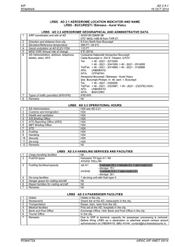

© Copyright 2026