
CYCLICAL IJEIIAVIOR OF TIIR TIDAl, INLRT AT NAUSET REACH
CYCLICAL IJEIIAVIOR OF TIIR TIDAl, INLRT AT NAUSET REACH,
CIIATIIAI\1, MASSACHUSETTS
Graham S. Giese
Woods Hole Oceanographic Institution
Woods Hole, MA 02543
A8STRACT
Study of historical data concerning shoreline forms and change on southeastern
Cape Cod over the past 200 years revealed a cyclical pattern of change in the barrier beach
system ofT Chatham, Massachusetts. with a period of approximately 150 years. Based on
the observed patterns and deductions concerning the processes controlling those patterns,
predictions of breaching of the barrier beach and new inlet formation were provided to local
coastal resource managers, reducing the negative impacts accompanying the formation of
the new inlet when it eventually occurred.
INTRODUCTION
The characteristics of tidal inlet migration on barrier beaches, and the physical
processes associated with such migrations, have been studied and reported with increasing
frequency in recent years (e.g, Mitchell, I 875; Goldsmith, 1972; Bruun, 1978; Boon and
Byrne, 1981; Aubrey and Speer, 1984). In addition to their scientific value, such studies
have important applications to coastal management. Changes in tidal characteristics and
wave pa!lems that accompany inlet migration and initiation produce a suite of associated
changes within the estuaries behind the barriers: estuaries which, with their surrounding
wetlands and uplands, are among the most highly valued coastal resources. Navigation,
shell-fisheries, private and public property, and recreational activities, as well as natural
ecosystems, are all subject to impacts resulting directly or indirectly from altered tidal
ranges, phases and currents, and altered wave energy nux.
As an example of the importance of inlet migration studies to coastal management, a
study of coastal changes at Chatham, Massachusetts, is presented here. Chatham,
occupying Cape Cod's extreme southeastern corner, lies at the end of two littoral drift
systems: one directed easterly along the Cape's south coast and one directed southerly
along the southern portion of the east coast (Figure 1). As a result, Chatham's upland
shores, together with numerous estuaries and wetlands, are relatively well protected behind
a shield of barrier beaches.
Chatham townspeople are alert to changes and potential changes in the barrier shield
(e.g., Nickerson, 1931 ). In keeping with this tradition, and suspecting that a change was
imminent in the long easterly barrier known as Nauset Beach (or North Beach), the
Chatham Conservation Commission requested in 1976 a study (Giese, 1978) to detern1ine,
l.cciUJe N111e~ on Cna•Wd and E"~;IH;trint' Studir,, \'etl :'9
0 fi l\uh1e~. l Wci~har IJ:ch.J. llydrurt)namic~ ;md ~rdimenl Dynotmic" of 1 id:d lnlcl~
Sr11nll'fl· \ rrla~ Ne..,. Ynrk. Inc .. JQ~H
-t"
270
as accurately as possible, what changes to expect nnd whnt
271
cour~cs
of net inn
~hould
he
taken in light of the expected changes.
All of the landfonns of Chathartl consist of materials emplaced by one or the other
of two distinct process-systems: deposition of materials released by melting during the
The present report presents a conceptual model, and like all models it differs from
retreat of the Pleistocene continental ice sheet, or deposition of materials eroded from these
reality. A modeling approach to the Chatham barrier beach problem is used because of the
glacial deposits by wave action and carried to their present location by waves, currents and
complexity of the natural system. The purpose of the model is to exc:lude secondary causes
winds. The glacial deposits, which make up the "uplands" of Chatham, have been in place
and effects in order to pre~ent clearly the primary causes and effects of inlet change. Also,
for some 16,000 years (Stone and Borns, 1986), during which time sea level has risen
like all models, it is based on incomplete data. Tite greater the amount of information put
into the model, the closer it approaches reality. As additional historical data are located, and
over 100 meters. It is the submergence of these Pleistocene glacial deposits by the rising
sea that has produced most of the "inner" coastline of Chatham as it exists today.
as future data become available, .the model should be adjusted appropriately.
In contrast, the "outer" coastline is formed by wave, current and wind transported
However, it is not likely that the basic structure of this primary model will be
materials that have been deposited within the recent past. The eastern outer coast of
altered by the additions. The basic processes involved in the development of the Chatham
Chatham - Nauset Beach and Monomoy - comprises the southern part of a series of
barrier beaches have been understood for a long time. Henry Mitchell (IR74, 1875) a
barrier beaches, islands and spits that are formed of sediments eroded by wave action from
century ago, said much of what is said here. It is difficult, from the viewpoint of a specific
"present time" to separate significant changes from insignificant ones, and therefore much.
southern outer coast of Chatham- Forest Beach, Ridgevale Beach and Harding Beach - is
the sea cliffs of Eastham and Wellneet and carried southward by littoral drifting. The
care should be exercised in making large model corrections based on contemporary
similarly made up of barrier beaches, islands and spits that consist of materials eroded and
observations.
carried eastward from the exposed glacial deposits of the Nantucket Sound coast west of
Chatham.
Altogether, the barrier beaches form a protective envelope around the uplands of
Chatham. They provide the town her abundant sheltered harbors, tidal nats, and salt
marshes, and they provide protection from erosion and therefore relative stability for the
town's inner coastline. However, the barriers are not stable forms but rather constantly
adjust to changing conditions. As the barriers change, the degree and type of shelter
provided by them changes and, as a result, the harbors, nats, marshes and inner coastline
also change.
It has been observed that the changes undergone by many barrier beaches,
including those at Chatham (Goldsmith, 1972), follow cyclical patterns. During the past
200 years, a large amount of information has been gathered concerning the fonn and
changes in form of the Chatham barrier beaches. The objectives of the present study are:
first, to detennine, by the analysis of this existing information, the patterns of change
undergone by the Chatham barrier beaches over the past 200 years; second, to deduce the
controlling processes from the observed patterns; and third, to predict, based on these
patterns and processes and the engineering changes that have been imposed on the system,
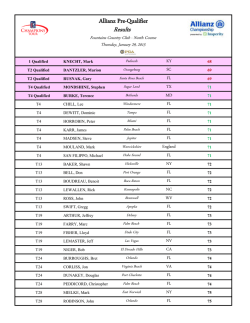
NANTUCKET
50UND
the patlems of changes that may be expected in the future.
METHODS
0
t
l
,
•
5
The underlying rationale of this study is that the large amount of existing
NAUTICAL ..,JL['j
professional and specialized information concerning the Chatham barrier beaches should be
Figure 1.
Chatham Harbor-Pleasant Day estuary and Nauset Beach-Monomoy barrier
system, ~;_i.J:g 1980. The tidal inlet east of Chatham Light fonned in January,
19R7 and has been superimposed onto the earlier shoreline configuration.
collected, analyzed and interpreted so as to make it available and useful to tltose individuals
and groups responsible for making decisions concerning the management of the coastal
272
resources of Chatham.
273
Much of this information represents the work of geologists,
On the east coast, the barrier beach from Nauset Harbor to Strong Island (i.e., the
hydrographers and engineers whose reports are generally unavailable to, and sometimes
northern portion of Nauset Beach), has maintained a fairly constant form, without
unintelligible to, the general public. Additional infommtion necessary for this study was
pennanent breaks. However, a comparison of shoreline locations over the 200-year period
derived from char1s and maps which, while generally available. are seldom found together
indicates that this "stable" segment of barrier beach has migrated landward at a relatively
in one place at one time.
unifom1 rate of between 1.5 and 3 m per year.
The study covers a time period of 200 years, beginning with the remarkably
accurate 1772 chart of Des Barres, and ending in 1972 with a doctoral disserlation by V.
Goldsmith (1972) that describes in detail much of the history and controlling processes of
the study area. Although there exists a considerable body of infonnation concerning
Chatham shoreline changes prior to 1772 (e.g., Goldsmith, 1972; Nickerson, 1931; and
Mitchell, 1874), the detail and continuity through time of the early descriptions are
insufficient for the purposes of this study.
Once the primary data sources (reports, historical accounts, studies, maps and
char1s) for the 200-year study period had been collected, pertinent infommtion was divided
chronologically into 20-year periods. For each 20-year period a generalized diagram was
prepared representing the major (and omitting the minor) shoreline features of that time
period. It should be emphasized that each diagram represents a composite of all data
available for that time period, and therefore each necessarily differs from the coastal form at
any one time during that period.
Based in part on the pallems of shoreline development revealed by the 20-year
/ !?~; 1}
'~ ~·I
~~(
d'i'
«
J'
jJ
1770·1790
diagrams, in part on available tidal and hydraulic data (U.S. Depar1ment of Commerce,
1977; U.S. Army Corps of Engineers, 1957. 1968), and in part on previous work by the
author and others (especially Mitchell. 1874, and Goldsmith. 1972) the processes
controlling the observed shoreline changes were deduced.
Next, using knowledge of the controlling processes and the past shoreline
behavior, predictions were made of future shoreline development (Figure 2). It should be
recognized that while specific time periods and specific fonns were designated for each
future stage of development, this was done to suggest the time frames and type of coastal
fonns that might be expected.
I
•
-.~;
•'-,
I
•I
,)/
J
,,'.f /910f,IJO
i.... L~ L.. Z~ 1.
.
--J -,j}~~-~
JL. JL .. J,.fl .,L~ ,l~
,m..
-1
{~;
RESULTS AND DISCUSSION
Summary or Coastal Changes
A survey of the fonns of Chatham barrier beaches over thC' past 200 years (rig. 2 l
reveals some distinct characteristics:
On the south coast, the barrier beach (Harding Beach) which joins the mainland at
west Chatham and extends southeastward, forcing a 90' bend in the Oyster River, has
maintained a fairly constant fonn. It has not been breached by rwturnl causes. It has
increased slowly in width and in length. In 1965, a controlled inlet was cut through this
barrier beach and it was joined to Morris Island by a sand dike constructed hy the U.S.
Anny Corps of Engineers.
Figure2.
Historical changes in the Nauset Beach-Monomoy barrier system illustrated
by generalized 20-year di:~grarns from 1770-1790 to 1950-1970 and predicted
future changes illustrated by 10-year diagram from 1975-1985 to l995-21XI5
as they were presented to the Chatham Conservation Commission in 1978.
Note the approximately 140-year historical repetition of fonns apparent in the
first three diagrams in the bottom row, The letter "A" marks, tn the 17701790 diagram, the approximate inlet location in 1740; in the 1830-1850
diagram, the inlet that fonned in 1846; in the 1975-1985 diagram, the breach
that fonned in 1978; and in the 1985-1995 diagram, the predicted location of a
future inlet The actual location of the inlet that fonned in January. 1987, is
indicated by the arrow.
274
On the east coast, the barrier beach south of Inward Point to the
275
~outhern
extremity
second.:uy fonns of the inner shoreline. Third in importance is tidal action. This is the
of the system (Monomoy Point), has been stable over the entire period. The northern end
process responsible for the secondary features of the barrier beaches, especially the inlets.
of this section has narrowed somewhat due to erosion along the eastern coast, while the
Each of these processes will be discussed separately.
southern end widened by growing southeastward approximately one-half mile between
I 887 and 1964 (Old ale et a1.,1971 ). However, there has been a marked
decre~se
Coastal submergence. Zeigler et al. (1965) have presented a general view of
in the
the development of the shoreline fonn of southeastern Massachusetts due to submergence
lengthening of the barrier during the past 200 years. While Mitchell ( 1881i) reported that
between 15.000 and 6,500 years ago. Fifteen thousand years ago, "present day" Cape
"the dry land of Monomoy has extended southward 2 miles during the past century,"
Cod, Martha's Vineyard, Nantucket, and Georges Bank were all part of a single land fonn
Oldale et aL (1971) show virtually no lengthening (as opposed to widening) since 1887.
On the east coast, between Strong Island and Inward Point, the barrier beach has
undergone a regular series of changes.
which extended some 320 km east of the present eastern limit of the land. By 10,000 years
ago, Georges Bank was reduced to an island about 80 km long, and by 6,500 years ago
Two hundred years ago, the barrier beach
that island was disappearing. Even at that time, however, Cape Cod, Martha's Vineyard,
extending southward from Nauset Inlet was a barrier spit which ended approximately
and Nantucket were joined still and the ever-shrinking land mass which they fonned
opposite the present location of Tern Island. The Chatham coast southward from this point
included much of the "present day" Nantucket Shoals.
was not protected. The barrier beach began again at Morris Island and continued without
Relative sea-level has risen along the Massachusetts coast over the past40 years at a
rate ranging between 2 and 3 mm. per year (Aubrey and Emery, 1983), about one-third of
interruption to Monomoy Point. The northern barrier gradually grew southward, until, by
1820, it reached south of Morris Island and overlapped the southern barrier, which then
which is due to global sea-level rise and the remainder to subsidence (Braatz and Aubrey,
separated from Morris Island. Following the separation, the south end of the northern
in press). By applying this rate of sea-level rise to the areal distribution of upland in
barrier continued to grow southward and the north end of the southern barrier continued to
Chatham, Giese and Aubrey ( 1987) have calculated that the town loses a minimum of 0.4
retreat southward.
Finally, in I 846, a new inlet formed through the northern barrier opposite Ministers
Chatham owes its general fonn in part to this passive submergence of the glacial deposits,
hectares (I acre) per year of upland due to the passive submergence. The inner shoreline of
Point (Allen Point). The inlet rapidly grew wider and as it did so, the barrier beach south
and in part to erosional and depositional processes associated with changes in the barrier
of it gradually disintegrated, and its remnants were driven westward onto the Chatham
beaches.
Wa,·e action. The Chatham outer coast is fonned of barrier beaches that consist
mainland.
Gradually, the barrier beach north of the inlet grew southward once more and the
of sediment transported southward by littoral drifting due to wave action. The source of
barrier beach south of Morris Island regained a continuous fom1 and reallached to Morris
this sediment is the eroding cliffs in Eastham and Wellfleet. The original map by Des
Island, so that by about 1940, the general form of 1!!00 had returned. After 1940, the
Barres of 1772 shows the barrier beach as outside of, and unauached to, the Orleans
post-1800 pattern was repeated- continued southward growth of the northern barrier until
upland, and a note on the map indicates that the end of the barrier off Chatham Harbor had
it reached south of Morris Island; separation of the southern barrier from Morris Island;
grown approximately 3 miles southward (from the point designated "A" on the 1770-1790
continued southward growth of the northern barrier and southward retreat of the north end
of the southern barrier. The southern barrier was breached (as had been predicted by Oldale
discussion of the rate of southward growth of this barrier beach as well as of Monomoy
et al., 1971) in 1978 just north of Inward Point (marked "A" on the diagram for 1975-19!!5
diagram in Figure 2) in 30 years. During the first half of the 19th century, there was much
in Figure 2).
(see, for example, Hitchcock, 1837).
C. H. Davis (1849) recognized that the barriers were built of sediment supplied by
Processes
There are three general processes responsible for the shoreline fonm and changes
currents which, he believed, divided at a point near Nauset Light - north of that point the
the eroding cliffs to the north. He postulated that the sediment was ttansported by tidal
that have been described. First in importance is coastal submergence - that is, a rise in the
resultant tidal flow was northward; south of it, the resultant was southward. Accordingly,
level of the sea surface relative to the land surface. It is this process that detennined the
Davis believed. northward growing spits developed in Truro and Provincetown, and
primary fonn of the coast coupled with the morphology of the glacial drift surface. The
general outline of the inner shoreline of Chatham is the result of submergence. Second in
southward growing spits in Chatham.
However, during the second half of the 19th century, the role of waves as the
importance is wave action. Wave action is responsible for the general outline of the outer
primary agent causing liuoral drifting became clear, and in 1875 H. Mitchell wrote:
shoreline of Chatham - for the barrier beaches them-selves- as well as for the specific,
276
277
"One may easily see how the Nauset beach composed of
Tidal action. While wave action is responsible for the existence of the barrier
alluvia swept down the outside coast by the sea from the
beaches that form Chatham's outer shoreline, tidal now is the factor that, together with
northeast, has extended itself along the resultant between the
wave action, controls the inlets through the barriers, and therefore, to a large extent, the
ocean waves on the one hand and the outnow of Pleasant
form of barriers. The tidal hydraulics and inlet dynamics of the Chatham barrier beach
Bay on the other. In this way, it has gone on till the too
system did not receive detailed study until the second half of tlie 20th century. The Anny
confined waters of Pleasant Bay have forced a more direct
Corps of Engineers (1968) installed tide gauges and current meters in Chatham Harbor and
outlet again, and the march of the beach rrom above has
Pleasant Bay, and used the results and Keulegan's (1951) model to calculate the hydraulic
recommenced. The early history of these movements is in
friction of the system. The effect of the tidal inlets on the southerly-directed liuoral drifting
no wise peculiar; the same may be observed at many other
and thereby on the barrier beach south of the inlets has been discussed by Goldsmith
places upon our sandy coast. But this familiar history seems
(1972). A detailed description of the "Chatham Bars" inlet and its associated shoals was
to be closed."
published by lline ( 1975).
Brieny. the system works as follows: The existence of, and the changes of, a tidal
This paragraph describes, as well as any could, the basic processes controlling the
inlet through a barrier beach are controlled by the balance between two opposing forces: the
development of Nauset Beach. Only the last sentence should be changed - while ''this
volume rate of tidal now of water through the inlet which acts to keep it open, and the
familiar history" appeared to Mitchell to be closed, it most certainly was not. as events
volume rate of littoral drifting of sediment along the outside shoreline of the barrier which
during the century between his writing and the present time have shown.
acts to close it. The rate of littoral drifting is controlled by the characteristics of the waves
Tite second major mode of change of the barrier beaches of Chatham - their steady
that reach the shoreline. The rate of tidal flow is determined by the tidal range and the
landward (westward) migration - also was observed, measured and discussed during the
surface area of the body of water inside the barrier. An increase in the rate of littoral
second half of the 19th century. The fact of this migration was demonstrated strikingly by
drifting tends to narrow the inlet which results in an increase in the speed of tidal flow and
the discovery, in 1863, of the wreck of the ship. Sparrow-Hawk, on the (JUter side of
therefore in channel scour. By this means balance is maintained (e.g., O'Brien, 1931;
Nauset beach (Anon .. 1865). The Sparrow-Hawk had been wrecked in 1626. on the inner
Bruun, 1978).
side of Nauset Beach and therefore her discovery 237 years later on the outside proved that
the barrier had moved westward a distance equal to its width during that time period.
Precise measurements of the westward barrier migration were obtained first by II.
Without tides, a continuous barrier beach could extend from Eastham to Monomoy
Point. Even with tides, such a continuous barrier could exist, provided that the barrier
were everywhere separated sufficiently from the mainland that tidal flow could occur freely
Marin din of the U.S. Coast and Geodetic Survey for a 10-km length of shoreline beginning
from Pleasant Bay through Chatham Harbor to Nanrucket Sound. When tides are added to
about I .5 km north of the inlet into Pleasant Bay in 1887 and continuing northward to
both sides of such a continuous barrier, the potential for an inlet through the barrier is
Nauset Inlet (Marindin, 1889). l-Ie compared his survey of this coastline undertaken in
added also: the difference in tidal range between the open ocean (about 2.0 m) and
1887-11!88 with a survey made in 1868, and detemtined that the "crestline" of the beach
Nantucket Sound (about I .2 m) would result in a hydraulic head across the banier, and
showed a mean recession or 2.4 m per year averaged over the 10-km length.
this, in tum. would produce a pressure gradient across any storm-produced breach that
The landward migration of the barriers is accomplished in part by the erosion or the
might occur. forcing a tidal current through it. Whether or not the resulting incipient inlet
beach and in part by sand transport across the barrier, from east to west. This important
would reach a critical size (Escoffier, 1940; van de Kreeke, 1985) and remain open, would
crossbarrier transport is accomplished by three mechanisms: dune migration, storm wave
depend upon the volume rate of the littoral drift attempting to close it.
overwash, and deposition on the inside of tidal inlets in the form or flood tidal deltas
(Leatherman and Zaremba, 1986).
In fact, however, tidal flow in Chatham Harbor is restricted, and becomes more so
as the barrier beach lengthens and migrates westward. As the degree of restriction
In summary. the effect of wave action is, ftrSt, to transport sand southward along
increases, the range of the Chatham Harbor-Pleasant Bay tide decreases and its phase lag
the barrier beaches; and second, to cause the barriers to migrate westward. 11te annual
(relative to the outside tide) increases. Both effects increase the hydraulic head across the
volume of sand moved southward by wave action has been calculated (Zeigler et al., 1965)
banier and eventually the constriction becomes so great that when a breach occurs through
to be about 230,000 m3.
the northern part of the barrier (a natural occurrence as described above), Chatham Harbor-
278
279
Pleasant Bay water is discharged through the hreakthrough instead of thrn11gh the inner
CONCLUSIONS
channel, and tlte breach increases to critical size and becomes an inlet.
I.
The southward moving sand supplied by littoral drifting is intercepted at the new
The Chatham coast consists of two different types of land forms: a relatively stable
inner coast formed chiefly by submergence of Pleistocene glacial deposits but modified in-
inlet. Some sediment is carried in and added to the flood tidal delta and some is carried out
part by wave action; and an extremely dynamic outer coast consisting of barrier beaches
and added to tlte ebb tidal delta. Because of the reduction in tlte volume of sand supplied to
fonned by wave, tidal and wind action.
it, the barrier south of the new inlet is "starved." It gradually breaks down and is moved
2.
landward.
By providing protection from large waves, they greatly reduce coastal erosion and storm
Eventually, the inlet is no longer an inlet but rather marks the southern end of the
The barrier beaches are a valuable component of Chatham's coastal environment.
and flood damage along the inner coast. By forming a sheltered estuarine environment
barrier spit which grows southward with the addition of sediment supplied by littoral
between themselves and the inner coast, they provide for an extensive salt marsh, a
drifting. The previous barrier, south of the "new" spit, moves onto the Chatham mainland,
productive fin and shellfishery, and a protected harbor for commercial and pleasure craft.
Conning the "peninsula" of Monomoy. At this stage, the attachment of Monomoy to the
3.
southern Chatham mainland is secured by rapid lilloral drifting along this shoreline
to, a number of different natural forces and processes:
resulting from its open exposure to waves.
Coastal erosion west of Chatham provides sand for Chatham's south coast barrier
beaches.
When the "new" barrier spit grows far enough southward to overlap the southern
The Chatham barrier beaches owe their existence to, and change form in response
barrier, and when this southern barrier becomes breached in the ordinary manner, the
Coastal erosion north of Chatham provides sand for Chatham's east coast barrier
breach remains open because the littoral drifting required to close it is no longer available.
beaches.
Thus the northern end of the southern barrier retreats as the southern end of the northern
Eastward directed net wave energy is responsible for sand transport to the barriers
along the south coast.
barrier advances. The cycle is reinitiated when the nortltern barrier once again has become
sufficiently long and close to the Chatham mainland to produce a hydra11lic hend
acrns~
the
barrier sufficient to enlarge a stonn-produced breach to critical si1.e.
The new inlet
Southward directed net wave energy and an absence of obstacles to littoral drifting
are responsible for sand transport to the barriers along the east coast.
or 1987. A new cycle of inlet change was initiated by a severe
northeasterly storm occurring together with a perigean spring tide on January 2,19R7. ·n,e
Tidal flow maintains a channel from Stage Harbor to Nantucket Sound and from
Pleasant Bay and Chatham Harbor to the Atlantic Ocean.
barrier beach was breached at a point almost directly east of Chatham Light I louse -a low.
Easterly winds, storm waves and stomt tides are responsible for sand transport
narrow reach that had been overwashed (but not breached) during previous spring tides.
westward across the east coast barrier beaches in the form of dune movement, overwash
Chatham townspeople had noted the narrowing of the beach at tltat point ove-r the previous
deposits, and breakthroughs and flood tidal deltas.
few years, and the possibility of its breaching had been discussed widely.
The new inlet enlarged rapidly to 100m wide by January 16, 500111 by February 3,
and I km by April IS. Analysis of a 30-day tide record from Chatharnllarlx>r taken during
Tidal range and phase differences provide the hydraulic potential necessary to
maintain a new inlet to Chatham Harbor when the east coast barrier has migrated too far
westward toward the Chatham mainland.
The Chatham barrier beaches undergo changes in form that are adaptations and
April revealed a mean tidal range of 1.4 rn, as compared with a range of 1.1 m recorded
4.
approximately 20 years earlier (U.S. Army, 1968). The increased tidal range and wave
responses to the forces that act upon them and form them Such changes in the form of the
energy produced a variety of coastal erosion and channel shoaling problems with strong
barriers make it possible for them to adjust to the changes in the imposed forces, some of
impacts on the fishing and boating industries, and on private and public property and
which result from changes in the barriers tltemselves.
interests. Shoreline straightening processes have resulted in rapid erosion, and in some
5.
cases accretion, along the inner shoreline in the vicinity of the new inlet, and existing
past 200 years are cyclical. The period of the cycle is approximately !50 years. Assuming
The major changes in form undergone by the Chatham east coast barriers over the
navigation channels have shoaled or disappeared entirely. At the same time, of course, new
that the cyclical changes continue without interruption, the future form of the shoreline can
channels have fonned, most importantly the new inlet itself, the use of which rt>duces by
be predicted.
about an hour and a half the running time of commercial fishing vessels between Clwtham
Commission, for the periods .1975-1985, 1985-1995, and 1995-2005 are presented in
Harbor and the Atlantic.
Figure 2.
Shoreline predictions, made in 1978 for the Chatham Conservation
280
6.
281
·n1e 1971! report to the Chatham Conservation Commission (Giese, 1971!) proved to
REFERENCES
be useful to the community by communicating to the general public infonnation readily
Anon., 1865. Loss of the Sparrow-Hawk in 1626. Alfred Mudge & Son, Boston, 44 pp.
available to coaslal scientists and engineers concerning the behavior of this barrier
beach/estuary syslem. Its relalive wide readership was achieved by careful packaging (e.g.,
Aubrey, D.G. and Speer, P.E., 1984. Updrift migralion of tidal inlets. J. Geology,
92:531-545.
the 20-year diagrams); concise, non-technical writing; and wide-spread distribution as a
Aubrey, D.G. and Emery, K.O., 1983. Eigenanalysis of recent Uni1ed Stales sea levels.
separale section inserted into the local weekly newspaper, the Chronicle. Because lhe
community generally accepted the inevitability of barrier breaching and lhe shoreline
changes that would accompany il, the Conservation Commission was able to enforce more
olherwi.~e.
Conlinenlal Shelf Research, 2:21-33.
Boon, J.D. and Byrne, R.J., 1981. On basin hypsometry and morphodynamic response
of coastal inlel systems. Marine Geology, 40:27-48.
and
Braalz, B. V. and Aubrey, D.G., 1987. Recent relative sea-level change in North america.
thereby reduced the negative impacts accompanying the formation of a new 1idal inlet.
In: Nummedai, D., Pilkey, O.H. and Howard, J.D. (eds.), Sea-Level Fluctuation
7.
Cycles of downdrift inlet migration and subsequent breaching updrift are
and Coastal Evolulion, Society of Economic Paleonlologists and Mineralogists,
stringent restrictions on coastal developmenlthan would have been possible
characteristic of undisturbed barrier beaches (Mitchell, 11!75), and while the cycle may be
Special Publication No. 41, p. 29-46.
defined more clearly and beuer recorded at Nauset Beach than at many other locations, the
Bruun, P., 1978. Stability of tidal inlels. Elsevier, New York, 506 pp.
methodology described in this report could be applied usefully elsewhere. As an alternative
Crane. D.A., 1963. Coastal flooding in Barnslable County, Cape Cod, Massachuseus.
means of environmental managemenl, communities may find that they are better able to
preserve their coastal and estuarine resources by predicling and planning fClf tidal inlet
changes than by altempting to prevent such changes.
8.
The mosl critical requirement for improved tidal in lei prediclions is the development
of adequate mathematical models for such syslems. However useful empirical techniques,
such as those described above, may prove to be in particular siiUations, predictions based
on site-specific observations alone do not lead to useful solu1ions to the general problem.
Because of the wide variety and complex form of natural barrier beach/estuary systems,
Commonwealth of Massachuselts, Water Resources Commission, 63 pp.
Davis. C.H., 1849. Memoir upon the geological action of the tidal and other currents of
the ocean. Mem. American Academy, Boston, 4:117-156.
Escoffier, F.F., 1940. The stabilily of tidal inlets. Shore and Beach, 8(4):114-115.
Giese, G.S., 1978. The barrier beaches of Chatham, Massachusells. Provincetown
Center for Coastal Studies Report, April 1978, and Cape Cod Chronicle, June I,
1978, Special Supplement, 7 pp.
Giese, G.S. and Aubrey, D.G., 1987. Passive retreat of Massachusetts coastal upland due
general solutions applicable to many individual systems must be sought through
to relative sea-level rise. Massachusetts Office of Coastal Zone Management, 17 pp
mathematical models derived from hydrodynamical principles. Analytical models such as
+ appendices.
that of van de Kreeke (1984) contribute significanlly to our understanding of the roles and
Goldsmith, V., 1970. Large-scale inlet migration and beach retreat on Monomoy Island,
relative magnitudes of the controlling forces and require funher developmenl. But lhe
Cape Cod: 1620-1970. (abs). Coaslal Sedimentation Research Group Meeting:
greatest need for the purpose of practical inlet migration predictions is the development of
numerical models adequate for application to a wide range of natural systems.
Effects of Extreme Conditions on Coastal Environmenls, Kalamazoo, Mich.
Goldsmith, V., 1972. CoaSial processes of a barrier island complex and adjacent ocean
floor: Monomoy Island - Nauset Spit, Cape Cod, Massachusetts. Unpublished
ACKNOWLEDGMENTS
doctoral dissertation, Univ. Massachusetts, 469 pp.
The study reported in this report was carried out in 1wo phases. ll1e firs! phase,
Hine, A.C., 1975. Bedform distribulion and migration patterns on tidal deltas in the
conducted between 1976 and 1978, was commissioned by the Chalham Conservation
Chatham Harbor estuary, Cape Cod, Massachusetts. Estuarine Research, p. 235-
Commission at the suggestion of 1\lrs. Alice Hiscock, al that time chairman of the
Commission. The second phase was carried out in 1987 wilh supporl from the Woods
Hole Oceanographic lnslitulion Sea Grant Program under grant NA86Ai\-D-SG090 from
the Nalional Atmospheric and Oceanic Administralion, Depanment of Commerce. Use of
the facilities of Wf!OI Coaslal Research Center are gratefully acknowledged. Helpful
suggestions and manuscript review provided by 1he David Aubrey and Rohert Oldale.
Woods Hole Oceanographic lnslitution Contribution Number 6797.
252.
Hilchcock, E .• 1837. On certain causes of geological change now in operalion in
Massachusetts. Boston Journal of Natural History, 1:69-82.
Johnson, D., 1925. The New England- Acadian Shoreline. John Wiley and Sons, New
York, 608 pp.
283
282
Keulegan, G.H., 1951. Third progress report on tidal now in entrances. Water level
fluctuations of basins in communication with seas. Report No. 1146, National
Bureau of Standards, U.S. Department of Commerce, Washington, DC. 32 pp.
Koteff, C., Oldale, R.N. and Hartshorn, J.H., 1968. Geologic map of the Monomoy
Point Quadrangle, Barnstable County, Cape Cod, Massachusells. U.S. Geological
Pleistocene glacial· and interglacial
stratigraphy of New England, Long Island, and adjacent Georges Bank and Gulf of
Maine. In: Sibraua, V., Dowan, D.Q. and Richmond, G.M. (eds.), Quaternary
Glaciations in the Northern Hemisphere. Pergamon Press, Oxford, England, p.
39-52.
U.S. Army Corps of Engineers, 1957. Chatham, Mass., Beach Erosion Control Stlldy.
Survey Map GQ-787.
Leatherman, S.P. and Zaremba, R.E., 1986. Dynamics of a northern barrier beach:
Nauset Spit, Cape Cod, Massachnsells. Geological Society of America llulletin.
85th Congress, I st Session, House Document No. I 67, 37 pp.
U.S. Army Corps of Engineers, 196!!. Survey_ Report: Pleasant Day, Chatham, Orleans,
llarwich, Massachusetts. Department of the Anny, New England Division, Corps
97:116-124.
Marindin, H. L., 1889.
Stone. B.D. and Borns, II. W.J., Jr., 198Ci.
Encroachment of the sea upon the coast of Cape Cod,
Massachusetts, as shown by comparative surveys. Report of the Superintendent of
the United States Coast and Geodetic Survey, Appendix No. 12, p. 403-404.
Mitchell, H., 1874. Report to Prof. Benjamin Pierce, Superintendent United States Coast
Survey, concerning Nauset Beach and the peninsula of Monomoy. Report of the
Superintendent of the United States Coast Survey for 1871. Appendix No. 9. p.
Mitchell, H., 1875. Additional report concerning the changes in the neighborhood of
Chatham and Monomoy. Report of the Superintendent of the United States Coast
Survey for 1873, Appendix No. 9, p. 103-107.
Mitchell, H., I 886. A report on Monornoy and its shoals. Report of the Superintendent of
the United States Coast and Geodetic Survey, Appendix No.8, p. 255-261.
Nickerson, J. A., 1963. The North Beach at Chatham. Unpublished manuscript, 4 pp.
Nickerson, W. S., 1931. Land Ho!- 1620. Houghton Mifnin Co., Boston. 155 pp.
O'Brien, M.P., 1931. Estuary tidal prisms related to entrance areas. Civil Engineering.
I (8):738-739.
Oldale, R.N., Friedman, J.D. and Williams. R.S .. Jr., 1971. Changes in coastal
U.S. Geological
Survey Prof. Paper 750-B. p. BIOI-BI07.
Sears, P.ll., 1868. Massachusetts General Court: Committee llearing · Cape Cod llarbor.
Shaler, N.S., 1897. Geology of the Cape Cod Dimict. I Rth Annual Rerort of the U.S.
Geological Survey, 2:497-593.
Shelton, J. S., 1966. Geology Illustrated. W. H. Freeman & Co .. San Francisco, p. 190·
191.
Shepard, F. P., and Wanless, H. R., 1971. Our Changing Coastlines.
Book Co., New York. p. 23, 46-50.
Massachusetts~
61 pp. +appendices.
U.S. Department of Commerce, 1977. Tide Table, East Coast of North and South
America. U.S. Government Printing Office, Washington, D.C.
van de Kreeke,
J:, 1985. Stability of tidal inlets: Pass Cavallo, Texas. Estuarine, Coastal
and Shelf Science, 21:33-43.
Whiting, ILL., 1869. Report of the special survey of. Provincetown llarbor,
Massachusetts. Report of the Superintendent of the United States Coast Survey,
134-143.
morphology of Monomoy Island, Cape Cod. Massachusetts.
of Engineers, Waltham,
1\fcGraw-llill
for the year 1867, Appendix No. 12, p. 149-157.
Woodworth, J. D.• and Wigglesworth, E., 1934. Geography and geology of the region
including Cape Cod, the Elizabeth Islands, Nantucket, Marthas Vineyard, No
Mans Land and Block Island. Mem. Museum Comp. Zool. Harvard Coli., 52,
322 p.
Zeigler, J. M., Tuttle, S.D., Tasha, IU. and Giese, G.S., 19Ci5. The age and development of the Provincclands Hook, Outer Cape Cod. Massachusetts. Limnology and
Oceanography, IO:R298-R311.


© Copyright 2026